|
Sun | Mon | Tue | Wed | Thu | Fri | Sat |
|---|
June | 1 | 2 | 3 - Monument Hill, Ganaraska
9:00 AM 07/03/2024 https://hikes.brucetrail.org/event/monument-hill-ganaraska-4/2024-07-03/ Click here for more information or to register Hosting Club: Blue Mountains
Category: Register in person the morning of hike.
Location (Google Maps): Tim Hornton’s 281 First Street #4. Collingwood, ON L9Y 1B2 Hike Leader(s): David Little Click here to contact Hike Leader(s) Pace: Medium – 3 to 4 km/hr
Terrain: Moderate – Some hills and/or some poor footing
Distance: 9 km Description
This is a loop trail located near Wasaga Beach. Lots of hills and options to take. This will be an exploration of some new trails to hike! Be prepared to explore the variety within this hike. Bring a snack or lunch and water.
| 4 | 5 | 6 - RIM 2 RIM Badge Hike #1 Pretty River Rim (First in a series of 3 for the Rim2Rim badge)
8:00 AM 07/06/2024 https://hikes.brucetrail.org/event/rim-2-rim-badge-hike-1-pretty-river-rim-first-in-a-series-of-3-for-the-rim2rim-badge/2024-07-06/ This is a Multi-Day HikeYou are signing up for the following dates and times:
2024-07-06 at 08:00
2024-07-27 at 08:00
2024-08-10 at 08:00 Click here for more information or to register Hosting Club: Blue Mountains
Category: Register online ONLY
Location (Google Maps): Hike meets in the parking lot behind Tim Hortons on First St. in Collingwood. Hike Leader(s): Hart Fischer Click here to contact Hike Leader(s) Pace: Medium – 3 to 4 km/hr
Terrain: Moderate – Some hills and/or some poor footing
Distance: 18.5 Description
Meet at Trailhead. About 18.5 km with almost 810 m elevation gain. Park your car in the small Bruce Trail Parking Lot [BTPL] on the Pretty River Road [44.428118, -80.276849]. If this small BTPL is filled, use the large Ontario Parks Lower Pretty River lot [44.430983, -80.275474]. Do not park along Pretty River Road as it is a strictly enforced no parking zone by the Town of Blue Mtns. The hike starts in the small BTPL. Proceed north on the white blazed trail until you come to the blue blazed side trail – John Haigh Side Trail. Proceed west past the highest point on the Bruce Trail. Continue until you reach the intersection of the 2nd line and 6th Sideroad. Retrace your steps to the BTPL. Have a break. Proceed east along the white blazed trail until you reach the Blue Mtns Clearview Townline. Head south and continue south past Osprey-The Blue Mountains Townline. Follow the white blazed trail until you reach the blue side trail – Standing Rock & Caves Side Trail. Turn west and take the blue blazed side trail through the Singhampton Caves until it rejoins the white blazed trail again. Turn east (left) and follow the white blazed trail which turns west and then north retracing your steps back to the parking lot. Bring lots of snacks, lunch and water. [gotohttps://www.alltrails.com/explore/map/map-march-8-2023-f875227 for a detailed map of the hike] Check the other schedules dates for associated hike description.
- Margaret Paull Side Trail
9:00 AM 07/06/2024 https://hikes.brucetrail.org/event/two-hike-day-hike-1-margaret-paull-side-trail/2024-07-06/ Click here for more information or to register Hosting Club: Blue Mountains
Category: Register in person the morning of hike.
Location (Google Maps): Hike meets in the parking lot behind Tim Hortons on First St. in Collingwood. Hike Leader(s): Bob Moenck Click here to contact Hike Leader(s) Pace: Leisurely – 3 km/hr. or less
Terrain: Easy – Mostly flat and usually good footing, Strenuous – Hilly with steep climbs and some poor footing
Distance: 5 km Description
We will drive via Grey Rd.119 to the end of the 6th Line in the Beaver Valley section. We will hike along the white blazed trail to km 11.3 where it joins up with the Margaret Paull Side Trail. We will follow the side trail back to the white blazed trail, then 6 Distance: 5km return to the cars. Bring water and a snack.
|
7 | 8 | 9 | 10 - Bibbulmun Friendship Trail
8:30 AM 07/10/2024 https://hikes.brucetrail.org/event/bibbulmun-friendship-trail-3/2024-07-10/ Click here for more information or to register Hosting Club: Blue Mountains
Category: Register in person the morning of hike.
Location (Google Maps): Hike meets in the parking lot behind Tim Hortons on First St. in Collingwood. Hike Leader(s): Mary-Lynn Chenard Click here to contact Hike Leader(s) Pace: Medium – 3 to 4 km/hr
Terrain: Moderate – Some hills and/or some poor footing
Distance: 7 km Description
This is one of our Friendship trails running along BTC trails and other conserved land north of Boyne Valley Provincial Park. We will park at km 29.4 on 1st Line E in the Dufferin Hi-Land section. The 7 km figure eight hike will follow the white blazed trail to km 25.4, looping back to the parking lot via the Oliver Creek Side Trail and the Moss Haven Side Trail. Bring a lunch or snack and water. *The Bibbulmun Track in Western Australia stretches 1,000 km from Kalamunda in the Perth Hills to the historic town of Albany on the south coast.
| 11 | 12 | 13 - Pine River
9:00 AM 07/13/2024 https://hikes.brucetrail.org/event/pine-river-3/2024-07-13/ Click here for more information or to register Hosting Club: Blue Mountains
Category: Register in person the morning of hike.
Location (Google Maps): Hike meets in the parking lot behind Tim Hortons on First St. in Collingwood. Hike Leader(s): Michael Treuman Click here to contact Hike Leader(s) Pace: Leisurely – 3 km/hr. or less
Terrain: Moderate – Some hills and/or some poor footing
Distance: 7 km Description
We will drive to Kilgorie in the Dufferin Hi-Land section and park the cars at km 34.9 on Centre Road. From here, we will hike a figure eight loop utilizing the white blazed trail, the new Pine River Valley Side Trail and the Kilgorie Side Trail. This hike boasts a wonderful view from the Bell Tower Side Trail, ruins of an old powerhouse, the stunning Pine River, lake views, ponds, and more! The ruins of the old powerhouse along the Pine River are almost all that remain of the Dufferin Light and Power Company. Nearby is the old flume that brought water from a dam, which was constructed in 1909 and was the largest of its kind in Ontario. The plant provided power until 1923. Bring a snack or lunch and water.
|
14 | 15 | 16 | 17 - Standing Rock
9:00 AM 07/17/2024 https://hikes.brucetrail.org/event/standing-rock/2024-07-17/ Click here for more information or to register Hosting Club: Blue Mountains
Category: Register in person the morning of hike.
Location (Google Maps): Hike meets in the parking lot behind Tim Hortons on First St. in Collingwood. Hike Leader(s): Allison Thomas Click here to contact Hike Leader(s) Pace: Medium – 3 to 4 km/hr
Terrain: Moderate – Some hills and/or some poor footing
Distance: 10-12 km Description
Standing Rock-Singhampton Caves Starting at the Franks Kiln Parking Lot on Hwy 91 we have an enjoyable hike along the white blazed trail. Following the upper escarpment, descending to the Standing Rock Side Trail where the trail turns into an obstacle course of rocks that we scramble up and maneuver around. Squeezing through cracks and crevices as we continue the ascent up through the “caves” we will arrive at the white blazed trail and loop back to parking lot.
| 18 | 19 | 20  CANCELLED FAMILY FUN HIKE Nottawasaga Bluffs and Keyhole Loop CANCELLED FAMILY FUN HIKE Nottawasaga Bluffs and Keyhole Loop 9:00 AM 07/20/2024 https://hikes.brucetrail.org/event/family-fun-hike-nottawasaga-bluffs-and-keyhole-loop-2/2024-07-20/ Click here for more information or to register Hosting Club: Blue Mountains
Category: Cancelled
Location (Google Maps): Hike meets in the parking lot behind Tim Hortons on First St. in Collingwood. Hike Leader(s): Kelly-Leigh Thomas Click here to contact Hike Leader(s) Pace: Medium – 3 to 4 km/hr
Terrain: Moderate – Some hills and/or some poor footing
Distance: 5 km Description
We will drive to the parking lot on 15/16 Sideroad in Singhampton then commence a loop hike through the Nottawasaga Bluffs. There will be great views and varied terrain. Fun scrambling over and down rocks and crawling through the Keyhole! Bring a snack and water.
|
21 | 22 | 23 | 24 - Beaver Valley Geology Hike Badge #2/8 Margaret Paull and Indian Brook
9:00 AM 07/24/2024 https://hikes.brucetrail.org/event/beaver-valley-geology-hike-badge-2-8-margaret-paull-and-indian-brook/2024-07-24/ Click here for more information or to register Hosting Club: Blue Mountains
Category: Register online ONLY
Location (Google Maps): Hike meets in the parking lot behind Tim Hortons on First St. in Collingwood. Hike Leader(s): Annette Sandberg Linda Finley Click here to contact Hike Leader(s) Pace: Leisurely – 3 km/hr. or less
Terrain: Easy – Mostly flat and usually good footing
Distance: 4.3 km Description
Flower ports are created by water that exploits cracks and eventually removes the material between the flowerpot and the main rock face. The water smooths and round the rock of the flowerpot. The flowerpots at Indian Brook were created several thousands of years ago when lake levels were significantly higher than they are today.
| 25 | 26 | 27 - RIM 2 RIM Badge Hike #2 Mad River Rim (Second in a series of 3 for the Rim2Rim badge)
8:00 AM 07/27/2024 https://hikes.brucetrail.org/event/early-start-hike-2-rim-2-rim-badge-mad-river-rim-second-in-a-series-of-3-for-the-rim2rim-badge/2024-07-27/ Click here for more information or to register Hosting Club: Blue Mountains
Category: Register online ONLY
Location (Google Maps): Meet at trailhead Hike Leader(s): Hart Fischer Click here to contact Hike Leader(s) Pace: Medium – 3 to 4 km/hr
Terrain: Moderate – Some hills and/or some poor footing
Distance: 10 km Description
about 10 km with almost 400m elevation gain. Park your car in the Devil’s Glen Provincial Park Parking Lot [44.36161, -80.20824] The hike starts here. Follow the white blazed trail south and down to the Devil’s Glen Country Club Parking Lot. Proceed east on the blue blazed Mad River Side Trail. Continue parallel to the Mad River, through Glen Huron and south on Conc 8 S.CR #62 until you come to Sideroad 15-16 Nottawasaga. Here you will see both white and blue blazes. This is a shared Bruce Trail/ Ganaraska Trail section. Continue up the hill until you see the Ganaraska Trail End Marker – a large boulder close to the Devil’s Glen Country Club Gate. Turn around and head back to the cars. For a detailed map… [go to https://www.alltrails.com/explore/map/r2r-2-a666587
 Car Hike: Nottawasaga Lookout Nature Reserve and Standing Rock Car Hike: Nottawasaga Lookout Nature Reserve and Standing Rock 9:00 AM-2:30 PM 07/27/2024 https://hikes.brucetrail.org/event/car-hike-nottawasaga-lookout-nature-reserve-and-standing-rock/2024-07-27/ 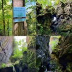 Click here for more information or to register Hosting Club: Toronto, Blue Mountains
Category: Car Hike
Location (Google Maps): Where Pretty River Access Trail leaves Pretty River Rd. N44.424089, W80.288414 Hike Leader(s): Ross Estrella Click here to contact Hike Leader(s) Pace: Moderate
Terrain: Hilly, Rocky
Distance: 11.5 kms Description
The beauty of hiking is about savouring the experience, cherishing the views and the chance to connect with nature and people. Join me in hiking the scenic Nottawasaga Lookout Nature Reserve and the Standing Rock and Caves Side Trail. Let’s enjoy the amazing beauty of it’s cliffs, crevices and ravine habitants along the forested slope that offers the cross section of the Escarpment flora, fauna and topography. We’ll be at moderate pace of 3-4 kph to enjoy the beautiful landscape. Bring snack, lunch and sufficient water to quinch your thirst. Bring sun screen, sun head protection and bug spray in the event our friendly mosquitoes welcome us. Hiking shoe and poles are strongly recommended. Please dress appropriately as to weather forecast. Have your personal medications and health card with you at all times. Please arrive fifteen minutes early.
- Balsam Wetlands Nature Reserve
9:00 AM 07/27/2024 https://hikes.brucetrail.org/event/two-hike-day-hike-1-balsam-wetlands-nature-reserve/2024-07-27/ Click here for more information or to register Hosting Club: Blue Mountains
Category: Register in person the morning of hike.
Location (Google Maps): Hike meets in the parking lot behind Tim Hortons on First St. in Collingwood. Hike Leader(s): Mary-Lynne Chenard Click here to contact Hike Leader(s) Pace: Leisurely – 3 km/hr. or less
Terrain: Moderate – Some hills and/or some poor footing
Distance: 6.5 km Description
This hike is through the 284 acres of Balsam Wetlands. We will park at km 34.2 on Concession 10 South and proceed hiking across a farmer’s field and continue through a pine forest. This hike has recently been realigned so that it no longer follows the Highlands Nordic cross country ski trail and now goes through woodlands and some 9 interesting rock formations to the Duntroon Quarry. We will then follow the white trail passing some deep crevices to the Bruce Trail parking lot off 91. Hikers will then be shuttled back to the cars. Bring a snack and water.
|
28 | 29 | 30 | 31 - Creemore Nature Preserve-Mingay Loop
9:00 AM 07/31/2024 https://hikes.brucetrail.org/event/creemore-nature-preserve-mingay-loop-4/2024-07-31/ Click here for more information or to register Hosting Club: Blue Mountains
Category: Register in person the morning of hike.
Location (Google Maps): Hike meets in the parking lot behind Tim Hortons on First St. in Collingwood. Hike Leader(s): Terry Kimmberly Click here to contact Hike Leader(s) Pace: Leisurely – 3 km/hr. or less
Terrain: Easy – Mostly flat and usually good footing
Distance: 5 km Description
Hike this 204 acre property featuring majestic mature sugar maple trees and a meandering cold water stream. This lush Niagara Escarpment forest is home to a variety of rare and at-risk species. The sounds of hairy and pileated woodpeckers echo through the trees. We will creatively combine Mingay, Maple Leaf and Trout trails to complete a loop-deloop. Bring a snack and water
| August | August | August |
