Hike Schedule
Join us for a hike! Registration required:
All hikes available to BTC members. Some hikes are open to non-members.
TIP: The calendar view displays up to 7 hikes on a day, but often there are more. Click “More events” to see them all.
Categories
- 07June 7, 2026
Car Hike: Uxbridge-Brock Track
https://hikes.brucetrail.org/event/car-hike-uxbridge-brock-track-5/Sorry, the registration cut-off time for this hike has been reached.Not a member? Click here to join today!Hosting Club: Toronto
Category: Car Hike
Location (Google Maps):Meet at the Brock Tract parking lot on the east side of Durham 1/Brock Rd., approximately 5 km south of Coppin’s Corners, Uxbridge or 1 km north of Uxbridge Pickering Town Line. 1401 Brock Rd. (Free parking).
Hike Leader(s): Amir Alemohammad Click here to contact Hike Leader(s)
Pace: Moderate (3-4 km/hr)
Terrain: Flat, Hilly, Level 2 (Intermediate – some hills and uneven surfaces, rocks and roots underfoot), Variable
Distance (km): 15-16 kmDescription
Join us for a wonderful hike in Uxbridge the capital trail of Canada, in starting from Brock Track parking lot. We will hike the Brock Track and Wilder Forest among the amazing trails of Uxbridge.Boots mandatory, poles recommended, bring two litres of water and dress according to weather conditions.
Please arrive at 7:45 for a 8:00 start.
Beware, Iphone Maps may take you to the wrong location. Check the location with Google Maps the previous night.
This is a joint hike with Oak Ridges Trail Association (ORTA).

Nature Reserves at Otter Lake and MapleCross at Cape Chin
https://hikes.brucetrail.org/event/nature-reserves-at-otter-lake-and-maplecross-at-cape-chin/Sorry, the registration cut-off time for this hike has been reached.Not a member? Click here to join today!Hosting Club: Niagara, Peninsula
Category: Peninsula Blue Series
Location (Google Maps): Meet at Bruce Trail Parking lot located off of Cape Chin North Road.Hike Leader(s): Barb Reuber Click here to contact Hike Leader(s)
Pace: Medium (3.0 – 4.5 km/h): A comfortable pace for most hikers with steady progress.
Terrain: Moderate: Rolling hills, mild slopes and rocky paths.
Distance: 15 kmDescription
Peninsula BTC is offering a series of hikes covering all of the side trails on the Peninsula section of the Bruce Trail. These hikes are a great opportunity for those who want to do some hiking but don’t want to commit to a full end-to-end; for those who have completed an end-to-end and want to explore more of the beautiful trails on the Peninsula and for locals and visitors who want to get out on the trail on the weekend.The series will include 27 hikes on Sundays (and maybe the odd Saturday) over 2026 and 2027, covering more than 150 km of side trails or 78 trails! We will be offering hikes on a roughly biweekly basis, with hikes posted approximately two months in advance. The hikes will generally be loop hikes, although car shuttling may be required for a few hikes. Register for each hike individually, no need to commit to all 27 hikes!
For those who would like to earn the Peninsula Side Trails badge, these hikes provide a chance to join a group for some or all of the side trail hikes.
This hike features two spectacular nature reserves at Otter Lake and MapleCross Cape Chin. Both of these reserves contain vital wetlands and deep forest ecosystems providing uninterrupted habitat for many species. As well, Maple Cross includes spectacular cliffs and the iconic view at Cape Chin. This is a long hike at 15 km. We will hike the Cape Chin Meadows, Pat Daunt, Bard and Otter Lake Side Trails.
Hikers should be prepared for cool weather and possible wet trails. Bring a lunch, water and snacks. Hike leader will contact registered hikers one week before the hike.
If you would like to be notified when the side trail hikes are posted, go to the bottom of the Hikes page on the PBTC website to sign-up for hike notifications.
Caledon Hills E2E in 4 - Hike #3
https://hikes.brucetrail.org/event/caledon-hills-4-hike-e2e-3/Sorry, the registration cut-off time for this hike has been reached.Not a member? Click here to join today!Hosting Club: Caledon Hills
Category: End-to-End
Location (Google Maps): Roadside parking – km 35.0 on Coolihans Sideroad, east of where the trail crosses the road.Hike Leader(s): Dan Patterson Click here to contact Hike Leader(s)
Pace: Medium – 3 to 4 km/hour
Terrain: Strenuous – hilly with steep climbs and some poor footing
Distance: 19.1 kmDescription
Meet at Coolihans Side Rd., roadside parking. We will shuttle to Willoughby Rd. at the end of Escarpment Sideroad to start our hike. Bring sufficient water, electrolytes, bug spray, sun glasses, lunch and snacks. Poles are helpful. Volunteers will be required to participate in shuttling and driver return as well as a sweep.Go Train Hike: Battle Of Stoney Creek Re-enactment
https://hikes.brucetrail.org/event/go-train-hike-battle-of-stoney-creek-re-enactment/Sorry, the registration cut-off time for this hike has been reached.Not a member? Click here to join today!Hosting Club: Toronto
Category: GO Train Hike
Location (Google Maps): Meet in the Great Hall of Toronto’s Union Station to take Niagara bound train to Stoney Creek. The train will also stop at Exhibition and Port Credit GO StationsHike Leader(s): Tom Swales Click here to contact Hike Leader(s)
Pace: Moderate (3-4 km/hr)
Terrain: Level 2 (Intermediate – some hills and uneven surfaces, rocks and roots underfoot)
Distance (km): 10 kmDescription
We will hike from Confederation GO Station in Stoney Creek toward the Devil’s Punchbowl Side Trail and then into Battlefield Park. The battle re-enactment will take place at 2:00 PM. We will return to the GO station by bus. Steep ascent to the view from the Devil’s Punchbowl. Details will be updated closer to the event date.#5 Side Trail Challenge the Twelve
https://hikes.brucetrail.org/event/5-side-trail-challenge-the-twelve/Sorry, the registration cut-off time for this hike has been reached.Not a member? Click here to join today!Hosting Club: Niagara
Category: Loop
Location (Google Maps): Twelve Mile Creek #5 side trail challengeHike Leader(s): Heather Howkins Click here to contact Hike Leader(s)
Pace: Medium 3- 4 km/hr
Terrain: Easy: mostly flat, good footing
Distance: 10.4Description
#5 hike in the side trail challenge .We will meet at the parking lot on the Twelve and hike along the creek,
photos required : Graffiti under the bridges, Twelve Mile Creek, pedestrian bridge over highway 406
This is a an easy trail, without much shade. Please bring snack, water and be prepared for the weather.
Rainbow Hike at Bruce Peninsula National Park
https://hikes.brucetrail.org/event/rainbow-hike-at-bruce-peninsula-national-park/Sorry, the registration cut-off time for this hike has been reached.Not a member? Click here to join today!Hosting Club: Peninsula
Category: Rainbow Hike
Location (Google Maps): Bruce Peninsula National Park Visitors Centre
120 Chi sin tib dek Road, Tobermory, OntarioHike Leader(s): Marg Glendon Click here to contact Hike Leader(s)
Pace: Leisurely (2.0 – 3.0 km/h): A relaxed pace with frequent breaks and a focus on enjoyment., Medium (3.0 – 4.5 km/h): A comfortable pace for most hikers with steady progress.
Terrain: Easy: Flat forested sections or lowland trails., Moderate: Rolling hills, mild slopes and rocky paths.
Distance: 2-5kmDescription
Peninsula Bruce Trail Club (PBTC) is excited to celebrate Pride Month at Bruce Peninsula National Park (BPNP) on the Bruce Trail!This inclusive, family-friendly 2SLGBTQIA+ hike offers a safe and supportive space for trans, gay, lesbian, bisexual, queer, 2Spirit, intersex, asexual people, as well as allies and friends.
The day includes two hiking options. We’ll begin with a short introduction at the Visitor Centre, then walk an easy section of the Bruce Trail to the Burnt Loop Lookout with a Park Interpreter and PBTC Hike Leaders. Park Interpretation will include an introduction to this unique ecosystem and the wildlife which it supports, using a Queer Ecology perspective.
At Burnt Point Loop Lookout, participants can choose to return to the Visitor Centre with PBTC hike leaders, continuing along the Bruce Trail toward the Cairn in Tobermory. Or, continue with PBTC hike leaders and Park Interpreter on the more rugged Burnt Point Loop Trail.
The Burnt Point Loop hike is about 4 km and features typical Saugeen Peninsula terrain – a packed forest floor with exposed rocks and root, moderate elevation, about 1-2 metres widith natural step ups.The Trail winds through a lovely cedar forest across a rocky inlet, and includes beautiful views of Fathom Five National Marine Park, including Flowerpot Island, Bears Rump Island and Middle Island. With a bit of luck we may also spot the Chi-Cheemaun ferry making a crossing.
Both groups will meet back at the Visitor Centre to enjoy lunch together or explore the shops in Tobermory. Plan for about 3 hours for the hike and lunch.
Washrooms are available on site. All participants will receive a Bruce Trail Pride Badge to celebrate Pride month. The Bruce Trail Conservancy Pride Badge represents a celebration of 2SLGBTQIA+ inclusion on the Bruce Trail.
Parks Canada parking and entry fees apply upon arrival. https://parks.canada.ca/pn-np/on/bruce/visit/tarifs-fees.
If you would like to offer or receive a ride share, please complete the following Google Form: https://forms.gle/AtAETCoHrWTXSoY89 Grey Bruce Pride will facilitate connecting community members amongst Grey Bruce. A consent waiver is included.
You may choose to use your Parks Canada parking permit to extend your day by visiting nearby Singing Sands. Or, take a short walk to the village of Tobermory to explore the local shops and restaurants.
- 08June 8, 2026
Car Hike: Dufferin E2E 1/4
https://hikes.brucetrail.org/event/car-hike-dufferin-e2e-1-4-2/Sorry, the registration cut-off time for this hike has been reached.Not a member? Click here to join today!Hike open to BTC Members only.
Hosting Club: Toronto, Dufferin Hi-Land
Category: Car Hike
Location (Google Maps):Km 0.0 Mono Centre. Coordinates N 44.026195,W 80.071516 map 19
Hike Leader(s): Smadar Junkin Click here to contact Hike Leader(s)
Pace: Brisk (4-5 km/hr)
Terrain: Challenging, Level 3 (Advanced – steep hills and some scrambling over boulders), Variable
Distance (km): 14.1 kmDescription
First hike of 4 to complete the Dufferin section. We will shuttle to km 14.1 and hike back. Hikers are expected to in the parking area and ready to shuttle by 8:15. Everyone needs to take part in the car shuttle. Bring 2 litres of water, snacks and lunch, bug repellent , sun screen. Hiking boots.EASY DOES IT HIKE, Merrit Island
https://hikes.brucetrail.org/event/easy-does-it-hike-merrit-island-2/Sorry, the registration cut-off time for this hike has been reached.Not a member? Click here to join today!Hosting Club: Niagara
Category: Leisurely
Location (Google Maps): 8 Merrit Island, Welland,OnHike Leader(s): Diane Marlatt Click here to contact Hike Leader(s)
Pace: Leisurely <3 km/hr
Terrain: Easy: mostly flat, good footing
Distance: 4KmDescription
Fundraising hike - Sydenham Stained Glass badge in 9 hikes
https://hikes.brucetrail.org/event/fundraising-hike-sydenham-stained-glass-badge-in-9-hikes/Sorry, the registration cut-off time for this hike has been reached.Not a member? Click here to join today!This is a Multi-Day Hike
You are signing up for the following dates:
2026-06-08, 2026-06-15, 2026-06-22, 2026-08-10, 2026-08-17, 2026-08-24, 2026-08-31, 2026-09-08, 2026-09-21Hosting Club: Beaver Valley, Sydenham
Location (Google Maps): On Monday June 8th – parking area at Blantyre – km 0.0 – at 9 am
Meeting locations for other hiking dates are listed in the detailed hike plan to be distributed after registration.Hike Leader(s): David Royston Click here to contact the hike leader.
Pace: Medium
Terrain: Moderate, Some rocky footing, Some steep sections
Length of Hike: variesDescription
All 9 Stained Glass badges over 3 years – Hike Series #5 – Sydenham Section – we will complete an end to end of the Sydenham section over 9 days as follows: (1) Blantyre to SR 3; (2) SR 3 to Woodford; (3) Woodford to SR 24; (4) SR 24 to Bothwells Corner; (5) Bothwells Corner to Concession 3; (6) Concession 3 to Indian Acres Road; (7) Indian Acres Road to Lundy Road; (8) Lundy Road to Colpoys Range Road; and (9) Colpoys Range Road to Wiarton. The detailed hike plan will be distributed to participants on registration.All hikes will proceed at a moderate pace (approx 4 km per hour not including the lunch stop). Breaks will be taken throughout each hike as appropriate. Hikes will proceed rain or shine.
Except for shuttles, hikers are expected to be self reliant. Please bring everything you may need such as water, lunch, snacks, personal medical kit and appropriate footwear and clothing.
At the beginning of the first hike, participants will be expected to sign a waiver in favour of the hike leader similar to the one in favour of the BTC signed on registration. If there are any questions, please contact the hike leader.
CANCELLED - Duncan Escarpment Provincial Park
https://hikes.brucetrail.org/event/duncan-escarpment-provincial-park/Sorry, the registration cut-off time for this hike has been reached.Not a member? Click here to join today!Hosting Club: Iroquoia
Category: General Hike
Location (Google Maps): Duncan Escarpment Provincial Park – small parking lot on Side Road 9. If you would like to carpool from Mississauga, please contact the Hike Leader.Hike Leader(s): Karen Bergmann Click here to contact Hike Leader(s)
Pace: Medium – 3 to 4 km/hr
Terrain: Strenuous – Hilly with steep climbs and some poor footing
Distance: 11 kmsDescription
Time for an adventure in the Beaver Valley section! This loop hike is challenging and so rewarding! Takes about 2 hours drive from the GTA. We’ll hike on the main trail and a couple of side trails in a loop. There are hilly parts and plenty of rocks and roots. Bring water and a snack/lunch. If you would like to carpool from Mississauga, I am happy to have a few people ride with me. I will send an email a couple of days prior to the hike.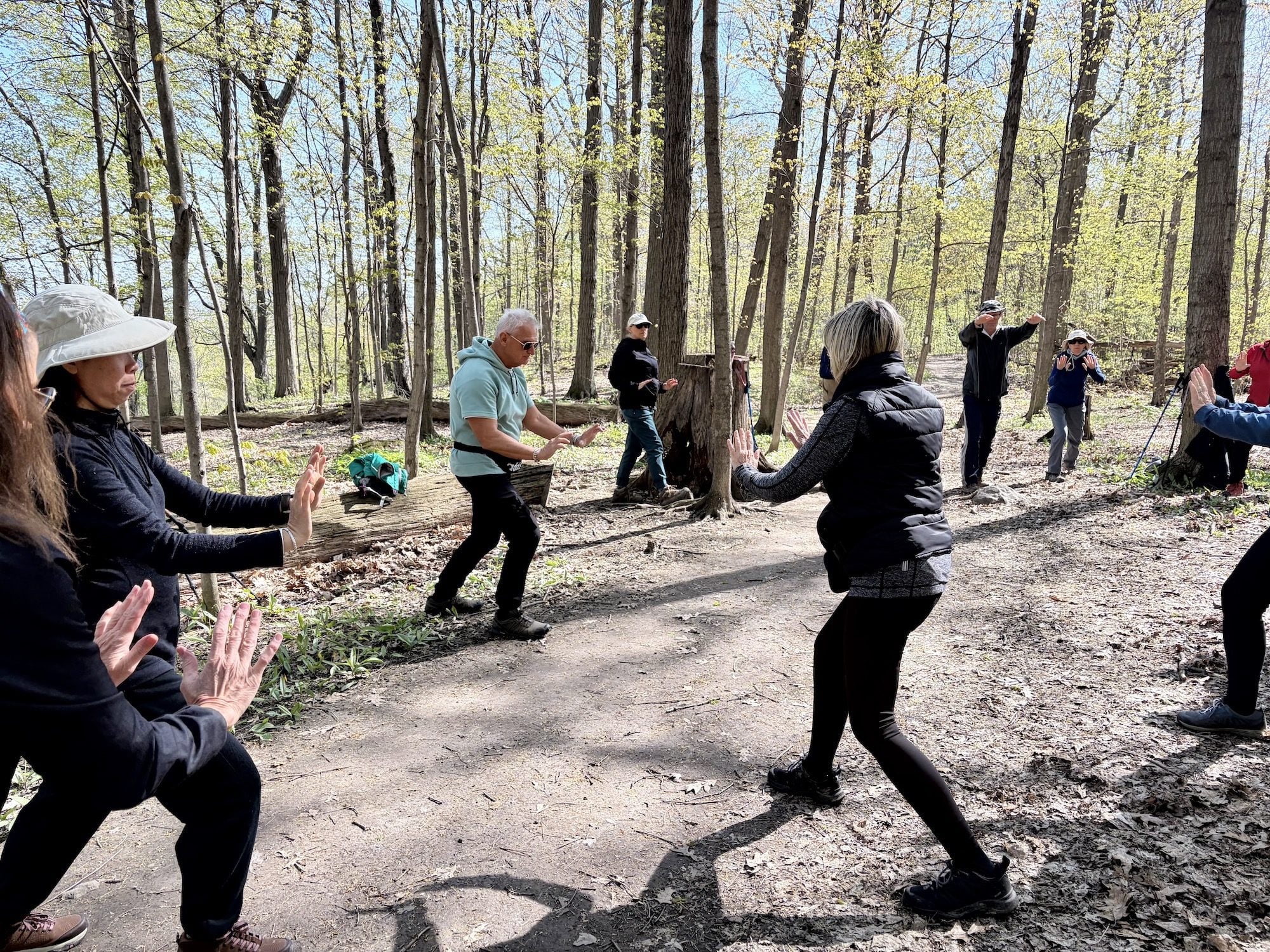
Tai Chi with Hike
https://hikes.brucetrail.org/event/tai-chi-with-hike/Sorry, the registration cut-off time for this hike has been reached.Not a member? Click here to join today!Hosting Club: Niagara
Category: Mindfulness
Location (Google Maps): Meet at the entrance to Woodend Conservation Area, Taylor Rd, Niagara-on-the-LakeHike Leader(s): Margaret Northfield Click here to contact Hike Leader(s)
Pace: Medium 3- 4 km/hr
Terrain: Moderate: some hills and some poor footing
Distance: 5-6kmDescription
Seeking balance, calm and strength without high impact exercise? Join us for a short hike. Tai Chi Master, Mike Van Natter will instruct us on the benefits of Tai Chi as well as lead us through several Tai Chi movements along our way. - 09June 9, 2026
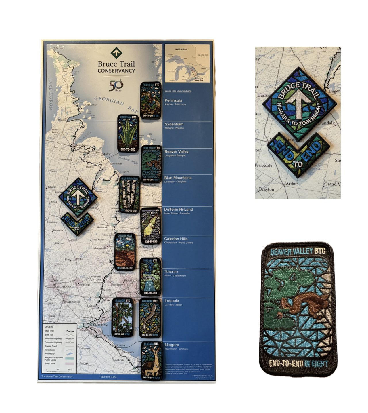
Beaver Valley Stained Glass Badge Fundraiser - June 9, 10, 11, 12 13, 2026 7:30 meet time
https://hikes.brucetrail.org/event/beaver-valley-stained-glass-badge-fundraiser-june-9-10-11-12-13-2026-730-meet-time/Sorry, the registration cut-off time for this hike has been reached.Not a member? Click here to join today!Hosting Club: Iroquoia, Beaver Valley
Category: Stained Glass Badge End to End Fundraiser Hike
Location (Google Maps): Registered participants will receive a WhatsApp invitation (optional)which can be used for photo share and other pertinent information.
June 9 – Meet at the Kolopore Uplands Parking Lot Grey Rd 2 located 650m south of the Trail 44.422919, -80.405597 (30) Shuttle to Roadside Parking along the north side of Maple Lane 44.504973, -80.331780 (4) 26km
June 10 – Meet at Kolopore Uplands, Shuttle to Roadside Parking on the northern shoulder of Sideroad 7B where the main trail enters the forest. 44.395310, -80.518495 (6) 20km
June 11 – Meet at Hogg’s Falls parking lot 44.285307, -80.543081 (16) Shuttle to Sideroad 7B 21km
June 12 – Meet at Hogg’s Falls Shuttle to John Muir Epping Lookout – Enter from Grey Rd 7, 300 m north of 19 Sideroad 44.461522, -80.554756 (40) 29km
June 13 – Meet at John Muir Lookout. Shuttle to BTC parking lot on the east side of Grey Rd 12 where the trail crosses the road. 44.500537, -80.632902 (15) 24kmHike Leader(s): Ruth Moffatt Click here to contact Hike Leader(s)
Pace: Brisk – 4 to 5 km/hr, Medium – 3 to 4 km/hr
Terrain: Dependent on Conditions, Moderate – Some hills and/or some poor footing, Strenuous – Hilly with steep climbs and some poor footing
Distance: 20-29 per dayDescription
Beaver Valley Stained Glass Badge Fundraiser End 2 EndEveryone who is registered for this hike series will be invited to join an optional WhatsApp which can be used to share photos and other information.
In this series of 5 hikes you will get a chance to test your strength, endurance and perseverance! You will be rewarded with the breathtaking views of spring in the valley, good company and of course the Beaver Valley Stained Glass badge ETE badge. This is a monetized hike – proceeds go to the Beaver Valley Bruce Trail Club to continue to maintain infrastructure along the trail. There are no refunds.
This E2E is intended for strong hikers only. We will be hiking at a steady pace with very few short breaks It will be tough hiking due to the distances involved so be sure of your physical ability before signing up for this hike. We will take only a few short breaks and lunch. Photo stops, as well. It is expected that everyone keep pace with the person in front of them. Bio breaks are as you need; please let the sweep know and they will wait for you.
Please do not register for this hike unless you can commit to all 5 days. If you need to miss one day, please make it up before this hike begins.
The Stained Glass ETE Beaver Valley Club series can only be completed with a club leader.
All hikes in this series will include a car shuttle and everyone will take a turn as a shuttle driver. Please have your vehicle passenger-ready with at least 4 available seatbelts.
If you have any questions please email me.
Please bring all snacks/lunch and at least 2l of water as well as all the other things you require for a long day hike including a first aid kit, bug spray, sunscreen and poles, if you use them.
No dogs. Do not show up unregistered.
Any questions may be directed through contact on this form.
If you cannot make it, please remove yourself from registration.To cancel your registration, here is a step by step:
– Sign into your account on the BTC website
– Click on My Hikes under your account
– This will take you to a list of hikes you have registered for
– Scroll down to the appropriate hike and cursor over to the far right hand column under the Action column.
– Click Cancel under the hike you wish to cancelThere are no drop outs. If for some reason you are unable to complete the days’ hike, you will be responsible for finding your way back to your vehicle. Badges will be presented on the last day, hopefully. If not, a list of finishers will be sent to the club for mailing out.
Refunds: https://brucetrail.org/paid-hike-refund-policy/
Long Haulers Hike NEW TIME NEW LOCATION
https://hikes.brucetrail.org/event/long-haulers-hike-new-time-new-location-4/Sorry, the registration cut-off time for this hike has been reached.Not a member? Click here to join today!Hosting Club: Niagara
Location (Google Maps): Short Hills Wiley Road, Thorold
Pace: Fast 5+ km/hr
Terrain: Moderate: some hills and some poor footing
: 10k+Description
Back to our regular Spot for the Tuesday Long Hike. Note the new location. We will hike the trails around Short Hills Dress for the weather and bring sunscreen bug spray, poles snack and drinkCar Hike: Dufferin E2E 2/4
https://hikes.brucetrail.org/event/car-hike-dufferin-e2e-2-4-2/Sorry, the registration cut-off time for this hike has been reached.Not a member? Click here to join today!Hike open to BTC Members only.
Hosting Club: Toronto, Dufferin Hi-Land
Category: Car Hike
Location (Google Maps):Km 28.3, 1st Line E coordinates N 44.148246,W 80.118529 map 20
Hike Leader(s): Smadar Junkin Click here to contact Hike Leader(s)
Pace: Brisk (4-5 km/hr)
Terrain: Level 3 (Advanced – steep hills and some scrambling over boulders)
Distance (km): 14.2 km.Description
Second hike of the series to complete the Dufferin section. Please be in the parking area at 8;15 and be ready to shuttle by 8:30. Bring 2 litres of water, food, bug repellent, sun screen. Hiking boots. We will shuttle to km 14.1 and walk back. Everyone is expected to participate in the car shuttle during the 4 days hike.Peter Beecham and Griffith Ravine Side Trails
https://hikes.brucetrail.org/event/peter-beecham-and-griffith-ravine-side-trails/Sorry, the registration cut-off time for this hike has been reached.Not a member? Click here to join today!Hosting Club: Dufferin Hi-Land
Category: Tuesday Hike
Location (Google Maps):(Google Maps) Caledon Hills Section, Map 18. Meet at roadside parking on 4th Line East, Mono 1.5 km north of 5 Sideroad.
Hike Leader(s): Les Babbage, Inge Eckerich, Julie Daley,Tony Evangelista Click here to contact Hike Leader(s)
Pace: Leisurely
Terrain: Moderate
Distance: Long Hike 5 km Short Hike 2.7 kmDescription
From roadside parking at km 54.9, we will hike west via the Peter Beecham Side Trail and Main Trail until we reach 3rd Line EHS. At this point, we will retrace our steps and return to the parking lot, taking the Griffith Ravine Side Trail at Km 56.2. The short hike will take the Griffith Ravine Side Trail when we first meet it to return to the parking.Bring water, snacks, and sunscreen. Hiking poles are recommended.
9:15 Short Hike, Short Hills Provincial Park, St. Catharines
https://hikes.brucetrail.org/event/915-short-hike-short-hills-provincial-park-st-catharines/Sorry, the registration cut-off time for this hike has been reached.Not a member? Click here to join today!Hike open to BTC Members only.
Hosting Club: Niagara
Category: Hike
Location (Google Maps): Short Hills Provincial Park, Pelham Rd entranceHike Leader(s): Debbie Demizio Click here to contact Hike Leader(s)
Pace: Medium 3- 4 km/hr
Terrain: Moderate: some hills and some poor footing
Distance: 7 kmDescription
Hike the main and side trails of Short Hills Provincial Park. Please wear appropriate footwear, bring water and hiking poles. Check yourself for ticks following the hike.Forks of the Credit - postponed.
https://hikes.brucetrail.org/event/forks-of-the-credit-6/Sorry, the registration cut-off time for this hike has been reached.Not a member? Click here to join today!Hosting Club: Caledon Hills
Category: Tuesday Hikers
Location (Google Maps): Mississauga Rd. intersection with Elora-Cataract Trailway.
Driving direction: From Highway 401, north on Mississauga Rd., pass through Belfountain village, after crossing Cataract Rd. and Elora-Cataract Trailway, park on either side of the road.
Alternate direction: North on Highway 410, continue on Highway 10, at Caledon Village, left on Charleston Sideroad (24), left on Mississauga Rd., drive 2 km to the roadside parking.Hike Leader(s): Mohammad Shafiq Click here to contact Hike Leader(s)
Pace: Medium – 3 to 4 km/hour
Terrain: Moderate – some hills and/or some poor footing
Distance: 11 kmDescription
Will enter Forks of the Credit Conservation Area using Elora-Cataract Trailway and hike main Bruce Trail, Mill Pond Trail and parts of conservation trails.
Bring water and snack; poles are recommended.
Optional refreshment stop at one of the cafes nearby – more information on the hiking day.Urban Walk: Valley View Park
https://hikes.brucetrail.org/event/urban-walk-valley-view-park-thornhill-175/Sorry, the registration cut-off time for this hike has been reached.Not a member? Click here to join today!Hosting Club: Toronto
Location (Google Maps): Parking lot is off Sycamore Drive, East of Bayview , across Starbucks plaza
Bus 91 from Finch East station stops at Sycamore station.Hike Leader(s): MOHAMMAD AGHAMIRI Click here to contact Hike Leader(s)
Pace: Moderate (3-4 km/hr)
Terrain: Hilly, Level 2 (Intermediate – some hills and uneven surfaces, rocks and roots underfoot)
Distance (km): 6-7 kmDescription
We will explore Valleyview and Maple View parks, and walk along German Mill Creak, in return we stop in Huntington park and have snack under beautiful shed.Although this is considered an “Urban Walk”, you can expect some hills up and down and uneven surfaces with tree roots. Please bring hiking poles, Ice cleats water and snacks.
Terra Cotta Loop Hike
https://hikes.brucetrail.org/event/terra-cotta-loop-hike-2/Sorry, the registration cut-off time for this hike has been reached.Not a member? Click here to join today!Hike open to BTC Members only.
Hosting Club: Caledon Hills
Category: General
Location (Google Maps): Terra Cotta Conservation Area (entry fee $8 per person at the gate)
14452 Winston Churchill Blvd., Halton HillsHike Leader(s): Jane Hull Click here to contact Hike Leader(s)
Pace: Medium – 3 to 4 km/hour
Terrain: Moderate – some hills and/or some poor footing
Distance: 6.5 kmDescription
Join us for a late spring loop hike through Terra Cotta Conservation area. We will hike several of the trails (moderate difficulty with some hilly sections/roots/rocks) and may spot some remaining spring wildflowers, or see some painted turtles in the wetland ponds. Bring your choice of hydration and snacks.. Hiking boots/shoes required. Participants will be notified the night before if the hike must be cancelled due to inclement weather.POSTPONED due to weather -Tuesday Trekkers- Dufferin (km36.8-55.5) 3of 3
https://hikes.brucetrail.org/event/dufferin-km36-8-55-5-3-of-3/Sorry, the registration cut-off time for this hike has been reached.Not a member? Click here to join today!Hosting Club: Beaver Valley
Location (Google Maps): Meet at the Roadside parking on Mulmur-Nottawasaga Townline, 550 m east of Lavender Rd at the Cemetery. Km 54.9 Map 21 Ed 31
Shuttle to BT parking off of 15th Sideroad.Hike Leader(s): Kristina Rettie Click here to contact the hike leader.
Pace: Brisk, Medium
Terrain: Moderate, Some rocky footing, Some steep sections, Strenuous
Length of Hike: 18kmDescription
This Dufferin E2E will take place over 3 Tuesdays. Come out for all of them and earn you Dufferin E2E badge (you can apply for this independenly) or just come to the ones that interest you. We will start at km 0 and make our way north to km 55.5 covering the entire Dufferin section.This will be a car shuttle hike so please come with your car passenger ready. We will all take turns being the shuttle driver.
This time of year we can expect all types of trail conditions. Please be prepared with for the condition of the day.
Bring water lunch and a snack
Please no dogs
Walk In Nature Series (WINS) Tuesday Summer Evenings - Jones Falls trails
https://hikes.brucetrail.org/event/walk-in-nature-series-wins-jones-falls-trails/Sorry, the registration cut-off time for this hike has been reached.Not a member? Click here to join today!Hosting Club: Sydenham
Category: General Hike
Location (Google Maps): Click the Google Maps link to take you there. Meet and park at the Owen Sound Transportation parking lot 200 m north of Springmount. In the Bruce Trail Reference, Edition 31, meet at the Merle Gunby Side Trail trailhead, west of km 101.8 on Map 32Hike Leader(s): Stewart Brown Click here to contact Hike Leader(s)
Pace: Medium: 3 to 4 km/h
Terrain: Moderate: Some hills and/or poor footing
Distance: 5 kmDescription
Tuesday evening WINS summer hikes begin at 6:30 p.m. as a way to enjoy the daylight and nice weather of summer evenings. Join us on this evening hike to view Jones Falls both from above and below. Enjoy the tranquil beauty of the forests of the Pottawatomi Convservation area on the Merle Gunby side trail atop the escarpment and the Memorial Forest side trail along the base of the escarpment. - 10June 10, 2026
WEDNESDAY WALKERS -Kolapore to Metcalfe
https://hikes.brucetrail.org/event/wednesday-walkers-kolapore-to-metcalfe-3/Sorry, the registration cut-off time for this hike has been reached.Not a member? Click here to join today!Hosting Club: Beaver Valley
Location (Google Maps): Meet in the Metcalfe Rock parking lot, just south of km 27.9, Map 25, Edition 31
Hike Leader(s): Margaret Yaraskavitch Click here to contact the hike leader.
Pace: Medium
Terrain: Moderate, Some rocky footing, Some steep sections
Length of Hike: 5.5kmsDescription
We will meet in the Metcalfe Rock parking lot and then arrange ourselves to shuttle to the Kolapore Parking lot. The hike starts by getting some road walking out of the way. Then it’s a varied walk past pasture/field/meadow, through cedar stands and under deciduous forest canopy to the base of Metcalfe Rock. Please bring water. - 11June 11, 2026
NEW TIME 8:00 Long Hike, Glen Road Jordan
https://hikes.brucetrail.org/event/new-time-800-long-hike-glen-road-jordan-4/Sorry, the registration cut-off time for this hike has been reached.Not a member? Click here to join today!Hosting Club: Niagara
Location (Google Maps):
3640 Glen Road Jordan
Pace: Fast 5+ km/hr
Terrain: Strenuous: hilly, with steep climbs, poor footing
: 10 kmDescription
Hike in and around Ball’s Falls and Jordan. Dress for the weather: bring bug spray, sunscreen drink and poles.Car Hike: Dufferin E2E 3/4
https://hikes.brucetrail.org/event/car-hike-dufferin-e2e-3-4-2/Sorry, the registration cut-off time for this hike has been reached.Not a member? Click here to join today!Hosting Club: Toronto, Dufferin Hi-Land
Category: Car Hike
Location (Google Maps):Km 28.3 1st Line E coordinates N 44.148246,W 80.118529 map 20
Hike Leader(s): Smadar Junkin Click here to contact Hike Leader(s)
Pace: Brisk (4-5 km/hr)
Terrain: Challenging, Level 3 (Advanced – steep hills and some scrambling over boulders), Variable
Distance (km): 12.4 kmDescription
3ed hike towards the completion of the Dufferin E2E. Hikers are expected to arrive 15 minutes early and be ready to shuttle. We will shuttle to km 40.7 and hike back. Bring food, 2 litres of water, bug repellent, sun screen. Hiking boots. Everyone is expected to participate in the car shuttle during the 4 days hike.Hiking around Jordan
https://hikes.brucetrail.org/event/hiking-around-jordan-58/Sorry, the registration cut-off time for this hike has been reached.Not a member? Click here to join today!Hosting Club: Niagara
Location (Google Maps): Sho’arishon Park (Jordan Hollow)
Hike Leader(s): Bill Russell Click here to contact Hike Leader(s)
Pace: Medium 3- 4 km/hr
Terrain: Moderate: some hills and some poor footing
Distance: 7 kmDescription
Hiking in and around Jordan, Jim Rainforth Trail and Balls Falls (alternating every 3 weeks)Urban Walk: Valley View Park
https://hikes.brucetrail.org/event/urban-walk-valley-view-park-thornhill-176/Sorry, the registration cut-off time for this hike has been reached.Not a member? Click here to join today!Hosting Club: Toronto
Location (Google Maps): Parking lot is off Sycamore Drive, East of Bayview , across Starbucks plaza
Bus 91 from Finch East station stops at Sycamore station.Hike Leader(s): MOHAMMAD AGHAMIRI Click here to contact Hike Leader(s)
Pace: Moderate (3-4 km/hr)
Terrain: Hilly, Level 2 (Intermediate – some hills and uneven surfaces, rocks and roots underfoot)
Distance (km): 6-7 kmDescription
We will explore Valleyview and Maple View parks, and walk along German Mill Creak, in return we stop in Huntington park and have snack under beautiful shed.Although this is considered an “Urban Walk”, you can expect some hills up and down and uneven surfaces with tree roots. Please bring hiking poles, Ice cleats water and snacks.

Toronto Islands Evening Walk
https://hikes.brucetrail.org/event/urban-walk-toronto-islands-evening-walk-24/Sorry, the registration cut-off time for this hike has been reached.Not a member? Click here to join today!Hosting Club: Toronto
Location (Google Maps):
Jack Layton Ferry Terminal, by the gate to the Wards Island Ferry. Please arrive 20 minutes prior to departure to check in with hike leader.
From Union Station take the LRT and get off at the stop Ferry Docks.Walk up to the Ferry Docks on Queens Quay West, street level. at the foot of Bay Street.
Hike Leader(s): Miriam Stevens Click here to contact Hike Leader(s)
Pace: Leisurely (2-3 km/hr)
Terrain: Flat, Level 1 (Easy – mostly on flat, well maintained trails with hard-packed surface)
Distance (km): 6-9 kmDescription
After a day’s work come and “cool off” on the Toronto Islands free of fumes and traffic. Enjoy the view of the city skyline and Toronto’s beautiful island parkland.
Pack a dinner for a sit down picnic. Also bring a warm jacket and flashlight.
Return fare ticket for the ferry is $9.57 for adults, $6.15 for seniors
Please check the hike schedule for weather related cancellations (hike will be updated by 11:00 AM day of the hike if any changes)
Toronto Island evening hikes will take place every Thursday in May and June 2026.
Same time and same meeting place. No preregistration is required – just show up at the ferry docks at 5:40 PM and sign in with the hike leader. - 12June 12, 2026
23rd Annual Excellent Orchid Adventure Weekend (2 overnights)
https://hikes.brucetrail.org/event/car-hike-23th-annual-excellent-orchid-adventure-weekend-2-overnights/Sorry, the registration cut-off time for this hike has been reached.Not a member? Click here to join today!This is a Multi-Day Hike
You are signing up for the following dates and times:
2026-06-12 at
2026-06-13 at
2026-06-14 atHosting Club: Toronto
Category: Car Hike
Location (Google Maps):Princess Hotel
34 Bay St, Tobermory, ON N0H 2R0Hike Leader(s): Jeanette Vincent. Brenda Menezes. David Royle. Click here to contact Hike Leader(s)
Pace: Leisurely (2-3 km/hr)
Terrain: Level 2 (Intermediate – some hills and uneven surfaces, rocks and roots underfoot)
Distance (km): 10 – 12 KmDescription
We continue Greg Vincent’s legacy of weekends away. Please join Jeanette Vincent, Brenda Menezes and David Royle as we explore the Tip o’ the Bruce, Tobermory in search of orchids and other flowers. Our search will extend to Flowerpot Island (cost approx. $65.00 for the glass bottom ferry and Parks Canada fee). The wildflowers in the Tobermory area at this time of year are wonderful and our slow paced walks will focus on these and other flowers and the area’s great views. We stay and have our meals at a comfortable hotel overlooking Little Tub Harbour. Approximately 10/12km/day.Before registering at the hotel please contact us for the price package of the hotel for the weekend.
This outing is restricted to those staying with us at the Princess Hotel in Tobermory for the weekend – the hotel fills quickly. You will need a car to access this outing. Please contact the Princess Hotel for a reservation.1-519-592-8282 or info@tobermoryprincesshotel.com and mention Vincent/Royle Excellent Orchid weekend.
Car Hike: Dufferin E2E 4/4
https://hikes.brucetrail.org/event/car-hike-dufferin-e2e-4-4-2/Sorry, the registration cut-off time for this hike has been reached.Not a member? Click here to join today!Hike open to BTC Members only.
Hosting Club: Toronto, Dufferin Hi-Land
Category: Car Hike
Location (Google Maps):Km 40.7 Prince of Wales Rd, coordinated N 44.200231,W 80.164257
Hike Leader(s): Smadar Junkin Click here to contact Hike Leader(s)
Pace: Brisk (4-5 km/hr)
Terrain: Challenging, Level 3 (Advanced – steep hills and some scrambling over boulders), Variable
Distance (km): 14.8 kmsDescription
Last to to complete the Dufferin E2E section. Bring food, water, bug repellent, sun screen. We will shuttle to km 55.5 and walk back. Everyone is expected to participate in the car shuttle during the 4 days hike. Badge day, treats day.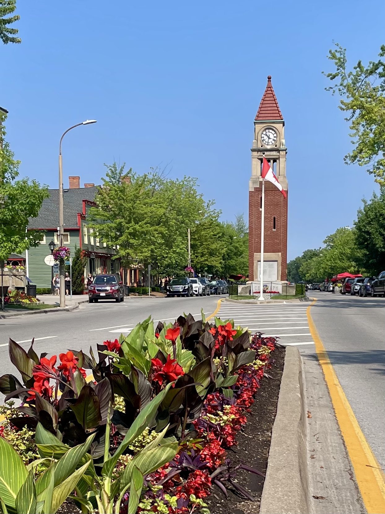
Niagara-on-the-Lake Tour
https://hikes.brucetrail.org/event/niagara-on-the-lake-tour-29/Sorry, the registration cut-off time for this hike has been reached.Not a member? Click here to join today!Hosting Club: Niagara
Category: Urban
Location (Google Maps): Park on King St near Centre at the entrance to Veteran’s Memorial Park, Niagara-on-the-LakeHike Leader(s): Margaret Northfield Click here to contact Hike Leader(s)
Pace: Medium 3- 4 km/hr
Terrain: Easy: mostly flat, good footing
Distance: 6-7kmDescription
Each Friday we will explore Niagara-on-the-Lake while getting a moderate paced walk. Discover where the Niagara River meets Lake Ontario. Experience the Heritage District, woods and the Niagara Parkway.Some weeks may be totally on sidewalks and roads while others may include a mix of trail and paved pathways.
Great way to build up endurance for longer more strenuous hikes.
Plan to stay for conversation and a coffee at Sweets & Swirls, Community Centre, Niagara Stone Rd., NOTL
Brisk Fridays - Lindenwood/Ron Savage
https://hikes.brucetrail.org/event/brisk-fridays-lindenwood-ron-savage/Sorry, the registration cut-off time for this hike has been reached.Not a member? Click here to join today!Hosting Club: Sydenham
Category: General Hike
Location (Google Maps): Click the Google Maps link to take you there. Meet and park in the Bruce Trail off-road parking lot on Lindenwood Road, 1 km east of Grey Rd 17. In the Bruce Trail Reference, Edition 31, meet at km 125.7 on Map 33.Hike Leader(s): Stewart Brown Click here to contact Hike Leader(s)
Pace: Brisk: 4 to 5 km/h
Terrain: Moderate: Some hills and/or poor footing
Distance: 18 kmDescription
Brisk Fridays hikes are, um, brisk-paced, fun and energetic. We do take time to stop and appreciate points of interest. This hike is a challenging, brisk hike through the beautiful forests of several BTC properties, Lindenwood Pond side trail, The Gap side trail, then to trails of The Glen Management Area, around the Ron Savage side trail and returning to parking northbound along the white-blazed trail.Niagara E2E #3: Louth Conservation Area to Short Hills
https://hikes.brucetrail.org/event/niagara-e2e-3-louth-conservation-area-to-short-hills/Sorry, the registration cut-off time for this hike has been reached.Not a member? Click here to join today!Hike open to BTC Members only.
Hosting Club: Dufferin Hi-Land
Category: General Hike
Location (Google Maps): Parking lot located at the end of Wiley Road in Short Hills Provincial Park. See Google Map links for GPS.Hike Leader(s): Stuart Law Click here to contact Hike Leader(s)
Pace: Medium
Terrain: Slippery and Steep Sections, Moderate
Distance: 14 kmsDescription
Join us on this shuttle hike in a series of Friday hikes across the beautiful Niagara Section. Mud, rocks and slippery slopes guaranteed. Please bring a garbage bag and an extra pair of footwear for the drive back. Boots mandatory. Hiking poles recommended. Please wear a hat, long sleeves and long pants and bring a head net for the bugs (just in case), 2.5L of water, a snack, a lunch, bug spray and sunscreen.
CANCELLED - Afternoon Hike -Terra Cotta to Walking Fern
https://hikes.brucetrail.org/event/afternoon-hike-terra-cotta-to-walking-fern/Sorry, the registration cut-off time for this hike has been reached.Not a member? Click here to join today!Hosting Club: Iroquoia
Category: Afternoon/Evening Hikes
Location (Google Maps): Meet at 4:15 pm on 10 Line, between Terra Cotta and Silver Creek Conservation Areas.Hike Leader(s): Karen Bergmann Click here to contact Hike Leader(s)
Pace: Medium – 3 to 4 km/hr
Terrain: Moderate – Some hills and/or some poor footing
Distance: 6 kmsDescription
A short afternoon hike, we will carpool from 10 Line to Winston Churchill Blvd and hike back through Terra Cotta CA along the main trail and then on the Walking Fern Side Trail, which is very technical (rocky). Bring bug spray/bug net and sufficient water and sturdy hiking boots. - 13June 13, 2026
Peninsula Sunrise Series: Burnt Point Loop & Lookout Tower
https://hikes.brucetrail.org/event/peninsula-sunrise-series-burnt-point-loop-lookout-tower-2/Sorry, the registration cut-off time for this hike has been reached.Not a member? Click here to join today!Hosting Club: Peninsula
Category: Sunrise Hike
Location (Google Maps): Bruce Peninsula National Park Visitor’s CenterHike Leader(s): Kathleen Stahlbaum Click here to contact Hike Leader(s)
Pace: Leisurely (2.0 – 3.0 km/h): A relaxed pace with frequent breaks and a focus on enjoyment.
Terrain: Easy: Flat forested sections or lowland trails., Moderate: Rolling hills, mild slopes and rocky paths.
Distance: ~6 kmDescription
Experience the magic of dawn on the Bruce Trail with the Sunrise Hike Series offered by the Peninsula Bruce Trail Club. These early morning hikes provide a perfect opportunity to awaken your senses, boost your energy, and immerse yourself in the tranquility of nature as the sun paints the sky with breathtaking hues. As we make our way through scenic forest trails, we’ll pause to witness the first light shimmering on the turquoise waters of Georgian Bay – a sight that will surely leave you in awe!Beyond the beauty, morning light helps regulate your circadian rhythm, elevating your mood, boosting energy levels and improving sleep quality. Whether you’re looking to start your day with a sense of calm, capture stunning sunrise photos, or simply reconnect with nature, these hikes offer a unique and inspiring way to greet the day.
On Saturday June 13th, join us in hiking the Burnt Point Loop where we’ll experience the sun rising over the Bay from the edge of the shoreline as well as the iconic Bruce Peninsula National Park Visitor’s Center Lookout Tower. We’ll have the joy of taking in the stunning colours of the sky as the first light sparkles on the stunning turquoise waters. This peaceful sunrise hike is the perfect way to connect with nature, capture some incredible photos, and start the day with fresh air and inspiration. Whether you’re a morning person or just love a good adventure, come experience the magic of dawn from one of the best vantage points on the Bruce Peninsula!
Don’t forget to bring a headlamp or flashlight (preferably with a red light setting) as we begin our adventure in the pre-dawn quiet. Join us and discover how a sunrise hike can nourish your mind, body, and spirit – setting the tone for a brighter, more balanced day.
This hike is approximately 6 kms in length. Expect to be on the trail for 2-3 hours. Pace will be leisurely with ample time to enjoy the sunrise, take some photographs, and nourish yourself!
How to prepare
- Get a good night’s sleep
- Bring lots of water and a snack (breakfast and/or coffee are recommended if that’s your thing!)
- Bring a headlamp or flashlight (preferably with a red light setting)
- Wear waterproof hiking boots (There will be mud!)
- Hiking poles are recommended but not necessary
- Bring insect repellant or wear protective clothing
- Bring sunscreen
In the event of cloudy/rainy weather, the hike will be held on Sunday, June 14th. Please watch your emails for a confirmation the week of the hike!

Laura Secord
https://hikes.brucetrail.org/event/laura-secord/Sorry, the registration cut-off time for this hike has been reached.Not a member? Click here to join today!Hosting Club: Niagara
Category: Event Hikes
Location (Google Maps): Niagara Region Offices 1815 Sir Isaac Brock Way, Thorold, ON L2V 4T7Hike Leader(s): Lynskie Click here to contact Hike Leader(s)
Pace: Medium 3- 4 km/hr
Terrain: Moderate: some hills and some poor footing
Distance: 32kmsDescription
This is a self-led hike. Hike along the Bruce Trail from Laura Secord’s Homestead in Queenston to Decew House in Thorold. Participants will be transported by bus from check in at Niagara Region office to the start of the hike and will hike at their own pace to the final checkpoint. There will be volunteer drivers available to drive you back to your car once the hike is over. You may be asked to wear a mask in the car.Bring snacks, water and bug spray. We also recommend sunscreen, basic first aid supplies, spare socks and a cell phone. There will be 3 checkpoints (2 along the trail and one at the end) to replenish water and snacks and anyone wishing to drop out of the hike should do so at a checkpoint. Hikers are responsible for informing club volunteers of their intention to drop out.
You will receive a reminder email two days before the event with further details about the hike.
TBTC Stained Glass Fundraiser Badge Two Day Hike
https://hikes.brucetrail.org/event/car-hike-tbtc-stained-glass-badge-fundraiser-two-day-hike-june13-and-june14-2026/Sorry, the registration cut-off time for this hike has been reached.Not a member? Click here to join today!This is a Multi-Day Hike
You are signing up for the following dates and times:
2026-06-13 at 08:00
2026-06-14 at 08:00Hosting Club: Toronto
Category: Car Hike
Location (Google Maps): Limehouse parking lot north of km21.6 map12, edition31 across from the school on the south side of 22 Sideroad. GPS N43.638113, W79.979272Hike Leader(s): Ross Estrella Click here to contact Hike Leader(s)
Pace: Brisk (4-5 km/hr), Moderate (3-4 km/hr)
Terrain: Hilly, Level 2 (Intermediate – some hills and uneven surfaces, rocks and roots underfoot), Rocky, Variable
Distance (km): 28Description
Join us on this two day monetized fundraiser event with the proceeds going towards the Toronto Bruce Trail Club dedicated on “Preserving a Ribbon of Wilderness for Everyone Forever”. Your eagerness joining in the conservation and preservation effort will be rewarded with coveted Stained Glass E2E Badge. Prior to signing please qualify your physical capacity as there’s no opportunity for dropping out and trail will be under mixed condition and of varying pace. Ensure you bring sufficient snacks/lunch, preferred hydration liquid, sunscreen and sun head protection. Bug spray in the event our friendly mosquitoes welcome us. Comfortable hiking shoe, poles are highly recommended. Make sure you have your personal medication/first aid kit (if any) and health card at all times.This a multi day hike June 13 and June 14 and joiners must register for both days. We’ll cover 28kms on Day One and 22kms on Day Two. There’s no perfect way to predict the weather so please dress accordingly as weather forecast. Please make sure your car is shuttle ready. Please have your enthusiasm at all times. Arrive fifteens minutes early for shuttling schedule. Registration fee is not refundable if dropping out less than a week prior to start of hike.

Sydenham Stained Glass Badge E2E in 8 Hikes
https://hikes.brucetrail.org/event/sydenham-stained-glass-badge-e2e-in-8-hikes/Sorry, the registration cut-off time for this hike has been reached.Not a member? Click here to join today!This is a Multi-Day Hike
You are signing up for the following dates:
2026-06-13, 2026-06-14, 2026-06-20, 2026-06-21, 2026-06-27, 2026-06-28, 2026-07-04, 2026-07-05Hosting Club: Caledon Hills, Sydenham
Category: End-to-End
Location (Google Maps): Meet at a parking lot off of 6th Concession Road south.Hike Leader(s): Lily Li Click here to contact Hike Leader(s)
Pace: Brisk – 4 to 5 km/hour, Medium – 3 to 4 km/hour
Terrain: Moderate – some hills and/or some poor footing
Distance: 21 kmDescription
Earn the Hart’s Tongue Stained Glass / Fundraiser badge, which is part of the collectable Bruce Trail Clubs stained glass-themed fundraiser set. This is a special series of 8 hikes in 4 weekends to complete the Sydenham section of 166 kms. Hike distances range from 18 to 23 km each day with about 4 km/hour pace. The hike is intended to be moderate to brisk.Please dress according to the weather presented that day. Bring at least 2 liters of water and electrolytes, lunch, snack, hat, sunscreen and bug spray for the long day of hike.
This is a car shuttle hike. Please have your vehicle ready as everyone will be taking a turn either to drive to the start point of our hike or to get our drivers back at the end of the day.
School Bus Hike: Forks of the Credit and Cheltenham Badlands
https://hikes.brucetrail.org/event/school-bus-hike-forks-of-the-credit-and-cheltenham-badlands/Sorry, the registration cut-off time for this hike has been reached.Not a member? Click here to join today!Trip Information
Departure Time: 08:30
Return to City Time: 18:00
Departure Point: Kipling Departure PointOptional Items
Hosting Club: Toronto
Category: Bus Hike
Location (Google Maps): Forks of the Credit Provincial ParkHike Leader(s): Felix Wan; Tim Wainwright Click here to contact Hike Leader(s)
Pace: Moderate (3-4 km/hr)
Terrain: Hilly, Level 2 (Intermediate – some hills and uneven surfaces, rocks and roots underfoot), Rocky, Variable
Distance (km): 14Description
Join us as we explore the varied landscapes of the trails in Forks of the Credit Provincial Park. We’ll follow a mixture of local park trails, side trails, and the main Bruce Trail, visiting Cataract Falls along the way. Outside the park, we’ll board the bus to skip some road walking, and then hike an in-and-out to the iconic Cheltenham Badlands. Our route spans across Bruce Trail Maps #14 and 15.There are a few hills to navigate, a climb up a 166-step staircase at the end of Mill Pond Side Trail, and approximately 2.5 km of road walking.
The total hike distance is approximately 14 km, and there will be a dropout point after approximately 11 km. Time permitting, we will have a refreshment stop at Spirit Tree Estate Cidery (https://spirittreecider.com/), which offers non-alcoholic options and various food/gift items for purchase.
Wet and muddy trail conditions are possible. Hiking boots, poles, and gaiters are recommended.
Car Hike: Rouge Park
https://hikes.brucetrail.org/event/car-hike-rouge-national-park-scarborough-on-2/Sorry, the registration cut-off time for this hike has been reached.Not a member? Click here to join today!Hosting Club: Toronto
Location (Google Maps): Free parking in Mast Trail parking Lot off Kingston Road
Hike Leader(s): MOHAMMAD AGHAMIRI Click here to contact Hike Leader(s)
Pace: Moderate (3-4 km/hr)
Terrain: Hilly, Level 2 (Intermediate – some hills and uneven surfaces, rocks and roots underfoot)
Distance (km): 14-15 kmDescription
We will hike Vista trail and part of orchard trail, will enjoy look outs between Rouge river and Little Rouge creek
• Please dress appropriately for the weather.
• We will have short water ,picture and a 15 minute snack break. Everyone is welcome!Please bring lots of water and snacks ,hiking poles are recommended
phone number for the day of hike 289 588 6482
Seven Rivers Hike Badge Series- Hike 3
https://hikes.brucetrail.org/event/seven-rivers-hike-badge-series-hike-3/Sorry, the registration cut-off time for this hike has been reached.Not a member? Click here to join today!Hosting Club: Dufferin Hi-Land
Category: General Hike
Location (Google Maps): Noisy River Blue Mountains Section Map 21
Parking: roadside at km 6.1 on County Road 9 south of Dunedin.Hike Leader(s): Tristan Goguen and Pat Foley Click here to contact Hike Leader(s)
Pace: Medium
Terrain: Moderate
Distance: 10.2 KmDescription
– Today we will Hike from the road side parking on County Rd 9 south bound on the main trail. We will cross the Noisy river and hike through the forest and along the escarpment where we will have the opportunity to observe many crevices and older growth trees. Once we arrive in Lavender we will reach the end of the Dufferin Hi Land section then return north bound to the cars.Please be prepared for the weather, we will hike rain or shine. Ensure you have enough water,lunch and snacks, sunscreen and bug repellent. Hats and sunglasses are recommended as are poles and sturdy shoes.
For those wishing to earn their 7 Rivers – complete all 7 hikes, badges will be available on the last day from the hike leaders at a cost of $10 for members and $15 for non members.
Anyone completing make-up hikes may log their hikes and apply directly to the Dufferin Highlands BT Club for the badge.
Mono Cliffs Provincial Park Scenic Hike
https://hikes.brucetrail.org/event/mono-cliffs-provincial-park-scenic-hike/Sorry, the registration cut-off time for this hike has been reached.Not a member? Click here to join today!Hosting Club: Caledon Hills
Category: Nature Walks
Location (Google Maps): •Do not go to the Mono Cliff Provincial Park Parking lot on 3rd Line EHS, this is the wrong place.
•Meet the hike leader at the Mono Centre parking lot. The entrance to the parking area is on your right, just before a tennis court.
. Please arrive 15 minutes before the start time.Hike Leader(s): Priyantha(Pri) Amarasinghe Click here to contact Hike Leader(s)
Pace: Leisurely – 3 km/hour or less
Terrain: Moderate – some hills and/or some poor footing
Distance: 10 kmDescription
This loop hike is one of the more popular forest adventures in Mono Cliffs. Its trail system offers a great deal of diversity, featuring marshes, dry woods, ponds, and rolling hills that lead to several excellent viewpoints.Among the several trails within the park, we take on a combination of the most scenic sections, including the main Bruce Trail, the Clifftop Side Trail with stops at the wooden steps going down to the escarpment valley for pictures and walking back up, and continue hiking further north to the Lookout deck for a good view of the plain below. Next stop is at Scenic Rock Cliffs/Jacobs Ladder (there are 45 steel steps to reach the bottom deck for beautiful rock cliff pictures and go back up the same way). We then hike further north past McCarston’s Lake onto the Lookout Trail for a scenic view of the highest point in the park, at 507m/1607 ft, before joining the Walter Tovell Side Trail, from where we hike back to the Mono Centre parking.
Most of the path is flat, grassy trail with a few rocky inclines and those metal and wooden steps as mentioned above.
Must haves
Good, well-broken hiking shoes, bug spray, water, a lunch snack, personal hygiene stuff/garbage bag to carry any food waste/wrappings and ideally a wide-brimmed sun hat or a cap to protect from the midday heat. Trekking poles are recommended.
RAINBOW HIKE: Three Waterfalls + a Hiker Cafe
https://hikes.brucetrail.org/event/rainbow-hike-three-waterfalls-a-hiker-cafe/Sorry, the registration cut-off time for this hike has been reached.Not a member? Click here to join today!Hosting Club: Iroquoia
Category: Rainbow Hike
Location (Google Maps): Parking lot at corner of Wilson & Academy, downtown AncasterHike Leader(s): Doug O’Neill Click here to contact Hike Leader(s)
Pace: Leisurely – 3km/hr or less, Medium – 3 to 4 km/hr
Terrain: Moderate – Some hills and/or some poor footing
Distance: 13 KM approximatelyDescription
Happy Pride Month!This queer-led, all-inclusive 2SLGBTQIA+ hike starts in downtown Ancaster, connects with the Bruce Trail—stopping at three waterfalls—then follows a mishmash of sidetrails with lunch at the Trail Centre/Historic Train Station (indoor washrooms). Arrive by 9:30 a.m. for a 9:45 a.m. start. In honour of Pride Month, we’ll head to the gay-owned and operated Trails Cafe in Ancaster for our optional post-hike refreshment stop.
Fully accessible by Hamilton Public Transit or car. We’ll start and end in the same spot, no shuttle or carpooling required.
What’s a Rainbow Hike: The aim of the Bruce Trail’s Rainbow Hikes is to create a safe, welcoming space for 2SGBTQIA+ hikers—including trans, gay, lesbian, bisexual, queer, Two-Spirit, intersex, asexual, and straight friends—to show up and be themselves in a safe and friendly outdoor setting. Our hiking group typically includes 20 to 25 people representing a full spectrum of sexual orientations, ages. gender identities, and expressions. Diversity Rules 🙂
Highlights for this hike: Three waterfalls (Tiffany, Sherman and Canterbury), Hermitage ruins, Dundas Valley Conservation nature interpretation centre. Bonus: The Basadinaa Experience—the relatively new Indigenous-led trail-signage journey along the BT main Trail in Dundas Valley.
Where to meet: We’ll rendezvous at the small parking lot right the corner of Wilson Street East and Academy in Ancaster (put 392 Wilson Street East into your GPS).
Coming by Hamilton Transit: Take the 5A MEADOWLANDS via McMASTER bus from King and Bay (in downtown Hamilton), get off at Rousseaux at Wilson (in Ancaster), and walk 5 minutes (max) up Wilson street to our meeting spot.
Parking at corner of Wilson Street East and Academy. Just look for the unpaved parking lot right at the corner. Free. If full, there’s also parking across the street.
If you arrive early and you need to visit the loo, there’s a Tim Horton’s (370 Wilson). You need to ask for the washroom key and they may prioritize people who are buying something. Try your luck!
Bring sufficient water (1 L minimum–There’s a fountain to replenish at half-way point) and proper lunch, energizing snacks. Hiking boots or sturdy shoes. Avoid shorts during tick season. Hat, sunblock, insect repellent.
Get your complimentary Bruce Trail Rainbow badge!
Feel free to reach out to the Hike Leader Doug if you have any questions “Click here to contact Hike Leader” on this form.
Geology Hike #7 Memorial Forest and Jones Falls
https://hikes.brucetrail.org/event/geology-hike-7-memorial-forest-and-jones-falls-2/Sorry, the registration cut-off time for this hike has been reached.Not a member? Click here to join today!Hosting Club: Sydenham
Category: Geology Hike
Location (Google Maps):end of Youngs Drive by Pottawatomi Memorial Forest
Hike Leader(s): Carol Graham-Mullin Click here to contact Hike Leader(s)
Pace: Leisurely: 3 km/h or less
Terrain: Moderate: Some hills and/or poor footing, Strenuous: Hilly with steep climbs and some poor footing., There might be muddy sections.
Distance: 3 km. approxDescription
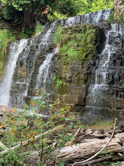
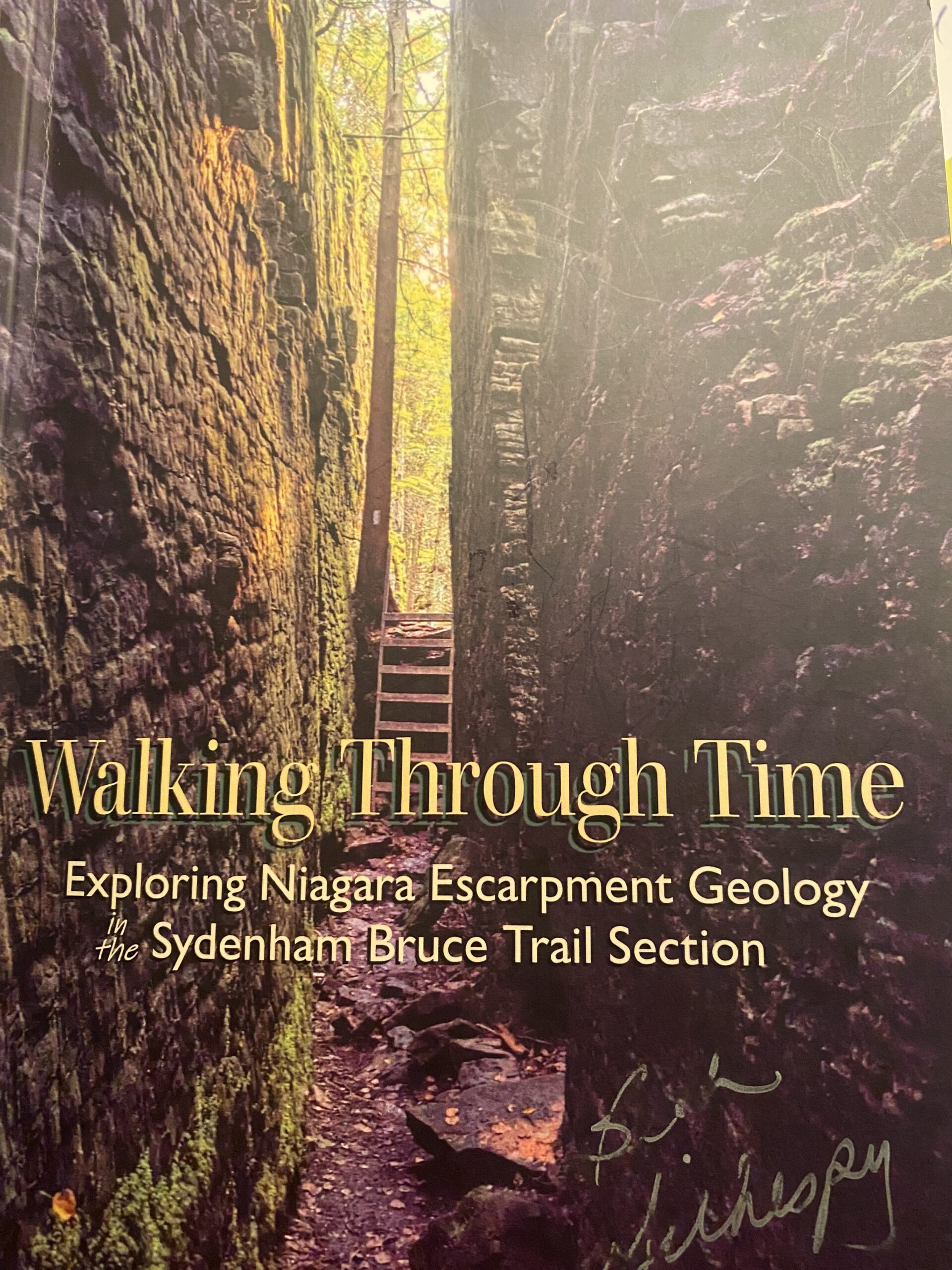
This is Geology Hike #7 (Memorial Forest and Jones Falls loop) following Beth Gilhespy’s book “Walking Through Time” in the Sydenham Bruce Trail Section. You will be hiking below and then along the top of the escarpment, viewing house-sized talus boulders, stunning Jones Falls from below and scampering up a rock wall to the top dolostone layer. Several outliers of rock show the effects of cambering separations from the escarpment face.This is a loop hike, starting from the roadside parking area along Youngs Drive and the Pottawatomi Memorial Forest (accessed from Grey Road 17B aka Nicol’s Gully Road.)
Copies of Beth’s book will be available for purchase. Special member’s only price of $37.00 . Cash or etransfer. If paying with cash, please bring exact change. A special guest may join us ! Please bring water and a snack if you wish. Proper hiking footwear and hiking poles are recommended.

Urban Walk: Waterfront Trail 1/11 - Rattray Marsh
https://hikes.brucetrail.org/event/urban-walk-waterfront-trail-1-11-rattray-marsh-3/Sorry, the registration cut-off time for this hike has been reached.Not a member? Click here to join today!Hosting Club: Toronto
Category: Car Hike
Location (Google Maps):Mississauga Waterfront Trail
Hike Leader(s): Brian Rideout Click here to contact Hike Leader(s)
Pace: Moderate (3-4 km/hr)
Terrain: Flat
Distance (km): 9.3 kmDescription
Please join me at Union Station under the clock inside the Great Hall no later than 9:00 am. We will take the 9:14 train to Clarkson, arriving 9 :51 am. If you want to meet us in Clarkson be there at that time. We start hiking at 10:00 am. Consider purchasing the $10 day pass for the GO train for use with your smart phone. Some of you may find the regular senior rate is cheaper.We will hike from Clarkson to Port Credit through Rattray Marsh and along the shoreline. The estimated distance is 9.9 km. Here is an online map of our route Rattray Marsh to Port Credit https://onthegomap.com/s/m4m7g3sj
Bring a snack, at least 2 liters of water, sun screen and bug spray.
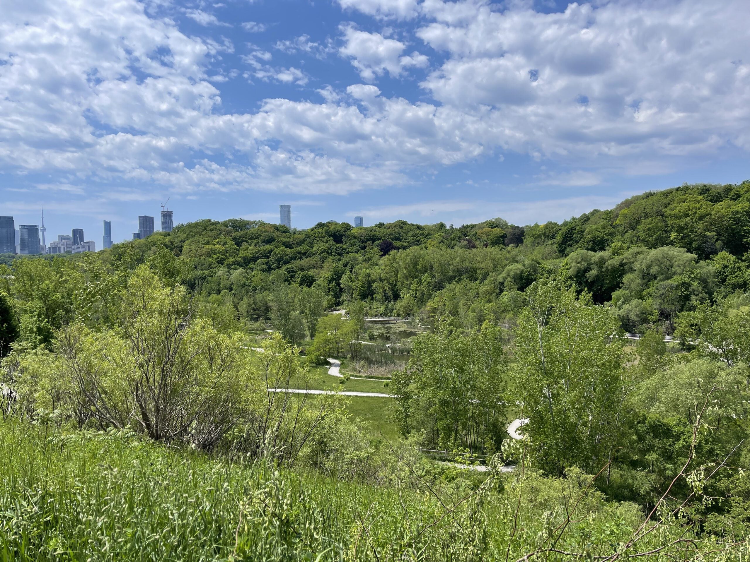
Introductory Hike - Evergreen Brick Works
https://hikes.brucetrail.org/event/introductory-hike-evergreen-brickworks-3/Sorry, the registration cut-off time for this hike has been reached.Not a member? Click here to join today!Hosting Club: Toronto
Category: TBTC Special Events
Location (Google Maps):Meet the hike leader in Tiffany Commons in front of the watershed wall at the Evergreen Brick Works (across from the cafe). To reach the Evergreen Brick Works you may take the free shuttle from outside Broadview Subway Station (departs every 30 minutes from 7:45 am until 9:45 (driver takes scheduled break at 10:15) or TTC Route #28 Bayview South from Davisville Subway Station (every 30 minutes)
Hike Leader(s): Tom Swales, Click here to contact Hike Leader(s)
Pace: Leisurely (2-3 km/hr)
Terrain: Level 1 (Easy – mostly on flat, well maintained trails with hard-packed surface), Variable
Distance (km): 4 kmDescription
The public is invited to join us for a short introductory hike from the Evergreen Brick Works as part of our Toronto Bruce Trail Day activities at the Evergreen Brick Works in Toronto. The club will have a booth staffed with volunteers providing information about the Bruce Trail and the Toronto Bruce Trail Club. Our hike will explore the wetlands, woodlands, and natural meadows of the Evergreen Brick Works, ascend into the beautiful Moore Park Ravine and return to the Evergreen Brick Works via the scenic outlook overlooking the Evergreen Brick Works and adacent ravines. A wonderful opportunity to enjoy the beautiful Evergreen Brick Works site, the Evergreen farmers market, and learn about the Toronto Bruce Trail Club’s year round hiking program and conservation work. Preregistration on the hike schedule is not required – just arrive 15 minutes prior to the hike to sign up with the hike leaders.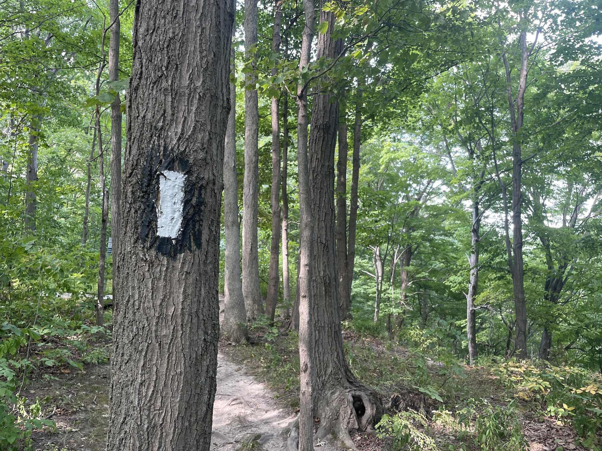
Fireman's Park Loop
https://hikes.brucetrail.org/event/firemans-park-loop-3/Sorry, the registration cut-off time for this hike has been reached.Not a member? Click here to join today!Hosting Club: Niagara
Category: Loop
Location (Google Maps): Meet in the upper parking lot of Fireman’s Park, Dorchester and Mountain Rds, Niagara FallsHike Leader(s): Margaret Northfield Click here to contact Hike Leader(s)
Pace: Medium 3- 4 km/hr
Terrain: Moderate: some hills and some poor footing
Distance: 7-8kmDescription
This hike is a nice blend of the Fireman Park trail system with the main Bruce Trail. Water and poles recommended.
Hiking 101 Workshop At Evergreen Brick Works
https://hikes.brucetrail.org/event/hiking-101-workshop-at-evergreen-brickworks-2/Sorry, the registration cut-off time for this hike has been reached.Not a member? Click here to join today!Hosting Club: Toronto
Category: TBTC Special Events
Location (Google Maps):BMO Atrium, Evergreen Brick Works – In Toronto’s Don Valley on Bayview Avenue
Click here to contact Hike Leader(s)
Distance (km): N/A
Description
Are you new to hiking or interested in getting started? Join us at the Evergreen Brick Works for a one hour session where you will learn about what to have in your backpack for your hike, a young person’s perspective of how they got into hiking, hiking with your family and children, and the Toronto Bruce Trail Club’s organized hiking program including bus hikes, coach trips, car hikes, urban walks, and GO Train hikes. Toronto Bruce Trail Club volunteers will also be on hand at the TBTC booth through the duration of the farmer’s market (until 1:00 PM) available to answer your questions about our club and the Bruce Trail Conservancy.Introductory Hike - Evergreen Brick Works
https://hikes.brucetrail.org/event/introductory-hike-evergreen-brickworks-4/Sorry, the registration cut-off time for this hike has been reached.Not a member? Click here to join today!Hosting Club: Toronto
Category: TBTC Special Events
Location (Google Maps):Meet the hike leader in Tiffany Commons in front of the watershed wall at the Evergreen Brick Works (across from the cafe). Please contact ttc.ca to confirm transit information, as summer construction projects may be underway. Previously, to reach the Evergreen Brick Works took the free shuttle from outside Broadview Subway Station (departs every 30 minutes from 7:45 am until 9:45 (driver takes scheduled break at 10:15) or TTC Route #28 Bayview South from Davisville Subway Station (every 30 minutes)
Hike Leader(s): Ray Berzins Click here to contact Hike Leader(s)
Pace: Leisurely (2-3 km/hr)
Terrain: Flat, Level 1 (Easy – mostly on flat, well maintained trails with hard-packed surface)
Distance (km): 6 kmDescription
An introductory hike from the Evergreen Brick Works proceeding southbound to a ravine trail and then northwest past Milkman’s Lane into Park Drive Reservation. We will continue northwest to Mount Pleasant Road and return to the Evergreen Brick Works. There is an option to turn back earlier at the Glen Road Bridge. Preregistration on the hike schedule is not required – just arrive 15 minutes prior to the hike to sign up with the hike leaders.