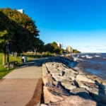
Pace: Medium Terrain: Easy, Moderate Distance: 18.9km
Description Meet at Allanburg Bridge on the Welland Canal and Hwy 20, there is a gravel parking lot. We will be doing the Welland Canals Hike #1 to give a flavour of all 4 Welland Canals. Since this hike is the longest in the series, we are starting at 8 (the other hikes start at 8:30) on Labour Day and will be walking at a quick pace to meet our goal of being finished before lunch. If you are interested in receiving your badge after completing the 4th hike on Sept 29th, please let me know and pay in cash or via etransfer (I can give you directions on the hike) $10 for members (please provide BTC number) or $15 for non-members. Badge info: https://niagarabrucetrail.club/badges/
Please wear good walking shoes (the path/trail is mostly flat), poles if you like and water/snacks.
Description This challenging “hike” is intended for those wishing to train for future challenging hikes. Choose your own pace to go up and down the moderately steep hill over 60 minutes. The terrain is a hard packed gravel surface. Feel free to bring light weights to increase the intensity of your training. Bring water, hiking poles, snack and dress for the weather.
Hosting Club: Iroquoia Category: Special Event Location (Google Maps): Please park in the Lions Club Pool Parking lot in Grimsby 1 Elm St and walk into the park area under the trees.
Pace: Leisurely – 3km/hr or less Terrain: Moderate – Some hills and/or some poor footing, Strenuous – Hilly with steep climbs and some poor footing Distance: About and hour of yoga followed by a hike up to Beamer’s Conservation Area
Description Here’s a perfect way to welcome September –
Join Certified Yoga Instructor Angela and Certified Hike Leader Ruth, both Iroquoia Bruce Trail Club volunteers, for a morning of gentle yoga and a 5km hike up to Beamer’s Conservation Area. Please bring your yoga mat and water and any props you like to have and afterwards you will need comfortable hiking shoes or running shoes for the hike as well as water and snacks if you need. Everyone is welcome; please register.
Time: 9:00am – 12:00noon
Date: Sept 1, 2025
Location: Coronation Park which is accessible from the Lion’s Club Pool parking lot at 1 Elm St, Grimsby. Just park and walk into the park under the trees. Cost: By donation. All proceeds go to the Iroquoia Bruce Trail Club who will use the funds towards “Preserving a ribbon of Wilderness, for Everyone, Forever.”
Pace: Moderate (3-4 km/hr) Terrain: Flat, Level 1 (Easy – mostly on flat, well maintained trails with hard-packed surface) Distance: 8 kms
Description Join us for this nice and relaxing late afternoon walk on Labour Day. We will meet in front of the Loblaws on St. Clair (next to St. Clair West subway station) and proceed up through the pretty Cedarvale Ravine and eventually meet up with the Beltline Trail where we will then proceed to Yonge and St. Clair and the end of the walk. A great way to finish off the holiday weekend! (Note that the start and end points are slightly different)
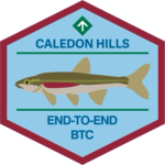
Hosting Club: Caledon Hills Category: End-to-End Location (Google Maps): Meet at BTC parking on the east side of the 5th Line EHS, just south of Hockley Road, 43.993572, -80.014057.
Directions: From Hwy #10 head east on Hockley Road for 9.4 km. Turn right onto 5 Line E/5th Line EHS. Drive for 90 m. The parking lot is on the left.
Shuttle to Mono Community Centre Parking Lot, 44.026195, -80.071516
Pace: Brisk – 4 to 5 km/hour Terrain: Strenuous – hilly with steep climbs and some poor footing Distance: 21.5 kilometres
Description Earn the new Redside Dace End-to-End badge in three hikes. This series follows the Club’s Fall Colour’s E2E plan, with a couple of distance modifications. The hikes provide an opportunity to audit and prepare the Trail before the Thanksgiving event. Bring gardening pruners if you have them. Periodically, the group will quickly trim back overgrown vegetation. Pack sufficient water and snacks to boost your energy.
Hike 1 – Hike southbound from Mono Community Centre south to km 51.7/Access to Hemlock Ridge ST. Distance: approximately 21.5 km
Hike 2 – Hike northbound from km 0.0/Creditview Road to approx km 26/Mountainview Road. Distance: approximately 26 km
Hike 3 – Hike northbound from km 26/Mountainview Road to km 51.7/Access to Hemlock Ridge ST. Distance: approximately 26 km
Up-to-date details will be provided to participants closer to the dates due to a trail reroute in the Mountainview Road area in the spring.
Location (Google Maps): Parking lot is off Sycamore Drive East of Bayview , across Starbucks plaza Bus 91 from Finch east station stops at Sycamore station.
Pace: Moderate (3-4 km/hr) Terrain: Hilly, Level 2 (Intermediate – some hills and uneven surfaces, rocks and roots underfoot), Variable Distance: 6-7 km
Description We will explore Valleyview and Maple View parks, and walk along German Mill Creak, in return we stop in Huntington park and have snack under beautiful shed ,
Even it is considered Urban walk, it is urban hike as we have some up and down hills and tree roots, please bring your hiking poles, water and snacks,
Description Hike the main and sidetrails in Shorthills Provincial Park. Please wear hiking boots, bring water and insect repellant. Check yourself for ticks following the hike.
Hosting Club: Caledon Hills Category: Tuesday Hikers Location (Google Maps): Mono Community Centre Parking, 200 m south of Mono Centre. Free in the gravel surface lot. do not park on the paved surface. Driving direction: From Highway 410 go north, continue on Highway 10, pass through Orangeville, continue to Mono Centre Rd. (8), turn right, road will merge with 2nd Line EHS north, parking on the right just before Mono Centre.
Pace: Medium – 3 to 4 km/hour Terrain: Moderate – some hills and/or some poor footing Distance: 12 – 13 km
Description Will hike main Bruce Trail, South Outlier, Walter Tovell, McCarston’s Lake and Lookout Side Trails. Bring water, snack, bug spray and sun protection. Poles recommended.
Pace: Leisurely Terrain: Slippery and Steep Sections, Moderate Distance: 6.0 Km, Short hike 3.5 km
Description We will hike the Main trail to Turnbull Side Trail and Springwater Side Trail. The short hike will return to parking lot by Main Trail. Longer hike will continue south on Main Trail to the newly opened Third Outlier Side Trail, connecting to the Whitetail Refuge Side Trail and returning to parking by way of the Laidlaw Side Trail. Bring water and snacks.
Pace: Medium: 3 to 4 km/h Terrain: Moderate: Some hills and/or poor footing, Strenuous: Hilly with steep climbs and some poor footing., There might be muddy sections., There might be sections with water on the trail. Distance: 10 km
Description We will carpool from the Kemble arena to the parking at the Edmonstone side trail on map 34. From there we head NW on the side trails to meet the white blazed Bruce trail through to the Don Richards side trail. We loop back to the parking via Mystery cabin side trail and Maple Cross Ridge side trails then back onto the white blazed trail to the parking. Please wear sturdy shoes/boots and clothing that will protect you from insects and possible poison ivy.
Pace: Medium – 3 to 4 km/hr Terrain: Moderate – Some hills and/or some poor footing Distance: 8.8
Description Wodehouse Karst (Southern Route): Rock Outcrop in Bowles Gully at Stop 9 (Pages 98-100) At Bowles Gully two Escarpment rock layers – the Amabel Dolostone and the Manitoulin Dolostone – outcrop along the sides of the steep ski hill.
Pace: Medium Terrain: Moderate, Some rocky footing, Some steep sections Length of Hike: 5.9 km
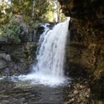
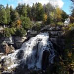
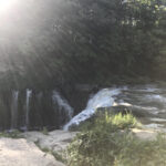
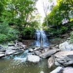
Description This hike takes us through BTC protected land. We will walk through a mature deciduous forest on the Main Trail and then we’ll walk the Stew Hilt’s Side Trail. Crossing a stream, we reach a waterfall, usually trickling in the fall. Our route will have us return on the higher Main Trail which provides a beautiful view of the Cuckoo Valley.
Guidelines:
Arrive 15 minutes before the start of the hike.
Wear sturdy footwear and appropriate attire for the weather and the terrain. Hiking poles are a good idea in any season, especially if the terrain is rocky or slippery. In winter, snowshoes or icers/crampons are needed when conditions dictate. Wearing appropriate clothing and footwear prevents injuries and shows consideration for a safe and positive group hiking experience.
Always carry I.D. and your health card.
Bring sufficient water and snacks (or lunch if indicated). A minimum of 1L of water is recommended on all hikes, and 3L is recommended for long, challenging hikes in the heat of the summer.
Bring sunscreen and insect repellent (for spring and summer hikes).
Hosting Club: Sydenham Category: An evening walk. Location (Google Maps): Meet in the municipal parking lot by the river on the west side of 1st Ave E between 7th St E and 8th St E in Owen Sound
Pace: Brisk: 4 to 5 km/h Terrain: Moderate: Some hills and/or poor footing Distance: Approx 6 km
Description Join us for a brisk summer`s evening hike exploring Owen Sound paths and neighbourhoods, followed by an opportunity for refreshments. There is no need to show up 15 minutes early for this hike, but we will leave promptly at 7:00 pm
Description This will be our permanent Thursday Location until Bridge repairs complete. From Cave Spring Conservation Area explore the trail network on the escarpment towards Kinsman Park and Moyer Road.
You must register for each hike. Bring Poles, snack bug spray, sunscreen and a drink. Dress for the weather
Hosting Club: Toronto Category: Urban Walk Location (Google Maps): Parking lot is off Sycamore Drive East of Bayview , across Starbucks plaza Bus 91 from Finch east station stops at Sycamore station.
Pace: Moderate (3-4 km/hr) Terrain: Hilly, Level 2 (Intermediate – some hills and uneven surfaces, rocks and roots underfoot), Variable Distance: 7-8 km
Description We will explore Valleyview and Maple View parks, and walk along German Mill Creak, in return we stop in Huntington park and have snack under beautiful shed ,
Even it is considered Urban walk, it is urban hike as we have some up and down hills and tree roots, please bring your hiking poles, water and snacks,
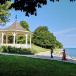
Description Enjoy the benefits of pausing for a yoga practice as we tour through the trails, parkland and Historic Niagara-on-the-Lake. No mat required. Movement will focus on a flow of standing poses designed especially for hikers. Plan to stay for conversation and a warm cup of coffee or tea at Sweets & Swirls, Community Centre, Niagara Stone Road, NOTL.
Hosting Club: Toronto Category: Annual TBTC E2E Location (Google Maps): On Saturday September 6, hike the entire Toronto section of the Bruce Trail north to south, of just over 50km.
Pace: Brisk (4-5 km/hr), Fast (5 km/hr or greater) Terrain: Challenging Distance: 50.4 km
Description Come test your grit on our 1 day E2E which will be held on Saturday Sept. 6, 2025. Cost for members is $40 which includes bus transportation from Hilton Falls CA to the south end of Cheltenham Badlands (where you will begin your hike), online registration fees, parking in Hilton Falls CA, and the official one day E2E badge. We will be offering snacks and water every 10-11km. Any available spots left on June 23 will be opened to non-members at a cost of $45. This is a long, strenuous hike suitable for experienced, fast paced hikers. Hikers are expected to to maintain a minimum pace of 4km/hr and must reach each checkpoint by a prescribed time in order to continue to ensure everyone is off the trail before dark. Meet at the Hilton Falls CA entrance gate at 5:30 am (Gate will be opened early for us). The bus will leave the parking lot at 6:00 am promptly to bring you to your starting point at km 50.4 where you will begin hiking back to your vehicle.
Based on the hike beginning at 6:45am, hikers must reach checkpoint 1 at km 38.8 (11.6km) by 9:30 am, checkpoint 2 at km 27.8 (11.1km) by 12:15 pm, checkpoint 3 at km 17.4 (10.4 km) by 2:45 pm, checkpoint 4 at km 8.9 (8.5 km) by 5:00 pm to continue. Bring your fully charged cell phone, basic 1st aid supplies, and a water bottle.
Space is limited, hikes go rain or shine, and no dogs are welcome. Hikers over the age of 16 are permitted on this event. There will be no refunds or tax receipts issued for anyone who cancels their registration. For specific questions, please contact Jacquie Van Dyke at vdyke0946@gmail.com. Registration closes at midnight on August 31, 2025.
Hosting Club: Toronto Category: Annual TBTC E2E Location (Google Maps): The Toronto Bruce Trail section which runs from just south of Hilton Falls CA on Appleby Line to the south entrance of the Cheltenham Badlands on Creditview Rd. On both days, we will meet in the community parking lot in the village of Limehouse (GPS Coordinates 43.638154, -79.979152), 11139 22nd Side Road, below the school.
Description Hike the Toronto section of the Bruce Trail over two days. Hikers must maintain a minimum pace 0f 4km/hr and reach the checkpoints by the cutoff time in order to continue. On Saturday, the bus will take hikers from Limehouse to the south entrance of the Cheltenham Badlands where the hike will begin. Hikers will hike south to their vehicles in Limehouse – a distance of approximately 28 km. Hikers will reach checkpoint 1 at km 38.8 (11.6 km) by 11:00 am and checkpoint 2 at km 27.8 (11.0 km) by 1:45 pm to continue. On Sunday, the bus will take hikers again from Limehouse, to km 0.0 on Appleby Line where the hike will begin. Hiking north to Limehouse, hikers must reach checkpoint 1 at km 11.4 in the Pear Tree parking lot by 11:00 am to continue. Water refill and snacks will be available at the checkpoints. Bring your fully charged cell phone, basic 1st aid supplies, and a water bottle.
Those who complete the distances on both days will receive the special 2 Day Club E2E badge. The registration fee includes the online registration fee, bus shuttle, and the official E2E badge. If any spots are still available at 9:00 am on Monday June 23, registration will also be opened for non-members (child and adult) at a cost of $65. These are strenuous hikes suitable for experienced, long distance, fast paced hikers. Space is limited, hikes go rain or shine, and no dogs are permitted on this event. Hikers must find their own way each morning to the meeting point in Limehouse. There will be no refunds or tax receipts issued for anyone who cancels their registration. For questions, please contact Jacquie Van Dyke at vdyke0946@gmail.com. Registration closes at midnight on August 31, 2025. On September 1, an email will go out to all participants with the exact parking location. It will be in Limehouse.
You are signing up for the following dates and times: 2025-09-06 at 07:45 2025-09-07 at 2025-09-08 at 2025-09-09 at 2025-09-10 at 2025-09-11 at 2025-09-12 at 2025-09-13 at
Pace: Brisk – 4 to 5 km/hr Terrain: Dependent on Conditions, Moderate – Some hills and/or some poor footing, Strenuous – Hilly with steep climbs and some poor footing Distance: 165km over 8 days ~ 20km – 25 km+ per day.
Description Overview
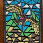
Important – Please do not register for this hike unless you are sure you can attend all 8 days. You may only miss 1 day if you have to. This is a special series of 8 hikes to complete the Peninsula section of the Bruce Trail. The organization, guidance, logistics and the Turkey Vulture stained glass badge is included in your fee which is non-refundable. (You may swap out the stained-glass badge for the regular end to end badge) Proceeds support the Peninsula Bruce Trail Club which in turn supports the Bruce Trail Conservancy mission to “Preserving a ribbon of wilderness, for everyone, forever.”
For this E2E in 8, we will be following the main trail northbound eventually finishing in Tobermory. Please note that you are signing up for the entire series of 8 hikes as a Group Hike. The Peninsula in 8 series is geared to experienced long distance hikers with the expectation of a 3 to 5.0 km/ hr. pace maintained over a 20km plus day. The section is approximately 165km so daily distances will be based on available parking. No dropout points have been established and therefore hikers who must drop out, will be responsible for their own transportation back to their vehicle. Please note that public transportation back to your vehicle is basically non-existent in this section. Please be honest about your hiking abilities. We will hike at a steady pace but there will be plenty of time to take pictures and to enjoy the flora and fauna of this beautiful but challenging section. This particular set of 8 hikes is intended to be Moderate/Brisk. It is a group hike so it is important you are able to keep pace with the person in front of you.
Attire and Daily Hikes.
Hikers will be expected to be wearing proper hiking boots and layered clothing with the expectation of cool and possible wet weather. Sufficient food and water for a full day of hiking is required as well as hiking poles (if you use them), and wet weather gear is strongly recommended. Bug spray is also suggested. Clothing adjustments, bio-breaks are as needed. Please let the sweep person know and they will wait for you. A morning break around 10am and a 10-15 minute on-trail lunch break will be scheduled. An afternoon break will be based on our expected finish time. Depending on weather conditions, these times may vary. Everyone must carry a First Aid kit.
Since this is an end to end that would normally be held over 10 days, please do not sign up for this hike if you need to miss any of the days. It is 8 straight days and your attendance is needed in each of the days for sharing of car shuttling. One day may be made up if you absolutely must miss a day.
All participants will be expected to take turns either driving to the start or driving the drivers back at the end of the day. Carpooling to our meeting spot with 2 people in the car is generally ok but we would like to minimize and equalize the driving/shuttling as much as possible so it is fair for all participants.
Parking Fees
Some parking locations require paid parking, and hikes that enter Bruce Peninsula National Park. The fee for this E2E-in-8 does not include any parking/entry fees for hikers. These costs, where applicable, will be shared amongst all participants unless you have a parking or park pass.
Leave No Trace
Please remember, like all hikes, this is a Leave No Trace hike. Pack out whatever you pack in. Do not toss anything onto or into any sections of the trail. We will also try to leave the trail better than we found it so we will be collecting collectable garbage we might see along the way. Daily volunteers to collect trail trash will be supplied with a bag. Dogs will not be welcome on this hike.
Accommodations
It is strongly recommended you make reservations for accommodations as soon as you register for the hike. Accommodations can be made anywhere in the Peninsula but I recommend staying in Lion’s Head which is about mid-way of the section. There is a motel, a campground and several B&B’s. Moving from accommodation to accommodation, while in the Peninsula, is doable but generally not recommended. If you would like a roommate, I can share your email with any other registered participants who are also looking for shared accommodations. Please let me know.
Daily
We meet for each hike by at least 7:45am each day. A schedule for meeting and start locations will be sent to each participant in May. We will hike northerly each day. The schedule is subject to change.
Accommodation Check in is Sept 5 – first day of hiking is Sept 6. Checkout Sept 13 or 14 – last day of hiking is Sept 13.
Pace: Moderate (3-4 km/hr) Terrain: Hilly, Level 2 (Intermediate – some hills and uneven surfaces, rocks and roots underfoot), Variable Distance: 13-14 km
Description Join us for a wonderful hike in Jefferson Forest and have a snack/lunch beside the Bond Lake. We will hike among tall trees and bushes of the Jefferson Forest and across the Bayview-Yonge corridor to reach to the Bond Lake. Boots mandatory, poles recommended, bring at least 2L of water, bug spray, sunscreen, snack/lunch and dress according to the weather conditions. Please avoid parking along the road. Difficulty Level: 2 (Moderate)
Please arrive @7:45 AM for start of 8:00AM.
This is a joint hike with the Oak Ridges Trail Association (ORTA).
Description Meet at Louth Conservation Parking lot on Staff Avenue and head towards Swayze Falls, using a mix of side and main trails. En route, we will check out the new bridge crossing the lower falls at Rockway. Bring water and a snack.
Pace: Moderate (3-4 km/hr) Terrain: Flat, Level 2 (Intermediate – some hills and uneven surfaces, rocks and roots underfoot) Distance: 12-14 km
Description We will walk along lake Ontario, visiting ponds ,swans and light house • Please dress appropriately for the weather. • We will have short water ,picture,Bio and a 15 minute snack breaks. Everyone is welcome!
Description Explore a lakeshore park, shoreline and cliff top trail in Niagara-on-the-Lake. This beachcombing hike involves uneven ground, clambouring over fallen trees, a pebbly beach, sandy, wet and exposed areas. Hat and poles are highly recommended. Please note: This is not a maintained trail so caution is needed.
Pace: Medium – 3 to 4 km/hr Terrain: Easy – Mostly flat and usually good footing Distance: 6 – 6.5 km
Description We will meet at 9:15 a.m. for a 9:30 start. There are several municipal parking lots in the area and some street meter parking allows all day parking. Park near Brant Street and Lakeshore Road. Meet outside (to the right) of the Waterfront Hotel (Brant and Lakeshore) by the stairs leading to the water. We will walk out to the Brant Street Pier then along the waterfront trail, passing Spencer Smith Park, the Naval Veterans Walkway, 1 km of beach (during this hike we will not have time for a swim; perhaps another time), and continue to the Burlington Canal Bridge before turning back. The route along the shoreline of Lake Ontario is lovely. Hiking poles are not necessary however if you use them bring them. Please wear proper footwear (no open toe shoes). Bring a hat, sunglasses, sunscreen, bug spray, water, and a snack. Bring a jacket as it might be cool along the water. If you have a story of Burlington, a joke, or an interesting hiking adventure bring that with you to share with the group. After the hike you can explore the many downtown shops, cafes and restaurants. No dogs please.
Hosting Club: Toronto Category: Car Hike Location (Google Maps): Parking Area at Louth Conservation Area
Hike Leader(s): Alina Lin
Pace: Brisk (4-5 km/hr) Terrain: Challenging, Hilly, Level 2 (Intermediate – some hills and uneven surfaces, rocks and roots underfoot), Variable Distance: 18 km
Description The Niagara region is one of Canada’s most productive fruit-growing areas. Strolling along country roads lined with farms and orchards, you’ll see ripe peaches, plums, and grapes hanging from the trees and smell the sweet fragrance of the harvest in the air—you’ll truly understand why it’s called a Fruit Paradise. To make the most of the short harvest season, let’s hike the Niagara section of the Bruce Trail and if you are interested, visit local farms afterward—perhaps even enjoy some fruit picking!
This is the fourth of a five-hike End-to-End series covering the entire Niagara section of the Bruce Trail. The full section stretches over 80 kilometers from Niagara-on-the-Lake to Grimsby. I am using Map Edition 29, so please note that kilometer markings may not be fully up to date, and actual hiking distances may vary slightly.
Meeting Point: Roadside parking lot at KM 49.3. Please arrive before 9:15 AM to allow time for car shuttle coordination. GPS: N43.121706, W79.351235. Parking Area at Louth Conservation Area. Enter from Staff Ave, Louth, 500 m north of Pelham Rd (Regional Rd 69).
We will car shuttle to the starting point of the hike at KM66.9 GPS:N43.146108, W79.475609. Enter from Hixon St at the intersection of Kinsmen Rd and Frost Rd.
The group will then hike from KM66.9 back to KM49.3. All drivers are expected to participate in the car shuttle, either before or after the hike.
Important Notes:
Wear sturdy hiking boots and dress appropriately for the weather
Hosting Club: Toronto Category: GO Train Hike Location (Google Maps):
Hike will start from McMaster University GO Bus Terminal. We will meet at Toronto’s Union Station 8:30 AM to take the 8:47 AM Train to Aldershot where we will transfer to the GO Bus for a short ride to McMaster University. On the return we take the GO Train to Toronto from West Harbour GO Train Station. If you have a smart phone then the return fare is just $10 with GO’s Weekend Pass. Seniors fare return from Union is about $11.44. If meeting us at McMaster you will have to make your way back to start by local transit or Uber and parking fee would apply.
Pace: Moderate (3-4 km/hr) Terrain: Hilly, Level 2 (Intermediate – some hills and uneven surfaces, rocks and roots underfoot), Variable Distance: 12-13 km
Description This will be a one way hike through the trails of the RBG’s (Royal Botanical Gardens) South Shore Cootes Paradise Trails to Princess Point and then continuing on Hamilton’s Waterfront Trail along Burlington Bay to Bayfront Park which is a 7 minute walk to the West Harbour GO Station. Cootes Paradise is the largest and most diverse of RBG’s sanctuaries. Nestled between the Niagara Escarpment and Lake Ontario the picturesque area is significant as a migratory bird flyover zone and home to a wide variety of flora and fauna. There will be a few hills including one steeper one.
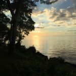
Description Moonlight Night Hike – Take in the magic of the rising moon over Lake Ontario and the Niagara River. This hike includes a stop to connect with your senses – sights, sounds, smells and the rhythm of your breath. Counts towards your night hike badge (5 night hikes).
Hosting Club: Toronto Category: Annual TBTC E2E Location (Google Maps): On Saturday September 6, hike the entire Toronto section of the Bruce Trail north to south, of just over 50km.
Pace: Brisk (4-5 km/hr), Fast (5 km/hr or greater) Terrain: Challenging Distance: 50.4 km
Description Come test your grit on our 1 day E2E which will be held on Saturday Sept. 6, 2025. Cost for members is $40 which includes bus transportation from Hilton Falls CA to the south end of Cheltenham Badlands (where you will begin your hike), online registration fees, parking in Hilton Falls CA, and the official one day E2E badge. We will be offering snacks and water every 10-11km. Any available spots left on June 23 will be opened to non-members at a cost of $45. This is a long, strenuous hike suitable for experienced, fast paced hikers. Hikers are expected to to maintain a minimum pace of 4km/hr and must reach each checkpoint by a prescribed time in order to continue to ensure everyone is off the trail before dark. Meet at the Hilton Falls CA entrance gate at 5:30 am (Gate will be opened early for us). The bus will leave the parking lot at 6:00 am promptly to bring you to your starting point at km 50.4 where you will begin hiking back to your vehicle.
Based on the hike beginning at 6:45am, hikers must reach checkpoint 1 at km 38.8 (11.6km) by 9:30 am, checkpoint 2 at km 27.8 (11.1km) by 12:15 pm, checkpoint 3 at km 17.4 (10.4 km) by 2:45 pm, checkpoint 4 at km 8.9 (8.5 km) by 5:00 pm to continue. Bring your fully charged cell phone, basic 1st aid supplies, and a water bottle.
Space is limited, hikes go rain or shine, and no dogs are welcome. Hikers over the age of 16 are permitted on this event. There will be no refunds or tax receipts issued for anyone who cancels their registration. For specific questions, please contact Jacquie Van Dyke at vdyke0946@gmail.com. Registration closes at midnight on August 31, 2025.
Hosting Club: Toronto Category: Annual TBTC E2E Location (Google Maps): The Toronto Bruce Trail section which runs from just south of Hilton Falls CA on Appleby Line to the south entrance of the Cheltenham Badlands on Creditview Rd. On both days, we will meet in the community parking lot in the village of Limehouse (GPS Coordinates 43.638154, -79.979152), 11139 22nd Side Road, below the school.
Description Hike the Toronto section of the Bruce Trail over two days. Hikers must maintain a minimum pace 0f 4km/hr and reach the checkpoints by the cutoff time in order to continue. On Saturday, the bus will take hikers from Limehouse to the south entrance of the Cheltenham Badlands where the hike will begin. Hikers will hike south to their vehicles in Limehouse – a distance of approximately 28 km. Hikers will reach checkpoint 1 at km 38.8 (11.6 km) by 11:00 am and checkpoint 2 at km 27.8 (11.0 km) by 1:45 pm to continue. On Sunday, the bus will take hikers again from Limehouse, to km 0.0 on Appleby Line where the hike will begin. Hiking north to Limehouse, hikers must reach checkpoint 1 at km 11.4 in the Pear Tree parking lot by 11:00 am to continue. Water refill and snacks will be available at the checkpoints. Bring your fully charged cell phone, basic 1st aid supplies, and a water bottle.
Those who complete the distances on both days will receive the special 2 Day Club E2E badge. The registration fee includes the online registration fee, bus shuttle, and the official E2E badge. If any spots are still available at 9:00 am on Monday June 23, registration will also be opened for non-members (child and adult) at a cost of $65. These are strenuous hikes suitable for experienced, long distance, fast paced hikers. Space is limited, hikes go rain or shine, and no dogs are permitted on this event. Hikers must find their own way each morning to the meeting point in Limehouse. There will be no refunds or tax receipts issued for anyone who cancels their registration. For questions, please contact Jacquie Van Dyke at vdyke0946@gmail.com. Registration closes at midnight on August 31, 2025. On September 1, an email will go out to all participants with the exact parking location. It will be in Limehouse.
You are signing up for the following dates and times: 2025-09-06 at 07:45 2025-09-07 at 2025-09-08 at 2025-09-09 at 2025-09-10 at 2025-09-11 at 2025-09-12 at 2025-09-13 at
Pace: Brisk – 4 to 5 km/hr Terrain: Dependent on Conditions, Moderate – Some hills and/or some poor footing, Strenuous – Hilly with steep climbs and some poor footing Distance: 165km over 8 days ~ 20km – 25 km+ per day.
Description Overview
Important – Please do not register for this hike unless you are sure you can attend all 8 days. You may only miss 1 day if you have to. This is a special series of 8 hikes to complete the Peninsula section of the Bruce Trail. The organization, guidance, logistics and the Turkey Vulture stained glass badge is included in your fee which is non-refundable. (You may swap out the stained-glass badge for the regular end to end badge) Proceeds support the Peninsula Bruce Trail Club which in turn supports the Bruce Trail Conservancy mission to “Preserving a ribbon of wilderness, for everyone, forever.”
For this E2E in 8, we will be following the main trail northbound eventually finishing in Tobermory. Please note that you are signing up for the entire series of 8 hikes as a Group Hike. The Peninsula in 8 series is geared to experienced long distance hikers with the expectation of a 3 to 5.0 km/ hr. pace maintained over a 20km plus day. The section is approximately 165km so daily distances will be based on available parking. No dropout points have been established and therefore hikers who must drop out, will be responsible for their own transportation back to their vehicle. Please note that public transportation back to your vehicle is basically non-existent in this section. Please be honest about your hiking abilities. We will hike at a steady pace but there will be plenty of time to take pictures and to enjoy the flora and fauna of this beautiful but challenging section. This particular set of 8 hikes is intended to be Moderate/Brisk. It is a group hike so it is important you are able to keep pace with the person in front of you.
Attire and Daily Hikes.
Hikers will be expected to be wearing proper hiking boots and layered clothing with the expectation of cool and possible wet weather. Sufficient food and water for a full day of hiking is required as well as hiking poles (if you use them), and wet weather gear is strongly recommended. Bug spray is also suggested. Clothing adjustments, bio-breaks are as needed. Please let the sweep person know and they will wait for you. A morning break around 10am and a 10-15 minute on-trail lunch break will be scheduled. An afternoon break will be based on our expected finish time. Depending on weather conditions, these times may vary. Everyone must carry a First Aid kit.
Since this is an end to end that would normally be held over 10 days, please do not sign up for this hike if you need to miss any of the days. It is 8 straight days and your attendance is needed in each of the days for sharing of car shuttling. One day may be made up if you absolutely must miss a day.
All participants will be expected to take turns either driving to the start or driving the drivers back at the end of the day. Carpooling to our meeting spot with 2 people in the car is generally ok but we would like to minimize and equalize the driving/shuttling as much as possible so it is fair for all participants.
Parking Fees
Some parking locations require paid parking, and hikes that enter Bruce Peninsula National Park. The fee for this E2E-in-8 does not include any parking/entry fees for hikers. These costs, where applicable, will be shared amongst all participants unless you have a parking or park pass.
Leave No Trace
Please remember, like all hikes, this is a Leave No Trace hike. Pack out whatever you pack in. Do not toss anything onto or into any sections of the trail. We will also try to leave the trail better than we found it so we will be collecting collectable garbage we might see along the way. Daily volunteers to collect trail trash will be supplied with a bag. Dogs will not be welcome on this hike.
Accommodations
It is strongly recommended you make reservations for accommodations as soon as you register for the hike. Accommodations can be made anywhere in the Peninsula but I recommend staying in Lion’s Head which is about mid-way of the section. There is a motel, a campground and several B&B’s. Moving from accommodation to accommodation, while in the Peninsula, is doable but generally not recommended. If you would like a roommate, I can share your email with any other registered participants who are also looking for shared accommodations. Please let me know.
Daily
We meet for each hike by at least 7:45am each day. A schedule for meeting and start locations will be sent to each participant in May. We will hike northerly each day. The schedule is subject to change.
Accommodation Check in is Sept 5 – first day of hiking is Sept 6. Checkout Sept 13 or 14 – last day of hiking is Sept 13.
Pace: Moderate (3-4 km/hr) Terrain: Hilly, Level 2 (Intermediate – some hills and uneven surfaces, rocks and roots underfoot), Variable Distance: 13-14 km
Description Join us for a wonderful hike in Jefferson Forest and have a snack/lunch beside the Bond Lake. We will hike among tall trees and bushes of the Jefferson Forest and across the Bayview-Yonge corridor to reach to the Bond Lake. Boots mandatory, poles recommended, bring at least 2L of water, bug spray, sunscreen, snack/lunch and dress according to the weather conditions. Please avoid parking along the road. Difficulty Level: 2 (Moderate)
Please arrive @7:45 AM for start of 8:00AM.
This is a joint hike with the Oak Ridges Trail Association (ORTA).
Description Meet at Louth Conservation Parking lot on Staff Avenue and head towards Swayze Falls, using a mix of side and main trails. En route, we will check out the new bridge crossing the lower falls at Rockway. Bring water and a snack.
Pace: Moderate (3-4 km/hr) Terrain: Flat, Level 2 (Intermediate – some hills and uneven surfaces, rocks and roots underfoot) Distance: 12-14 km
Description We will walk along lake Ontario, visiting ponds ,swans and light house • Please dress appropriately for the weather. • We will have short water ,picture,Bio and a 15 minute snack breaks. Everyone is welcome!
Description Explore a lakeshore park, shoreline and cliff top trail in Niagara-on-the-Lake. This beachcombing hike involves uneven ground, clambouring over fallen trees, a pebbly beach, sandy, wet and exposed areas. Hat and poles are highly recommended. Please note: This is not a maintained trail so caution is needed.
Pace: Medium – 3 to 4 km/hr Terrain: Easy – Mostly flat and usually good footing Distance: 6 – 6.5 km
Description We will meet at 9:15 a.m. for a 9:30 start. There are several municipal parking lots in the area and some street meter parking allows all day parking. Park near Brant Street and Lakeshore Road. Meet outside (to the right) of the Waterfront Hotel (Brant and Lakeshore) by the stairs leading to the water. We will walk out to the Brant Street Pier then along the waterfront trail, passing Spencer Smith Park, the Naval Veterans Walkway, 1 km of beach (during this hike we will not have time for a swim; perhaps another time), and continue to the Burlington Canal Bridge before turning back. The route along the shoreline of Lake Ontario is lovely. Hiking poles are not necessary however if you use them bring them. Please wear proper footwear (no open toe shoes). Bring a hat, sunglasses, sunscreen, bug spray, water, and a snack. Bring a jacket as it might be cool along the water. If you have a story of Burlington, a joke, or an interesting hiking adventure bring that with you to share with the group. After the hike you can explore the many downtown shops, cafes and restaurants. No dogs please.
Hosting Club: Toronto Category: Car Hike Location (Google Maps): Parking Area at Louth Conservation Area
Hike Leader(s): Alina Lin
Pace: Brisk (4-5 km/hr) Terrain: Challenging, Hilly, Level 2 (Intermediate – some hills and uneven surfaces, rocks and roots underfoot), Variable Distance: 18 km
Description The Niagara region is one of Canada’s most productive fruit-growing areas. Strolling along country roads lined with farms and orchards, you’ll see ripe peaches, plums, and grapes hanging from the trees and smell the sweet fragrance of the harvest in the air—you’ll truly understand why it’s called a Fruit Paradise. To make the most of the short harvest season, let’s hike the Niagara section of the Bruce Trail and if you are interested, visit local farms afterward—perhaps even enjoy some fruit picking!
This is the fourth of a five-hike End-to-End series covering the entire Niagara section of the Bruce Trail. The full section stretches over 80 kilometers from Niagara-on-the-Lake to Grimsby. I am using Map Edition 29, so please note that kilometer markings may not be fully up to date, and actual hiking distances may vary slightly.
Meeting Point: Roadside parking lot at KM 49.3. Please arrive before 9:15 AM to allow time for car shuttle coordination. GPS: N43.121706, W79.351235. Parking Area at Louth Conservation Area. Enter from Staff Ave, Louth, 500 m north of Pelham Rd (Regional Rd 69).
We will car shuttle to the starting point of the hike at KM66.9 GPS:N43.146108, W79.475609. Enter from Hixon St at the intersection of Kinsmen Rd and Frost Rd.
The group will then hike from KM66.9 back to KM49.3. All drivers are expected to participate in the car shuttle, either before or after the hike.
Important Notes:
Wear sturdy hiking boots and dress appropriately for the weather
Hosting Club: Toronto Category: GO Train Hike Location (Google Maps):
Hike will start from McMaster University GO Bus Terminal. We will meet at Toronto’s Union Station 8:30 AM to take the 8:47 AM Train to Aldershot where we will transfer to the GO Bus for a short ride to McMaster University. On the return we take the GO Train to Toronto from West Harbour GO Train Station. If you have a smart phone then the return fare is just $10 with GO’s Weekend Pass. Seniors fare return from Union is about $11.44. If meeting us at McMaster you will have to make your way back to start by local transit or Uber and parking fee would apply.
Pace: Moderate (3-4 km/hr) Terrain: Hilly, Level 2 (Intermediate – some hills and uneven surfaces, rocks and roots underfoot), Variable Distance: 12-13 km
Description This will be a one way hike through the trails of the RBG’s (Royal Botanical Gardens) South Shore Cootes Paradise Trails to Princess Point and then continuing on Hamilton’s Waterfront Trail along Burlington Bay to Bayfront Park which is a 7 minute walk to the West Harbour GO Station. Cootes Paradise is the largest and most diverse of RBG’s sanctuaries. Nestled between the Niagara Escarpment and Lake Ontario the picturesque area is significant as a migratory bird flyover zone and home to a wide variety of flora and fauna. There will be a few hills including one steeper one.
Description Moonlight Night Hike – Take in the magic of the rising moon over Lake Ontario and the Niagara River. This hike includes a stop to connect with your senses – sights, sounds, smells and the rhythm of your breath. Counts towards your night hike badge (5 night hikes).
Pace: Moderate (3-4 km/hr) Terrain: Hilly, Level 2 (Intermediate – some hills and uneven surfaces, rocks and roots underfoot), Rocky, Variable Distance: 16-18
Description We will hike through the rolling hills and peaceful valleys of Mulmur and the scenic north part of Boyne Valley. The trails offer beautiful countryside views, forest paths, and fresh late-summer air.
Some hills and variable terrain.
Hiking boots mandatory, poles optional. Bring at least 2L of water, snack/lunch, and dress according to the weather.
Hosting Club: Caledon Hills Category: General Location (Google Maps): Meet at the parking lot at Raymore Park, GPS 43.696716, -79.515087. We will car pool from there.
Pace: Medium – 3 to 4 km/hour Terrain: Moderate – some hills and/or some poor footing Distance: Approximately 8 km
Description Hurricane Hazel, Canada’s “Storm of the Century”, struck in October 1954. The flooding caused widespread destruction and loss of life. Areas along the Humber River were particularly hard hit.
We will follow the Humber River Recreational Trail in Weston, and hear how Hurricane Hazel turned the usually placid Humber into a raging torrent that swept away bridges, cars, houses, and people.
Bring water and a snack. Sturdy footwear is required. Some sections will be rocky, some in the bush, and some on paved surfaces. No dogs please.
Pace: Medium – 3 to 4 km/hr Terrain: Moderate – Some hills and/or some poor footing Distance: 9 kms
Description Meeting at 9:15 roadside on Snake Rd, we will carpool to Sydenham Lookout and hike back. This takes us along the main Bruce Trail, up and down a few hills, through forests, under Hwy 6 and through Clappison Woods to Snake Rd. Be prepared for a few challenges along the way, bringing bug spray/bug net and plenty of water, as well as a snack, as needed.
Pace: Leisurely: 3 km/h or less Terrain: Moderate: Some hills and/or poor footing Distance: Varies, approximately 10-15 km each day
Description On this series of hikes, we will explore magnificent waterfalls and fascinating fossils in the Sydenham section of the Bruce Trail. Using Beth Gilhespy’s Walking Through Time geological chronicle, hikers can learn more about the origins and geological features of the Niagara Escarpment. Referred to in Anishinaabemowin (Anishinaabe language) as Gchi-Bimadinaa (The Great Cliff That Runs Along), or in Kanyen’kehá:ka (Mohawk language) as Kastenhraktátye (Along The Cliffs), the Escarpment runs like a spine from Niagara Falls up through to Manitoulin Island and beyond. These series of hikes over four days will count towards earning the Geology badge offered through the Sydenham Bruce Trail Club.
Suggested accommodations: Silver Lake Mennonite Camp near Sauble Beach
slmc.ca/retreats/retreats/
Scroll to Weekday Wanders- Fossils & Falls to register
Stay in a retreat centre and be treated to home cooked meals while taking in the beauty of the local landscape. Shared or private rooms available.
Cost: $390+ HST, cost includes accommodation for 3 nights and 8 meals
Hosting Club: Niagara Category: Register Location (Google Maps): Ball’s Falls Conservation Area – Centre for Conservation, Elgin Room – 3292 Sixth Ave. Lincoln. Park in the main parking area it is free for the event.
Description Attention all pastry chefs and fans of the Great Canadian and British Baking Shows! Why not use your culinary skills to impress our valued landowners?
We are looking for hand held treats (ex. squares, tarts, cookies, shortbreads, brownies) for our annual Landowner Appreciation Celebration. We are asking bakers to bring along some homemade sweets for 6-8 people to enjoy.
This year’s event will have a hiking theme and feature biodiversity hikes which you can sign up for on the day along with information from the biodiversity committee and BTC land stewardship. NBTC merchandise will be available for purchase at the event. Food will be provided by our creative Social Convenor Joanne and friends. Cash bar. Prize draws. Come out and say thank you to our landowners for allowing us to hike across their private properties. It’s always a fun afternoon made even more special by your desserts!
Hosting Club: Niagara Category: Loop Location (Google Maps): Ball’s Falls Conservation Area, Centre for Conservation, Glen Elgin Room, 3292 Sixth Ave., Lincoln. Park in the main parking area it is free for the event.
Description Join us on one of these Biodiversity Hikes led by NBTC nature hike leaders & learn about the ecosystems in this area in recognition of our LANDOWNER APPRECIATION CELEBRATION! Please meet at the Glen Elgin Room and we will split into smaller groups leaving at 3:00 and 3:30 pm depending on numbers. An easy-moderate hike will go to the upper falls and an easy hike will go to the lower falls.
Come for the hike but stay for the celebration! There will be food by our creative social convenor Joanne and friends, a cash bar, prize raffle, biodiversity displays, merchandise sales, and much more! This year’s event will have a hike theme. A great opportunity to meet our Niagara landowners and to say thank you for allowing us to cross their private properties.
You are signing up for the following dates and times: 2025-09-08 at 07:45 2025-09-09 at 2025-09-10 at 2025-09-11 at 2025-09-15 at 2025-09-16 at 2025-09-17 at 2025-09-18 at
Hosting Club: Iroquoia, Peninsula Category: General Hike Location (Google Maps): Meet at Halfway Dump (no reservation required after Sep 2), and car pool to Tobermory to park on Harpur Dr
Pace: Brisk – 4 to 5 km/hr Terrain: Strenuous – Hilly with steep climbs and some poor footing Distance: 24.4
Description Hike the beautiful Peninsula section 163 kms over 8 days. We will meet each morning at 7:45 and be ready to shuttle at 8:00. Hikers will take turns shuttling and taking drivers to their cars each day.
Hikers should wear layered clothing, hiking boots, poles, hat, sunscreen, bug spray, rain gear and bring plenty of water, snacks and lunch. We will hike rain or shine.
Full itinerary will be emailed to hikers the week before the first hike.
Description This challenging “hike” is intended for those wishing to train for future challenging hikes. Choose your own pace to go up and down the moderately steep hill over 60 minutes. The terrain is a hard packed gravel surface. Feel free to bring light weights to increase the intensity of your training. Bring water, hiking poles, snack and dress for the weather.
Description Meet at Woodend conservation area in the gravel parking lot. We will be doing the Welland Canals Hike #2 past the Third and present canal. Note the hike starts at 8:30am and is the 2nd in the Welland Canals badge series. If you are interested in receiving your badge after completing the 4th hike on Sept 29th, please let me know and pay in cash or via etransfer (I can give you directions on the hike) $10 for members (please provide BTC number) or $15 for non-members. Badge info: https://niagarabrucetrail.club/badges/
Please wear good walking shoes (the path/trail is mostly flat), poles if you like and water/snacks.
Pace: Brisk (4-5 km/hr) Terrain: Challenging, Hilly Distance: 22 km
Description Welcome to Blue Mountains E2E, we will hike the section in 3 days. Please register to each hike individually. We will enjoy the beautiful section and go up and down the hills. Please bring 2 litres of water, bug protection, snacks and lunch. If you need to get in touch with me, email me on my email address provided in this posting. Arrive 15 minutes early so we can shuttle by 8:30. Please note that we are shuttling to a paid parking. Everyone is expected to pay their share of the parking.
Location (Google Maps): Parking lot is off Sycamore Drive East of Bayview , across Starbucks plaza Bus 91 from Finch east station stops at Sycamore station.
Pace: Moderate (3-4 km/hr) Terrain: Hilly, Level 2 (Intermediate – some hills and uneven surfaces, rocks and roots underfoot), Variable Distance: 7-8 km
Description We will explore Valleyview and Maple View parks, and walk along German Mill Creak, in return we stop in Huntington park and have snack under beautiful shed ,
Even it is considered Urban walk, it is urban hike as we have some up and down hills and tree roots, please bring your hiking poles, water and snacks,
Hosting Club: Caledon Hills Category: Tuesday Hikers Location (Google Maps): Going north on Highway 410 that becomes Highway 10, turn left on King Road (9), right on Mississauga Rd., right on The Grange Sideroad to the intersection with Creditview Road for parking. You may choose a different route depending upon where driving from. Consider carpooling as parking is limited.
Pace: Medium – 3 to 4 km/hour Terrain: Strenuous – hilly with steep climbs and some poor footing Distance: 6-7 km
Description Will hike Devils Pulpit and Ring Kiln Side Trails, including a walk around impressive ruins of lime kiln. Although it’s a relatively short walk, going down Devils Pulpit and climbing up will make for the distance. Bring hydration drink and snack, poles are strongly recommended. After hike, optional refreshment stop at nearby Higher Ground cafe in Belfountain.
Pace: Leisurely, Medium Terrain: Moderate Distance: 6.3 km, Short hike: 3 km
Description We will hike a loop consisting of the Main Trail and Boyne Valley Side Trail. The short option will return to parking from the Boyne River bridges by way of Centre Road road allowance. Bring water and snacks.
Hosting Club: Toronto Category: Car Hike Location (Google Maps): Meet at Public parking across from Limehouse Public School, 11122 – 22 Side Road, Limehouse On
Pace: Leisurely (2-3 km/hr) Terrain: Flat, Level 2 (Intermediate – some hills and uneven surfaces, rocks and roots underfoot) Distance: 4.3 km
Description Join BTC ecologist Lyndsey Wilkerson and members of the Toronto Bruce Trail Club’s Biodiversity Team on a leisurely hike to observe and learn about the wetlands along the Toronto section of the Bruce Trail. The new routing of the Main Trail north of Limehouse until it reaches Sixth Line passes over boardwalks through marsh and swamp that were, until recently, remote and not easily reachable. Such wetlands provide habitat for 70% of our province’s at-risk species. Bring your cameras and the iNaturalist app on your phone. These will enable you to record what we are going to see. Lyndsey will also be showing us the wetlands Seed Orchard that the BTC is using to help restore wetlands plant species on its lands along this part of the Niagara Escarpment. Bring your lunch, water and snacks. This hike will go rain or shine.
Hosting Club: Sydenham Category: General Hike Location (Google Maps): Parking area at the end of Concession 3, Georgian Bluffs. From the corner of Concession 3 and Grey Road 5, near Creamery HIll, drive 1.7 km north along Concession 3 to roadside parking at the end of the road.
Pace: Medium: 3 to 4 km/h Terrain: Moderate: Some hills and/or poor footing Distance: 4 km
Description The Walk In Nature Series (WINS) consists of short loop hikes in the Sydenham section of the Bruce Trail that combine nature appreciation with fitness in a safe and welcoming group environment led by an experienced hike leader. Hikes normally occur twice monthly on the second Tuesday evening and the fourth Sunday morning of each month. Consider these hikes to be 90- or 120-minute reset appointments with yourself in nature that promote health and fitness. Medium paced WINS hikes are open to all ages and levels of hiking experience whether members or non-members of the Bruce Trail Conservancy (BTC).
This hike, at West Rocks Management Area, loops through a network of forested trails that bring us to a panoramic lookout over Owen Sound.
Our 4 km loop takes us along West Rocks trails to Chalmers Quarry at km 98.4 , to Derby Forest Side Trail and return to parking.
Cover up for insects and vegetation, bring water and a snack, and hiking poles may be helpful.
Pace: Brisk (4-5 km/hr) Terrain: Challenging, Hilly Distance: 25 km
Description Second hike in the Blue Mountains E2E series. This is the longest hike of the series. Beautiful, hilly and challenging. Please bring 2litres of water. Arrive 15 minutes early. The meeting place parking is a paid parking, everyone is expected to pay their share of the parking fees. We will shuttle to km 46.8 and hike back.
Location (Google Maps): Park in the small BTC parking lot on the north side of Graham’s Hill Road, just west of where the Trail crosses Graham’s Hill Road at km 74.2, Map 26, Edition 31
Pace: Medium Terrain: Moderate, Some rocky footing, Some steep sections Length of Hike: 4.2 km
Description This is a there-and-back hike along a varied stretch of Valley edge. Karst topography, old growth forest and streams with waterfalls are on our route as well as meadow and wild fruit trees. There are long views across the Valley.
Guidelines
Arrive 15 minutes before the start of the hike.
Wear sturdy footwear and appropriate attire for the weather and the terrain. Hiking poles are a good idea in any season, especially if the terrain is rocky or slippery. In winter, snowshoes or icers/crampons are needed when conditions dictate. Wearing appropriate clothing and footwear prevents injuries and shows consideration for a safe and positive group hiking experience.
Always carry I.D. and your health card.
Bring sufficient water and snacks (or lunch if indicated). A minimum of 1L of water is recommended on all hikes, and 3L is recommended for long, challenging hikes in the heat of the summer.
Bring sunscreen and insect repellent (for spring and summer hikes).
Pace: Medium – 3 to 4 km/hr Terrain: Moderate – Some hills and/or some poor footing Distance: 7.5 km
Description We will walk the trails to and from the McMaster University campus on mostly good trails with a few hills along the way. Please be at the start point by 9:45 am and we will leave by 10:00 am. RBG parking pass or paid parking at Princess Point. Bring bug repellant, sunscreen, water and a snack. I will cancel in the case of rain – please check your email the evening before the hike. I will email you the day before the hike with contact information for cancellations after 3:30 pm on the day prior to the hike.
Description This will be our permanent Thursday Location until Bridge repairs complete. From Cave Spring Conservation Area explore the trail network on the escarpment towards Kinsman Park and Moyer Road.
You must register for each hike. Bring Poles, snack bug spray, sunscreen and a drink. Dress for the weather
Description Hike #3 of 3. Badge day! Beautiful and hilly. This is a brisk pace hike. The pace is expected to be 4 to 4.5 km per hour. Bring 2 litres of water. Aim to get there 15 minutes early. We will shuttle to km 67.3 and walk back.
Pace: Medium – 3 to 4 km/hr Terrain: Strenuous – Hilly with steep climbs and some poor footing Distance: 14 KM
Description We will follow the main BT and take in several side trails to make a 14 KM hike with several loops. The footing along the route is usually good, but the terrain will include some steep climbs.
The weather in September can be still be quite warm, muggy and buggy! Dress for the weather, keeping in mind that insects, including ticks, can still be in full force. Take appropriate precautions to avid insect bites, including using insect repellent and wearing clothing that covers the legs and arms. Hiking boots are required and poles are recommended.
Bring plenty of water and a snack. Please arrive by 8:15 am as we will leave promptly at 8:30 am.
Location (Google Maps): Parking lot is off Sycamore Drive East of Bayview , across Starbucks plaza Bus 91 from Finch east station stops at Sycamore station.
Pace: Moderate (3-4 km/hr) Terrain: Hilly, Level 2 (Intermediate – some hills and uneven surfaces, rocks and roots underfoot), Variable Distance: 7-8 km
Description We will explore Valleyview and Maple View parks, and walk along German Mill Creak, in return we stop in Huntington park and have snack under beautiful shed ,
Even it is considered Urban walk, it is urban hike as we have some up and down hills and tree roots, please bring your hiking poles, water and snacks,
Pace: Medium Terrain: Some rocky footing, Some steep sections Length of Hike: varies – 17.3 km, 15.4 km, 14.1 km and 20.5 km
Description Hi. I’m David. Over the years, I’ve led many hikes all across Ontario. Welcome to my new project – Stained Glass badges for all Bruce Trail sections from Niagara to Peninsula. The project is a 3 year one. This fall the sections to be completed are Blue Mountains, Dufferin and Caledon. First up – Blue Mountains. Those interested are welcome to join for particular sections or the whole series. These are fundraiser hikes and participants are required to register separately for each section when it appears on the BTC hike schedule website and pay the registration fee. The fee for the Blue Mountains section is $30 for BTC members and $40 for non BTC members.
These hikes will be at a moderate pace (4 km per hr not including lunch break) and will proceed rain or shine. There will be a lunch break around midday (approx 30 min) as well as breaks throughout the day as appropriate. Except for the shuttles, participants are expected to be self reliant. Please bring plenty of water, lunch, snacks, appropriate clothing and footwear, personal medical kit and anything else you may need.
I do not have a current first aid certification and there is no guarantee there will be anyone on the hikes with such. In addition to the waiver in favour of the BTC participants are required to sign at registration, they will also be required to sign a similar waiver in favour of myself at the start of each hike (I’m just a volunteer at this).
Each hike will involve a shuttle and everyone will be expected to do their share of the shuttle driving. Shuttle drivers should not expect compensation for doing shuttles. Shuttle drivers will be selected by the hike leader at the start of each hike.
The hike schedule is attached below. If there are any questions, please let me know.
Hosting Club: Niagara Category: Urban Location (Google Maps): Park on King St near Centre St at entrance to Veteran’s Memorial Park, Niagara-on-the-Lake
Description Each Friday we will explore some history of Niagara-on-the-Lake while getting a moderate paced walk. Discover where the Niagara River meets Lake Ontario. Experience the Heritage District, woods and the Niagara Parkway.
Some weeks may be totally on sidewalks and roads while others may include a mix of trail and paved pathways.
Great way to build up endurance for longer more strenuous hikes.
Plan to stay for conversation and a coffee at Sweets & Swirls, Community Centre, Niagara Stone Rd., NOTL
Pace: Leisurely (2.0 – 3.0 km/h): A relaxed pace with frequent breaks and a focus on enjoyment., Medium (3.0 – 4.5 km/h): A comfortable pace for most hikers with steady progress. Terrain: Difficult: Steep ascents/descents, rocky scrambling, and some rugged escarpment paths., Easy: Flat forested sections or lowland trails., Moderate: Rolling hills, mild slopes and rocky paths. Distance: ~6.5km
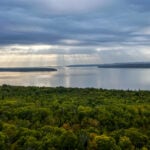
Description Experience the magic of dawn on the Bruce Trail with the Sunrise Hike Series offered by the Peninsula Bruce Trail Club. These early morning hikes provide a perfect opportunity to awaken your senses, boost your energy, and immerse yourself in the tranquility of nature as the sun paints the sky with breathtaking hues. As we make our way through scenic forest trails, we’ll pause to witness the first light shimmering on the turquoise waters of Georgian Bay – a sight that will surely leave you in awe!
Beyond the beauty, morning light helps regulate your circadian rhythm, elevating your mood, boosting energy levels and improving sleep quality. Whether you’re looking to start your day with a sense of calm, capture stunning sunrise photos, or simply reconnect with nature, these hikes offer a unique and inspiring way to greet the day.
On Saturday September 13th, join us in hiking along the Purple Valley Access Trail, Malcolm Bluff Side Trail, and stretch of Main Trail through the Malcolm Bluff Shores Nature Reserve to experience the sun rising over the Bay from the edge of the Escarpment. We’ll have the joy of taking in the stunning colours of the sky as the first light sparkles on the stunning turquoise waters. This peaceful sunrise hike is the perfect way to connect with nature, capture some incredible photos, and start the day with fresh air and inspiration. Whether you’re a morning person or just love a good adventure, come experience the magic of dawn from one of the best vantage points on the Bruce Peninsula!
Don’t forget to bring a headlamp or flashlight (preferably with a red light setting) as we begin our adventure in the pre-dawn quiet. Join us and discover how a sunrise hike can nourish your mind, body, and spirit—setting the tone for a brighter, more balanced day.
This hike is approximately 6.5 kms in length. Expect to be on the trail for 3 hours. Pace will be leisurely with ample time to enjoy the sunrise, take some photographs, and nourish yourself!
How to prepare:
Get a good night’s sleep
Bring lots of water and a snack (breakfast and/or coffee are recommended if that’s your thing!)
Bring a headlamp or flashlight (preferably with a red light setting)
Wear waterproof hiking boots
Hiking poles are recommended but not necessary
Bring insect repellant or wear protective clothing
Hosting Club: Dufferin Hi-Land Category: General Hike Location (Google Maps): Park on the east side of Prince of Wales in the Parking Lot just north of hwy #89
Description We will hike both side and main trail for a 10 km loop. This hike will feature some steep climbs and more moderate terrain. Park in the parking lot on the east side of Prince of Wales. Dress for weather conditions and bring at least 1L water and a snack. Please arrive by 8:45 am as we will leave promptly at 9 am.
Description We will hike around Woodend before heading to Fireman’s Park. After looping through Fireman’s we head back to Woodend. Bring water & snacks. Poles recommended.
Hosting Club: Caledon Hills Category: General Location (Google Maps): Scotsdale Farm, Map 13. Directions; from Highway 401, head north on Trafalgar Road past Georgetown. Trafalgar briefly merges with Highway 7 for about 3 km before separating to the right at the village of Silver Creek. At the stop light in Silver Creek, continue north on Trafalgar Road for about 1 km to the entrance of Scotsdale Farm on your right. Drive in about half a kilometre to reach the parking area.
Pace: Medium – 3 to 4 km/hour Terrain: Moderate – some hills and/or some poor footing Distance: 14 km
Description Join us for a loop hike along the main Bruce Trail and its scenic side trails, including the stunning Great Esker Side Trail.
Please dress appropriately for the weather, bring plenty of water, and pack some snacks. Note that parts of the trail are rocky, so poles are highly recommended.
We are committed to fostering an inclusive and welcoming environment. This hike is an LGBTQ+ safe space, and everyone is encouraged to join us!
Pace: Medium – 3 to 4 km/hr Terrain: Strenuous – Hilly with steep climbs and some poor footing Distance: 14 km
Description Come by car or transit for this all-inclusive 2SLGBTQI+ friendly hike from Smokey Hollows Waterfall, Waterdown to downtown Dundas.
Please arrive at the Smokey Hollow parking lot, 80 Mill St. South, by 8:45 a.m. for a 9 a.m. start.
We’ll follow the main trail along Grindstone Creek, through Clappison Woods, Borer’s Falls and Rock Chapel before heading down Sydenham to Dundas. We’ll be in deciduous forest for much of the day. Some excellent lookouts. Expect hills, a handful of steep climbs and descents, plus some rocky terrain. There are no spots to refill your water bottle. It’s that expected all hikers can manage 3.5 km per hour on uneven terrain. We’ll be on the trail from 9 a.m. until approximately 1:30-2 pm. allowing for rest stops, bio breaks and lunch. If you’re looking for a slow leisurely pace on flat terrain, this may not be the ideal hike for you.
Lunch will be at an abandoned skate park in the middle of nowhere. It’s not what you’d expect to see along the Bruce Trail.
By transit. The easiest route is to take HSR transit or GO Bus (depending where you live) to Aldershot GO station, then hop on the 18 Leavitt Loop bus and get off at “Mill at Mountain Brow,” near the Smokey Hollows parking lot. The bus drivers on this route are accustomed to hikers.
By car: There is unpaid parking at Smokey Hollow. Note: As I discovered on my pre-hike, the parking lot fills up early. An alternative: There’s street parking on Flanders Drive, which is about a 15-minute walk to Smokey Hollows (80 Mill St. South). PLEASE allow yourself enough time to find parking as we’re meeting at Smokey Hollows parking lot at 8:45 a.m latest. There are no washroom facilities at the starting point (um, plan accordingly or skip the large coffee :).
Upon reaching downtown Dundas at the end of the hike, drivers can do group Uber shuttles back to the Smokey Hollows parking lot. Anyone coming by transit can simply hop the bus from Dundas back to Hamilton.
Bring 1.5 litres of water and lunch. Sunscreen is also recommended. Hiking boots or sturdy footwear are recommended.
Get your complimentary Bruce Trail Rainbow badge and/or sticker at the end of the hike! For those interested, we frequently go for refreshments (pub or ice cream) in Dundas.
Feel free to reach out to the Hike Leader if you have any questions – “Click here to contact Hike Leader” on this form.
Hosting Club: Toronto Category: Car Hike Location (Google Maps): Kinsmen Park at KM66.9
Hike Leader(s): Alina Lin
Pace: Brisk (4-5 km/hr) Terrain: Challenging, Flat, Hilly, Level 2 (Intermediate – some hills and uneven surfaces, rocks and roots underfoot), Rocky, Variable Distance: 17 km
Description The Niagara region is one of Canada’s most productive fruit-growing areas. Strolling along country roads lined with farms and orchards, you’ll see ripe peaches, plums, and grapes hanging from the trees and smell the sweet fragrance of the harvest in the air—you’ll truly understand why it’s called a Fruit Paradise. To make the most of the short harvest season, let’s hike the Niagara section of the Bruce Trail and if you are interested, visit local farms afterward—perhaps even enjoy some fruit picking!
This is the last hike of a five-hike End-to-End series covering the entire Niagara section of the Bruce Trail. The full section stretches over 80 kilometers from Niagara-on-the-Lake to Grimsby. I am using Map Edition 29, so please note that kilometer markings may not be fully up to date, and actual hiking distances may vary slightly.
Meeting Point: Kinsmen Park at KM66.9 GPS:N43.146108, W79.475609. Enter from Hixon St at the intersection of Kinsmen Rd and Frost Rd.
We will car shuttle to the starting point of the hike Beamer Memorial Conservation Area at KM2.2, -Iroquoia Section GPS:N 43.188540, W 79.573428. Enter from Quarry Rd, which intersects with Ridge Rd W just west of Beamers Falls.
The group will then hike from KM2.2 back to KM66.9. All drivers are expected to participate in the car shuttle, either before or after the hike.
Important Notes:
Wear sturdy hiking boots and dress appropriately for the weather
Hosting Club: Toronto Category: Car Hike Location (Google Maps): Meeting place will be Scotsdale Farm parking lot. This is off Trafalgar Rd 1.7 km north of Highway 7. There is a sign at the road into the farm. Km29.8
Pace: Leisurely (2-3 km/hr) Terrain: Flat, Level 1 (Easy – mostly on flat, well maintained trails with hard-packed surface) Distance: 5 km
Description Last September Mara McHaffie a staff ecologist from the BTC and I led a very successful fern Id hike and are going to do another one this fall. This is a very slow paced “”look and learn” kind of hike. There is lots of opportunity for photographs and questions. The section we are going to view this year is a well travelled part of the trail and has quite a variety of vegetation. I have not counted the ferns I have seen already this season but maybe we will go beyond the 12 or 13 varieties we found last year. THis hike will go rain or shine so come dressed for any weather. Bring water and snacks.
Pace: Leisurely: 3 km/h or less Terrain: Moderate: Some hills and/or poor footing Distance: 5km
Description Join us on this Discovery Hike of the Pines and Clearview Loops – we’ll take our time, and see what we can find. We’ll be hiking upwards of 5km, depending on the group. The Pines loop is a relatively flat and easy walk. Clearview is more moderate, with some loops. Either way we’ll hike through forests along the Escarpment, and past the remnants of an old stone barn. Free ‘Boots on the Trail’ badges are available to youth 18 and under. This is also a great route to choose for the By the Seasons badge.
As we’ll be taking our time, this hike is suitable for families, new hikers, and anyone wanting a more leisurely hike. All ages are welcome. We’ll likely take a couple of hours (possibly more), depending on the group and conditions – bring a snack, and wear good footwear. Portions of the trail may be a bit mucky. An email re: trail conditions to expect will be sent out prior to our hike together.
If you are unable to register, please contact the hike leader via the link above. Carpooling may be available upon request.
Pace: Leisurely (2.0 – 3.0 km/h): A relaxed pace with frequent breaks and a focus on enjoyment., Medium (3.0 – 4.5 km/h): A comfortable pace for most hikers with steady progress. Terrain: Difficult: Steep ascents/descents, rocky scrambling, and some rugged escarpment paths., Easy: Flat forested sections or lowland trails., Moderate: Rolling hills, mild slopes and rocky paths. Distance: ~6.5km
Description Experience the magic of dawn on the Bruce Trail with the Sunrise Hike Series offered by the Peninsula Bruce Trail Club. These early morning hikes provide a perfect opportunity to awaken your senses, boost your energy, and immerse yourself in the tranquility of nature as the sun paints the sky with breathtaking hues. As we make our way through scenic forest trails, we’ll pause to witness the first light shimmering on the turquoise waters of Georgian Bay – a sight that will surely leave you in awe!
Beyond the beauty, morning light helps regulate your circadian rhythm, elevating your mood, boosting energy levels and improving sleep quality. Whether you’re looking to start your day with a sense of calm, capture stunning sunrise photos, or simply reconnect with nature, these hikes offer a unique and inspiring way to greet the day.
On Saturday September 13th, join us in hiking along the Purple Valley Access Trail, Malcolm Bluff Side Trail, and stretch of Main Trail through the Malcolm Bluff Shores Nature Reserve to experience the sun rising over the Bay from the edge of the Escarpment. We’ll have the joy of taking in the stunning colours of the sky as the first light sparkles on the stunning turquoise waters. This peaceful sunrise hike is the perfect way to connect with nature, capture some incredible photos, and start the day with fresh air and inspiration. Whether you’re a morning person or just love a good adventure, come experience the magic of dawn from one of the best vantage points on the Bruce Peninsula!
Don’t forget to bring a headlamp or flashlight (preferably with a red light setting) as we begin our adventure in the pre-dawn quiet. Join us and discover how a sunrise hike can nourish your mind, body, and spirit—setting the tone for a brighter, more balanced day.
This hike is approximately 6.5 kms in length. Expect to be on the trail for 3 hours. Pace will be leisurely with ample time to enjoy the sunrise, take some photographs, and nourish yourself!
How to prepare:
Get a good night’s sleep
Bring lots of water and a snack (breakfast and/or coffee are recommended if that’s your thing!)
Bring a headlamp or flashlight (preferably with a red light setting)
Wear waterproof hiking boots
Hiking poles are recommended but not necessary
Bring insect repellant or wear protective clothing
Hosting Club: Dufferin Hi-Land Category: General Hike Location (Google Maps): Park on the east side of Prince of Wales in the Parking Lot just north of hwy #89
Description We will hike both side and main trail for a 10 km loop. This hike will feature some steep climbs and more moderate terrain. Park in the parking lot on the east side of Prince of Wales. Dress for weather conditions and bring at least 1L water and a snack. Please arrive by 8:45 am as we will leave promptly at 9 am.
Description We will hike around Woodend before heading to Fireman’s Park. After looping through Fireman’s we head back to Woodend. Bring water & snacks. Poles recommended.
Hosting Club: Caledon Hills Category: General Location (Google Maps): Scotsdale Farm, Map 13. Directions; from Highway 401, head north on Trafalgar Road past Georgetown. Trafalgar briefly merges with Highway 7 for about 3 km before separating to the right at the village of Silver Creek. At the stop light in Silver Creek, continue north on Trafalgar Road for about 1 km to the entrance of Scotsdale Farm on your right. Drive in about half a kilometre to reach the parking area.
Pace: Medium – 3 to 4 km/hour Terrain: Moderate – some hills and/or some poor footing Distance: 14 km
Description Join us for a loop hike along the main Bruce Trail and its scenic side trails, including the stunning Great Esker Side Trail.
Please dress appropriately for the weather, bring plenty of water, and pack some snacks. Note that parts of the trail are rocky, so poles are highly recommended.
We are committed to fostering an inclusive and welcoming environment. This hike is an LGBTQ+ safe space, and everyone is encouraged to join us!
Pace: Medium – 3 to 4 km/hr Terrain: Strenuous – Hilly with steep climbs and some poor footing Distance: 14 km
Description Come by car or transit for this all-inclusive 2SLGBTQI+ friendly hike from Smokey Hollows Waterfall, Waterdown to downtown Dundas.
Please arrive at the Smokey Hollow parking lot, 80 Mill St. South, by 8:45 a.m. for a 9 a.m. start.
We’ll follow the main trail along Grindstone Creek, through Clappison Woods, Borer’s Falls and Rock Chapel before heading down Sydenham to Dundas. We’ll be in deciduous forest for much of the day. Some excellent lookouts. Expect hills, a handful of steep climbs and descents, plus some rocky terrain. There are no spots to refill your water bottle. It’s that expected all hikers can manage 3.5 km per hour on uneven terrain. We’ll be on the trail from 9 a.m. until approximately 1:30-2 pm. allowing for rest stops, bio breaks and lunch. If you’re looking for a slow leisurely pace on flat terrain, this may not be the ideal hike for you.
Lunch will be at an abandoned skate park in the middle of nowhere. It’s not what you’d expect to see along the Bruce Trail.
By transit. The easiest route is to take HSR transit or GO Bus (depending where you live) to Aldershot GO station, then hop on the 18 Leavitt Loop bus and get off at “Mill at Mountain Brow,” near the Smokey Hollows parking lot. The bus drivers on this route are accustomed to hikers.
By car: There is unpaid parking at Smokey Hollow. Note: As I discovered on my pre-hike, the parking lot fills up early. An alternative: There’s street parking on Flanders Drive, which is about a 15-minute walk to Smokey Hollows (80 Mill St. South). PLEASE allow yourself enough time to find parking as we’re meeting at Smokey Hollows parking lot at 8:45 a.m latest. There are no washroom facilities at the starting point (um, plan accordingly or skip the large coffee :).
Upon reaching downtown Dundas at the end of the hike, drivers can do group Uber shuttles back to the Smokey Hollows parking lot. Anyone coming by transit can simply hop the bus from Dundas back to Hamilton.
Bring 1.5 litres of water and lunch. Sunscreen is also recommended. Hiking boots or sturdy footwear are recommended.
Get your complimentary Bruce Trail Rainbow badge and/or sticker at the end of the hike! For those interested, we frequently go for refreshments (pub or ice cream) in Dundas.
Feel free to reach out to the Hike Leader if you have any questions – “Click here to contact Hike Leader” on this form.
Hosting Club: Toronto Category: Car Hike Location (Google Maps): Kinsmen Park at KM66.9
Hike Leader(s): Alina Lin
Pace: Brisk (4-5 km/hr) Terrain: Challenging, Flat, Hilly, Level 2 (Intermediate – some hills and uneven surfaces, rocks and roots underfoot), Rocky, Variable Distance: 17 km
Description The Niagara region is one of Canada’s most productive fruit-growing areas. Strolling along country roads lined with farms and orchards, you’ll see ripe peaches, plums, and grapes hanging from the trees and smell the sweet fragrance of the harvest in the air—you’ll truly understand why it’s called a Fruit Paradise. To make the most of the short harvest season, let’s hike the Niagara section of the Bruce Trail and if you are interested, visit local farms afterward—perhaps even enjoy some fruit picking!
This is the last hike of a five-hike End-to-End series covering the entire Niagara section of the Bruce Trail. The full section stretches over 80 kilometers from Niagara-on-the-Lake to Grimsby. I am using Map Edition 29, so please note that kilometer markings may not be fully up to date, and actual hiking distances may vary slightly.
Meeting Point: Kinsmen Park at KM66.9 GPS:N43.146108, W79.475609. Enter from Hixon St at the intersection of Kinsmen Rd and Frost Rd.
We will car shuttle to the starting point of the hike Beamer Memorial Conservation Area at KM2.2, -Iroquoia Section GPS:N 43.188540, W 79.573428. Enter from Quarry Rd, which intersects with Ridge Rd W just west of Beamers Falls.
The group will then hike from KM2.2 back to KM66.9. All drivers are expected to participate in the car shuttle, either before or after the hike.
Important Notes:
Wear sturdy hiking boots and dress appropriately for the weather
Hosting Club: Toronto Category: Car Hike Location (Google Maps): Meeting place will be Scotsdale Farm parking lot. This is off Trafalgar Rd 1.7 km north of Highway 7. There is a sign at the road into the farm. Km29.8
Pace: Leisurely (2-3 km/hr) Terrain: Flat, Level 1 (Easy – mostly on flat, well maintained trails with hard-packed surface) Distance: 5 km
Description Last September Mara McHaffie a staff ecologist from the BTC and I led a very successful fern Id hike and are going to do another one this fall. This is a very slow paced “”look and learn” kind of hike. There is lots of opportunity for photographs and questions. The section we are going to view this year is a well travelled part of the trail and has quite a variety of vegetation. I have not counted the ferns I have seen already this season but maybe we will go beyond the 12 or 13 varieties we found last year. THis hike will go rain or shine so come dressed for any weather. Bring water and snacks.
Pace: Leisurely: 3 km/h or less Terrain: Moderate: Some hills and/or poor footing Distance: 5km
Description Join us on this Discovery Hike of the Pines and Clearview Loops – we’ll take our time, and see what we can find. We’ll be hiking upwards of 5km, depending on the group. The Pines loop is a relatively flat and easy walk. Clearview is more moderate, with some loops. Either way we’ll hike through forests along the Escarpment, and past the remnants of an old stone barn. Free ‘Boots on the Trail’ badges are available to youth 18 and under. This is also a great route to choose for the By the Seasons badge.
As we’ll be taking our time, this hike is suitable for families, new hikers, and anyone wanting a more leisurely hike. All ages are welcome. We’ll likely take a couple of hours (possibly more), depending on the group and conditions – bring a snack, and wear good footwear. Portions of the trail may be a bit mucky. An email re: trail conditions to expect will be sent out prior to our hike together.
If you are unable to register, please contact the hike leader via the link above. Carpooling may be available upon request.
Description Hiking 101 is an introductory course for novice hikers, members and non-members alike. If you want some guidance on where to begin, what to wear, and what to take along, this is the course for you. The course is 3 Sunday afternoon sessions with a combination of workshop/Q& A followed by short hikes along the trail. Dress in weather appropriate clothing and wear good walking shoes.
Time: 11:00 am – 1:30pm
Meeting locations: Sunday, Sept 14- Queenston Heights Park, Niagara River Pkwy, near the Bruce Trail CairnN 43.157826 W 79.052045, Paid parking.
Pace: Medium – 3 to 4 km/hr Terrain: Moderate – Some hills and/or some poor footing Distance: 14 km
Description From the Scotsdale Farm parking lot, we will hike the main trail and side trails in Silver Creek Conservation area for a 14k loop. The terrain through this area can be tricky with uneven footing and rough, rocky areas. Wear sturdy footwear and clothing appropriate to conditions. Insect repellent is recommended. Bring a snack and plenty of water.
Please arrive at 8:15 am as well will leave promptly at 8:30 am.
Location (Google Maps): Parking lot is off Sycamore Drive East of Bayview , across Starbucks plaza Bus 91 from Finch east station stops at Sycamore station.
Pace: Moderate (3-4 km/hr) Terrain: Hilly, Level 2 (Intermediate – some hills and uneven surfaces, rocks and roots underfoot), Variable Distance: 7-8 km
Description We will explore Valleyview and Maple View parks, and walk along German Mill Creak, in return we stop in Huntington park and have snack under beautiful shed ,
Even it is considered Urban walk, it is urban hike as we have some up and down hills and tree roots, please bring your hiking poles, water and snacks,
Hosting Club: Sydenham Category: General Hike Location (Google Maps): Meet at Roadside Parking on 4th Concession S., where the Bighead River crosses the road. If you are coming from Owen Sound, drive East on Grey Rd 18. Turn south at the Bognor Marsh parking lot and follow Concession 4 South for about 4.5 km to the parking spot. This is a one way hike, but I will drop a car at the end before we start, so there won’t be a car shuttle. Please arrive at the hike start at 8:45 so we can start hiking promptly at 9.
Pace: Medium: 3 to 4 km/h Terrain: Strenuous: Hilly with steep climbs and some poor footing. Distance: 7.5 km
Description We start in the Bighead River Valley and follow the lowlands west until the trail starts to climb. There is one very steep hill which is 500 m long, and it provides a fun but challenging climb. The rest of the trail travels along the top of the escarpment with some scenic views to the south. We finish the hike with a short loop in the Massie Hills Forest.
Description Hike the main and sidetrails in Shorthills Provincial Park. Please wear hiking boots, bring water and insect repellant. Check yourself for ticks following the hike.
Pace: Leisurely Terrain: Moderate Distance: Long Hike 5 km Short Hike 2.7 km
Description From roadside parking at km 54.9, we will hike west via the Peter Beecham Side Trail and Main Trail until we reach 3rd Line EHS. At this point, we will retrace our steps and return to the parking lot, connecting with the Griffith Ravine Side Trail at Km 56.2 along the way.
For a shorter trip, hikers can join the Griffith Ravine Side Trail at km 56.2 and return to the parking lot. (2.7 km hike)
Bring water, snacks, and sunscreen. Hiking poles are recommended.
Pace: Medium – 3 to 4 km/hr Terrain: Moderate – Some hills and/or some poor footing Distance: 8 kms
Description We will hike the main trail from Speyside, to the Al Shaw ST, Hilton Falls ST and onto the Vanderleck ST up to 17 Side Road and then return the same way. There are some very technical (rocky) sections on this hike but no major hills. Bring bug spray/bug net and a snack, as needed.
You are signing up for the following dates and times: 2025-09-17 at 08:00 2025-09-18 at 2025-09-19 at 2025-09-20 at 2025-09-21 at 2025-09-22 at 2025-09-23 at 2025-09-24 at
Hosting Club: Iroquoia, Sydenham Category: Stained Glass Badge End to End Fundraiser Hike Location (Google Maps): Bruce Trail Parking Lot on East side of Grey Rd 12
Pace: Brisk – 4 to 5 km/hr Terrain: Dependent on Conditions, Moderate – Some hills and/or some poor footing, Strenuous – Hilly with steep climbs and some poor footing Distance: The entire section is about 175km which will be split over 8 continuous days. Approx. 20-25km per day
Description Welcome to Sydenham Bruce Trail Club – This end to end will cover the entire section over 8 days. While the section is approx 175km in length, there are about 50km on road, mostly backroads.
Overview
This is a special series of 8 hikes to complete the Sydenham section of the Bruce Trail. The organization, guidance, logistics and the Hart’s Tongue stained glass badge, designed by Joe Borges is included in your fee. Proceeds support the Sydenham Bruce Trail Club which in turn supports the Bruce Trail Conservancy mission to “Preserving a ribbon of wilderness, for everyone, forever.”
For this E2E in 8, we will be following the main trail southbound from Wiarton eventually finishing in Blantyre. Please note that you are signing up for the entire series of 8 hikes as a Group Hike. The Sydenham in 8 ETE is geared to experienced long distance hikers with the expectation of a 3 to 5.0 km/ hr. pace maintained over a 20km plus day. The section is approximately 175km so daily distances will be based on available parking. No dropout points have been established and therefore hikers who must drop out, will be responsible for their own transportation back to their vehicle. Please note that transportation back to your vehicle is very limited in this section. We will hike at a steady pace but there will be plenty of time to take pictures and to enjoy the flora and fauna of this beautiful section. This particular set of 8 hikes is intended to be Moderate/Brisk. Please be honest about your degree of physical fitness and abilities prior to registration. It is a group hike so it is important you are able to keep pace with the person in front of you.
Attire and Daily Hikes.
Hikers will be expected to be wearing proper hiking boots and layered clothing with the expectation of cool or warm and possibly wet weather. Sufficient food and at least 2l of water for a full day of hiking is required as well as hiking poles (if you use them), and wet weather gear is strongly recommended. Bug spray is also suggested. Clothing adjustments, bio-breaks are as needed. Please let the sweep person know and they will wait for you. A morning break around 10am and a 10-15 minute on-trail lunch break will be scheduled. An afternoon break will be based on our expected finish time. Depending on weather conditions, these times may vary. Everyone must carry a First Aid kit.
Missing Hikes/Making-up Hikes
This is a group hike and it is intended that all participants plan to attend each day. If you intend to participate in the entire 8 days but absolutely must miss one day, you may self-complete this day on your own and still qualify for the stained glass badge. You must make the day up prior to finishing the hike. Since this is a car shuttle hike, please ensure your vehicle is car shuttle ready for 4 other passengers. All participants will be expected to take turns either driving to the start or driving the drivers back at the end of the day. Carpooling to our meeting spot with 2 people in the car is generally ok but we would like to minimize and equalize the driving/shuttling as much as possible so it is fair for all participants.
Parking Fees
Some parking locations might require paid parking. The fee for this E2E-in-8 does not include any parking/entry fees for hikers. These costs, where applicable, will be shared amongst all participants unless you have a parking or park pass.
Leave No Trace
Please remember, like all hikes, this is a Leave No Trace hike. Pack out whatever you pack in. Do not toss anything onto or into any sections of the trail. We will also try to leave the trail better than we found it so we will be collecting any trail trash along the way if there is any.
Dogs will not be welcome on this hike.
Accommodations
It is strongly recommended you make reservations for accommodations for this hike if you are participating from out of town. Accommodations can be made anywhere but Owen Sound has many motels to choose from as well as the KOA Campground. It is pretty central to the northern and the southern sections of the Sydenham section of trail. If you would like a roommate, I can share your email with any other registered participants who are also looking for shared accommodations. Please let me know.
Daily
We meet for each hike by at least 7:45am each day. A schedule for meeting and start locations will be sent to each participant in May. We will hike southerly each day. The schedule is subject to change.
First day of hiking is Sept 17 – last day is Sept 24.
Location (Google Maps): Park in the lower parking lot of the Beaver Valley Ski Club, near the Valley Crossover Side Trail. From there, a few vehicles will be needed to shuttle to our starting point on Sideroad 7A.
Pace: Medium Terrain: Moderate, Some rocky footing, Some steep sections Length of Hike: 5 km
Description After shuttling to Sideroad 7A, our hike begins as we walk through the BTC’s Kimberley Springs Nature Reserve, which includes beautiful Bill’s Creek. We also see the Stone Foundation Side Trail. After returning to the Main Trail, we then take the Kimberley Forest Side Trail. The Kimberley Forest is a beautiful multi-use and multi-trail area. Much of the walk is downhill as it finishes at the base of Beaver Valley Ski Club.
Pace: Leisurely – 3km/hr or less Terrain: Moderate – Some hills and/or some poor footing Distance: Approx. 7 km.
Description Join us in hiking this lovely section of trail between Kilbride Park and the Calcium Pits on Twiss Rd. The trail goes through pleasant woodland, past the remains of rock fences left from pioneer times, through some rocky areas and past the old calcium pits. Meet behind Kilbride Public School near the tennis courts at 9:45 am. for a 10:00 am. start. Bring water, a snack, sunscreen and insect repellent. I will send out an email a few days before with my cell number.
Description This will be our permanent Thursday Location until Bridge repairs complete. From Cave Spring Conservation Area explore the trail network on the escarpment towards Kinsman Park and Moyer Road.
You must register for each hike. Bring Poles, snack bug spray, sunscreen and a drink. Dress for the weather
Pace: Medium Terrain: Moderate Length of Hike: 18.5 km
Description This is a series of 4 hikes to earn the Niagara Bruce Trail Stained Glass Fundraiser badge. Please arrive at 8:15 a.m. each day ready to shuttle to the start of our hikes. Please be prepared to be asked to take a turn shuttling hikers. Our first hike meets east of km 18.5, on the north side of Glendale Ave, 50 m east of the Welland Canal, N43.145572, W79.191214. Once registrations are complete I’ll send out details for the other hikes. Be aware that these are medium paced hikes, 3 to 4 km /hr, sometimes a bit faster on flat stretches, sometimes a bit slower on hills. Self evaluate whether this hike is for you as we will be hiking together as a group at this pace. As always bring sufficient water, food, insect and sun protection, dress appropriately for the weather. Life happens, so you can make up one hike if you need to miss one. My contact info, text or call 519 695 7691 or email g60collings@gmail.com. Looking forward to hiking with you! Glenda
Location (Google Maps): Parking lot is off Sycamore Drive East of Bayview , across Starbucks plaza Bus 91 from Finch east station stops at Sycamore station.
Pace: Moderate (3-4 km/hr) Terrain: Hilly, Level 2 (Intermediate – some hills and uneven surfaces, rocks and roots underfoot), Variable Distance: 7-8 km
Description We will explore Valleyview and Maple View parks, and walk along German Mill Creak, in return we stop in Huntington park and have snack under beautiful shed ,
Even it is considered Urban walk, it is urban hike as we have some up and down hills and tree roots, please bring your hiking poles, water and snacks,
Hosting Club: Dufferin Hi-Land Category: General Hike Location (Google Maps): Roadside parking on Mountainview Road at the Mountainview Road Access Trail. (Mountainview Road between Escarpment Side Road and Charleston Side Road). Rough GPS coordinates below.
Description Join us on a there and back hike taking in the new BTC property at Meltwater Moraine, the Songbird Nature Reserve and the Paris Moraine Side Trail. Please bring 2.5L of water, lunch, sunblock, bug spray and a smile.
Pace: Moderate (3-4 km/hr) Terrain: Challenging, Hilly, Level 3 (Advanced – steep hills and some scrambling over boulders), Rocky Distance: Moderate group about 12 km, fast group 15 km +
Description Please contact Evergreen Resort to ensure they have accommodation for your before you book your seat on the coach.
Join us for three days of guided hiking on the beautiful Saugeen Peninsula. Spend your days on the Bruce Trail and your evenings at Evergreen Resort overlooking Lake Huron.
We will explore the Skinner’s Bluff, Cape Crocker, Hope Bay, Barrow Bay, Lion’s Head, and/or Cape Chin areas. Hikes will be up to 15 km (dropouts will not be possible) with lots of awesome views. Expect some strenuous climbs, some challenging footing over boulders and crevasses, and some exposed sections. These hikes are not suitable for people who are afraid of heights. All fit, experienced hikers comfortable walking on this type or terrain are welcome. There will be a moderate group and a fast group; both will do full day hikes with no dropouts. Please note: The Peninsula section is rugged. There will not be a sight seeing group or other activities for non-hikers.
Accommodation is in one-, two-, and three-bedroom cottages (linens, bedding, and towels provided). Each cottage has a full bathroom, fridge, and heater. The resort has a hot tub and a private beach perfect for viewing sunsets. Cost is $370.75 per person (plus taxes and gratuity extra). This includes two nights’ accommodation, two dinners, two breakfasts, and two boxed lunches.
Coach fare is $180 for members, $200 for non-members, and $110 for children.
Registration instructions:
Please reserve your cottage and your seat on the coach at the same time.
Call Evergreen Resort at 519-534-1868 to book your cottage. You will need to find roommates/cottagemates. There are no single hotel rooms.
To reserve your seat on the bus, register here starting on Friday June 20 at 7 AM.
Cancellation policy: While we are hoping for sunshine, the trip cannot be cancelled due to weather. Coach fare is non-refundable.
Our coach will depart at 7 AM on Friday September 19. We plan to be back in Toronto between 7 and 8 PM on Sunday September 21. Departure locations: 10 York Mills Rd and HWY 400 and Major Mackenzie Park and Ride.
Hosting Club: Iroquoia, Dufferin Hi-Land Category: General Hike Location (Google Maps): Boyne Valley Provincial Park – parking lot on Prince of Wales Drive 80 metres south of Prince of Wales Side Trail
Pace: Medium – 3 to 4 km/hr Terrain: Moderate – Some hills and/or some poor footing Distance: 13 km
Description We will hike BT side trails and the main trail for 13K loop. This hike will feature some steep climbs and more moderate terrain. We will meet at the parking lot on Prince of Wales Drive just south of the Prince of Wales Side Trail. Dress for weather conditions, keeping in mind that insects, including ticks, will still be active. Bring plenty of water and a snack. Please arrive by 8:15 am as we will eave promptly at 8:30 am.
Description Enjoy the benefits of pausing for a yoga practice as we tour through the trails, parkland and Historic Niagara-on-the-Lake. No mat required. Movement will focus on a flow of standing poses designed especially for hikers. Plan to stay for conversation and a warm cup of coffee or tea at Sweets & Swirls, Community Centre, Niagara Stone Road, NOTL.
Hosting Club: Dufferin Hi-Land Category: General Hike Location (Google Maps): Limehouse CA parking lot off Fifth Line. See Google Maps link for GPS coordinates.
Description Join us on a shuttle hike from Scotsdale Farm to Limehouse on a beautiful Fall day. We will take in the new Main Trail reconfiguration as well as several side trails. Please bring a garbage bag and a change of footwear for the shuttle, 2L of water, a snack, a lunch and a smile. Please be ready to shuttle at 9:30 am sharp.
Pace: Medium – 3 to 4 km/hr Terrain: Moderate – Some hills and/or some poor footing Distance: 6.5 kms
Description Meeting in the parking lot behind the Kilbride School, we will hike along the main trail to Twiss Road and turn around and hike back. There is some technical footing near the Twiss Road end of the trail, but otherwise this is a fairly easy hike. Bring bug spray/bug net and water.
Hosting Club: Iroquoia Category: Special Event Location (Google Maps): Two different bus loading locations (one for each wknd) will be provided to registered hikers only. Unregistered hikers who show up will not be permitted to board the buses.
Pace: Brisk – 4 to 5 km/hr Terrain: Dependent on Conditions Distance: 122km (30-35 each day) – Self-paced with checkpoint deadlines
Description Please join us for the annual Iroquoia Bruce Trail Club self-paced End-to-End. You can enjoy and complete the entire club distance of 122 km over four days (approximately 30-35km each day).
**NEW THIS YEAR: We will have an all new End-To-End badge in 2025**
Please be honest about your physical abilities. These 4 days are not recommended for new hikers or anyone who hasn’t completed these distances recently. The registration fee is non-refundable.
The hikes will traverse the varied and often strenuous terrain from Grimbsy in the south, to the 401 in Milton. You will pass many waterfalls and beautiful vistas. Checkpoint stations will be approximately every 10 km offering snacks, water refill, and assistance. Please bring your own First Aid Kit.
The hike is $95 for members and $110 for non-members and includes bus transportation from the meeting point to the hike starting point, refreshments, parking, permit costs, and the official E2E badge. The fee is non-refundable. After costs, the proceeds go to the Iroquoia Bruce Trail Club who support The Bruce Trail Conservancy mission of “Preserving a ribbon of wilderness, for everyone, forever.”
Registration opens at 8am on March 29, 2025 for Bruce Trail Conservancy members only. You may be a member of any club. If any spots are still available after the first two weeks, registration will also be opened for non-members at a cost of $110.
Details will be emailed to participants once registration is received. As mentioned, these are longer hikes and are not suitable for beginning hikers. For both events, hikers are expected to maintain an average pace of 4 km/hr (or more). Hikers will be required to reach each checkpoint on each day by a prescribed time in order to continue, and ensure everyone is off the trail before dark. Please be aware that volunteers are running this event and will be waiting.
Space is limited, hikes go rain or shine, and no dogs are permitted on this event. For questions, please use the contact hike leader form available through the link on this page.
Location (Google Maps): Glasgow Trail, Concession Road 2 Park in parking lot at the trail head.
From Highway 404 turn right to Stouffville Rd, till to the end of road and turn left on York Durham line in About 1km turn right to Webb Rd. and turn right to Concession Road 2 ,you will see parking lot in 500 meters
Hosting Club: Toronto Category: Car Hike Location (Google Maps): Roadside parking on Kimerly Dr.
Hike Leader(s): Alina Lin
Pace: Brisk (4-5 km/hr) Terrain: Challenging, Flat, Hilly, Level 2 (Intermediate – some hills and uneven surfaces, rocks and roots underfoot), Variable Distance: 19 km
Description It’s time for the fall colors—and no autumn feels complete without a hike on the Bruce Trail.
This is the first hike of a End-to-End series covering the entire Iroquoia section of the Bruce Trail. The full section stretches over 120 kilometers from Grimsby to Milton. I am using Map Edition 29 to plan the hikes, and so please note that kilometer markings may not be fully up to date, and actual hiking distances may vary slightly.
Meeting Point: KM29.5. Roadside parking on Kimerly Dr. Hamilton. GPS: 43.227607, -79.813513. Please arrive before 8:45am to allow time for car shuttle coordination.
We will car shuttle to KM46.7, the starting point of the hike at Dundas Valley Conservation Parking lot(paid parking lot) on Artaban Rd, 180 m north of Lion’s Club Rd. GPS: N 43.240974, W 79.975582.
The group will then hike from KM46.7 back to KM29.5. We will add a bit fun by climbing up and down the Wentworth Steps Side Trail, a set of 498 steel steps.
All drivers are expected to participate in the car shuttle, either before or after the hike. All hikers are expected to chip in for the parking fees.
Important Notes:
Wear sturdy hiking footwear and dress appropriately for the weather
Description Fall colours will be underway as we hike up the main trail towards 8th SD and continue north. We’ll hike the Oliver Creek ST loop, one of my favourite properties, and retrace our steps back to the start. Look forward to seeing your smiles at 8:45 with snack, water, and appropriate footwear/clothing.
Description We will be hiking down the escarpment into the village of Queenston. After touring around Queenston we will be heading back up the escarpment to Queenston Heights Park. Mixture of trail and road walking.
Hosting Club: Caledon Hills Category: General Location (Google Maps): Hockley Rd. and 5th Line EHS, north of km 51.8 on the east side of 5th Line EHS, just south of the Hockley Rd. (NOT THE MAIN HOCKLEY VALLEY PP PARKING)
Pace: Brisk – 4 to 5 km/hour, Fast – 5+ km/hour Terrain: Strenuous – hilly with steep climbs and some poor footing Distance: 21 km
Description 🚐 Shuttle Required 🚐
Are you looking for a challenge? Training for an end-to-end, or just love a bit of self-inflicted suffering? You’ve come to the right place.
To prep for fall and winter hiking season, I’ll be posting more intense hikes—this one will push you. We’ll cover 21 km at a fast pace, starting from 5th Line EHS, through Hockley Valley, and finishing at Mono Community Centre. Expect steep climbs and rolling hills.
⚠️ This is a brutal hike. Please be honest about your abilities—there are no drop-out points. Once we start, you’ll need to keep up.
We’ll need drivers to help with shuttling: from Mono CC down to 5th Line EHS, and then back for vehicle pickup.
Start time is 9:00 AM SHARP.
Unless the forecast is over -50°C, this hike goes—rain or shine.
Pace: Leisurely – 3 km/hr. or less, Brisk – 4 to 5 km/hr Terrain: Moderate – Some hills and/or some poor footing Distance: 5 km
Description Barn Foundation on Stone Foundation Side Trail at Stop 6 (Pages 95- 97) Barn Foundations are wonderful places to see many different rock types, including the Escarpment’s Fossil Hill Dolostone layer, which is full of coral and other fossils.
Pace: Medium – 3 to 4 km/hr Terrain: Moderate – Some hills and/or some poor footing Distance: 9 kms
Description There are so many trails here that it’s hard to choose where to go. But this hike will take us down the main trail to the Side Trails of Duff Pit, Reservoir, Trafalgar Rd and Great Esker to the main trail and Maureen Bennett Side Trail and finishing on the Bennett Heritage Trail. Bring bug spray/bug net and plenty of water.
Hosting Club: Caledon Hills Category: General Location (Google Maps): Meet at the roadside parking on Coolihans Sideroad, km 35.0 Map 17, near where the Trail crosses the road. This is just west of the intersection of Glen Haffy Road and Coolihans Sideroad (even though the GPS coordinates are showing just to the east). It is best to aim for arriving around 10:15, so we can start hiking as close to 10:30 am as possible. Thanks!
Pace: Leisurely – 3 km/hour or less Terrain: Moderate – some hills and/or some poor footing Distance: Approximately 6 km
Description Looking to get out on a Saturday but not give up your whole day? This Glen Haffy hike might be the one for you! We’ll hike the main Bruce Trail and conservation trails to make an approximately 6 km route. The pace will be a relaxed one, so you can enjoy the sights and sounds of fall in the forest. Consider the following in your preparations: a hat, a jacket, insect repellent, sunscreen, hiking boots/shoes, poles. You are encouraged to bring water and a snack as there will be a short break. No dogs please. You can expect a reminder/update message one or two days before the hike.
Pace: Moderate (3-4 km/hr) Terrain: Hilly, Level 2 (Intermediate – some hills and uneven surfaces, rocks and roots underfoot), Variable Distance: 10-11 km
Description Please join us for a September hike in Rouge National Urban Park, a unique asset right within Toronto’s boundaries. Enjoy scenic views, hopefully cooler temperatures, the large wetland area, and the trail through the Cedar Forest. Expect some “healthy” hills.
The hike will start at the Toronto Zoo entrance. To get there you may meet Tom at Union Station at 9:00 am in the Great Hall by the Travaler’s Aid information desk with the clock over it. We will take the 9:21 AM Lakeshore East GO Train to Rouge Hill station and transfer to TTC Route 200 seasonal service to the Toronto Zoo (free transfer if you have a Presto Card). You may also board at any Lakeshore East/West GO station or take TTC Route #86 from Kennedy Station (approximately 42 minutes) or Route #85 from Don Mills Sation (approximately 50 minutes). Note that the Zoo Road Day area is closed for construction of a new visitor centre. The adjacent parking is lot is also closed. We will finish at the campground on Kingston Road to the south so taking public transit is recomended. Unlike most urban walks within the city limits there will be no dropout points.
Bring at least 2 liters of water, lunch, snacks, layers appropiate to the weather conditions, and rain gear (if applicable).
Note that the toilet facilities in the southern section of the park are limited to a couple “portable potties” on Park Road and the Twyn Rivers Day Use area until construction is completed.
Optional Apres-hike stop at The Black Dog Pub on Island Road.
Here is a map of the proposed route: https://onthegomap.com/s/p9ql44rs
Hosting Club: Dufferin Hi-Land Category: Special Events Location (Google Maps): BTC parking lot on 2nd Line EHS north of 25 Sideroad at the beginning of the Splitrock Side Trail. GPS coordinates below.
Bruce Trail Conservancy and the Dufferin Hi-Land Biodiversity Committee are participating in the TD tree planting event at Splitrock Narrows on September 20.
Start time: 1:00 p.m. Finish time: 4:00 p.m.
Meet at the Splitrock Narrows Nature Reserve (Bruce Trail Conservancy) parking lot located at 755437 2nd Line EHS, Shelburne ON. For exact directions to the parking lot, google GPS Coordinates: 44.074908, -80.084144. Volunteers will direct you to park in the Bruce Trail Conservancy parking lot.
Volunteers need to be prepared for physical activity including digging, lifting, and planting, and may be asked to do other planting activities such as mulching, securing mulch mats, placing tree guards, and watering. You will have access to drinking water at the event, and we recommend that you bring a refillable water bottle to reduce waste. More details on TD registration page.
Registration Link: https://www.tdtreedays.com/en-ca/mono-splitrock-narrows-nature-reserve ONLY. Please do not register on the BTC Hike Schedule.
If you have any problems registering, contact Mara McHaffie, BTC Land Stewardship Coordinator, Ecologist mara.mchaffie@brucetrail.org
Pace: Moderate (3-4 km/hr) Terrain: Flat, Hilly, Level 2 (Intermediate – some hills and uneven surfaces, rocks and roots underfoot), Variable Distance: 13-14 km
Description Join us for a wonderful hike in Jefferson Forest and have a snack/lunch beside the Bond Lake. We will hike among tall trees and bushes of the Jefferson Forest and across the Bayview-Yonge corridor to reach to the Bond Lake. Boots mandatory, poles recommended, bring at least 2L of water, bug spray, sunscreen, snack/lunch and dress according to the weather conditions. Please avoid parking along the road. Difficulty Level: 2 (Moderate)
Please arrive @7:45 AM for start of 8:00AM.
This is a joint hike with the Oak Ridges Trail Association (ORTA).
Pace: Leisurely (2.0 – 3.0 km/h): A relaxed pace with frequent breaks and a focus on enjoyment. Terrain: Moderate: Rolling hills, mild slopes and rocky paths. Distance: ~2km
Description The Peninsula Bruce Trail Club and the Owen Sound Field Naturalists invite you to a special day celebrating the launch of Walking Through Time – Exploring the Geology of the Saugeen (Bruce) Peninsula, the third book in Beth Gilhespy’s acclaimed series.
In this latest volume, Beth takes readers on a fascinating journey through one of Ontario’s most geologically rich and scenic landscapes – from fossil-filled cliffs and quiet wetlands to rugged shorelines shaped by ancient tropical seas and shifting continents. With 13 detailed hikes, maps, and interpretive notes, this is the perfect guide for curious hikers and nature lovers.
Event Highlights:
Book Launch & Meet the Author – Chat with Beth from 10:00 AM – 3:00 PM and purchase signed copies (cash, cheque, or e-transfer).
Guided Geology Hikes – Join Beth for a 2 km interpretive walk along the Lion’s Head shoreline at 11:00 AM.
Social Time – Connect with fellow hikers, naturalists, and geology enthusiasts.
Registration Details:
The book launch is open to all – no registration required.
To join one of the geology hikes, pre-registration is required
You do not need to be a BTC member to participate in a hike.
Wear sturdy footwear and dress for the weather
Come for the book, stay for the rocks – we can’t wait to see you there! 🥾📚🪨
Pace: Leisurely (2.0 – 3.0 km/h): A relaxed pace with frequent breaks and a focus on enjoyment. Terrain: Moderate: Rolling hills, mild slopes and rocky paths. Distance: ~2km
Description The Peninsula Bruce Trail Club and the Owen Sound Field Naturalists invite you to a special day celebrating the launch of Walking Through Time – Exploring the Geology of the Saugeen (Bruce) Peninsula, the third book in Beth Gilhespy’s acclaimed series.
In this latest volume, Beth takes readers on a fascinating journey through one of Ontario’s most geologically rich and scenic landscapes – from fossil-filled cliffs and quiet wetlands to rugged shorelines shaped by ancient tropical seas and shifting continents. With 13 detailed hikes, maps, and interpretive notes, this is the perfect guide for curious hikers and nature lovers.
Event Highlights:
Book Launch & Meet the Author – Chat with Beth from 10:00 AM – 3:00 PM and purchase signed copies (cash, cheque, or e-transfer).
Guided Geology Hikes – Join Beth for a 2 km interpretive walk along the Lion’s Head shoreline at 1:00 PM.
Social Time – Connect with fellow hikers, naturalists, and geology enthusiasts.
Registration Details:
The book launch is open to all – no registration required.
To join one of the geology hikes, pre-registration is required
You do not need to be a BTC member to participate in a hike.
Wear sturdy footwear and dress for the weather
Come for the book, stay for the rocks – we can’t wait to see you there! 🥾📚🪨
Pace: Leisurely: 3 km/h or less Terrain: Moderate: Some hills and/or poor footing Distance: 4 km
Description We will carpool to do two connected loop hikes of Fossil Glen and Frank Holley. This will be hikes 31 and 32 in the book Exploring Sydenham. There will be one secret to find on each hike. If you do not have a book and would like one ($30) let me know by using the “Contact hike leader” link.
You are signing up for the following dates and times: 2025-09-22 at 07:45 2025-09-23 at 2025-09-24 at 2025-09-25 at 2025-09-29 at 2025-09-30 at 2025-10-01 at 2025-10-02 at
Pace: Brisk – 4 to 5 km/hour Terrain: Strenuous – hilly with steep climbs and some poor footing Distance: 23.2 km
Description We’ve had so much fun completing the Bruce Trail in the Fall of 2023 and again in 2024, that we’ve decided to do it again!
This hike series covers the Sydenham section; 168 km over 8 days.
Note that hikers have alternative dates if they wish – choose 29 Sept or 7 Oct for Hike #5 and 2nd or 8th Oct for Hike #8. The first options give hikers the week of Oct 6th off. The second options give some rest days for those participating in Sydenham’s official Club E2E.
We will meet each morning at 7:45 and be ready to shuttle at 8:00. Hikers will take turns shuttling and taking drivers to their cars each day. Any parking costs will be shared among hikers.
Hikers should wear layered clothing, hiking boots, poles, hat, sunscreen, bug spray, rain gear and bring plenty of water, snacks and lunch. We will hike rain or shine.
Full itinerary will be emailed to hikers the week before the first hike.
Description Meet at Port Dalhousie Public Parking lot near Lakeport road in St. Catharines. Note this is PAID PARKING. For other parking options see here: https://www.stcatharines.ca/en/roads-parking-and-traffic/parking-in-port-dalhousie.aspx We will be doing the Welland Canals Hike #4. Note the hike starts at 8:30am and is the 4th in the Welland Canals badge series. If you are interested in receiving your badge after completing the 4th hike on Sept 29th, please let me know and pay in cash or via etransfer (I can give you directions on the hike) $10 for members (please provide BTC number) or $15 for non-members. Badge info: https://niagarabrucetrail.club/badges/
Please wear good walking shoes (the path/trail is mostly flat), poles if you like and water/snacks.
Pace: Medium – 3 to 4 km/hr Terrain: Moderate – Some hills and/or some poor footing Distance: 15 k
Description Starting from the roadside parking, the hike will follow the main trail, the Terra Cotta Side Trail, and the Rockside Side Trail to form a loop. This hike will feature some tricky footing, including rocky areas and a few steep climbs. Regular breaks and a snack stop will be included. Bring snacks, and plenty of water. Insect repellent is also recommended. Please arrive at 8:15 am as we will depart promptly at 8:30 am.
Hosting Club: Caledon Hills Category: General Location (Google Maps): Roadside parking on the west side of 2nd Line EHS. Caledon Hills section near Glen Cross/Hockley Valley.
Pace: Medium – 3 to 4 km/hour Terrain: Moderate – some hills and/or some poor footing Distance: 9 km
Description Relatively easy hike, some hills and roots, but well worth the drive! We’ll stop for a short lunch. Bring snacks, water, good hiking shoes/boots and poles are always recommended. This will be a car hike, we’ll meet at roadside parking on the west side of 2nd Line EHS and car pool to the beginning of the hike, which is at the east side of the Fifth Line EHS just south of Hockley Road.
Pace: Leisurely – 3 km/hour or less, Medium – 3 to 4 km/hour Terrain: Easy – mostly flat and usually good footing, Moderate – some hills and/or some poor footing Distance: 6.5 km
Description This is the first of a series of 10 hikes for people new to hiking and will be a loop through Mono Cliffs Provincial Park. Hikes will be offered Mondays and Thursdays and we will be earning the Dufferin 60 in 60 badge for completing all ten hikes. You need to register for each hike. Distances will range from 6.5 – 8.5 km. It is encouraged to wear closed-toed comfortable shoes or hiking boots and to bring a hat, sun screen, bug spray, rain poncho, snacks, and water.
Caledon Hills Secion Map 15, Meet at Party City in Orangeville at 9:00 am for car pool or at roadside parking on Mississauga Rd near Cataract Rd where the Elora Cataract Trail crosses at 9:30 am
Pace: Leisurely, Medium Terrain: Moderate Distance: 9 Km. Short hike 5 km
Description We will hike loops consisting of Elora -Cataract Trailway, Main Trail, Dorothy Medhurst and Mill Pond sidetrails. Shorter hike will turn back before the Main Trail/Dorothy Medhurst loop
Pace: Medium – 3 to 4 km/hr Terrain: Moderate – Some hills and/or some poor footing Distance: 5km
Description Enjoy spectacular fall colors from three scenic lookouts on the Pretty River Provincial Park upper level. We will follow the crevice line looking over Clearview Township and the Pretty River Valley, taking in sweeping views of the autumn forest in full color.
Description Join in on this moderate hike for this first day of Fall. Intermittent tai chi with instructor Mike Van Natter. Tai chi is a perfect supplement to hiking by improvimpng strength, flexibility, balance and breathing.
Pace: Medium Terrain: Moderate, Some rocky footing, Some steep sections Length of Hike: 4.5 km
Description After shuttling to 13A, we will be walking through a stretch of valley slope. There are mature hardwood forests, numerous crevices and interesting rock formations along our route. We end with a big view across the Beaver Valley.
Guidelines
Arrive 15 minutes before the start of the hike.
Wear sturdy footwear and appropriate attire for the weather and the terrain. Hiking poles are a good idea in any season, especially if the terrain is rocky or slippery. In winter, snowshoes or icers/crampons are needed when conditions dictate. Wearing appropriate clothing and footwear prevents injuries and shows consideration for a safe and positive group hiking experience.
Always carry I.D. and your health card.
Bring sufficient water and snacks (or lunch if indicated). A minimum of 1L of water is recommended on all hikes, and 3L is recommended for long, challenging hikes in the heat of the summer.
Bring sunscreen and insect repellent (for spring and summer hikes).
Pace: Medium – 3 to 4 km/hr Terrain: Strenuous – Hilly with steep climbs and some poor footing Distance: 7.5 km
Description We will do a loop on the East side of Kerns Road including the Ian Reid Side Trail and then do a loop using the main Bruce Trail and King Road Side Trail on the West side of Kerns. A couple of the hills will be steep and may be slippery. We will stop for a snack between the two loops. Bring water, a snack, sunscreen. Hiking poles recommended. Please arrive at least 10 minutes prior to start time as I will be leaving on time. In case of rain, I will cancel the hike so please check your email the night before the hike. I will be providing contact information on the day before the hike in case you need to cancel after 4:00 pm on that day or the morning of the hike.
Description This will be our permanent Thursday Location until Bridge repairs complete. From Cave Spring Conservation Area explore the trail network on the escarpment towards Kinsman Park and Moyer Road.
You must register for each hike. Bring Poles, snack bug spray, sunscreen and a drink. Dress for the weather
Location (Google Maps): Parking lot is off Sycamore Drive East of Bayview , across Starbucks plaza Bus 91 from Finch east station stops at Sycamore station.
Pace: Moderate (3-4 km/hr) Terrain: Hilly, Level 2 (Intermediate – some hills and uneven surfaces, rocks and roots underfoot), Variable Distance: 7-8 km
Description We will explore Valleyview and Maple View parks, and walk along German Mill Creak, in return we stop in Huntington park and have snack under beautiful shed ,
Even it is considered Urban walk, it is urban hike as we have some up and down hills and tree roots, please bring your hiking poles, water and snacks,
Pace: Leisurely – 3 km/hour or less, Medium – 3 to 4 km/hour Terrain: Easy – mostly flat and usually good footing, Moderate – some hills and/or some poor footing Distance: 6.5 km loop
Description This is the second hike in the 10 hike series to earn the 60 in 60 badge for Dufferin Section. Hills, forest, farmland, styles and road.
Pace: Brisk – 4 to 5 km/hr, Leisurely – 3km/hr or less Terrain: Easy – Mostly flat and usually good footing Distance: 9-10 km
Description ***CANCELLED** Please see the Hiking Schedules up for 4 upcoming October-November-December Rainbow Hikes.
Everyone is welcome on this uber-friendly, all-inclusive 2SLGBTQAI+ Rainbow Hike.
Tonight’s hike, along the Chedokee Trail and Robert MacLaren Sidetrail, includes an (optional) opportunity to try Japanese interval walking (Nihon-shiki)—for at least one 30-minute segment. The rest of the evening you simply walk at your regular pace. Our August experiment got the thumbs up from participants!
How it works: • Alternate 3 minutes of brisk walking (enough to raise your heart rate and make talking difficult) with 3 minutes of slower, recovery walking • Each cycle = 6 minutes; we’ll repeat it five times for a total of 30 minutes • If everyone agrees, we’ll try another 30-minute interval toward the end of our hike. • No one gets left behind (and if they did, well, we’ve not heard from them since 🙂
Everyone gets a Bruce Trail Rainbow Badge. Again, this is NOT a high-intensive evening. The Japanese interval walking is 30-minutes of the hike. It’s a regular hike otherwise.
Bring water, perhaps a snack if you’ve skipped dinner, and sturdy shoes (runners will work for this hike)
Coming by transit?: the No 7 Hillcrest Loop bus will drop you off right where we’ll begin the hike.
Email any questions to Doug – “Click here to contact Hike Leader” on this form.
Hosting Club: Iroquoia, Caledon Hills Category: General Hike Location (Google Maps): Parking lot on east side of 3rd line EHS, with access to Glen Cross Side Trail
Pace: Medium – 3 to 4 km/hr Terrain: Strenuous – Hilly with steep climbs and some poor footing Distance: 14 km
Description We will hike a loop including the main trail and BT side trails in the Hockley Valley. Footing will be mostly good but there will be a number of steep hills to climb and descend. Bring a snack and plenty of water. Insect repellent is recommended. Wear sturdy footwear and clothing appropriate to conditions. Please arrive by 8:15 am as we will leave promptly at 8:30AM.
Hosting Club: Niagara Category: Urban Location (Google Maps): Park on King St near Centre St at the entrance to Veteran’s Memorial Park, Niagara-on-the-Lake
Description Each Friday we will explore some history of Niagara-on-the-Lake while getting a moderate paced walk. Discover where the Niagara River meets Lake Ontario. Experience the Heritage District, woods and the Niagara Parkway.
Some weeks may be totally on sidewalks and roads while others may include a mix of trail and paved pathways.
Great way to build up endurance for longer more strenuous hikes.
Plan to stay for conversation and a coffee at Sweets & Swirls, Community Centre, Niagara Stone Rd., NOTL
Hosting Club: Dufferin Hi-Land Category: General Hike Location (Google Maps): Mono Community Centre. 200m south of Mono Centre (County Road 8). Gravel parking lot. See GPS co-ordinates below.
Description Join us on a beautiful Fall walk north and south of Mono Centre. Lots of side trails connected by the main trail. Hiking boots mandatory. Please bring 2L of water, a snack, a lunch and a smile. Optional pub stop after the hike.
Pace: Medium – 3 to 4 km/hr Terrain: Moderate – Some hills and/or some poor footing Distance: 8 kms
Description We will meet at 9:15 in the Pear Tree parking lot on 15 Side Road and carpool to 6th Line at the Halton Agreement Forest and hike back along the Hilton Falls Side Trail, Al Shaw Side Trail and the main trail. This trail has some serious rocks and we cross a couple of creeks. Bring bug spray and plenty of water.
You are signing up for the following dates and times: 2025-09-27 at 07:30 2025-09-28 at 07:30 2025-10-04 at 07:30 2025-10-05 at 07:30 2025-10-18 at 07:30 2025-10-19 at 07:30 2025-10-25 at 07:30 2025-10-26 at 07:30
Pace: Medium (3.0 – 4.5 km/h): A comfortable pace for most hikers with steady progress. Terrain: Difficult: Steep ascents/descents, rocky scrambling, and some rugged escarpment paths., Moderate: Rolling hills, mild slopes and rocky paths. Distance: Approx. 162.15km total [~21km per day]
Description Peninsula End2End in 8 Hikes
Hike Overview:
Route: Northbound from Wiarton to Tobermory
Pace: Medium (3-4 km/h)
Terrain: Moderate/Difficult
Distance: Approximately 162 km total (~21 km per day)
Expectations: Expect to be on-trail for 7-9 hours each day, depending on the daily distance (ranging from 19.2 km to 25.1 km). Time on the trail may vary based on terrain, conditions, and the pace of the group (3-4 km/h). Breaks will be taken for lunch, snacks, photography, and to appreciate the scenery.
Meeting Time: 7:30 AM. Please arrive no later than 15 minutes prior to the scheduled time
Registration fee does not include Bruce Peninsula National Park entry fee. Parking charges will be shared among participants.
Registration Includes Badge fee
Participant Requirements:
Intermediate/experienced hikers, comfortable with longer distances and elevation gains.
Must be physically fit for group hiking.
Proper hiking boots, layered clothing, and wet weather gear required. Hiking poles recommended.
Essentials: Lunch, snacks, water, bug spray.
Transportation:
Car Shuttle: Participants will take turns as shuttle drivers. Ensure your vehicle is passenger-ready.
Accommodations:
Early reservations recommended, especially near meeting points or in Lion’s Head. Suggested options: motels, campgrounds, hostels, and B&Bs.
Hosting Club: Iroquoia, Peninsula Category: Stained Glass Badge End to End Fundraiser Hike Location (Google Maps): On the first day we will meet at Blue Water Park across from the Wiarton arena 315 George St
Pace: Brisk – 4 to 5 km/hr Terrain: Dependent on Conditions, Strenuous – Hilly with steep climbs and some poor footing Distance: 165km over 8 days ~ 20km – 25 km+ per day.
Description Overview
Important – Please do not register for this hike unless you are sure you can attend all 8 days. You may only miss 1 day and will need to make it up prior to the start of the series in order to qualify for the badge. This is a special series of 8 hikes to complete the Peninsula section of the Bruce Trail. The organization, guidance, logistics and the Turkey Vulture stained glass badge is included in your fee which is non-refundable. (You may swap out the stained-glass badge for the regular end to end badge) Proceeds support the Peninsula Bruce Trail Club which in turn supports the Bruce Trail Conservancy mission to “Preserving a ribbon of wilderness, for everyone, forever.”
For this E2E in 8, we will be following the main trail northbound eventually finishing in Tobermory. Please note that you are signing up for the entire series of 8 hikes as a Group Hike. The Peninsula in 8 series is geared to experienced long distance hikers with the expectation of a 3 to 5.0 km/ hr. pace maintained over a 20km plus day. The section is approximately 165km so daily distances will be based on available parking. No dropout points have been established and therefore hikers who must drop out, will be responsible for their own transportation back to their vehicle. Please note that public transportation back to your vehicle is basically non-existent in this section. Please be honest about your hiking abilities. We will hike at a steady pace but there will be plenty of time to take pictures and to enjoy the flora and fauna of this beautiful but challenging section. This particular set of 8 hikes is intended to be Moderate/Brisk. It is a group hike so it is important you are able to keep pace with the person in front of you.
Attire and Daily Hikes.
Hikers will be expected to be wearing proper hiking boots and layered clothing with the expectation of cool and possible wet weather. Sufficient food and water for a full day of hiking is required as well as hiking poles (if you use them), and wet weather gear is strongly recommended. Bug spray/sunscreen is also suggested. Clothing adjustments, bio-breaks are as needed. Please let the sweep person know and they will wait for you. A morning break around 10am and a 10-15 minute on-trail lunch break will be scheduled. An afternoon break will be based on our expected finish time. Depending on weather conditions, these times may vary. Everyone must carry a First Aid kit.
Since this is an end to end that would normally be held over 10 days, please do not sign up for this hike if you need to miss any of the days. It is 8 straight days and your attendance is needed on each of the days for sharing of car shuttling.
All participants will be expected to take turns either driving to the start or driving the drivers back at the end of the day. Carpooling to our meeting spot with 2 people in the car is generally ok but please know you will go into rotation twice as we try to minimize and equalize the driving/shuttling as much as possible so it is fair for all participants.
Parking Fees
Some parking locations require paid parking, and hikes that enter Bruce Peninsula National Park. The fee for this E2E-in-8 does not include any parking/entry fees for hikers. These costs, where applicable, will be shared amongst all participants unless you have a parking or park pass.
Leave No Trace
Please remember, like all hikes, this is a Leave No Trace hike. Pack out whatever you pack in. Do not toss anything onto or into any sections of the trail. We will also try to leave the trail better than we found it so we will be collecting collectable garbage we might see along the way. Daily volunteers to collect trail trash will be supplied with a bag. Dogs will not be welcome on this hike.
Accommodations
It is strongly recommended you make reservations for accommodations as soon as you register for the hike. Accommodations can be made anywhere in the Peninsula but I recommend staying in Lion’s Head which is about mid-way of the section. There is a motel, a campground and several B&B’s. Moving from accommodation to accommodation, while in the Peninsula, is doable but generally not recommended. If you would like a roommate, I can share your email with any other registered participants who are also looking for shared accommodations. Please let me know.
Daily
We meet for each hike by at least 7:45am each day. A schedule for meeting and start locations will be sent to each participant in August. We will hike northerly each day. The schedule is subject to change.
Accommodation Check in is Sept 26 first day of hiking is Sept 27. Checkout Oct 4 or 5th as the last day of hiking is Oct 4.
Hosting Club: Toronto Category: Bus Hike Location (Google Maps): km 15.7 (Stoney Creek) to km 0.0 (Grimsby) Bruce Trail Reference Guide 31st ed. Maps 5-6
Pace: Moderate (3-4 km/hr) Terrain: Level 2 (Intermediate – some hills and uneven surfaces, rocks and roots underfoot), Rocky, Variable Distance: 16 km
Description Our Iroquoia in 8 series will cover the 122.5 km Iroquia Section of the Bruce Trail in eight moderate paced hikes of a maximum distance of 15-16 km per day. The first four hikes are scheduled for the Fall of 2025 (bi-weekly commencing Sep 27th) and the last four hikes are scheduled for the Spring of 2026. There will be the opportunity to earn the Iroquoia “stained glass” fundraiser badge. For the fundraiser badge, you are allowed to complete up to a maximum of three of the hikes independently if you miss the scheduled hikes (this badge cannot be earned independently ). Funds from the fundraiser badge go towards the Iroquoia club’s endeavors to protect the Niagara Escarpment and the trail ‘forever, for everyone”. There will also be the option to earn the Red Fox Independent badge ($10 Members/$15 Non-Members) which is available to those who hike the section independetly or on organized hikes. Hikers who have completed the section and qualify will be presented with the badge of their choice on the eighth hike in the Spring. Badge fees will be collected prior to the final hike.
Everyone is welcome to join any of the hikes in the series whether regardless if they want to complete the E2E or come on just a few.
Those who want to complete the E2E/earn one of the badges are strongly advised to register as soon as registration opens to ensure seating on the bus.
This hike will go in the reverse direction of the original hike starting off in Stoney Creek (Hamilton), hiking towards Beamer Memorial Conservation Area (currently beautiful with the fall colours and with the best views) and descending the stairs into Grimsby and the border with the Niagara Section. Those who prefer to skip the road section may board the bus and cut off 2.67 km reducing total distance to 13.3 k.
Time permitting there will be a refreshment stop in downtown Grimsby.
** This hike is meant for hikers taking the Bus from Kipling Subway only. **
Hosting Club: Toronto Category: Bus Hike Location (Google Maps): Km 0 (Grimsby) to km 15.7 (Stoney Creek) – Bruce Trail Reference Guide 31st ed. Maps 5-6
Pace: Moderate (3-4 km/hr) Terrain: Hilly, Level 2 (Intermediate – some hills and uneven surfaces, rocks and roots underfoot), Rocky, Variable Distance: 16 km
Description Our Iroquoia in 8 series will cover the 122.5 km Iroquia Section of the Bruce Trail in eight moderate paced hikes of a maximum distance of 15-16 km per day. The first four hikes are scheduled for the Fall of 2025 (bi-weekly commencing Sep 27th) and the last four hikes are scheduled for the Spring of 2026. There will be the opportunity to earn the Iroquoia “stained glass” fundraiser badge. For the fundraiser badge, you are allowed to complete up to a maximum of three of the hikes independently if you miss the scheduled hikes (this badge cannot be earned independently ). Funds from the fundraiser badge go towards the Iroquoia club’s endeavors to protect the Niagara Escarpment and the trail ‘forever, for everyone”. There will also be the option to earn the Red Fox Independent badge ($10 Members/$15 Non-Members) which is available to those who hike the section independetly or on organized hikes. Hikers who have completed the section and qualify will be presented with the badge of their choice on the eighth hike in the Spring. Badge fees will be collected prior to the final hike.
Everyone is welcome to join any of the hikes in the series whether regardless if they want to complete the E2E or come on just a few.
Those who want to complete the E2E/earn one of the badges are strongly advised to register as soon as registration opens to ensure seating on the bus.
Hike #1 will pickup where we left off in the Spring at the end of the Niagara E2E series at the boundary between the Niagara and Iroquoia sections in Grimsby. Note that the hike will begin with a steep climb up the escarpment from Grimsby shortly after the bus drops us off. We will ascend the staircase to Beamer Conservation Area with views over Grimsby and Lake Ontario. After exiting the Conservation area there will be a couple of km of road before continuing along the top of the escarpment. The trail continues along the escarpment through Woolverton, Wiona, and Vinemount Conservation areas. Time permitting there will be a refreshment stop in downtown Stoney Creek.
** This hike is meant for hikers taking the Bus from Kipling Subway only. **
Pace: Moderate (3-4 km/hr) Terrain: Hilly, Level 2 (Intermediate – some hills and uneven surfaces, rocks and roots underfoot), Variable Distance: 14-15 km
Description We will hike Vista trail and part of orchard trail, will enjoy look outs between Rouge river and Little Rouge creek • Please dress appropriately for the weather. • We will have short water ,picture and a 15 minute snack break. Everyone is welcome!
Hosting Club: Toronto Category: Car Hike Location (Google Maps): KM2.2@Beamer Memorial Conservation Area
Hike Leader(s): Alina Lin
Pace: Brisk (4-5 km/hr) Terrain: Challenging, Flat, Hilly, Level 2 (Intermediate – some hills and uneven surfaces, rocks and roots underfoot), Rocky, Variable Distance: 16 km
Description It’s time for the fall colors—and no autumn feels complete without a hike on the Bruce Trail.
This is the 2nd hike of an End-to-End series covering the entire Iroquoia Bruce Trail section. The full section stretches over 120 kilometers from Grimsby to Milton. I am using Map Edition 29 to plan the hikes, and so please note that kilometer markings may not be fully up to date, and actual hiking distances may vary slightly.
Meeting Point: KM2.2. Beamer Memorial Conservation Area. Enter from Quarry Rd, which intersects with Ridge Rd W just west of Beamers Falls. 43.188540, -79.573428. Please arrive before 8:45am to allow time for car shuttle coordination.
We will car shuttle to KM18.2 on Oakridge Dr. off Green Rd, south of King St (at the Oakridge Drive Access Trail). GPS: 43.213943, -79.742417. The group will then hike from KM18.2 back to KM2.2.
All drivers are expected to participate in the car shuttle, either before or after the hike. All hikers are expected to chip in for parking fees, if applicable. The activity option for after hike is to pick grapes at Lipsitt Orchards.
Important Notes:
Wear sturdy hiking footwear and dress appropriately for the weather
Hosting Club: Sydenham Category: Geology Hike Location (Google Maps): Park roadside where Cole’s Sideroad meets Taylor Sideroad, just north of Concession 20. Coles Sideroad is accessed via Concession 20 between Wolseley (Grey Road #17) and Kemble. Map 34 (31st edition) near km. 136.9
Pace: Leisurely: 3 km/h or less Terrain: Easy: Mostly flat and good footing., Moderate: Some hills and/or poor footing, Strenuous: Hilly with steep climbs and some poor footing., There might be muddy sections. Distance: 6 km
Description This large BTC nature reserve is geologically rich, with several layers of Escarpment rock, cliffs, fossils and glacial erratics, plus some interesting signs of pioneer settlement. Join Carol to explore this large intact and healthy ecosystem. Copies of Beth’s book “Walking Through Time Exploring in the Sydenham Bruce Trail Section” will be available to purchase at the end of the hike. Cash or e-transfer only.
Hosting Club: Niagara Category: Event Hikes Location (Google Maps): Thirty Road, Grimsby, just down from Ridge Rd Parking is available in the triangle at the intersection of Thirty Road & Ridge Road.
Pace: Medium 3- 4 km/hr Terrain: Moderate: some hills and some poor footing Distance: Not a long hike (2-4km)
Description This event is to work on removing invasive honeysuckle from the BTC Thirty Mile Creek Nature Reserve off Thirty Road in Grimsby. We will also be planting 40 native shrubs to restore biodiversity in the understory where invasive honeysuckle has been removed in previous years. We will meet for 10 am at the designated parking area at the intersection of Thirty Road & Ridge Road East and walk in together. Invasive honeysuckle removal methods depend on size – small being pulled by hand and hung on tree branches by the roots to dry out, medium sized pulled through the use of extractigators (special shovel like tools that help pry out the small shrubs) & large having to be cut with chain saws. We will only be tackling small and medium shrubs on this day, leaving the larger ones to be cut by work crews on another date. We hope to have many volunteers on site and we will tackle this area in one day/one work party per year.
Join us at 10:00 am and stay as long as you can – it’s an easy walk out for those that just want to work for an hour or two. If you plan on staying longer, pack a lunch & don’t forget lots of water, long pants, long sleeves, work gloves & sturdy footwear. Volunteers make a difference – come out and join us for a fun work day!
Students under 16 MUST be accompanied by a parent/guardian on this hike (please refer to the BTC link https://brucetrail.org/wp-content/uploads/2022/06/VOL.05.01_Minors_Volunteering_Policy_-_Approved_February_2016.pdf )
16 or more but under 18? Bring a waiver signed by a guardian.
students wishing to receive community service hours (4Hours max) must bring service forms from school.
Please wear clothes for work – long pants tucked into socks, appropriate footwear (no sandals), long sleeves and work gloves
Description Come visit our table while attending the Niagara Regional Native Centre’s Nurturing Our Roots traditional pow wow at their headquarters at 382 Airport Rd, Niagara-on-the-Lake, ON
A wonderful opportunity to learn about First Nations cultures, community, and traditions with powerful dances, songs, stunning regalia, traditional foods, and a vibrant marketplace of Indigenous vendors.
Please note that this is not a hike – just an invitation to come and to visit our NBTC table with the other vendors and community groups and enjoy the events.
If you wish to hike before attending the Pow Wow, sign up for Robin’s urban hike in NOTL (check the hike schedule) and join us at the Pow Wow afterward.
Please read the information available on the NRNC’s website to learn more.
If it is your first time attending a Pow Wow, the website has important information on protocols and what you can expect: https://nrncpowwow.info
Note that the location was changed from Butler’s Barracks to the NRNC at 382 Airport Rd, Niagara-on-the-Lake, ON and the Lacrosse tournament originally planned has been postponed.
Hosting Club: Toronto Category: Urban Walk Location (Google Maps): Meet by the TTC Stop on the Southeast Corner of Scarlett Road and Eglinton Avenue West. Take the #79 Scarlett Road bus from Runnymede Station to Eglinton or the Eglinton West #32A from Eglinton West Station to Scarlett Road.
Pace: Leisurely (2-3 km/hr) Terrain: Variable, Level 1 (Easy – mostly on flat, well maintained trails with hard-packed surface) Distance: 10-12 km
Description Leisurely hike (3 kms/hour – No Racers Please) suitable for beginners and families. Hike along the Humber River trail and into the Swansea village at Runnymede road and Bloor street west. The hike will end opposite Runnymede Subway near the Village Playhouse Theatre and local restaurants and pubs. Distance may vary according to the weather and trail conditions and how people feel. Early dropout is possible at Old Mill Subway Station.
After the hike you may choose to join us for dinner at around 6 PM at Ali Baba Mediterranean restaurant or at a nearby pub. We will attend the play “Bus Stop”at 8 PM at The Bloor West Village Players theatre, 2190 Bloor Street West, Toronto. Call the Theatre directly at (416) 767 7702 to reserve your ticket, cost $26- $29.00. Please do mention that you’re with the Bruce Trail Conservancy, Toronto Club so they know we are supporting them.
Anyone is welcome to join us for the hike only, join us for the theatre performance, or, join us for all three: Hike, Dinner and play. Paid parking is available off Kennedy Avenue north of Bloor Street West (behind the Village Playhouse Theatre building). There is no parking available at the start of the hike.
Pace: Leisurely (2.0 – 3.0 km/h): A relaxed pace with frequent breaks and a focus on enjoyment. Terrain: Easy: Flat forested sections or lowland trails. Distance: 2 km
Description Join us for the first Mindfulness Hike of the series. On this hike we will enjoy hiking short and beautiful loop which ends on the Rush Cove shoreline looking out over Georgian Bay. It will be a leisurely hike on gentile terrain and we will sit in silence the shoreline at the end of the hike.
To assist us in quieting our minds, this will be an unplugged hike, meaning you will be required to leave your phone behind but the hike leader will bring a (powered off) cellphone in case of emergency. At various points in the hike we will explore sensory meditations, hiking in silence and witnessing the world around us.
Everyone is welcome, no prior meditation or hiking experience necessary. To allow time to slow down mindfully, we will be out for approximately 90 minutes.
Hike 2 in this series will take place on Oct. 5th as part of Bruce Trail Day. Follow this link for registration: https://hikes.brucetrail.org/event/mindful-walk-in-nature-mciver-pond-3/2025-10-05/
Hosting Club: Toronto Category: Car Hike Location (Google Maps):
2499 Brock Rd, Uxbridge, ON L9P 1R4. We will meet at the East Duffins Headwaters parking lot at the WILDER FOREST trail head. As soon as you got off the Brock Road, passing the horse back riding facility, there is a free designated parking lot 70 meters down the lane to your right. It includes a sign board for East Duffins Headwaters with a map of the trails. Please do not park on the lane or in the horse back riding property.
Pace: Moderate (3-4 km/hr) Terrain: Flat, Hilly, Level 2 (Intermediate – some hills and uneven surfaces, rocks and roots underfoot), Variable Distance: Approx.15-16 Km
Description Join us for a delightful hike in Uxbridge, as we explore Wilder Forest, Walker Woods, and Glen Major Forest on a scenic loop starting from Brock Road. We’ll pass Concession Road 6, heading west and back, while also venturing onto several side trails for even more stunning views.
What to Expect:
•Beautiful scenic views and lookouts facing south
•A mix of hilly and flat terrain
•Frequent 2-minute breaks for hydration and photos, with a 10-20 minute lunch/snack stop
•Stay on designated trails at all time
What to Bring and Wear:
•Hiking Boots and poles (recommended) and be prepared for the bugs
•At least 2 liters of water
•Your favorite snacks and lunch (pack your own refreshments for an outdoor meal)
•Dress according to variable weather conditions!
Important Details:
•Stay on the designated trails
•Be prepared for the elements and enjoy the adventure!
Looking forward to seeing you on the trail!
Don’t forget your camera and a smile as we explore the beauty of the Uxbridge trails!
This is a joint hike with the Oak Ridges Trail Association (ORTA).
Hosting Club: Dufferin Hi-Land Category: General Hike Location (Google Maps): Roadside parking at the end of 17 Sideroad, 730m northeast of Halton Road 25 north of the 401.
Pace: Medium Terrain: Dependent on Conditions, Strenuous Distance: 16 kms
Description Join us on a four-hike end-to-end hike series covering the Toronto Section plus a few kilometres up to The Grange. Today’s hike is the first of that shuttle series. We will make our way on the Main Trail from Kelso to Speyside. Please bring 2.5L of water, a snack, a lunch, and a smile. Please also bring footwear to change into after the hike and a garbage bag to put your boots in for the shuttle. Hiking boots mandatory. Poles very much recommended. It will be very rocky in sections. Please arrive at 9 am and be ready to shuttle at 9:15 sharp. Entry fee payable at Kelso CA.
Pace: Medium – 3 to 4 km/hr Terrain: Strenuous – Hilly with steep climbs and some poor footing Distance: 10 kms
Description We will hike to Crawford Lake and around the trails and back to Twiss Road. There are some rocky sections along the way. Please bring water and a snack.
Hosting Club: Sydenham Category: General Hike Location (Google Maps): Roadside parking at the end of Concession 14 in Georgian Bluffs. Drive 2 km north of Copperkettle on Grey Road 17 then 1.5 km east on Concession 14 to the dead end.
Pace: Medium: 3 to 4 km/h Terrain: Moderate: Some hills and/or poor footing Distance: 4 km
Description The Walk In Nature Series (WINS) consists of short loop hikes in the Sydenham section of the Bruce Trail that combine nature appreciation with fitness in a safe and welcoming group environment led by an experienced hike leader. Hikes normally occur twice monthly on the second Tuesday early evening and the fourth Sunday morning of each month. Consider these hikes to be 90- or 120-minute reset appointments with yourself in nature that promote health and fitness. Medium paced WINS hikes are open to all ages and levels of hiking experience whether members or non-members of the Bruce Trail Conservancy (BTC).
This hike at Lindenwood Pond Nature Reserve explores the comforting, richly forested side trails of a beautiful BTC property.
Our 4 km loop takes us along The Gap Side Trail to the Lindenwood Pond Side Trail, then follows the escarpment edge along the Main Trail from km 123.6 to km 122.1 before returning to parking along The Gap Side Trail.
Cover up for insects and vegetation, bring plenty of water and a snack, and hiking poles may be helpful.
Hosting Club: Niagara Category: Loop Location (Google Maps): Start with hike at Louth Conservation Area 3193 Staff Avenue Jordan Station ON L0R 1S0 and then drive to Westcott Vineyards
Description We will hike the main trail and side trails at Louth Conservation Area from 10:00 a.m. until 11:30 a.m then we will make the short 2 minute drive to Westcott Vineyards at 3180 17th Street Jordan ON L0R 1S0. At Westcott one of the friendly and knowledgeable staff will take us through a 3 flight wine tasting experience. The cost for the wine tasting is $20 per person tax included. Please bring your $20 with you as I will collect it prior to the hike to make the payment process easier for Westcott. Thank you.
Description Meet at the corner of Sobey’s parking lot on Glendale closest to the intersection of Glendale and Mountain road in St. Catharines. We will be doing the Welland Canals Hike #3 to Richard Pierpoint Park. Note the hike starts at 8:30am and is the 3rd in the Welland Canals badge series. If you are interested in receiving your badge after completing the 4th hike on Sept 29th, please let me know and pay in cash or via etransfer (I can give you directions on the hike) $10 for members (please provide BTC number) or $15 for non-members. Badge info: https://niagarabrucetrail.club/badges/
Please wear good walking shoes (the path/trail is mostly flat), poles if you like and water/snacks.
Pace: Medium – 3 to 4 km/hr Terrain: Moderate – Some hills and/or some poor footing Distance: 15 km
Description
Starting at the Limehouse Parking Lot, the hike will follow the main trail, the Canada Goose Side Trail, the Ridge Side Trail and the Todd Bardes Meadowland Side Trail to form at 15 km loop. The route will include some rough, rocky areas which can be tricky to navigate. Wear hiking boots and bring poles to help navigate the terrain. There will be regular breaks, including a snack stop along the way. Bring snacks and plenty of water. While insects are not usually as active at the end of September, ticks will still be present so clothing covering the legs are arms is recommended as is insect repellent. Please arrive at 8:15 am as we will depart promptly at 8:30 am.
Pace: Leisurely – 3 km/hour or less, Medium – 3 to 4 km/hour Terrain: Easy – mostly flat and usually good footing, Moderate – some hills and/or some poor footing Distance: 6.4 km shuttle hike
Description This is the third hike in the 10 hike series and takes us through a pine plantation, along the road to Whitfield and a lengthy descent to Kilgorie.
Location (Google Maps): Parking lot is off Sycamore Drive East of Bayview , across Starbucks plaza Bus 91 from Finch east station stops at Sycamore station.
Pace: Moderate (3-4 km/hr) Terrain: Hilly, Level 2 (Intermediate – some hills and uneven surfaces, rocks and roots underfoot), Variable Distance: 7-8 km
Description We will explore Valleyview and Maple View parks, and walk along German Mill Creak, in return we stop in Huntington park and have snack under beautiful shed ,
Even it is considered Urban walk, it is urban hike as we have some up and down hills and tree roots, please bring your hiking poles, water and snacks,
Pace: Medium – 3 to 4 km/hour Terrain: Moderate – some hills and/or some poor footing Distance: 8km
Description Orange Shirt Day is a time for reflection, learning, and remembrance. It invites Canadians to confront the legacy of residential schools and engage in meaningful conversations about reconciliation.
Let’s join together for a hike as we share and learn from each other about reconciliation. I’ll share what I have learned on my journey of learning while we explore the medicine garden, community gardens and a depending on team interest a visit to a Caledon historical site. There will be a raffle of a book by one of my favourite Indigenous authors at the end of the formal hike 🙂
A park pass can be obtained on site or through https://trca.ca/parks/albion-hills-conservation-area/?utm_medium=organic&utm_source=GMBlisting&utm_campaign=AlbionHills#albfees
We will meet at 9AM at Chalet parking lot. Please be on time. There are restrooms at the chalet and throughout the park, and we will decide as a team our path to the medicine garden and back.
Please wear your orange shirt if you have one, and if you don’t and wish to get one: https://orangeshirtday.org/merchandise/ and/or local vendors including Mark’s warehouse/Cdn Tire.
Pace: Leisurely Terrain: Easy Distance: 6.6 km; Short hike: 3.3 km.
Description We will hike the Main Trail from parking on 30 Sideroad through woods and open fields to Km 8.9 on 1st Line. The short hike will end at this point and return by shuttle to parking. The longer hike will return by way of the Main Trail. Bring water, snacks and sun screen.
Hosting Club: Toronto, Caledon Hills Category: Car Hike Location (Google Maps): First of this series will be starting at Lavender Cemetery parking area. Km 54.9 . 550m east of Lavender Hill Rd. Mulmur-Nottawasaga Town line. Parking on north side of the road.
Pace: Moderate (3-4 km/hr) Terrain: Level 2 (Intermediate – some hills and uneven surfaces, rocks and roots underfoot), Variable Distance: 8-11km each hike
Description The fall is a lovely time to hike this section. The trees will be turning colour and there will be fungi and mushrooms along the trail. The plan is to get this series of hikes completed before the snow flies. There will be 6 hikes all on consecutive Tuesdays starting September 30 , through October, finishing November 4th. All hikes are less than 10km. This is a slow to moderate paced hike series. There is some challenging terrain and road work too. The hikes with be completed north to south where best suited for the hikers. There will be a car shuffle each week. The location of the meeting place for the first hike is listed here. The following hike meeting points will be emailed to all registered hikers. Please come prepared for any kind of weather. Bring water lunch and snacks.