Hike Schedule
Join us for a hike! Registration required.
All hikes available to BTC members. Some hikes are open to non-members.
See Refund Policy for Paid Hikes >
TIP: The calendar view displays up to 7 hikes on a day, but often there are more. Click “View more events” to see them all.
Categories
- 05May 5, 2024

Hike Leader’s Hike/Social
https://hikes.brucetrail.org/event/hike-leaders-hike-social-2/Sorry, the registration cut-off time for this hike has been reached.Not a member? Click here to join today!Hosting Club: Iroquoia
Category: Hike Leader’s Hike
Location (Google Maps): We will meet at the back of the Kilbride School on Panton Street at 08:30 sharp. From here we will carpool to the roadside parking at Twiss Road, (just south of Camp Manitou- Boy Scout camp and just north of Derry Rd.) See link below for directions.
As this roadside parking area has limited room for cars and does tend to fill up quickly and early on weekends we will carpool to this location. As there is plenty of parking at the nearby Kilbride Park, behind Kilbride School at the end of Panton St we will shuttle from there to Twiss road.Hike Leader(s): Dave Salt Click here to contact Hike Leader(s)
Pace: Medium – 3 to 4 km/hr
Terrain: Moderate – Some hills and/or some poor footing
Distance: Approx 10kmDescription
This is a rescheduled hike from April 13 that was cancelled due to weather. I am changing the format slightly from a Iroquoia hike leader social to a meet & greet the Iroquoia hike leaders. Everyone is welcome on this hike and it will be a great opportunity for non-leaders to meet our team and to learn what being a BT hike leader is all about. After we carpool to the Twiss road parking area we will hike toward the Guelph Line where we will cross the road and enter the Crawford Lake Conservation Area and make our way to the Nassagawaya Canyon lookout where we will take a short break. From the lookout we will retrace our steps back to the Guelph Line and back to Twiss road. All hikers will be carpooled back to Panton Street where most cars will be parked behind the Kilbride school. If the weather allows we can have an optional social afterwards for additional conversations.Please dress for the weather. Bring water and snacks in addition to a lunch.
Please bring suntan lotion and bug spray if you are partial to that as we may be in the early timing for blackfly season.Hiking Rotary Park to Decew House
https://hikes.brucetrail.org/event/hiking-rotary-park-to-decew-house/Sorry, the registration cut-off time for this hike has been reached.Not a member? Click here to join today!Hosting Club: Niagara
Category: In and Out
Location (Google Maps): Rotary ParkHike Leader(s): Sheila Massey Click here to contact Hike Leader(s)
Pace: Medium
Terrain: Strenuous
Distance: Approximately 10Description
This hike is very scenic with hills up the escarpment along the way. We cross the Laura Secord Bridge and continue to Morningstar Mill. If volunteers are there, we can see how the mill operates and possibly get a chance to go through the historic house. Then we continue walking a rocky path along Lake Moodie where we end up at Decew House. From there we walk over to the First Nations Peace Monument returning by the same trails back to Rotary Park. If you have any questions email smassey449@gmail.comHighland Creek Urban Walk: Guildwood to Rouge Hill & Some Yoga
https://hikes.brucetrail.org/event/highland-creek-urban-walk-guildwood-to-rouge-hill-some-yoga/Sorry, the registration cut-off time for this hike has been reached.Not a member? Click here to join today!Hosting Club: Toronto
Category: Urban Walk
Location (Google Maps): We will meet in front of the Guildwood GO Station. See Meeting details below.Hike Leader(s): Leonora Rochwerger Click here to contact Hike Leader(s)
Pace: Moderate
Terrain: Flat
Distance: 11.5 kmDescription
Description: Join us for a pleasant walk and some Yoga along Highland Creek and the Waterfront Trail to Port Union. We will meet outside Guildwood Go Train Station, and head to Highland Creek Community Park to hike along the Highland Creek Trail. If weather allows, we will find a flat area along the way to pause and do some gentle Yoga standing poses- no Yoga mat is required. We will continue our hike and reach the Waterfront Trail, ending in Rouge Hill Go Station. Those interested can join us for an after-hike coffee/tea at a local coffee shop.Route map: https://onthegomap.com/s/j7htp3e6
How to get there and get home: We will meet as a group no later than 09:30 outside the Guildwood Go Station. GO trains run eastbound approximately every 30 minutes from Union Station. Bus 86 from Kennedy Station is an alterantive to get there using TTC transit. If you are driving, there is free parking outside the station. To go back, you can take the westbound GO train to Union Station and beyond. If you parked at Guildwood, you can take the westbound train for 1 station to retrieve the car.
What to bring: Proper walking /hiking shoes, at least 1.5 litres of water and a packed lunch. Appropriate clothing for the weather. No Yoga mats required. No dogs allowed.

Toronto Urban Badge Hike - 5 of 7
https://hikes.brucetrail.org/event/toronto-urban-badge-hike-5-of-7-3/Sorry, the registration cut-off time for this hike has been reached.Not a member? Click here to join today!Hosting Club: Toronto
Category: Urban Walk
Location (Google Maps):Toronto, Ontario, Canada
Hike Leader(s): Brian Rideout Click here to contact Hike Leader(s)
Pace: Moderate
Terrain: Flat
Distance: 9.6 kmDescription
Please join me at the north east corner of Bathurst and Finch by 10 AM. We will hike east on the Finch Hydro Corridor Trail and south along East Don Parklands to Sheppard and Leslie (km 41.6 to km 51.2). Here is an online map with km markings of our route for all 7 hikes for the Toronto Urban Badge.Please make sure you bring at least 2 liters of water, a lunch, bug spray and sunscreen.
Spring Social Hike: Rocklyn Creek
https://hikes.brucetrail.org/event/spring-social-hike-rocklyn-creek/Sorry, the registration cut-off time for this hike has been reached.Not a member? Click here to join today!Hosting Club: Sydenham
Category: General Hike
Location (Google Maps): Meet at Walter’s Falls Community Centre at 1:30 and we will shuttle to the start of the hike from there.Hike Leader(s): Fran Turner Click here to contact Hike Leader(s)
Pace: Medium: 3 to 4 km/h
Terrain: Strenuous: Hilly with steep climbs and some poor footing.
Distance: 4.3 kmDescription
We’ll meet at the Walter’s Falls Community Centre at 1:30. After a very short car shuttle, our hike begins at Deviation Road. We will hike west along the top of the escarpment for 3 km, enjoying the scenic vistas and the beautiful forest for 3 km, then descend into the Rocklyn Creek valley and follow the waterfalls out to the road. The creek portion is muddy at this time of year, so waterproof footwear is strongly advised. This is a very pretty hike, but there are several steep ascents and descents with rocky terrain and uneven footing. Hiking poles are helpful.Spring Social Hike: Mossy Gorge
https://hikes.brucetrail.org/event/spring-social-hike-mossy-gorge/Sorry, the registration cut-off time for this hike has been reached.Not a member? Click here to join today!Hosting Club: Sydenham
Category: General Hike
Location (Google Maps): Walter’s Falls Community CentreHike Leader(s): Bob Knapp Click here to contact Hike Leader(s)
Pace: Leisurely: 3 km/h or less
Terrain: Moderate: Some hills and/or poor footing
Distance: 2.5 kmDescription
A wonderful opportunity to discover this very interesting newly acquired BTC property.
A rough trail has been marked, but hikers must be able to step over branches and walk on uneven ground.
The hike will include views of large maple trees and a hike up the Gorge! We will make several stops to look at features.We will meet outside the Community Hall 1:00-1:15 for instructions and to arrange car pooling the 5 kilometres to the start of the hike.
Spring Social Hike: Walter's Falls Loop
https://hikes.brucetrail.org/event/spring-social-hike-walters-falls-loop/Sorry, the registration cut-off time for this hike has been reached.Not a member? Click here to join today!Hosting Club: Sydenham
Category: General Hike
Location (Google Maps): Walter’s Falls Community CentreHike Leader(s): Danuta Valleau Click here to contact Hike Leader(s)
Pace: Leisurely: 3 km/h or less
Terrain: Moderate: Some hills and/or poor footing
Distance: 4.8 kmDescription
Walk or carpool to Walters Falls Inn crossing the bridge on main trail which traverses the escarpment and follows the river upstream, returning on the other side of the river via the Walters Creek Side Trail. Walking poles or sticks are helpful for downhill sections. Some areas by the river may be muddy.This is a beautiful hike in any season through mixed forest, and close to a running stream, with low and high sections.
- 06May 6, 2024

Frontenac Park - Perimeter Challenge
https://hikes.brucetrail.org/event/frontenac-park-perimeter-challenge/Sorry, the registration cut-off time for this hike has been reached.Not a member? Click here to join today!This is a Multi-Day Hike
You are signing up for the following dates and times:
2024-05-06 at 09:00
2024-05-07 at 07:30Hosting Club: Iroquoia, Toronto
Category: Special Event
Location (Google Maps): A new hike and badge will be available this spring!
– promoted by Friends of the Frontenac Provincial Park
– Frontenac Provincial Park is about 3-4 hours away depending on traffic from the GTA. Overnight, nearby accommodation is strongly recommended.
– 50 km to complete the perimeter of Frontenac Provincial Park
– 3 hikes which we will complete over 2 days
– registration for the Perimeter Challenge opens April 1, 2024
– registration to participate in this challenge as organized by Steve and Smadar opens January 2, 2024 at 9am
– hikes to be completed May 6&7, 2024
– please note we are meeting at 9am the first day and 7:30am the second day.Smadar Junkin and I will lead hikes over 2 days, Monday May 6 and Tuesday May 7.
May 6 – meet at 9:00, shuttle and be hiking by 10:00; 23.6 kms
May 7 – meet at 7:30, shuttle and be hiking by 8:30; 27 kmsBoth days we will meet at Kingsford Dam (44.5775331, -76.5221817) and shuttle to 6767 Perth Rd (44.5048042, -76.4739223)
Hike Leader(s): Steven White Click here to contact Hike Leader(s)
Pace: Brisk – 4 to 5 km/hr, Medium – 3 to 4 km/hr
Terrain: Moderate – Some hills and/or some poor footing, Strenuous – Hilly with steep climbs and some poor footing
Distance: May 6 -23.6kms; May 7 – 27kmsDescription
Register for this hike on BTC Calendar on January 2/24 @9am.Register with Friends of the Frontenac when registration opens April 01, 2024. All hikers must register themselves to be eligible for the badge. https://www.friendsofrontenac.com/perimeter-challenge. The cost is $10. This special event hike is intended for those who wish to obtain the badge.
Hikers are to bring snacks, lunch, 2 litres of water, hat, BUG SPRAY as May can bring black flies/mosquitos, rainwear, hiking shoes/boots, hiking poles, first aid kit. We will take turns to shuttle to trail head and at end of day, both days. Please ensure your vehicle is shuttle-ready.
For those hikers staying at Snug Harbour, we hope you will join us for a potluck dinner on May 6. Let Smadar know what you’d like to bring at smadarjunkin@hotmail.com
Hiker Initiation Program Webinar
https://hikes.brucetrail.org/event/hiker-initiation-program-webinar/Sorry, the registration cut-off time for this hike has been reached.Not a member? Click here to join today!Hosting Club: Toronto
Category: TBTC Special Events
Location (Google Maps): Online Zoom MeetingHike Leader(s): Tanya Cora, Juliet Williams Click here to contact Hike Leader(s)
Description
New to hiking? Not sure what to wear, what to bring and where to go? the Toronto Bruce Trail Club’s popular Hiker Initiation Program is back for you! The 2024 Hiker Initiation Program offers an information webinar followed by Introductory hikes, and both members and non-members are welcome!Our Hiker Initiation Program (affectionately named HIP) has introduced over 1000 people to hiking since its inception in 2009. Learn the ins-and-outs of hiking, and the benefits of hiking presented by experienced hike leaders from the Toronto Club. You’ll also learn about the Bruce Trail, our hiking programs, biodiversity, and etc. The information session will talk about:
- The Bruce Trail and its wonders;
- Hiking basics, safety and tips;
- Organized hiking programs with the Bruce Trail Club;
- Unique winter coach program.
Please register for the webinar at:
https://us02web.zoom.us/webinar/register/WN_h9HhmurgRriVX4TFlBM6Xg#/registration - 07May 7, 2024
NEW TIME 8:00 Long Hike Wiley Road Short Hills
https://hikes.brucetrail.org/event/new-time-800-long-hike-wiley-road-short-hills/Sorry, the registration cut-off time for this hike has been reached.Not a member? Click here to join today!Hosting Club: Niagara
Category: Loop
Location (Google Maps):Short Hills Wiley Road Entrance
Hike Leader(s): Alan Laver Click here to contact Hike Leader(s)
Pace: Medium
Terrain: Moderate
Distance: 10kmDescription
Explore Short Hills and the majestic side trails of Scarlett Tanager, Hemlock. Swayze Falls and Terrace. Register for each hike
Bring Poles bug spray water, snack, and dress for the weather

Adopt-a-Road Clean-up
https://hikes.brucetrail.org/event/adopt-a-road-clean-up/Sorry, the registration cut-off time for this hike has been reached.Not a member? Click here to join today!Hosting Club: Iroquoia
Category: Special Event
Location (Google Maps): Grimsby Adopt-a-RoadHike Leader(s): Ruth Moffatt Click here to contact Hike Leader(s)
Pace: Leisurely – 3km/hr or less
Terrain: Moderate – Some hills and/or some poor footing
Distance: 3-4kmDescription
This is an Adopt-a-Road event and is inspired by the Peninsula Club who have a similar event along Hwy 6. We will be supplied with vests, bags and gloves. You will only need to bring water. It will involve cleaning up the trash from both sides of Regional Rd 81 in Grimsby from Casablanca to Kelson Rd on both sides of Regional Rd 81. This event, while not a hike, will involve a lot of bending over along the roadside. All instructions and safety precautions will be provided to all participants.A complimentary breakfast or lunch will follow this inaugural event. This is a group activity and is intended to foster community involvement and awareness for the Iroquoia Bruce Trail Club. Signage will be installed and there will be publicity and promotion on social media with both the Niagara Region and Iroquoia Bruce Trail Club.
9:15 Short Hike - Short Hills Park, Pelham Rd
https://hikes.brucetrail.org/event/915-short-hike-short-hills-park-pelham-rd-2/Sorry, the registration cut-off time for this hike has been reached.Not a member? Click here to join today!Hosting Club: Niagara
Category: Hike
Location (Google Maps): Short Hills Provincial Park, Pelham Rd lotHike Leader(s): Sheila Massey Click here to contact Hike Leader(s)
Pace: Medium
Terrain: Moderate
Distance: ~ 6kmsDescription
Hike the main and side trails in Short Hills Provincial Park. Bring hiking boots, water, sunscreen and bug spray.Spring Wildflowers and Trees - Oliver Creek and Walker's Woods
https://hikes.brucetrail.org/event/spring-wildflowers-and-trees-oliver-creek-and-walkers-woods-3/Sorry, the registration cut-off time for this hike has been reached.Not a member? Click here to join today!Hosting Club: Dufferin Hi-Land
Category: Tuesday Hike
Location (Google Maps):Dufferin Hi-Land Section, Map 20. Meet at north end of 2nd Line EHS off 8 Sideroad where the road ends and the 2nd Line EHS Side Trail begins (near Km 24.3). Park on the west side of 2nd Line south of the first driveway.
Hike Leader(s): Brenda Carling, Les Babbage Click here to contact Hike Leader(s)
Pace: Leisurely
Terrain: Moderate
Distance: 6 km; Short hike: 3 kmDescription
Brenda Carling will lead us as we explore and identify the trees and blooming wildflowers along the Oliver Creek Side Trail and the Main Trail through Walker’s Woods. Bring a camera, snacks and water.Pine River Loops
https://hikes.brucetrail.org/event/pine-river-loops/Sorry, the registration cut-off time for this hike has been reached.Not a member? Click here to join today!Hosting Club: Caledon Hills
Category: Tuesday Hikers
Location (Google Maps): Parking loop on north side of River Road just east of Prince of Wales Road.
The directions are as follows:
-find your way to Orangeville
-follow Hwy 10 north to Primrose
-continue straight through the stop light at Hwy 89 on to Prince of Wales Road.
-follow Prince of Wales Road until it ends at the bottom of a long winding hill
-turn right on to River Road
-follow River Road approximately 500M
-the Pine River Fishing Area parking is on the leftHike Leader(s): Jerry Bakker Click here to contact Hike Leader(s)
Pace: Medium – 3 to 4 km/hour
Terrain: Strenuous – hilly with steep climbs and some poor footing
Distance: 11 kmDescription
This will be a hilly and potentially muddy hike. We start and finish with a short walk on River Road. After connecting with the main section of the Bruce Trail the rest of the hike will be in the forest. Walking poles recommended and a lunch. Parking is limited so please consider car pooling. - 08May 8, 2024
Wodehouse Karst
https://hikes.brucetrail.org/event/wodehouse-karst-6/Sorry, the registration cut-off time for this hike has been reached.Not a member? Click here to join today!Hosting Club: Blue Mountains
Category: Register in person the morning of hike.
Location (Google Maps): Hike meets in the parking lot behind Tim Hortons on First St. in Collingwood.Hike Leader(s): David Little Click here to contact Hike Leader(s)
Pace: Medium – 3 to 4 km/hr
Terrain: Moderate – Some hills and/or some poor footing, Strenuous – Hilly with steep climbs and some poor footing
Distance: 12 kmDescription
We will drive to the Wodehouse Karst parking lot on the 7th Line south of Sideroad 7A in the Beaver Valley section. We will hike along the Wodehouse Karst Side Trail to the white blazed trail at km 83.6 and hike south to km 79.5. Here we will meet up with the Valley Crossover Side Trail and hike north to meet up with the Kimberley Side Trail. Continuing north on the Kimberley Side Trail we meet up with the white blazed trail at km 83.1 and retrace our steps back to the cars. Bring a snack or lunch and water.WEDNESDAY WALKERS - South of Loree
https://hikes.brucetrail.org/event/wednesday-walkers-south-of-loree/Sorry, the registration cut-off time for this hike has been reached.Not a member? Click here to join today!Hosting Club: Beaver Valley
Location (Google Maps): Meet at the corner of Sideroad 21 and the 4th Line. By the entrance of the Intercept Side Trail, km 2.3 The Bruce Trail Reference, Edition 31
Hike Leader(s): Margaret Yaraskavitch Click here to contact the hike leader.
Pace: Medium
Terrain: Moderate, Some rocky footing, Some steep sections
Length of Hike: 7 kmDescription
This hike is in the Loree area. We’ll walk a step creekside section to reach the lookout over Nottawasaga Bay. From there, we’ll head out of Sideroad 21 to an area with a beautiful glowing stream. After crossing Sideroad 21 again, we’ll enter the Len Gentler Memorial Forest but we’ll only use the Len Gentler Side Trail to make our way back to our trailhead. A little bit of road walking finishes our hike.COVID-19 Precautions Before, During and After your Hike
- Each hiker joining a Bruce Trail Club organized hike must perform a self-screening check before hiking.
Find Ontario’s self-assessment tool here: https://covid-19.ontario.ca/self-assessment/ - If you are experiencing COVID-19 symptoms, stay home.
Other Guidelines
- Arrive 15 minutes before the start of the hike.
- Wear sturdy footwear and appropriate attire for the weather and the terrain.
Hiking poles are a good idea in any season, especially if the terrain is rocky or slippery. In winter, snowshoes or icers/crampons are needed when conditions dictate.
Wearing appropriate clothing and footwear prevents injuries and shows consideration for a safe and positive group hiking experience. - Always carry I.D. and your health card.
- Bring sufficient water and snacks (or lunch if indicated). A minimum of 1L of water is recommended on all hikes, and 3L is recommended for long, challenging hikes in the heat of the summer.
- Bring sunscreen and insect repellent (for spring and summer hikes).
- Bring your own first aid kit.
- Please leave dogs at home.
Invasive Plant Pull and Nature Hike
https://hikes.brucetrail.org/event/invasive-plant-pull-and-nature-hike-2/Sorry, the registration cut-off time for this hike has been reached.Not a member? Click here to join today!Hosting Club: Niagara
Category: Hike
Location (Google Maps): St Paul St., Niagara Falls, north of Mountain Rd on the west sideHike Leader(s): Mary-Lyn Hopper Click here to contact Hike Leader(s)
Pace: Leisurely
Terrain: Easy
Distance: 4 kmDescription
The Bruce Trail Conservancy is dedicated to the biodiversity of the lands adjacent ot he trail. For the first 1 1/2 hours the focus will be on removing invasives in the area, likely garlic mustard and English Ivy. An optional hour hke will follow with the focus being on learning more about biodiversity and the plant matter along the trail.
Good Companions Christie Lake
https://hikes.brucetrail.org/event/good-companions-christie-lake-2/Sorry, the registration cut-off time for this hike has been reached.Not a member? Click here to join today!Hosting Club: Iroquoia
Category: Good Companions
Location (Google Maps): Christie Lake. First parking lot on your RIGHT as you enter the Christie Lake Conservation area off Hwy 5, Dundas Road.Hike Leader(s): Janina Vanderpost Click here to contact Hike Leader(s)
Pace: Medium – 3 to 4 km/hr
Terrain: Moderate – Some hills and/or some poor footing
Distance: 8 kmDescription
We will hike around Christie Lake, a lovely area. The terrain varies from open fairly flat paths to some hilly sections through forest. The length of the hike may vary slightly depending on weather and conditions. If you do not have a Hamilton Conservation Authority pass, there is an entry fee. Bring the usual – hiking boots, water, snack, clothing layers, poles if using.11:00 am Hike & Picnic
https://hikes.brucetrail.org/event/1100-am-hike-picnic-14/Sorry, the registration cut-off time for this hike has been reached.Not a member? Click here to join today!Hosting Club: Niagara
Category: Loop
Location (Google Maps):Locust Grove Picnic Area
Hike Leader(s): Marion Hanover Click here to contact Hike Leader(s)
Pace: Medium
Terrain: Moderate
Distance: 7 kmDescription
Hike around Queenston area. Optional outdoor gathering in Locust Grove including pot luck picnic after the hike.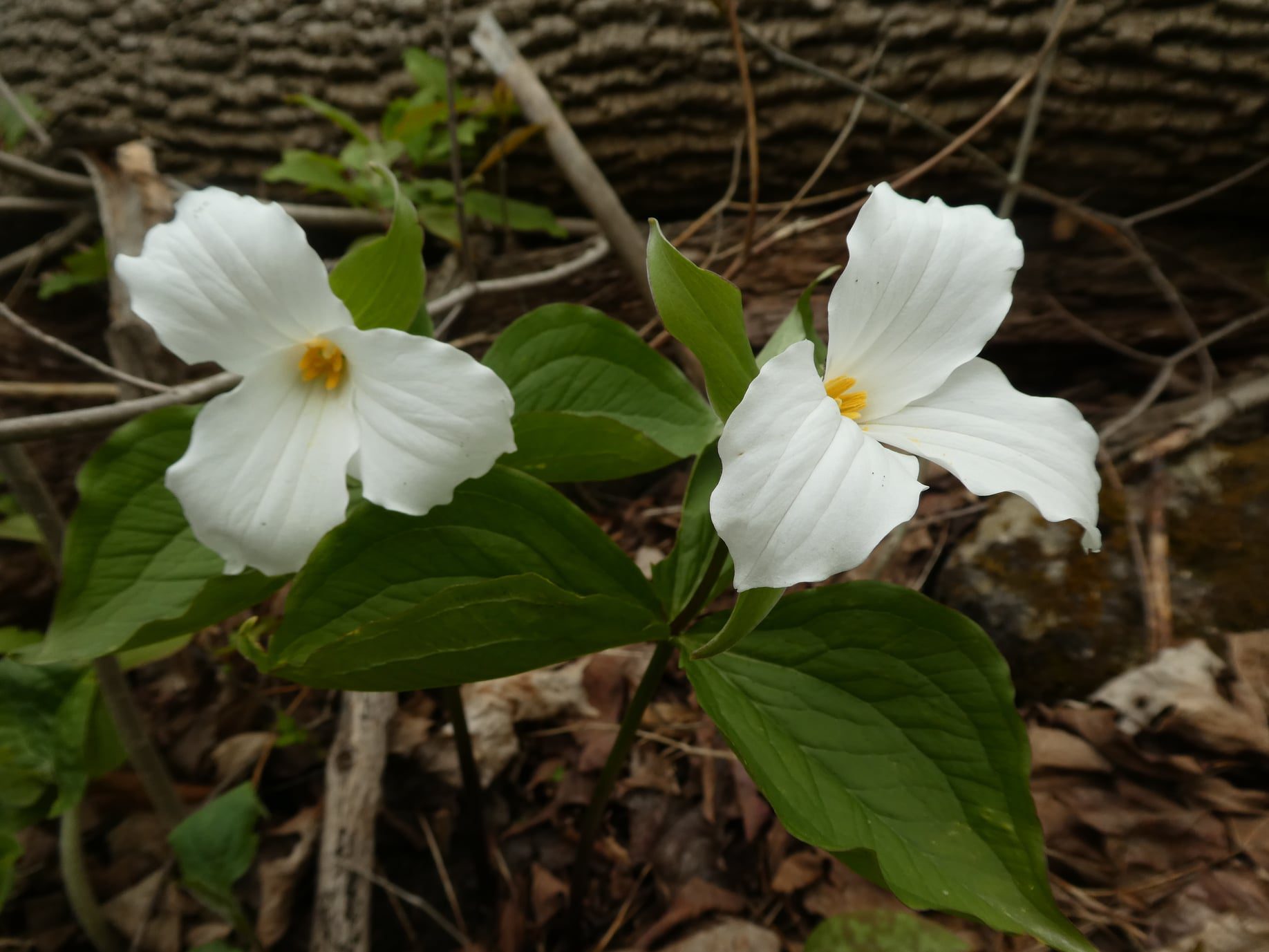
Afternoon Hike - Halton Agreement Forest
https://hikes.brucetrail.org/event/afternoon-hike-halton-agreement-forest-2/Sorry, the registration cut-off time for this hike has been reached.Not a member? Click here to join today!Hosting Club: Iroquoia
Category: Afternoon/Evening Hikes
Location (Google Maps): Parking lot on 6th Line, about 3 kms up from Campbellville Rd. Small parking lot so plan to arrive between 4 and 4:15 pm.Hike Leader(s): Karen Bergmann Click here to contact Hike Leader(s)
Pace: Medium – 3 to 4 km/hr
Terrain: Moderate – Some hills and/or some poor footing
Distance: About 7 kmsDescription
We will hike a few of the bike trails. The bugs may be out so bring bug spray. Hoping to see some spring wildflowers. - Each hiker joining a Bruce Trail Club organized hike must perform a self-screening check before hiking.
- 09May 9, 2024
NEW TIME 8:00 am Long Hike Jordan to Moyer / Louth
https://hikes.brucetrail.org/event/900-am-long-hike-jordan-to-moyer-louth-70/Sorry, the registration cut-off time for this hike has been reached.Not a member? Click here to join today!Hosting Club: Niagara
Location (Google Maps):
Jordan Hollow Park 3039 King St Jordan
Hike Leader(s): Alan Laver Click here to contact Hike Leader(s)
Pace: Medium
Terrain: Moderate
Distance: 10kDescription
From Jordan Hollow Hike the main trail to Upper and Lower Balls Falls, Moyer Road or Louth and Return. You must register for each hike. Bring Poles, sunscreen, bug spray , snack and a drink and dress for the weather
Urban Walk: Valley View and Maple view Parks Thornhill
https://hikes.brucetrail.org/event/car-hike-valley-view-and-maple-view-parks-thornhill-4/Sorry, the registration cut-off time for this hike has been reached.Not a member? Click here to join today!Hosting Club: Toronto
Location (Google Maps): Parking lot at the corner of Bayview Ave, and Sycamore Dr. South of Highway 7
Sycamore Dr. is 2 blocks south of highway 7,parking lot is across plaza of Dollarama and Star boxHike Leader(s): Mohammad Aghamiri Click here to contact Hike Leader(s)
Pace: Moderate
Terrain: Variable
Distance: 7-8 kmDescription
We will explore Valleyview and Maple view parks, and walk along German Mill Creek,Beaver Valley End-to-End Hike 4 of 9
https://hikes.brucetrail.org/event/beaver-valley-end-to-end-hike-4-of-9/Sorry, the registration cut-off time for this hike has been reached.Not a member? Click here to join today!Hosting Club: Caledon Hills
Category: End-to-End
Location (Google Maps): Meet at Hogg’s Falls parking, km 65.1, Map 26 (Ed. 31). Shuttle to start at Windy Lane.Hike Leader(s): Nancy Mooney Click here to contact Hike Leader(s)
Pace: Medium – 3 to 4 km/hour
Terrain: Moderate – some hills and/or some poor footing, Strenuous – hilly with steep climbs and some poor footing
Distance: 78.5 – 65.1 = 13.4 km totalDescription
This is the fourth hike in the series and continues along the west side of Beaver Valley and the ski club. The trail takes us through a pine plantation, past waterfalls and the Boyne River, over boardwalks to Hogg’s Falls.9:15 Short Hike, Jordan Hollow
https://hikes.brucetrail.org/event/915-short-hike-jordan-hollow-109/Sorry, the registration cut-off time for this hike has been reached.Not a member? Click here to join today!Hosting Club: Niagara
Category: Hike
Location (Google Maps): Jordan Hollow Park, Jordan StationHike Leader(s): Bill Russell Click here to contact Hike Leader(s)
Pace: Medium
Terrain: Strenuous
Distance: ~ 6kmsDescription
Hike the main and side trails around Jordan and Balls Falls. Bring hiking boots, water, sunscreen and bug spray.
Crawford to Rattlesnake and back (Registration with Conservation Halton recommended)
https://hikes.brucetrail.org/event/crawford-to-rattlesnake-and-back-registration-with-conservation-halton-recommended/Sorry, the registration cut-off time for this hike has been reached.Not a member? Click here to join today!Hike open to BTC Members only.
Hosting Club: Iroquoia
Category: Thursday Group
Location (Google Maps): Meet at Crawford Lake Conservation Area at the first parking lot on the left in time for a 9:30 departure. Registration through Conservation Halton is strongly recommended. We hike over to Rattlesnake point and do the loop through the canyon and return. Trails could be wet. Bring snack and water. Optional snack or coffee in Campbellville.Hike Leader(s): Paul Toffoletti Click here to contact Hike Leader(s)
Pace: Medium – 3 to 4 km/hr
Terrain: Strenuous – Hilly with steep climbs and some poor footing
Distance: 8kmDescription
Birds and Wild Flowers on Hemlock Ridges
https://hikes.brucetrail.org/event/birds-and-wild-flowers-on-hemlock-ridges/Sorry, the registration cut-off time for this hike has been reached.Not a member? Click here to join today!Hosting Club: Caledon Hills
Category: Nature Walks
Location (Google Maps): Hemlock Ridges – Hockley Road and 5th Line EHS Mono. Parking area north of km 51.8 on the east side of 5th Line.Hike Leader(s): Gary Hall Click here to contact Hike Leader(s)
Pace: Leisurely – 3 km/hour or less
Terrain: Moderate – some hills and/or some poor footing
Distance: 3 kmDescription
This Nature Walk will take place on the BTC’s beautiful Hemlock Ridges property. This is a good time of year to observe migrating birds before the leaves come out. We’ll stop regularly to listen to birds and admire spring flowers. Bring binoculars, camera and cell phone. Cell phone apps like Merlin, Seek and iNaturalist can help in identification of flora and fauna along the route.
Urban Walk: Toronto Islands Evening Walk
https://hikes.brucetrail.org/event/urban-walk-toronto-islands-evening-walk-2/Sorry, the registration cut-off time for this hike has been reached.Not a member? Click here to join today!Hosting Club: Toronto
Location (Google Maps): Jack Layton Ferry Terminal, near the gates to Wards Island Ferry. Arrive 20 minutes prior to departure to check in with hike leader.
From Union Station take the LRT and get off at the stop Ferry Docks.Walk up to the Ferry Docks on Queens Quay West, street level. at the foot of Bay Street.
Hike Leader(s): Miriam Stevens Click here to contact Hike Leader(s)
Pace: Leisurely
Terrain: Flat
Distance: 6-9 kmDescription
After a day’s work come and “cool off” on the Toronto Islands free of fumes and traffic. Enjoy the view of the city skyline and Toronto’s beautiful island parkland.
Pack a dinner for a sit down picnic. Food is not available for purchase on the Islands early in the season. Also bring a warm jacket and flashlight.
Return fare ticket for the ferry approx $10.00 less for seniors.
Hikes will take place rain or shine.
Toronto Island evening hikes will take place every THURSDAY in MAY and JUNE 2024.
Same time and same meeting place. No preregistration is required – just show up at the ferry docks at 5:40 PM and sign with the hike leader. - 10May 10, 2024
Car Hike: Toronto E2E in 4 sections - 2 of 4
https://hikes.brucetrail.org/event/car-hike-toronto-e2e-in-4-sections-2-of-4/Sorry, the registration cut-off time for this hike has been reached.Not a member? Click here to join today!Hosting Club: Iroquoia, Toronto
Category: General Hike
Location (Google Maps): Meet at km 12.1 (Map 12), southeast side of 15 Sideroad, in Acton (same as for hike 1). Coordinates N43.584721364546816, W-79.96933398937986. Click on the Google link for personalized driving instructions.Hike Leader(s): Susan Glofcheskie Click here to contact Hike Leader(s)
Pace: Medium – 3 to 4 km/hr
Terrain: Moderate – Some hills and/or some poor footing
Distance: 14 kmDescription
This is the second of a four-series hike of the complete Toronto Club section of the Bruce Trail.Please bring gaiters and poles for the slippery mud. Bring 1.5 to 2 litres of water, bug spray, sunscreen and a snack. Hiking boots/shoes are mandatory. For further details, refer to hike 1 of 4 on May 3.
Please arrive by 8 am, so we can leave at 8:15 am to shuttle to our starting point (km 26.5).
This is a series of 4 hikes to complete the Toronto section. You must sign up for all 4 hikes if you wish an ETE badge at a cost of $5 members/$15 non-members.

Car Hike: CHBTC 60th Anniversary E2E Badge Combo 3/5
https://hikes.brucetrail.org/event/car-hike-chbtc-60th-anniversary-e2e-badge-combo-3-5/Sorry, the registration cut-off time for this hike has been reached.Not a member? Click here to join today!Hike open to BTC Members only.
Hosting Club: Toronto, Caledon Hills
Category: Car Hike
Location (Google Maps): Hike #3 – Meet at km 31.5 on Innis Lake Rd, north of Finnerty Sideroad. Additional parking is available on the south shoulder of Finnerty Sideroad east of Innis Lake Rd. GPS N43.918917, W79.909387Hike Leader(s): Jacquie Van Dyke Click here to contact Hike Leader(s)
Pace: Moderate
Terrain: Hilly
Distance: 12kmDescription
Come to one, a few, or all of these hikes to celebrate Caledon’s 60th anniversary! By completing all 5 of these hikes, you’ll qualify for BOTH of Caledon’s NEW badges. On this third of five hikes, we’ll meet on Innis Lake Rd and shuttle to our starting point. We’ll hike through a lot of forested areas today – including The Dingle, Glen Haffy CA, and part of the Humber Valley. We’ll also pass the point where the Oak Ridges Moraine Trail (ORTA) meets the Bruce Trail.We’ll stop for a short snack break and also a lunch break, so please bring enough food to last the hike, 2L of water, bug repellent, and proper hiking attire. Hiking boots/shoes are mandatory. It may be rainy so ensure you have rain gear with you.

9:00 am Niagara-on-the-Lake Tour
https://hikes.brucetrail.org/event/900-am-niagara-on-the-lake-tour-23/Sorry, the registration cut-off time for this hike has been reached.Not a member? Click here to join today!Hosting Club: Niagara
Category: Urban
Location (Google Maps): Veterans Memorial Park, park just outside the park on King StreetHike Leader(s): Robin Garrett Click here to contact Hike Leader(s)
Pace: Medium
Terrain: Easy
Distance: 6-7 kmDescription
Robin Garrett & Margaret Northfield are a team! Each Friday one of us will lead our group through different neighbourhoods, trails and parkland throughout Historic Niagara-on-the-Lake.Moderate pace with some weeks entirely on sidewalks and roads while others may include a mix of trails and paved pathways. Great way to build up endurance for longer more strenuous hikes.
Prepare for cooler windy conditions on open parkland and along Lake Ontario and Niagara River trails.
Plan to stay for conversation and a warm cup of coffee or tea at Sweets & Swirls, Community Centre, Niagara Stone Road, NOTL
Tumbled Rocks loop and Dodd's Hill loop.
https://hikes.brucetrail.org/event/tumbled-rocks-loop-and-dodds-hill-loop/Sorry, the registration cut-off time for this hike has been reached.Not a member? Click here to join today!Hosting Club: Sydenham
Category: General Hike
Location (Google Maps):Meet at 9:45 am at Kemble Arena parking lot (319897 Kemble Rock Road) to carpool to trail head. Limited parking at trail head. 5 minute drive from Kemble.
Hike Leader(s): Carol Graham-Mullin Click here to contact Hike Leader(s)
Pace: Leisurely: 3 km/h or less, Medium: 3 to 4 km/h
Terrain: Easy: Mostly flat and good footing., Moderate: Some hills and/or poor footing, Strenuous: Hilly with steep climbs and some poor footing.
Distance: 6 km. approxDescription
We will hike 2 loops : Tumbled Rocks Sidetrail loop and then main trail to Dodd’s Hill loop. Beautiful views, spring flowers and ferns! Also, a walk through the Porcupine Crevice. Bring water and snacks and poles are recommended. If you are unable to register, please call or text the leader at 226-787-8804.Neighbourhood hike: Beamsville/Ashby Park to Bruce Trail loop
https://hikes.brucetrail.org/event/neighbourhood-hike-beamsville-ashby-park-to-bruce-trail-loop-2/Sorry, the registration cut-off time for this hike has been reached.Not a member? Click here to join today!Hosting Club: Niagara
Category: Loop
Location (Google Maps):Meet at Ashby Park
4079 Ashby Dr, Beamsville, ON L0R 1B6Hike Leader(s): Angela Lytle Click here to contact Hike Leader(s)
Pace: Medium
Terrain: Moderate
Distance: 5kDescription
Let’s take a local hike starting in a Beamsville neighbourhood after work or school!This neighbourhood loop hike starts in Beamsville’s local Ashby park, goes up Hillside trail (past the monarch way station), across Hillside and up Hixon to join the Bruce trail. From there we will hike east on the Bruce Trail towards Quarry road, and then loop back to Ashby park.
The pace of the hike will be moderate. The terrain is mixed with some paved paths, street and sidewalk, as well as the trail. There are some rocky sections of the trail.
Meet at 5:15 by the playground in the park to depart at 5:30. Limited street parking available next to the park, or walk if you live nearby! The full loop should take around 1.5 hours (max 2 hours) depending on our collective pace.
Hiking shoes are needed, poles are recommended. Carry water and some snacks.
- 11May 11, 2024
Peninsula in 6 Challenger Series A Hike #5 Dyers Bay to Halfway Dump
https://hikes.brucetrail.org/event/peninsula-in-6-challenger-series-a-hike-5-dyers-bay-to-halfway-dump/Sorry, the registration cut-off time for this hike has been reached.Not a member? Click here to join today!Hike open to BTC Members only.
Hosting Club: Peninsula
Location (Google Maps): Halfway Dump Side Trail via Emmett Lake Road
Fee by Park
Capacity: 50
Coordinates: 45.227342, -81.480393Hike Leader(s): Margaret O’Dell Click here to contact Hike Leader(s)
Pace: Fast
Terrain: Difficult
Distance: 27.4 KmDescription
Hike #5 of 6 Dyers Bay to Halfway Log DumpPeninsula in 6 Challenger Series
Complete 162.4 km section from Wiarton to Tobermory in 6 hikes.- You must sign up for EACH hike individually. The series is spread-out over 2 weeks, and 3 weekends. You are not automatically accepted into either series as a whole.
- This hike series is intended for experienced distance hikers only. Hikers must demonstrate recent experience completing hikes exceeding 25 km over difficult terrain and at a brisk pace;
- If a hiker is unable to keep pace with the group, or finds the distance too challenging, their future hike registrations may be canceled by the hike leader.
- Be very aware of your ability to join this series.
- Hikes will average 4.5 km per hour including breaks, moving pace is 5 km per hour;
- Expect to be on-trail for 7 – 9 hours;
- Meeting time is scheduled for 7:00am; arrive no later than 15 minutes prior to the meeting time;
- Hikers must carry sufficient hydration, accessible snacks, lunch, first-aid kit, rain gear, extra socks, and possibly protective boot covers (i.e. bags);
- Hikers will be expected to participate in shuttling hikers to the start and to drive shuttlers back to their car. Responsibility will be shared equally;
- Any applicable parking fees will be shared within the group.
Dufferin Hi-Land Two-Day End-to-End
https://hikes.brucetrail.org/event/dufferin-hi-land-two-day-end-to-end-2/Sorry, the registration cut-off time for this hike has been reached.Not a member? Click here to join today!This is a Multi-Day Hike
You are signing up for the following dates and times:
2024-05-11 at 07:00
2024-05-12 at 07:00Hosting Club: Dufferin Hi-Land
Category: Special Events
Location (Google Maps): 586387 10th Sideroad, Mulmur. GPS Coordinates: N 44 13849 W 080 13649. This is the first farm 200m west of Center Rd on 10th (also called 17 when west of Center rd) There is a church on the corner. Please arrive by 7:45 latest to allow time for check in. Buses depart at 8:00 am. BTC Map 20 just west of km 30.4 (Whitfield).
Directions to Parking Location:
If coming by Hwy 10 from Orangeville:
– follow 10 north to Primrose
– proceed straight through the intersection onto Dufferin County Road 19, also called Prince of Wales Road
– follow this road for 6 km to first stop sign
– turn right, proceed approx 1 km
– the church is highly visible on the left side, parking is 200m west of the church.Hike Leader(s): Stuart Law Click here to contact Hike Leader(s)
Pace: Brisk
Terrain: Dependent on Conditions, Slippery and Steep Sections, Slippery Sections Likely, Strenuous
Distance: 55km (29km & 26km)Description
Join us for two days of hiking the rolling hills of Dufferin County. Enjoy the spring flowers while earning your Red Trillium Badge. Hike distances are approximately 29km on Day 1 and 26km on Day 2. There will be checkpoints along the hike with volunteers providing assistance, refreshments and snacks. Registration is $65 for members and $75 for non-members, which includes shuttle bus service, checkpoint snacks and refreshments, Red Trillium Badge (must complete full hike to earn badge), and post-hike refreshments. Space is limited so register early! No dogs. No children under twelve. No refunds. Further details to be provided to participants upon registration.DOUBLE Surprise Hike EARLY START
https://hikes.brucetrail.org/event/double-surprise-hike-early-start/Sorry, the registration cut-off time for this hike has been reached.Not a member? Click here to join today!Hosting Club: Blue Mountains
Category: Register on-line or sign-in morning of hike
Location (Google Maps): Hike meets in the parking lot behind Tim Hortons on First St. in Collingwood.Hike Leader(s): Hart Fischer Click here to contact Hike Leader(s)
Pace: Brisk – 4 to 5 km/hr
Terrain: Strenuous – Hilly with steep climbs and some poor footing
Distance: LongDescription
This will be a surprise. Guaranteed to be super challenging and
strenuous. Come prepared for a workout. You should be a hiker experienced in longer
distance hikes as well as managing various terrains. Bring lots of water, snacks and
lunch and maybe even dinner.Introductory Hike: Scotsdale Farm
https://hikes.brucetrail.org/event/hiker-initiation-program-h-i-p-bus-hike-scotsdale-farm-introductory-hike/Sorry, the registration cut-off time for this hike has been reached.Not a member? Click here to join today!Trip Information
Departure Time: 08:30
Return to City Time: 16:30
Departure Point: York Mills Bus PickupOptional Items
Hosting Club: Toronto
Category: Bus Hike
Location (Google Maps):Scotsdale Heritage Farm
The Bus will depart from the north side of York Mills Road just east of Yonge Street in front of the York Mills Centre opposite the Shell gas station. Look for the yellow school bus.
Several other groups depart from this location so verify that it is the Bruce Trail Bus before boarding.Hike Leader(s): Tom Swales, David Royle Click here to contact Hike Leader(s)
Pace: Moderate
Terrain: Variable
Distance: 7 – 10 kmDescription
Join us for an introductory hike suitable for beginners at scenic Scottsdale Farm near Georgetown. We will hike on the Bruce Trail and side trails in the area for a distance of 7-10 km. Bruce Trail Reference Guide Map # 13We will be on the trail for around 4 hours, so bring lunch, snack and at least 1.5 L of water. We’ll hike a circular route on trails which include the main Bruce Trail and side trails. Expect variable terrain with a few hills, rocky spots. Hiking Boots are strongly recommended. Bring gear appropriate for the weather conditions of the day. Toronto Bruce Trail Club hikes go rain or shine.
Please note that masks are recommended while on the bus and there is no eating on the bus.
This introductory hike compliments the 2024 Hiker Initiation Program webinar hosted by Toronto Bruce Trail Club (TBTC). The information webinar will be held Monday May 6th at 6:30 PM where TBTC hike leaders will speak on reasons to hike, the Bruce Trail, our hiking activity program, biodiversity, and how to enjoy the trail responsibly. If you are new to hiking and/or the Bruce Trail consider registering for this presentation.
You can register for the webinar at:
https://us02web.zoom.us/webinar/register/WN_h9HhmurgRriVX4TFlBM6Xg#/registration
Members are encouraged to bring a friend that have expressed interest in hiking but haven’t had the chance to hike with the club.
We’ll have a refreshment stop in Georgetown with a choice of pubs or cafes before heading back to the city. We expect to arrive back at York Mills Subway by 4:30 depending on the traffic.

Prediction Hike Challenge
https://hikes.brucetrail.org/event/prediction-hike-challenge/Sorry, the registration cut-off time for this hike has been reached.Not a member? Click here to join today!Hosting Club: Caledon Hills
Category: Prediction Hike Fundraiser
Location (Google Maps): Akela and Scouters Heather and Ross Hamlin Nature Reserve at Riverside WoodsMeet at the BTC Parking Lot, 713377 1st Line EHS, Mono, 43.959916, -80.070494
Directions: From ON-9, head north onto 2nd Line EHS for 3 km. Turn left/west onto Side Road 5 for 1.5 km. Turn right onto 1st Line EHS for approximately 1 km. Continue straight into the parking lot.
From ON-10, head east on Hockley Road/Dufferin County Road 7 for 1 km. Continue straight onto Side Road 5 for 1.5 km. Turn left onto 1st Line EHS for approximately 1 km. Continue straight into the parking lot.
[/if 111]
Event Coordinator(s): Sandy Green & Sally Cohen Click here to contact Event Coordinator(s)
Terrain: Moderate – some hills and/or some poor footing
Distance: 4.5 kilometres or 15.0 kilometresDescription
Plan to attend our fourth and final organized Prediction Hike Challenge. Choose one of two predetermined hikes – 4.5 km or 15.0 km. Provide a personal to-the-second prediction of how long it will take you to complete the distance on event day. Registration fees are $30.00 for adults and $10.00 for children and students.Light refreshments and beverages will be served at mid location checkpoints and as part of a celebration at the end. Take lots of pictures, but NO peeking at time, pace, or distance technology during the hike. Trail Marshalls will be situated along the trail to help with directions.
Everyone will receive a spectacular collectible badge. The hikers in each distance category with the closest prediction to their actual time will be awarded a fabulous prize. If you wish to reserve a particular limited edition badge, register early. In addition to the actual three badges, there is a “blooper/printing oops” badge.
Proceeds from the event will go towards trail development projects.
For further details visit https://caledonbrucetrail.ca/hiking/hikes/prediction-hike-challenge-2024/.
Trillium hike Bethesda Trail Richmond Hill
https://hikes.brucetrail.org/event/car-hike-bethesda-trail-richmond-hill-19/Sorry, the registration cut-off time for this hike has been reached.Not a member? Click here to join today!Hosting Club: Toronto
Location (Google Maps): Meet at Bethesda Trail Head Parking on Bethesda Sideroad off Bayview Avenue, across from Lake Wilcox. This parking lot is free.
Hike Leader(s): Mohammad Aghamiri Click here to contact Hike Leader(s)
Pace: Moderate
Terrain: Hilly, Variable
Distance: 14-17 kmDescription
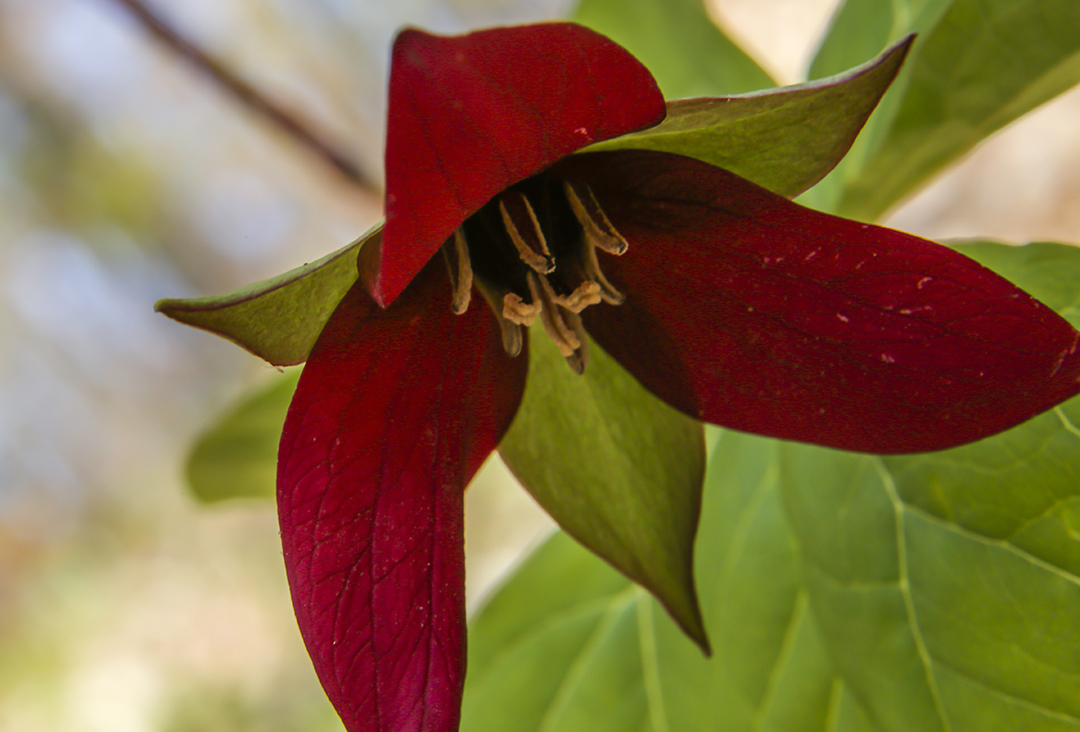
Join us to explore Jefferson Forest and Bond lake and thousands of trillium flowersPlease bring hiking poles, proper closing and shoes and lots of water,
Please carefully read safety procedures during the hike:
1-Hikers must stay between the leader and the sweep.
2-Hikers must advise the leader or the sweep if they wish to leave the group.
3- Hikers must follow the whistle instructions: 1 blast- stay where you are; 2 blasts come to the leader; 3 blasts – come to the leader quickly.
4-Hike leader may request volunteers to stop at trail intersections, they need to help hikers to the direction the group walk and wait till they see the sweep .
5-Hikers have to make sure they can see the persons behind and in front of

Queenston to Horiticultural Grounds
https://hikes.brucetrail.org/event/queenston-to-horiticultural-grounds/Sorry, the registration cut-off time for this hike has been reached.Not a member? Click here to join today!Hosting Club: Niagara
Category: Loop
Location (Google Maps): Meet near the cairn in Queenston Heights Park, Niagara River ParkwayHike Leader(s): Margaret Northfield Click here to contact Hike Leader(s)
Pace: Medium
Terrain: Easy
Distance: 8kmDescription
Hike to Niagara Glen and back through the Niagara Parks Botanical Gardens.Paid parking at Queenston Heights check out the annual parking pass
$45 for 2 cars.

Iroquoia Bruce Trail Club AGM Hike
https://hikes.brucetrail.org/event/iroquoia-bruce-trail-club-agm-hike/Sorry, the registration cut-off time for this hike has been reached.Not a member? Click here to join today!Hike open to BTC Members only.
Hosting Club: Iroquoia
Category: Special Event
Location (Google Maps): St. James United Church 306 Parkside Dr Waterdown (Hamilton)Hike Leader(s): Ruth Moffatt Click here to contact Hike Leader(s)
Pace: Medium – 3 to 4 km/hr
Terrain: Easy – Mostly flat and usually good footing, Moderate – Some hills and/or some poor footing, Strenuous – Hilly with steep climbs and some poor footing, Dependent on Conditions
Distance: Less than 10kmDescription
Please join us for a pre-AGM hike to and from the location of the Iroquoia Bruce Trail Club AGM. The hike will proceed over to Great Falls along Mill St, main trail to the Eric Best ST, back on the main trail to Norman Pearson ST, back through Grindstone Creek along the main trail and then to Rockcliffe ST, backout to Dundas St E and return to the parking lot just in time for the AGM to begin. Please bring enough water and snacks for your hike. Trails may be muddy, so gaiters would be useful.
Urban Walk; Don Valley to The Distillery District
https://hikes.brucetrail.org/event/urban-walk-don-valley-to-the-distillery-district-2/Sorry, the registration cut-off time for this hike has been reached.Not a member? Click here to join today!Hosting Club: Toronto
Category: Urban Walk
Location (Google Maps):Toronto
Hike Leader(s): Brian Rideout Click here to contact Hike Leader(s)
Pace: Moderate
Terrain: Flat
Distance: 27.5 kmDescription
This hike follows the Don River south from Steeles Ave East at Leslie St through Toronto to the Distillery District, through a series of ravines and several parks. We will detour to street level when we cross the 401 (trail closed due to construction) and again south of Pottery Rd where we take the Bayview Ave Extension (trail closed due to construction).Please bring a lunch and at least two liters of water. Be prepared for cool / wet weather.
Here is an online map of our route: Don Valley to The Distillery