Hike Schedule

Join us for a hike! Registration required:

All hikes available to BTC members. Some hikes are open to non-members.

Read hiker guidelines >

TIP: The calendar view displays up to 7 hikes on a day, but often there are more. Click “More events” to see them all.

Show Hikes By Club

Categories

Reset Filters
Mon May 0 1

Caledon Hills end to end 3 of 4

8:30 AM-2:45 PM
Sorry, the registration cut-off time for this hike has been reached.
Not a member? Click here to join today!

Hike open to BTC Members only.

Hosting Club: Niagara
Category: Car Pool
Location (Google Maps): Meet on 4th Line EHS (km 55.1) north of 5 Sideroad, carpool to km 35.2, Glenhaffy Rd.
NOTE, we had to do this hike on May 1st because of road work on the Escarpment RD.

Hike Leader(s): Vince Zvonar Click here to contact Hike Leader(s)

Pace: Brisk
Terrain: Moderate
Distance: 19.9

Description

Mon May 0 1

Crawford Lake CA

9:30 AM-11:30 AM
Sorry, the registration cut-off time for this hike has been reached.
Not a member? Click here to join today!

Hosting Club: Iroquoia
Category: General Hike
Location (Google Maps): Crawford Lake Conservation Area

Hike Leader(s): Bronwen Tregunno Click here to contact Hike Leader(s)

Pace: Leisurely – 3km/hr or less
Terrain: Moderate – Some hills and/or some poor footing
Distance: 7 km

Description

We’ll check out the spring flowers starting at the BT side trail then following the main trail as it hugs the escarpment past the lookout.  Bring snack, water, insect repellant, sun filter, & personal first aid kit.  We can also look in on the historical reconstruction of indigenous village. Washrooms on site.  Reservations required and entrance fee in effect for non Conservation Halton annual pass holders  https://www.conservationhalton.ca/  Meet at lower parking lot.   Please come slightly early so we can get started right at 9:30 am.  Contact Bron brontreg@cogeco.ca or 905-334-4013 (text or call) for any questions.

Sorry, the registration cut-off time for this hike has been reached.
Not a member? Click here to join today!

Hosting Club: Niagara
Category: Loop
Location (Google Maps):

Short Hills Wiley Road Entrance

Hike Leader(s): Alan Laver Click here to contact Hike Leader(s)

Pace: Medium
Terrain: Moderate
Distance: 10km

Description

Explore Short Hills and the majestic side trails of Scarlett Tanager, Hemlock. Swayze Falls and Terrace. Register for each hike

Bring Poles water, snack, sunscreen and bug spray and dress for the weather

Tue May 0 2

9:15 Short hike - Pelham Road, Short Hills

9:15 AM-10:30 AM
Sorry, the registration cut-off time for this hike has been reached.
Not a member? Click here to join today!

Hosting Club: Niagara
Category: Loop
Location (Google Maps): Pelham Road entrance, Short Hills Provincial Park

Hike Leader(s): janet davey Click here to contact Hike Leader(s)

Pace: Medium
Terrain: Moderate
Distance: 6 kms

Description

Hike the main and side trails in Short Hills Provincial Park.  Bring hiking boots, water and bug spray.

Sorry, the registration cut-off time for this hike has been reached.
Not a member? Click here to join today!

Hosting Club: Dufferin Hi-Land
Category: Tuesday Hike
Location (Google Maps):

Dufferin Hi-Land Section, Map 20. Meet at north end of 2nd Line EHS off 8 Sideroad where the road ends and the 2nd Line EHS Side Trail begins. Park on the west side of 2nd Line south of the first driveway.

Hike Leader(s): Brenda Carling, Les Babbage Click here to contact Hike Leader(s)

Pace: Leisurely
Terrain: Moderate
Distance: 6 km; Short hike: 3 km

Description

Brenda Carling will lead us as we explore and identify the trees and blooming wildflowers along the Oliver Creek Side Trail and the Main Trail through Walker’s Woods. Bring a camera, snacks and water.

Tue May 0 2

Rod's Talk and William's Walk

9:30 AM
Sorry, the registration cut-off time for this hike has been reached.
Not a member? Click here to join today!

Hosting Club: Peninsula

Location (Google Maps): 8 Sylvia St., Lion’s Head

Hike Leader(s): Marg Glendon Click here to contact Hike Leader(s)

Pace: Leisurely
Terrain: Easy, Moderate
Distance: ~3 KM

Description

Bruce Trail Conservancy acknowledges that climate change requires us to think differently about energy and consider ways which will help us to adapt and mitigate the impact of climate change in our environment. Today’s hike will start with an example of alternative energy use for our homes.

We will start our day with a visit to Rod’s energy efficient home. Rod will speak about the unusual construction of the buildings (Durisol block), the use of the air source heat pump to provide heating and domestic hot water, net metering with solar PV, and some of their garden projects including rainwater harvesting.

Following our educational start to the day, we will drive to the Lion’s Head Marina to park our vehicles and walk along the Bruce Trail to William’s Cave Side Trail. The trail includes street walking, some uneven terrain and a short rocky approach to view William’s Cave. This cave is a good example of wave action (over thousands of years ago)  which pounded against the dolostone rock to create a cave. Then, we retrace our steps to our parked vehicles. The hike includes a spectacular view of the escarpment, rocky shoreline, beautiful green water of Georgian Bay and picturesque harbour and lighthouse. This is a leisurely paced hike. We will finish the morning by having our lunch either at Lion’s Head Beach or near the Lighthouse. Expect to be about 2 ½ hours plus lunch.

Tue May 0 2

Pretty River Valley Spring Flower Hike

9:45 AM-2:00 PM
Sorry, the registration cut-off time for this hike has been reached.
Not a member? Click here to join today!

Hosting Club: Caledon Hills
Category: Tuesday Hikers
Location (Google Maps): Pretty River Valley Provincial Park – Blue Mountains Section. Roadside parking area, west of km 53.1 on the 6th Sideroad, where the John Haigh Side Trail crosses 6th Line. Map 23.

Hike Leader(s): Doris Harper Click here to contact Hike Leader(s)

Pace: Medium – 3 to 4 km/hour
Terrain: Moderate – some hills and/or some poor footing
Distance: 12 km

Description

Spring is arriving and the trails in Pretty River will be lined with Trilliums and other spring flowers. On this hike we will also enjoy great views of Georgian Bay, and hike to the highest elevation point of the Bruce Trail.

We will hike the main trail, part of the John Haigh Side Trail, and the Pretty River Side Trail, to form an 11 -12 km loop.

Bring, water, snacks, bug spray, sunscreen, poles suggested.

Wed May 0 3

Wodehouse Karst

9:00 AM-2:00 PM
Sorry, the registration cut-off time for this hike has been reached.
Not a member? Click here to join today!

Hosting Club: Blue Mountains
Category: Register on-line or sign-in morning of hike
Location (Google Maps): Hike meets in the parking lot behind Tim Hortons on First St. in Collingwood.

Hike Leader(s): David Little Click here to contact Hike Leader(s)

Pace: Brisk – 4 to 5 km/hr, Medium – 3 to 4 km/hr
Terrain: Moderate – Some hills and/or some poor footing, Strenuous – Hilly with steep climbs and some poor footing
Distance: 12km

Description

For experienced hikers. We will drive to the Beaver Valley Ski Resort in the Beaver Valley section. From the Beaver Valley Ski Resort parking lot we start on the Kimberly Forest Side Trail to the white blazed trail. We go north on the white blazed trail and meet with the Wodehouse Karst Side Trail where we hike to the end. At the white blazed trail we head south back to the Beaver Valley Ski Resort. Lookout deck for lunch. After our lunch break we take the Crossover Side Trail back to the Beaver Valley ski resort parking lot. Bring a snack or lunch and water. Map 26 Edition 30

Wed May 0 3

Nature Walk in Griffiths Ravine

9:30 AM-12:30 PM
Sorry, the registration cut-off time for this hike has been reached.
Not a member? Click here to join today!

Hosting Club: Caledon Hills
Category: Nature Walks
Location (Google Maps): Roadside parking on 4th Line EHS at the entrance to the Peter Beecham Side Trail. Take Side Road 5 west from Airport Road to 4th Line E, turn right and go about 1.4 kilometres to roadside parking on the west side at the curve.
Or, take the 4th Line E north from Hockley Road. Go up the hill and around the big curve.

Hike Leader(s): Richard Smythe Click here to contact Hike Leader(s)

Pace: Leisurely – 3 km/hour or less
Terrain: Moderate – some hills and/or some poor footing
Distance: 3 to 5 kms

Description

This is a loop walk following the Peter Beecham Side Trail, the Main Trail and the Griffith Ravine Side Trail. It will be slow at times with numerous stops to observe the spring ephemerals, listen to bird songs, and take photos. Bring your binoculars, camera, and cellphone. Apps like Merlin, Seek, and iNaturalist will help identify flora and fauna along the route.

Wed May 0 3

Queenston loop

2:00 PM-4:30 PM
Sorry, the registration cut-off time for this hike has been reached.
Not a member? Click here to join today!

Hosting Club: Niagara
Category: Loop
Location (Google Maps): Locust Grove Parking Lot

Hike Leader(s): Heather Howkins Click here to contact Hike Leader(s)

Pace: Medium
Terrain: Moderate
Distance: 8k

Description

We will walk through the village of Queenston , through agricultural land and return on the Bruce Trail to Queenston Heights.

Please bring a snack and water.

Sorry, the registration cut-off time for this hike has been reached.
Not a member? Click here to join today!

Hosting Club: Sydenham
Category: An evening walk.
Location (Google Maps): Meet in the municipal parking lot by the river on the west side of 1st Ave. E between 7th St. E and 8th St. E in Owen Sound.

Hike Leader(s): Harriet Nixon Click here to contact Hike Leader(s)

Pace: Medium: 3 to 4 km/h
Terrain: Moderate: Some hills and/or poor footing
Distance: Approx 5 km

Description

Join us for an evening hike just before the Full Flower Moon, exploring walking paths and neighbourhoods in Owe Sound. This hike leaves at 7:00 pm – no need to arrive 15 minutes early. Following the hike there is an opportunity to go out for refreshments. For further information or if you are unable to register, contact Hike Leader Harriet Nixon at 519-373-6598 or harrietnixon@bmts.com

Sorry, the registration cut-off time for this hike has been reached.
Not a member? Click here to join today!

Hike open to BTC Members only.

This is a Multi-Day Hike

You are signing up for the following dates:

2023-05-04, 2023-05-05, 2023-05-06, 2023-05-07, 2023-05-08, 2023-05-09, 2023-05-10, 2023-05-11, 2023-05-12, 2023-05-13

Hosting Club: Peninsula

Location (Google Maps): Peninsula ETE in 10 – Start May 4 Finish May 13.
Please read all details in the hike description before registering for the hike.

Hike Leader(s): Ruth Moffatt Click here to contact Hike Leader(s)

Pace: Brisk, Medium
Terrain: Difficult, Moderate
Distance: Approximately 15-20km per day depending on available parking locations

Description

Please note there are no refunds or transfers. If you register for this hike and change your mind, please cancel your name from the registered list as there will be others on the waitlist. 

It is very important to read all the details for this hike prior to registering.

Overview

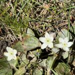
This is a special series of 10  hikes to complete the Peninsula section of the Bruce Trail.  There will be a new accomplishment badge, included in the registration fee featuring the Turkey Vulture  – which has been designed by Joe Borges and will hopefully be made available on our last day. In addition to hiking the main trail, we will be collecting bird songs via the Merlin app (you do not need a cell phone) to go toward the Peninsula Birder Badge as well as the Fern Badge and Orchid Badge as we see/hear them. A few landlocked Side Trails (like McKay’s Harbour, High Dump, part of Devil’s Monument, Sydney Bay Bluff Lookout) will also be included for those who wish to log trails for the Side Trails badge. If you choose, many other side trails can be done after we finish each day’s hike. This is an option for participants.

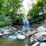
For this E2E in 10, we will be following the main trail northbound eventually finishing in Tobermory. Please note that you are signing up for the entire series of 10 hikes as a Group Hike. The Peninsula in 10 series is geared to experienced long distance hikers with the expectation of a 3  to 5.0 km/ hr. pace maintained over a 15km plus day.  The section is approximately 165km so daily distances will be based on available parking. No dropout points have been established and therefore hikers who must drop out, will be responsible for their own transportation back to their vehicle. Please note that transportation back to your vehicle is very limited in this section.  Please be honest about your hiking abilities. We will hike at a steady pace but there will be plenty of time to take pictures and to enjoy the flora and fauna of this beautiful but challenging section.

Again, this particular set of 10 hikes is intended to be Moderate/BriskPlease be honest about your degree of physical fitness prior to registration. It is a group hike so it is important you are able to keep pace with the person in front of you.

This ETE in 10 and the one scheduled in June cannot be combined to complete one ETE but you can register to complete them both if you would like two ETE’s.

Attire and Daily Hikes. 

Hikers will be expected to be wearing proper hiking boots and layered clothing with the expectation of cool and possible wet weather.  Sufficient food and water for a full day of hiking is required as well as hiking poles (if you use them), and wet weather gear is strongly recommended. Bug spray is also suggested. Clothing adjustments, bio-breaks are as needed. Please let the sweep person know and they will wait for you. A morning break around 10am and a 10-15 minute on-trail lunch break will be scheduled. An afternoon break will be based on our expected finish time. Depending on weather conditions, these times may vary.

Fee

The fee goes towards supporting the Peninsula Bruce Trail Club, which in turn supports the mission of the Bruce Trail Conservancy, which is: “Preserving a ribbon of wilderness, for everyone, forever.”  

For the time being, registration for the Peninsula E2E-in-Ten will be limited to members of the Bruce Trail Conservancy.  Hikers may be a member of any section.

Car Shuttles and Missing Hikes

maximum of 3 (of the 10) hikes can be self-completed as a result of scheduling challenges, but it is intended that this badge be earned while hiking as part of a group led by a certified hike leader. Car shuttles are shared amongst the hikers. If you intend to arrive at the meeting locations with more than yourself in your vehicle, please let the hike leader know in advance. Car pooling to our meeting spot with 2 people in the car is generally ok but we would like to minimize and equalize the driving/shuttling as much as possible so it is fair for all participants. If you know you will miss more than 3 of the hikes, it’s likely best to sign up for another end to end, however, whatever hikes are completed on this series may go toward completion of an independent ETE for the regular Peninsula ETE flowerpot badge. If you are able to complete the hikes you know you will miss ahead of time, all the better.

Transportation

This series will be through-hikes and will require car shuttling. You must be willing to drive and/or to be a passenger. Some parking locations require paid parking, and hikes that enter Bruce Peninsula National Park.  The fee for this E2E-in-10 does not include any parking/entry fees for hikers. These costs, where applicable, will be shared amongst all participants unless you have a parking or park pass.

Leave No Trace

Please remember, like all hikes, this is a Leave No Trace hike. Pack out whatever you pack in. Do not toss anything onto or into any sections of the trail. We will also try to leave the trail better than we found it so we will be collecting collectable garbage we might see along the way. Daily volunteers to collect trail trash will be supplied with a bag. Dogs will not be welcome on this hike.

Accommodations

It is strongly recommended you make reservations for accommodations as soon as you register for the hike. Accommodations can be made anywhere in the Peninsula but I recommend staying in Lion’s Head which is about mid-way of the section. There is a motel, a campground, a hostel, and several B&B’s. Moving from accommodation to accommodation, while in the Peninsula, is doable but generally not recommended as it is a bit of a hassle. If you require suggestions on where to stay or if you would like a roommate, I can share your email with any other registered participants who are also looking for shared accommodations. Please let me know.

Daily

We meet for each hike by at least 7:45am each day. A schedule for meeting and start locations will be sent to each participant in April. We will hike northerly each day. The schedule is subject to change.

This hike is limited to 12 participants including the hike leader.

Sorry, the registration cut-off time for this hike has been reached.
Not a member? Click here to join today!

Hosting Club: Niagara
Category: In and Out
Location (Google Maps):

Jordan Hollow Park 3039 King St Jordan

Hike Leader(s): Alan Laver Click here to contact Hike Leader(s)

Pace: Medium
Terrain: Moderate
Distance: 10k

Description

From Jordan Hollow Hike the main trail to Upper and Lower Balls Falls, Moyer Road or Louth and Return. You must register for each hike. Bring Poles, sunscreen, bug spray , snack and a drink ices and dress for the weather

Thu May 0 4

Sydenham E2E Hike 4 of 14

9:15 AM-2:00 PM
Sorry, the registration cut-off time for this hike has been reached.
Not a member? Click here to join today!

Hosting Club: Caledon Hills
Category: End-to-End
Location (Google Maps): Meet at Lindenwood parking area, 500 m west of km 128.4 on the Lindenwood Road. Shuttle to start at Cole’s Sideroad.

Hike Leader(s): Nancy Moooney Click here to contact Hike Leader(s)

Pace: Medium – 3 to 4 km/hour
Terrain: Moderate – some hills and/or some poor footing, Strenuous – hilly with steep climbs and some poor footing
Distance: From km 139.6 – 128.4, plus 0.9 of side trail, total 12.1 km

Description

This hike involves farmland, fields, and forests, logging roads and crevices as we head south through the Lindenwood Management Area.

Thu May 0 4

9:15 Short hike - Jordan Hollow

9:15 AM-10:30 AM
Sorry, the registration cut-off time for this hike has been reached.
Not a member? Click here to join today!

Hosting Club: Niagara
Category: Loop
Location (Google Maps): Jordan Hollow Park

Hike Leader(s): Bill Russell Click here to contact Hike Leader(s)

Pace: Medium
Terrain: Strenuous
Distance: 6 kms

Description

Hike the main trail and side trails around Jordan and Balls Falls.  Bring hiking boots, water and bug spray.

Thu May 0 4

Spring Ephemerals

10:00 AM-12:30 PM
Sorry, the registration cut-off time for this hike has been reached.
Not a member? Click here to join today!

Hosting Club: Iroquoia
Category: Thursday Group
Location (Google Maps): Crawford Lake Conservation Area. 3115 Conservation Rd.Milton

Hike Leader(s): Anne Armstrong Click here to contact Hike Leader(s)

Pace: Leisurely – 3km/hr or less
Terrain: Moderate – Some hills and/or some poor footing, Slippery Sections Likely
Distance: Approx. 7 km.

Description

Spring Ephemerals refers to early Spring wildflowers. Today we will be completing a circuit of Crawford Lake as we hunt for wildflowers. Meet at 9:45 am. for  10:00 am. start. We will walk at a pace allowing us to stop and photograph wildflowers as we go. This route will have some rocky sections. Bring water, a snack and poles if using. Conservation area pass or parking fee in effect. Registration with Halton CA necessary.
Leader: Anne Armstrong 905 617 3937 hikingrandma@gmail.com

Sorry, the registration cut-off time for this hike has been reached.
Not a member? Click here to join today!

Hike open to BTC Members only.

This is a Multi-Day Hike

You are signing up for the following dates and times:

2023-05-04 at 11:00
2023-05-05 at 09:30
2023-05-18 at 10:00
2023-05-19 at 10:30
2023-06-01 at 09:30
2023-06-02 at 09:30
2023-06-15 at 10:00
2023-06-16 at 09:10
2023-06-29 at 10:30
2023-06-30 at 09:30
2023-09-07 at 09:00
2023-09-08 at 09:00
2023-09-21 at 10:30
2023-09-22 at 09:00
2023-10-05 at 09:00
2023-10-06 at 10:30
2023-10-19 at 09:00
2023-10-20 at 09:30

Hosting Club: Peninsula

Location (Google Maps): 2023 Peninsula E2E in 18 (May 5th to Oct 20th)

Hike Leader(s): Randy Vanderlaan, Saabir Sohrab Click here to contact Hike Leader(s)

Pace: Medium
Terrain: Difficult, Easy, Moderate
Distance: Average 10Km

Description

“The “Peninsula End to End” is intended for hikers that want to complete the entire “end to end” series and participate in all 18 hikes. Please register for all 18 hikes.”“If you are interested in only some of the hikes, please email Randy [randy@newhallklein.com]. We will contact you as spots become available.” 

Peninsula End-To- End” Hikers [18 Hike Series]

The Peninsula is one of the most picturesque but also the most rugged section of the Bruce Trail. Please come prepared for all weather conditions.

You will receive an email notification if there is any change in the schedule or in case of cancellation.

Due to parking availability and car shuttle logistics for our large group, we have arranged a School Bus Charter to transport us to and from our hikes. The fee is $10 per hike or $180 per hiker, which includes the cost of the charter and Bruce Peninsula National Park “day-use fees.” This fee will not change based on the number of hikes attended.

If you have any questions about our hike, please contact the Hike Leader.

Please note our hike speed typically does not exceed 3km per hour and we will take breaks to enjoy our beautiful scenery.

REMINDERS:

  1. Arrival:
  •     Please arrive 15 minutes before start of hike.
  1. Clothing and Footwear:
  • Hikers are expected to wear (or carry) appropriate attire for the weather and the terrain. This will prevent injuries and show consideration for a safe and positive group hiking experience.
  • Sturdy footwear is necessary.
  • Hiking poles are not required but are a good idea in any season especially for rocky and slippery terrain.
  1. What to Pack:
  •     I.D. and your health card.
  •     Water (minimum 1L) ,snacks and lunch.
  •     Sunscreen and insect repellent.
  1. Group Hikers Etiquette:
  •     We move as a group. It keeps the vibe right.
  •     We take all breaks together.
  •     It isn’t a race. The hike is paced by the group leader. YOU ARE ON A TEAM.
Thu May 0 4

Bruce Trail Walk in the Park

1:00 PM
Sorry, the registration cut-off time for this hike has been reached.
Not a member? Click here to join today!

Hosting Club: Peninsula

Location (Google Maps): Meet up at Municipal Parking Lot beside Dockside Willie’s at Bluewater Park, Wiarton

Hike Leader(s): Marg Glendon

Pace: Leisurely
Terrain: Easy, Moderate
Distance: ~3 1/2 KM

Description

Spring is a wonderful time for renewal –join us for a Spring Walk in the Park! This hike is on the Bruce Trail through Bluewater Park in Wiarton, along the pretty Colpoy’s Bay shore. We will follow the Bruce Trail to Waterworks Park and return to our parked vehicles ~ 3 ½ KM. Our path is on flat, even terrain along boardwalk, roadside and gravel walking paths.  Bring a light backpack with water, snack and binoculars. At the end of the hike, let’s finish with a “snack-nic” at Bluewater Park. Our walk will be about 1 1/2 hours.

Thu May 0 4

Toronto, Toronto Islands

6:00 PM-9:00 PM
Sorry, the registration cut-off time for this hike has been reached.
Not a member? Click here to join today!

Hosting Club: Toronto
Category: Urban Walk
Location (Google Maps): Meet inside the Jack Layton Ferry Terminal, foot of Bay Street, beyond the cashiers selling the ferry tickets, in the open area with the benches and Muskoka chairs. From Union Station take the LRT one stop to “Ferry Docks” or take bus number #19 or #72 on Bay Street southbound to the Queens Quay. Walk across Queen Quay south through the park to the ferry terminal.

Hike Leader(s): Miriam Stevens, Tom Swales Click here to contact Hike Leader(s)

Pace: Leisurely
Terrain: Flat
Distance: 8-12 km

Description

After a day’s work, come and “cool off” on the Toronto Islands free of fumes and traffic to enjoy the view of the city skyline and Toronto’s own beautiful island parkland oasis away from the city. Pack a dinner for a sit-down picnic. Note that food is not available for purchase on the islands early in the season. Bring a warm jacket and flashlight. Return ticket for the ferry is approximately $8.70, $5.60 for seniors. The hike will take place rain or shine. Toronto Island Evening Hikes will take place every Thursday in May and June, same time and meeting place. The route and time we return to the city may vary depending if the ferries are running on the Spring or Summer (starts in May) schedule.  Contact Hike Leaders via the Contact form for further information or to confirm the current ferry schedule that will be in place the week of the hike. Registration is not required for this hike – just meet the Hike Leader at the above location.


Sorry, the registration cut-off time for this hike has been reached.
Not a member? Click here to join today!

Hosting Club: Niagara
Category: Night
Location (Google Maps): Veteran’s Memorial Park, park just outside the park on King St.

Hike Leader(s): Robin Garrett Click here to contact Hike Leader(s)

Pace: Medium
Terrain: Easy
Distance: 6-7 km

Description

Moonlight Night Hike – Take in the magic of the rising moon over Lake Ontario and the Niagara River. This hike includes a stop to connect with your senses – sights, sounds, smells and the rhythm of your breath. Counts towards your night hike badge (5 night hikes).

Fri May 0 5

Queenston Loop

9:00 AM-10:30 AM
Sorry, the registration cut-off time for this hike has been reached.
Not a member? Click here to join today!

Hosting Club: Niagara
Category: Urban
Location (Google Maps): Meet near the Bruce Trail cairn, Queenston Heights Park, Niagara Parkway.

Hike Leader(s): Karen Couch Click here to contact Hike Leader(s)

Pace: Medium
Terrain: Easy
Distance: 5-6 km

Description

Hike Alfred Trot’s side trail and around Queenston Heights Park.

Fri May 0 5

Legs of Sydenham May 2023 (Hike 1 of 3)

9:00 AM-3:30 PM
Sorry, the registration cut-off time for this hike has been reached.
Not a member? Click here to join today!

Hosting Club: Iroquoia
Category: General Hike
Location (Google Maps):

We will meet at Crossroads Victory Church corner of 19th St W and Somers St., Owensound. Approx KM 107 of Sydenham Section. Map 33.

Hike Leader(s): Karen Capindale-Smith Click here to contact Hike Leader(s)

Pace: Medium – 3 to 4 km/hr
Terrain: Moderate – Some hills and/or some poor footing
Distance: 20 km

Description

This is the first of 3 legs in the Sydenham Section. Please see mate hikes on May 6 & 7. Join us for one hike or all. On this hike, we will meet at Crossroads Victory Church corner of 19th St W and Somers St., Owen Sound. Approx KM 107 of Sydenham Section. Map 33. (Contact with property owners made).We will car shuttle to  parking on Lindenwood Rd just easy of Highway 17. Approx km 126 of Sydenham Section. Map 33. We will hike back to our meeting Point for a total of Approx 20 KM. Please bring water, snack, lunch and appropriate layered clothing. Carpooling recommended due to limited parking.

Hike leader: Karen Capindale-Smith, kjcapindale@gmail.com. Please use cell (905-749-0914) for hike morning cancellations.

No Dogs Please. Rain or Shine.

Expect a baked goods surprise!

Sat May 0 6

Boyne Valley-Primrose Loop

8:00 AM-2:00 PM
Sorry, the registration cut-off time for this hike has been reached.
Not a member? Click here to join today!

Hosting Club: Blue Mountains
Category: Register on-line or sign-in morning of hike
Location (Google Maps): Hike meets in the parking lot behind Tim Hortons on First St. in Collingwood.

Hike Leader(s): AnHong MacNeil Click here to contact Hike Leader(s)

Pace: Medium – 3 to 4 km/hr
Terrain: Moderate – Some hills and/or some poor footing
Distance: 14km

Description

We will head to the parking area on Centre Rd. south of the 5 Sideroad, at the edge of the forest in Dufferin Hi-Lands section. We will proceed to make a two loop hike through the Boyne Valley Provincial Park. The hike will include great views from Murphy’s Pinnacle. Bring water and lunch.

Sat May 0 6

Car Hike: Bethesda Trail Richmond Hill

8:15 AM-1:30 PM
Sorry, the registration cut-off time for this hike has been reached.
Not a member? Click here to join today!

Hosting Club: Toronto
Category: Car Hike
Location (Google Maps): Meet at Bethesda Trail Head Parking on Bethesda Sideroad off Bayview Avenue, across from Lake Wilcox. This parking lot is free.

Hike Leader(s): Mohammad Aghamiri Click here to contact Hike Leader(s)

Pace: Moderate
Terrain: Variable
Distance: 14-17KM

Description

Join us to explore Jefferson Forest and Bond lake ,

Right time to see thousands of Trillium wild flowers covering more than hundred acres of the forest,

we will repeat this hike possibly 2 more times to see these beautiful wild  flowers growing.

Please bring  hiking poles, proper closing and shoes and lots of water,

Please carefully read  safety procedures during the hike:

1-Hikers must stay between the leader and the sweep.

2-Hikers must advise the leader or the sweep if they wish to leave the group.

3- Hikers must follow the whistle instructions: 1 blast- stay where you are; 2 blasts come to the leader; 3 blasts – come to the leader quickly.

4-Hike leader may request volunteers to stop at trail intersections, they need to help hikers to the direction the group walk and wait till they see the sweep .

5-Hikers have to make sure they can  see the persons behind and in front of them.

Sat May 0 6

Legs of Sydenham May 2023 (Hike 2 of 3)

9:00 AM-3:30 PM
Sorry, the registration cut-off time for this hike has been reached.
Not a member? Click here to join today!

Hosting Club: Iroquoia
Category: General Hike
Location (Google Maps):

We will meet at Parking at 6th Concession just north of Sideroad 3. Approx KM 23.1 of Sydenham Section. Map 29.

Hike Leader(s): Karen Capindale-Smith Click here to contact Hike Leader(s)

Pace: Medium – 3 to 4 km/hr
Terrain: Moderate – Some hills and/or some poor footing
Distance: 21 km

Description

This is the second of 3 legs in the Sydenham Section. Please see mate hikes on May 5 & 7. Join us for one hike or all. On this hike, we will meet at Parking at 6th Concession just north of Sideroad 3. Approx KM 23.1 of Sydenham Section. Map 29. We will car shuttle Parking St Vincent-Sydenham townline just north of Highway 26. Approx KM 44.4 of Sydenham Section. Map 30 and hike back to our meeting Point for a total of Approx 21 KM. Please bring water, snack, lunch and appropriate layered clothing. Carpooling recommended due to limited parking.

Hike leader: Karen Capindale-Smith, kjcapindale@gmail.com. Please use cell (905-749-0914) for hike morning cancellations.

No Dogs Please. Rain or Shine.

Expect a baked goods surprise!

Sorry, the registration cut-off time for this hike has been reached.
Not a member? Click here to join today!

Hosting Club: Toronto
Category: Urban Walk
Location (Google Maps): Meet in the Great Hall of Union Station by the information desk with the clock with no later than 9:00 AM to take the Lakeshore West train towards Aldershot departing at 9:15 AM

Hike Leader(s): Tom Swales, Lindita Kalo Click here to contact Hike Leader(s)

Pace: Moderate

Distance: 12 km

Description

From Aldershot GO Station we will hike to scenic Hidden Valley Park and the Hendrie Valley Sanctuary, a popular spot for birdlife. Then on to Burlington Heights and the Hamilton Waterfront Trail to catch the train back to Toronto from the West Harbour GO Station. Optional drop out at Burlington Heights by taking the local bus to Burlington GO Station. Optional pub stop at Fisher’s Pier 4 pub north of West Harbour GO Station.

Sat May 0 6

Sydney Bay Loop

9:15 AM
Sorry, the registration cut-off time for this hike has been reached.
Not a member? Click here to join today!

Hosting Club: Sydenham
Category: General Hike
Location (Google Maps): The Owen Sound Galaxy Theatre parking lot. Meet at the tall “Galaxy Centre” sign next to the traffic lights.

Hike Leader(s): Ian Mills Click here to contact Hike Leader(s)

Pace: Medium: 3 to 4 km/h
Terrain: Strenuous: Hilly with steep climbs and some poor footing., There might be muddy sections., There might be sections with water on the trail.
Distance: 12 km

Description

Starting at the end of Pitt Road (Map 36 – south of Km 35.8) on the Boundary Bluffs Side Trail north to and along the main trail overlooking Sydney Bay until Hart’s Tongue Side Trail then following the Boundary Bluffs Side Trail south to our start area. This is a 4 hour hike excluding stops – we will be taking a lunch break half way. While the pace is medium expect a challenging hike with lots of ups and downs. Good hiking shoes mandatory and a walking stick is recommended. If you are unable to register please call or text Ian Mills @ 416-848-8818.

Sorry, the registration cut-off time for this hike has been reached.
Not a member? Click here to join today!

Hike open to BTC Members only.

Hosting Club: Dufferin Hi-Land
Category: General Hike
Location (Google Maps): Devil’s Glen Provincial Park – parking lot at km 31.7 (Map 22, Blue Mountains Section)

Hike Leader(s): Margery Cruise,Les Babbage Click here to contact Hike Leader(s)

Pace: Medium
Terrain: Moderate, Slippery and Steep Sections, Strenuous
Distance: 8.6 km

Description

From km 31.7, we will walk to the viewing platform and return to the trail to follow the main trail to km 26.0, walk east along Ganaraska Trail, North on Concession Road 8 in Glen Huron. Just past Station Street, we turn west to follow the Mad River Side Trail, then join the main trail at km 30.6 and return north to the parking lot.

Directions: From CR 124 and HW 89, north on CR 124 to Singhampton, continue east on CR124 to Devil’s Glen Provincial Parking entrance on the right.

Hikers completing all 4 hikes in this series will be eligible to purchase the Rim to Rim Badge from Blue Mountains BTC. You can also make up any hikes you aren’t able to attend or register for by completing the hike yourself at a more convenient time.

Sorry, the registration cut-off time for this hike has been reached.
Not a member? Click here to join today!

Hosting Club: Toronto
Category: TBTC Special Events
Location (Google Maps): Parking at the Outdoor Education Center, Fallbrook Trail and 27th Sideroad.

Hike Leader(s): Lynn McFerran Click here to contact Hike Leader(s)

Pace: Leisurely
Terrain: Variable

Description

This is the first of what is hoped to be a series of Indigenous led hikes along the Toronto section. We are excited to start this series off with Alan Colley Toronto Aboriginal Eco Tours as the leader of a spring hike looking at the flora and fauna along the trails. Alan is an Anishinaabe, of the Wolf Clan educator and guide. He has shared his knowledge with others on hikes along the waters of the rivers and lakes in GTA. He works to bring together the traditional ways of the elders and share the Seven Grandfather and 13 Grandmother Moon Teachings. This is one of this video links .https://lakeshorearts.ca/in-search-of-roots/

Sat May 0 6

10:00 NBTC SPRING Nature Hike

10:00 AM-11:30 AM
Sorry, the registration cut-off time for this hike has been reached.
Not a member? Click here to join today!

Hosting Club: Niagara
Category: Loop
Location (Google Maps):

Louth Conservation Area

Hike Leader(s): Alicia Aitchison Click here to contact Hike Leader(s)

Pace: Leisurely
Terrain: Moderate
Distance: ~5km

Description

NBTC SPRING NATURE HIKE

Join us for this second of four 2023 NBTC Nature Hikes to learn more about the biodiversity along the Niagara Escarpment.  We will explore the trails throughout Louth Conservation area which offer beauty in all four seasons.  Hikes will be held January, May, August & October – it will be amazing to see all the changes throughout the seasons.  Your hike leaders, members of the NBTC Biodiversity Committee, will share their knowledge of the amazing flora & fauna along the trail as well as any biodiversity projects in the works for this year.

Be sure to register in advance as space is limited & the hike will be rescheduled in the event of heavy rains or heavy snow.

Contact Alicia Aitchison, aliciaaitchison1@gmail.com, with any questions.

Sorry, the registration cut-off time for this hike has been reached.
Not a member? Click here to join today!

Hosting Club: Beaver Valley

Location (Google Maps): Meet in the Johnston’s Sideroad parking area on the north side of the road, km 74.3, Map 26, Edition 30 of Bruce Trail Guide. Please follow the directions of the parking attendant.

Hike Leader(s): Glenda Collings Click here to contact the hike leader.

Pace: Leisurely
Terrain: Moderate, Some rocky footing, Some steep sections
Length of Hike: The hike will be approximately 1 1/2 hours.

Description

You’ll join Beth Gilhespy, conservationist and long time Bruce Trail supporter for the launch of her book, “Walking Through Time – Exploring Niagara Escarpment Geology in the Beaver  Valley Bruce  Trail Section”.  Chat with Beth and mingle with other hikers and geology lovers before you head out on a guided hike south to Hilt’s Falls, with commentary by Beth along the way.  Books will be available for sale with the added bonus of a signed copy to treasure.

COVID-19 Precautions Before, During and After your Hike

  1. Each hiker joining a Bruce Trail Club organized hike must perform a self-screening check before hiking.
    Find Ontario’s self-assessment tool here: https://covid-19.ontario.ca/self-assessment/
  2. If you are experiencing COVID-19 symptoms, stay home.
  3. Personal Protective Equipment:
    • Hikers may choose to wear masks.
  4. Wear sturdy footwear and appropriate attire for the weather and the terrain.
    Hiking poles are a good idea in any season, especially if the terrain is rocky or slippery.
    Wearing appropriate clothing and footwear prevents injuries and shows consideration for a safe and positive group hiking experience.
  5. Always carry I.D. and your health card.
  6. Bring sufficient water and snacks (or lunch if indicated). A minimum of 1L of water is recommended.
  7. Bring sunscreen and insect repellent (for spring and summer hikes).
  8. Bring your own first aid kit.
  9. Please leave dogs at home.

Sat May 0 6

Car Hike: Scotsdale Farm - Spring Flowers

10:00 AM-2:30 PM
Sorry, the registration cut-off time for this hike has been reached.
Not a member? Click here to join today!

Hosting Club: Toronto
Category: Car Hike
Location (Google Maps): Meet at the main parking lot on Scotsdale Farm next to the old homestead. From Hwy 401 go north on Trafalgar Road past Georgetown. At Silvercreek turn right at the lights. Go about 1 km north to the entrance of Scotsdale Farm on your right.

Hike Leader(s): Al Brown Click here to contact Hike Leader(s)

Pace: Moderate
Terrain: Variable

Description

One of the attractions of hikes at this time of year is spring flowers. Scotsdale Farm has an abundance of them and we will enjoy the view as we hike about 13 km over variable terrain.

After the hike those interested may meet for refreshments at Sheppard’s Crook in old Georgetown.

Sorry, the registration cut-off time for this hike has been reached.
Not a member? Click here to join today!

Hosting Club: Iroquoia
Category: Education Hike
Location (Google Maps): Saltfleet Conservation Area

Hike Leader(s): Bronwen Tregunno Click here to contact Hike Leader(s)

Pace: Leisurely – 3km/hr or less
Terrain: Easy – Mostly flat and usually good footing
Distance: 2-3 km

Description

Guest leader Scott Peck, Director, Watershed Management Services, Hamilton Conservation Authority will lead us on a gentle walk on a level trail that overlooks wetlands.  Scott will make several stops along the trail and explain the history and progression of the Saltfleet CA project.  This has become a hotspot for birders but you don’t need to bring binoculars as we won’t be looking for birds this time!  Paid parking $8.00 per day but free with HCA membership pass.  More about Saltfleet CA https://conservationhamilton.ca/conservation-areas/saltfleet-conservation-area/    Hiking boots recommended.  Bring your own snack, sun filter, insect repellant, water and personal 1st aid kit.  No facilities.   Your questions about wetlands and conservation authorities role in water management are welcome.   Note that ticks are now active.  To learn more about ticks go to https://conservationhamilton.ca/ticks-and-lyme-disease/  Contact Bron at 905-334-4013 (text) or email brontreg@cogeco.ca.

Sorry, the registration cut-off time for this hike has been reached.
Not a member? Click here to join today!

Hosting Club: Beaver Valley

Location (Google Maps): Meet in the Johnston’s Sideroad parking area on the north side of the road, km 74.3, Map 26, Edition 30 of Bruce Trail Guide. Please follow the directions of the parking attendant.

Hike Leader(s): Glenda Collings Click here to contact the hike leader.

Pace: Leisurely
Terrain: Moderate, Some rocky footing, Some steep sections
Length of Hike: The hike will be approximately 1 1/2 hours.

Description

You’ll join Beth Gilhespy, conservationist and long time Bruce Trail supporter for the launch of her book, “Walking Through Time – Exploring Niagara Escarpment Geology in the Beaver  Valley Bruce  Trail Section”.  Chat with Beth and mingle with other hikers and geology lovers before you head out on a guided hike south to Hilt’s Falls, with commentary by Beth along the way.  Books will be available for sale with the added bonus of a signed copy to treasure.

COVID-19 Precautions Before, During and After your Hike

  1. Each hiker joining a Bruce Trail Club organized hike must perform a self-screening check before hiking.
    Find Ontario’s self-assessment tool here: https://covid-19.ontario.ca/self-assessment/
  2. If you are experiencing COVID-19 symptoms, stay home.
  3. Personal Protective Equipment:
    • Hikers may choose to wear masks.
  4. Wear sturdy footwear and appropriate attire for the weather and the terrain.
    Hiking poles are a good idea in any season, especially if the terrain is rocky or slippery.
    Wearing appropriate clothing and footwear prevents injuries and shows consideration for a safe and positive group hiking experience.
  5. Always carry I.D. and your health card.
  6. Bring sufficient water and snacks (or lunch if indicated). A minimum of 1L of water is recommended.
  7. Bring sunscreen and insect repellent (for spring and summer hikes).
  8. Bring your own first aid kit.
  9. Please leave dogs at home.

Sorry, the registration cut-off time for this hike has been reached.
Not a member? Click here to join today!

Hosting Club: Toronto
Category: Car Hike
Location (Google Maps): We will meet each other in front of Walmart at 90 Dundas St E, Waterdown, Hamilton.

Hike Leader(s): Mehrnoush Ahmadi; Minoo Namazi

Pace: Brisk, Moderate
Terrain: Challenging, Rocky
Distance: 19km.

Description

Welcome to Clappison Woods, where we’ll be embarking on a scenic hike with a stunning waterfall as our destination. The hike will take us on a winding spiral path through the woods, offering breathtaking views of the natural landscape.

As we make our way towards Smoke Hollow Waterfall, we’ll traverse a rocky and sometimes muddy terrain. It’s important that all hikers come equipped with sturdy hiking boots to provide ample support and traction, as well as gaiters to keep the mud and rocks out of your shoes. Additionally, trekking poles will prove useful for maintaining balance and taking some pressure off your joints.

The hike will feature several short water breaks to keep us hydrated and energized throughout our journey. When we arrive at Smokey Hollow Waterfall, we’ll take a well-deserved half-hour break to rest our legs and enjoy the stunning natural beauty around us. Take a moment to savor a snack, and let the soothing sound of the waterfall wash over you.

Overall, this hike promises to be a challenging but rewarding adventure, filled with natural wonders and stunning views. Get ready to lace up your hiking boots and experience the beauty of Clappison Woods and Smoke Hollow Waterfall

Sorry, the registration cut-off time for this hike has been reached.
Not a member? Click here to join today!

Hosting Club: Toronto
Category: Car Hike
Location (Google Maps): Meet in the parking lot east side of Concession 2, (Whitchurch-Stouffville), 200m south of Webb Rd. This is a free Parking lot.

Hike Leader(s): Amir Alemohammad

Pace: Moderate
Terrain: Flat, Hilly, Variable
Distance: 14-16 Km

Description

Join me to explore the nature of Goodwood and Secord Forest. The trail is fairly level lowland wetlands with many boardwalks making an otherwise inaccessible terrain traversable. There are a few meadows and upland woods  thrown in there though. Although mostly a flat trail, expect some hills and sharp steep trails in between. In this season a mix of birds sounds and spring flowers adds to the beauty of the scene. Secord Forest, Pond and dog cemetery will be on our way to the hike. Bring at least two litters of water and your favorite snacks. Boots mandatory, poles highly recommended. Dress according to the spring humid. Be prepared for the rise of the bugs and make your spray ready on hand.

Sun May 0 7

Prediction Hike

8:30 AM-2:00 PM
Sorry, the registration cut-off time for this hike has been reached.
Not a member? Click here to join today!

Hosting Club: Caledon Hills
Category: Prediction Hike Fundraiser
Location (Google Maps): Whitetail Refuge Nature Reserve a BTC Protected Natural Area
JUST SOUTH OF 754415 Mono Centre Road
Mono Centre, ON

Google GPS Coordinates: 44.020487, -80.070738

Directions: From ON-10 turn east onto Dufferin Rd 8/Mono Centre Rd. Drive for approximately 5.0 km. Park on the field on the east side of the road as directed by volunteers.

From Airport Road/County Rd 18 turn west onto Dufferin Rd 8/Mono Centre Rd. Drive for 7.5 km. Park on the field on the east side of the road as directed by volunteers.

[/if 111]

Event Coordinator(s): Sandy Green & Sally Cohen Click here to contact Event Coordinator(s)

Terrain: Moderate – some hills and/or some poor footing
Distance: 7 km and 16 km

Description

Plan for a fantastic FUN-filled time hiking with family and friends in the northern section of our trail. Choose to complete one of two predetermined hikes, a distance of approximately 7 km or 16km. Be ready to provide a personal ‘to-the-second’ prediction of how long it will take you to complete the distance. Go to http://caledonbrucetrail.ca/hiking/club-badges/prediction-hike-fundraiser-badge/ for specific route directions.

Take lots of pictures, but remember NO peeking at time, pace, or distance technology during the hike. Participants hiking the longer distance will start between 8:30 am and 8:45 am and those hiking the shorter distance between 8:45 am and 9:00 am.

Light refreshments and beverages will be served at a mid location checkpoint and as part of a celebration at the end. Trail Marshalls will be situated along the trail to help with directions and other concerns.

The hikers in each distance category with the closest prediction to their actual time will be awarded a fabulous prize. Everyone will receive a spectacular collectible badge. This year’s new badge will be the final one of the series.

Sun May 0 7

Legs of Sydenham May 2023 (Hike 3 of 3)

9:00 AM-3:30 PM
Sorry, the registration cut-off time for this hike has been reached.
Not a member? Click here to join today!

Hosting Club: Iroquoia
Category: General Hike
Location (Google Maps):

We will meet at Parking St Vincent-Sydenham townline just north of Highway 26. Approx KM 44.4 of Sydenham Section. Map 30.

Hike Leader(s): Karen Capindale-Smith Click here to contact Hike Leader(s)

Pace: Medium – 3 to 4 km/hr
Terrain: Moderate – Some hills and/or some poor footing
Distance: 21 km

Description

This is the third of 3 legs in the Sydenham Section. Please see mate hikes on May 5 & 6. Join us for one hike or all. On this hike, we will meet at roadside Parking St Vincent-Sydenham townline just north of Highway 26. Approx KM 44.4 of Sydenham Section. Map 30. We will car shuttle to roadside parking on Irish Block Rd just north of Highway 26. Approx km 67 of Sydenham Section. Map 31. We will hike back to our meeting Point for a total of Approx 21 KM. Please bring water, snack, lunch and appropriate layered clothing. Carpooling recommended due to limited parking.

Hike leader: Karen Capindale-Smith, kjcapindale@gmail.com. Please use cell (905-749-0914) for hike morning cancellations.

No Dogs Please. Rain or Shine.

Expect a baked goods surprise!

Sorry, the registration cut-off time for this hike has been reached.
Not a member? Click here to join today!

Hosting Club: Beaver Valley

Location (Google Maps): Meet in the Johnston’s Sideroad parking area on the north side of the road, km 74.3, Map 26, Edition 30 of Bruce Trail Guide. Please follow the directions of the parking attendant.

Hike Leader(s): Glenda Collings Click here to contact the hike leader.

Pace: Leisurely
Terrain: Moderate, Some steep sections, Some rocky footing
Length of Hike: The hike will be approximately 1 1/2 hours.

Description

You’ll join Beth Gilhespy, conservationist and long time Bruce Trail supporter for the launch of her book, “Walking Through Time – Exploring Niagara Escarpment Geology in the Beaver  Valley Bruce  Trail Section”.  Chat with Beth and mingle with other hikers and geology lovers before you head out on a guided hike south to Hilt’s Falls, with commentary by Beth along the way.  Books will be available for sale with the added bonus of a signed copy to treasure.

COVID-19 Precautions Before, During and After your Hike

  1. Each hiker joining a Bruce Trail Club organized hike must perform a self-screening check before hiking.
    Find Ontario’s self-assessment tool here: https://covid-19.ontario.ca/self-assessment/
  2. If you are experiencing COVID-19 symptoms, stay home.
  3. Personal Protective Equipment:
    • Hikers may choose to wear masks.
  4. Wear sturdy footwear and appropriate attire for the weather and the terrain.
    Hiking poles are a good idea in any season, especially if the terrain is rocky or slippery.
    Wearing appropriate clothing and footwear prevents injuries and shows consideration for a safe and positive group hiking experience.
  5. Always carry I.D. and your health card.
  6. Bring sufficient water and snacks (or lunch if indicated). A minimum of 1L of water is recommended.
  7. Bring sunscreen and insect repellent (for spring and summer hikes).
  8. Bring your own first aid kit.
  9. Please leave dogs at home.

Sorry, the registration cut-off time for this hike has been reached.
Not a member? Click here to join today!

Hosting Club: Beaver Valley

Location (Google Maps): Meet in the Johnston’s Sideroad parking area on the north side of the road, km 74.3, Map 26, Edition 30 of Bruce Trail Guide. Please follow the directions of the parking attendant.

Hike Leader(s): Glenda Collings Click here to contact the hike leader.

Pace: Leisurely
Terrain: Moderate, Some steep sections, Some rocky footing

Description

You’ll join Beth Gilhespy, conservationist and long time Bruce Trail supporter for the launch of her book, “Walking Through Time – Exploring Niagara Escarpment Geology in the Beaver  Valley Bruce  Trail Section”.  Chat with Beth and mingle with other hikers and geology lovers before you head out on a guided hike south to Hilt’s Falls, with commentary by Beth along the way.  Books will be available for sale with the added bonus of a signed copy to treasure.

COVID-19 Precautions Before, During and After your Hike

  1. Each hiker joining a Bruce Trail Club organized hike must perform a self-screening check before hiking.
    Find Ontario’s self-assessment tool here: https://covid-19.ontario.ca/self-assessment/
  2. If you are experiencing COVID-19 symptoms, stay home.
  3. Personal Protective Equipment:
    • Hikers may choose to wear masks.
  4. Wear sturdy footwear and appropriate attire for the weather and the terrain.
    Hiking poles are a good idea in any season, especially if the terrain is rocky or slippery.
    Wearing appropriate clothing and footwear prevents injuries and shows consideration for a safe and positive group hiking experience.
  5. Always carry I.D. and your health card.
  6. Bring sufficient water and snacks (or lunch if indicated). A minimum of 1L of water is recommended.
  7. Bring sunscreen and insect repellent (for spring and summer hikes).
  8. Bring your own first aid kit.
  9. Please leave dogs at home.

Sorry, the registration cut-off time for this hike has been reached.
Not a member? Click here to join today!

Hosting Club: Sydenham
Category: General Hike
Location (Google Maps):

Parking at the north end of Georgian Bluffs Concession 3, north of km 98.7 (Map 32)

Hike Leader(s): Bill Snel Click here to contact Hike Leader(s)

Pace: Leisurely: 3 km/h or less
Terrain: Easy: Mostly flat and good footing., Moderate: Some hills and/or poor footing
Distance: 4 km

Description

We will hike north to the Derby Forest Side Trail then east to the the escarpment edge above Owen Sound. Then south until we come out on concession 3 and then a short road piece back to our cars. For more information contact Bill Snel at w.snel2@gmail.com or call landline (519) 470-0584.  If you are unable to register, please contact the leader to let him know you will be attending.

Sun May 0 7

2:00pm AGM Nature Hike

2:00 PM-3:30 PM
Sorry, the registration cut-off time for this hike has been reached.
Not a member? Click here to join today!

Hosting Club: Niagara
Category: Citizen Science
Location (Google Maps): Fireman’s Park Lower Parking Lot, Dorchester Ave, Niagara Falls

Hike Leader(s): Niagara Hike Leader Click here to contact Hike Leader(s)

Pace: Leisurely
Terrain: Easy
Distance: 5k

Description

Join us for a pre AGM Nature Hike with the BTC Conservationist and 2 other hike leaders. We will hike the trails around Fireman’s Park and focus on floral and tree species identification.
We will split into groups of hikers as people arrive with a total of 3 hikes and a maximum of 25 per hike.
NBTC AGM follows
Dress for the weather and bring snacks and water.

Sun May 0 7

NBTC Annual General Meeting

4:00 PM-7:30 PM
Sorry, the registration cut-off time for this hike has been reached.
Not a member? Click here to join today!

Hosting Club: Niagara
Category: Register
Location (Google Maps): Upper parking lot of Firemen’s Park, 2275 Dorchester Road, Niagara Falls, Ontario

Description

Come out to meet the Niagara Bruce Trail Board as well as other members!

Guest Speaker: Adam Brylowski, Manager of Conservation and Trail, Bruce Trail Conservancy

Learn what the board has done and what their future plans are.  Make your voice heard.

Volunteer Appreciation Awards Presentation.

This event is outside.  Please dress accordingly.  Bring your own chair.

Stay for the BBQ ($5 fee).  T-shirts, neck scarves and bumper stickers available to purchase.  Cash or transfers accepted.

Registration Required.

Mon May 0 8

Caledon Hills end to end 2 of 4

8:30 AM-2:45 PM
Sorry, the registration cut-off time for this hike has been reached.
Not a member? Click here to join today!

Hike open to BTC Members only.

Hosting Club: Niagara
Category: Car Pool
Location (Google Maps): Meet on Glenhaffy Rd. (km 35.2) and Coolihans Sideroad, carpool to km 16.1, Willoughby Rd.
Note, this hike had to be changed with the next hike(#3) because of road work on Escarpment RD.

Hike Leader(s): Vince Zvonar Click here to contact Hike Leader(s)

Pace: Brisk
Terrain: Moderate
Distance: 19

Description

Mon May 0 8

Waterdown City Park to Smokey Hollow

9:00 AM-1:00 PM
Sorry, the registration cut-off time for this hike has been reached.
Not a member? Click here to join today!

Hosting Club: Iroquoia
Category: Happy Wanderers
Location (Google Maps):

City View Park SOUTH parking lot off of Kerns Rd which runs south from #5 hwy

Hike Leader(s): Wayne Riley Click here to contact Hike Leader(s)

Pace: Medium – 3 to 4 km/hr
Terrain: Dependent on Conditions, Moderate – Some hills and/or some poor footing
Distance: 14 km +/-

Description

We will head west from the City View parking lot returning  using the  King Rd side trail and on to Smokey Hollow then return to the parking lot.

Hike leader: Wayne Riley   RSVP thru the hike calendar

Cancellations the morning of the hike: 289-456-3498

Bring lunch, water, no dogs please, Hiking boots required


Sorry, the registration cut-off time for this hike has been reached.
Not a member? Click here to join today!

Hosting Club: Beaver Valley

Location (Google Maps): Meet in the Metcalfe Rock parking area, 10th Line, just south of km 27.9, Map 25, Edition 30.

Hike Leader(s): Glenda Collings Click here to contact the hike leader.

Pace: Medium
Terrain: Moderate, Some rocky footing, Some steep sections, Strenuous
Length of Hike: 9 km

Description

This is a popular loop hike taking in Metcalfe Rock, Duncan Crevices, Pinnacle Rock and Mill Creek.  The leaves should be popping!  Be prepared for some mud on the trail and bring snacks and water.

COVID-19 Precautions Before, During and After your Hike

  1. Each hiker joining a Bruce Trail Club organized hike must perform a self-screening check before hiking.
    Find Ontario’s self-assessment tool here: https://covid-19.ontario.ca/self-assessment/
  2. If you are experiencing COVID-19 symptoms, stay home.
  3. Personal Protective Equipment:
    • Hikers may choose to wear masks

Transportation

It is the Bruce Trail Conservancy’s current policy that car shuttles are allowed.  It is at the discrepancy of individual hike leaders to make that decision.

Other Guidelines

  1. Arrive 15 minutes before the start of the hike.
  2. Wear sturdy footwear and appropriate attire for the weather and the terrain.
    Hiking poles are a good idea in any season, especially if the terrain is rocky or slippery. In winter, snowshoes or icers/crampons are needed when conditions dictate.
    Wearing appropriate clothing and footwear prevents injuries and shows consideration for a safe and positive group hiking experience.
  3. Always carry I.D. and your health card.
  4. Bring sufficient water and snacks (or lunch if indicated). A minimum of 1L of water is recommended on all hikes, and 3L is recommended for long, challenging hikes in the heat of the summer.
  5. Bring sunscreen and insect repellent (for spring and summer hikes).
  6. Bring your own first aid kit.
  7. Please leave dogs at home.
Mon May 0 8

Dodds Hill loop

10:00 AM
Sorry, the registration cut-off time for this hike has been reached.
Not a member? Click here to join today!

Hosting Club: Sydenham
Category: General Hike
Location (Google Maps): Meet at 9:45 am at Kemble Arena parking lot to carpool to trail head. Limited parking at trail head. 5 minute drive from Kemble.

Hike Leader(s): Carol Graham-Mullin Click here to contact Hike Leader(s)

Pace: Medium: 3 to 4 km/h
Terrain: Moderate: Some hills and/or poor footing, There might be muddy sections., There might be sections with water on the trail.
Distance: 4 km. approx

Description

We will hike from the trailhead at end of Concession Rd 24  and hike along the Dodd’s Hill sidetrail east, meet the main trail and head north along the scarp edge and west to the Dodd’s Hill sidetrail and loop back to the start. We may also add a short section west to see the view of the islands. If you are unable to register, please call or text the leader at 226-787-8804.

Sorry, the registration cut-off time for this hike has been reached.
Not a member? Click here to join today!

Hosting Club: Niagara

Location (Google Maps):

Short Hills Wiley Road Entrance

Hike Leader(s): Alan Laver

Pace: Medium
Terrain: Moderate
10km

Description

Explore Short Hills and the majestic side trails of Scarlett Tanager, Hemlock. Swayze Falls and Terrace. Register for each hike

Bring Poles water, snack, sunscreen and bug spray and dress for the weather

Tue May 0 9

9:15 Short hike - Pelham Road, Short Hills

9:15 AM-10:30 AM
Sorry, the registration cut-off time for this hike has been reached.
Not a member? Click here to join today!

Hosting Club: Niagara

Location (Google Maps): Pelham Road entrance, Short Hills Provincial Park

Hike Leader(s): janet davey Click here to contact Hike Leader(s)

Pace: Medium
Terrain: Moderate
Distance: 6 kms

Description

Hike the main and side trails in Short Hills Provincial Park.  Bring hiking boots, water and bug spray.

Tue May 0 9

Bognor Marsh Loop

9:30 AM-11:30 AM
Sorry, the registration cut-off time for this hike has been reached.
Not a member? Click here to join today!

Hosting Club: Sydenham
Category: General Hike
Location (Google Maps): Meet at roadside parking on 4th Concession North. Take 4th Concession N south from Highway 26, park at where the road ends (Map 31)

Hike Leader(s): Fran Turner Click here to contact Hike Leader(s)

Pace: Brisk: 4 to 5 km/h
Terrain: Strenuous: Hilly with steep climbs and some poor footing.
Distance: 7 km

Description

This hike circumnavigates the Bognor Marsh.  This is a good place to see water birds including ducks, herons, egrets.  We start at the top of the escarpment and hike down to the marsh.  We’ll hike around the south end of the marsh – it can be quite muddy here so waterproof footwear is a must!  From the west side of the marsh we’ll climb back up to the top of the escarpment and back to the cars.  This hike includes steep uphill and downhill climbs.  Poison ivy is found along the trail in one small area, so long pants are necessary. If you are unable to register, please call or text the leader at 519-590-0706.

Tue May 0 9

Hockley/Humber Valley

9:30 AM-11:30 AM
Sorry, the registration cut-off time for this hike has been reached.
Not a member? Click here to join today!

Hosting Club: Dufferin Hi-Land
Category: Tuesday Hike
Location (Google Maps): Map 17, 43.4
7th Line Parking Lot, at Airport Rd

Hike Leader(s): Julie Daley, Les Babbage, Inge Eckerich, Tony Evangelista Click here to contact Hike Leader(s)

Pace: Medium
Terrain: Moderate, Slippery and Steep Sections
Distance: 7 km, short hike 3.5 km

Description

From the 7th Line Parking lot (43.4) we will hike south along the main trail to hwy 9, and return on the same route. There are some hills and steep sections. The spring wildflowers should be sprouting 😊 Short hike will be to 41.8, and return, no hills, 3.5 km. Please bring water and snack

Tue May 0 9

Spllt Rock Narrows plus Mono Cliffs

10:00 AM-2:00 PM
Sorry, the registration cut-off time for this hike has been reached.
Not a member? Click here to join today!

Hosting Club: Caledon Hills
Category: Tuesday Hikers
Location (Google Maps): Split Rock Narrows parking lot. From Hwy 10, turn east on 25 Sideroad then north on 2nd line EHS.

Hike Leader(s): Barbara Euler 416-578-1744 Click here to contact Hike Leader(s)

Pace: Medium – 3 to 4 km/hour
Terrain: Easy – mostly flat and usually good footing
Distance: 11 km

Description

Since Mono Cliffs is often very busy, we will start and end our hike outside the boundaries of the provincial park. There is a variety of terrain and viewpoints and we hope to see some spring wildflowers. Lunch at McCarston’s Lake.

Visitors and guests welcome.

Sorry, the registration cut-off time for this hike has been reached.
Not a member? Click here to join today!

Hosting Club: Blue Mountains
Category: Organized Hike
Location (Google Maps): Hike meets in the parking lot behind Tim Hortons on First St. in Collingwood.

Hike Leader(s): Mary-Lynne Chenard Click here to contact Hike Leader(s)

Pace: Medium – 3 to 4 km/hr
Terrain: Moderate – Some hills and/or some poor footing
Distance: 10.3km

Description

We will park the cars at km 44.5 on the Osprey-Blue Mountains Townline and car shuttle to km 34.2 where we will begin the hike. The trail enters a maple forest and follows the Escarpment through a mixed hardwood forest and crosses a farmer’s field. The trail meanders through a mature forest and heads back to the edge of the Escarpment past a lookout point. Descending through a cut in the cliff, the trail drops steeply to a stream at the base of the Escarpment. Bring a snack or lunch and water. Don’t forget to log your hike! Map 22/23 Edition 30

Wed May 1 0

Waterdown City Park to #5 hwy

9:00 AM-1:00 PM
Sorry, the registration cut-off time for this hike has been reached.
Not a member? Click here to join today!

Hosting Club: Iroquoia
Category: Hikers R Us
Location (Google Maps):

City View Park SOUTH parking lot off of Kerns Rd which runs south from #5 hwy

Hike Leader(s): Wayne Riley Click here to contact Hike Leader(s)

Pace: Medium – 3 to 4 km/hr
Terrain: Dependent on Conditions, Moderate – Some hills and/or some poor footing
Distance: 12 km +/-

Description

We will head east from the parking lot and stop at #5  hwy returning  to the parking lot using the Ian Reid  side trail.

Hike leader: Wayne Riley   RSVP thru the hike calendar

Cancellations the morning of the hike: 289-456-3498

Bring lunch, water, no dogs please, Hiking boots required


Wed May 1 0

Firemans Park crazy eights

9:30 AM-12:00 PM
Sorry, the registration cut-off time for this hike has been reached.
Not a member? Click here to join today!

Hosting Club: Niagara
Category: Loop
Location (Google Maps): Fireman’s Park

Hike Leader(s): Heather Howkins Click here to contact Hike Leader(s)

Pace: Medium
Terrain: Moderate
Distance: 8k

Description

Meet in  upper Parking lot off Dorchester Rd  – we will make a crazy eight loop through the park

Please bring a snack and water .

Sorry, the registration cut-off time for this hike has been reached.
Not a member? Click here to join today!

Hosting Club: Niagara
Category: Event Hikes
Location (Google Maps): St Paul St Niagara Falls, north of Mountain Rd. Park on west side of road to enter

Hike Leader(s): Mary-Lyn Hopper Click here to contact Hike Leader(s)

Terrain: Easy

Description

Wed May 1 0

Spring Wildflowers

10:00 AM-1:00 PM
Sorry, the registration cut-off time for this hike has been reached.
Not a member? Click here to join today!

Hosting Club: Iroquoia
Category: Good Companions
Location (Google Maps): Hilton Falls Conservation Area, Camp.Belleville Rd. East of Guelph Line

Hike Leader(s): Anne Armstrong Click here to contact Hike Leader(s)

Pace: Leisurely – 3km/hr or less
Terrain: Moderate – Some hills and/or some poor footing
Distance: 8km

Description

Hilton Falls is rich with flora at this time of year. We will follow a little used route to a lovely flooded marsh area with lots of wildflowers and a good patch of Walking Fern. Time permitting we will visit another area of great wildflower sightings. Bring water, a snack/lunch, sunscreen and insect repellent. Poles will be useful. Make a registration through Halton Conservation Authority.
Leader: Anne Armstrong 905 617 3937 hikingrandma@gmail.com

Sorry, the registration cut-off time for this hike has been reached.
Not a member? Click here to join today!

Hosting Club: Niagara

Location (Google Maps):

Jordan Hollow Park 3039 King St Jordan

Hike Leader(s): Alan Laver

Pace: Medium
Terrain: Moderate
10k

Description

From Jordan Hollow Hike the main trail to Upper and Lower Balls Falls, Moyer Road or Louth and Return. You must register for each hike. Bring Poles, sunscreen, bug spray , snack and a drink ices and dress for the weather

Thu May 1 1

Lindenwood to East Linton

9:00 AM
Sorry, the registration cut-off time for this hike has been reached.
Not a member? Click here to join today!

Hosting Club: Sydenham
Category: General Hike
Location (Google Maps): Roadside parking on East Linton Sideroad where the road turns north, at km 118.2 (Map 33)

Hike Leader(s): Maureen McFarland Click here to contact Hike Leader(s)

Pace: Medium: 3 to 4 km/h
Terrain: Moderate: Some hills and/or poor footing, Strenuous: Hilly with steep climbs and some poor footing.
Distance: 10 km

Description

We meet at East Linton Sideroad and carpool to the parking lot on Lindonwood Road.  From there we hike south along the escarpment edge back to East Linton Road.  Much of this section is rocky with crevices and runs along the escarpment edge.  If the group is up for it, we’ll climb down the Gap Side Trail through a wide crevice and up again then continue hiking south.  Bring a lunch or snack and plenty of water.  If you are unable to register for this hike, please call or text Maureen McFarland to let her know you are coming.

Thu May 1 1

Sydenham E2E Hike 5 of 14

9:15 AM-2:30 PM
Sorry, the registration cut-off time for this hike has been reached.
Not a member? Click here to join today!

Hosting Club: Caledon Hills
Category: End-to-End
Location (Google Maps): Meet at roadside parking west of km 115.5 near the intersection of Indian Acres Road and Gordon Sutherland Parkway. Shuttle to start at Lindenwood parking area.

Hike Leader(s): Nancy Mooney Click here to contact Hike Leader(s)

Pace: Medium – 3 to 4 km/hour
Terrain: Moderate – some hills and/or some poor footing, Strenuous – hilly with steep climbs and some poor footing
Distance: From km 128.4 to 115.5, total distance 12.9 km.

Description

This hike takes us through The Glen Management Area, including a series of crevices and mixed forests.

Thu May 1 1

9:15 Short hike - Jordan Hollow

9:15 AM-10:30 AM
Sorry, the registration cut-off time for this hike has been reached.
Not a member? Click here to join today!

Hosting Club: Niagara

Location (Google Maps): Jordan Hollow Park

Hike Leader(s): Bill Russell Click here to contact Hike Leader(s)

Pace: Medium
Terrain: Strenuous
Distance: 6 kms

Description

Hike the main trail and side trails around Jordan and Balls Falls.  Bring hiking boots, water and bug spray.

Sorry, the registration cut-off time for this hike has been reached.
Not a member? Click here to join today!

Hosting Club: Caledon Hills
Category: Nature Walks
Location (Google Maps): Meet at Bruce Trail parking, 2nd Line EHS at the beginning of the Splitrock Side Trail. Map 19. 755437 2nd Line EHS, Shelburne, ON L0N 1S8.

Directions: Located east of Hwy 10, south of Hwy 89 and about 1.3 kms north of 25 Sideroad.

Hike Leader(s): Richard Smythe Click here to contact Hike Leader(s)

Pace: Leisurely – 3 km/hour or less
Terrain: Moderate – some hills and/or some poor footing
Distance: About 3 kms

Description

This is a loop walk, guided by Hamish Duthie and Lynn Allen, following the Splitrock Side Trail and the Ralph Tremills Side Trail. It will be slow at times with numerous stops to observe the spring ephemerals, listen to bird songs, and take photos – so bring your binoculars, camera, and cellphone.

Bring water and snacks. Good hiking shoes or boots, gaiters and poles are recommended.

Sorry, the registration cut-off time for this hike has been reached.
Not a member? Click here to join today!

Hosting Club: Toronto
Category: Car Hike
Location (Google Maps):

Meet at the roadside parking southeast of km 44.5 where the Rockside Side Trail meets Heritage Road. Please do not block access to the gate. Map 14

Hike Leader(s): Janet Patterson Click here to contact Hike Leader(s)

Pace: Leisurely
Terrain: Variable
Distance: approx 3 km

Description

Join us for a walk in the woods as we marvel at the abundance of spring wildflowers that border the trail. Angelika, our guide, will share her knowledge of the native plants we find, many of which are considered “ephemerals”, since they will bloom for such a brief period in late April and May. If you are not familiar with the iNaturalist app, or if you’re new to it, you’ll get some tips from Janet (please download it at home). Bring plenty of water, snacks/lunch, sunscreen, insect repellent. Optional: camera, binoculars. There will be some uneven ground, so hiking shoes are strongly recommended.

This hike is brought to you by the TBTC’s Biodiversity Team. We endeavour to promote the critical role we can all play in protecting and conserving the Niagara Escarpment.

Maximum of 10 participants.

Thu May 1 1

Spring Walk in the Woods

1:00 PM
Sorry, the registration cut-off time for this hike has been reached.
Not a member? Click here to join today!

Hosting Club: Peninsula

Location (Google Maps): Meet at Municipal Parking Lot beside Dockside Willie’s Restaurant at Bluewater Park in Wiarton.

Hike Leader(s): Marg Glendon Click here to contact Hike Leader(s)

Pace: Leisurely
Terrain: Easy, Moderate
Distance: ~3 1/2 KM

Description

Arrive a few minutes early, if possible. At the meet-up location, we will organize a carpool to drive to the entrance of Spirit Rock Conservation Area. Our walk down the laneway leads us through  a mixed forest and arrives at the Corran. We will take time to explore the ruins of the McNeil mansion and read the information plaques which describe the settler history of this site. At this time of year, birds are returning and spring wildflowers are beginning to emerge– so bring your binoculars and identification resources. Spirit Rock Side Trail departs from the Corran and leads to a lovely lookout over Colpoy’s Bay. Group participants may stay at the Corran or join us for a short walk on the Spirit Rock Side Trail to the lookout. The Spirit Rock Side Trail is on uneven terrain. We will return to the parked vehicles and carpool back to the municipal parking lot.

What to bring: Light back pack with water, snacks, insect repellent.  Hiking poles would helpful, but not essential. This is a leisurely  2 ½ hour hike.

Thu May 1 1

Toronto, Toronto Islands

5:45 PM-9:00 PM
Sorry, the registration cut-off time for this hike has been reached.
Not a member? Click here to join today!

Hosting Club: Toronto

Location (Google Maps): Meet inside the Jack Layton Ferry Terminal, foot of Bay Street, beyond the cashiers selling the ferry tickets, in the open area with the benches and Muskoka chairs. From Union Station take the LRT one stop to “Ferry Docks” or take bus number #19 or #72 on Bay Street southbound to the Queens Quay. Walk across Queen Quay south through the park to the ferry terminal.

Hike Leader(s): Miriam Stevens, Tom Swales Click here to contact Hike Leader(s)

Pace: Leisurely
Terrain: Flat
Distance: 8-12 km

Description

After a day’s work, come and “cool off” on the Toronto Islands free of fumes and traffic to enjoy the view of the city skyline and Toronto’s own beautiful island parkland oasis away from the city. Pack a dinner for a sit-down picnic. Note that food is not available for purchase on the islands early in the season. Bring a warm jacket and flashlight. Return ticket for the ferry is approximately $8.70, $5.60 for seniors. The hike will take place rain or shine. Toronto Island Evening Hikes will take place every Thursday in May and June, same time and meeting place. The route and time we return to the city may vary depending if the ferries are running on the Spring or Summer (starts in May) schedule.  Contact Hike Leaders via the Contact form for further information or to confirm the current ferry schedule that will be in place the week of the hike. Registration is not required for this hike – just meet the Hike Leader at the above location.


Fri May 1 2

Niagara-on-the-Lake Tour

9:00 AM-10:30 AM
Sorry, the registration cut-off time for this hike has been reached.
Not a member? Click here to join today!

Hosting Club: Niagara
Category: Urban
Location (Google Maps): Park on King St near Centre St, Niagara-on-the-Lake

Hike Leader(s): Margaret Northfield Click here to contact Hike Leader(s)

Pace: Medium
Terrain: Easy
Distance: 5-6 km

Description

Each Friday we will explore different neighbourhoods, trails and parkland throughout Historic Niagara-on-the-Lake.

Moderate pace with some weeks entirely on sidewalks and roads while others may include a mix of trails and paved pathways. Great way to build up endurance for longer more strenuous hikes.

Plan to stay for conversation and a warm cup of coffee or tea at Sweets & Swirls, Community Centre, Niagara Stone Road, NOTL

Sorry, the registration cut-off time for this hike has been reached.
Not a member? Click here to join today!

Hosting Club: Dufferin Hi-Land
Category: General Hike
Location (Google Maps): Meet at Rock Hill parking lot on 1st Line EHS north of HWY 89, between 10 and 5 Sideroads, Mulmur Township.

Hike Leader(s): Margery Cruise Click here to contact Hike Leader(s)

Pace: Leisurely
Terrain: Easy, Moderate
Distance: 5 km

Description

We will explore the main trail and side trails (Enchanted Forest and Moss Haven) looking for wild flowers and listening for birds. We recommend that all participants download Merlin, Seek and iNaturalist apps to their phones. These apps will be used for identification of birdds, plants, trees.

Directions: From HWY 10 and HWY 89, travel east on HWY 89 to 1st Line E in Mulmur to parking lot on east side, south of 10 sideroad.


Fri May 1 2

Wildflower Hike with Barbara Palmer

2:00 PM-4:00 PM
Sorry, the registration cut-off time for this hike has been reached.
Not a member? Click here to join today!

Hosting Club: Sydenham
Category: Botany Hike
Location (Google Maps): Small parking lot on 6th Concession S, south of Sideroad 6, north of km 23.1 (Map 29)

Hike Leader(s): Barbara Palmer Click here to contact Hike Leader(s)

Pace: Leisurely: 3 km/h or less
Terrain: Easy: Mostly flat and good footing., Moderate: Some hills and/or poor footing, There might be muddy sections.

Description

Join Barbara Palmer, a local amateur botanist, for an exploration of the wildflowers that make their home in Sydenham section.  The warm weather this weekend will speed up the pace of spring, bringing more of the wildflowers out.  This will be a leisurely hike with lots of stops to examine and identify the flowers and plants that we find along the trail.  Bring sunscreen and bug spray.  Approx. 2 hours.

Sat May 1 3

Sydenham official end to end

7:45 AM-5:00 PM
Sorry, the registration cut-off time for this hike has been reached.
Not a member? Click here to join today!

Hike open to BTC Members only.

This is a Multi-Day Hike

You are signing up for the following dates:

2023-05-13, 2023-05-14, 2023-06-03, 2023-06-04, 2023-09-16, 2023-09-17, 2023-09-30, 2023-10-01

Hosting Club: Sydenham
Category: General Hike
Location (Google Maps): Owen Sound area – details to be provided by email after registration

Hike Leader(s): Bill Snel Click here to contact Hike Leader(s)

Pace: Medium: 3 to 4 km/h
Terrain: Moderate: Some hills and/or poor footing, There might be muddy sections., There might be sections with water on the trail.
Distance: The 8 hikes vary from 19.0 to 24.1 kms

Description

The official Sydenham end-to-end consists of 8 hikes on 4 week-ends. Registration will be on the Bruce Trail on-line hike schedule (hikes.brucetrail.org) under Saturday 13 May 2023. COVID protocols will be followed. You must bring a mask and wear it on the bus. Attendance is restricted to 48 (one bus). At 8 pm on Wednesday 01 March 2023 registration opens for Bruce Trail members only at $120 each. NO REFUNDS. If any spots are still available at 8 pm on Wednesday 15 March 2023 registration will also be opened for non-members at a cost of $160 each. The fee covers: bus transportation each morning from the hike end location to the hike start, a badge, 1 or 2 checkpoints each day with water and snacks. You will hike on your own without a hike leader. Complete details will be provided once you are registered. For questions contact Bill Snel at sydenhame2e@gmail.com.

Sat May 1 3

Two Day End to End

8:00 AM-6:00 PM
Sorry, the registration cut-off time for this hike has been reached.
Not a member? Click here to join today!

This is a Multi-Day Hike

You are signing up for the following dates:

2023-05-13, 2023-05-14

Hosting Club: Dufferin Hi-Land
Category: Special Events
Location (Google Maps): 586387 10th Sideroad
GPS Coordinates: N 44 13849 W 080 13649
This is the first farm 200m west of Center Rd on 10th (also called 17 when west of Center rd) There is a church on the corner. Please arrive by 7:45 latest to allow time for check in. Buses depart at 8:00 am

Map Reference #20

Directions to Parking Location:
If coming by Hwy 10 from Orangeville
– follow 10 north to Primrose
– proceed straight through the intersection onto Dufferin County Road 19, also called Prince of Wales Road
– follow this road for 6 km to first stop sign
– the road sign says
– turn right, proceed approx 1 km
– the church is highly visible on the left side, parking is 200m west of the church.

Hike Leader(s): Hyo-Eun Shin, Les Babbage, Susan Bate Click here to contact Hike Leader(s)

Pace: Brisk
Terrain: Dependent on Conditions, Moderate, Strenuous
Distance: 55km (29km & 26km)

Description

Join us for two days of hiking the rolling hills of Dufferin County. Enjoy the spring flowers while earning your Red Trillium Badge. Hike distances are approximately 29km on Day 1 and 26km on Day 2. There will be checkpoints along the hike with volunteers providing assistance, refreshments and snacks. Registration is $55 for members and $65 for non-members, which includes shuttle bus service, checkpoint snacks and refreshments, Red Trillium Badge (must complete full hike to earn badge), and post-hike refreshments. Space is limited so register early!

Sat May 1 3

Bus Hike: Awenda Provincial Park

8:00 AM-6:15 PM
Sorry, the registration cut-off time for this hike has been reached.
Not a member? Click here to join today!

Trip Information
Departure Time: 08:00
Return to City Time: 18:15
Departure Point: York Mills Bus Pickup

Optional Items

Hosting Club: Toronto
Category: Bus Hike
Location (Google Maps): Awenda Provincial Park

Hike Leader(s): Martina Furrer, Nijole Mockevicius, Ross Estrella, Lisa Lifshitz Click here to contact Hike Leader(s)

Pace: Moderate
Terrain: Hilly, Variable
Distance: 12 – 14

Description

Join us for an awesome spring hike in Awenda Provincial Park. Enjoy amazing views of Georgian Bay and beautiful spring wildflowers. Mostly small rolling hills. One steep climb to come back up from the beach. Two groups.

Bring lunch, water (1.5 to 2 litres), and sun, rain and bug protection.

Bus departs 10 York Mills Rd at 8 AM. We hope to be back in Toronto around 6 PM. Return time will depend on traffic and road conditions. In good conditions driving time is around 1.5 hours. No refreshment stop.

Sat May 1 3

Car Hike: Bethesda Trail Richmond Hill

8:15 AM-1:30 PM
Sorry, the registration cut-off time for this hike has been reached.
Not a member? Click here to join today!

Hosting Club: Toronto

Location (Google Maps): Meet at Bethesda Trail Head Parking on Bethesda Sideroad off Bayview Avenue, across from Lake Wilcox. This parking lot is free.

Hike Leader(s): Mohammad Aghamiri Click here to contact Hike Leader(s)

Pace: Moderate
Terrain: Variable
Distance: 14-17KM

Description

Join us to explore Jefferson Forest and Bond lake ,

Right time to see thousands of Trillium wild flowers covering more than hundred acres of the forest,

we will repeat this hike possibly 2 more times to see these beautiful wild  flowers growing.

Please bring  hiking poles, proper closing and shoes and lots of water,

Please carefully read  safety procedures during the hike:

1-Hikers must stay between the leader and the sweep.

2-Hikers must advise the leader or the sweep if they wish to leave the group.

3- Hikers must follow the whistle instructions: 1 blast- stay where you are; 2 blasts come to the leader; 3 blasts – come to the leader quickly.

4-Hike leader may request volunteers to stop at trail intersections, they need to help hikers to the direction the group walk and wait till they see the sweep .

5-Hikers have to make sure they can  see the persons behind and in front of them.

Sorry, the registration cut-off time for this hike has been reached.
Not a member? Click here to join today!

Hike open to BTC Members only.

Hosting Club: Iroquoia
Category: Special Event
Location (Google Maps): Kilbride Public School, 6611Panton Street, Burlington, ON
River & Ruin side trail

Hike Leader(s): Dave Salt Click here to contact Hike Leader(s)

Pace: Medium – 3 to 4 km/hr
Terrain: Moderate – Some hills and/or some poor footing
Distance: 7.7

Description

Please  meet at the Kilbride public school. There is ample parking for us  around the back of the school.

We will walk along Panton Street, followed by the 8th sideroad where we will access the Bruce trail at Twiss road. Follow the BT south where we will branch off on the river & ruin side trail before rejoining the BT to a return at the school parking area.

We will be joined today by Martin Rumble who will provide some insight into conservation efforts.

Please arrive by 08:45 as we will be leaving promptly at 09:00

Please dress accordingly for the weather. Hiking shoes are required, water and snack.

Our hike distance today will be 7.7 km

Aprox 2.5 hrs

Sat May 1 3

Lime Kiln, Caves and Standing Rock

9:00 AM-2:00 PM
Sorry, the registration cut-off time for this hike has been reached.
Not a member? Click here to join today!

Hosting Club: Blue Mountains
Category: Register on-line or sign-in morning of hike
Location (Google Maps): Hike meets in the parking lot behind Tim Hortons on First St. in Collingwood.

Hike Leader(s): Allison Thomas Click here to contact Hike Leader(s)

Pace: Medium – 3 to 4 km/hr
Terrain: Moderate – Some hills and/or some poor footing
Distance: 10km

Description

MUST HAVE LONG SPIKE CRAMPONS (ICERS)We start at the BTC parking lot off of Cty. Rd. 91. This in and out hike. Hikers will explore Frank’s Lime Kiln first. We will then follow the white blazed trail to km 41.3 and take the Singhampton Side Trail back to the white blazed trail. We then head to the Standing Rock Side Trail to explore. Bring crampons as you won’t get through without them. Once we make it to the top of the caves, we loop around, retracing some of our steps back to the cars. Bring water and a snack. Map 22 Edition 30

Sorry, the registration cut-off time for this hike has been reached.
Not a member? Click here to join today!

Hike open to BTC Members only.

Hosting Club: Iroquoia
Category: Special Event
Location (Google Maps): Kilbride Public School – 6611 Panton Street, Burlington, ON
River & Ruin Side Trail

Hike Leader(s): Anita Bergsma Click here to contact Hike Leader(s)

Pace: Leisurely – 3km/hr or less
Terrain: Moderate – Some hills and/or some poor footing
Distance: 5km

Description

Join us on Saturday May 13th for a gentle hike on the River and Ruin side trail!

Please meet at the Kilbride Public School.  There is parking for everyone at the back of the school.

We will walk along Panton Street, followed by the 8th sideroad where we will access the Bruce trail at Twiss road. Follow the BT south where we will branch off on the River & Ruin Side Trail hiking to the bridge then turning around to return to the school parking area.

This hike is suitable for families with children, please note parents are responsible for their children for the duration of the hike.

Free Junior Hiker badges are available for the children participating in the hike.

Bring snacks, a warm beverage, and weather-appropriate clothing.

Your Hike Leaders are:  Anita Bergsma, Karen Capindale-Smith, Robert House

This will be a 5 km hike at gentle pace for adults and children for approximately 1.5 hours.  The terrain is moderate with some hills

See you on the trail.

Sorry, the registration cut-off time for this hike has been reached.
Not a member? Click here to join today!

Hike open to BTC Members only.

Hosting Club: Dufferin Hi-Land
Category: General Hike
Location (Google Maps): Western end of Boston Mills Road west of Mississauga Road near km 47.4 BTC Map 14.

Hike Leader(s): Stuart Law Click here to contact Hike Leader(s)

Pace: Medium
Terrain: Dependent on Conditions, Moderate
Distance: 18.5 kms

Description

Join us on our 4th in a series of five Humane Hiking hikes to complete the Caledon Hills section.  Today we take in the Cheltenham Badlands and the Forks of the Credit.  Some road walking required but lots of time in the woods too.  Some hills for sure but nothing remotely like the Hockley Valley!  Please bring 2.5L of water, bug spray, a garbage bag and extra pair of shoes for the shuttle, a snack, a lunch, an appreciation of nature and a smile.

Sat May 1 3

9:30 Enjoy the Flora around The Falls

9:30 AM-11:15 AM
Sorry, the registration cut-off time for this hike has been reached.
Not a member? Click here to join today!

Hosting Club: Niagara
Category: In and Out
Location (Google Maps): Dufferin Islands parking lot, off Burning Springs Hill, Niagara Falls. Note: a parking fee applies, as part of the Niagara Falls Parkway parking system.

Hike Leader(s): Karen Couch Click here to contact Hike Leader(s)

Pace: Medium
Terrain: Easy
Distance: 6 kms

Description

Experience the flora in the Dufferin Islands Nature Area, Oakes Garden Theatre and in between along the Niagara Parkway. With luck the tulips will be in full bloom.

Sat May 1 3

Nature Hike - observing spring growth

10:00 AM-11:30 AM
Sorry, the registration cut-off time for this hike has been reached.
Not a member? Click here to join today!

Hosting Club: Niagara
Category: Hike
Location (Google Maps): Woodend Conservation Area

Hike Leader(s): Mary-Lyn Hopper Click here to contact Hike Leader(s)

Pace: Leisurely
Terrain: Moderate

Description

In this leisurely hike we will look for signs of spring and identify spring flowers.

Sat May 1 3

Fossil Glen Geology Hike with Beth Gilhespy

12:30 PM-3:00 PM
Sorry, the registration cut-off time for this hike has been reached.
Not a member? Click here to join today!

Hosting Club: Sydenham
Category: Geology Hike
Location (Google Maps): The Owen Sound Galaxy Theatre parking lot. Meet at the tall “Galaxy Centre” sign next to the traffic lights.

Hike Leader(s): Beth Gilhespy Click here to contact Hike Leader(s)

Pace: Leisurely: 3 km/h or less
Terrain: Easy: Mostly flat and good footing., Moderate: Some hills and/or poor footing
Distance: 2 km

Description

Beth Gilhespy, a conservationist, amateur geologist and former Bruce Trail Conservancy CEO, will introduce us to the geology and fossils found in our area.  This will be a slow, exploratory hike of 1 1/2 to 2 hours in length.  Beth will explain the geological history of this area and help us to find and identify fossils.  This hike is suitable for anyone who would like to learn more about geology and fossils, including families and children.  Non members are welcome.  Preregistration is required.

If you do not wish to carpool from Owen Sound, please call or text Maureen McFarland at 647-918-4180 or email at maureen.mcfarland@gmail.com.

Sun May 1 4

Car hike: Limehouse

8:00 AM-2:00 PM
Sorry, the registration cut-off time for this hike has been reached.
Not a member? Click here to join today!

Hosting Club: Toronto
Category: Car Hike
Location (Google Maps): We will meet each other at the roadside parking on 17 Sideroad, which is 730 meters northeast of Halton Rd 25.

Hike Leader(s): Mehrnoush Ahmadi Click here to contact Hike Leader(s)

Pace: Brisk, Moderate
Terrain: Flat, Rocky, Variable
Distance: 19km

Description

Join us for an unforgettable hiking experience in the Limehouse Conservation Area, one of the best hiking trails near Toronto. Our hike will take us to the Limehouse Cliffs and the Hole in the Wall, two unique geological features that are popular attractions for hikers and nature lovers on the Bruce Trail.

Hikers should exercise caution when visiting the Limehouse Cliffs and the Hole in the Wall. It is important to follow the marked trails and stay on designated paths to avoid damaging the fragile ecosystem.

To ensure a comfortable hike, hiking boots are required, and we also recommend dressing appropriately for weather conditions and bringing insect repellent spray and sun protection cream. It’s important to carry a minimum of 2 litres of water and lunch to keep your energy levels up.

We will take short breaks for water along the way, and also take a 30-minute lunch break to enjoy the scenery and recharge.

Everybody is welcome! See you there!

Sorry, the registration cut-off time for this hike has been reached.
Not a member? Click here to join today!

Hosting Club: Niagara
Category: Loop
Location (Google Maps): Woodend Conservation Area – Taylor Road Parking Lot

Hike Leader(s): Alicia Aitchison Click here to contact Hike Leader(s)

Pace: Leisurely
Terrain: Moderate
Distance: ~4km

Description

Join us for a leisurely bird watching hike through the Carolinian forest along the Niagara Escarpment at Woodend Conservation Area and around the Niagara College Ponds.  This area is a very popular birding spot & we will be joined by Colleen Reilly, leader of the Pipits birding club and member of the Board of the Ontario Field Ornithologists as well Mara McAffie, BTC Ecologist & fellow birder.  Colleen & Mara will lead us on this leisurely hike & share their knowledge & passion for birding

Sorry, the registration cut-off time for this hike has been reached.
Not a member? Click here to join today!

Hosting Club: Toronto
Category: Urban Walk
Location (Google Maps): Public Washrooms, Artificial Ice Rink, Ramsden Park, 300 meters west of Rosedale Subway Station. From the subway cross to the west side. Follow Ramsden Park Road to the end and continue straight taking the left branch path until you reach the washrooms on the right. We will meet here outside the washrooms.

Hike Leader(s): Andrew Proczek; Thomas Swales Click here to contact Hike Leader(s)

Pace: Leisurely, Moderate
Terrain: Flat, Variable
Distance: 12.5 km

Description

Rosedale Valley Road is a pleasant walk and no one released the hounds. Wayne Crockett, July 25, 2020. Please join me for the third of three interconnected hikes inspired by Wayne who would start and finish many of his urban walks at Castle Frank Station. Starting in Ramsden Park we will be following what used to be Castle Frank Brook in the 1800s. The first two hikes featured Mount Pleasant and Prospect Cemeteries and this one will include two more, St. James and the Necropolis, two cemeteries in proximity to each other. In between the two we will visit the Victorian neighborhood of Don Vale in Old Cabbagetown which has the largest concentration of surviving Victorian Homes in all of North America. After stopping for our lunch break at Riverdale farm we will continue along the Lower Don River Trail and reroute as previously advertised from Lake Shore Blvd. E. to Queen St. E. and Broadview Ave and then north through the Riverdale neighborhood to Riverdale Park East, finishing at Broadview Subway Station. Among the historic homes, buildings and churches we will visit will be The “Group of Seven” Studio Building, Wellesley Cottages, and the Toronto Necropolis Chapel.

Apart from the one climb up from the Rosedale Ravine to St. James Cemetery, the hike is mostly flat. Please pack 2 litres of water, a lunch or snacks, a hat and sun screen.

Public Washrooms at km 0, km 5.5 & 6.8, Riverdale Farm.

The route: https://onthegomap.com/s/g880u45q

Sun May 1 4

Crawford Lake Wildflowers CANCELLED

10:00 AM-12:30 PM
Sorry, the registration cut-off time for this hike has been reached.
Not a member? Click here to join today!

Hosting Club: Iroquoia
Category: General Hike
Location (Google Maps): Crawford Lake Conservation Rd. Conservation Rd., north of Derry Rd., east side

Hike Leader(s): Anne Armstrong Click here to contact Hike Leader(s)

Pace: Leisurely – 3km/hr or less
Terrain: Moderate – Some hills and/or some poor footing
Distance: Approx.8 km.

Description

Please join me for a hike in this lovely Conservation Area with its many  trails and escarpment views. We will be on the lookout for early Spring Ephemerals (aka wildflowers). Of course they love to grow in amongst the rocks so expect some rocky sections. Poles would be useful. Bring a snack, water, sunscreen and insect repellent and your camera. Meet in the lower parking lot. You must make a reservation for entry into the  Conservation Area, done through Halton Conservation Area Parks. Please note that if cancelling the morning of the hike, text the leader or email. Even though it is Mothers’ Day you can still get home for the celebrations after the hike!
Leader: Anne Armstrong 905617 3937 hikingrandma@gmail.com

Sorry, the registration cut-off time for this hike has been reached.
Not a member? Click here to join today!

Hosting Club: Sydenham
Category: Geology Hike
Location (Google Maps): Parking lot at Harrison Park, in front of the Harrison Park Inn & Restaurant, north of km 96.7 (Map 32)

Hike Leader(s): Beth Gilhespy Click here to contact Hike Leader(s)

Pace: Leisurely: 3 km/h or less
Terrain: Moderate: Some hills and/or poor footing, Strenuous: Hilly with steep climbs and some poor footing.
Distance: 8 km

Description

Beth Gilhespy, a conservationist, amateur geologist and former Bruce Trail Conservancy CEO, will introduce us to the geology of our area.  This will be a slow, exploratory hike of 4 to 5 hours in length.  Beth will explain the geological history of the Palisades and Inglis Falls. This hike is longer than the Saturday hike and while there will be frequent stops to explore the geology, it is more suited to hikers with some experience. Non members are welcome.  Preregistration is required.

Mon May 1 5

Caledon Hills end to end 4 of 4

8:30 AM-2:30 PM
Sorry, the registration cut-off time for this hike has been reached.
Not a member? Click here to join today!

Hike open to BTC Members only.

Hosting Club: Niagara
Category: Car Pool
Location (Google Maps): Meet on 3rd Line EHS (km 71.3) south of Duferincounty Rd 8, carpool to 4th Line EHS (km 55.1)

Hike Leader(s): Vince Zvonar Click here to contact Hike Leader(s)

Pace: Brisk
Terrain: Moderate

Description

Sorry, the registration cut-off time for this hike has been reached.
Not a member? Click here to join today!

Hike open to BTC Members only.

This is a Multi-Day Hike

You are signing up for the following dates and times:

2023-05-15 at 09:00
2023-05-19 at

Hosting Club: Iroquoia
Category: Special Event
Location (Google Maps): Kingston area

Hike Leader(s): Louise Langlais Click here to contact Hike Leader(s)

Pace: Brisk – 4 to 5 km/hr
Terrain: Strenuous – Hilly with steep climbs and some poor footing
Distance: 12-40 km, depending on type of activity

Description

Come explore the Kingston area with Louise, who now lives there.

Activities will include:
1/ Cycling on the Cataraqui Rail Trail from Perth Road to Chaffey’s Lock and back. If it’s open, we will visit the historical Opinicon Resort for their famous homemade ice cream. We will be cycling through some lovely Canadian Shield area, 20 km each way. You will need a mountain bike because there is some loose gravel on this trail.
2/ Hiking in Frontenac Provincial Park, likely from Perth Road to Flagpole Hill or the Little Slide loop. Both are rugged and stunning. The distance will be approximately 12-14 km.
3/ Cycling on the Waterfront Trail (off road), from Gananoque to Ivy Lea and back. Approx 40-50 km. After our ride, we will try to squeeze in a Thousand Islands dinner or sunset cruise. Individual participants will be expected to look after their own cruise booking and paying, but we will go as a group.
4/ Paddling a canoe or kayak on Elbow Lake, located close to Frontenac Outfitters.
5/ Hike to a spectacular lookout on Blue Mountain, with views of the Appalachian Mountains and Charleston Lake.
6/ A walking tour of downtown Kingston, perhaps one of the evening haunted tours after dinner at a local restaurant.

Participants will be responsible for arranging their own accommodations and paying for any rentals and tours.

Sorry, the registration cut-off time for this hike has been reached.
Not a member? Click here to join today!

Hosting Club: Iroquoia
Category: Happy Wanderers
Location (Google Maps):

Dundas Valley Trail Centre

Hike Leader(s): Wayne Riley Click here to contact Hike Leader(s)

Pace: Medium – 3 to 4 km/hr
Terrain: Moderate – Some hills and/or some poor footing
Distance: 14 – 16 k

Description

We will meet at the parking lot of the Dundas Valley Trail Centre 43.248410 79.993747,  fee applies

We will take the Artaban side  trail to Sherman and Tiffany Falls and return on the main trail to Canterbury Falls  then back to the parking lot ( 14-16K )

Bring water, lunch, insect spray, hiking boots and no dogs please

RSVP using the Bruce Trail site

Cancellations the morning of the hike call 289 456 3498

Mon May 1 5

Webinar: TBTC Hiker Initiation Program

6:30 PM-8:00 PM
Sorry, the registration cut-off time for this hike has been reached.
Not a member? Click here to join today!

Hosting Club: Toronto
Category: TBTC Special Events
Location (Google Maps): Zoom Conference Call

Hike Leader(s): Juliet Williams, Martina Furrer, George Lennon, Louise Kent, Tom Swales

Distance: N/A

Description

Join experienced Toronto Bruce Trail Club Hike Leaders for an introductory Zoom conference call, the first part of our Hiker Initiation Program (H.I.P),  who will discuss the ins-and-outs of hiking, the benefits of hiking, hiking the trail responsibly, appreciating biodiversity, the Bruce Trail, the Toronto Bruce Trail Club hiking program and the benefits of becoming a member. This popular program has introduced over 1000 people to hiking since its inception in 2009. This presentation is open to both members and non-members. On Saturday May 20th join us for a Bus Hike or Car Hike at Scotsdale Heritage Farm near Georgetown or an Urban Walk in High Park Toronto preceded by a workshop on hiking tips and basic survival skills. Please refer to the entries on the Hike Calendar on May 20th for details and to register for these hikes. The progam is free of charge, other than the $20 Bus Fare if you select that hike.

Register for the introductory hiking information session webinar at:

https://us02web.zoom.us/webinar/register/WN_fc7gzs0DQNaKZBLT4iod6w#/registration

If you are not a current member of the Bruce Trail Conservancy just leave the membership number field blank


Sorry, the registration cut-off time for this hike has been reached.
Not a member? Click here to join today!

Hosting Club: Niagara

Location (Google Maps):

Short Hills Wiley Road Entrance

Hike Leader(s): Alan Laver

Pace: Medium
Terrain: Moderate
10km

Description

Explore Short Hills and the majestic side trails of Scarlett Tanager, Hemlock. Swayze Falls and Terrace. Register for each hike

Bring Poles water, snack, sunscreen and bug spray and dress for the weather

Tue May 1 6

Fairmount - Siegerman Loop

9:00 AM-1:00 PM
Sorry, the registration cut-off time for this hike has been reached.
Not a member? Click here to join today!

Hosting Club: Sydenham
Category: General Hike
Location (Google Maps): Roadside parking on Sideroad 22B just east of Grey Road 7 at Km 98.3 (Map 27). We will meet at the Blue sign for the Fairmount side trail.

Hike Leader(s): Fran Turner Click here to contact Hike Leader(s)

Pace: Brisk: 4 to 5 km/h
Terrain: Strenuous: Hilly with steep climbs and some poor footing., There might be muddy sections.
Distance: 14.6 km

Description

This is a beautiful hike with scenic lookouts over the Beaver Valley.  We’ll hike down the escarpment into the Beaver Valley and along the sides of two babbling brooks as we climb back up again.  We’ll stop to admire beautiful Webwood Falls.  The most spectacular scenery comes at the end as we enjoy panoramic vistas of the Beaver Valley from the Fairmount Side Trail.  Pack a light lunch or a substantial snack as we will have a nourishment break.  This hike has long steep sections and is recommended for fit hikers.  If you are unable to register, please call or text the leader at 519-590-0706.

Tue May 1 6

9:15 Short hike - Pelham Road, Short Hills

9:15 AM-10:30 AM
Sorry, the registration cut-off time for this hike has been reached.
Not a member? Click here to join today!

Hosting Club: Niagara

Location (Google Maps): Pelham Road entrance, Short Hills Provincial Park

Hike Leader(s): janet davey Click here to contact Hike Leader(s)

Pace: Medium
Terrain: Moderate
Distance: 6 kms

Description

Hike the main and side trails in Short Hills Provincial Park.  Bring hiking boots, water and bug spray.

Sorry, the registration cut-off time for this hike has been reached.
Not a member? Click here to join today!

Hosting Club: Peninsula

Location (Google Maps): 388 Cape Chin Road North, Lion’s Head.

Hike Leader(s): Marg Glendon Click here to contact Hike Leader(s)

Pace: Leisurely, Medium
Terrain: Easy, Moderate
Distance: ~4 KM total

Description

This is a two-part nature-themed hike with a visit to Otter Lake Nature Reserve and its neighbour,  Maple Cross Nature Reserve at Cape Chin. Join Brian Popelier, BTC Ecologist as he introduces us to the wonders of Otter Lake’s Spring birding season and then guides us for a car- hike and walk at MCNRCC to learn more about current habitat restoration here.

The Otter Lake property is part of a larger provincially significant wetland complex. It is comprised of a variety of wetland habitats including meadow marsh, thicket swamp, deciduous treed swamp, Graminoid fen and the properties namesake, the shallow calcareous Otter Lake. The wetlands support water loving plants and host a variety of wetland and marsh birds, fish, amphibians and reptiles. introduce you to the wonders of Otter Lake’s spring birding season.

Habitat restoration is important where human activity has degraded the natural environment.  Brian will lead us on a hike and chat as we discuss the many ways the Bruce Trail Conservancy works towards protecting and restoring the ecology and sensitive lands of the Niagara Escarpment. With 523 acres of iconic Saugeen (Bruce) Peninsula landscape, a breathtaking 270-degree view of Georgian Bay, and 1.8 kilometers of the Bruce Trail’s Optimum Route, the Maple Cross Nature Reserve at Cape Chin is a natural masterpiece and a true conservation gem.

In total, this hike will take about 4 hours. Bring binoculars, insect repellent, lunch, water and snacks. Wear sunscreen, hat, and sun protective clothing. We encounter some wet spots on the hike, so wear water proof hiking boots and bring gators, if you have them.


Tue May 1 6

South Boyne Valley/North Mono Cliffs

9:30 AM-11:30 AM
Sorry, the registration cut-off time for this hike has been reached.
Not a member? Click here to join today!

Hosting Club: Dufferin Hi-Land
Category: Tuesday Hike
Location (Google Maps): Map 20, 13.3,
30th Sideroad, 1km East of #10 Hwy
Dufferin Hi-Land, south of Boyne Valley

Hike Leader(s): Julie Daley, Les Babbage, Inge Eckerich, Tony Evangelista Click here to contact Hike Leader(s)

Pace: Medium
Terrain: Easy
Distance: 6km, short hike 3km

Description

Hike will begin at roadside parking on 30th Sideroad (map 20, 13.3). We will hike south along the main trail through a mix of forests and fields to 1st Line EHS  (map 19, 10.0). We will then return along the same trail. Terrain is mostly flat with a few moderate hills. Please bring water and snack.

Short hike will return earlier, 3km

Tue May 1 6

Two Loops and Lunch in Beaver Valley

10:30 AM-3:00 PM
Sorry, the registration cut-off time for this hike has been reached.
Not a member? Click here to join today!

Hosting Club: Caledon Hills
Category: Tuesday Hikers
Location (Google Maps): Km 13.7 on Map 24. From Shelburne, take Rd. 124 north. Turn left on Grey Rd. 4, then right on Grey Rd. 2. In Ravenna, turn right on Rd. 119, then left to dead end of 6th Line.

Hike Leader(s): Barbara Euler Click here to contact Hike Leader(s)

Pace: Medium – 3 to 4 km/hour
Terrain: Moderate – some hills and/or some poor footing
Distance: 14 km

Description

We will hike a loop using the Main Trail and the Margaret Paull Side Trail through forest and fields featuring small flowerpots formed by ancient seas and some waterfalls. Then we will drive into Ravenna where we can pick up the famous Country Market sandwiches (or bring your own lunch if you prefer). We’ll drive to the Loree Forest to have our lunch and hike a loop (some options for distance) with beautiful views over Georgian Bay.

Sorry, the registration cut-off time for this hike has been reached.
Not a member? Click here to join today!

Hosting Club: Blue Mountains
Category: Organized Hike
Location (Google Maps): Hike meets in the parking lot behind Tim Hortons on First St. in Collingwood.

Hike Leader(s): Hart Fischer Click here to contact Hike Leader(s)

Pace: Medium – 3 to 4 km/hr
Terrain: Moderate – Some hills and/or some poor footing
Distance: 11.6km

Description

We will park the cars at km 55.7 on the 2nd Line and car shuttle to km 44.5 where we will begin the hike. The trail follows the Pretty River and heads through a cedar forest. We climb steeply up and over a moraine with excellent views to the south over the Pretty River Valley. The trail leads from a mature forest to the Petun Conservation Area where lichen-encrusted granite boulders can be seen. Bring a snack or lunch and water. Don’t forget to log your hike! Map 23 Edition 30

Wed May 1 7

The Birds of Hemlock Ridges

9:00 AM-12:00 PM
Sorry, the registration cut-off time for this hike has been reached.
Not a member? Click here to join today!

Hosting Club: Caledon Hills
Category: Nature Walks
Location (Google Maps): Hemlock Ridges – 5th Line E Mono just south of Hockley Road

Hike Leader(s): Gary Hall Click here to contact Hike Leader(s)

Pace: Leisurely – 3 km/hour or less
Terrain: Moderate – some hills and/or some poor footing
Distance: 3-4 km.

Description

The middle of May is an excellent time to look for migrating birds. On this walk, we will look and listen for signs of bird activity. We’ll see how many species of birds we can discover on the Hemlock Ridges Nature Reserve. Bring binoculars and a camera if you have them. Downloading the Merlin app on your cell phone will greatly enhance your enjoyment of this activity. As an added bonus, enjoy the many species of wild flowers present on Hemlock Ridges.

Sorry, the registration cut-off time for this hike has been reached.
Not a member? Click here to join today!

Hosting Club: Niagara
Category: In and Out
Location (Google Maps): Centennial Lilac Gardens parking, 14004 Niagara River Parkway, Niagara Falls, ON; north of Floral Clock parking.

Hike Leader(s): Karen Couch Click here to contact Hike Leader(s)

Pace: Medium
Terrain: Easy
Distance: 6 kms

Description

Experience the colours and scents of this unique garden on the north side of the Floral Clock, featuring over 200 varieties. Then walk along the Niagara River Parkway to loop through the Botanical Gardens while enjoying the spring blossoms.

Wed May 1 7

Kemble Sidetrails

9:30 AM-12:30 PM
Sorry, the registration cut-off time for this hike has been reached.
Not a member? Click here to join today!

Hosting Club: Sydenham
Category: General Hike
Location (Google Maps): Roadside parking at the corner of Coles and Taylor Side Roads, south of km 140.7 (Map 34)

Hike Leader(s): Sheri Hatcher Click here to contact Hike Leader(s)

Pace: Medium: 3 to 4 km/h
Terrain: Moderate: Some hills and/or poor footing, There might be muddy sections.
Distance: 10 km

Description

We will do a loop starting at the Don Richards Side Trail. We will hike the Mystery Cabin Side Trail, the Main Trail, Cedar Point Side Trail and the Kemble Wetland Side Trail (if not too wet) then head back to our vehicles. This loop hike follows crevices and passes through mature cedar and hardwood forests.  If you are unable to register, please call or text Sheri Hatcher at 519-270-5068 to let her know you are coming.

Sorry, the registration cut-off time for this hike has been reached.
Not a member? Click here to join today!

Hosting Club: Niagara
Category: Leisurely
Location (Google Maps):

We will meet at gravel parking lot on Park Road South, Grimsby just down the hill from Ridge Road.

Hike Leader(s): Alicia Aitchison Click here to contact Hike Leader(s)

Pace: Leisurely
Terrain: Easy
Distance: ~4 km

Description

GARLIC MUSTARD HIKES – Join us & HELP US FILL THE CRIB!  We will hike in from Ridge Road – picking the invasive garlic mustard & greater celandine along the trail side along the way – bring a bag to fill (reusable grocery bag or garbage bag work well).  Once we hike into the crib location we will dump our bags into the crib and pick garlic mustard in that area for a while & then hike back out.  There are lots of spring ephemerals along the way to admire – mayapples, trout lilies, wild ginger and many others – reducing the invasive species will give these natives a chance to thrive!

Long sleeves are recommended & don’t forget your work gloves.

If parking fills up at the bottom of the hill there is room for a couple of cars to park at the trail head at Ridge Road.


Wed May 1 7

Good Companions - Spring Valley - Ancaster

10:00 AM-12:30 PM
Sorry, the registration cut-off time for this hike has been reached.
Not a member? Click here to join today!

Hosting Club: Iroquoia
Category: Good Companions
Location (Google Maps):

Ancaster Little League Ball Park – Jerseyville Rd (across from the Ancaster Lions Outdoor Pool) – See map below

Hike Leader(s): Ted Bossence Click here to contact Hike Leader(s)

Pace: Medium – 3 to 4 km/hr
Terrain: Dependent on Conditions, Strenuous – Hilly with steep climbs and some poor footing
Distance: 8 – 10 km depending on whether we follow the Headwaters Trail to the end or not

Description

We will follow the Spring Valley Trail, Martins Road, Headwaters Trail etc. in the western part of the Dundas Valley .  Bring sunscreen, bug repellant,  water and a snack (poles would also be useful).  If I cancel due to rain I will notify you by email no later than the night before, so please check your emails before you leave for the hike.  Please arrive a few minutes before the 10:00am time since I will be leaving promptly at 10:00.

If you need to cancel after the 4:00pm cut-off time, please inform me by email the day before the hike at tedbossence@sympatico.ca , or by text at (905) 334-8752 the morning of the hike.

Sorry, the registration cut-off time for this hike has been reached.
Not a member? Click here to join today!

Hosting Club: Niagara

Location (Google Maps):

Jordan Hollow Park 3039 King St Jordan

Hike Leader(s): Alan Laver

Pace: Medium
Terrain: Moderate
10k

Description

From Jordan Hollow Hike the main trail to Upper and Lower Balls Falls, Moyer Road or Louth and Return. You must register for each hike. Bring Poles, sunscreen, bug spray , snack and a drink ices and dress for the weather

Thu May 1 8

9:15 Short hike - Jordan Hollow

9:15 AM-10:30 AM
Sorry, the registration cut-off time for this hike has been reached.
Not a member? Click here to join today!

Hosting Club: Niagara

Location (Google Maps): Jordan Hollow Park

Hike Leader(s): Bill Russell Click here to contact Hike Leader(s)

Pace: Medium
Terrain: Strenuous
Distance: 6 kms

Description

Hike the main trail and side trails around Jordan and Balls Falls.  Bring hiking boots, water and bug spray.

Thu May 1 8

Annual Bluebell Walk

10:00 AM-1:00 PM
Sorry, the registration cut-off time for this hike has been reached.
Not a member? Click here to join today!

Hosting Club: Iroquoia
Category: Thursday Group
Location (Google Maps): Sixteen Mile Creek Valley, Oakville

Hike Leader(s): Anne Armstrong Click here to contact Hike Leader(s)

Pace: Leisurely – 3km/hr or less
Terrain: Moderate – Some hills and/or some poor footing
Distance: Approx. 9 km.

Description

Not only is the Sixteen Mile Creek Valley rich in history, it is rich in flora, especially in the Spring and Summer months. Although our main objective today is to find the gorgeous Bluebells which grow here, we will be on the lookout for other species as well. Please meet in the parking lot next to the baseball fields on the south east corner of Neyagawa Blvd. and River Glen Blvd. at 9:45 am. for a 10:00 am. start. Sixteen Mile Creek valley is an oasis in the centre of Oakville. Bring water, a snack, sunscreen and insect repellent and poles if using.
Leader: Anne Armstrong 905 617 2927

Thu May 1 8

Toronto, Toronto Islands

5:45 PM-9:00 PM
Sorry, the registration cut-off time for this hike has been reached.
Not a member? Click here to join today!

Hosting Club: Toronto

Location (Google Maps): Meet inside the Jack Layton Ferry Terminal, foot of Bay Street, beyond the cashiers selling the ferry tickets, in the open area with the benches and Muskoka chairs. From Union Station take the LRT one stop to “Ferry Docks” or take bus number #19 or #72 on Bay Street southbound to the Queens Quay. Walk across Queen Quay south through the park to the ferry terminal.

Hike Leader(s): Miriam Stevens, Tom Swales Click here to contact Hike Leader(s)

Pace: Leisurely
Terrain: Flat
Distance: 8-12 km

Description

After a day’s work, come and “cool off” on the Toronto Islands free of fumes and traffic to enjoy the view of the city skyline and Toronto’s own beautiful island parkland oasis away from the city. Pack a dinner for a sit-down picnic. Note that food is not available for purchase on the islands early in the season. Bring a warm jacket and flashlight. Return ticket for the ferry is approximately $8.70, $5.60 for seniors. The hike will take place rain or shine. Toronto Island Evening Hikes will take place every Thursday in May and June, same time and meeting place. The route and time we return to the city may vary depending if the ferries are running on the Spring or Summer (starts in May) schedule.  Contact Hike Leaders via the Contact form for further information or to confirm the current ferry schedule that will be in place the week of the hike. Registration is not required for this hike – just meet the Hike Leader at the above location.


Thu May 1 8

CANCELLED - Hamilton Waterfront Dog Walk

7:00 PM-9:00 PM
Sorry, the registration cut-off time for this hike has been reached.
Not a member? Click here to join today!

Hosting Club: Iroquoia
Category: General Hike
Location (Google Maps): Bayfront Park, 200 Harbour Front Drive Hamilton

Hike Leader(s): Bronwen Tregunno Click here to contact Hike Leader(s)

Pace: Leisurely – 3km/hr or less
Terrain: Easy – Mostly flat and usually good footing
Distance: 7 km

Description

Cancelled.  We will have other dog walks so keep an eye out!  Many of us love to exercise with our ‘best friends’ along trails and pathways! Join Kathrin Konig, PR Director of Iroquoia Bruce Trail Club and dedicated dog ‘owner’, as she shares dog walking safety tips and trail etiquette.  We’ll walk along a section of the popular Waterfront Trail starting at Bayfront Park and walking to Princess Point and back and perhaps do the loop at Bayfront as well.  This is a wide paved path that we’ll be sharing it with cyclists, rollerbladers and other walkers and 4 legged friends.  Kathrin has walked many sections of the Bruce Trail and area with her two pals Jethro and Juniper but she will bring only one to this walk. We are limiting this walk to 10 participants and request that you bring only one dog with you. NOTE: Dogs mush be leashed at ALL times.  Please have a 6 foot leash and not the long retractable leashes that can be dangerous for cyclists and pedestrians. Please make sure your dog is well behaved, doesn’t jump on or threaten other participants and doesn’t constantly bark.  We want to be able to chat with each other and hear Kathrin!  Also bring ‘scoop’ bags.  As always bring snacks, water and personal first aid for you and your pet. Be prepared for biting insects like ticks.  More information is at https://conservationhamilton.ca/ticks-and-lyme-disease/  If you have a ‘human’ friend or partner that wants to come, please email me and I will add them on my list brontreg@cogeco.ca Questions can be sent via text 905-334-4013.   You may also contact Kathrin for dog etiquette/safety questions at kathrinkoniga@gmail.com

Sorry, the registration cut-off time for this hike has been reached.
Not a member? Click here to join today!

This is a Multi-Day Hike

You are signing up for the following dates:

2023-05-19, 2023-05-20, 2023-05-21, 2023-05-22

Hosting Club: Toronto
Category: Car Hike
Location (Google Maps): Evergreen Resort (Red Bay)
139 Resort Rd, Wiarton, ON N0H 2T0

Hike Leader(s): Jeanette Vincent. Brenda Menezes. David Royle Click here to contact Hike Leader(s)

Pace: Moderate
Terrain: Hilly, Rocky, Variable
Distance: 15km

Description

We continue Greg Vincent’s legacy of weekends away. Please join Jeanette Vincent, Brenda Menezes and David Royle as we explore the Lower Bruce Peninsula. The spring flowers will welcome us to the trails. We stay and have our meals at a comfortable resort at Red Bay.  Each day we will hike the Bruce Trail and its side trails to form loops with great views of Georgian Bay and its islands.  The carpet of trilliums is the best along the length of the Bruce Trail. Approximately 15km/day.

This outing is restricted to those staying with us at Evergreen Resort for the weekend.  You will need a car to access this outingPlease contact Evergreen for a reservation 1-519-534-1868 or frontdesk.evergreenresort@gmail.com and mention Vincent Victoria Day weekend.

Before registering at Evergreen Contact: please contact Jeanette vincentjeanette1604@gmail.com | 519-588-5916 For prices and more details.

Fri May 1 9

Niagara-on-the-Lake Tour

9:00 AM-10:30 AM
Sorry, the registration cut-off time for this hike has been reached.
Not a member? Click here to join today!

Hosting Club: Niagara
Category: Urban
Location (Google Maps): Park on King St near Centre St, Niagara-on-the-Lake

Hike Leader(s): Margaret Northfield Click here to contact Hike Leader(s)

Pace: Medium
Terrain: Easy
Distance: 5-6 km

Description

Each Friday we will explore different neighbourhoods, trails and parkland throughout Historic Niagara-on-the-Lake.

Moderate pace with some weeks entirely on sidewalks and roads while others may include a mix of trails and paved pathways. Great way to build up endurance for longer more strenuous hikes.

Plan to stay for conversation and a warm cup of coffee or tea at Sweets & Swirls, Community Centre, Niagara Stone Road, NOTL

Sorry, the registration cut-off time for this hike has been reached.
Not a member? Click here to join today!

Hosting Club: Caledon Hills
Category: Nature Walks
Location (Google Maps): Parking Lot on Mono 5 Sideroad on the north side of the road where the Trail crosses.
43.974055, -79.984988

Directions: From Airport Rd., turn east on Side Rd 5. Drive for 600 meters

Hike Leader(s): Susan Atkinson Click here to contact Hike Leader(s)

Pace: Leisurely – 3 km/hour or less
Terrain: Easy – mostly flat and usually good footing
Distance: 5.0 kilometres

Description

Pique your curiosity about the awakening forest in the Hockleycrest area (Map 18). Bring your binoculars and cellphone. Apps like Merlin, Seek, and iNaturalist will help identify flora and fauna along the route.

Fri May 1 9

Beaver Valley West Loop

9:30 AM
Sorry, the registration cut-off time for this hike has been reached.
Not a member? Click here to join today!

Hosting Club: Beaver Valley

Location (Google Maps): Meet in the lower Beaver Valley Ski Club parking lot, access from Grey Road 30 of Grey Road 13, just south of Kimberley. Map 26, Edition 30.

Hike Leader(s): Ed Stedman Click here to contact the hike leader.

Pace: Medium
Terrain: Moderate, Some rocky footing, Some steep sections
Length of Hike: approx. 9 km

Description

This is a loop hike which heads west on the Valley Crossover Side Trail from the Beaver Valley Ski Club, south to walk down Graham’s Hill Road then back north on Lower Valley Rd to the parking lot.  A good workout with some walking on forest sided rural roads.

COVID-19 Precautions Before, During and After your Hike

  1. Each hiker joining a Bruce Trail Club organized hike must perform a self-screening check before hiking.
    Find Ontario’s self-assessment tool here: https://covid-19.ontario.ca/self-assessment/
  2. If you are experiencing COVID-19 symptoms, stay home.
  3. Personal Protective Equipment:
    • Hikers may choose to wear masks

Transportation

It is the Bruce Trail Conservancy’s current policy that car shuttles are allowed.  It is at the discrepancy of individual hike leaders to make that decision.

Other Guidelines

  1. Arrive 15 minutes before the start of the hike.
  2. Wear sturdy footwear and appropriate attire for the weather and the terrain.
    Hiking poles are a good idea in any season, especially if the terrain is rocky or slippery. In winter, snowshoes or icers/crampons are needed when conditions dictate.
    Wearing appropriate clothing and footwear prevents injuries and shows consideration for a safe and positive group hiking experience.
  3. Always carry I.D. and your health card.
  4. Bring sufficient water and snacks (or lunch if indicated). A minimum of 1L of water is recommended on all hikes, and 3L is recommended for long, challenging hikes in the heat of the summer.
  5. Bring sunscreen and insect repellent (for spring and summer hikes).
  6. Bring your own first aid kit.
  7. Please leave dogs at home.
Sat May 2 0

3 DAY Niagara End to End

7:00 AM-5:00 PM
Sorry, the registration cut-off time for this hike has been reached.
Not a member? Click here to join today!

This is a Multi-Day Hike

You are signing up for the following dates and times:

2023-05-20 at 07:00
2023-05-21 at 07:00
2023-05-22 at 07:00

Hosting Club: Niagara
Category: Event Hikes
Location (Google Maps):

Saturday May 20: Lions Swimming Pool Elm St, Grimsby 43.193664, -79.564864
Sunday May 21: Brock University Parking Lot Merrittville Highway, St Catharines 43.115423, -79.247160
Monday May 22: Queenston Heights Park, Niagara Parkway, Niagara-on-the-Lake, ON 43.1593144, -79.055405

Terrain: Moderate
Distance: 83.3

Description

This is the NBTC Annual End to End Event over 3 days from Grimsby to Queenston.
Participants will be transported by bus from check in to the start of the hike and will hike at their own pace to the final checkpoint.

It is a self led hike Day 1 25 k: https://www.plotaroute.com/route/994249?units=km
Day 2 27k : https://www.plotaroute.com/route/994840?units=km
Day 3 28k :https://www.plotaroute.com/route/995636?units=km

Bring snacks, water and bug spray.
We would also recommend sunscreen, basic first aid supplies, spare socks and a cell phone.
There will be 3 checkpoints on each day along the trail to replenish water and snacks and anyone wishing to drop out of the hike should do so where possible at the checkpoint. Trail angels will also be available should hikers become incapacitated and unable to reach a checkpoint. Hikers are responsible for informing the Organizing Niagara Personnel of their intention to drop out.

Sat May 2 0

Saturday Only Niagara End to End

7:00 AM-5:00 PM
Sorry, the registration cut-off time for this hike has been reached.
Not a member? Click here to join today!

Hosting Club: Niagara
Category: Event Hikes
Location (Google Maps):

Saturday May 20: Lions Swimming Pool Elm St, Grimsby 43.193664, -79.564864

Terrain: Moderate
Distance: 25

Description

This is the NBTC Annual End to End Event Day 1 Only from Balls Falls to Grimsby
Participants will be transported by bus from check in to the start of the hike and will hike at their own pace to the final checkpoint.

It is a self led hike Day 1 25 k: https://www.plotaroute.com/route/994249?units=km

Bring snacks, water and bug spray.
We would also recommend sunscreen, basic first aid supplies, spare socks and a cell phone.
There will be 3 checkpoints on each day along the trail to replenish water and snacks and anyone wishing to drop out of the hike should do so where possible at the checkpoint. Trail angels will also be available should hikers become incapacitated and unable to reach a checkpoint. Hikers are responsible for informing the Organizing Niagara Personnel of their intention to drop out.

Sat May 2 0

Car Hike: Bethesda Trail Richmond Hill

8:15 AM-1:30 PM
Sorry, the registration cut-off time for this hike has been reached.
Not a member? Click here to join today!

Hosting Club: Toronto

Location (Google Maps): Meet at Bethesda Trail Head Parking on Bethesda Sideroad off Bayview Avenue, across from Lake Wilcox. This parking lot is free.

Hike Leader(s): Mohammad Aghamiri Click here to contact Hike Leader(s)

Pace: Moderate
Terrain: Variable
Distance: 14-17KM

Description

Join us to explore Jefferson Forest and Bond lake ,

Right time to see thousands of Trillium wild flowers covering more than hundred acres of the forest,

we will repeat this hike possibly 2 more times to see these beautiful wild  flowers growing.

Please bring  hiking poles, proper closing and shoes and lots of water,

Please carefully read  safety procedures during the hike:

1-Hikers must stay between the leader and the sweep.

2-Hikers must advise the leader or the sweep if they wish to leave the group.

3- Hikers must follow the whistle instructions: 1 blast- stay where you are; 2 blasts come to the leader; 3 blasts – come to the leader quickly.

4-Hike leader may request volunteers to stop at trail intersections, they need to help hikers to the direction the group walk and wait till they see the sweep .

5-Hikers have to make sure they can  see the persons behind and in front of them.

Sorry, the registration cut-off time for this hike has been reached.
Not a member? Click here to join today!

Trip Information
Departure Time: 08:30
Return to City Time: 16:30
Departure Point: York Mills Bus Pickup

Optional Items

Hosting Club: Toronto
Category: Bus Hike
Location (Google Maps): Scotsdale Heritage Farm

The Bus will depart from the north side of York Mills Road just east of Yonge Street in front of the York Mills Centre opposite the Shell gas station. Look for the yellow school bus.
Several other groups depart from this location so verify that it is the Bruce Trail Bus before boarding.

Hike Leader(s): Tom Swales,George Lennon, Tanya Cora, Danny Pivnick Click here to contact Hike Leader(s)

Pace: Moderate
Terrain: Rocky, Variable
Distance: 7 – 12 km

Description

Join us for an introductory hike suitable for beginners at scenic Scottsdale Farm near Georgetown. We will hike on the Bruce Trail and side trails in the area for a distance of 10-12 km. Bruce Trail Reference Guide Map # 13

We will be on the trail for around 4 hours, so bring lunch, snack and at least 1.5 L of water. We’ll hike a circular route on trails which include the main Bruce Trail, Bennett Heritage Trail,  and Maureen smith Side Trails. Expect variable terrain with a few hills, rocky spots. Hiking Boots are strongly recommended. Bring gear appropriate for the weather conditions of the day. Toronto Bruce Trail Club hikes go rain or shine. Those that want a shorter hike will have an option of a 7  km hike.

The Bus Fare will be provided at the reduced rate of $20.00 (to be prepaid online by credit card upon registration).  Children under 12 are free. Please note that participants are required to wear a mask on the bus.

This introductory hike is part of the 2023 Hiker Initiation Program hosted by Toronto Bruce Trail Club (TBTC).  An information webinar will be held Monday May 15th at 6:30 PM where TBTC hike leaders will speak on reasons to hike, the Bruce Trail, our hiking activity program, biodiversity, and how to enjoy the trail responsibly.  If you are new to hiking and/or the Bruce Trail consider registering for this presentation. You may register for the Webinar here: https://us02web.zoom.us/webinar/register/WN_fc7gzs0DQNaKZBLT4iod6w

Members are encouraged to bring a friend that have expressed interest in hiking but haven’t had the chance to hike with the club.

We’ll have a refreshment stop in Georgetown before heading back to the city.  We expect to arrive back at York Mills Subway by 4:30 depending on the traffic.

Sorry, the registration cut-off time for this hike has been reached.
Not a member? Click here to join today!

Hosting Club: Toronto
Category: TBTC Special Events
Location (Google Maps):

Scotsdale Heritage Farm Parking Area. From Hwy 401 at Exit 328 take Trafalgar Rd north for 10 km to where Trafalgar joins Hwy 7 at traffic lights. Turn left and follow for 3 km until Hwy 7 swings left. At that point continue straight ahead on Trafalgar for 2 km. Entrance to Scotsdale Farm is on your right. Look for the blue sign. BTC Reference Guide Map 13. Address: 13807 Trafalgar Road.

Cell #’s for Hike Leaders – Peter (905) 301-4091, Liz Hemmerick (416) 805-6729

Hike Leader(s): Peter Leeney, Sajedeh Zahraei, Liz Hemmerick, Natalia Svechnikova Click here to contact Hike Leader(s)

Pace: Leisurely
Terrain: Rocky, Variable
Distance: 10KM+

Description

This introductory hike is part of the 2023 Hiker Initiation Program hosted by Toronto Bruce Trail Club (TBTC). The are multiple events included in this program:

1  – Hiking Information Session Webinar – Monday May 15, 6:30pm – 8:00pm
An overview of the Bruce Trail and the ins-and-outs of hiking presented by our experienced Hike Leaders. Register for the Webinar here: https://us02web.zoom.us/webinar/register/WN_fc7gzs0DQNaKZBLT4iod6w

2 – Car Hike – Scotsdale Farm – Saturday May 20 ­- Venture out by car for scenic 10 km loop hike on the Main Bruce Trail and Side Trails at Silver Creek Conservation Area.

3 – Bus Hike – Scotsdale Farm – Saturday May 20 – Venture out by bus for scenic hike on the Main Bruce Trail and Side Trails at Silver Creek Conservation Area.

4 — Everyone is welcome to participate in any of the above events. Registration for the Webinar is through this link: https://us02web.zoom.us/webinar/register/WN_fc7gzs0DQNaKZBLT4iod6w. Registration for all hikes is through the Bruce Trail Conservancy Hike Calendar. All hikes are free of charge except for the Bus Hike to which a $20 Return Bus Fare (payable by Credit Card upon registration) applies.

Please arrive for the Hike by 8:40am to attain a parking spot and give yourself time to get ready. The group will depart at 9:00am. We will be at the trail for around 4 hours, so bring lunch, snack and at least 1.5 L of  water.

We’ll hike a circular route on trails around Scotsdale Farm near Georgetown which include the main Bruce Trail and Side Trails. Expect variable terrain with a few hills, rocky spots. Hiking Boots are strongly recommended. Bring gear appropriate for the weather conditions of the day. Our hikes go rain or shine except in the event of hazardous conditions.

This is a “Car Hike” which means hikers provide their own transportation to the trail. Hikers without access to a car should plan to join the Bus Hike the same day.


Sorry, the registration cut-off time for this hike has been reached.
Not a member? Click here to join today!

Hosting Club: Sydenham
Category: General Hike
Location (Google Maps): The Owen Sound Galaxy Theatre parking lot. Meet at the tall “Galaxy Centre” sign next to the traffic lights.

Hike Leader(s): Franziska Edney Click here to contact Hike Leader(s)

Pace: Medium: 3 to 4 km/h
Terrain: Moderate: Some hills and/or poor footing, Strenuous: Hilly with steep climbs and some poor footing.
Distance: 8.2 kms

Description

We will climb to the top of the escarpment, then follow the white trail, and return via the Ron Savage and Frank Holley Side Trail. This is a beautiful wooded area with many crevices and interesting rock formations. Poles advised, bring a snack if you wish. If you are unable to register, please call or text the leader at 519 379 2573.

Sorry, the registration cut-off time for this hike has been reached.
Not a member? Click here to join today!

Hosting Club: Toronto
Category: TBTC Special Events
Location (Google Maps): High Park Nature Centre
375 Colborne Lodge Dr, Toronto ON M6S 0A4
(next to the Tennis Courts)

Hike Leader(s): Marie-Josée Roy Click here to contact Hike Leader(s)

Pace: Leisurely
Terrain: Variable
Distance: n/a

Description

Let’s get started on the right (hiking) foot! Join us for a workshop on hiking tips and basic survival skills. Topics covered: proper gear/clothing/footwear; essentials to carry in your backpack; priority survival skills; First Aid; communication; navigation; and more. The workshop will be followed by a 1-hour hike in beautiful High Park.

This hike is part of the 2023 Hiker Initiation Program hosted by the Toronto Bruce Trail Club

On Monday May 15th those new to the Bruce Trail and hiking are invited to join experienced Hike Leaders for a Webinar Introductory Session to learn the reasons to hike, about the Bruce Trail, our hiking activity program, biodiversity, and how to enjoy the trail responsibly. You may register for the Webinar here: https://us02web.zoom.us/webinar/register/WN_fc7gzs0DQNaKZBLT4iod6w

to learn about the Bruce Trail,

Sorry, the registration cut-off time for this hike has been reached.
Not a member? Click here to join today!

Hosting Club: Toronto
Category: Urban Walk
Location (Google Maps):

Entrance to Tommy Thompson Park at Leslie St and Unwin Ave.

Hike Leader(s): Ray Berzins Click here to contact Hike Leader(s)

Pace: Leisurely
Terrain: Flat
Distance: 7 km

Description

For first 3.5 km we will try to observe as much as possible along natural footpaths, so wear long pants, long stockings and whatever else will protect you from ticks. Bring binoculars. After lunch the nature walk will end and hikers can use the Multi-use Trail to continue walking to the end of the spit or return back to the park entrance by 2PM. It will be cooler and more windy than inland so bring warm clothing and a warm beverage with your lunch.

Sorry, the registration cut-off time for this hike has been reached.
Not a member? Click here to join today!

Hosting Club: Toronto
Category: Urban Walk
Location (Google Maps): Southwest corner of Yonge Street & Queens Quay W

Hike Leader(s): Alina Lin

Pace: Moderate
Terrain: Flat
Distance: 15k

Description

Embark on a captivating journey through Toronto’s remarkable urban trail systems. From the scenic Don River in the east to the captivating Waterfront in the south, the tranquil Humber River in the west, and the enchanting Finch Corridor in the north, this diverse collection of trails offers an unforgettable opportunity to explore the city’s  longest trails on foot.

By interconnecting these four trail systems, which weave through more than ten parks and trails, we are creating an awe-inspiring loop spanning approximately 74 kilometers. As a testament to your accomplishment, completing the entire loop will earn you the Toronto Urban Hiking Badge—the first ever urban hiking badge launched by the Toronto Bruce Trail Club.

Distance: 15km. Start from Yonge & Queens Quay and end at Old Mills Station.

Pace: 4kph

Trail condition: mostly flat and paved.

Bring water and snacks. Dress and prepare for the weather.

Sun May 2 1

Sunday Only Niagara End to End

7:00 AM-5:00 PM
Sorry, the registration cut-off time for this hike has been reached.
Not a member? Click here to join today!

Hosting Club: Niagara
Category: Event Hikes
Location (Google Maps):

Sunday May 21: Brock University Parking Lot Merrittville Highway, St Catharines 43.115423, -79.247160

Terrain: Moderate
Distance: 27.1

Description

This is the NBTC Annual End to End Event over 3 days from Grimsby to Queenston.
You are registering for Day 2 Only
Participants will be transported by bus from check in to the start of the hike and will hike at their own pace to the final checkpoint.

It is a self led hike
Day 2 27k : https://www.plotaroute.com/route/994840?units=km

Bring snacks, water and bug spray.
We would also recommend sunscreen, basic first aid supplies, spare socks and a cell phone.
There will be 3 checkpoints on each day along the trail to replenish water and snacks and anyone wishing to drop out of the hike should do so where possible at the checkpoint. Trail angels will also be available should hikers become incapacitated and unable to reach a checkpoint. Hikers are responsible for informing the Organizing Niagara Personnel of their intention to drop out.

Sorry, the registration cut-off time for this hike has been reached.
Not a member? Click here to join today!

Hike open to BTC Members only.

Hosting Club: Dufferin Hi-Land
Category: General Hike
Location (Google Maps): Red P BTC parking on 3rd Line EHS north of Hockley Road at the start of the Glen Cross Side Trail. BTC Map 18.

Hike Leader(s): Stuart Law Click here to contact Hike Leader(s)

Pace: Medium
Terrain: Dependent on Conditions, Slippery Sections Likely, Strenuous
Distance: 19 kms

Description

Join us on our final Humane Hiking hike to complete the Caledon Hills section.  We journey from the big hills of the Hockley Valley to the beautiful trails of Mono Cliffs Provincial Park taking in the main trail and the Glen Cross, South Outlier, Walter Tovell, Lookout and Laidlaw Side Trails.  Please bring 2.5L of water, a garbage bag and extra footwear for the shuttle, bug spray, a snack, a lunch, an appreciation of nature and a smile.

Sorry, the registration cut-off time for this hike has been reached.
Not a member? Click here to join today!

Hosting Club: Toronto
Category: Car Hike
Location (Google Maps): We will meet at the parking lot of the Silver Creek Outdoor Education Centre.

Hike Leader(s): Monica Pasquali, Andrew Proczek Click here to contact Hike Leader(s)

Pace: Leisurely
Terrain: Variable
Distance: 4.5 km, with the option to drop out at 3 km

Description

Enjoy the sights, sounds, and smells of spring with a leisurely, family-friendly nature hike in the Silver Creek Conservation Area!  After meeting at the Silver Creek Outdoor Education Centre parking lot at 10 am, we will walk north along the main trail, climbing the escarpment as we go, and then we will turn around and walk back south going downhill via the Roberts Side Trail, making a 3 km loop.  For those who would like to extend their hike, they can join us on an additional loop that includes the Irwin Quarry Side Trail going up and the main trail going down, which will add an additional 1.5 km to the day’s hiking distance.  Children under 13 years of age are encouraged to join their parents/guardians on this hike so they can fulfill the requirements for the Toronto Bruce Trail Club’s Youth Badge – all family members who are planning on joining us should register for the hike, including children.  You should bring enough water and food for a 2-hour hike, comfortable hiking shoes, sun and bug protection, appropriate clothing for the weather, and good observational skills so we can spot lots of flora, fauna, and fungi while we hike.  Please note that the trail is quite rocky and hilly in places, and is therefore not stroller-friendly, so any children who join us should be capable of walking on their own or be carried comfortably by their parents/guardians for the duration of the hike.

Sun May 2 1

Sunday Social Hike - Above Colpoys Bay

1:30 PM-4:00 PM
Sorry, the registration cut-off time for this hike has been reached.
Not a member? Click here to join today!

Hosting Club: Sydenham
Category: General Hike
Location (Google Maps): The Owen Sound Galaxy Theatre parking lot. Meet at the tall “Galaxy Centre” sign next to the traffic lights.

Hike Leader(s): Danuta Valleau Click here to contact Hike Leader(s)

Pace: Medium: 3 to 4 km/h
Terrain: Moderate: Some hills and/or poor footing
Distance: 6 km

Description

Following the Curley Harnden Side Trail, we walk along the forest track to the escarpment edge, turn right to follow the main trail for 2 km, then follow the Len Holley Side Trail for another 1.6 km to the parked cars.

Bring bug repellent, sunscreen, water and snacks. Walking poles or sticks are helpful.  If you are unable to register, please call or text Danuta Valleau at 519-378-5630 to let her know you are coming.

Mon May 2 2

Monday only Niagara End to End

7:00 AM-5:00 PM
Sorry, the registration cut-off time for this hike has been reached.
Not a member? Click here to join today!

Hosting Club: Niagara
Category: Event Hikes
Location (Google Maps):

Monday May 22: Queenston Heights Park, Niagara Parkway, Niagara-on-the-Lake, ON 43.1593144, -79.055405

Terrain: Moderate
Distance: 28

Description

This is the NBTC Annual End to End Event over 3 days from Grimsby to Queenston.
You are Registering for Monday only
Participants will be transported by bus from check in to the start of the hike and will hike at their own pace to the final checkpoint.

It is a self led hike
Day 3 28k :https://www.plotaroute.com/route/995636?units=km

Bring snacks, water and bug spray.
We would also recommend sunscreen, basic first aid supplies, spare socks and a cell phone.
There will be 3 checkpoints on each day along the trail to replenish water and snacks and anyone wishing to drop out of the hike should do so where possible at the checkpoint. Trail angels will also be available should hikers become incapacitated and unable to reach a checkpoint. Hikers are responsible for informing the Organizing Niagara Personnel of their intention to drop out.

Mon May 2 2

Clappison Woods to Smokey Hollow MAP 9

10:00 AM-2:30 PM
Sorry, the registration cut-off time for this hike has been reached.
Not a member? Click here to join today!

Hosting Club: Iroquoia
Category: General Hike
Location (Google Maps): Park at Clappison Corners Walmart Parking Lot -east side -also parking lot above near Dollar Tree-we will meet in the grassy area between parking lots

Hike Leader(s): Cathie Green Click here to contact Hike Leader(s)

Pace: Medium – 3 to 4 km/hr
Terrain: Moderate – Some hills and/or some poor footing
Distance: Approximately 12 kms

Description

There and Back through Clappison Woods – we will follow that along to Grindstone Creek and Smokey Hollow Falls

Some steep and rocky trail as well as staircase to view the Great Falls – Pack water, snack, wear weather appropriate clothing, hiking poles, boots recommended as well as bug spray


Sorry, the registration cut-off time for this hike has been reached.
Not a member? Click here to join today!

Hosting Club: Niagara

Location (Google Maps):

Short Hills Wiley Road Entrance

Hike Leader(s): Alan Laver

Pace: Medium
Terrain: Moderate
10km

Description

Explore Short Hills and the majestic side trails of Scarlett Tanager, Hemlock. Swayze Falls and Terrace. Register for each hike

Bring Poles water, snack, sunscreen and bug spray and dress for the weather

Tue May 2 3

Spring Birds and Blooms

9:00 AM
Sorry, the registration cut-off time for this hike has been reached.
Not a member? Click here to join today!

Hosting Club: Peninsula

Location (Google Maps): Meet up at Dyers Bay Parking Lot 45.162455727854116, -81.34088304473234 . We will carpool to Britain Lake Road to Lillie Parking area km 113.4. Parking fees may be in effect for non-resident vehicles at Dyers Bay.

Hike Leader(s): Marg Glendon Click here to contact Hike Leader(s)

Pace: Leisurely
Terrain: Easy, Moderate
Distance: ~1.5 km with possibility of extended the hike distance, if time allows.

Description

Join Peter Rasberry for a leisurely Spring hike on the Cottrill Lake Side Trail. This lovely sidetrail winds 1.4km through both mixed and hardwood forest, and along the shore of this small inland lake.  This should be peak time for both spring wildflowers, and bird migration, so it will be a leisurely walk focusing on the identification and appreciation of both!  If time permits, we will have the option of adding on the Anne and Clayton Roberts Side Trail.

We will meet at the parking lot in Dyers Bay 45.162455727854116, -81.34088304473234 at 9:00 am, and car pool out the Britain Lake Road to the start of our hike at the Lillie Parking area km 113.4. Parking fees may be in effect for non-resident vehicles at Dyers Bay.  Dress appropriately, bring snacks, water, cameras, binoculars and field guides.  Insect repellant might also be useful.

This hike (including car pooling) is approximately 3 hours in duration.

Tue May 2 3

9:15 Short hike - Pelham Road, Short Hills

9:15 AM-10:30 AM
Sorry, the registration cut-off time for this hike has been reached.
Not a member? Click here to join today!

Hosting Club: Niagara

Location (Google Maps): Pelham Road entrance, Short Hills Provincial Park

Hike Leader(s): janet davey Click here to contact Hike Leader(s)

Pace: Medium
Terrain: Moderate
Distance: 6 kms

Description

Hike the main and side trails in Short Hills Provincial Park.  Bring hiking boots, water and bug spray.

Tue May 2 3

Forks of the Credit

9:30 AM-2:30 PM
Sorry, the registration cut-off time for this hike has been reached.
Not a member? Click here to join today!

Hosting Club: Caledon Hills
Category: Tuesday Hikers
Location (Google Maps): Mississauga Rd. intersection with Elora-Cataract Trailway.
Driving direction: From Highway 401, north on Mississauga Rd., pass through Belfountain village, after crossing Cataract Rd. and Elora-Cataract Trailway, park on either side of the road.
Alternate: North on Highway 410, continue on Highway 10, at Caledon Village, left on Charleston Sideroad (24), left on Mississauga Rd., drive 2 km to the roadside parking.

Hike Leader(s): Mohammad Shafiq Click here to contact Hike Leader(s)

Pace: Medium – 3 to 4 km/hour
Terrain: Moderate – some hills and/or some poor footing
Distance: 13 km

Description

Will enter Forks of the Credit Conservation Area using the Elora-Cataract Trailway and hike the main Bruce Trail, Mill Pond, Cataract and Dorothy Medhurst Side Trails and parts of conservation trails. Lunch break at a lovely spot on the Credit River, one of the sweet spots on the river.
Bring 2 bottles of water and snack; poles are recommended.

Will observe Forest Bathing for 20 minutes during the hike.

Distance will be adjusted depending on weather, ie reduced if too warm.

Hike leader contact: 416-566-0503

Sorry, the registration cut-off time for this hike has been reached.
Not a member? Click here to join today!

Hike open to BTC Members only.

This is a Multi-Day Hike

You are signing up for the following dates and times:

2023-05-24 at 07:30
2023-05-31 at 07:30

Hosting Club: Iroquoia
Category: Special Event
Location (Google Maps): Limehouse Conservation Area
Intersection of 22 Sideroad and 5th Line

Hike Leader(s): Ruth Moffatt Click here to contact Hike Leader(s)

Pace: Brisk – 4 to 5 km/hr
Terrain: Dependent on Conditions, Strenuous – Hilly with steep climbs and some poor footing
Distance: May 24th about 29km; May 31 about 21km

Description

This is a two day fundraiser hike for the Toronto Bruce Trail Club. Your fee includes the new stained glass badge featuring the historic limestone arch over Blackcreek. The fee goes towards supporting the Toronto Bruce Trail Club, which in turn supports the mission of the Bruce Trail Conservancy “preserving a ribbon of wilderness, for everyone, forever”.
https://hikingthegta.com/2015/06/23/limehouse/
Please meet at the same location both days and try to be 15 min early so we can leave promptly.
Please come prepared with at least 2 litres of water, snacks, lunch, bug spray, sun screen, first aid kit, and poles if you use them.
The hike will be a quick pace with not a lot of stopping 4km -5km per hour. Please be honest about your hiking abilities.
Like all hikes, this is a Leave No Trace. Please pack out what ever you pack in.
We will take time to collect any trail trash we see.
Since the top end of Toronto is land locked, we will do a do-si-do car shuttle which works really well for the 2.5km at the top end. It’ll all be explained when we get there.
Please come prepared to share in the cost of admission at Hilton Falls, where the hike starts on May 31.

This is a car shuttle hike – please bring a mask in case anyone on the hike would prefer everyone in the vehicle to wear one.

If you have any questions, please do not hesitate to contact the hike leader.

Sorry, the registration cut-off time for this hike has been reached.
Not a member? Click here to join today!

Hosting Club: Blue Mountains
Category: Organized Hike
Location (Google Maps): Hike meets in the parking lot behind Tim Hortons on First St. in Collingwood.

Hike Leader(s): David Little Click here to contact Hike Leader(s)

Pace: Medium – 3 to 4 km/hr
Terrain: Moderate – Some hills and/or some poor footing
Distance: 13.5km

Description

We will park the cars at km 67.3 on Maple Lane and car shuttle to km 55.7 to begin the hike. The trail ascends the Escarpment with a steep climb over large rocks and heads through a forest and some fields. On the top of the escarpment the trail passes through a deciduous forest. There are spectacular views of Georgian Bay and Collingwood as the trail makes its way along and just below the Escarpment. Bring a snack or lunch and water. Don’t forget to mail in your log and choose your payment option for your well deserved End2End badge. Map 23/24 Edition 30

Wed May 2 4

Hermitage Loops

10:00 AM-12:30 PM
Sorry, the registration cut-off time for this hike has been reached.
Not a member? Click here to join today!

Hosting Club: Iroquoia
Category: Good Companions
Location (Google Maps):

Hermitage parking lot, Dundas Valley Conservation Area, 621 Sulphur Springs Rd, near corner of Sulphur Springs Rd and Mineral Springs Rd.

Hike Leader(s): Craig Sim Click here to contact Hike Leader(s)

Pace: Medium – 3 to 4 km/hr
Terrain: Moderate – Some hills and/or some poor footing
Distance: 7k (approximate)

Description

Meet in Hermitage parking lot, Dundas Valley Conservation Area, 621 Sulphur Springs Rd, near corner of Sulphur Springs Rd and Mineral Springs Rd. We will do loops within DVCA. One specific hill quite steep. Wear hiking boots. Dress in layers appropriate to weather, bring snack and water. Be aware of Covid protocols. We leave at 10am. To cancel day of hike text cell#289-659-0007. Cell day of hike only.

Sorry, the registration cut-off time for this hike has been reached.
Not a member? Click here to join today!

Hosting Club: Niagara

Location (Google Maps): St Paul St Niagara Falls, north of Mountain Rd. Park on west side of road to enter

Hike Leader(s): Mary-Lyn Hopper Click here to contact Hike Leader(s)

Terrain: Easy

Description

Sorry, the registration cut-off time for this hike has been reached.
Not a member? Click here to join today!

Hosting Club: Niagara

Location (Google Maps):

Jordan Hollow Park 3039 King St Jordan

Hike Leader(s): Alan Laver

Pace: Medium
Terrain: Moderate
10k

Description

From Jordan Hollow Hike the main trail to Upper and Lower Balls Falls, Moyer Road or Louth and Return. You must register for each hike. Bring Poles, sunscreen, bug spray , snack and a drink ices and dress for the weather

Thu May 2 5

Woodford to Bognor Marsh

9:00 AM
Sorry, the registration cut-off time for this hike has been reached.
Not a member? Click here to join today!

Hosting Club: Sydenham
Category: General Hike
Location (Google Maps): Bognor Marsh Conservation Area parking lot, northwest corner of County Road 18 and 4th Concession S, at km 29.4 (Map 30)

Hike Leader(s): Maureen McFarland Click here to contact Hike Leader(s)

Pace: Medium: 3 to 4 km/h
Terrain: Moderate: Some hills and/or poor footing, Strenuous: Hilly with steep climbs and some poor footing.
Distance: 12.5 kms

Description

We meet at Bognor Marsh and carpool to Woodford Community Centre.  From there we hike south back to Bognor Marsh.  Much of this hike is along the escarpment edge, with good views off to the east.  It is a rugged section, with lots of crevices and a few climbs up and down the excarpment.  We end at Bognor Marsh with views over the marsh and of the shore birds who make the marsh their home.  Bognor Marsh may be quite wet in springtime.  Bring a lunch or snack, and plenty of water.  If you have a Grey Sauble Conservation Authority Parking Pass bring it too.  Parking at Bognor Marsh is not free.  If you are unable to register, please call or text Maureen McFarland at 647-918-4180 to let her know you are coming.

Thu May 2 5

Sydenham E2E Hike 6 of 14

9:15 AM-1:30 PM
Sorry, the registration cut-off time for this hike has been reached.
Not a member? Click here to join today!

Hosting Club: Caledon Hills
Category: End-to-End
Location (Google Maps): Meet in parking lot at Grey-Bruce Tourist Information Office west of km 104.4. Enter from Hwy 6, just north of the junction of Hwys 6 and 21. Shuttle to start at km 115.5.

Hike Leader(s): Nancy Mooney Click here to contact Hike Leader(s)

Pace: Medium – 3 to 4 km/hour
Terrain: Easy – mostly flat and usually good footing, Moderate – some hills and/or some poor footing
Distance: From km 115.5 – 104.4 plus a bit of side trail. Total distance 11.5 km.

Description

This hike is relatively easy as we leave the Georgian Bluffs area and approach Owen Sound via rail trail and roads. There are some areas with crevices and nice views along the way. Lunch or ice cream after!

Thu May 2 5

9:15 Short hike - Jordan Hollow

9:15 AM-10:30 AM
Sorry, the registration cut-off time for this hike has been reached.
Not a member? Click here to join today!

Hosting Club: Niagara

Location (Google Maps): Jordan Hollow Park

Hike Leader(s): Bill Russell Click here to contact Hike Leader(s)

Pace: Medium
Terrain: Strenuous
Distance: 6 kms

Description

Hike the main trail and side trails around Jordan and Balls Falls.  Bring hiking boots, water and bug spray.

Thu May 2 5

Hilton Falls Wildflower Treasures

10:00 AM-1:00 PM
Sorry, the registration cut-off time for this hike has been reached.
Not a member? Click here to join today!

Hosting Club: Iroquoia
Category: Thursday Group
Location (Google Maps): Hilton Falls Conservation Area, 4985 Campbellville Rd. Milton

Hike Leader(s): Anne Armstrong Click here to contact Hike Leader(s)

Pace: Leisurely – 3km/hr or less
Terrain: Easy – Mostly flat and usually good footing
Distance: 10 – 11 Km.

Description

Hilton Falls Beaver Meadow route has some areas of a large concentration of wildflowers including variegated Trilliums and Perfoliate Bellwort. There are also some unusual ferns. Join us for this lovely circular route to search for wildflowers. We will stop at the falls for our snack. Bring water, a snack, sunscreen, insect repellent and poles if using.
Leader: Anne Armstrong 905 617 3937 hikingrandma@gmail.com

Thu May 2 5

Spring Interpretive Hike

10:00 AM
Sorry, the registration cut-off time for this hike has been reached.
Not a member? Click here to join today!

Hosting Club: Peninsula

Location (Google Maps): Meet at the intersection of Crooked Toe Road and Boundary Road at 24.4 KM. Arrive a few minutes early so that we can begin the hike at 10 a.m.

Hike Leader(s): Marg Glendon Click here to contact Hike Leader(s)

Pace: Leisurely, Medium
Terrain: Easy, Moderate
Distance: ~5 km

Description

Spring is here! Let’s explore the signs of Spring at the McIver Wetland and adjoining hardwood forest with Bob Knapp, a PBTC Land Steward. Bob will provide interpretation for this Spring hike. This wetland is a popular site for migrating birds, amphibians and reptiles. The hardwood forest will be coming alive with an unfurling of new green leaves, while fern and mossy rocks frame  early Spring wildflowers. We will finish our hike with lunch on the cabin deck together.

Bring a light backpack with a  snack, water and lunch. Wear a hat, long sleeved protective clothing. Bring insect repellent. At this time of year, there may be some wet spots,  please wear waterproof hiking boots. A camera, binoculars and gators might be helpful, but not essential.

This hike will be about 3 hours in duration.

Thu May 2 5

Toronto, Toronto Islands

5:45 PM-9:00 PM
Sorry, the registration cut-off time for this hike has been reached.
Not a member? Click here to join today!

Hosting Club: Toronto

Location (Google Maps): Meet inside the Jack Layton Ferry Terminal, foot of Bay Street, beyond the cashiers selling the ferry tickets, in the open area with the benches and Muskoka chairs. From Union Station take the LRT one stop to “Ferry Docks” or take bus number #19 or #72 on Bay Street southbound to the Queens Quay. Walk across Queen Quay south through the park to the ferry terminal.

Hike Leader(s): Miriam Stevens, Tom Swales Click here to contact Hike Leader(s)

Pace: Leisurely
Terrain: Flat
Distance: 8-12 km

Description

After a day’s work, come and “cool off” on the Toronto Islands free of fumes and traffic to enjoy the view of the city skyline and Toronto’s own beautiful island parkland oasis away from the city. Pack a dinner for a sit-down picnic. Note that food is not available for purchase on the islands early in the season. Bring a warm jacket and flashlight. Return ticket for the ferry is approximately $8.70, $5.60 for seniors. The hike will take place rain or shine. Toronto Island Evening Hikes will take place every Thursday in May and June, same time and meeting place. The route and time we return to the city may vary depending if the ferries are running on the Spring or Summer (starts in May) schedule.  Contact Hike Leaders via the Contact form for further information or to confirm the current ferry schedule that will be in place the week of the hike. Registration is not required for this hike – just meet the Hike Leader at the above location.


Fri May 2 6

9:00 Floral Clock & Botanical Gardens

9:00 AM-10:30 AM
Sorry, the registration cut-off time for this hike has been reached.
Not a member? Click here to join today!

Hosting Club: Niagara
Category: Leisurely
Location (Google Maps): Floral Clock Parking Lot (no charge)

Hike Leader(s): Robin Garrett Click here to contact Hike Leader(s)

Pace: Medium
Terrain: Easy
Distance: 6 km

Description

Enjoy the cheerfulness of budding spring flowers and trees. We will check out the new plantings at the Floral Clock, walk among the daffodils along the Niagara River Parkway trail, and loop through the Botanical Garden to revel in the magnificence of spring flowering plants and trees.

Sorry, the registration cut-off time for this hike has been reached.
Not a member? Click here to join today!

This is a Multi-Day Hike

You are signing up for the following dates:

2023-05-27, 2023-05-28

Hosting Club: Blue Mountains
Category: End-to-End
Location (Google Maps):

Hike Leader(s): Christine Lasky Click here to contact Hike Leader(s)

Pace: Brisk – 4 to 5 km/hr, Fast – 5+ km/hr
Terrain: Moderate – Some hills and/or some poor footing, Strenuous – Hilly with steep climbs and some poor footing
Distance: 69 km -Day 1: 35km Day 2: 34km

Description

Join us this spring for the Blue Mountains Bruce Trail Club annual End-to-End hike event. This 2 Day Hike is for those hikers keen on a great big challenge You will wind your way through the beautiful and varied terrain of the Blue Mountains Club trails. Enjoy the early signs of nature awakening at this time of the year, the beautiful vistas and the rugged escarpment. You will cover the 69 km distance of our section which runs from Lavender to Swiss Meadows. Checkpoint stations will be offered approximately every 10 kms offering snacks, water refill and assistance along the way. A BBQ at Highlands Nordic is included at the end of Saturday Hike commencing at 3:00 pm. Hike details will be emailed to participants shortly after registration is received. Note, this event consists of longer distances and is generally not suitable for beginning hikers.

Sorry, the registration cut-off time for this hike has been reached.
Not a member? Click here to join today!

This is a Multi-Day Hike

You are signing up for the following dates:

2023-05-27, 2023-05-28, 2023-05-29

Hosting Club: Blue Mountains
Category: End-to-End
Location (Google Maps):

Hike Leader(s): Christine Lasky Click here to contact Hike Leader(s)

Pace: Brisk – 4 to 5 km/hr, Medium – 3 to 4 km/hr
Terrain: Moderate – Some hills and/or some poor footing, Strenuous – Hilly with steep climbs and some poor footing
Distance: 69 km

Description

Join us this spring for the Blue Mountains Bruce Trail Club all-new THREE DAY End-to-End hike event. This 3 Day hike is for those hikers wanting to complete our section over three days. You will wind your way through the beautiful and varied terrain of the Blue Mountains Club trails. Enjoy the early signs of nature awakening at this time of the year, the beautiful vistas and the rugged escarpment. You will cover the 69 km distance of our section which runs from Lavender to Swiss Meadows. Checkpoint stations will be offered approximately every 10 kms offering snacks, water refill and assistance along the way. A BBQ is included on the Saturday at the end of the hike day, at Highlands Nordic, and will commence at 3:00 pm. Details will be emailed to participants shortly after registration is received. Note, this event consists of longer distances and is generally not suitable for beginning hikers.

Sorry, the registration cut-off time for this hike has been reached.
Not a member? Click here to join today!

Hike open to BTC Members only.

Hosting Club: Dufferin Hi-Land
Category: General Hike
Location (Google Maps): Maple Lane Black BTC parking at km 0.0 Beaver Valley Section, BTC Map 24. N 44.504973, W 80.331780. Closest major intersection is at Banks where Hwy 119 crosses 4th Line. Our meeting spot is north and east of that.

Hike Leader(s): Stuart Law Click here to contact Hike Leader(s)

Pace: Medium
Terrain: Dependent on Conditions, Moderate, Slippery Sections Likely
Distance: 24.5 kms

Description

Join us on the first of a series of hikes to complete a Beaver Valley Section E2E.  This hike is very long at 24.5 kms but the rest of the hikes will be about 15 kms each to accommodate the more difficult terrain in the valley itself.  While our first hike is long we will be hiking it at a Humane Hiking pace (or as a very accomplished Toronto section hike leader once said – an “all day” pace) and we will stopping regularly to rest and hydrate.  Please make sure you are ready to shuttle at 8:00 am sharp.  A local overnight stay is recommended given the early start.  Please bring 3L of water, a lunch, snacks, bug spray, sun block, an appreciation of nature and a smile.  Hiking boots mandatory.  Gaiters and poles recommended.  Please bring a change of footwear and a garbage bag for the shuttle given the anticipated mud in spots along the way.  No dropouts.  Please be honest with your ability to hike the 24.5 km distance.

Sat May 2 7

Cherry Beach Down town Toronto

8:15 AM-1:30 PM
Sorry, the registration cut-off time for this hike has been reached.
Not a member? Click here to join today!

Hosting Club: Toronto
Category: Car Hike
Location (Google Maps): free parking lot at the end of Cherry Street

Hike Leader(s): Mohammad Aghamiri Click here to contact Hike Leader(s)

Pace: Moderate
Terrain: Flat
Distance: 14-15KM

Description

Park  in Cherry Beach parking lot

We will explore Tommy Thompson park along Lake Ontario and listen to the birds and visit light house at the end of park.

Some safety procedures during the hike:

1-Hikers must stay between the leader and the sweep.

2-Hikers must advise the leader or the sweep if they wish to leave the group.

3- Hikers must follow the whistle instructions: 1 blast- stay where you are; 2 blasts come to the leader; 3 blasts – come to the leader quickly.

4-Hike leader may request volunteers to stop at trail intersections, they need to help hikers to the direction the group walk and wait till they see the sweep .

5-Hikers have to make sure they can  see the persons behind and in front of them.

Sat May 2 7

Bus Hike: Dundas Valley

8:30 AM-5:30 PM
Sorry, the registration cut-off time for this hike has been reached.
Not a member? Click here to join today!

Trip Information
Departure Time: 08:30
Return to City Time: 17:30
Departure Point: Kipling Departure Point

Optional Items
Shawn & Ed Brewery Visit ($.01)

Hosting Club: Toronto
Category: Bus Hike
Location (Google Maps): Dundas Valley Conservation Area

Hike Leader(s): Tom Swales, Peter Leeney, Tim Wainwright Click here to contact Hike Leader(s)

Pace: Moderate
Terrain: Hilly, Variable
Distance: 12 KM

Description

Join us for a Spring hike from Ancaster through the Dundas Valley Conservation Area on the Spring Valley Trail, Hilltop Trail, Headwaters Trail, Bruce Trail, McCormack Trail into the town of Dundas Ontario – “The Valley Town”.  Hopefully, we’ll have the chance to enjoy the Spring wildflowers. Before returning to Toronto there will be the chance to explore the charming town, a glass or flight at the local craft brewery, or a refreshment stop of your choice..

Sorry, the registration cut-off time for this hike has been reached.
Not a member? Click here to join today!

Hosting Club: Sydenham
Category: General Hike
Location (Google Maps): The Owen Sound Galaxy Theatre parking lot. Meet at the tall “Galaxy Centre” sign next to the traffic lights.

Hike Leader(s): Ian Mills Click here to contact Hike Leader(s)

Pace: Medium: 3 to 4 km/h
Terrain: Strenuous: Hilly with steep climbs and some poor footing., There might be muddy sections., There might be sections with water on the trail.
Distance: 10 km

Description

Starting at 145.3 (Map 34) and taking the Main Trail to the Mystery Cabin side trail and returning via the Main Trail to Nels Maher side trail. If you are unable to register please call or text Ian Mills @ 416-848-8818.

Sat May 2 7

Nature Hike - observing signs of Spring

10:00 AM-11:30 AM
Sorry, the registration cut-off time for this hike has been reached.
Not a member? Click here to join today!

Hosting Club: Niagara
Category: Hike
Location (Google Maps): Fireman’s Park, Niagara Falls. Lower parking lot, off Dorchester Rd.

Hike Leader(s): Mary-Lyn Hopper Click here to contact Hike Leader(s)

Pace: Leisurely
Terrain: Moderate

Description

  1. In this leisurely hike we will observe signs of nature
Sorry, the registration cut-off time for this hike has been reached.
Not a member? Click here to join today!

Hosting Club: Toronto
Category: Urban Walk
Location (Google Maps): Old Mill Station entrance

Hike Leader(s): Alina Lin

Pace: Moderate
Terrain: Flat
Distance: 18km

Description

Embark on a captivating journey through Toronto’s remarkable urban trail systems. From the scenic Don River in the east to the captivating Waterfront in the south, the tranquil Humber River in the west, and the enchanting Finch Corridor in the north, this diverse collection of trails offers an unforgettable opportunity to explore the city’s  longest trails on foot.

By interconnecting these four trail systems, which weave through more than ten parks and trails, we are creating an awe-inspiring loop spanning approximately 74 kilometers: https://onthegomap.com/s/c2c1hf3n . As a testament to your accomplishment, completing the entire loop will earn you the Toronto Urban Hiking Badge—the first ever urban hiking badge launched by the Toronto Bruce Trail Club.

Distance: 18km. Start from Old Mills and end at Finch & Weston.

Pace: 4kph

Trail condition: mostly flat and paved.

Bring water and snacks. Dress and prepare for the weather.

Sorry, the registration cut-off time for this hike has been reached.
Not a member? Click here to join today!

Hosting Club: Toronto
Category: Urban Walk
Location (Google Maps):

Entrance to Tommy Thompson Park at Leslie St and Unwin Ave.

Hike Leader(s): Ray Berzins Click here to contact Hike Leader(s)

Pace: Leisurely
Terrain: Flat
Distance: 7 km

Description

For first 3.5 km we will try to observe as much as possible along natural footpaths, so wear long pants, long stockings and whatever else will protect you from ticks. Bring binoculars. After lunch the nature walk will end and hikers can use the Multi-use Trail to continue walking to the end of the spit or return back to the park entrance by 2PM. It will be cooler and more windy than inland so bring warm clothing and a warm beverage with your lunch.

Sat May 2 7

1:00pm Garlic Mustard Hike

1:00 PM-3:00 PM
Sorry, the registration cut-off time for this hike has been reached.
Not a member? Click here to join today!

Hosting Club: Niagara
Category: Leisurely
Location (Google Maps):

We will meet at the gravel parking lot on Park Rd South, Grimsby just down the hill from Ridge Rd.

Hike Leader(s): Michele Altobelli Click here to contact Hike Leader(s)

Pace: Leisurely
Terrain: Moderate
Distance: Approximately 4km

Description

Join us to HELP FILL THE CRIB!!

We will hike in from Ridge Road picking invasive garlic mustard and greater celandine along the way (reusable grocery bags or garbage bags work well). Once at the crib location, we will dump our bags and pick garlic mustard in that area for a while, dump it, then hike back out. Plenty of native spring plants to admire along the way – reducing invasive species will give these species a chance to thrive!

Sat May 2 7

Bruce Trail Family Walk

2:30 PM
Sorry, the registration cut-off time for this hike has been reached.
Not a member? Click here to join today!

Hosting Club: Sydenham, Peninsula

Location (Google Maps): Meet at the Bluewater Park Municipal Parking Lot in Wiarton (near Dockside Willie’s) a few minutes prior to 2:30 p.m.

Hike Leader(s): Marg Glendon

Pace: Leisurely
Terrain: Easy
Distance: ~2 KM

Description

Join a Bruce Trail Hike Leader for a short family nature scavenger hike along the Bruce Trail at Bluewater Park in Wiarton. This is an easy hike along flat terrain (fine gravel and paved surface). Learn about the Bruce Trail and  how to find your way on the Bruce Trail. Help your child participate in a nature scavenger hunt along the hike. At the end of the hike, we will share our observations and talk about what we saw with one another! Bring a snack and enjoy a family picnic at the end of our hike, together!

What to wear and bring:

Wear sturdy walking shoes, hat, sun protective clothing, and sunscreen. Bring water bottle for each person,  a light backpack, cell phone, snacks for your family. A cell phone would be helpful, but not essential.

FREE!

Sun May 2 8

Toronto Section E2E 1/4

8:00 AM-2:00 PM
Sorry, the registration cut-off time for this hike has been reached.
Not a member? Click here to join today!

Hosting Club: Niagara, Toronto
Category: Car Pool
Location (Google Maps): We meet each other on the east side of the road where the trail crosses Fourth Line. Please note that you should not park in front of the junkyard.

Hike Leader(s): Mehrnoush Ahmadi Click here to contact Hike Leader(s)

Pace: Medium
Terrain: Moderate
Distance: 17km

Description

This is the first leg of the Toronto section E2E hike, which is divided into four parts. Each part requires separate registration.

If you would like to receive the badge for completing the E2E, there is a fee of ten dollars.

IF THE HIKERS WOULD LIKE TO OBTAIN THE NEW FOUND RAISING BADGE, they have the option to e-transfer the fee (The fee is $30.00 for BTC members and $40.00 for non-members) to the TBTC treasurer’s email at tbtctreasurer211@gmail.com and receive it when complete the section.

Please note that this is a carpool hike, so it’s important to come with an empty car and be prepared for carpooling and sharing rides. The parking fees will be determined and divided among the hikers

Dress appropriately for the weather conditions. Make sure to bring snacks, lunch, and a minimum of 2 liters of water.

During the hike, we will take short water breaks, as well as a 30-minute lunch break.

Every body is welcome! See you there!

Sun May 2 8

Urban Walk: Whitby to Oshawa

10:30 AM-1:45 PM
Sorry, the registration cut-off time for this hike has been reached.
Not a member? Click here to join today!

Hosting Club: Toronto
Category: Urban Walk
Location (Google Maps):

Whitby, Ontario

Hike Leader(s): Brian Rideout Click here to contact Hike Leader(s)

Pace: Moderate
Terrain: Flat
Distance: 10 km

Description

Please join me under the clock in the Great Hall of Union Station by 9:05 am.  We will take the eastbound Lakeshore train departing 9:20 AM, arriving in Whitby at 10:13 AM.  If you prefer to drive, please meet at the north entrance of Whitby Go Station near the washrooms and the ticket counter.

Please check out the GO Transit website and consider purchasing a one day pass for $10.

We will hike south to the lake and east to Oshawa along the Waterfront Trail for an estimated distance of 9.5 km.  We will pass through several parks in Whitby and Oshawa along the way.
While in Oshawa we will take Durham Region Transit to the Fox and the Goose pub and to Oshawa GO so please bring your Presto card and / or cash fare.  Please bring sun screen, bug spray, a light snack and at least 2 liters of water.
Here is a map of our route: https://onthegomap.com/s/0v859vb3


Sorry, the registration cut-off time for this hike has been reached.
Not a member? Click here to join today!

Hosting Club: Sydenham
Category: General Hike
Location (Google Maps): 11th Concession – north of Km 86.5 where the road intersects the Owen Sound Rail Trail (Map 32)

Hike Leader(s): Ian Mills Click here to contact Hike Leader(s)

Pace: Leisurely: 3 km/h or less
Terrain: Moderate: Some hills and/or poor footing, There might be muddy sections., There might be sections with water on the trail.
Distance: 5 km

Description

In and out hike to the giant dolostone blocks where we will have a quick break for snacks. Proper hiking footwear required and a walking stick will be helpful. BTC Map # 32. If you are unable to register, please call or text Ian Mills @ 416-848-8818.

Mon May 2 9

8:30 Rockway

8:30 AM-10:00 AM
Sorry, the registration cut-off time for this hike has been reached.
Not a member? Click here to join today!

Hosting Club: Niagara
Category: Hike
Location (Google Maps): Rockway Conservation Area, Pelham Rd

Hike Leader(s): Sam Rutherford Click here to contact Hike Leader(s)

Pace: Medium
Terrain: Strenuous
Distance: 6k

Description

Rocky hike through woodland with hills and spectacular water fall

Sorry, the registration cut-off time for this hike has been reached.
Not a member? Click here to join today!

Hosting Club: Iroquoia
Category: General Hike
Location (Google Maps): Christie Lake Conservation Area

Hike Leader(s): Bronwen Tregunno Click here to contact Hike Leader(s)

Pace: Leisurely – 3km/hr or less
Terrain: Moderate – Some hills and/or some poor footing
Distance: 7-8 km

Description

CANCELLED.  So sorry everyone but something popup up and I can’t lead this hike!  See you next time. We’ll meet at the main parking lot once you enter the main gate to Christie CA 43.282473,-80.0277386 which is just to right at first fork.  We’ll walk around the lake with a short detour to look at Darnley Mill Ruins & Cascades at Christie Dam.  Bring your  lunch and drink and we might picnic at one of the pavilions if the weather is nice.  During the week the gate is unmanned and fee is $16 per vehicle or free with HCA annual vehicle pass. https://conservationhamilton.ca/admissions-fees/  For hiking bring snack, water, insect repellant, sun filter and personal first aid kit.  Ticks are active so long pants recommended. More information at https://conservationhamilton.ca/blog/tick-safety/  Contact Bron brontreg@cogeco.ca or 905-334-4013 for more information.

Sorry, the registration cut-off time for this hike has been reached.
Not a member? Click here to join today!

Hosting Club: Niagara

Location (Google Maps):

Short Hills Wiley Road Entrance

Hike Leader(s): Alan Laver

Pace: Medium
Terrain: Moderate
10km

Description

Explore Short Hills and the majestic side trails of Scarlett Tanager, Hemlock. Swayze Falls and Terrace. Register for each hike

Bring Poles water, snack, sunscreen and bug spray and dress for the weather

Tue May 3 0

9:15 Short hike - Pelham Road, Short Hills

9:15 AM-10:30 AM
Sorry, the registration cut-off time for this hike has been reached.
Not a member? Click here to join today!

Hosting Club: Niagara

Location (Google Maps): Pelham Road entrance, Short Hills Provincial Park

Hike Leader(s): janet davey Click here to contact Hike Leader(s)

Pace: Medium
Terrain: Moderate
Distance: 6 kms

Description

Hike the main and side trails in Short Hills Provincial Park.  Bring hiking boots, water and bug spray.

Tue May 3 0

Duncan Caves/Metcalf Rock Loop

9:30 AM-1:30 PM
Sorry, the registration cut-off time for this hike has been reached.
Not a member? Click here to join today!

Hosting Club: Dufferin Hi-Land
Category: Tuesday Hike
Location (Google Maps): (Google Maps): Beaver Valley Section Map 25. We will meet at the SuperBurger parking lot (north-west corner of Hwy 89/Hwy 10 intersection) for carpooling at 8:30 am. Otherwise meet at the parking area at km 27.9, 100 meters south of where the Main Trail crosses the 10th Line on the east side for a 9:30 start.

Hike Leader(s): Tony Evangelista, Les Babbage, Inge Eckerich, Julie Daley Click here to contact Hike Leader(s)

Pace: Medium
Terrain: Moderate
Distance: Long Hike 10 km Short Hike 5 km

Description

We will hike through the Duncan Cave Provincial Nature Reserve and the Chuck Grant Side Trail/Main Trail Loop. The short hike will end at the parking area at km 33.3 and car shuttle back to Metcalfe Rock parking.

Bring lunch, water and snacks. Sunscreen, insect repellant and hiking poles are recommended.

Tue May 3 0

Craigleith circuit

9:30 AM-12:00 PM
Sorry, the registration cut-off time for this hike has been reached.
Not a member? Click here to join today!

Hosting Club: Beaver Valley

Location (Google Maps): Craigleith ski club parking lot
164 Craigleith Rd
Blue Mountains
L9Y 0S4

Hike Leader(s): Ruth Hayworth Click here to contact the hike leader.

Pace: Brisk
Terrain: Moderate, Some steep sections, Strenuous
Length of Hike: 2 to 2.5 hours

Description

We will hike up the mountain in the forested area between Craigleith ski club and Blue Mountain ski area, after our ascent we will join the Bruce Trail with some lovely views to Georgian Bay. We will continue along the Bruce Trail to a scenic look out and then return through a forest path between Craigleith and Alpine ski clubs.

Sorry, the registration cut-off time for this hike has been reached.
Not a member? Click here to join today!

Hosting Club: Caledon Hills
Category: Tuesday Hikers
Location (Google Maps): Meet at Limehouse Conservation Area on Fifth Line near km 20.4 Map 12 Edition 29. From Hwy 401 take Trafalgar Rd. North. At Sideroad 22 turn left and follow 3 km to village of Limehouse. Turn left on Fifth Line and follow south for one km to parking at ball diamonds on your left.

Hike Leader(s): Jennie Greenfield Click here to contact Hike Leader(s)

Pace: Medium – 3 to 4 km/hour
Terrain: Moderate – some hills and/or some poor footing
Distance: 9.5 km

Description

We will hike the main trail and the Black Creek and Todd Bordes Meadowland Side Trails north of Limehouse to 5th Line and back. Along the way we will pass the remains of an old mill on Black Creek, lime kilns, and a restored powder magazine. We will hike along the edge of fields, through forest and meadowland, the highlight being the rock fissures and crevices around the ‘Hole-in-the-Wall’ ladders.

We will stop for water breaks along the way and a longer snack / lunch break later in the hike. Bring plenty of water, lunch, sunscreen, and bug repellent. Hiking boots required, please dress appropriately for weather conditions.

Please note there is warning about high tick activity in the area, please take precautions – Tick repellent, long pants and sleeves, pants tucked into socks or gators.

Hike Leader contact # 416-452-0310 on the day of hike, leave a message or send a text, and I will respond ASAP

Wed May 3 1

Hart's DOUBLE Surprise Hike!

8:00 AM-2:00 PM
Sorry, the registration cut-off time for this hike has been reached.
Not a member? Click here to join today!

Hosting Club: Blue Mountains
Category: Experienced hikers ONLY/STRENUOUS
Location (Google Maps): Hike meets in the parking lot behind Tim Hortons on First St. in Collingwood.

Hike Leader(s): Hart Fischer Click here to contact Hike Leader(s)

Pace: Brisk – 4 to 5 km/hr
Terrain: Strenuous – Hilly with steep climbs and some poor footing
Distance: looooong

Description

This will be a surprise! Guaranteed to be super challenging and strenuous! Come prepared for a workout. You should be a hiker experienced in longer distance hikes as well as managing various terrains. Bring lots of water, snacks and lunch and maybe even dinner!!

Wed May 3 1

Hendrie Valley and Sheelah Dunn Dooley

9:30 AM-12:00 PM
Sorry, the registration cut-off time for this hike has been reached.
Not a member? Click here to join today!

Hosting Club: Iroquoia
Category: Good Companions
Location (Google Maps): Park on the Spring Garden Road lay by’s across from the Royal Botanical Gardens main building or use your RBG pass to park in the parking lot.

Hike Leader(s): Paul Toffoletti Click here to contact Hike Leader(s)

Pace: Medium – 3 to 4 km/hr
Terrain: Moderate – Some hills and/or some poor footing
Distance: 8km

Description

The hike will start at the RBG, go through the Woodland Cemetery and down into Hendrie Valley. We will then take a small side trail and visit the recently acquired Sheelah Dunn Dooley Nature Reserve that the Hamilton Naturalist Club now owns. Find out what the eco-goats were about.  Return via Cherry Hill gate. There will be a little bit of road walking. Overall, a pleasant hike on established trails except Sheelah Dunn Dooley could be muddy depending on the weather the days before. At the end, there will be an optional apres hike at the Rose Garden Cafe near by. Call my cell 289-230-2038 or email paulbrucetrail@gmail.com if you have to cancell that morning or need help finding the meeting place. We will be out in the open at times, so bring a hat and water.

Wed May 3 1

Metcalfe Rock - Chuck Grant ST Loop

9:30 AM-12:30 PM
Sorry, the registration cut-off time for this hike has been reached.
Not a member? Click here to join today!

Hosting Club: Beaver Valley

Location (Google Maps): Meet in the Metcalfe Rock parking lot on the 10th line. Km 27.9 (Guidebook Edition 30)

Hike Leader(s): Margaret Yaraskavitch Click here to contact the hike leader.

Pace: Medium
Terrain: Moderate, Some rocky footing, Some steep sections
Length of Hike: 9 km

Description

Enjoy a varied route. Along a field, crossing creeks, deciduous forest. There will be several great viewpoints and there will be an optional short trip through the impressive Metcalfe Rock Side Trail.

Wed May 3 1

The Amazing Diversity of Insects

10:00 AM-1:00 PM
Sorry, the registration cut-off time for this hike has been reached.
Not a member? Click here to join today!

Hosting Club: Caledon Hills
Category: Nature Walks
Location (Google Maps): Whitetail Refuge Nature Reserve. Meet at the Mono Centre Community Centre, 754483 Mono Centre Road.

Hike Leader(s): Gary Hall Click here to contact Hike Leader(s)

Pace: Leisurely – 3 km/hour or less
Terrain: Moderate – some hills and/or some poor footing
Distance: 3 – 4 km

Description

Discover the amazing diversity of insects on the Bruce Trail with entomologist Jim Chaput and learn about these sentinels of our fragile environment. Learn what you can do to help these amazing species.


Please click here to add yourself to this hike? (Note there is a limit of x people allowed for this hike)