Hosting Club: Blue Mountains Category: Register in person the morning of hike. Location (Google Maps): Hike meets in the parking lot behind Tim Hortons on First St. in Collingwood.
Pace: Medium – 3 to 4 km/hr Terrain: Moderate – Some hills and/or some poor footing Distance: 6 km
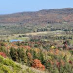
Description Map 21, Edition 30: We will carpool and drive to Honeywood and then to km 47.5 on Centre Road in the Dufferin Hi-Land section. We will park the cars and shuttle to km 41.7 on 20 Sideroad to begin the hike. This hike is over the newly acquired Honeywood Ridge property. It includes forest and open farm country with commanding views. Bring a snack or lunch and water.
Hosting Club: Niagara Category: Car Pool Location (Google Maps): Meet at Quarry Road Parking Lot (Map 4 km 67.9) and carpool to Grimsby Lions Community Pool, 1 Elm Street N 43.193201º, W 79.565301º
Description Hike the entire Niagara section in 5 hikes from Grimsby to Queenston. Please bring snacks and water. Be prepared for weather. Poles are recommended. Bring $10 for badge once you have completed all hikes.
Hosting Club: Iroquoia Category: General Hike Location (Google Maps): Meet/Park at 7342 Twiss Rd, Campbellville (North of Derry Rd & South of Conservation Rd)
Pace: Medium – 3 to 4 km/hr Terrain: Moderate – Some hills and/or some poor footing Distance: 10 – 11 kms
Description We will hike into Crawford Forestry Tract and Crawford Lake Side Trail and back. Also included is the Iroquoian Village, which has three reconstructed longhouses.
Free parking at trail head on Twiss Road (North of Derry Rd and South of Conservation Rd – see Google link above).
Hike leader: Susan Glofcheskie: email: glofcheskies@rogers.com. Cell 416-576-3163. Please use email prior to the hike and cell on the day of the hike.
Wear appropriate quick-dry clothing and hiking boots. Bring sunscreen, insect repellant (summer), icers (winter), snacks, a personal first aid kit and 1 – 2 litres of water.
For personalized driving directions, click on the hike in the BTC hike calendar, then on (Google Maps) to the right of the word Location, and your smart phone should navigate you to the correct location.
Please arrive at least 15 minutes early. If you are unable to attend, please email me as soon as possible in advance of the hike, or text me if it is < 2 hours before the hike.
Hosting Club: Toronto Category: Car Hike Location (Google Maps): Parking is at the end of Boston Mills Road, just west of the intersection with Mississauga Road. Take care not to block the private driveway. Driving directions: From Highway 410 north, continue on Highway 10, left on King Street, right on Mississauga Rd., left on Boston Mills Rd. to parking at the dead end.
Pace: Leisurely Terrain: Variable Distance: approximately 6 k
Description
We’ll take a slower pace to allow time to observe and identify the ferns, fungi, birds, dragonflies, etc. that we encounter along the trail. Using the iNaturalist app, participants will be encouraged to take photos with their smartphones and contribute observations to the Bruce Trail Conservancy’s iNaturalist Project. Of course anyone who simply wants to take in the wonders of nature while we walk is also welcome to come along! Note: Limit of 10 hikers, and registration is mandatory.
From Jordan Hollow Hike the main trail to Upper and Lower Balls Falls, Moyer Road or Louth and Return. You must register for each hike. Bring Poles, sunscreen, bug spray , snack and a drink and dress for the weather
Hosting Club: Caledon Hills Category: End-to-End Location (Google Maps): Meet at the south end of Jones Rd., km 14.0. Shuttle to start at Greenhill Rd.
Pace: Medium – 3 to 4 km/hour Terrain: Moderate – some hills and/or some poor footing Distance: From 28.7 to 14.0, 14.7 km. Maps 7, 6
Description This is the ninth hike of ten. The trail begins along an open slope and crosses Red Hill Creek then follows the escarpment brow to Felker’s Falls. We then hike to Devil’s Punch Bowl and along the escarpment to Jone’s Rd. Access Trail and vehicles.
Hosting Club: Niagara Category: Urban Location (Google Maps): Meet in Queenston Heights Parking lot (may have paid parking) near the Bruce Trail cairn. Enter the park from the roundabout, turn left and another immediate left to park near the cairn.
Hosting Club: Sydenham Category: Geology Hike Location (Google Maps): Meet at the bend of Concession 11, south from Superior Street. Roadside parking and small parking lot where the rail trail crosses Concession 11, north of km 86.5 (Map 32)
Pace: Medium: 3 to 4 km/h Terrain: Moderate: Some hills and/or poor footing, There might be icy and slippery sections., There might be muddy sections., There might be sections with water on the trail. Distance: approx. 5 km
Description We will be exploring the bottom of crevices and viewing the karst and cambering features of the rock formations. The conditions may warrant wearing icers or snowshoes, depending on the conditions that day. There is a steep ladder into the bottom of one crevice. Hikers can avoid this if they wish. Poles recommended. Bring water and snacks as needed. Please contact the hike leader at 226-787-8804 if you are unable to register.
Description We will hike along Seaton trail and enjoy the lovely sceneries of forest and river at the same time
Some safety procedures during the hike:
1-Hikers must stay between the leader and the sweep.
2-Hikers must advise the leader or the sweep if they wish to leave the group.
3- Hikers must follow the whistle instructions: 1 blast- stay where you are; 2 blasts come to the leader; 3 blasts – come to the leader quickly.
4-Hike leader may request volunteers to stop at trail intersections, they need to help hikers to the direction the group walk and wait till they see the sweep .
5-Hikers have to make sure they can see the persons behind and in front of them.
Meet at Elm St Grimsby and car pool to Kinsman Park.A beautiful hike on the trail. We will pass lovely vineyards, creek beds and farmers fields. Hiking boots and poles highly recommended as the terrain can be extremely slippery if wet or icy. Please bring water, poles and dress in layers.
Hosting Club: Toronto Category: Car Hike Location (Google Maps): (Google Location) Km 55.7 Map 21, GPS N44.268877, W-80.”-“156810 Meet at roadside parking along Mulmur-Nottawasaga Townline between Lavender Hill Rd. and 1st Line EHS. Please arrive fifteen minutes early for car shuttle. All other meeting points will be emailed to participating hikers at a later date.
Description Wanna to earn the Dufferin Hi-Land E2E Badge? Join a three day hike covering the 56.3 kms length of the club. Autumn is ideal time for hiking as you can breathe in the sweet smell of the golden leaves as you stroll beneath the trees or when stepping on the freshly fallen leaves on the ground. Add to soothing crisp air clearing our lungs, there’s *no bugs.* We’ll be pacing on a 4-5 km an hour with occasional stoppage to capture the beauty of the landscape. Please ensure to bring enough water for hydration, snack and lunch. Dress appropriately for the weather including proper footwear. Arm yourself with sunscreen and head protection against sun or rain and First Aid Kit if available be included in your backpack. Please note that you’re signing for a three day hike. All three hikes must be completed with the hike leader to earn the Badge. If you miss one or two legs of the section you may perform a make up hike and still qualify for the badge.
Cost of Badge is $10.00 for BTC member and $15.00 dollars for Non member.
Hosting Club: Toronto Category: Car Hike Location (Google Maps): Meet 17.4k, N 43.615163,W 79.975157 and drive to Hilton Conservation Area paid parking, N 43.505705,W 79.961589
Pace: Brisk Terrain: Rocky Distance: 14-18k per hike
Description Earn The new Toronto stained glass badge!!! You are registering for the three days – Nov 4(0-17.4k),Nov 11(17.4-36.1k),& Nov 18(36.1-50.3k) Hikers need to complete all three hikes with the leader. Hikers are allowed to miss one hike that they will make up on their own and still qualify for the badge. Please keep a log of the missed hikes and give them to the leader on the last day. The fee goes towards supporting the Toronto Bruce Trail Club, which in turn supports the mission of the Bruce Trail Conservancy “preserving a ribbon of wilderness, for everyone, forever”. For the time being registration is limited to members of the Bruce Trail Conservancy. Small group as parking is limited. We will hike within 4-5k per hour over varied/rocky terrain. Please be honest with yourself of your physical fitness level to hike at this pace over rocky terrain. Arrive 15 minutes early, wear sturdy footwear, bring 2 liters of water. We will carpool to the beginning of the hike. Paid parking will be shared.
Description Join us to hike the Toronto section of the Bruce Trail in a series of four moderate pace/moderate distance Level 2 hikes (15-16 km a day). Those who complete all 4 hikes will qualify for the Toronto club’s diamond E2E badge. The badge fee ($5 members/$15 non-members) will be collected on Hike #3.
Members may alternatively choose to use the hikes to earn the new stained glass Limehouse stone bridge fundraiser badge. Available to members only the badge fee is $30 and proceeds go to protecting and preserving the Bruce Trail. Please contact the Hike Leader if you are interested in earning the fundraiser badge for further instructions. This badge can be earned only on one of the series of special group hikes led by a BTC Hike Leader and not individually.
Hikers who complete all 4 hikes will qualify for either the diamond badge or stained glass fundraiser badge, as they have chosen.
Any hikers are welcome to join the hikes regardless of working towards one of E2E badges.
There will be a refreshment/social stop in Georgetown after the hike before returning to the Kipling Station departure point by approximately 5:30 PM
This final hike in the series will take us between the Terra Conservation Area and the Caledon section border leading past the Cheltenham Badlands.
** Hikers are required to bring a mask and wear it on the bus. Masks must fit properly and cover the nose, mouth and chin. For the highest level of protection against Covid-19, respiratory viruses or the flu, KN95 or N95 masks are recommended. **
Hosting Club: Blue Mountains Category: Register in person the morning of hike. Location (Google Maps): Hike meets in the parking lot behind Tim Hortons on First St. in Collingwood.
Pace: Leisurely – 3 km/hr. or less Terrain: Moderate – Some hills and/or some poor footing Distance: 6 km
Description We will drive to the parking lot on 15/16 Sideroad in Singhampton and explore the Nottawasaga Bluffs. We will hike in a figure 8 loop taking in the Lookout along the way. Bring a snack and water.
Pace: Fast Terrain: Challenging, Variable Distance: 19 KM
Description This is a fast paced hike on the Main Trail and the Side Trails (ST) on Map 18, in the Caledon section. From the parking lot we will enter the Main Trail at 61.3KM, Map 18 (Ed. 30). We will hike to Dunby Road, Map 18, 68.0KM (Ed. 30). We will then return back and hike through the Cam Snell ST, Glen Cross ST, Isabel East ST and Tom East ST to return to the parking lot. Bring 1.5 – 2 liters of water and your lunch. Please dress for the weather. Hiking boots are required. No dogs.
Pace: Medium Terrain: Moderate Length of Hike: 7.5 km
Description This is a series of 7 hikes to earn the Beaver Valley Geology badge. We will use the criteria listed in Beth Gilhespy’s book, Walking Through Time, Exploring Niagara Escarpment Geology in the Beaver Valley Bruce Trail Section. We’ll boost our knowledge of the local geology along the way as we take the required photos. Hikers are welcome to join any or all of the hikes, however, they must complete all 7 hikes to earn the badge. Bring sufficient water and snacks.
Hike Seven: Greirsville, Webwood Falls
COVID-19 Precautions Before, During and After your Hike
Each hiker joining a Bruce Trail Club organized hike must perform a self-screening check before hiking. Find Ontario’s self-assessment tool here: https://covid-19.ontario.ca/self-assessment/
If you are experiencing COVID-19 symptoms, stay home.
Personal Protective Equipment:
Hikers may choose to wear masks
Transportation
It is the Bruce Trail Conservancy’s current policy that car shuttles are allowed. It is at the discrepancy of individual hike leaders to make that decision.
Other Guidelines
Arrive 15 minutes before the start of the hike.
Wear sturdy footwear and appropriate attire for the weather and the terrain. Hiking poles are a good idea in any season, especially if the terrain is rocky or slippery. In winter, snowshoes or icers/crampons are needed when conditions dictate. Wearing appropriate clothing and footwear prevents injuries and shows consideration for a safe and positive group hiking experience.
Always carry I.D. and your health card.
Bring sufficient water and snacks (or lunch if indicated). A minimum of 1L of water is recommended on all hikes, and 3L is recommended for long, challenging hikes in the heat of the summer.
Bring sunscreen and insect repellent (for spring and summer hikes).
Hosting Club: Dufferin Hi-Land Category: General Hike Location (Google Maps): Devil’s Glen Provincial Park – parking lot at km 31.7 (Map 22, Blue Mountains Section)
Pace: Medium Terrain: Moderate, Strenuous Distance: 8.6 km
Description From km 31.7, we will follow the main trail to km 26.0, walk east along Ganaraska Trail, North on Concession Road 8 in Glen Huron. Just past Station Street, we turn west to follow the Mad River Side Trail, then join the main trail at km 30.6 and return north to the parking lot.
Directions: From CR 124 and HW 89, north on CR 124 to Singhampton, continue east on CR124 to Devil’s Glen Provincial Parking entrance on the right.
This is a series of 7 hikes: 3 Headwaters North and 4 Headwaters South. Hikers completing all 7 hikes in this series will be eligible to purchase a Headwaters Hike Series Badge (when available) from Dufferin Hi-Land BTC. The North section is offered in the Fall of 2023, while the south section will be offered in the Spring of 2024.
Description We will hike through Scotsdale Farm on the main trail plus the Bennet and Great Esker side trails. This route takes us through a variety of terrain from rocky escarpment outcrops to glacial features and former farmlands, over small rivers. Most of the trail is in the forest. Hiking boots are recommended.
After the hike all are invited to meet for refreshments in Georgetown.
To get to the meeting place drive north on Trafalgar Road past Georgetown. Turn left onto Hwy 7 and go about 5 km to the stop light at Silver Creek. Turn right onto Trafalgar again and go about 1 km to the entrance. The parking area is adjacent to the old homestead, about half a kilometer from the road.
Hosting Club: Toronto Category: Urban Walk Location (Google Maps): Meet at 3 PM at the bus Route #79 stop at south east corner of Scarlett Road and Eglinton West.
Join us for a leisurely hike (3 km/hour) over mostly flat terrain. Suitable for beginners and families. We will follow the Humber River Trail to Old Mill and then hike parts of Swansea to Runnymede & Bloor. Optional dropout at Old Mill Subway Station.
After the hike you may choose to join us for dinner at 6:00 PM either at Ali Baba Mediterranean Cuisine or at a nearby pub (your choice, both near Runnymede Subway and the theatre).
We will attend the play at 8:00 PM at the Village Players, 2190E Bloor Street West to see the play “A sting in the Tale” by Brian Clemens & Dennis Spooner .
Call the theatre directly at 416 767 7702 to reserve your ticket ($29.00 adults and seniors) and mention that you are with the Bruce Trail Conservancy, Toronto Club.
Anyone may choose to come for the hike only, join us for the theatre performance, or join us for all three: Hike, dinner and play.
Description Important Notice: FALL BACK SET YOUR CLOCKS BACK AN HOUR Discover the perfect escape at this easy, gorgeous trail just 50 minutes from Toronto. Immerse yourself in the tranquility of a beautiful boardwalk that gracefully winds through both water and land. Let the scenic surroundings captivate you as you enjoy a leisurely stroll, offering a serene retreat not far from the bustling energy of the city. Please dress appropriately according to the weather.
Hosting Club: Iroquoia, Beaver Valley Category: Special Event Location (Google Maps): Meet at the skiers parking lot in Kolopore on Grey Rd 2 which is 650m south of where the trail crosses the road.
Pace: Brisk – 4 to 5 km/hr, Medium – 3 to 4 km/hr Terrain: Moderate – Some hills and/or some poor footing, Strenuous – Hilly with steep climbs and some poor footing Distance: Between 15 and 24km each day
Description This hike series, normally done over 8 days, will be reduced to 6 due to time constraints. To qualify for the badge, you should attend every day. If 6 continuous days is not possible, you may elect to make-up one of the days on your own. Perhaps you might like to split the longest scheduled day to complete it over two other days – it’s up to you. I’d the day is made up prior to the completion, you will still qualify to get your badge on the last day. This special stained glass badge, depicting the tenacious cedar, was designed by Joe Borges and is featured along the Beaver Valley section of trail in many, many spots. This hike series is a fundraiser for Beaver Valley Club and will include an experienced hike leader familiar with the trail & all logistics. Your fee includes your badge, guidance and maybe a treat or two. Please be prepared to share in some of the car shuttles. There are no refunds. This hike is rated as a Medium pace but since it’s a group hike, we take care of one another and can hike only as quickly as our sweep. It’s important to try to keep pace with the person in front of you.
Please bring the 10 essentials to carry in your backpack including enough snacks, lunch and recommended 2 litres of water as well as a First Aid Kit. Please check the weather and ensure you have rain gear if there is rain forecast. If there is a piece of Beaver Valley section of trail you need, you are welcome to join for that day or days. A full schedule will be emailed in advance of the start date.
Hosting Club: Toronto Category: Urban Walk Location (Google Maps): We will meet at the TTC bus platform area inside Finch Station (bus # 36). See Meeting details below.
Description Description: We will start our hike at the Herbert G. Carnegie Centennial Centre and will walk along the West Don River Trail through the beautiful forested ravine system of the Hinder Area. Along the way, we will find a flat area to pause – weather permitting- and do some gentle Yoga standing poses- no Yoga mat is required. We will continue our hike through Earl Bales Park, where we will stop for lunch. After lunch, we will start our way back and end our hike on Bathurst St, North of Sheppard Ave.
How to get there and get home: We will meet as a group no later than 09:00 at the TTC bus platform inside Finch Station, in order to take together bus #36. If you are arriving by subway- go up (without exiting) to the TTC bus platform. Otherwise, enter the Finch station and walk to the TTC bus platform. To go back to Finch Station at the end of the hike, the Bus # 7 runs North on Bathurst, with a transfer to Bus #36 Eastbound towards Finch Station.
What to bring: Proper walking /hiking shoes, at least 1.5 liters of water and a packed lunch. Appropriate clothing for the weather. No Yoga mats required. No dogs allowed
Description If you are coming from Union Station, take the 9:03 am Westbound Lakeshore train to Burlington GO Station. We will meet inside the Burlington GO Station Building near the bathrooms and we will start hiking at 10 am. If you are driving, you can park at Burlington GO Station for free on the weekends. We will hike from Burlington GO to the Hamilton Beach Trail stopping for lunch at Confederation Park and then we will return to the Burlington GO Station by taking the #12 GO Bus that leaves from Centennial Pkwy north of the QEW in Hamilton. You may consider buying a 10 dollar weekend GO day pass that is only available as an e-ticket that you activate on your phone. Please see the route map here.
Hosting Club: Sydenham Category: General Hike Location (Google Maps): The Owen Sound Galaxy Theatre parking lot. Meet at the tall “Galaxy Centre” sign next to the traffic lights.
Pace: Leisurely: 3 km/h or less Terrain: Moderate: Some hills and/or poor footing Distance: 5.7 km
Description We will carpool to the Glen for a nice loop hike in the Glen Management area and good views from the cliff tops. Contact is Bill Snel at w.snel2@gmail.com or landline (519) 470-0584. If unable to register phone the hike leader.
Hosting Club: Niagara Category: Loop Location (Google Maps): Fireman’s Park, Lower Parking Lot. The entrance to the parking lot is on Dorchester just after the railway tracks
Hosting Club: Caledon Hills Category: General Location (Google Maps): Meet at the roadside parking at the junction of Escarpment Side Road and Willoughby Road, km 15.9 (Map 15). Car Pool to roadside parking at Mountain View Side Trail on Mountain View Road. Google Map Coordinates: 43.894254, -79.922522, north of km 26.8 (Map 16).
Pace: Medium – 3 to 4 km/hour Terrain: Moderate – some hills and/or some poor footing Distance: 10.2 km
Description In 1907, a passenger train went off the tracks on the steep Horseshoe Valley curve on the Niagara Escarpment. Seven people were killed and dozens were injured. The Bruce Trail passes close to the location of this disaster. Join us for a hike that includes panoramic views from Escarpment Road, and to learn about the tragic history of the famous Horseshoe Curve Rail Disaster.
Bring your choice of hydration and snacks. We will be going through the forest, as well as walking on roads. Sturdy footwear is essential.
Pace: Medium – 3 to 4 km/hr Terrain: Moderate – Some hills and/or some poor footing Distance: about 8 km
Description We will be on both blue side trails and the main trail. It’s a wonderful place to enjoy nature in this urban area. The start is hilly and then we’ll enjoy mostly flat on our way west to King Road. There are some great lookouts to see Burlington and the lake. We’ll loop back and have a hilly finish. Poles and hiking shoes/boots are recommended. Please bring water and a snack.
Hosting Club: Caledon Hills Category: Tuesday Hikers Location (Google Maps): Meet at 2nd Line EHS parking, north of Mono Centre. Driving directions: Go on Highway 410 north, continue on Highway 10 north, drive through Orangeville, turn right on Mono Centre Rd. (8), left on 2nd Line EHS to parking at km 2.2, north of 20 Sideroad (Edition 31, map 19). Please note parking is not at Mono Community Centre but further on 2nd Line EHS.
Pace: Medium – 3 to 4 km/hour Terrain: Moderate – some hills and/or some poor footing Distance: 12 km
Description Will car shuttle to Hurontario Street, just south of Highway 89, km 14.1 (Edition 31, map 20) and hike main Bruce Trail and McCarson’s Lake Side Trail for a 12 km hike that includes about 5 km road walk. The hike will help our colleagues to complete Dufferin section end-to-end. Kindly be prepared to participate in car shuttle. Bring snacks and your choice of hydration. Poles are recommended. Dress according to weather, it’s getting chilly. Hike leader contact # 416-566-0503
Pace: Medium Terrain: Moderate Distance: 7.8 km, short hike 3km
Description This is an in and out hike, consisting of farmer’s fields, wooded areas, riverside vistas, and some road walking. Those wishing a short hike will turn around at Concession 10. Please bring a snack, appropriate clothing for the weather, and equipment (ie poles). Carpooling is available at Super Burger (hwy 10 & 89) at 8:45.
Pace: Brisk Terrain: Some rocky footing, Some steep sections, Strenuous Length of Hike: 16.8km
Description Please join us as we chip away through the Sydenham section. This will be a series of 11 hikes that range between 13-19kms with one longer hike of 24km. We will begin our journey at the northern end of Sydenham and work our way south to try and avoid the dangers the falling leaves and snow will bring.
If you complete the 11 hikes in this series you will qualify for Sydenham’s new independent badge. Please keep track of your hikes as each hiker will be submitting their own badge request.
All hikes in this series will include a car shuttle and everyone will take a turn as a shuttle driver. Please have your vehicle passenger ready.
Nov 7 hike – meet@km98.7 carpool to 115.5
If you have any questions please text me @ 519-410-9077 (this is the most efficient way)
Please bring plenty of water and snacks/lunch
No dogs
Please text Kristina @ 519-410-9077 for morning of cancelations
COVID-19 Precautions Before, During and After your Hike
Each hiker joining a Bruce Trail Club organized hike must perform a self-screening check before hiking. Find Ontario’s self-assessment tool here: https://covid-19.ontario.ca/self-assessment/
If you are experiencing COVID-19 symptoms, stay home.
Transportation
It is the Bruce Trail Conservancy’s current policy that car shuttles are allowed. It is at the discrepancy of individual hike leaders to make that decision.
Other Guidelines
Arrive 15 minutes before the start of the hike.
Wear sturdy footwear and appropriate attire for the weather and the terrain. Hiking poles are a good idea in any season, especially if the terrain is rocky or slippery. In winter, snowshoes or icers/crampons are needed when conditions dictate. Wearing appropriate clothing and footwear prevents injuries and shows consideration for a safe and positive group hiking experience.
Always carry I.D. and your health card.
Bring sufficient water and snacks (or lunch if indicated). A minimum of 1L of water is recommended on all hikes, and 3L is recommended for long, challenging hikes in the heat of the summer.
Bring sunscreen and insect repellent (for spring and summer hikes).
Pace: Fast Terrain: Challenging, Rocky Distance: 17 KM
Description This is the second hike is a series of fast paced hikes on the Main Trail and the Side Trails (ST) on Map 18, in the Caledon section. From the parking lot we will enter the Main Trail at 61.3KM, Map 18 (Ed. 30) and walk South on the trail to 5th Line EHS, Map 18, 52.3KM. We will then turn back and hike through the Griffith Ravine ST on the way back to return to the parking lot. Bring 1.5 – 2 liters of water and your lunch. Please dress for the weather. Hiking boots are required. No dogs.
Hosting Club: Blue Mountains Category: Register in person the morning of hike. Location (Google Maps): Hike meets in the parking lot behind Tim Hortons on First St. in Collingwood.
Hosting Club: Niagara Category: Car Pool Location (Google Maps): Meet at the Rockway Presbyterian Church at 2100 Pelham Road near the Rockway Conservation Area parking lot and carpool to Quarry Road parking lot N 43.142846º, W 79.458913º The Rockway Conservation Area parking lot is still closed. The church is 450m west of the parking lot on the south side of Pelham Road.
Description Niagara E2E in 5 hikes. Hike #2 is the longest at 20.2 kms so pack snacks, lunch and lots of water. Be prepared for weather. Poles are recommended. Please bring $10 for the badge once you have completed all 5 hikes.
Pace: Leisurely – 3km/hr or less Terrain: Moderate – Some hills and/or some poor footing Distance: Approx. 9 km.
Description Today we hike to Smokey Hollow and back. This is a favourite hike destination, a place rich in history. It’s hard to imagine this spot bustling with light industry and busy with trade and commerce. This is a “there and back hike”. Please meet in the south parking lot of City View Park at 9:45am. for a 10:00 am. start. Bring water , a snack and sunscreen. Poles would be useful for some rocky sections and climbing back up from the Hollow. Leader: Anne Armstrong 905-617-3937 hikingrandma@gmail.com Note: If cancelling the morning of the hike please call or text me.
Hosting Club: Niagara, Iroquoia Category: Good Companions Location (Google Maps): Kinsmen Park, parking lot end of Frost Rd, near Kinsmen Rd and Frost Rd, Beamsville/Lincoln
Pace: Medium – 3 to 4 km/hr Terrain: Moderate – Some hills and/or some poor footing, Strenuous – Hilly with steep climbs and some poor footing Distance: 8-10km
Description Beautiful views of farmland from escarpment. A lovely hike, quite rocky at times, some hills. Wear hiking boots or shoes with good tread. Dress in layers according to weather, including rain gear. Bring water and snack. For last minute cancellation cell 289-659-0007 day of hike only.
From Jordan Hollow Hike the main trail to Upper and Lower Balls Falls, Moyer Road or Louth and Return. You must register for each hike. Bring Poles, sunscreen, bug spray , snack and a drink and dress for the weather
Hosting Club: Caledon Hills Category: End-to-End Location (Google Maps): Meet at Grimsby Lions Community Pool, Elm St. at the south end of Coronation Park, km 0.0. Shuttle to start at Jones Rd.
Pace: Medium – 3 to 4 km/hour Terrain: Moderate – some hills and/or some poor footing, Strenuous – hilly with steep climbs and some poor footing Distance: From 0.0 to 14.0, 14.0 km. Maps 6, 5
Description This is the last hike of the series! We will hike below the escarpment, then gradually climb and enjoy views over Lake Ontario. We then follow roads to reach Beamer Memorial Conservation Area which offers several lookouts before our descent to the road and vehicles.
Hosting Club: Iroquoia Category: Thursday Group Location (Google Maps): Meet at the circular parking lot by the pavilion at the RBG Arboretum at 9:45AM
Our hike starts with a short, sandy beach walk to the entrance of this magical mixed forest trail. Bring a light backpack with water, snack and your camera or binoculars. Poles are beneficial, but not required. This 3 1/2 km hike (out and back) and is generally on flat and even terrain. There may some wet spots along the way.
For those wishing to stay for a cool down at the end of our hike and short visit at the beach – bring a hot beverage and lawn chair.
You can learn more about Black Creek Provincial Park here: https://visitlionshead.ca/profile/black-creek-provincial-park/1575/
Duration: 1 ½ hour total
If needed, driving instructions to Black Creek Provincial Park are available upon request.
Please share any health concerns or considerations with the hike leaders prior to the hike.
Description Each Friday we will explore different neighbourhoods, trails and parkland throughout Historic Niagara-on-the-Lake.
Moderate pace with some weeks entirely on sidewalks and roads while others may include a mix of trails and paved pathways. Great way to build up endurance for longer more strenuous hikes.
Prepare for cooler windy conditions on open parkland and along Lake Ontario and Niagara River trails.
Plan to stay for conversation and a warm cup of coffee or tea at Sweets & Swirls, Community Centre, Niagara Stone Road, NOTL
Pace: Medium – 3 to 4 km/hr Terrain: Dependent on Conditions, Moderate – Some hills and/or some poor footing Distance: 12 km
Description We will hike on the Conservation Trails, the Rattlesnake Point Side Trail, the main Bruce Trail, and Crawford Lake Side Trail to Crawford Lake and back. Wear appropriate clothing and footwear for weather conditions.
Pace: Leisurely, Medium Terrain: Easy Distance: ~5 km
Description To use poles? Or not to use poles? That is the question for today’s hike. Join Jason Watkins, Physiotherapist from Peninsula Physiotherapy in Wiarton, for a short lunch and learn talk about the pros and cons of using hiking poles. Are hiking poles different from walking poles? How should I use hiking poles? Ask Jason the questions you have wondered about! Then, we will practise our new learning by hiking on the Bruce Trail along Colpoy’s Bay shore – aiming for Spirit Rock Spiral Staircase – about 5 km out and back- in total. There will be an option for those wishing to climb the staircase to the top of escarpment, while others enjoy the view from the shoreline. Poles are provided by Grey Bruce Health Unit and can be borrowed through PBTC for the duration of the hiking series. If time allows, we will stop at Lost Art Café in Wiarton for coffee before returning to our parked vehicles at the end of the hike. Be prepared for a 2 1/2 hour group hike experience. Portapotties are available at the Municipal Parking Lot.
Donation: Please bring a canned food donation for the local food bank.
Parking: Free Municipal Parking at Bluewater Park (near Dockside Willie’s) – 402 William St., Wiarton.
Port Dalhousie Heritage District, Public Parking Lot St Catharines
Terrain: Easy Distance: 45
Description
Celebrate the 200 year anniversary of the Welland Canal and earn a New Limited Edition Badge. We will award 100 Badges this year and 100 Next Year Looking for a distance challenge? We invite Hikers, Runners, joggers Walkers and Strollers The Merrithon is a long distance hike from Port Colborne to Port Dalhousie along the welland Canal. This is a self-guided hike along mainly paved trail. A Map of the trail can be found at http://niagarabrucetrail.club/wp/badges/ under the Merritthon badge
Everyone who completes the route and goes through all of the checkpoints will earn the Limited Edition Prestigious Merritthon Badge
Fee: $50 includes Bus transport to start of hike, checkpoints, badge and helps to support the Bruce Trail Conservancy in its mission to preserve a ribbon of wilderness, for everyone, forever.
BUS LEAVES AT 7:00 SHARP. Late arrivers will need to check in and make their own way to Port Colborne
BUS Leaves at 7:00 Sharp. Late arrivals must make their own way to the start after checking in at Port Dalhousie
Check in: At Port Dalhousie Parking Lot St Catharines from 6:40. Buses will transport hikers to Port Colborne.
Route: Follow the yellow blazes from Port Colborne to Port Dalhousie back to the parking lot What to bring: Bring your own water and snacks. Wear comfortable sturdy shoes and dress for the weather.
Extra water and snacks will be available at the checkpoints.
COVID Safety Precautions: Please note the precautions before, during and after your hike… https://brucetrail.org/pages/explore-the-trail/hike-schedule.
FAQ’s
What if it rains? This is a rain or shine event.
What if I need to drop out? Trail Angel’s will be available from the checkpoints.
How long will it take to finish? We estimate that the hike will take between 8 and 9 hours. If you do not reach the last checkpoint by 4:00pm you will have to withdraw
Is my ticket/registration transferable/refundable? yes. Refundable up to 10 days before event but not transferrable. Please let us know if you cannot make it.
Contact: Alan Laver alanjlaver@gmail.com 416 303 5613
Description Bus departs 10 York Mills Rd at 8:00 AM and Major Mackenzie Dr and HWY 400 Park and Ride at 8:20 AM. If you wish to be picked up at the Major Mackenzie Dr and HWY 400 Park and Ride, type ‘yes’ in the additional information field. Please arrive 15 minutes before departure. The bus waits for no one.
We will begin the hike at km 34.2 by winding our way through forest and farmland to the entrance of Devil’s Glen Provincial Park. We will walk to the nearby lookout platform to admire the steep bedrock gorge at the edge of the escarpment. The lower valley walls are steep and covered with dense deciduous forest. Rare harts tongue and smooth cliff brake ferns grow on these steep cliffs. We will descend a series of natural steps down to the Mad River. Then we climb uphill switchbacks to reach the junction with the Ganaraska Trail that stretches from here to Port Hope. The Bruce Trail continues along the Escarpment edge to McKinney’s Hill and its superb view to the east. The trail passes Freedom Rock and the Nottawasaga Bluffs Lookout. Some white cedar trees in this park are well over 1,000 years old. We will end the day’s hike at km 21.9, and then head for Shelburne for refreshments before our return to Toronto.
** Hikers are required to bring a mask and wear it on the bus. Masks must fit properly and cover the nose, mouth and chin. For the highest level of protection against Covid-19, respiratory viruses or the flu, KN95 or N95 masks are recommended. **
This is a fast paced hike on the Main Trail and the Side Trails (ST) on Map 18, in Hockley Valley, Caledon Hills section. We will walk North from the parking lot Map 18, 45.5KM (Ed 30) on the Main Trail taking the Hemlock Ridge (ST), until we reach 4th Line EHS (54.3KM). We return back, hiking the Glacier Valley Side Trail ST, Hockley Crest ST, Harmony ST and the Darcy ST coming out on Mono 5 Sideroad to walk back to the cars. Bring 1.5 – 2 liters of water and your lunch. Please dress for the weather. Hiking boots are required. No dogs.
Description Will explore Toronto part of Rouge park along Rouge river and Little Rouge Creek,
Some safety procedures during the hike:
1-Hikers must stay between the leader and the sweep.
2-Hikers must advise the leader or the sweep if they wish to leave the group.
3- Hikers must follow the whistle instructions: 1 blast- stay where you are; 2 blasts come to the leader; 3 blasts – come to the leader quickly.
4-Hike leader may request volunteers to stop at trail intersections, they need to help hikers to the direction the group walk and wait till they see the sweep .
5-Hikers have to make sure they can see the persons behind and in front of them.
Hosting Club: Blue Mountains Category: Register in person the morning of hike. Location (Google Maps): Hike meets in the parking lot behind Tim Hortons on First St. in Collingwood.
Pace: Medium – 3 to 4 km/hr Terrain: Moderate – Some hills and/or some poor footing Distance: 11 km
Description Starting at Glen Huron the trail will immediately climb the escarpment, taking us through a variety of mixed forests to the edge of the Devils Glen Provincial Park. We will then encounter multiple switchbacks to descend to the Mad River Side Trail where we enjoy seeing this river grow as we travel along the river bank to return to our cars. Bring a snack or lunch and water.
Pace: Medium Terrain: Difficult, Moderate Distance: ~3.5km
Description Explore the recently added Dolostone Arch Side Trail in the Peninsula. This scenic trek features two striking rock formations: a captivating natural arch overhang and a limestone grotto.
Prepare for the weather and ensure you have water, some light snacks, and sturdy footwear for the rugged terrain.
Description We will hike the Main trail and Side Trails (ST) in the Scotsdale Farm / Silver Creek area. We start on the Bennett Heritage ST going North to join the Main Bruce trail at 35.1KM, Map 13, Ed 30. We turn back on the Main trail and join the Great Esker ST at 33.4KM. We leave the Great Esker trail to take the new Trafalgar ST, Reservoir ST and finally the Duff Pit ST to return back to the Main trail at 28.4KM. We take the Main trail going north until 31.2KM and take the Maureen Smith ST to return back on the Bennett Heritage ST to return back to the parking lot. Dress according to the weather. Hiking boots are required. Bring your lunch and 1.5-2 litres of water. No dogs.
You are signing up for the following dates and times: 2023-11-12 at 08:30 2023-11-25 at 08:30 2023-11-26 at 08:30 2023-12-02 at 08:30 2023-12-03 at 08:30 2023-12-09 at 08:30 2023-12-10 at 08:30
Hosting Club: Niagara Category: Event Hikes Location (Google Maps): Nov 12: Meet at Woodend Conservation Area, Taylor Road, Niagara-on-the-Lake, 43.1432995, -79.1672588, Carpool to the BTC Southern Terminus 14184 Niagara River Pkwy, Niagara-on-the-Lake, 43.1602848, -79.052315. Nov 25 Meet at Decew House, Decew Rd Thorold. 43.1078074, -79.2498458. Carpool to Woodend Conservation Area, Taylor Road, Niagara-on-the-Lake, 43.1432995, -79.1672588. Nov 26: Meet at Roland Rd parking lot east of Effingham St 43.090278, -79.305073. Carpool to Decew House, Decew Rd Thorold. 43.1078074, -79.2498458 Dec 2: Meet at 3640 Glen Rd Jordan 43.139030, -79.373893. Carpool to Roland Rd parking lot east of Effingham St 43.090278, -79.305073. Dec 3: Meet at 3774 Quarry Rd Beamsville, 43.142799, -79.458922. Carpool to 3640 Glen Rd Jordan 43.139030, -79.373893. Dec 9: Meet at Mountainview Conservation Area, Beamsville 43.1577899 -79.4974062. Carpool to 3774 Quarry Rd Beamsville, 43.142799, -79.458922 Dec 10: Meet at Grimsby Lions Club Pool 1 Elm St 43.193201, -79.565301. Carpool to Mountainview Conservation Area, Beamsville 43.1577899 -79.4974062
Pace: Brisk Terrain: Moderate Distance: 12 – 15k per day
Description
Meet time is 8:15 for 8:30 start. . This is a special series of 7 hikes to complete the Niagara section of the Bruce Trail. There will be a new accomplishment badge, included in the registration fee featuring the White-tailed deer – which has been designed by Joe Borges and will be made available on our last day. The White-tailed deer is common throughout Niagara. For this E2E in 7, we will be following the main trail east to west eventually finishing in Grimsby. Some days we will hike east to west and other days, west to east depending on parking availability. Please note that you are signing up for the entire series of 7 hikes as a Group Hike. The Niagara in 7 series is geared to experienced long distance hikers with the expectation of a 3 to 5.0 km/ hr. pace maintained over a day up to 15km. The section is approximately 85km so daily distances will be based on available parking. No dropout points have been established and therefore hikers who must drop out, will be responsible for their own transportation back to their vehicle. Please be honest about your hiking abilities. We will hike at a steady pace but there will be plenty of time to take pictures and to enjoy the flora and fauna of this beautiful but challenging section.
Again, this particular set of 7 hikes is intended to be Moderate/Brisk. Please be honest about your degree of physical fitness prior to registration. It is a group hike so it is important you are able to keep pace with the person in front of you.
Attire and Daily Hikes.
Hikers will be expected to be wearing proper hiking boots and layered clothing with the expectation of hot and humid weather. Sufficient food and 2 litres of water for a full day of hiking is required as well as hiking poles (if you use them). Check the daily forcast and prepare for wet weather, as well. Bug spray is strongly suggested. Clothing adjustments, bio-breaks are as needed. Please let the sweep person know and they will wait for you. A morning break around 10am and a 10-15 minute on-trail lunch break will be scheduled. An afternoon break will be based on our expected finish time. Depending on weather conditions, these times may vary. Please check for ticks everyday. Wear a wide brimmed hat and hang your backpack up off the ground. This area is endemic to black-legged ticks.
Fee
The fee goes towards supporting the Niagara Bruce Trail Club, which in turn supports the mission of the Bruce Trail Conservancy, which is: “Preserving a ribbon of wilderness, for everyone, forever.” For the time being, registration for the Niagara E2E-in-seven will be limited to members of the Bruce Trail Conservancy. Hikers may be a member of any section.
Car Shuttles and Missing Hikes
A maximum of 2 (of the 7) hikes can be self-completed as a result of scheduling challenges, but it is intended that this badge be earned while hiking as part of a group led by a certified hike leader. Car shuttles are shared amongst all hikers. If you intend to arrive at the meeting locations with more than yourself in your vehicle, please let the hike leader know in advance. Car pooling to our meeting spot with 2 people in the car is generally ok but we would like to minimize and equalize the driving/shuttling as much as possible so it is fair for all participants. If you know you will miss more than 2 of the hikes, it’s likely best to sign up for another end to end, however, whatever hikes are completed on this series may go toward completion of an independent ETE for the regular Niagara section. If you are able to complete the hikes you know you will miss ahead of time, all the better.
Transportation
This series will be through-hikes and will require car shuttling. You must be willing to drive and/or to be a passenger. Some parking locations require paid parking, and hikes that enter Niagara Parks. The fee for this E2E-in-7 does not include any parking/entry fees for hikers. These costs, where applicable, will be shared amongst all participants unless you have a parking or park pass.
Leave No Trace
Please remember, like all hikes, this is a Leave No Trace hike. Pack out whatever you pack in. Do not toss anything onto or into any sections of the trail. We will also try to leave the trail better than we found it so we will be collecting collectable garbage we might see along the way. Daily volunteers to collect trail trash will be supplied with a bag. Dogs will not be welcome on this hike.
Daily
We meet for each hike by at least 6:45am each day. The schedule is subject to change. Please set aside July 24th as a potential alternate day in the event of weather related postponement.
This hike is limited to 12 participants including the hike leader.
Description This hike will follow a trail along the Welland Canal, walk through Mary Malcolmson Eco Park, continue to Sunset Beach, follow Walker’s Creek Trail, visit flower murals along the fences of the Port Weller Community Centre, follow the trails of Malcomson Park and return to Lock 1 of the Canal.
Pace: Medium – 3 to 4 km/hr Terrain: Moderate – Some hills and/or some poor footing, Strenuous – Hilly with steep climbs and some poor footing Distance: Approx 7.5
Description Arrive 15mins early for 10am start.
Bring water & snacks as will be taking a short break. Be prepared for winter conditions if we get snow before hike – hiking poles, icers.
If you need to cancel day of hike please text me at (905) 815-7100
Pace: Medium: 3 to 4 km/h Terrain: Moderate: Some hills and/or poor footing Distance: Approximately 6 km
Description We will walk along the base of the escarpment on the Memorial Forest Side Trail and ascend through a crevasse to join the Main Trail along the top of the escarpment. We will head to Jones Falls and explore the area. We will then take the Merle Gunby Side Trail loop and join up with the Main Trail again. This hike ends with a steep descent back to the parking lot. Please arrive 15 minutes before the start time. If you are unable to register, please call or text the leader at 519-270-5068.
Hosting Club: Caledon Hills Category: Tuesday Hikers Location (Google Maps): Meet at roadside parking on Kimberly Dr. in Hamilton; km 29.4 Iroquoia section of the BTC Trail Guide. Park by the Kimberly Dr. access Side Trail. We will car pool to the parking area on Scenic Dr. to start the hike.
Pace: Medium – 3 to 4 km/hour Terrain: Moderate – some hills and/or some poor footing Distance: 11 km
Description From roadside parking on Kimberly Dr., we will shuttle to the parking area on Scenic Dr. GPS 43.245533 -79.930693.
We will hike mainly on the Chedoke Radial Trail from where we can enjoy great views over the lake and the city. The trail also wanders through forested areas.
Bring water , snacks, poles(optional). Comfortable sturdy shoes or boots recommended. Dress for the weather, and the forecast.
We will also be accompanying hikers on their End t0 End journey of the Bruce Trail.
Hosting Club: Dufferin Hi-Land Category: Tuesday Hike Location (Google Maps): (Google Maps) Dick’s Dam Park is located in Bolton. For carpooling, meet at the parking area on the east side of the Party City/Winners building, (Hwy10 and 4th Ave. in Orangeville) at 8:30 am. Or from King Street and Hwy 50 (Queen St.) in downtown Bolton, drive north on Queen St. (Hwy 50) and in 0.5 km cross the bridge over the Humber River. Turn left on Hickman St., then right on Glasgow Rd. Follow Glasgow Rd. around the bend to parking on your left at Dick’s Dam Park for a 9:30 am start.
Pace: Medium Terrain: Moderate, Slippery and Steep Sections Distance: Long Hike 9 km Short Hike 4km
Description We will car shuttle to the parking area at Castlederg Sideroad and then hike back to the cars at Dick’s Dam. The short hike can end at the car(s) stationed at Duffy’s Lane and Emil Kolb’s parking lot.
Hiking poles are recommended. Bring lunch, water, and snacks.
Optional refreshment stop after the hike at Coffee Time in Bolton.
Pace: Brisk Terrain: Some rocky footing, Some steep sections, Strenuous Length of Hike: 14.9km
Description Please join us as we chip away through the Sydenham section. This will be a series of 11 hikes that range between 13-19kms with one longer hike of 24km. We will begin our journey at the northern end of Sydenham and work our way south to try and avoid the dangers the falling leaves and snow will bring.
If you complete the 11 hikes in this series you will qualify for Sydenham’s new independent badge. Please keep track of your hikes as each hiker will be submitting their own badge request.
All hikes in this series will include a car shuttle and everyone will take a turn as a shuttle driver. Please have your vehicle passenger ready.
Nov 14 hike – meet@km83.8 carpool to 98.7
If you have any questions please text me @ 519-410-9077 (this is the most efficient way)
Please bring plenty of water and snacks/lunch
No dogs
Please text Kristina @ 519-410-9077 for morning of cancelations
COVID-19 Precautions Before, During and After your Hike
Each hiker joining a Bruce Trail Club organized hike must perform a self-screening check before hiking. Find Ontario’s self-assessment tool here: https://covid-19.ontario.ca/self-assessment/
If you are experiencing COVID-19 symptoms, stay home.
Transportation
It is the Bruce Trail Conservancy’s current policy that car shuttles are allowed. It is at the discrepancy of individual hike leaders to make that decision.
Other Guidelines
Arrive 15 minutes before the start of the hike.
Wear sturdy footwear and appropriate attire for the weather and the terrain. Hiking poles are a good idea in any season, especially if the terrain is rocky or slippery. In winter, snowshoes or icers/crampons are needed when conditions dictate. Wearing appropriate clothing and footwear prevents injuries and shows consideration for a safe and positive group hiking experience.
Always carry I.D. and your health card.
Bring sufficient water and snacks (or lunch if indicated). A minimum of 1L of water is recommended on all hikes, and 3L is recommended for long, challenging hikes in the heat of the summer.
Bring sunscreen and insect repellent (for spring and summer hikes).
Hosting Club: Blue Mountains Category: Register in person the morning of hike. Location (Google Maps): Hike meets in the parking lot behind Tim Hortons on First St. in Collingwood.
Pace: Medium – 3 to 4 km/hr Terrain: Moderate – Some hills and/or some poor footing Distance: 8.2
Description We will drive to and park some cars at 20 Sideroad and Prince of Wales Road (km 41.7) in the Dufferin Hi-Land section. We will then drive to km 49.7 on County Road 21 where we will begin the hike. We will follow a steep descent to the Black Bank River then climb out of the valley. After we cross Prince of Wales Road, there is an ascent to the top of the escarpment providing great views over the valley. We have a long gradual descent to the cars at the end of the hike at km 41.7. Bring a snack or lunch and water.
Hosting Club: Niagara Category: Car Pool Location (Google Maps): Meet at Decew House Heritage Park map 3 km 31.2 and carpool to Rockway Presbyterian Church Parking lot at 2100 Pelham Road (corner of Ninth & Pelham). The church is 450m west of the Rockway Conservation Parking lot which is still closed. There is also construction around the church parking lot so be careful where you park.
Description Niagara E2E in 5 hikes. Hike#3 is 17.5 kms so please bring enough snacks and water. Be prepared for the weather. Poles are recommended. Please bring $10 for badge once you have completed all 5 hikes.
Description This hike is a there-and-back walk. We begin on the edge of the Beaver Valley and then head towards a beaver pond. A walk along the edge of fields takes us into a wood lot, then to the Young Wetland. Birds are often sighted on the water. From there, we stroll the rest of the BTC-managed Young property to Sideroad 19, seeing fields regenerating towards a natural state. We walk back to the parking area, where we can enjoy a panoramic view into the Beaver Valley.
Pace: Leisurely – 3km/hr or less Terrain: Easy – Mostly flat and usually good footing Distance: Approx 7-8 km.
Description Come join me for a hike into Bronte Creek Provincial Park along urban and forest trails and along the east bank of Bronte Creek. Meet in the children’s playground on the west side of Valleyridge Dr., just below Dundas St. at 9:45 am. for a 10:00 am. start. Bring water, a snack and poles if using. We should have good views over the creek. Leader: Anne Armstrong 905 617 3937 hikingrandma@gmail.com
From Jordan Hollow Hike the main trail to Upper and Lower Balls Falls, Moyer Road or Louth and Return. You must register for each hike. Bring Poles, sunscreen, bug spray , snack and a drink and dress for the weather
Hosting Club: Iroquoia Category: Thursday Group Location (Google Maps):
Hilton Falls Conservation Area parking lot, Campbellville Rd/Side Rd 5 East of Guelph Line Rd. Reservation required with valid Conservation pass or fee for parking.
Pace: Brisk – 4 to 5 km/hr Terrain: Moderate – Some hills and/or some poor footing Distance: 13km
Description We will hike the Beaver Dam loop and part of the Hilton Falls and Red Oak Trails at a brisk speed. There will an opportunity to visit the falls and stop for other sights along the way but we will be walking at a clip. Please bring water, a snack and appropriate layers for the weather.
Contact Information: kjcapindale@gmail.com; Hike morning use cell (905)749-0914
Description Falls on a hike! Each one of us has experienced a fall of some kind on the Bruce Trail. Want to learn how you can reduce your risk of falling?
We are so pleased that Pat Turner, Retired Occupational Therapist and hiking enthusiast, will join us today! Pat will introduce us to a few practical exercises and share tips which you can integrate into your routine hikes. These simple daily exercises and tips will enhance and ensure that any hike is safe, enjoyable and helps to prevent falls. Important information for any hiker!
Today’s hike is about ~4 Km, generally on flat terrain along a wide path which leads to a rocky shore.
Escarpment Biosphere Conservancy stewards this interesting nature reserve and conducts rattlesnake and bat research onsite during the Spring, Summer and Fall season. To learn more about volunteering with EBC or about Alvar Bay Nature Reserve go here: https://escarpment.ca/see-our-preserves/bruce-county-and-huron-shore/cape-hurd-alvar-bay . We are thankful for EBC’s stewardship of this property and trails.
Duration: 2 hours
Parking : Park on the west side of Cape Hurd Road near the entrance to Alvar Bay Nature Reserve
No washrooms onsite.
Wear layers, hat, mittens and boots with good tread. Bring a light backpack with water and snack.
Hosting Club: Sydenham Category: General Hike Location (Google Maps): Roadside parking on St.Vincent-Sydenham Townline, 1 km north of Sideroad 24 at km 55.2 (Map 30)
Pace: Medium: 3 to 4 km/h Terrain: Moderate: Some hills and/or poor footing Distance: 4.5 km
Description This hike will take us along the white trail on top of the escarpment, also called the Lebanon Mountain Friendship Trail, and along the Department of National Defence property . We will walk back to our cars via the Bayview Escarpment Side Trail. Poles advised. Please contact or text the hike leader at 519 379 2573 if unable to register.
Each Friday we will explore different neighbourhoods, trails and parkland throughout Historic Niagara-on-the-Lake.
Moderate pace with some weeks entirely on sidewalks and roads while others may include a mix of trails and paved pathways. Great way to build up endurance for longer more strenuous hikes.
Prepare for cooler windy conditions on open parkland and along Lake Ontario and Niagara River trails.
Plan to stay for conversation and a warm cup of coffee or tea at Sweets & Swirls, Community Centre, Niagara Stone Road, NOTL
Pace: Medium Terrain: Moderate, Some steep sections Length of Hike: 8.1 km
Description We will be hiking to Loree Forest from Intercept Side Trail, getting some cardio on the few climbs on the way. Once we loop the forest, we’ll continue down to the Loree side Trail, then walk back to our cars. The leaves will be gone so there will be great views – a perk of late fall hiking. Bring a snack and sufficient water. Speaking of late fall, our outing will depend on what the weather does and you’ll be kept in the loop on that.
Pace: Leisurely Terrain: Easy, Moderate Distance: ~ 3 1/2 KM
Description Join Brian Popelier, BTC Ecologist on this hike as we learn about the restoration of this lovely BTC Nature Reserve. We will take a stroll here to see nature’s bounty and imagine how birds and animals depend on it for nourishment and nest building. Then – a hop, skip and jump away is the John Appleton Sidetrail and Hawthorne Sidetrail which creates a loop with the main trail , in total ~3 km. This well protected walk in the woods path meanders through the property crossing crevices and a few very short “up and down” sections.
Description We will meet inside the Clarkson GO Station near the bathrooms at 6:30 pm and walk along the lake through Rattray Marsh to Port Credit (see route here.) Head lamps or flashlights are required as the sun will have set. The after hike stop is the Archtop Coffee Bar and Market in Port Credit. Hikers can take the 23 Lakeshore Westbound Miway bus back to the Clarkson GO (Presto is accepted) or they can use the nearby Port Credit GO Station to return home.
Hosting Club: Toronto Category: Car Hike Location (Google Maps): Park along Fairfield Dr. or Dufferin Street, Gathering at trail head in Dufferin Street.
Description Will explore Toronto part of Rouge park along Rouge river and Little Rouge Creek,
Some safety procedures during the hike:
1-Hikers must stay between the leader and the sweep.
2-Hikers must advise the leader or the sweep if they wish to leave the group.
3- Hikers must follow the whistle instructions: 1 blast- stay where you are; 2 blasts come to the leader; 3 blasts – come to the leader quickly.
4-Hike leader may request volunteers to stop at trail intersections, they need to help hikers to the direction the group walk and wait till they see the sweep .
5-Hikers have to make sure they can see the persons behind and in front of them.
Pace: Moderate Terrain: Hilly Distance: Fast group: 16 to 18 km, Moderate group: about 13 km
Description
Join us for an awesome hike with great views and fun hills. We will split into two groups and hike from Hockley Valley to the Split Rock Side Trail. Moderate group will hike about 13 km, and the fast group 16 to 18 km. Refreshments after if time allows.
Description See the majestic Falls from several vantage points. We will hike both sides of the Niagara River, crossing the Rainbow Bridge and going to Goat Island.
Bring passport or Nexus to cross the border. Bring $1 for the bridge fee.
A drink and snack are recommended. This hike will take 3-4 hours depending upon the ease/difficulty of border crossings. Please allow extra time.
Hosting Club: Blue Mountains Category: Register in person the morning of hike. Location (Google Maps): Hike meets in the parking lot behind Tim Hortons on First St. in Collingwood.
Pace: Medium – 3 to 4 km/hr Terrain: Moderate – Some hills and/or some poor footing Distance: 8 km
Description Car shuttle hike. We will drive to km 55.7 on the Mulmur-Nottawasaga Townline in the Dufferin Hi-Land section and leave the cars. We will then shuttle to km 47.5 on Centre Road to begin the hike. The trail climbs steeply up the east slope of the valley, passes through forest and alongside open fields. It has beautiful views to the east across the Nottawasaga Lowlands. Bring a snack and water.
Hosting Club: Toronto Category: Car Hike Location (Google Maps): We will meet at the parking lot of Spirit Tree Estate Cidery located at 1137 Boston Mills Rd, Caledon. (Map 14 of the Bruce Trail Reference Guide, Edition 30)
Pace: Leisurely Terrain: Flat, Variable Distance: 5.8 km
Description Celebrate the upcoming holidays with a march along the Bruce Trail and a visit to a local artisan market!
First, we’ll do an out-and-back march along the main trail of the Bruce Trail as it flows out of the Toronto section and into the Caledon Hills section. We will begin our hike at the Spirit Tree Estate Cidery parking lot and then follow the main trail on Boston Mills Road and Creditview Road in order to reach the Cheltenham Badlands. We will continue our hike along the main trail that runs through the Badlands, as well as walk along Olde Baseline Road for a short distance in order to see the Badlands in all their glory! We will then retrace our steps to return to Spirit Tree Estate Cidery.
After our hike, we’ll visit the “Handcrafted with Love” artisan market at Spirit Tree Estate Cidery to do a little holiday shopping, and we’ll follow that up with a delicious pizza lunch enjoyed outdoors at the cidery.
For the main Bruce Trail in the Toronto section: Children under 13 years of age who participate in this hike will be eligible for the Toronto Bruce Trail Club’s Youth Badge (https://torontobrucetrailclub.org/the-trail/badges) – all family members who are planning on joining us should register for the hike, including children.
For the main Bruce Trail in the Caledon section: While on our hike within the Cheltenham Badlands, I will provide assistance to hikers of all ages who are interested in earning the Caledon Hills Bruce Trail Club’s Nature Hunter Badge (http://caledonbrucetrail.ca/hiking/club-badges/nature-hunt-badge/). I will point out and identify trees and wildflowers as we hike, as well as explain plant life cycles. You should bring enough water and food for a 2-hour hike, comfortable hiking shoes, appropriate clothing for the weather, a camera if you want to work on the Caledon Hills Bruce Trail Club’s Nature Hunter Badge, and money if you intend to join us for shopping and lunch at Spirit Tree Estate Cidery (https://spirittreecider.com/) after the hike.
Description Hike the main trail and portions of two side trails. The Niagara College Side Trail feature various points of interest while the main trail we will follow offers a view of multi-layered rock formations and a large block of dolostone that has broken away from the Escarpment. Look for Indigenous Marker Trees.
Hosting Club: Toronto Category: Car Hike Location (Google Maps): 10 a.m. from Crawford Lake Conservation Area – 3115 Conservation Rd. Milton ON L9T 2X3, Canada (map) Meeting point is at the parking lot next to the Visitor Centre
Description We will hike around Crawford Lake, a rare example of a meromictic lake and the Bruce Trail on our way to the Nassagaweya Canyon with great views and looping back to the Longhouse Village. Crawford Lake is also an important site for global scientific research. Click here to learn more about these studies and how our rare meromictic lake may help scientists define a new proposed epoch: the Anthropocene.
Additional Notes:
Reservations are not required but are recommended. If you book online, you can reserve your spot and save money on gate fees.
Click to reserve. https://www.conservationhalton.ca/parks/crawford-lake/
For the hike What to bring: water and snacks/lunch What to wear: Wear hiking boots or good walking shoes. Be prepared for the weather forecast of the day.
Hosting Club: Sydenham Category: General Hike Location (Google Maps): Meet in the north-east corner of the parking lot at Home Depot on Highway 26 on the east side of Owen Sound.
Pace: Medium: 3 to 4 km/h Terrain: Moderate: Some hills and/or poor footing, Strenuous: Hilly with steep climbs and some poor footing., There might be icy and slippery sections., There might be muddy sections., There might be sections with water on the trail. Distance: 6 kms
Description We will carpool to Silent Valley and hike a couple of loops – the Silent Valley Side Trail to the Avalanche Pass Side Trail. From there will we pick up the main trail going south to where it meets the Wilson Homestead Side Trail. Following the Wilson Homestead Side Trail, we pass the foundation of the settlers’ barn and well. Further on, we pass the remains of the plane that crashed in the forest 40 years ago. Good footwear is required for this hike. The Avalanche Pass Side Trail runs through an area of large boulders below the escarpment edge which can be slippery. November conditions are unpredictable, have your icers with you. Map 30. If you are unable to register, please call or text the hike leader at 647-918-4180.
Hosting Club: Dufferin Hi-Land Category: General Hike Location (Google Maps): Roadside parking on Centre Road in Kilgorie near post boxes. 30 metres south of River Road. Km 33.8 BTC Map 20.
Pace: Medium Terrain: Dependent on Conditions, Moderate, Slippery Sections Likely Distance: 18.3 kms
Description Join us for a quiet Sunday shuttle hike from Lavender to Kilgorie in the beautiful Dufferin Section. We will pass through Black Bank and the new Honeywood Section of trail opened last year. We will end our hike on the banks of the Pine River heading into Kilgorie. Please bring a garbage bag for your dirty boots and a pair of clean footwear to change into for the ride back (we will leave that stuff in the cars at the end of the hike). Please bring 2L of water, a warm drink, a snack, and a lunch. Please have your icers in your backpack just in case. Boots mandatory. Poles recommended. Please arrive at 8:45 to be ready to shuttle at 9 am sharp.
Description The Credit River ravine park system is beautiful in any season. Join me for this 10 km Sunday morning loop along the Credit River from Dundas to the 403 and back again through the U of T nature trail. The walk will start at the heated bathroom building in the first parking lot north of Dundas in Erindale Park and it will end at the very popular Apricot Tree Cafe on Dundas just west of Mississauga Road. Erindale park is easily accessible by Mississauga Miway buses leaving both Islington and Kipling subway stations.
Description This will be an 10 km loop hike into the Forks of the Credit Park from the Elora Cataract Trailway. We will hike around the Kettle Lake and up to see the falls. After the hike those interested are invited to take refreshments in the village of Erin. Hiking boots are recommended plus cool weather clothing.
To get to the meeting place drive north on Mississauga Road passing through the village of Belfountain. About 5 km north of Belfountain the Trailway crosses Mississauga Road. There is parking on the shoulders here but beware of no parking areas.
Hosting Club: Sydenham Category: General Hike Location (Google Maps): Roadside parking at the west end of Georgian Bluffs Young’s Dr. east of km 105.8 (Map 32)
Pace: Leisurely: 3 km/h or less Terrain: Moderate: Some hills and/or poor footing Distance: 3.2 km
Description A loop hike in the area of Jones Falls both below and above the escarpment. Contact is Bill Snel at w.snel2.com or landline (519) 470-0584. If unable to register phone the hike leader.
Hosting Club: Iroquoia, Toronto Category: General Hike Location (Google Maps): Meeting place and trailhead coordinates will be emailed to registered hikers the week before
Pace: Brisk – 4 to 5 km/hr Terrain: Moderate – Some hills and/or some poor footing Distance: 24-27 km per day
Description This series of hikes will entitle the successful hiker to obtain the new stained glass badge – a beautiful and unique badge. This series of hikes is for the experienced hiker due to pace (Brisk) , strenuous sections of Toronto trail and length of hike each day. Hikers should anticipate fall and winter conditions – boots, icers, poles, gators, layered clothing and come water, snacks, lunch, first aid kit. We will take turns shuttling from meeting place to trailhead each day and a driver will need to take the shuttle drivers back to their car at the end of the hike. We will meet each day at 7:45 and shuttle to trailhead – hikers should arrive 15 minutes early to ensure ready to leave at 7:45. Anticipate most hikes will take approx 6-7 hours including lunch and snack breaks. Please ensure you are physically able to manage the pace of this hike, potential wintry conditions and daily distance before registering. Refunds are not permitted. Your fee includes the badge.
Description Registered hikers will earn a new badge. The new Toronto stained glass badge!!!
You are registering for the three days – November 20, November 27, and Dec 4th.
Hikers need to complete all three hikes with the leader. Hikers are allowed to miss one hike that they will make up on their own and still qualify for the badge. Please keep a log of the missed hikes and give them to the leader on the last day.
The fee goes towards supporting the Toronto Bruce Trail Club, which in turn supports the mission of the Bruce Trail Conservancy “preserving a ribbon of wilderness, for everyone, forever”. For the time being registration is limited to members of the Bruce Trail Conservancy. This hike is intended to be BRISK (4-5k per hour). Register only if you are capable of sustaining this pace for the day over varied/rocky terrain.
Hikers are expected to follow the COVID 19 guideline and stay home if they have symptoms.
Hikers may choose to wear masks.
Arrive 15 minutes early, wear sturdy footwear, always carry ID cards, bring 2 litres of water, bring your own first aid kit.
Hosting Club: Niagara, Iroquoia Category: General Hike Location (Google Maps): Nov 20, 2023 – Meet in the parking lot by Allanburg Bridge 18.9km Nov 21, 2023 – Pt 1 – Meet at Woodend Conservation, Taylor Rd 8.5km Pt 2 – Meet in Sobeys Parking lot by Johannsson’s Bar 9km Nov 23, 2023 – Meet in the public parking lot in Port Dalhousie
Pace: Brisk – 4 to 5 km/hr, Medium – 3 to 4 km/hr Terrain: Moderate – Some hills and/or some poor footing Distance: Day 1 18.9km, Day 2 17.5km Day 3 7km
Description This is a special 4 part series of hikes to commemorate the 200th anniversary of the Welland Canal. I will try to have the badges available on the last day of the hike. $10 members/$15 non-members.
Please bring enough food and water for a lengthy day hike on the first two days. Our third day is a quick 7km. Dress for the expected and forecasted weather. Bring icers just in case. Please pack a first aid kit, and all the other items required for a day hike. No dogs, please.
Hosting Club: Toronto Category: Car Hike Location (Google Maps): We will meet for the first hike at the Grimsby Lions Community Pool. Enter at 1 Elm St. at the south end of Coronation Park.
Pace: Moderate Terrain: Challenging Distance: Distances will range between 15 and 26km.
Description
This is a special series of 6 hikes to complete the entire Iroquoia section of the Bruce Trail. The badge, included in the registration fee, was designed by Joe Borges and features the endangered Jefferson Salamander.
For this E2E in 6, we will be following the trail northbound, eventually finishing at the Toronto/Iroquoia border. The Iroquoia in 6 series is geared to experienced long distance hikers with the expectation of a 3-4 km/hr pace maintained over an 18 to 25km day. This pace must also be maintained on the hills, not just on the flat or gentle gradients. No dropout points have been established and therefore hikers who must drop out, will be responsible for their own transportation back to their vehicles. Please be honest about your hiking abilities.
Hikers will be expected to be wearing proper hiking footwear and layered clothing with the expectation of cool and possible wet weather and icy trail conditions. Sufficient food and water for a full day of hiking is required and hiking poles, crampons (icers) and wet weather gear are recommended. A 10-15 minute on-trail lunch break will be scheduled. The time will depend on weather conditions.
The fee goes towards supporting the Iroquoia Bruce Trail Club, which in turn supports the mission of the Bruce Trail Conservancy, which is: “Preserving a ribbon of wilderness, for everyone, forever.”
A maximum of 1 (of the 6) hikes can be self-completed as a result of scheduling challenges, but it is intended that this badge should be earned while hiking as part of a group led by a certified hike leader. If you miss more than one hike but still complete the distances on your own, you may apply for the regular club E2E badge. The hiking schedule will be sent to all registered participants prior to our start date.
PLEASE NOTE… THERE ARE NO REFUNDS!!
This series of linear hikes will require car shuttling and you must be willing to share in the driving. Some parking locations require paid parking, and hikes that enter Halton Conservation Areas may require reservations. The fee for the E2E-in-6 does not cover any parking/entry fees for hikers who are not members of the Halton CA and/or Hamilton CA. If the group has enough hikers who are members of a CA, those passes will be utilized (thank you in advance) to minimize costs. Since conservation passes are not free, please consider nominal compensation to the pass holder. At least one hike begins in one CA and possibly ends at another, so parking fees are unavoidable for non-CA members.
Pace: Brisk Terrain: Some rocky footing, Some steep sections, Strenuous Length of Hike: 14.9km (actually 11.5-KOA trail is closed for the season)
Description Please join us as we chip away through the Sydenham section. This will be a series of 11 hikes that range between 13-19kms with one longer hike of 24km. We will begin our journey at the northern end of Sydenham and work our way south to try and avoid the dangers the falling leaves and snow will bring.
If you complete the 11 hikes in this series you will qualify for Sydenham’s new independent badge. Please keep track of your hikes as each hiker will be submitting their own badge request.
All hikes in this series will include a car shuttle and everyone will take a turn as a shuttle driver. Please have your vehicle passenger ready.
Nov 21 hike – meet@km68.4 carpool to 83.8
If you have any questions please text me @ 519-410-9077 (this is the most efficient way)
Please bring plenty of water and snacks/lunch
No dogs
Please text Kristina @ 519-410-9077 for morning of cancelations
COVID-19 Precautions Before, During and After your Hike
Each hiker joining a Bruce Trail Club organized hike must perform a self-screening check before hiking. Find Ontario’s self-assessment tool here: https://covid-19.ontario.ca/self-assessment/
If you are experiencing COVID-19 symptoms, stay home.
Transportation
It is the Bruce Trail Conservancy’s current policy that car shuttles are allowed. It is at the discrepancy of individual hike leaders to make that decision.
Other Guidelines
Arrive 15 minutes before the start of the hike.
Wear sturdy footwear and appropriate attire for the weather and the terrain. Hiking poles are a good idea in any season, especially if the terrain is rocky or slippery. In winter, snowshoes or icers/crampons are needed when conditions dictate. Wearing appropriate clothing and footwear prevents injuries and shows consideration for a safe and positive group hiking experience.
Always carry I.D. and your health card.
Bring sufficient water and snacks (or lunch if indicated). A minimum of 1L of water is recommended on all hikes, and 3L is recommended for long, challenging hikes in the heat of the summer.
Bring sunscreen and insect repellent (for spring and summer hikes).
Hosting Club: Dufferin Hi-Land Category: Tuesday Hike Location (Google Maps): (Google Maps) The Murray Stewart Trail is located in Bolton. For carpooling meet at Party City (4th Ave. at Highway 10 in Orangeville) at 8:30 am. Or from King Street and Hwy 50 (Queen Street) drive east on King Street for 0.4 km and turn left onto Humber Lea Rd. Go up the hill to Kingsview Drive and turn right. After 0.4 km, turn left onto Kingsview Drive. The trailhead is located just past the stop sign on your right at the Kingsview Drive and Longwood Drive intersection. Park on Kingsview Drive for a 9:30 am start.
Pace: Medium Terrain: Easy, Slippery Sections Likely Distance: Long Hike 7 km Short Hike 3 km
Description We will hike the Murray Stewart Trail to the end and then turn back to hike the Bolton Camp loop. The loop rejoins the Murray Stewart Trail and heads back to the parked cars on Kingsview Drive. Those completing a shorter hike will walk to the end of the Murray Stewart Trail and then return directly to the parked cars without completing the Bolton Camp Loop.
Bring water and snacks. Poles are recommended Icers may be needed
Optional refreshment stop after the hike at Coffee Time in Bolton
Hosting Club: Caledon Hills Category: Tuesday Hikers Location (Google Maps): Meet at BTC parking lot on 1st Line E, km 28.3 (Edition 31, map 20). Driving directions: North on Highway 410, continue on Highway 10; at Primrose continue on Prince of Wales Rd., turn right on Dufferin Rd. 17 (10 Sideroad), right on 1st Line E to BTC parking. If coming from other directions use appropriate navigation.
Pace: Medium – 3 to 4 km/hour Terrain: Strenuous – hilly with steep climbs and some poor footing Distance: 12.5 km
Description Will shuttle to Sideroad 20, km 40.7 (Edition 31, map 21). Be prepared to participate in the shuttle and return to ensure all hikers get to their cars after the hike. Will hike main Bruce Trail through Kilgorie area; bring your choice of hydration and snacks. Dress according to weather, poles are recommended.
The hike will help our colleagues in Dufferin end-to-end.
Hosting Club: Blue Mountains Category: Register in person the morning of hike. Location (Google Maps): Hike meets in the parking lot behind Tim Hortons on First St. in Collingwood.
Pace: Medium – 3 to 4 km/hr Terrain: Moderate – Some hills and/or some poor footing Distance: 7 km
Description We will carpool from Tim’s in Collingwood to the snowmobilers parking lot near km 46.1. From here we will walk along the road to km 46.8 to begin the hike. We will follow the white blazed trail up a steep ascent to an upland cedar forest with nice views and then to another ascent along the prettiest babbling brook this side of paradise. The Pretty River Side Trail will take us back down the escarpment and then to our cars. Bring a snack and water.
Hosting Club: Niagara Category: Car Pool Location (Google Maps): Meet at Woodend Conservation Area Taylor Road and carpool to Decew House Heritage Park
Description Niagara E2E in 5 hikes. Hike#4 covers 14.6 kms. Bring snacks and water. Poles are recommended. Please bring $10 for badge once you have completed all 5 hikes.
Pace: Medium Terrain: Easy, Moderate Length of Hike: 8 kms
Description This hike is a little longer than other Wednesday Walker hikes but the terrain is quite flat. We’ll walk through strips of BTC protected land near fields with views across the Valley. From there, we use the Sligo Side Trail and then loop back on to the Main Trail. On this route, we’ll stop in a couple of places to talk about (historic) tree planting practices.
COVID-19 Precautions Before, During and After your Hike
Each hiker joining a Bruce Trail Club organized hike must perform a self-screening check before hiking. Find Ontario’s self-assessment tool here: https://covid-19.ontario.ca/self-assessment/
If you are experiencing COVID-19 symptoms, stay home.
Other Guidelines
Arrive 15 minutes before the start of the hike.
Wear sturdy footwear and appropriate attire for the weather and the terrain. Hiking poles are a good idea in any season, especially if the terrain is rocky or slippery. In winter, snowshoes or icers/crampons are needed when conditions dictate. Wearing appropriate clothing and footwear prevents injuries and shows consideration for a safe and positive group hiking experience.
Always carry I.D. and your health card.
Bring sufficient water and snacks (or lunch if indicated). A minimum of 1L of water is recommended on all hikes, and 3L is recommended for long, challenging hikes in the heat of the summer.
Bring sunscreen and insect repellent (for spring and summer hikes).
Hosting Club: Iroquoia Category: Good Companions Location (Google Maps): Meet at the Princess Point parking lot at the end of Macklin Street North in Hamilton. Macklin Street North is accessed either from Main Street West or King Street West, depending on which way you enter Hamilton. Please note that this is Royal Botanical Gardens property so you must use either an RBG parking pass or pay at the parking machines. Parking can be paid for by the hour.
Pace: Medium – 3 to 4 km/hr Terrain: Moderate – Some hills and/or some poor footing Distance: 9 km
Description Meeting at 9:45 am for a 10:00am start, this hike will take us through woodland and park trails along the south shore of Cootes Paradise. The walk will include the Sassafras Point Trail and possibly Caleb’s Walk. While essentially a “there and back” walk there will be some variation in trails going and returning.
Hosting Club: Toronto Category: Car Hike Location (Google Maps): Twiss Rd north of Derry Rd. Coordinates 43.447743,-79.953436 first day. All other meeting points will be emailed to the participating hikers at a later date.
Pace: Brisk Terrain: Hilly, Variable Distance: 19 km
Description Please note that this special series of 6 hikes to complete the Iroquoia section of the Bruce Trail event is a fund raiser to support the Iroquoia Club which in turn supports the mission of the Bruce Trail Conservancy which “preserving a ribbon of wilderness for everyone forever”. The cost is $30 per hiker. The funds will be collected by the Toronto club and will be transferred to the Iroquoia Club.
please note that you are signing for the entire series of 6 hikes a group hikes as a group hike.
please note that there are no refunds or transfers for the registration fee. If you register and change your mind, please cancel your name from the registered list as there will be others on the waiting list.
this hike series will reward you with a special fundraising badge, stain window style of the Jefferson salamander. Expected moving pace is 4- 4.5 km an hour. It is important that you keep pace with the person ahead of you. No dropout points have been established. If hikers drops out, they are responsible for transportation to their vehicle.
hikers will be expected to wear proper hiking boots and layered clothing according to the weather. Sufficient food and water for the length of the hike is expected. Wet weather gear is strongly recommended.
hikers are allowed to miss two group hikes, and expected to finish those on their own within the time frame of the series.
registration fee does not include parking and hikers are expected to share parking costs collectively.
From Jordan Hollow Hike the main trail to Upper and Lower Balls Falls, Moyer Road or Louth and Return. You must register for each hike. Bring Poles, sunscreen, bug spray , snack and a drink and dress for the weather
Location (Google Maps): Across from the Cameron Lake Municipal Boat Launch at 9 Beach Road, MNBP. From Highway 6, drive east on Cameron Lake Road to Beach Road. Turn right (south). Drive a few metres. Opposite the boat launch area, park in the municipal parking area.
Pace: Leisurely, Medium Terrain: Easy Distance: ~3 1/2km
Description Cameron Lake area is a unique ecosystem that nurtures a lovely mixed forest and provides a secure habitat for many birds in the area. Our walk in the woods will follow the snowmobile trail over terrain that is mostly sandy and flat with a few short, gentle inclines. There may be some wet spots along the way. The loop hike is ~3 1/2 km with an option for some hikers to exit at the 2 ½ km point, if they wish. No washrooms available.
We are very happy to have Bob Knapp join us for this walk in the woods! Bob is a long time volunteer with the Bruce Trail Conservancy – from land stewardship to trail captain and club leadership – Bob has done, and still does, so much for BTC and the broader conservation community. Bob will share his knowledge about tree identification and help us to deepen our understanding of the broader tree ecosystem.
Description Each Friday we will explore different neighbourhoods, trails and parkland throughout Historic Niagara-on-the-Lake.
Moderate pace with some weeks entirely on sidewalks and roads while others may include a mix of trails and paved pathways. Great way to build up endurance for longer more strenuous hikes.
Prepare for cooler windy conditions on open parkland and along Lake Ontario and Niagara River trails.
Plan to stay for conversation and a warm cup of coffee or tea at Sweets & Swirls, Community Centre, Niagara Stone Road, NOTL
Pace: Medium – 3 to 4 km/hr Terrain: Moderate – Some hills and/or some poor footing Distance: 10 km
Description We will hike through the Dundas Valley Conservation Area on the main Bruce Trail, Conservation trails and BT side trails. Bring water and snacks. Be sure to wear appropriate clothing and footwear.
Park in the main Parking lot located at 650 Governor’s Road. Parking fees will be required. See the Hamilton Conservation Authority for more information: https://conservationhamilton.ca/admissions-fees/
Please arrive at 9:15 am as we will leave promptly at 9:30 am.
Hosting Club: Toronto Category: Urban Walk Location (Google Maps): Meet at the Bronte Athletic Park parking lot. The baseball diamond will be on your right as you enter.
Description We will follow Donovan Bailey Trail to Bronte Road, then take Heritage Trail to Bronte Harbour. After a short break, we will continue along Waterfront Trail to Water’s Edge Drive, then walk southwest along Marine Drive to return to our starting point. The route is on a mixture of paved and packed gravel paths.
If you would like to read up on this walk, it is described as Hike No. 11 (‘Donovan Bailey/Bronte Village Loop’) in Nicola Ross’ book ”Halton Hikes” (2016).
Please dress appropriately for the weather. Hiking books and poles will not be necessary. Bring one litre of water, and a lunch or snacks.
Pace: Medium: 3 to 4 km/h Terrain: Moderate: Some hills and/or poor footing, There might be icy and slippery sections., There might be muddy sections. Distance: 4-4.5 km.
Description We will use the main trail south into Fossil Glen and loop back to the Frank Holley sidetrail and main trail to the cabin ruins on the main trail. Then return east to the trailhead below. Please bring icers or snowshoes as the conditions warrant for that day. Poles are also recommended. Please contact the hike leader at 226-787-8804 if you are unable to register.
Description Bus departs 10 York Mills Rd at 8:00 AM and Major Mackenzie Dr and HWY 400 Park and Ride at 8:20 AM. If you wish to be picked up at the Major Mackenzie Dr and HWY 400 Park and Ride, please email hike leaders. Please arrive 15 minutes before departure. The bus waits for no one.
Our hiking will resume at km 21.9 where we left off in the Nottawasaga Bluffs Conservation Area. We will pass by the ruins of a settlers’ lime kiln before entering mature cedar forests and then immature forests. Glaciers have deposited the spoon-shaped mounds of sand and gravel, called drumlins, that are on the left of the trail. Bring lunch and water. We will bid farewell to each other for the winter with a stopover in Shelburne on the way home to Toronto, and we will look to complete our end-to-end next spring.
If you are planning to order an end-to-end badge for the Blue Mountains Section please type ‘Yes’ in the Additional information Field when you register. I will collect from you your log and the $5 to pay for the badge on the hike when we hold the last of our hikes in this series next spring. I will email notice of our final hike to hikers on these Blue Mountains bus hikes when we have set the date next spring.
** Hikers are required to bring a mask and wear it on the bus. Masks must fit properly and cover the nose, mouth and chin. For the highest level of protection against Covid-19, respiratory viruses or the flu, KN95 or N95 masks are recommended. **
Hosting Club: Toronto Category: Car Hike Location (Google Maps): Meet at Bethesda Trail Head Parking on Bethesda Sideroad off Bayview Avenue, across from Lake Wilcox. This parking lot is free.
Description Join us to explore Jefferson Forest and Bond lake ,
Please bring hiking poles, proper closing and shoes and lots of water,
Please carefully read safety procedures during the hike:
1-Hikers must stay between the leader and the sweep.
2-Hikers must advise the leader or the sweep if they wish to leave the group.
3- Hikers must follow the whistle instructions: 1 blast- stay where you are; 2 blasts come to the leader; 3 blasts – come to the leader quickly.
4-Hike leader may request volunteers to stop at trail intersections, they need to help hikers to the direction the group walk and wait till they see the sweep .
5-Hikers have to make sure they can see the persons behind and in front of them.
Description Join us for the final Cave Springs Witch Hunt hike of the season. This hike can be used towards earning the Screaming Tunnel badge.
Discover the history of the 19th Century Quarry Pioneers and the Witch of Cave Springs
Please arrive by 8:45 so we can check in and be ready to head out at 9 am.
The meeting place is on Quarry Rd in Beamsville just next to the Bruce Trail. Google maps link: https://maps.app.goo.gl/Nr4gM9muiSt8DiUT8
The path to Cave Springs is quite rocky and has some hills. We recommend using hiking poles and wearing good hiking shoes. Carry water and dress for changeable weather.
The hike includes some local lore, but there’s a lot more than we can cover while hiking!
You can read more about the Witch of Cave Springs at this link, including reviewing a copy of “The Mystique of Cave Springs” by Margaret Reed: https://drive.google.com/drive/folders/1D1wreBwDD3PvD6YfqUGh1AkyJCPjhggf?usp=sharing
Description This hike follows the main trail along Moody Lake to the Morningstar Mill side trail, past the DeCew Falls to Morningstar Mill. Total 5.3 kms
Hosting Club: Blue Mountains Category: Register in person the morning of hike. Location (Google Maps): Hike meets at Tim Horton’s, Mosley Street, Wasaga Beach
Pace: Medium – 3 to 4 km/hr Terrain: Moderate – Some hills and/or some poor footing Distance: 6 km
Description We will meet at Tim Hortons in Wasaga Beach – take Beachwood Drive to Mosley Street and Tim Horton’s is on the right just before the bridge). We will hike over the Dunes and along the river. The hike is partially on the Ganaraska trail. Bring a snack and water.
Hosting Club: Iroquoia Category: Special Event Location (Google Maps): Park behind Kilbride School 6611 Panton St Burlington in the large parking lot behind the school.
Pace: Medium – 3 to 4 km/hr Terrain: Moderate – Some hills and/or some poor footing, Strenuous – Hilly with steep climbs and some poor footing Distance: About 8km
Description This is the 4th anniversary of Dan’s passing and we will gather to hike in his memory. Our hike will take us around the River and Ruin side Trail, Cleaver Side Trail and Dan Welsh Side Trail. Please wear plaid if you’d like and share your favourite memory. Donuts and coke will be complimentary/by donation after our hike back at the parking lot, tailgate style. Proceeds to the Bruce Trail Conservancy. Please bring enough water/snacks for a three hour hike and dress for the forecasted weather. Please bring your icers just in case. Dan Welsh memorial badges will be available for $20 each. It is hoped that eventually there will be a memorial award in his memory. If anyone needs a ride from Grimsby, please reach out to me.
Hosting Club: Dufferin Hi-Land Category: General Hike Location (Google Maps): Meet at the Snowmobile Parking Lot, 63597 Pretty River Rd north of Duntroon.
Pace: Medium Terrain: Moderate, Strenuous Distance: 9.9
Description We will walk 380 meters on Pretty River road to the trail start at km 46.8 (Map 23, Blue Mountains Section). We will follow the main trail to the John Haigh Side Trail follow it to the highest point of the Bruce trail. Then we turn around, retrace our steps and follow Pretty River Side Trail. When it joins the main trail, we will follow it back to Pretty River Road and walk east to the parking lot.
Directions: From CR 124 and HW 89, north on CR 124 to Singhampton, continue east on CR 124 and then north to Sideroad 33 and 34 Nottawasaga. Turn left and look for Snowmobile Parking Lot.
This is a series of 7 hikes: 3 Headwaters North and 4 Headwaters South. Hikers completing all 7 hikes in this series will be eligible to purchase a Headwaters Hike Series Badge (when available) from Dufferin Hi-Land BTC. The North section is offered in the Fall of 2023, while the south section will be offered in the Spring of 2024.
Hosting Club: Toronto Category: Urban Walk Location (Google Maps): Evergreen Brick Works – TTC 28 Terminal. TTC bus 28 connects Davisville Station and Evergreen Brick Works.
Description Let’s explore the city in winter and build up our appetites for the holiday season while earning the unique Toronto Urban Hike Badge.
To qualify for the badge, we will embark on a 74 KM loop (map: https://onthegomap.com/s/c2c1hf3n ) through a series of four Saturday hikes scheduled for Nov 25 (18 KM), Dec 2 (17 KM), Dec 9 (23 KM), and Dec 16 (20 KM). On both Nov 25 and Dec 2, we will conclude our hikes at Leslie & Sheppard, with the option to visit the Mountain Equipment Company North York store for an introduction to winter hiking gear.
Please bring hot beverage and snacks/light lunch for our journey. We will take short breaks for restroom stops and lunch at suitable locations along the trails. The majority of the route consists of paved paths, so running shoes are recommended over hiking boots.
Badges by request will be presented at the last hike. The cost of the badge is $5 for members and $15 for non-members.
Hosting Club: Sydenham Category: Health & Nature Hike Location (Google Maps): Parking lot by the Harrison Park Inn in Harrison Park, 137 2nd Avenue East, Owen Sound (Map 32)
Pace: Leisurely: 3 km/h or less Terrain: Easy: Mostly flat and good footing. Distance: about 4 km
Description We will cross the bridge together and walk south along the river, taking the side trail into the Grey Sauble Conservation Authority and tour the arboretum before retracing our steps via the river. Option to have lunch at the Harrison Park Inn afterwards. Please contact hike leader if interested. Bring walking poles if you have them. Supportive footwear (or snow shoes if conditions are right). Bring your own water bottle. If you are unable to register, please call or text the hike leader at 519-378-5630.
Pace: Moderate Terrain: Flat, Other (Refer to Description) Distance: 10km
Description
Meet at the Toronto Public Library, Beaches Branch. We will walk the boardwalk and easy pathways that wind along the variety of beaches from Silver Birch Avenue to Ashbridges Bay Park. It will be an out and back route, with lots of views into Lake Ontario, you will see many points of interest, parks, Kew gardens, including the historic Leuty Lifesaving Station and the historic architecture of the Ashbridges Bay Wastewater Treatment Plant, the R.C. Harris Filtration Plant. I have frequent visits to this area and we will make our way across Queen St. to walk the Glen Stewart Ravine a nice ascent, taking in beautiful picturesque natural areas along Ames creek, meandering on elevated boardwalks and stair cases and then descending the area on some of the pleasing neighourhood streets back to our start at the Beaches Branch Library. A pleasing area that offers a little something for everyone!
If you want something a little shorter you can drop-out at various areas along the way.
No dogs. Good footwear, snacks/lunch and water. Dress according to the weather conditions.
Hosting Club: Niagara Category: Event Hikes Location (Google Maps): PLZ308. Plaza is the building behind (attached) to the Cairns building (all glass) right above the campus store. Parking is free in Zone 1 on weekends and it is a short walk from the parking lot.
Description This is a 2 session course for “Hike Ontario” Certified Hike Leader. Led by Alan Laver a Certified Hike Ontario Instructor, the first session will take place on Zoom at 6:30 to 8:30 on November 24 and will be an opportunity to introduce yourself, get an insight to the course content and share your hiking experiences. The main session on Sunday at Brock University will start at 8:30 and will be in class learning until the afternoon when practical hike leading scenarios will take place. You must bring a backpack with items you would carry on a hike as a leader as we will be sharing this. Dress for the weather and bring a packed lunch. Most BTC members will be reimbursed by their individual clubs subject to participating in leading hikes Course Literature will be provided
Contact details Alan Laver at alanjlaver@gmail.com
Hosting Club: Dufferin Hi-Land Category: General Hike Location (Google Maps): Roadside parking near post boxes on Centre Road in Kilgorie, 30 metres south of River Road. km 33.8 BTC Map 20.
Pace: Medium Terrain: Slippery and Steep Sections, Slippery Sections Likely, Strenuous Distance: 16.5 kms
Description Join us for a quiet Sunday shuttle hike from the Boyne Valley to Kilgorie in the beautiful Dufferin Section. Lots of ups and downs! Please bring a garbage bag for your dirty boots and a pair of clean footwear to change into for the ride back (we will leave that stuff in the cars at the end of the hike). Please bring 2L of water, a warm drink, a snack, and a lunch. Please have your icers in your backpack just in case. Boots mandatory. Poles recommended. Please arrive at 8:45 to be ready to shuttle at 9 am sharp.
Pace: Medium Terrain: Moderate, Some rocky footing Length of Hike: 11.6 km
Description This is a lovely hike which takes us along a section of escarpment, to the terminus of the Beaver Valley Bruce Trail at Blantyre. We’ll see crevices, some scenic views, creeks, and farmland along the way. Bring snacks (and sufficient water) for a short break at the halfway point. Who knows what the weather will bring by late November, so keep your icers in the car. If there is sufficient snow, we’ll plan to shorten the hike and use snowshoes.
Description Meet at 10:30 a.m. at the entrance parking lot at 1 Leslie St. We will walk to the end of the spit and back using some of the various side trails. A unique place to experience nature and wildlife. The spit has been made from the rubble from an ever growing Toronto which began in 1959. Excellent views of Toronto and Lake Ontario.
No dogs. Bring snack/lunch water. Dropouts along the way. Dress appropriate for the weather conditions.
Hosting Club: Sydenham Category: General Hike Location (Google Maps): Meet in the north-east corner of the parking lot at Home Depot on Highway 26 on the east side of Owen Sound.
Pace: Leisurely: 3 km/h or less Terrain: Moderate: Some hills and/or poor footing, There might be icy and slippery sections., There might be muddy sections. Distance: 4 kms
Description We will carpool to Woodford Community Hall. From there we will walk along the main trail to the Woodford Escarpment Side Trail and follow it until it meets the main trail to return to the parking lot. On this trail there are a couple of crevices (the more difficult one can be avoided), remains of a pioneer homestead, a lime kiln and more. If the group wishes to go further, we can cross the highway to do the Crevice Springs Side Trail Loop. It would add another 1.4 kms to the day. Wear good footwear and bring a snack and water. Map 30. If you are unable to register, please call or text the leader at 647-918-4180.
You are signing up for the following dates and times: 2023-11-27 at 07:45 2023-11-28 at 07:45 2023-12-01 at 07:45 2023-12-04 at 07:45 2023-12-07 at 07:45 2023-12-08 at 07:45
Hosting Club: Iroquoia Category: Iroquoia E2E-in-Six Location (Google Maps): Fundraiser series of 6 hikes to complete Iroquoia End to End. We will meet at the end point of each hike and carpool shuttle to trailhead. We will take turns to shuttle drivers back to their cars at the end of each hike. List of hike meeting places and trailhead coordinates will be emailed to registered hikers the week before the hikes. Refunds are not allowed.
Pace: Brisk – 4 to 5 km/hr Terrain: Strenuous – Hilly with steep climbs and some poor footing Distance: 19-23 km per day
Description This series of hikes entitle the successful hiker to obtain the new stained glass badge with the Jefferson Salamander – a beautiful and unique badge. This series of hikes is for the experienced hiker due to pace (Brisk) , strenuous sections of Iroquoia trail and length of hike each day. Hikers should anticipate fall and winter conditions – boots, icers, poles, gators, layered clothing, water, snacks, lunch, first aid kit. We will take turns shuttling from meeting place to trailhead each day and a driver will need to take the shuttle drivers back to their car at the end of the hike. We will meet each day at 7:45 and shuttle to trailhead – hikers should arrive 15 minutes early to ensure ready to leave at 7:45. Anticipate most hikes will take approx 5-6 hours including lunch and snack breaks. Please ensure you are physically able to manage the pace, distance and potential wintry conditions of this hike before registering. Refunds are not allowed. Your fee includes the badge.
Description Moonlight Night Hike – Take in the magic of the rising moon over Lake Ontario and the Niagara River. This hike includes a stop to connect with your senses – sights, sounds, smells and the rhythm of your breath. Counts towards your night hike badge (5 night hikes).
Hosting Club: Sydenham Category: General Hike Location (Google Maps): Meet at the Blue sign for the start of the River Kwai side trail on the east side of St Vincent Sydenham Townline, just south of Sideroad 24/km 56.3 (Map 30). There is roadside parking on the east side of the Townline.
Pace: Brisk: 4 to 5 km/h Terrain: Strenuous: Hilly with steep climbs and some poor footing. Distance: 13.6 km
Description There is time for one last satisfying long hike before winter arrives. The River Kwai trail offers a pleasant hike through a hardwood forest with many magnificent old trees. The Bayview Escarpment section boasts over 2 km of spectacular views to the east, as well as many scenic cracks and crevices. This is a memorable hike. If you are unable to register, please call or text the hike leader at 519-590-0706.
Hosting Club: Caledon Hills Category: Tuesday Hikers Location (Google Maps): Cold Creek Conservation Area is 14125 11th Concession Nobleton On L0G1N0. From Hwy 410 and Mayfield Rd. it is a 30 minute drive. From Hwy 410:go east on Mayfield Rd. to Albion Vaughan Rd. and go north to King Rd. where you will go east to Concession Rd. 11. Go north on Concession 11 to Cold Creek CA. Parking is just outside CA gates. No fee required.
Pace: Medium – 3 to 4 km/hour Terrain: Moderate – some hills and/or some poor footing Distance: Approximately 8 km with an option of a shorter hike of 6.5 km
Description We will explore the beautiful rolling hills of this conservation area, going through a pine plantation, a cedar grove, as well as a mixed forest. The conservation area labels many of the trees with interesting information so we can identify trees from their bark.
We will hike the perimeter of the park – 6.5 km – and then for those who would like a little longer hike we can then hike some of the interior trails, adding another couple of kilometres.
Hosting Club: Dufferin Hi-Land Category: Tuesday Hike Location (Google Maps): Dufferin Hi-Land Section, Map 20, 18.7, parking lot on Centre Rd, south of 5 Sideroad
Pace: Medium Terrain: Moderate, Slippery and Steep Sections Distance: 7km, short hike 4.8km
Description This loop hike in Boyne Valley Provincial Park follows the main trail south, joins the Boyne Valley Side Trail, and returns to the parking lot on the main trail. Those wishing a short hike, turn around after 2.4km (16.3). Bring snacks, appropriate clothing, and equipment (ie poles, icers)
Pace: Medium – 3 to 4 km/hr Terrain: Easy – Mostly flat and usually good footing Distance: Approximately 8-9 kms
Description Meet at 10 am at Dundurn Castle Parking Lot(no fees) off York St Hamilton-easy access from 403
We will hike along the ridge(flat) to the stairs leading us down to Hamilton Bay Waterfront and walk the paved path to Bayfront Park and hike along some of their
bayfront trails-all paved paths over to the foot of James street to view the new Indigenous Art Installation -there will be a bathroom and snack break
We will return along city side streets -Please wear suitable clothing and footwear for the weather/poles/ water, snack.
OPTIONAL Social afterwards to have lunch at the Admiral Inn across the street from parking lot-
If interested in lunch-email me at cathiekygreen@gmail.com to let me know
Pace: Brisk Terrain: Some rocky footing, Some steep sections, Strenuous Length of Hike: 24.2
Description Please join us as we chip away through the Sydenham section. This will be a series of 11 hikes that range between 13-19kms with one longer hike of 24km. We will begin our journey at the northern end of Sydenham and work our way south to try and avoid the dangers the falling leaves and snow will bring.
If you complete the 11 hikes in this series you will qualify for Sydenham’s new independent badge. Please keep track of your hikes as each hiker will be submitting their own badge request.
All hikes in this series will include a car shuttle and everyone will take a turn as a shuttle driver. Please have your vehicle passenger ready.
Nov 28 hike – meet@km44.2 carpool to 68.4
If you have any questions please text me @ 519-410-9077 (this is the most efficient way)
Please bring plenty of water and snacks/lunch
No dogs
Please text Kristina @ 519-410-9077 for morning of cancelations
COVID-19 Precautions Before, During and After your Hike
Each hiker joining a Bruce Trail Club organized hike must perform a self-screening check before hiking. Find Ontario’s self-assessment tool here: https://covid-19.ontario.ca/self-assessment/
If you are experiencing COVID-19 symptoms, stay home.
Transportation
It is the Bruce Trail Conservancy’s current policy that car shuttles are allowed. It is at the discrepancy of individual hike leaders to make that decision.
Other Guidelines
Arrive 15 minutes before the start of the hike.
Wear sturdy footwear and appropriate attire for the weather and the terrain. Hiking poles are a good idea in any season, especially if the terrain is rocky or slippery. In winter, snowshoes or icers/crampons are needed when conditions dictate. Wearing appropriate clothing and footwear prevents injuries and shows consideration for a safe and positive group hiking experience.
Always carry I.D. and your health card.
Bring sufficient water and snacks (or lunch if indicated). A minimum of 1L of water is recommended on all hikes, and 3L is recommended for long, challenging hikes in the heat of the summer.
Bring sunscreen and insect repellent (for spring and summer hikes).
Hosting Club: Blue Mountains Category: Register in person the morning of hike. Location (Google Maps): Hike meets in the parking lot behind Tim Hortons on First St. in Collingwood.
Pace: Medium – 3 to 4 km/hr Terrain: Moderate – Some hills and/or some poor footing Distance: 10 km
Description Starting at Beaver Valley section km 27.9, we will follow the white blazed trail west toward Duncan Crevice Caves Provincial Nature Reserve. At km 32.6 we will take the Chuck Grant Side Trail to create a loop. This unique and wonderful hike includes a wide variety of terrain, two bridge crossings of Mill Creek, two climbs and descents of the escarpment, all with spectacular views from Metcalfe and Pinnacle Rocks. Optional descents and climbs into the Metcalfe and Duncan Crevices, weather and grip permitting. Bring a snack or lunch and water.
Description Niagara E2E in 5 hikes. Hike #5 completes the series. A parking fee is charged at Queenston Heights. Please bring snacks and water. Be prepared for weather. Poles are recommended. Please bring $10 for badge once you have completed all 5 hikes.
Pace: Medium Terrain: Easy, Moderate, Some rocky footing, Some steep sections Length of Hike: 6 km
Description Reroutes, for the better, have happened in the area of the Siegerman property! We’ll walk on a road allowance to the newly designed Siegerman Main Trail. Lovely views of a stream here. We’ll walk uphill and then walk a loop using the Allan Side Trail. Then we return on the Main Trail to our parked vehicles.
COVID-19 Precautions Before, During and After your Hike
Each hiker joining a Bruce Trail Club organized hike must perform a self-screening check before hiking. Find Ontario’s self-assessment tool here: https://covid-19.ontario.ca/self-assessment/
If you are experiencing COVID-19 symptoms, stay home.
Other Guidelines
Arrive 15 minutes before the start of the hike.
Wear sturdy footwear and appropriate attire for the weather and the terrain. Hiking poles are a good idea in any season, especially if the terrain is rocky or slippery. In winter, snowshoes or icers/crampons are needed when conditions dictate. Wearing appropriate clothing and footwear prevents injuries and shows consideration for a safe and positive group hiking experience.
Always carry I.D. and your health card.
Bring sufficient water and snacks (or lunch if indicated). A minimum of 1L of water is recommended on all hikes, and 3L is recommended for long, challenging hikes in the heat of the summer.
Bring sunscreen and insect repellent (for spring and summer hikes).
Hosting Club: Toronto Category: Urban Walk Location (Google Maps): Meet in front of The Gatehouse, located at the Northeast corner of Colonel Samuel Smith Park (Lake Shore and 14th Street)
Description We will explore Colonel Samuel Smith Park, including the waterfront and the exterior grounds of the former Lakeshore Psychiatric Hospital (now part of Humber College). The route is on a mixture of paved and packed gravel paths. Multiple inside washrooms and a covered picnic area are available.
There is limited free parking immediately south of The Gatehouse. A large parking lot is located at the end of Colonel Samuel Smith Park Drive.
If coming via TTC, please take the 44 Kipling South bus from Kipling subway station to Lake Shore.
Please dress appropriately for the weather. Hiking books and poles will not be necessary. Bring a thermos of coffee or tea, and snacks.
Pace: Medium – 3 to 4 km/hr Terrain: Moderate – Some hills and/or some poor footing Distance: 8 km
Description We will walk up the Chedoke Radial Trail and into the Iroquoia Heights Conservation Area. We will then loop back and follow the Scenic Drive Side Trail along the top of the escarpment and down either the Dundurn or Chedoke (Leader’s choice) escarpment stairs to the golf course parking lot. Bring water and a snack. Please arrive by 9:50 am. I will be leaving on time at 10:00 am. In case of rain/snow I will cancel the hike and notify you by email the evening before. Please check your email. If you must cancel after 4:00 pm on the Tuesday, please notify me by email at tedbossence@sympatico.ca on the Tuesday or by text on Wednesday morning at 905 334-8752.
Description Get into the Holiday Spirit with the Annual Winter Festival of Lights hike by the Falls. Hot apple cider and tea will be provided. Bring a holiday treat to share.
From Jordan Hollow Hike the main trail to Upper and Lower Balls Falls, Moyer Road or Louth and Return. You must register for each hike. Bring Poles, sunscreen, bug spray , snack and a drink and dress for the weather
Hosting Club: Caledon Hills Category: General Location (Google Maps): Meet at roadside parking at Filman Road, km 44.1 (map 8, Edition 31). Driving direction: Take Hwy 403 into Hamilton, continue to Exit 64 to Filman Road, drive about 1.1 kilometre to road the side parking.
Pace: Medium – 3 to 4 km/hour Terrain: Moderate – some hills and/or some poor footing Distance: 15.8 km
Description This is a shuttle hike, will shuttle to Sydenham Road, km 58.8 at the look-out point. Will hike white Bruce Trail including the section through Dundas Valley Conservation Area which is a beautiful part of the trail in Hamilton. There is an option for refreshment stop at local eatery after the hike.
Hosting Club: Iroquoia Category: Thursday Group Location (Google Maps):
Meet at Parking on Twiss Rd. (just south of Camp Manitou and north of Derry Rd.) and shuttle to Rattlesnake Pt. Conservation Area. Drivers will need Conservation Pass or fee to park at CA
Pace: Medium – 3 to 4 km/hr Terrain: Strenuous – Hilly with steep climbs and some poor footing Distance: +/- 12km
Description From Rattlesnake Pt. CA we will follow conservation side trails and main BT along the escarpment and descend/ascend Nassagaweya Canyon into Crawford Lake CA. From there we will wind our way through the CA and on to the calcium pits at Twiss Rd.
Please bring water, snack and lunch. Icers (god forbid) may be necessary