Hike Schedule
Join us for a hike! Registration required.
All hikes available to BTC members. Some hikes are open to non-members.
See Refund Policy for Paid Hikes >
TIP: The calendar view displays up to 7 hikes on a day, but often there are more. Click “View more events” to see them all.
Categories
- 29January 29, 2023
HIKE LEADER CERTIFICATION COURSE
https://hikes.brucetrail.org/event/hike-leader-certification-course/Sorry, the registration cut-off time for this hike has been reached.Not a member? Click here to join today!Hosting Club: Niagara
Category: Event Hikes
Location (Google Maps): Room WH207
Welch Hall Brock University. Parking free Zone 1Hike Leader(s): Alan Laver Click here to contact Hike Leader(s)
Description
This is a 2 session course for “Hike Ontario” Certified Hike Leader. The first session will take place on Zoom at 6:30 to 8:30 on January 27th and will be an opportunity to introduce yourself, get an insight to the course content and share your hiking experiences. The main session on Sunday at Brock University will start at 8:30 and will be in class learning until the afternoon when practical hike leading scenarios will take place. You must bring a backpack with items you would carry on a hike as a leader as we will be sharing this. Dress for the weather and bring a packed lunch.Most BTC members will be reimbursed by their individual clubs subject to participating in leading hikes
Course Literature will be provided
9:00 Hike from Rotary Park along 12 mile creek
https://hikes.brucetrail.org/event/900-hike-from-rotary-park-along-12-mile-creek/Sorry, the registration cut-off time for this hike has been reached.Not a member? Click here to join today!Hosting Club: Niagara
Category: In and Out
Location (Google Maps): Park at Rotary Park off Pelham RoadHike Leader(s): Mark Casburn Click here to contact Hike Leader(s)
Pace: Medium
Terrain: Moderate
Distance: 6kDescription
This will be an in and out hike. We will start at Rotary park and hike along 12 Mile Creek. Please bring hiking boots, water and icers due to slippery conditions.Mono Cliffs Provincial Park -CANCELLED DUE TO WEATHER TRAVEL ADVISORY
https://hikes.brucetrail.org/event/mono-cliffs-provincial-park-5/Sorry, the registration cut-off time for this hike has been reached.Not a member? Click here to join today!Hosting Club: Iroquoia
Category: General Hike
Location (Google Maps): Mono Cliffs Provincial ParkHike Leader(s): Pati Greenwood, Jeff Dowsett Click here to contact Hike Leader(s)
Pace: Medium – 3 to 4 km/hr
Terrain: Moderate – Some hills and/or some poor footing
Distance: 11 KmDescription
THE HIKE IS CANCELLED DUE TO A WINTER WEATHER TRAVEL ADVISORY.
We will hike through the Mono Cliffs Provincial Park on the main Bruce Trail and several side trails. Bring water and snacks. Wear clothing and footwear appropriate to conditions; icers and/or snowshoes may be required depending on conditions.
Park in the gravel lot at the Mono Community Centre, Mono Centre Road (County Road 8). Please arrive by 9:15 am as we will leave promptly at 9:30 am.
There will be an optional pub stop following the hike – details will be provided several days before the hike.
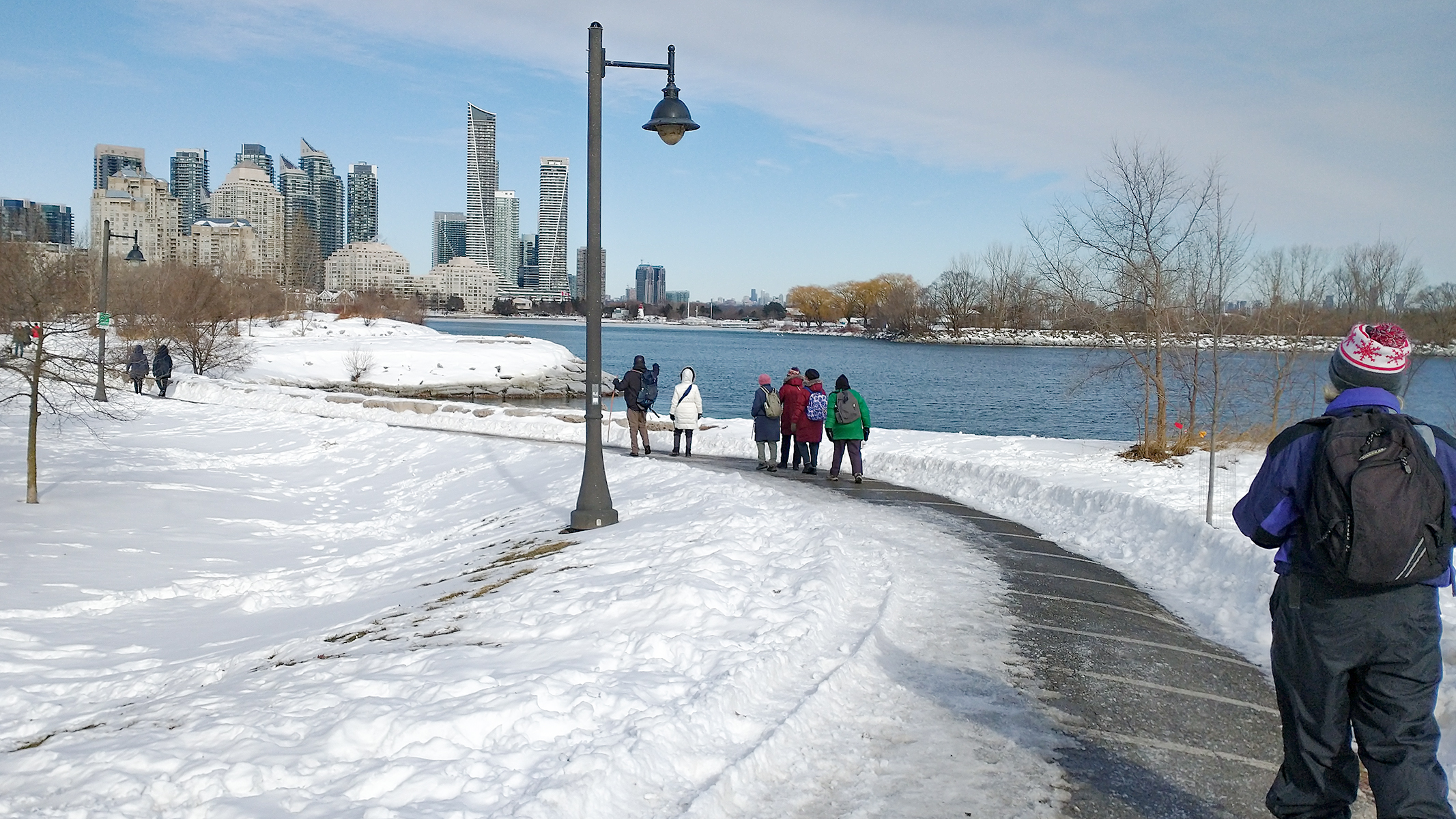
UrbanWalk: Waterfront Trail 3/8 - Long Branch
https://hikes.brucetrail.org/event/urbanwalk-waterfront-trail-3-8-long-branch/Sorry, the registration cut-off time for this hike has been reached.Not a member? Click here to join today!Hosting Club: Toronto
Location (Google Maps): Etobicoke Waterfront Trail
Hike Leader(s): Brian Rideout Click here to contact Hike Leader(s)
Pace: Moderate
Terrain: Flat
Distance: 9 kmDescription
Please join me at Kipling Station by 9:15 am. We will take the 123 bus departing 9:30 am, arriving 9:53 am. If you want to meet us at the Long Branch loop, be there by 9:53 am. We start hiking at 10:00 am.We will hike to the lake and then east to Parklawn. There we can catch a bus to Old Mill Station or take the Lakeshore bus / streetcar. The estimated distance is 9 km. Here is an online map of our route – Long Branch to Parklawn
Bring a snack, at least 2 liters of water, and icers. Dress for cold weather.

Sunday Rambles - Beamer Falls
https://hikes.brucetrail.org/event/sunday-rambles-beamer-falls/Sorry, the registration cut-off time for this hike has been reached.Not a member? Click here to join today!Hike open to BTC Members only.
Hosting Club: Iroquoia
Category: General Hike
Location (Google Maps): Meet at Grimsby Lions Pool (1 Elm St) to hike Beamer Memorial Conservation AreaHike Leader(s): Colleen Mabalay, Carol Swanson Click here to contact Hike Leader(s)
Pace: Medium – 3 to 4 km/hr
Terrain: Moderate – Some hills and/or some poor footing
Distance: Approx 6kmDescription
Beamer Memorial Conservation Area offers one of Niagara’s most breath-taking and panoramic views of the Niagara Escarpment and Lake Ontario. Hike up the escarpment to the falls, walk along the scenic lookout and Bruce Trails and soak up the picturesque views of the 40 Mile Creek Valley, the Lake Ontario shoreline and the escarpment ridge from one of the viewing platforms. Bring water and snack. Poles and/icers may be needed depending on weather and trail conditions. - 30January 30, 2023
Bass Lake and Ross McLean Side Trail
https://hikes.brucetrail.org/event/bass-lake-and-ross-mclean-side-trail/Sorry, the registration cut-off time for this hike has been reached.Not a member? Click here to join today!Hosting Club: Sydenham
Category: Snowshoe Hike
Location (Google Maps): The Galaxy Theatre parking lot. Meet in the parking lot at the tall “Galaxy Centre” sign next to the traffic lights.
1020 10th St. W., Owen SoundHike Leader(s): Maureen McFarland Click here to contact Hike Leader(s)
Pace: Medium: 3 to 4 km/h
Terrain: Moderate: Some hills and/or poor footing, There might be icy and slippery sections.
Distance: 7.5 kmsDescription
We’ll take the long way to Bass Lake on this hike. Starting at the Dawson Road Side Trail, we head north to the Ross McLean Side Trail, follow it to the main trail, then hike south to return. Map 34. Hiking poles are helpful.Please contact the leader if you wish to meet at the start of the hike at 647-918-4180.
- 31January 31, 2023
9:00 Long Hike Wiley Road Short Hills
https://hikes.brucetrail.org/event/900-long-hike-wiley-road-short-hills-10/Sorry, the registration cut-off time for this hike has been reached.Not a member? Click here to join today!Hosting Club: Niagara
Location (Google Maps):
Short Hills Wiley Road Entrance
Pace: Medium
Terrain: Moderate
: 10kmDescription
Explore Short Hills and the majestic side trails of Scarlett Tanager, Hemlock. Swayze Falls and Terrace. Register for each hike
Bring Poles water, snack and dress for the weather
9:15 Short hike, Rotary Park, St. Catharines
https://hikes.brucetrail.org/event/915-short-hike-pelham-road-short-hills-36/Sorry, the registration cut-off time for this hike has been reached.Not a member? Click here to join today!Hosting Club: Niagara
Location (Google Maps): Rotary Park, St. Catharines
Hike Leader(s): janet davey Click here to contact Hike Leader(s)
Pace: Medium
Terrain: Moderate
Distance: 6 kilometresDescription
Hike the trails in Rotary Park. Bring hiking boots, icers and water.Sligo, Beaver, Epping snowshoe hike (shuttle hike)
https://hikes.brucetrail.org/event/sligo-beaver-epping-snowshoe-hike-shuttle-hike/Sorry, the registration cut-off time for this hike has been reached.Not a member? Click here to join today!Hosting Club: Beaver Valley
Location (Google Maps): Meet at John Muir Lookout parking lot on Grey Rd 7, near km 96.9. From here we will shuttle to start at Sideroad13A (km89.5)
Map 27, Edition 30Hike Leader(s): Kristina Rettie Click here to contact the hike leader.
Pace: Brisk
Terrain: Moderate
Length of Hike: 10kmDescription
This Linear hike will include 3 side trails. Sligo Side Trail, Beaver Pond Lookout Side Trail and ending with the Epping Lookout Side Trail that will lead us to the John Muir Lookout area.This hike will require snowshoes as we go through fields and the snow can be thigh high making for a strenuous hike. Don’t let the flat terrain fool you.
Bring a snack and water!
Please no dogs
Text Kristina @ 519-410-9077 for morning of cancellations.
COVID-19 Precautions Before, During and After your Hike
- Each hiker joining a Bruce Trail Club organized hike must perform a self-screening check before hiking.
Find Ontario’s self-assessment tool here: https://covid-19.ontario.ca/self-assessment/ - If you are experiencing COVID-19 symptoms, stay home.
- Personal Protective Equipment:
- Hikers may choose to wear masks
Transportation
It is the Bruce Trail Conservancy’s current policy that car shuttles are allowed. It is at the discrepancy of individual hike leaders to make that decision.
Other Guidelines
- Arrive 15 minutes before the start of the hike.
- Wear sturdy footwear and appropriate attire for the weather and the terrain.
Hiking poles are a good idea in any season, especially if the terrain is rocky or slippery. In winter, snowshoes or icers/crampons are needed when conditions dictate.
Wearing appropriate clothing and footwear prevents injuries and shows consideration for a safe and positive group hiking experience. - Always carry I.D. and your health card.
- Bring sufficient water and snacks (or lunch if indicated). A minimum of 1L of water is recommended on all hikes, and 3L is recommended for long, challenging hikes in the heat of the summer.
- Bring sunscreen and insect repellent (for spring and summer hikes).
- Bring your own first aid kit.
- Please leave dogs at home.
Exploring Lowville Park, River and Ruin Side Trail and Maple Cross Nature Reserve. An option to explore Walt Rickli interactive, sculpture garden.
https://hikes.brucetrail.org/event/exploring-lowville-park-river-and-ruin-side-trail-and-maple-cross-nature-reserve-an-option-to-explore-walt-rickli-interactive-sculpture-garden/Sorry, the registration cut-off time for this hike has been reached.Not a member? Click here to join today!Hosting Club: Iroquoia, Caledon Hills, Dufferin Hi-Land
Category: Tuesday Hikers
Location (Google Maps): Iroquoia, Map 10 – Mount Nemo
Meet in Lowville Park, 6207 Lowville Park Rd. Burlington. Meet in the parking lot. NOTE: The parking lot is gated, but there is no charge to park here. Just drive up to the gate and the arm will rise automatically.Hike Leader(s): Doris Harper Click here to contact Hike Leader(s)
Pace: Medium – 3 to 4 km/hour
Terrain: Moderate – some hills and/or some poor footing
Distance: 12 kmDescription
We will hike the trails through Lowville Park, then cross Guelph Line to access the River and Ruin Side Trail and Maple Cross Nature Reserve. The trail connects to the main trail; so we will also hike the main trail there and back between No. 8 Sideroad and Britannia Rd. At the end of the hike, there is the option to take about 1/2 hour and wander through the sculpture garden.Bring, water and snacks, Poles, icers and gators recommended.
**Please check email before leaving home. Hike may be cancelled if unfavourable weather conditions occur**
Doris Harper
harpt7c@gmail.com
cell # 519-589-4114
Glen Haffy Conservation Area
https://hikes.brucetrail.org/event/glen-haffy-conservation-area-3/Sorry, the registration cut-off time for this hike has been reached.Not a member? Click here to join today!Hosting Club: Dufferin Hi-Land
Category: Tuesday Hike
Location (Google Maps): Caledon Hills Section, Map 17. Meet at roadside parking on Coolihans Sideroad at Glen Haffy Rd (Km 35.2).Hike Leader(s): Les Babbage, Inge Eckerich, Julie Daley, Tony Evangelista Click here to contact Hike Leader(s)
Pace: Leisurely
Terrain: Moderate, Slippery and Steep Sections
Distance: 6.1 km; Shorter hike: 4 kmDescription
We will hike north through Glen Haffy Conservation Area on the Main Trail, returning by way of several Park trails. The shorter hike will take a shorter loop back on Park trails. Bring water and snacks. Snowshoes and/or icers may be required.
Frosty Five Winter Blues Badge Series 3/5 Weekday
https://hikes.brucetrail.org/event/frosty-five-winter-blues-badge-series-3-5-weekday/Sorry, the registration cut-off time for this hike has been reached.Not a member? Click here to join today!Hosting Club: Caledon Hills
Category: Tuesday Hikers
Location (Google Maps): Meet at the BTC parking lot on the east side of 5th Line EHS, just south of Hockley Road. 43.993572, -80.014057 (Map 18, Edition 30)Directions: From ON-10 turn east onto Hockley Rd/Dufferin County Rd 7. Drive for 9.4 kilometres. Turn south/right onto 5 Line E. Drive for 100 metres.
Hike Leader(s): Sandy Green Click here to contact Hike Leader(s)
Pace: Medium – 3 to 4 km/hour
Terrain: Strenuous – hilly with steep climbs and some poor footing
Distance: 9.5 kilometresDescription
Beat the winter blues! Register individually for one, a few, or all of our Frosty Five Winter Blues Weekday Badge hikes. Participants who complete all five hikes will be eligible to receive a CHBTC Winter badge and a Sideways badge on the final hike. Hike three explores parts of the main Trail and Hemlock Ridge, Griffith Ravine and Glacier Valley Side Trails in the south Hockley Valley area. Bring your choice of hydration and snacks. Hiking boots and icers/crampons are required. See January 3, January 17, February 14, and February 28 for details pertaining to the other hikes in the series. (Note: If you wish to purchase badges, the cost of each badge is $10.00 for BTC members and $15.00 for non-members.)
- Each hiker joining a Bruce Trail Club organized hike must perform a self-screening check before hiking.
- 01February 1, 2023

Niagara Winter End to End #5 Decew House to Woodend Conservation Area
https://hikes.brucetrail.org/event/niagara-winter-end-to-end-5-decew-house-to-woodend-conservation-area/Sorry, the registration cut-off time for this hike has been reached.Not a member? Click here to join today!Hosting Club: Niagara
Category: Car Pool
Location (Google Maps): Meet at Woodend Conservation Area and Carpool to Decew HouseHike Leader(s): Sam Rutherford Click here to contact Hike Leader(s)
Pace: Medium
Terrain: Moderate
Distance: 14.5 kmsDescription
We will be car pooling, Bring Icers and poles. No dogs. To earn your Niagara Winter End to End badge, it must be completed between December 21, 2022 to March 21, 2023.
Because of the potential for bad winter trail conditions we have broken this e2e into 6 hikes rather than 5Caledon Hills E2E and winter badge 1/4
https://hikes.brucetrail.org/event/caledon-hills-e2e-and-winter-badge-1-4/Sorry, the registration cut-off time for this hike has been reached.Not a member? Click here to join today!Hike open to BTC Members only.
This is a Multi-Day Hike
You are signing up for the following dates and times:
2023-02-01 at 08:30Hosting Club: Toronto
Category: Car Hike
Location (Google Maps): Km 16.1. Coordinates N 43.831244,W 79.980588Hike Leader(s): Smadar Junkin Click here to contact Hike Leader(s)
Pace: Brisk
Terrain: Hilly, Variable
Distance: 16.1kmDescription
We will shuttle to km 0.0 and hike to km 16.1. We will enjoy the area of the Forks of the Credit and the Devil Pulpit. This hike can qualify for the winter badge as well as we will allow time for that badge.
must have snowshoes and icers. Bring 2 litres of water. We will follow all Covid 19 rules.
check before the hike in case the hike date is changes due to bad weather.Franks Lime Kiln, Singhampton Caves
https://hikes.brucetrail.org/event/franks-lime-kiln-singhampton-caves-2/Sorry, the registration cut-off time for this hike has been reached.Not a member? Click here to join today!Hosting Club: Blue Mountains
Category: Register on-line or sign-in morning of hike
Location (Google Maps): Hike meets in the parking lot behind Tim Hortons on First St. in Collingwood.Hike Leader(s): Kelly-Leigh Thomas Click here to contact Hike Leader(s)
Pace: Brisk – 4 to 5 km/hr, Medium – 3 to 4 km/hr
Terrain: Moderate – Some hills and/or some poor footing, Strenuous – Hilly with steep climbs and some poor footing
Distance: 12kmDescription
Please be prepared with icers’s or snowshoes.An enjoyable snowshoe along the white blazed trail through the upper escarpment, descending to the Standing Rock Side Trail where the trail becomes more challenging and quite the climb. An enjoyable view of Standing Rock in all its magnificence, then up and over icy rock faces and through icy cracks and crevices! Once at the top continue on to close the loop. Take the Franks Kiln Side Trail just before you reach the end of the loop to view a restored lime kiln that was originally built circa 1860. Bring a snack or lunch and water.Hamilton Bayfront to Princess Point
https://hikes.brucetrail.org/event/hamilton-bayfront-to-princess-point/Sorry, the registration cut-off time for this hike has been reached.Not a member? Click here to join today!Hosting Club: Iroquoia
Category: Good Companions
Location (Google Maps): 200 Harbour Front Dr Hamilton Meet by the gazebo. Free parkingHike Leader(s): Gayle Laws Click here to contact Hike Leader(s)
Pace: Medium – 3 to 4 km/hr
Terrain: Easy – Mostly flat and usually good footing
Distance: 8 kmDescription
This enjoyable walk by the Hamilton waterfront is from Bayfront Park parking lot to Princess Point, around a short loop at Princess Point and then back on a paved path. Sometimes we need a little encouragement to get out and enjoy the fresh air in the winter. Dress warmly as there may be winds.Evening Hike in Owen Sound
https://hikes.brucetrail.org/event/evening-hike-in-owen-sound-19/Sorry, the registration cut-off time for this hike has been reached.Not a member? Click here to join today!Hosting Club: Sydenham
Category: An evening walk.
Location (Google Maps): Meet in the municipal parking lot by the river on the west side of 1st Ave. E between 7th St. E and 8th St. E in Owen Sound.Hike Leader(s): Harriet Nixon Click here to contact Hike Leader(s)
Pace: Brisk: 4 to 5 km/h
Terrain: There might be icy and slippery sections.
Distance: Approx 5 kmDescription
This hike WILL leave at 7:00 pm – no need to arrive early. This evening we will explore trails and neighbourhoods in Owen Sound. Please bring icers if conditions are icy. For further information contact Harriet Nixon at 519-373-6598 or harrietnixon@bmts.com - 02February 2, 2023
9:00 am Long Hike Jordan to Moyer / Louth
https://hikes.brucetrail.org/event/900-am-long-hike-jordan-to-moyer-louth-35/Sorry, the registration cut-off time for this hike has been reached.Not a member? Click here to join today!Hosting Club: Niagara
Category: In and Out
Location (Google Maps):Jordan Hollow Park 3039 King St Jordan
Hike Leader(s): Alan Laver Click here to contact Hike Leader(s)
Pace: Medium
Terrain: Moderate
Distance: 10kDescription
From Jordan Hollow Hike the main trail to Upper and Lower Balls Falls, Moyer Road or Louth and Return. You must register for each hike. Bring Poles, snack and a drink ices and dress for the weather
9:15 Short hike, Jordan Hollow
https://hikes.brucetrail.org/event/915-short-hike-jordan-hollow-41/Sorry, the registration cut-off time for this hike has been reached.Not a member? Click here to join today!Hosting Club: Niagara
Location (Google Maps): Jordan Hollow Park Jordan
Hike Leader(s): Bill Russell Click here to contact Hike Leader(s)
Pace: Medium
Terrain: Moderate
Distance: 6 kilometresDescription
Hike the main trail and side trails around Jordan and Balls Falls. Bring hiking boots, icers and water.NEW DATE Boyd's Crevices
https://hikes.brucetrail.org/event/boyds-crevices-4/Sorry, the registration cut-off time for this hike has been reached.Not a member? Click here to join today!Hosting Club: Sydenham
Category: Snowshoe Hike
Location (Google Maps): Parking area at south end of 11th Concession by the rail trail, north of km 86.5 (Map 32)Hike Leader(s): Bill Snel Click here to contact Hike Leader(s)
Pace: Medium: 3 to 4 km/h
Terrain: Strenuous: Hilly with steep climbs and some poor footing., There are crevices or holes which may be hidden by layers of snow. Hike with extreme caution.Description
This will be an in and out hike. We will follow the rail trail to the main trail. We will walk through cedar forests which lead to giant dolostone blocks separated by spectacular crevices. We may need to remove our snowshoes as we explore the area. We will then head back to our vehicles.
Stew Hilt's Side Trail
https://hikes.brucetrail.org/event/stew-hilts-side-trail/Sorry, the registration cut-off time for this hike has been reached.Not a member? Click here to join today!Hosting Club: Beaver Valley
Location (Google Maps): Meet in the BTC parking lot near the end of Johnstons Side Road, km 74.3, Map 26, Edition 30
Hike Leader(s): Margaret Yaraskavitch Click here to contact the hike leader.
Pace: Medium
Terrain: Moderate, Some steep sections
Length of Hike: 5 kmDescription
Enjoy a part of the Beaver Valley that rarely has crowds. We will take the Main Trail to the Stew Hilt’s Side Trail. There is a wonderful view of a (frozen) waterfall. Once we join up with the Main Trail again, we’ll continue for a distance to enjoy cross-the-Valley views. We’ll then return on that section of Main Trail and continue on the Main Trail back to the parking area. Making the hike a loop “with a leg”.Please be prepared to wear snowshoes or icers, depending on the conditions at the time of the hike. Bring water and a snack.
COVID-19 Precautions Before, During and After your Hike
- Each hiker joining a Bruce Trail Club organized hike must perform a self-screening check before hiking.
Find Ontario’s self-assessment tool here: https://covid-19.ontario.ca/self-assessment/ - If you are experiencing COVID-19 symptoms, stay home.
- Personal Protective Equipment:
- Hikers may choose to wear masks
Transportation
It is the Bruce Trail Conservancy’s current policy that car shuttles are allowed. It is at the discrepancy of individual hike leaders to make that decision.
Other Guidelines
- Arrive 15 minutes before the start of the hike.
- Wear sturdy footwear and appropriate attire for the weather and the terrain.
Hiking poles are a good idea in any season, especially if the terrain is rocky or slippery. In winter, snowshoes or icers/crampons are needed when conditions dictate.
Wearing appropriate clothing and footwear prevents injuries and shows consideration for a safe and positive group hiking experience. - Always carry I.D. and your health card.
- Bring sufficient water and snacks (or lunch if indicated). A minimum of 1L of water is recommended on all hikes, and 3L is recommended for long, challenging hikes in the heat of the summer.
- Bring sunscreen and insect repellent (for spring and summer hikes).
- Bring your own first aid kit.
- Please leave dogs at home.
Down to the Hollow
https://hikes.brucetrail.org/event/down-to-the-hollow-2/Sorry, the registration cut-off time for this hike has been reached.Not a member? Click here to join today!Hosting Club: Iroquoia
Category: Thursday Group
Location (Google Maps): City View Park, 2500 Kerns Rd., South Entrance, East Side.Hike Leader(s): Anne Armstrong Click here to contact Hike Leader(s)
Pace: Leisurely – 3km/hr or less
Terrain: Moderate – Some hills and/or some poor footing
Distance: 10 – 11 km. depending on route selectedDescription
Today’s hike will take us from City View Park to Smokey Hollow and back. Depending on conditions we many include the McNally and Norman Pearson Side Trails which include a long climb up Grindstone Creek to Smokey Hollow. Meet at 9:45 am. for a 10:00 am. start in the first parking lot on your right in the most southerly parking lot of City View Park (not the one with the soccer fields and baseball diamond on Kerns Rd.) Bring water, a snack, icers and poles if using. If cancelling after 8:00 am. on the day before the hike please email leaders or text. Leaders: Anne and Phill Armstrong 905 617 3937 hikingrandma@gmail.com - Each hiker joining a Bruce Trail Club organized hike must perform a self-screening check before hiking.
- 03February 3, 2023

9:00 Niagara-on-the-Lake Tour - Black History
https://hikes.brucetrail.org/event/900-niagara-on-the-lake-tour-black-history/Sorry, the registration cut-off time for this hike has been reached.Not a member? Click here to join today!Hosting Club: Niagara
Category: Loop
Location (Google Maps): Park on King St near Centre St, at the entrance to Veteran’s Memorial ParkHike Leader(s): Margaret Northfield Click here to contact Hike Leader(s)
Pace: Medium
Terrain: Easy
Distance: 6-8kmDescription
Black History Hike #1 – An Introduction to Black Slavery in Upper CanadaSince 1995, the government of Canada officially recognized February as Black History Month; a time when Canadians are invited to reflect, educate and engage in the ongoing fight against anti-Black racism and discrimination. This series of four hikes will give us an opportunity to celebrate the strength and perseverance of the early Black community here in Upper Canada.
Wear extra warm clothing as we will be stopping several times. While the terrain is easy, consider bringing your walking sticks and/or footwear with micro spikes. Sidewalks and streets may be icy.

9:30 NOTL BLACK HISTORY SERIES - #1 of 4: An Introduction to Black Slavery in Upper Canada
https://hikes.brucetrail.org/event/930-notl-black-history-series-1-of-4-an-introduction-to-black-slavery-in-upper-canada/Sorry, the registration cut-off time for this hike has been reached.Not a member? Click here to join today!Hosting Club: Niagara
Category: Loop
Location (Google Maps):Veteran’s Memorial Park. Park on Veteran’s Lane, past tennis courts
Hike Leader(s): Karen Couch Click here to contact Hike Leader(s)
Pace: Medium
Terrain: Easy
Distance: 6 kmDescription
Since 1995, the government in Canada officially recognized February as Black History Month; a time when Canadians are invited to reflect, educate and engage in the ongoing fight against anti-Black racism and discrimination. During this and the other hikes in this series, you will learn about some of those who fought enslavement, and how they were pivotal in shaping our society to be as diverse as it is today.Wear extra warm clothing as we will be stopping several times. While the terrain is easy, consider bringing your walking sticks and/or footwear with micro spikes. Sidewalks and streets may be icy.

Orientation to Cross-Country Skiing
https://hikes.brucetrail.org/event/orientation-to-cross-country-skiing/Sorry, the registration cut-off time for this hike has been reached.Not a member? Click here to join today!Hike open to BTC Members only.
Hosting Club: Sydenham, Peninsula
Location (Google Maps): Colpoys Ski Trailhead. The Trailhead is located just north of Colpoys Bay on Bruce County Road 9 (44.785044° -81.124368°). Parking is available here.
Hike Leader(s): Marg Glendon Click here to contact Hike Leader(s)
Terrain: Easy
Description
Join us for an afternoon on the Bruce Trail at Colpoys Bay Ski Trail. Learn, or refresh your cross-country ski skills and techniques from a Bruce Trail Ski Club instructor. Don’t have skis? Consider renting equipment from nearby Suntrail Source for Adventure in Hepworth. PBTC and SBTC members only. FREE! (does not include ski rental) Registration required. Parking is available at the Colpoy’s Ski Trailhead (GPS co-ordinates – 44.783246, -81.124349) just north of the village of Colpoy’s Bay on the east side of County Road 9 – Bruce Trail Map 35. - 04February 4, 2023

Winter Coach Trip: Kawartha Nordic
https://hikes.brucetrail.org/event/winter-coach-trip-kawartha-nordic/Sorry, the registration cut-off time for this hike has been reached.Not a member? Click here to join today!Trip Information
Departure Time: 08:00
Return to City Time: 18:30
Departure Point: York Mills Bus PickupTrip Activities
Snowshoe ($11)
Senior Ski (65+) ($21)
Adult Ski ($23)
Junior Ski (4-17) ($16)
Optional Items
Snowshoe Rental ($12)
Ski Rental ($29)
Junior Ski Rental ($19)Hosting Club: Toronto
Category: Coach Trips
Location (Google Maps): Kawartha NordicHike Leader(s): Martina Furrer, George Lennon, Michael Humpage Click here to contact Hike Leader(s)
Description
Bus departs from 10 York Mills Rd at 8 AM. Please arrive 15 minutes before departure. The bus waits for no one.Join us for a fantastic day of cross-country skiing and snowshoeing at Kawartha Nordic on the beautiful Canadian Shield. Bring some seeds and feed the chickadees. Snowshoers: Join George and Michael for a fun-filled guided snowshoe hike, or team up with some friends and explore the trails at your own pace. Skiers: Explore the forest on 46 km of trails groomed for classic and skate skiing. Keep your eyes peeled for deer. Classic ski and skate ski rentals available. Limited snowshoe rentals available so best to bring your own. If renting equipment, complete the rental form and bring it with you to the rental shop.
Coach fares must be paid online when you register. Trail fees will be collected in cash on the bus (please bring exact change; quarters, dimes and nickels will not be accepted). Masks are mandatory while on the bus.
Car Hike: Boyd Conservation Park, Vaughan
https://hikes.brucetrail.org/event/car-hike-boyd-conservation-park-vaughan/Sorry, the registration cut-off time for this hike has been reached.Not a member? Click here to join today!Hosting Club: Toronto
Category: Car Hike
Location (Google Maps): Parking lot before the main gate of Boyd conservation park Islington Avenue,Hike Leader(s): Mohammad Aghamiri
Pace: Moderate
Terrain: VariableDescription
Explore the trails that wind through the beautiful valley at Boyd Conservation Area and the William Grainger Greenway. We will have lunch/snack in shelter with seated area,It is winter time all participants are required to have Ice cleats with them, have proper shoes, warm clothing and hot drinks with you.
Please carefully read safety procedures during the hike:
1-Hikers must stay between the leader and the sweep.
2-Hikers must advise the leader or the sweep if they wish to leave the group.
3- Hikers must follow the whistle instructions: 1 blast- stay where you are; 2 blasts come to the leader; 3 blasts – come to the leader quickly.
4-Hike leader may request volunteers to stop at trail intersections, they need to help hikers to the direction the group walk and wait till they see the sweep .
5-Hikers have to make sure they can see the persons behind and in front of them.

8:30 Niagara Winter End to End #3 Glen Road to Roland Road
https://hikes.brucetrail.org/event/830-niagara-winter-end-to-end-3-glen-road-to-roland-road/Sorry, the registration cut-off time for this hike has been reached.Not a member? Click here to join today!Hosting Club: Niagara
Category: Car Pool
Location (Google Maps): Short Hills Parking Lot at Roland Road. Car Pool to Glen RoadHike Leader(s): Alan Laver Click here to contact Hike Leader(s)
Pace: Medium
Terrain: Moderate
Distance: 13Description
We will be car pooling, Bring Icers and poles. No dogs. To earn your Niagara Winter End to End badge, it must be completed between December 21, 2022 to March 21, 2023.
Because of the potential for bad winter trail conditions we have broken this e2e into 6 hikes rather than 5
Frosty Five Winter Blues Badge Series 3/5 Weekend
https://hikes.brucetrail.org/event/frosty-five-winter-blues-badge-series-3-5-weekend/Sorry, the registration cut-off time for this hike has been reached.Not a member? Click here to join today!Hosting Club: Caledon Hills
Category: General
Location (Google Maps): Meet at the BTC parking lot on the east side of 5th Line EHS, just south of Hockley Road. 43.993572, -80.014057 (Map 18, Edition 30)Directions: From ON-10 turn east onto Hockley Rd/Dufferin County Rd 7. Drive for 9.4 kilometres. Turn south/right onto 5 Line E. Drive for 100 metres.
Hike Leader(s): Sandy Green Click here to contact Hike Leader(s)
Pace: Medium – 3 to 4 km/hour
Terrain: Strenuous – hilly with steep climbs and some poor footing
Distance: 9.5 kilometresDescription
Beat the winter blues! Register individually for one, a few, or all of our Frosty Five Winter Blues Weekend Badge hikes. Participants who complete all five hikes will be eligible to receive a CHBTC Winter badge and a Sideways badge on the final hike. Hike three explores parts of the main Trail and Hemlock Ridge, Griffith Ravine and Glacier Valley Side Trails in the south Hockley Valley area. Bring your choice of hydration and snacks. Hiking boots and icers/crampons are required. See January 7, January 21, February 18, and March 4 for details pertaining to the other hikes in the series. (Note: If you wish to purchase badges, the cost of each badge is $10.00 for BTC members and $15.00 for non-members.)

9:00 Woodend Wanderings
https://hikes.brucetrail.org/event/900-woodend-wanderings/Sorry, the registration cut-off time for this hike has been reached.Not a member? Click here to join today!Hosting Club: Niagara
Category: Loop
Location (Google Maps): Park at the entrance to Woodend Conservations Area, Taylor Road, Niagara-on-the-LakeHike Leader(s): Margaret Northfield Click here to contact Hike Leader(s)
Pace: Medium
Terrain: Moderate
Distance: 8kmDescription
We will weave our way through Woodend bathing in the forest, ridge and wetlands. Poles and icers are recommended. Bring a snack and drink.Pine River
https://hikes.brucetrail.org/event/eugenia-falls-3/Sorry, the registration cut-off time for this hike has been reached.Not a member? Click here to join today!Hosting Club: Blue Mountains
Category: Cancelled
Location (Google Maps): Hike meets in the parking lot behind Tim Hortons on First St. in Collingwood.Hike Leader(s): Michelle Wacker Click here to contact Hike Leader(s)
Pace: Medium – 3 to 4 km/hr
Terrain: Moderate – Some hills and/or some poor footing
Distance: 7kmDescription
Due to lack of registration there will be no morning sign-in. This hike has been cancelled.Please be prepared with icers’s or snowshoes.We will drive to Kilgorie in the Dufferin Hi-Land section and park the cars at km 34.9 on Centre Road. From here, we will hike a figure 8 loop utilizing the white blazed trail, the new Pine River Valley Side Trail, and the Kilgorie Side Trail. This hike boasts a wonderful view from the Bell Tower Side Trail, ruins of an old powerhouse, the stunning Pine River, lake views, ponds, and more! The ruins of the old powerhouse along the Pine River are almost all
that remain of the Dufferin Light and Power Company. Nearby is the old flume that brought water from a dam which, when constructed in 1909, was the largest of its kind in Ontario. The plant provided power until 1923. Bring a snack or lunch and water.
Map: 20 Edition 30Meditation Hike - Hungry Hollow
https://hikes.brucetrail.org/event/meditation-hike-hungry-hollow/Sorry, the registration cut-off time for this hike has been reached.Not a member? Click here to join today!Hosting Club: Iroquoia
Category: General Hike
Location (Google Maps): Trail begins on Miller Drive, Georgetown. Closest address is 124 Miller Drive. Plenty of parking on the road.Hike Leader(s): Anita Bergsma Click here to contact Hike Leader(s)
Pace: Medium – 3 to 4 km/hr
Terrain: Easy – Mostly flat and usually good footing
Distance: 5 kmDescription
Join me for a Guided Meditation Hike through Hungry Hollow Georgetown. It will be 5km at a slow to moderate pace on well groomed trails. The trails wind through the Hungry Hollow Ravine along Silver Creek. The trail is nestled in Georgetown and known for its beautiful nature, marshes, meadows, and ponds, with boardwalks, and bridges.Meet at 9:45am Sharp to get ready and hike in at 10:00am.Duration: 2 hoursAlso a great hike for those that would like to start hiking and looking for an introduction to how to hike.Please bring your phone with a full battery and earbuds to listen to the meditation. Download Spotify. The meditation will be for 1/2 hour with plenty of time to meet and chat with the other hikers for the duration of our hike together.Please wear hiking boots, icers, backpack with water and snacks. Hiking poles are great for balance but optional..
Urban Walk: Waterfront Trail 5/8 - Bathurst
https://hikes.brucetrail.org/event/urban-walk-waterfront-trail-5-8-bathurst/Sorry, the registration cut-off time for this hike has been reached.Not a member? Click here to join today!Hosting Club: Toronto
Category: Urban Walk
Location (Google Maps): Toronto Waterfront TrailHike Leader(s): Brian Rideout Click here to contact Hike Leader(s)
Pace: Moderate
Terrain: Flat
Distance: 9.4 kmDescription
Please join me at Bathurst Station no later than 9:00 am. We will take the streetcar southbound departing 9:38 am, arriving at Adelaide St 9:54 am. If you want to meet us at Bathurst and Adelaide, be there by 9:54 am. We start hiking at 10:00 am.We will hike to the lake and east to Leslie St. The estimated distance is 9.4 km. Here is an online map of our route Bathurst to LeslieBring a snack, at least 2 liters of water, and icers. Dress for cold weather.Urban Walk: Sherwood Park/Sunnybrook Park
https://hikes.brucetrail.org/event/urban-walk-sherwood-park-sunnybrook-park/Sorry, the registration cut-off time for this hike has been reached.Not a member? Click here to join today!Hosting Club: Toronto
Category: Urban Walk
Location (Google Maps): NE Corner Yonge & Lawrence (by subway exit)Hike Leader(s): Tom Swales
Pace: Moderate
Terrain: Variable
Distance: 12 KMDescription
Join us for a hike through ravines from Yonge & Lawrence to Sunnybrook & Serena Gundy parks to end at Brentcliffe & Eglinton. Those who wish may continue to a refreshment stop at Cork’s Beer & Wine Bar in the Longo’s grocery store on Laird Ave. All are welcome but proper ice traction footwear (icers) is mandatory for safety reasons.
Snowshoe Adventure Badge #1 of 2
https://hikes.brucetrail.org/event/snowshoe-adventure-badge-1-of-2-2/Sorry, the registration cut-off time for this hike has been reached.Not a member? Click here to join today!Hosting Club: Beaver Valley
Location (Google Maps): Meet on the south shoulder at the end of North St. in Eugenia. (North Street is just north of the Top O’ The Rock store) Turn to park cars facing east. km 58.3, Map 26, Edition 30
Hike Leader(s): Glenda Collings Click here to contact the hike leader.
Pace: Medium
Terrain: Moderate, Some steep sections
Length of Hike: Approx. 6 kmDescription
This is the first hike of two to earn the Snowshoe Adventure badge. The hike will proceed without snowshoes if they’re not needed. Please do bring snowshoes and icers. We’ll be hiking along the escarpment through forest to the Beaver Valley landmark “The Penstocks” and then returning to our cars. Some great views to be had! If the night is clear and the moon is out, headlamps aren’t necessary and the tree shadows on the snow are beautiful.COVID-19 Precautions Before, During and After your Hike
- Each hiker joining a Bruce Trail Club organized hike must perform a self-screening check before hiking.
Find Ontario’s self-assessment tool here: https://covid-19.ontario.ca/self-assessment/ - If you are experiencing COVID-19 symptoms, stay home.
- Personal Protective Equipment:
- Hikers may choose to wear masks
Transportation
It is the Bruce Trail Conservancy’s current policy that car shuttles are allowed. It is at the discrepancy of individual hike leaders to make that decision.
Other Guidelines
- Arrive 15 minutes before the start of the hike.
- Wear sturdy footwear and appropriate attire for the weather and the terrain.
Hiking poles are a good idea in any season, especially if the terrain is rocky or slippery. In winter, snowshoes or icers/crampons are needed when conditions dictate.
Wearing appropriate clothing and footwear prevents injuries and shows consideration for a safe and positive group hiking experience. - Always carry I.D. and your health card.
- Bring sufficient water and snacks (or lunch if indicated). A minimum of 1L of water is recommended on all hikes, and 3L is recommended for long, challenging hikes in the heat of the summer.
- Bring sunscreen and insect repellent (for spring and summer hikes).
- Bring your own first aid kit.
- Please leave dogs at home.
Dufferin Hi-Land Winter Badge Hike # 3 of 4
https://hikes.brucetrail.org/event/dufferin-hi-land-winter-badge-hike-3-of-4-2/Sorry, the registration cut-off time for this hike has been reached.Not a member? Click here to join today!Hosting Club: Dufferin Hi-Land
Category: General Hike
Location (Google Maps): Dufferin Hi-Land, Map 19. Mono Cliffs Provincial Park. Meet at south end of 1st Line EHS, Mono (Km 7.9), south of 25 Sideroad.
Directions ; Coming north on Hwy 10 turn right on 25 Sideroad ( approx. 14 km north of Orangeville ) then right on 1st Line EHS follow to end. NOTE Parking is very limited if you can car pool with someone that would be a great help BE CAREFUL OF THE DITCHES!Hike Leader(s): Bryan and Carol Foley Click here to contact Hike Leader(s)
Pace: Medium
Terrain: Moderate
Distance: 8 kmDescription
Meet 6:15 pm for a 6:30 pm start Be on time no waiting ” IT’S COLD ” We will do a 8 km hike in Mono cliffs Prov. Park. Bring Water, Snack, Headlamp. Snowshoes are essential. Dress for the conditions. - Each hiker joining a Bruce Trail Club organized hike must perform a self-screening check before hiking.