Hike Schedule
Join us for a hike! Registration required:
All hikes available to BTC members. Some hikes are open to non-members.
TIP: The calendar view displays up to 7 hikes on a day, but often there are more. Click “More events” to see them all.
Categories
Hosting Club: Toronto
Category: Car Hike
Location (Google Maps): Greenwood Conservation Area, Ajax, Ontario
Hike Leader(s): Glynn Richardson; Tanya Cora Click here to contact Hike Leader(s)
Pace: Moderate
Terrain: Variable
Distance: 14 km
Description
Happy New Year! Let’s start 2022 with a hike!
Join myself and Tanya on a First Day hike through Greenwood Conservation Area along both the Trans Canada and Greenwood CA trails.
Bring snacks, lunch, water. Hiking boots and trail crampons are mandatory. You might want to consider hiking poles and gaitors as well.
There will be no dropouts and no dogs.
Check the weather and dress accordingly.
All participants are to be fully vaccinated against COVID-19.
Toronto apprentice hike leaders; if this hike is of interest to you, please contact me.

Hosting Club: Iroquoia
Category: New Year’s Day Hike
Location (Google Maps): Grimsby Lions Community Pool Parking lot
1 Elm St Grimsby
Hike Leader(s): Ruth Moffatt Click here to contact Hike Leader(s)
Pace: Medium – 3 to 4 km/hr
Terrain: Easy – Mostly flat and usually good footing, Strenuous – Hilly with steep climbs and some poor footing
Distance: ~7km
Description
Join us for a New Year’s Day hike from the Grimsby pool parking lot up to Beamer’s Conservation Area to Beamer’s Falls along 40 Mile Creek and back down to parking lot.
Distance will be about 7km with the strenuous bit being the climb up the hill. Otherwise the terrain is fairly flat. Beautiful vistas across the lake, and Grimsby and on a clear day you can see the mist of Niagara Falls. Bring your camera. Please wear weather appropriate footwear and icers/crampons for your boots if icy conditions exist.
Learn all about the Bruce Trail on this hike. A draw for one membership will be held at the end of the hike. You must be present to win.
Value $50
This is a Multi-Day Hike
You are signing up for the following dates and times:
2022-01-01 at 09:00
2022-03-19 at
Hosting Club: Toronto
Category: Car Hike
Location (Google Maps): Cherry Beach Down town Toronto
Hike Leader(s): Mohammad Aghamiri
Pace: Brisk, Moderate
Terrain: Flat
Distance: 14-15KM
Description
Park in Cherry Beach parking lot
Covid 19 protocol and procedure is in effect in parking lot and during hike, social distancing is mandatory all the time.
It is winter time all participants are required to have Ice cleats with them, have proper shoes, warm clothing and hot drinks with you.
Some safety procedures during the hike:
1-Hikers must stay between the leader and the sweep.
2-Hikers must advise the leader or the sweep if they wish to leave the group.
3- Hikers must follow the whistle instructions: 1 blast- stay where you are; 2 blasts come to the leader; 3 blasts – come to the leader quickly.
4-Hike leader may request volunteers to stop at trail intersections, they need to help hikers to the direction the group walk and wait till they see the sweep .
5-Hikers have to make sure they can see the persons behind and in front of them.
Hike open to BTC Members only.
Hosting Club: Blue Mountains
Category: Blue Mountain Hike
Location (Google Maps): Hike meets in the parking lot behind Tim Horton’s on First St. in Collingwood.
Hike Leader(s): Rosemary Petrie – (705) 293-4444 Click here to contact Hike Leader(s)
Pace: Leisurely – 3 km/hr. or less
Terrain: Easy – Mostly flat and usually good footing
Distance: 6-8 km
Description
CANCELLED!! Start the year off on the right foot!
This hike starts at the cross country skiers parking lot on County Rd 2.
We will go across the road and onto a traIl marked with BLUE RIBBONS which is for snowshoeing only.
We proceed through woods and some short hills and foot bridges until we enter Mitchell’s Woods.
Then we arrive at the Metcalfe Rock area where we turn around
and retrace our steps to the parking lot.
A very beautiful hike with varied terrain and some great views.
Bring water and a snack.
Hosting Club: Caledon Hills
Category: General
Location (Google Maps): Meet at Winston Churchill Blvd. intersection with Caledon Trailway.
Driving direction: North on Highway 410, continue on Highway 10 north, left on King Street (9), right on Winston Churchill Blvd., drive 1 kilometre to the road side parking on either side of the road.
Hike Leader(s): Mohammad Shafiq Click here to contact Hike Leader(s)
Pace: Medium – 3 to 4 km/hour
Terrain: Moderate – some hills and/or some poor footing
Distance: 13 km
Description
Will hike Terra Cotta Side Trail and the main Bruce Trail, a complete round trip to start new year on a hiking note. We will find an appropriate place to stop for snacks and drink. Shelter will be an option if willing to wait little longer for fuelling. This will be an opportunity to shed some grams of weight you may have added the night before – to be fit for 2022 hikes.
Bring usual stuff, snack, water, poles, icers. Warm drink is good this time of the year.
Physical distancing is to be maintained.
Hosting Club: Iroquoia
Category: New Year’s Day Hike
Location (Google Maps): Dundas Valley Conservation Area, 650 Governor’s Rd., Dundas
Hike Leader(s): Phillip Armstrong Click here to contact Hike Leader(s)
Pace: Medium – 3 to 4 km/hr
Terrain: Dependent on Conditions, Moderate – Some hills and/or some poor footing
Distance: Approx. 8 – 9 km.
Description
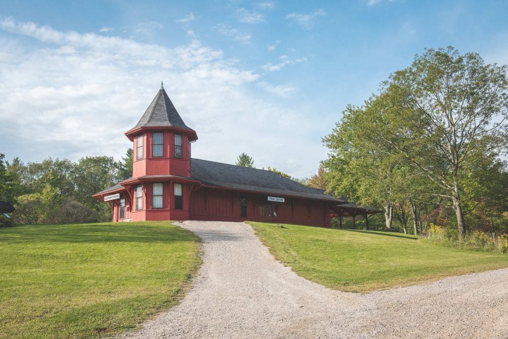
Bring in the New Year with an energetic hike, up and down the hills of the Dundas Valley Conservation Area. Meet at 9:45 am. for a 10:00 am. start at the Trail Centre. We will be heading to Canterbury Falls, stopping at the spring for some “tasty” water, the Hermitage and more interesting spots. We will then return from the falls to the Trail Centre. (Depending on weather and trail conditions we could do a loop hike to Sherman Falls and back.) Conservation Area Pass or parking fee in effect. Bring water, a snack, poles if using and icers.
Leader: Phill Armstrong 416 895 3937 hikingrandpa@gmail.com
Hosting Club: Niagara
Category: Event Hikes
Location (Google Maps):
Meet at Rockway Community Centre, 2021 Pelham Rd., Lincoln.
Hike Leader(s): Alan Laver Click here to contact Hike Leader(s)
Pace: Medium
Terrain: Moderate
Distance: 10km
Description
This Hike follows the trail towards staff avenue picking up the Louth side trail and returning.
Prize for Silliest Hat. Bring finger Food to share after the hike.
Hosting Club: Iroquoia
Category: New Year’s Day Hike
Location (Google Maps): Dundas Valley Conservation Area, 650 Governor’s Rd. Dundas
Hike Leader(s): Anne Armstrong Click here to contact Hike Leader(s)
Pace: Leisurely – 3km/hr or less
Terrain: Dependent on Conditions, Moderate – Some hills and/or some poor footing
Distance: Approx. 6 – 7 km.
Description
Start the new year with a lovely hike in the forests of the Dundas Valley Conservation Area. Meet at the Trail Centre, past the last parking lot and up the hill. (Bathrooms available) The hike begins at 10:30 so try to arrive about 10:15. We will complete the Sawmill Trail loop which goes through some some lovely pine and deciduous forests. Some hills. Bring water, a snack and poles if using. Icers may be necessary. (For the energetic we could complete the Deer Trail loop afterwards.) Conservation Area Pass or parking fee.
Leader: Anne Armstrong 905 617 3937 hikingrandma@gmail.com
Hike open to BTC Members only.
Hosting Club: Toronto
Category: Urban Walk
Location (Google Maps): The Tommy Thompson Park is at the SOUTH end of Leslie st at Unwin ave .
Hike Leader(s): Victor Ramautar, Cel: 416-708-8199; co-leader Fred Berktin Click here to contact Hike Leader(s)
Pace: Moderate
Terrain: Flat, Other (Refer to Description)
Distance: 10-12 kms
Description
It is New Years Day and experience tells me it will perhaps be very cold . It is advisable that all hikers coming on this hike MUST have ICERS. While the route to the lighthouse is flat most of the trail will probably be covered with ice. So, dress for the weather. Bring a lunch and a HOT drink along with water, and any other essential you might need for the day.
Parking is FREE. We meet in the parking lot. So that we can start the hike on time I urge everyone to arrive at least 15 minutes before departure time.
Hosting Club: Niagara
Category: Event Hikes
Location (Google Maps):
Meet at Rockway Community Centre, 2021 Pelham Rd., Lincoln.
Hike Leader(s): Alicia Aitchison Click here to contact Hike Leader(s)
Pace: Medium
Terrain: Moderate
Distance: 6km
Description
This is a hike around Rockway visiting the Falls and Rockway Side Trail
Prize for Silliest Hat. Bring finger Food to share after the hike.
Hosting Club: Iroquoia
Category: New Year’s Day Hike
Location (Google Maps): Dundas Valley Conservation Area
650 Governors Road, Dundas
ON, L9E 5E3
Hike Leader(s): Asia Shin Click here to contact Hike Leader(s)
Pace: Medium – 3 to 4 km/hr
Terrain: Easy – Mostly flat and usually good footing, Slippery Sections Likely
Distance: 3.4 Km
Description
The Main Loop Trail is a journey through a mature deciduous forest hemlock groves, stream valleys, an old apple orchard and open meadow. Points of interest also include the Trail Centre, Hermitage Ruins, Sulphur Spring and Hermitage Cascade.
Depending on weather, icers may needed.
Hosting Club: Beaver Valley
Location (Google Maps): Meet on the shoulder of 21st Sideroad, north side near the unopened road allowance below Loree, just east of km 8.4, Map 24, Edition 30
Hike Leader(s): Margaret Yaraskavitch Click here to contact the hike leader.
Pace: Medium
Terrain: Moderate
Length of Hike: 4 km
Description
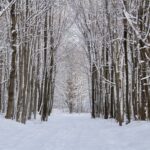
A great snowshoeing route! Fairly flat terrain with some variety. Mature deciduous forest, cedar groves, edge of farmland. If there is very little snow and regular footwear or icers are better to use, we’ll add another km-long loop to our route. Bring a snack and water.
Hosting Club: Iroquoia
Category: New Year’s Day Hike
Location (Google Maps): Dundas Valley Conservation Area and Bruce Trails
Hike Leader(s): Cathie Green Click here to contact Hike Leader(s)
Pace: Medium – 3 to 4 km/hr
Terrain: Moderate – Some hills and/or some poor footing
Distance: Approximately 10kms
Description
This is a 10-12 loop hike on DVCA trails and Bruce Trail – Park at the Dundas Valley Conservation Area Trail Centre-HCA Pass or charges apply per vehicle $11. No reservations required
Meet outside at the entrance to the Trail Centre by the picnic tables by 12 noon-We will hike the Main trail to the Merrick Apple Orchard and follow a few sides trails to Artaban Road
We will then go down the road to Sherman Falls and back along the newly reinstated Bruce Trail Main Trail to Canterbury Falls and back onto the DVCA Main Trail past the Hermitage Ruins to complete this trail and return to the Trail Centre. Please wear weather appropriate clothing and foot ware – Icers recommended as parts of this trail can be icy depending on weather conditions- Pack water/snack/hiking pole/cell phone
Washrooms should be open at Trail Centre-masks required Any questions, concerns -please text or email 416-931-2095 cathiekygreen@gmail.com
Hosting Club: Iroquoia
Category: New Year’s Day Hike
Location (Google Maps): Dundas Valley Conservation Area (start at the Train station)
Hike Leader(s): Allan Meyer Click here to contact Hike Leader(s)
Pace: Medium – 3 to 4 km/hr
Terrain: Moderate – Some hills and/or some poor footing
Distance: Approx 4km
Description
A great way to clear your head and start the New Year. Please join me for a fresh holiday hike. Please wear good footwear, bring icers as the terrain could be slippery. We will do the main loop and maybe a bit more. Please meet outside at the train station.
Hosting Club: Sydenham
Category: General Hike
Location (Google Maps): 294 Park Street, Georgian Bluffs
Hike Leader(s): Robert Knapp Click here to contact Hike Leader(s)
Pace: Medium: 3 to 4 km/h
Terrain: Moderate: Some hills and/or poor footing
Distance: 6 km
Description
Start the year off correctly by enjoying a 6 km snowshoe/hike. If it is stormy, then we will hike closer to the meeting place. Approx. 2.5 hours. Please preregister by December 29th so the Knapps know how many people to expect.
Hike open to BTC Members only.
Hosting Club: Dufferin Hi-Land
Category: Tuesday Hike
Location (Google Maps):
Dufferin Hi-Land, Map 19. Meet at the Mono Community Centre parking lot. Take Mono Centre Road east from Hwy 10 and look for the Community Centre on your right as you approach the stop sign in Mono Centre.
Hike Leader(s): Les Babbage Click here to contact Hike Leader(s)
Pace: Leisurely
Terrain: Dependent on Conditions
Distance: 4.8 or 7.5 km
Description
Our Annual New Years Day hike returns! Join us for a “day after the night before” hike to clear your head with a little exercise, fresh air and great company. Hot beverages and snacks available after the hike. Contributions to the snack table welcome!
Snow shoes or icers may be required, depending on conditions. Contact the hike leader if in doubt.
Hosting Club: Iroquoia
Category: New Year’s Day Hike
Location (Google Maps): Kilbride Park. Parking Lot is in behind Kilbride Public School.
Hike Leader(s): Joe Borges Click here to contact Hike Leader(s)
Pace: Medium – 3 to 4 km/hr
Terrain: Dependent on Conditions, Moderate – Some hills and/or some poor footing, Slippery Sections Likely
Distance: 7.2 km
Description
This is an Iroquoia New Year’s Day Hike starting at 2:00 in the afternoon and taking about 2 hours. 2/2 in 2022:)
It’s an in & out hike where will start & end at Kilbride Park. The parking lot is in behind the school next to the Tennis Courts.
This is a short hike with deceiving elevation changes (the Lowville Valley is steep in spots), there are lots of ups and downs, roots… although not too rocky a section. It’s a very beautiful track including a boardwalk through the marsh and a neat bridge over Bronte Creek. We we then do the River & Ruin Side Trail Loop along Bronte Creek with a stop at the “Ruin” the old Cleaver Farm House. And then we’ll head back to the cars.
Speed of Hike is Moderate at 3-3.5 KM / per hour. (Although stopping for photos is allowed:)
Please ensure you check the weather and are dressed appropriately with layers. Boots are required. Poles are recommended. If weather gets cold and icy, please have crampons (ice cleats) with you. And please bring at least 1L of water, snacks/food.
Hosting Club: Niagara
Category: Hike
Location (Google Maps): Decew House Heritage Park in Thorold/Fonthill
Hike Leader(s): Mark Casburn Click here to contact Hike Leader(s)
Pace: Medium
Terrain: Easy
Distance: 6 km
Description
Be prepared for wet/slippery conditions. Icers are recommended if ground is frozen.
Hosting Club: Iroquoia
Category: General Hike
Location (Google Maps): Hilton Falls Conservation Area Parking Lot
Hike Leader(s): Louise Langlais Click here to contact Hike Leader(s)
Pace: Brisk – 4 to 5 km/hr, Medium – 3 to 4 km/hr
Terrain: Moderate – Some hills and/or some poor footing
Distance: 12-16 km
Description
We will hike the trails in this lovely Conservation Area. Parking fee applies (unless you have a Halton Parks Pass, a great value) and you must reserve two time slots (9-11 and 11-1) in advance.
Hike Leader: Louise Langlais; Email: langlaislouise@gmail.com. Cell: 519-222-4040 on day of hike. At other times, email is the best way to contact me.
Wear appropriate quick-dry clothing and hiking boots. Bring sunscreen, insect repellent (summer), icers (winter), snacks, lunch, a personal first aid kit , and 1-2 litres of water. During COVID, also bring hand sanitizer and a face mask. For personalized driving directions, click on the hike in the BTC hike calendar, then on (Google Maps) to the right of the word Location, and your smart phone should navigate you to the correct location. Please arrive at least 15 minutes early. If you are unable to attend, please email me as long as possible in advance of the hike, or text me if it is <2 hours before the hike. There is often a waiting list, so the more advance notice you give, the better.
Hosting Club: Niagara
Category: Loop
Location (Google Maps):
Short Hills Wiley Road Entrance
Hike Leader(s): Alan Laver Click here to contact Hike Leader(s)
Pace: Medium
Terrain: Moderate
Distance: 12k
Description
Explore Short Hills and the majestic side trails of Scarlett Tanager, Hemlock. Swayze Falls and Terrace. Register for each hike
Bring Poles and Icers and dress for the weather
Hosting Club: Niagara
Category: Loop
Location (Google Maps): Short Hills Provincial Park, Pelham Road entrance
Hike Leader(s): janet davey Click here to contact Hike Leader(s)
Pace: Medium
Terrain: Moderate
Distance: 6 kilometres
Description
Hike the main and side trails in Short Hills. Bring hiking boots, icers & water.

Hosting Club: Caledon Hills
Category: Tuesday Hikers
Location (Google Maps): Roadside parking, km 16.1 along the southwest shoulder of the Willoughby Road and Escarpment Sideroad intersection.
From ON-10 turn west onto Escarpment Sideroad. Drive for 1.6 km.
Hike Leader(s): Sandy Green and Rob Martin Click here to contact Hike Leader(s)
Pace: Medium – 3 to 4 km/hour
Terrain: Strenuous – hilly with steep climbs and some poor footing
Distance: 11 km
Description
Plan to join one, a few, or all of our Frosty Five Weekday hikes. Participants who complete all five hikes will be eligible to receive the CHBTC Winter Badge on the final hike. Hike one explores parts of the main Trail and the Dorothy Medhurst Side Trail in the Forks of the Credit area. Bring your choice of hydration and snacks. Hiking boots and icers/crampons are required. See January 18, February 1, February 15, and March 1 for details pertaining to the other hikes in the series. (Note: If you wish to purchase a badge, the cost is $5.00 for BTC members and $10.00 for non-members.)
Hike open to BTC Members only.
Hosting Club: Dufferin Hi-Land
Category: Tuesday Hike
Location (Google Maps): Dufferin Hi-Land Section, Map 20. Meet at roadside parking on east side of 2nd Line EHS, Mulmur (Km 24.2)
Hike Leader(s): Les Babbage; Inge Eckerich; Bob Slack Click here to contact Hike Leader(s)
Pace: Leisurely
Terrain: Slippery and Steep Sections, Moderate
Distance: Longer hike: 5.8 km; Shorter hike: 3.5 km
Description
We will hike a loop consisting of the Main Trail to the Oliver Creek Side Trail loop. The short hike will cut off on the 2nd Line EHS Side Trail and return to the cars on the road. Bring icers and/or snowshoes.

Hosting Club: Iroquoia
Category: Hikers R Us
Location (Google Maps): 105 Sheffield Street, paved parking lot north east of the trail head (vs the often muddy gravel parking lot adjacent to the trail)
Hike Leader(s): Louise Langlais Click here to contact Hike Leader(s)
Pace: Brisk – 4 to 5 km/hr
Terrain: Easy – Mostly flat and usually good footing
Distance: 14-20 km
Description
We will hike along the pretty Speed River, from Hespeler to Preston and back. We will likely visit a local bakery in Preston to pick up treats to supplement our picnic lunches.
Cell: 519-222-4040, on day of hike. At other times, email is the best way to contact me (use the Contact the Hike Leader feature on the BTC web page). Wear appropriate quick-dry clothing and hiking boots. Bring sunscreen, insect repellent (summer), icers (winter), snacks, lunch, a personal first aid kit , and 1-2 litres of water. During COVID, also bring hand sanitizer and a face mask. Please arrive at least 15 minutes early.
If you are unable to attend, in addition to cancelling on the BTC hikes web page, please email me the day before, or text me if it is <2 hours before the hike. There is often a waiting list, so the more advance notice you give, the better.

Hosting Club: Niagara
Category: Car Pool
Location (Google Maps): Meet in the parking lot of Quarry Rd, Beamsville (Map 4, km 65.0) to carpool
Hike Leader(s): Sam Rutherford Click here to contact Hike Leader(s)
Pace: Medium
Terrain: Moderate
Distance: 14.8km
Description
Winter End-to-End Hikes must be completed between December 21, 2021 to March 19, 2022. Bring $10 for the badge if once you have completed all 5 hikes.
Poles and icers recommended. Bring water and snack.
Hosting Club: Niagara
Category: In and Out
Location (Google Maps):
Kinsman Park parking lot
Hike Leader(s): Karen Limardi Click here to contact Hike Leader(s)
Pace: Medium
Terrain: Moderate
Distance: 6-7 KM
Description
A beautiful hike on the trail. We will pass lovely vineyards, creek beds and farmers fields. There will be a teeny tiny bit of road walking on this hike. Hiking boots and poles highly recommended as the terrain can be extremely slippery if wet or icy. Please bring water, icers and dress in layers.
Hike open to BTC Members only.
Hosting Club: Blue Mountains
Category: Blue Mountain Hike
Location (Google Maps): Hike meets in the parking lot behind Tim Horton’s on First St. in Collingwood.
Hike Leader(s): Flo Kusiak – (705) 443-8075 Click here to contact Hike Leader(s)
Pace: Leisurely – 3 km/hr. or less
Terrain: Moderate – Some hills and/or some poor footing
Distance: 5-6 km
Description
The Leisurely group will begin the hike at the parking area on 12th Concession A at
km 76.8 in the Beaver Valley section.
We will hike south to km 74.3 and retrace our steps heading north to the cars.
Trail crosses two hay fields, enters a mature hardwood forest and
traverses along a slope to emerge into open farmland.
Bring water and a snack.
Map: 26 Edition 30
Hike open to BTC Members only.
Hosting Club: Blue Mountains
Category: Blue Mountain Hike
Location (Google Maps): Hike meets in the parking lot behind Tim Horton’s on First St. in Collingwood.
Hike Leader(s): Terry Kimmerly – (705) 351-2494 Click here to contact Hike Leader(s)
Pace: Medium – 3 to 4 km/hr
Terrain: Moderate – Some hills and/or some poor footing
Distance: 11-12 km
Description
We will begin the hike at the parking area on Johnston’s Sideroad at km 74.3 in the Beaver Valley section.
We will hike south to km 68.3 and retrace our steps heading north to the cars.
Trail climbs a high meadow then east across to Cuckoo Valley and down the Beaver Valley
towards the high eastern edges of the Escarpment.
Bring water and lunch.
Map: 26 Edition 30
Hosting Club: Iroquoia
Category: Good Companions
Location (Google Maps): Shell Park. Lakeshore Road, Oakville
Hike Leader(s): Mary Rose Click here to contact Hike Leader(s)
Pace: Medium – 3 to 4 km/hr
Terrain: Easy – Mostly flat and usually good footing
Distance: 8K
Description
We will walk west beside the lake and then double back to the park before going east to Bronte Harbour. We will walk along the lake and through the neighbourhoods, until we finally mosey back to the cars. Please remember to bring icers
Hosting Club: Niagara
Category: In and Out
Location (Google Maps):
Jordan Hollow Park 3039 King St Jordan
Hike Leader(s): Alan Laver Click here to contact Hike Leader(s)
Pace: Medium
Terrain: Moderate
Distance: 12k
Description
From Jordan Hollow Hike the main trail to Moyer Road or Louth and Return. You must register for each hike. Bring Poles and Icers
Hosting Club: Niagara
Category: Loop
Location (Google Maps): Jordan Hollow Park
Hike Leader(s): Bill Russell Click here to contact Hike Leader(s)
Pace: Medium
Terrain: Strenuous
Description
Hike along the Jordan Creek to Upper Balls Falls or the Jim Rainforth Trail. Bring hiking boots, icers and water.
Hike open to BTC Members only.
Hosting Club: Iroquoia
Category: Thursday Group
Location (Google Maps): City View Park, Burlington.
Make sure you come in the South entrance to the park not the North Entrance.
Hike Leader(s): Phillip Armstrong Click here to contact Hike Leader(s)
Pace: Medium – 3 to 4 km/hr
Terrain: Easy – Mostly flat and usually good footing
Distance: 8km
Description
We will hike the main trail to Fisher’s Pond and return. We hike around the pond, stop for a snack before coming back.
There is an optional return on the Ian Reid side trail adding about 1km of hilly scenic trail below the escarpment.
Hosting Club: Niagara
Category: Urban
Location (Google Maps): Veterans Memorial Park, park just outside the park on King Street
Hike Leader(s): Robin Garrett Click here to contact Hike Leader(s)
Pace: Medium
Terrain: Easy
Distance: 6-7 km
Description
Each Friday we will explore different neighbourhoods, trails and parkland throughout Historic Niagara-on-the-Lake.
Moderate pace with some weeks entirely on sidewalks and roads while others may include a mix of trails and paved pathways. Great way to build up endurance for longer more strenuous hikes.
Prepare for cooler windy conditions on open parkland and along Lake Ontario and Niagara River trails.
Plan to stay for conversation and a warm cup of coffee or tea at Sweets & Swirls, Community Centre, Niagara Stone Road, NOTL
Hosting Club: Beaver Valley
Location (Google Maps): Meet on the north shoulder of Sideroad 16C, access from 7th Line. Do not use the access from Grey Road 7 as it is no through access from that end. Km 91.9 Map 27 Edition 30
Hike Leader(s): Glenda Collings Click here to contact the hike leader.
Pace: Medium
Terrain: Moderate, Some steep sections
Length of Hike: Approx. 8 km depending on conditions
Description
This is an in and out snowshoe hike which may be shortened if we encounter deep snow. The hike will proceed as a “boot” hike if snowshoes aren’t needed. Please do bring snowshoes and icers. We’ll be travelling along the top of the escarpment with some good views across the valley.
COVID-19 Precautions Before, During and After your Hike
- Each hiker joining a Bruce Trail Club organized hike must perform a self-screening check before hiking.
Find Ontario’s self-assessment tool here: https://covid-19.ontario.ca/self-assessment/ - If you are experiencing COVID-19 symptoms, stay home.
- Personal Protective Equipment:
- Hikers may choose to wear masks
- Hikers may carry and use hand sanitizer, but should not be sharing it with the group
- Hikers who experience COVID-19 symptoms following a Bruce Trail Club organized hike must inform their local public health unit.
Find your local health unit at http://www.health.gov.on.ca/en/common/system/services/phu/locations.aspx
Transportation
All hikers are responsible for their own transportation to and from the hike.
Currently, there are no car shuttles on hikes – all hikes must be out-and-back or loop hikes.
Other Guidelines
- Arrive 15 minutes before the start of the hike.
- Wear sturdy footwear and appropriate attire for the weather and the terrain.
Hiking poles are a good idea in any season, especially if the terrain is rocky or slippery. In winter, snowshoes or icers/crampons are needed when conditions dictate.
Wearing appropriate clothing and footwear prevents injuries and shows consideration for a safe and positive group hiking experience. - Always carry I.D. and your health card.
- Bring sufficient water and snacks (or lunch if indicated). A minimum of 1L of water is recommended on all hikes, and 3L is recommended for long, challenging hikes in the heat of the summer.
- Bring sunscreen and insect repellent (for spring and summer hikes).
- Bring your own first aid kit.
- Please leave dogs at home.
Hike open to BTC Members only.
Hosting Club: Blue Mountains
Category: Blue Mountain Hike
Location (Google Maps): Hike meets in the parking lot behind Tim Horton’s on First St. in Collingwood.
Hike Leader(s): Kelly-Leigh Thomas (519) 501-8170 Click here to contact Hike Leader(s)
Pace: Medium – 3 to 4 km/hr
Terrain: Moderate – Some hills and/or some poor footing, Strenuous – Hilly with steep climbs and some poor footing
Distance: 7 km
Description
We will park on 4th Line in the Caledon Hills section, begin at km 55.1 and hike to the Hockley Valley Resort service road.
For the next 1.1km the Trail will traverse the Resort’s ski facilities.
A long descent occurs after the maintenance sheds.
The length is determined by snow and group ability.
Can be 5km before retracing steps, but easily shortened if required.
Bring water and lunch.
Map: 18 Edition 30

Hosting Club: Caledon Hills
Category: General
Location (Google Maps): Roadside parking, km 16.1 along the southwest shoulder of the Willoughby Road and Escarpment Sideroad intersection.
From ON-10 turn west onto Escarpment Side Road. Drive for 1.6 kilometres.
Hike Leader(s): Sandy Green and Rebecca Petre Click here to contact Hike Leader(s)
Pace: Medium – 3 to 4 km/hour
Terrain: Strenuous – hilly with steep climbs and some poor footing
Distance: 16.5 km
Description
Plan to join one, a few, or all of our Frosty Five hikes. Participants who complete all five hikes will be eligible to receive the CHBTC Winter Badge on the final hike. Hike one explores parts of the main Trail, the Forks of the Credit Provincial Park Meadow Trail and the Millpond, Cataract, and Dorothy Medhurst Side Trails in the Forks of the Credit area. Bring your choice of hydration and snacks. Hiking boots and icers/crampons are required. See January 22, February 5, February 19, and March 5 for details pertaining to the other hikes in the series. (Note: If you wish to purchase a badge, the cost is $5.00 for BTC members and $10.00 for non-members.)
Hike Update – In response to the newest Provincial restrictions limiting outdoor gatherings to 10 people, this hike will be modified. The group will be divided into two. As there are two hike leaders, a small group of first arrivals will hike with one hike leader. Shortly after, the remaining hikers will follow, lead by the second hike leader.
Hosting Club: Toronto
Location (Google Maps): Boyd Conservation Park
Hike Leader(s): Mohammad Aghamiri Click here to contact Hike Leader(s)
Pace: Fast, Moderate
Terrain: Variable
Description
There is A free parking lot before the gate of the park.
It is winter time all participants are required to have Ice cleats with them, have proper shoes, warm clothing and hot drinks with you.
Some safety procedures during the hike:
1-Hikers must stay between the leader and the sweep.
2-Hikers must advise the leader or the sweep if they wish to leave the group.
3-Hikers must leave their backpack on the trail facing in the direction the group is walking if leaving the trail for a call of nature. The sweep will wait for the hiker to return to the trail.
4- Hikers must follow the whistle instructions: 1 blast- stay where you are; 2 blasts come to the leader; 3 blasts – come to the leader quickly.
5-Hike leader may request volunteers to stop at trail intersections, they need to help hikers to the direction the group walk and wait till they see the sweep .
6-Hikers have to make sure they can see the persons behind and in front of them.
Hosting Club: Toronto
Category: Cancelled
Location (Google Maps): Highlands Nordic
Hike Leader(s): Martina Furrer, Wayne Crockett, Janet Patterson Click here to contact Hike Leader(s)
Description
THIS TRIP IS CANCELLED.
Welcome winter and join us for our first cross-country ski and snowshoe trip of 2022! For trail conditions and information about the resort visit https://highlandsnordic.ca/.
Snowshoers: Join Wayne and Janet for a guided snowshoe hike on the beautiful Bruce Trail. You must have your own snowshoes (or rent in the city) to participate in this hike. Pack lunch and water; you will be on the trail all day.
Skiers: Spend your day gliding through forests and fields on trails expertly groomed for classic and skate skiing. Enjoy beautiful views of the countryside and Georgian Bay. All skiing is self-guided.
To participate you must be fully vaccinated against COVID-19. You will have to show proof of vaccination to enter the bus. You must also wear a mask at all times while on the bus. On the morning of the trip you will need to complete Highlands Nordic’s Covid 19 Screening Form.
Coach fares must be paid online when you register. Trail fees will be collected in cash on the bus.

Hosting Club: Niagara
Category: Car Pool
Location (Google Maps):
Meet- pkg lot, Quarry Rd., Beamsville. (Map 4, km 65.0) Carpool
Hike Leader(s): Lauren Doig Click here to contact Hike Leader(s)
Pace: Medium
Terrain: Moderate
Distance: 14.8 km
Description
We will be car pooling, Bring Icers and poles. No dogs. To earn your Niagara Winter End to End badge, it must be completed between December 21, 2021 to March 19, 2022. Bring $10 for badge if you’ve done all 5 End to End hikes.

Hosting Club: Niagara
Category: Hike
Location (Google Maps): Meet at the Niagara Glen Nature Centre Parking Lot 3050 Niagara Parkway.
You will need icers and poles and will need to pay for parking
Hike Leader(s): Dan Wilson Click here to contact Hike Leader(s)
Pace: Medium
Terrain: Strenuous
Distance: 11 km
Description
Hike deep in the Niagara Gorge, stairways lead to 4 kilometres of rugged paths that wind through this pristine pocket of Carolinian Forest, past prehistoric geological formations, wild flora and fauna. The Niagara Glen overlooks the rapid waters of the Niagara River. This is a strenuous hike! Good chance hikers will get wet!! Parking fee required!!!
Hosting Club: Niagara
Category: In and Out
Location (Google Maps):
Rockway Community Centre, Pelham Road
Hike Leader(s): Vince Zvonar Click here to contact Hike Leader(s)
Pace: Medium
Terrain: Strenuous
Distance: 10k
Description
Hike the trail from Rockway to Louth and return
Bring Icers and Poles
Hosting Club: Iroquoia
Category: General Hike
Location (Google Maps): Bruce Trail Pear Tree parking lot on 15 Sideroad just west of Highway 25. Km 11.4 BTC Map 12.
Hike Leader(s): Stuart Law Click here to contact Hike Leader(s)
Pace: Medium – 3 to 4 km/hr
Terrain: Moderate – Some hills and/or some poor footing
Distance: 17 km
Description
Please join us on a there-and-back hike on the Hilton Falls Side Trail, Al Shaw Side Trail and part of the Main Trail. There will be quiet streams, snow-covered cedars, a secret cabin, and a brand new BTC bridge. We may even check out a flooded dam. There will be snow, ice and rocks underfoot so icers and hiking boots mandatory. Poles recommended. Please bring a snack, a lunch, water, a warm drink and a smile. Covid protocols respected. Please check BTC website for what to pack and what to wear. Please arrive at 9:00 am for a 9:15 sharp departure.
Hosting Club: Toronto
Category: Car Hike
Location (Google Maps):
Queen Elizabeth II Wildlands PP
Hike Leader(s): Glynn Richardson Click here to contact Hike Leader(s)
Pace: Moderate
Terrain: Challenging, Hilly, Rocky
Description
Are you an adventurer? Love to explore?
This hike will be off-trail and rugged, as we spend the day exploring forests, rock barrens and views in the area. We may get wet as we navigate our way around and over ponds, creeks and beaver dams. There will be lots of elevation change and challenges. This is an advanced hike! We’ll spend 6-8 hrs hiking 10-15 km.
Registered participants are to arrive 15 minutes prior to the hike for briefing. Bring a lunch plenty of water. No dogs. No dropouts.
Snowshoes, hiking poles, trail crampons (~2/3″ cleats), headlamp are MANDATORY (at least at the trailhead where we will evaluate existing conditions). Do not show up without them you will not be allowed to participate. It would also be a good idea to wear gaitors.
Space is limited.
Hosting Club: Niagara
Location (Google Maps):
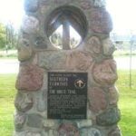
Queenston Heights Park, South Terminus Cairn, 14184 Niagara Pkwy Niagara On The Lake (Map #1, 0.0 km).
We’ll meet at the lawn between the restaurant and the washrooms.
Hike Leader(s): Helen Hermansen Click here to contact Hike Leader(s)
Pace: Medium
Terrain: Moderate
Distance: 8km
Description
Starting at Queenston Heights Park, we’ll be hiking the main trail with a loop along the Upper Canada Heritage Trail. The trail is mostly moderate with two steep sections to get down the escarpment, and then back up again. Bring hiking boots, poles, and be prepared for mud and/or snow. Note that if you don’t have a Niagara Parks Parking Pass, that you may need to pay for parking at the trailhead.
Hosting Club: Beaver Valley
Location (Google Maps): Meet on the north shoulder near the end of Sideroad 16C, off of 7th Line. Do not try to access Sideroad 16C from Grey Road 7, there is no access. Km 91.8 Map 27 Edition 30
Hike Leader(s): Margaret Yaraskavitch Click here to contact the hike leader.
Pace: Medium
Terrain: Moderate
Length of Hike: 3.8
Description
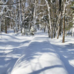
A wonderful loop for snowshoeing, generally with good probability of significant snowfall. Broad valley views, some varied elevation, wetlands, cedar groves, deciduous forest, a picturesque rural road. Bring water and a snack.
COVID-19 Precautions Before, During and After your Hike
- Each hiker joining a Bruce Trail Club organized hike must perform a self-screening check before hiking.
Find Ontario’s self-assessment tool here: https://covid-19.ontario.ca/self-assessment/ - If you are experiencing COVID-19 symptoms, stay home.
- Personal Protective Equipment:
- Hikers may choose to wear masks
- Hikers may carry and use hand sanitizer, but should not be sharing it with the group
- Hikers who experience COVID-19 symptoms following a Bruce Trail Club organized hike must inform their local public health unit.
Find your local health unit at http://www.health.gov.on.ca/en/common/system/services/phu/locations.aspx
Transportation
All hikers are responsible for their own transportation to and from the hike.
Currently, there are no car shuttles on hikes – all hikes must be out-and-back or loop hikes.
Other Guidelines
- Arrive 15 minutes before the start of the hike.
- Wear sturdy footwear and appropriate attire for the weather and the terrain.
Hiking poles are a good idea in any season, especially if the terrain is rocky or slippery. In winter, snowshoes or icers/crampons are needed when conditions dictate.
Wearing appropriate clothing and footwear prevents injuries and shows consideration for a safe and positive group hiking experience. - Always carry I.D. and your health card.
- Bring sufficient water and snacks (or lunch if indicated). A minimum of 1L of water is recommended on all hikes, and 3L is recommended for long, challenging hikes in the heat of the summer.
- Bring sunscreen and insect repellent (for spring and summer hikes).
- Bring your own first aid kit.
- Please leave dogs at home.
Hosting Club: Sydenham
Category: Snowshoe Hike
Location (Google Maps): Parking at the north end of Georgian Bluffs Concession 3, north of km 98.7 (Map 32)
Hike Leader(s): Bill Snel Click here to contact Hike Leader(s)
Pace: Leisurely: 3 km/h or less
Terrain: Moderate: Some hills and/or poor footing
Distance: 5 km
Description
We will snowshoe between one of the 3 trails that vary between 2 and 5 km depending on conditions. For more information contact Bill Snel at w.snel2@gmail.com or call landline (519) 470-0584.
Hosting Club: Niagara
Location (Google Maps):
Short Hills Wiley Road Entrance
Pace: Medium
Terrain: Moderate
: 12k
Description
Explore Short Hills and the majestic side trails of Scarlett Tanager, Hemlock. Swayze Falls and Terrace. Register for each hike
Bring Poles and Icers and dress for the weather
Hosting Club: Niagara
Location (Google Maps): Short Hills Provincial Park, Pelham Road entrance
Hike Leader(s): janet davey Click here to contact Hike Leader(s)
Pace: Medium
Terrain: Moderate
Distance: 6 kilometres
Description
Hike the main and side trails in Short Hills. Bring hiking boots, icers & water.
Hike open to BTC Members only.
Hosting Club: Dufferin Hi-Land
Category: Cancelled
Location (Google Maps): Dufferin Hi-Land Section, Map 19. Meet at Split Rock Narrows parking lot on 2nd Line, Mono, 1.5 km north of 25 Sideroad.
Hike Leader(s): Les Babbage, Inge Eckerich, Bob Slack Click here to contact Hike Leader(s)
Pace: Leisurely
Terrain: Moderate
Distance: 4.1 or 2.5 km
Description
We will hike on the Split Rock, Narrows and Ralph Tremills Side Trails. Shorter hike returns to parking lot via 2nd Line.
Hosting Club: Caledon Hills
Category: Tuesday Hikers
Location (Google Maps): Meet at Limehouse Conservation Area on Fifth Line near km 20.4 Map 12. From Hwy 401 take Trafalgar Rd. north. At Sideroad 22 turn left and follow 3 km to village of Limehouse. Turn left on Fifth Line and follow south for one km to parking at ball diamonds on your left. Leader’s phone 905-301-4091.
Hike Leader(s): Peter Leeney Click here to contact Hike Leader(s)
Pace: Medium – 3 to 4 km/hour
Terrain: Moderate – some hills and/or some poor footing
Distance: 12 km
Description
We will hike north on the Trail through Hole in the Wall and continue past 22nd Sideroad as far as Sixth Line and then return.

Hosting Club: Niagara
Category: Car Pool
Location (Google Maps): Meet at Rockway Community Centre parking lot, 2021 Pelham Rd, Lincoln. (Map 3, near km 45.1) to carpool.
Hike Leader(s): Sam Rutherford Click here to contact Hike Leader(s)
Pace: Medium
Terrain: Moderate
Distance: 20.2km
Description
Winter End-to-End Hikes must be completed between December 21, 2021 to March 19, 2022. Bring $10 for the badge if once you have completed all 5 hikes.
Poles and icers recommended. Bring water and snack.
No Dogs.
Hosting Club: Niagara
Category: In and Out
Location (Google Maps):
Lions swimming pool, Elm St, Grimsby
Hike Leader(s): Karen Limardi Click here to contact Hike Leader(s)
Pace: Medium
Terrain: Moderate
Distance: 6k
Description
Beamer Memorial Conservation Area offers one of Niagara’s most breath-taking and panoramic views of the Niagara Escarpment and Lake Ontario.
Take a walk along the scenic Lookout and Bruce Trails and soak up the picturesque views of the 40 Mile Creek Valley, the Lake Ontario shoreline and the escarpment ridge from one of our viewing. Bring icers and poles
Hike open to BTC Members only.
Hosting Club: Blue Mountains
Category: Blue Mountain Hike
Location (Google Maps): Hike meets in the parking lot behind Tim Horton’s on First St. in Collingwood.
Hike Leader(s): Hart Fischer (705) 606-0507 Click here to contact Hike Leader(s)
Pace: Medium – 3 to 4 km/hr
Terrain: Moderate – Some hills and/or some poor footing, Strenuous – Hilly with steep climbs and some poor footing
Distance: 6 km
Description
This is a snowshoe hike.
We will head to a suitable parking area in Craigleith.
Our trails will involve some escarpment climbing, switchbacks and there will be great views.
No matter what it will be a challenging hike.
Bring water and a snack.
Hosting Club: Iroquoia
Category: Happy Wanderers
Location (Google Maps): Parking lot on the north side of Kortright Road W (please use the GPS coordinates vs address, it’s easier and more accurate!)
Hike Leader(s): Louise Langlais Click here to contact Hike Leader(s)
Pace: Brisk – 4 to 5 km/hr, Medium – 3 to 4 km/hr
Terrain: Moderate – Some hills and/or some poor footing
Distance: 10-14 km
Description
We will hike the trails in Preservation Park. This area includes some lovely cedar forests.
Hike open to BTC Members only.
Hosting Club: Iroquoia
Category: Good Companions
Location (Google Maps): Dundurn Park, York Rd, Hamilton (near Dundurn Castle)
Hike Leader(s): Craig Sim Click here to contact Hike Leader(s)
Pace: Medium – 3 to 4 km/hr
Terrain: Moderate – Some hills and/or some poor footing
Distance: 8k (approximate)
Description
Meet at Dundurn Park parking lot, lot farthest from Dundurn Castle. We will walk toward Princess Point via stairs, then a bit of trails there. Some flat trail and some easy hills. Good views. Bring icers for potential winter conditions. Dress in layers adequate for weather, wear hiking boots, bring water and snack. Bring mask in case needed for stairs or outhouse. Observe Covid protocols. Up to day before hike contact by email. On day of hike only cell 289-659-0065.

Hosting Club: Niagara
Location (Google Maps):
Jordan Hollow Park 3039 King St Jordan
Pace: Medium
Terrain: Moderate
: 12k
Description
From Jordan Hollow Hike the main trail to Moyer Road or Louth and Return. You must register for each hike. Bring Poles and Icers
Hosting Club: Niagara
Location (Google Maps): Jordan Hollow Park
Hike Leader(s): Bill Russell Click here to contact Hike Leader(s)
Pace: Medium
Terrain: Strenuous
Description
Hike along the Jordan Creek to Upper Balls Falls or the Jim Rainforth Trail. Bring hiking boots, icers and water.
Hosting Club: Iroquoia
Category: Thursday Group
Location (Google Maps): Scotsdale Farm, 1365 Trafalgar Rd.
Hike Leader(s): Phillip Armstrong Click here to contact Hike Leader(s)
Pace: Leisurely – 3km/hr or less
Terrain: Moderate – Some hills and/or some poor footing
Distance: 10 km.
Description
Scotsdale Farm is a favourite destination. This hike will start at Scotsdale Farm but head west on main Bruce Trail to Duff Pit and return via the same route. Meet in the main parking lot of Scotsdale Farm at 9:45 am. for a 10:00 am. start. Bring a snack, water and poles if using. Icers may be necessary.
Leader: Phill Armstrong 416 895 3937 hikingrandpa@gmail.com
Hosting Club: Niagara
Category: Urban
Location (Google Maps):
Veterans Memorial Park, park just outside the park on King Street
Hike Leader(s): Robin Garrett Click here to contact Hike Leader(s)
Pace: Medium
Terrain: Easy
Distance: 6-7 km
Description
Each Friday we will explore different neighbourhoods, trails and parkland throughout Historic Niagara-on-the-Lake.
Moderate pace with some weeks entirely on sidewalks and roads while others may include a mix of trails and paved pathways. Great way to build up endurance for longer more strenuous hikes.
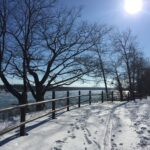
Prepare for cooler windy conditions on open parkland and along Lake Ontario and Niagara River trails.
Plan to stay for conversation and a warm cup of coffee or tea at Sweets & Swirls, Community Centre, Niagara Stone Road, NOTL

Hosting Club: Toronto
Category: Cancelled
Location (Google Maps): Scenic Caves
Hike Leader(s): Martina Furrer, David Royle, George Lennon Click here to contact Hike Leader(s)
Description
Trip cancelled.
Join us for an awesome day of skiing and snowshoeing at Scenic Caves Nature Adventures. Cross southern Ontario’s longest suspension bridge and enjoy great views of Georgian Bay. Snowshoers: Join David and George for a guided snowshoe hike. The group will maintain a comfortable level II pace, through old growth forest and moderate hills and cover about 11 KM. Prepare to be outside for four hours as we traverse spectacular vistas and some great lookouts. If you prefer, you can explore the resort trails with a friend at your own pace. Skiers: Enjoy forests, fields, and rolling hills on trails groomed for classic and skate skiing. Ski and snowshoe rentals available.
We’ve reserved the log cabin for our group. So there will be plenty of space to store extra gear and warm up by the fire.
To participate you must be fully vaccinated against COVID-19. You will have to show proof of vaccination to board the bus. You will also have to wear a mask at all times while on the bus.
Coach fares must be paid online when you register. Trail fees will be collected in cash on the bus.

Hike open to BTC Members only.
Hosting Club: Niagara
Category: Car Pool
Location (Google Maps):
Meet at Rockway Community Center parking lot on 2021 Pelham Road, Lincoln. (Map 3, near km 45.1) Carpool.
Hike Leader(s): Lauren Doig Click here to contact Hike Leader(s)
Pace: Medium
Terrain: Moderate
Distance: 20.2km
Description
We will be car pooling, Bring Icers and poles. No dogs. To earn your Niagara Winter End to End badge, it must be completed between December 21, 2021 to March 19, 2022. Bring $10 for badge if you have completed all 5 hikes.
Hosting Club: Niagara
Category: Loop
Location (Google Maps):
Kinsmen Park Frost Road Beamsville
Hike Leader(s): Vince Zvonar Click here to contact Hike Leader(s)
Pace: Medium
Terrain: Moderate
Distance: 8k
Description
Hike from the park along the main trail towards Cave Springs towards Cherry and return on a side trail forming a loop.
Dress for the weather and bring icers and poles
Hosting Club: Iroquoia
Category: General Hike
Location (Google Maps): Limehouse Conservation Area – southwest of km 20.4 at the baseball diamonds. Access from Fifth Line just southeast of the village of Limehouse. Red P Bruce Trail parking on the south end of the Limehouse Side Trail. BTC Map 12.
Hike Leader(s): Stuart Law Click here to contact Hike Leader(s)
Pace: Medium – 3 to 4 km/hr
Terrain: Moderate – Some hills and/or some poor footing
Distance: 18 km
Description
Join us on a winter hike from Limehouse to Speyside and back through woodland, fields and some road. We will take in side trails and the main trail as well as some unmarked trail and trail that used to be the Bruce Trail years ago. Be prepared to explore and be ready for cold temperatures, ice and rocks. Please dress accordingly. Icers mandatory. Please bring a snack, a lunch, a hot drink and a smile. Please arrive at 8:45 so as to be ready to go for 9:00 am sharp. The Hole-in-the-Wall awaits.
Hike open to BTC Members only.
Hosting Club: Blue Mountains
Category: Blue Mountain Hike
Location (Google Maps): Hike meets in the parking lot behind Tim Horton’s on First St. in Collingwood.
Hike Leader(s): Michael Treuman – (416) 518-0489 Click here to contact Hike Leader(s)
Pace: Leisurely – 3 km/hr. or less
Terrain: Moderate – Some hills and/or some poor footing
Distance: 4-8 km
Description
We will park at km91.9 on Sideroad 16C in the Beaver Valley Section.
We will follow the white blazed trail north to km94.9 and return via the Sligo Side Trail to the cars.
The leisurely hike heads north on the white blazed trail to km92.8 and loops back to the cars via the Sligo Side Trail.
Map: 27 Edition 30
Hike open to BTC Members only.
Hosting Club: Blue Mountains
Category: Blue Mountain Hike
Location (Google Maps): Hike meets in the parking lot behind Tim Horton’s on First St. in Collingwood.
Hike Leader(s): Michelle Wacker – (705) 730-8481 Click here to contact Hike Leader(s)
Pace: Medium – 3 to 4 km/hr
Terrain: Moderate – Some hills and/or some poor footing
Distance: 4-8 km
Description
We will park at km91.9 on Sideroad 16C in the Beaver Valley Section.
We will follow the white blazed trail north to km94.9 and return via the Sligo Side Trail to the cars.
The medium paced hike heads north on the white blazed trail to km92.8 and loops back to the cars via the Sligo Side Trail. This is a faster pace than the leisure group. Make sure you have signed up in appropriate group.
Map: 27 Edition 30
Hosting Club: Niagara
Category: Loop
Location (Google Maps):
Parking Lot on Merritt Island at the west end of cross street Welland
Hike Leader(s): Sylvia Wheeler Click here to contact Hike Leader(s)
Pace: Medium
Terrain: Easy
Distance: 7k
Description
Flat hike along paved trail alongside the Welland Canal
Hosting Club: Toronto
Category: Cancelled
Location (Google Maps): Mono Cliffs Provincial Park
Hike Leader(s): Wayne Crockett Click here to contact Hike Leader(s)
Pace: Moderate
Terrain: Hilly, Variable
Distance: 12 km
Description
Join me for a snowshoe hike through Mono Cliffs Provincial Park. We will do a combination of side trail and the main Bruce Trail, taking in a series of loops from the Mono Community Centre, including the Lookout Trail and a stop beside McCarsten Lake.
If there isn’t enough snow we’ll do an icer hike over the same area. Beautiful region to visit at any time of the year but particularly scenic in the winter.
THIS TRIP IS CANCELLED
Hosting Club: Toronto
Category: Car Hike
Location (Google Maps): Whitchurch-Stouffville
Hike Leader(s): Mohammad Aghamiri Click here to contact Hike Leader(s)
Description
Covid 19 protocol and procedure is in effect in parking lot and during hike, social distancing is mandatory all the time.
It is winter time all participants are required to have Ice cleats with them, have proper shoes, warm clothing and hot drinks with you.
Some safety procedures during the hike:
1-Hikers must stay between the leader and the sweep.
2-Hikers must advise the leader or the sweep if they wish to leave the group.
3- Hikers must follow the whistle instructions: 1 blast- stay where you are; 2 blasts come to the leader; 3 blasts – come to the leader quickly.
4-Hike leader may request volunteers to stop at trail intersections, they need to help hikers to the direction the group walk and wait till they see the sweep .
5-Hikers have to make sure they can see the persons behind and in front of them.
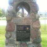
Hosting Club: Niagara
Location (Google Maps):
Queenston Heights Park, South Terminus Cairn, 14184 Niagara Pkwy Niagara On The Lake (Map #1, 0.0 km).
We’ll meet at the lawn between the restaurant and the washrooms.
Hike Leader(s): Helen Hermansen Click here to contact Hike Leader(s)
Pace: Medium
Terrain: Moderate
Distance: 8km
Description
Starting at Queenston Heights Park, we’ll be hiking the main trail with a loop along the Upper Canada Heritage Trail. The trail is mostly moderate with two steep sections to get down the escarpment, and then back up again. Bring hiking boots, poles, and be prepared for mud and/or snow. Note that if you don’t have a Niagara Parks Parking Pass, that you may need to pay for parking at the trailhead.
Hosting Club: Beaver Valley
Location (Google Maps): Meet on the south shoulder, facing east on North St. just north of Eugenia (Turn at Top O’ The Rock store) km 58.3 Map 26 Edition 30
Hike Leader(s): Glenda Collings Click here to contact the hike leader.
Pace: Medium
Terrain: Moderate, Some steep sections
Length of Hike: Approx. 6 km
Description
This will be an in and out hike with some great views across the valley. The hike will proceed as a “boot” hike if snowshoes aren’t needed. Please do bring snowshoes and icers.
COVID-19 Precautions Before, During and After your Hike
- Each hiker joining a Bruce Trail Club organized hike must perform a self-screening check before hiking.
Find Ontario’s self-assessment tool here: https://covid-19.ontario.ca/self-assessment/ - If you are experiencing COVID-19 symptoms, stay home.
- Personal Protective Equipment:
- Hikers may choose to wear masks
- Hikers may carry and use hand sanitizer, but should not be sharing it with the group
- Hikers who experience COVID-19 symptoms following a Bruce Trail Club organized hike must inform their local public health unit.
Find your local health unit at http://www.health.gov.on.ca/en/common/system/services/phu/locations.aspx
Transportation
All hikers are responsible for their own transportation to and from the hike.
Currently, there are no car shuttles on hikes – all hikes must be out-and-back or loop hikes.
Other Guidelines
- Arrive 15 minutes before the start of the hike.
- Wear sturdy footwear and appropriate attire for the weather and the terrain.
Hiking poles are a good idea in any season, especially if the terrain is rocky or slippery. In winter, snowshoes or icers/crampons are needed when conditions dictate.
Wearing appropriate clothing and footwear prevents injuries and shows consideration for a safe and positive group hiking experience. - Always carry I.D. and your health card.
- Bring sufficient water and snacks (or lunch if indicated). A minimum of 1L of water is recommended on all hikes, and 3L is recommended for long, challenging hikes in the heat of the summer.
- Bring sunscreen and insect repellent (for spring and summer hikes).
- Bring your own first aid kit.
- Please leave dogs at home.
Hike open to BTC Members only.
Hosting Club: Blue Mountains
Category: Blue Mountain Hike
Location (Google Maps): Hike meets in the parking lot behind Tim Horton’s on First St. in Collingwood.
Hike Leader(s): Rosemary Petrie – (705) 293-4444 Click here to contact Hike Leader(s)
Pace: Leisurely – 3 km/hr. or less
Terrain: Moderate – Some hills and/or some poor footing
Distance: 5 km
Description
We will head to Loree Forest and proceed with a two hour snowshoe hike by moonlight.
Leader and sweep will guide you with a headlamp through a beautiful moonlit forest loop.
The very first full moon of the year is known in many cultures as the Full Wolf Moon, which is appropriate
because wolves are much louder and more noticeable in January, which is when breeding season begins.
Badge available after the hike for $10.00.</strong
Map: 24 Edition 30
Hosting Club: Niagara
Location (Google Maps):
Short Hills Wiley Road Entrance
Pace: Medium
Terrain: Moderate
: 12k
Description
Explore Short Hills and the majestic side trails of Scarlett Tanager, Hemlock. Swayze Falls and Terrace. Register for each hike
Bring Poles and Icers and dress for the weather
Hosting Club: Niagara
Location (Google Maps): Short Hills Provincial Park, Pelham Road entrance
Hike Leader(s): janet davey Click here to contact Hike Leader(s)
Pace: Medium
Terrain: Moderate
Distance: 6 kilometres
Description
Hike the main and side trails in Short Hills. Bring hiking boots, icers & water.

Hosting Club: Caledon Hills
Category: Tuesday Hikers
Location (Google Maps): Roadside parking, km 35.2 on Coolihans Sideroad, west of where the Trail crosses the road.
From Airport Road/Peel Regional Road 7, turn east onto Coolihans Side Road. Drive for 1.4 kilometres.
Hike Leader(s): Sandy Green and Sally Cohen Click here to contact Hike Leader(s)
Pace: Medium – 3 to 4 km/hour
Terrain: Strenuous – hilly with steep climbs and some poor footing
Distance: 11.5 km
Description
Plan to join one, a few, or all of our Frosty Five hikes. Participants who complete all five hikes will be eligible to receive the CHBTC Winter Badge on the final hike. Hike two explores parts of the main Trail and the Glen Haffy Side Trail in the Glen Haffy area. Bring your choice of hydration and snacks. Hiking boots and icers/crampons are required. See January 4, February 1, February 15, and March 1 for details pertaining to the other hikes in the series. (Note: If you wish to purchase a badge, the cost is $5.00 for BTC members and $10.00 for non-members.)
Hike Update – In response to the newest Provincial restrictions limiting outdoor gatherings to 10 people, this hike will be modified. The group will be divided into two. As there are two hike leaders, a small group of first arrivals will hike with one hike leader. Shortly after, the remaining hikers will follow, lead by the second hike leader.
Hike open to BTC Members only.
Hosting Club: Dufferin Hi-Land
Category: Cancelled
Location (Google Maps): Dufferin Hi-Land Section, Map 19. Meet at Mono Community Centre hiker parking area off of 2nd Line Mono at south end of Mono Centre village.
Hike Leader(s): Les Babbage; Inge Eckerich; Bob Slack Click here to contact Hike Leader(s)
Pace: Leisurely
Terrain: Moderate
Distance: Long hike: 5.9 km; Short: 3.8 km
Description
Both hikes will take the Laidlaw Side Trail to Main Trail, then around the South Outlier loop to Main Trail and Laidlaw Side Trail. The longer hike will then do a loop hike of the Turnbull Side Trail. The shorter hike will continue directly to the parking lot on Laidlaw Side Trail.

Hosting Club: Niagara
Category: Night
Location (Google Maps): Veteran’s Memorial Park, park just outside the park on King St.
Hike Leader(s): Robin Garrett Click here to contact Hike Leader(s)
Pace: Medium
Terrain: Easy
Distance: 6-7 km
Description
Wolf Moon Night Hike – Silent hike along the Commons as we take in the magic of the rising moon. On the remainder of the hike, we will walk along the Niagara River and the streets of Historic Old Town and enjoy quiet conversation. Bring a night light and dress for weather – counts towards your night hike badge (5 night hikes).

Hosting Club: Niagara
Category: Car Pool
Location (Google Maps): Park at DeCew House, DeCew Rd, Thorold (map 3, km 29.8) to carpool.
Hike Leader(s): Sam Rutherford Click here to contact Hike Leader(s)
Pace: Medium
Terrain: Moderate
Distance: 17.5km
Description
Winter End-to-End Hikes must be completed between December 21, 2021 to March 19, 2022. Bring $10 for the badge if once you have completed all 5 hikes.
Poles and icers recommended. Bring water and snack.
No Dogs.
Hike open to BTC Members only.
Hosting Club: Iroquoia
Category: Good Companions
Location (Google Maps): Meet at the circular parking lot at RBG Arboretum.
10 Old Guelph Rd, Hamilton
Hike Leader(s): Jill Parratt Click here to contact Hike Leader(s)
Pace: Medium – 3 to 4 km/hr
Terrain: Easy – Mostly flat and usually good footing
Description
Meet at 9:15, hiking at 9:30.
Parking Fee if not a member of RBG.
We will hike a variety of trails depending on the conditions. Please bring water, snack, icers are mandatory.
Morning of the hike, you can text me at 905-399-3601.
Jill
Hike open to BTC Members only.
Hosting Club: Blue Mountains
Category: Blue Mountain Hike
Location (Google Maps): Hike meets in the parking lot behind Tim Horton’s on First St. in Collingwood.
Hike Leader(s): Hart Fischer (705) 606-0507 Click here to contact Hike Leader(s)
Pace: Medium – 3 to 4 km/hr
Terrain: Strenuous – Hilly with steep climbs and some poor footing
Distance: 10 km
Description
We will proceed to parking on 33/34 Sideroad Nottawasaga to begin a partial loop hike of the
Pretty River Valley Main Trail, Pretty River Side Trail and the John Haigh Side Trail.
While there are some steep ascents and descents that make this a challenging hike, the views are great and worth the effort.
Snowshoes and poles are a must to make the hike easier.
Bring lunch and beverages.
Map: 23 Edition 30

Hosting Club: Niagara
Location (Google Maps):
Jordan Hollow Park 3039 King St Jordan
Pace: Medium
Terrain: Moderate
: 12k
Description
From Jordan Hollow Hike the main trail to Moyer Road or Louth and Return. You must register for each hike. Bring Poles and Icers
Hosting Club: Niagara
Location (Google Maps): Jordan Hollow Park
Hike Leader(s): Bill Russell Click here to contact Hike Leader(s)
Pace: Medium
Terrain: Strenuous
Description
Hike along the Jordan Creek to Upper Balls Falls or the Jim Rainforth Trail. Bring hiking boots, icers and water.
Hosting Club: Sydenham
Category: Snowshoe Hike
Location (Google Maps): Grey Sauble Conservation Headquarters, 237897 Inglis Falls Road, Owen Sound
Hike Leader(s): Fran Turner Click here to contact Hike Leader(s)
Pace: Brisk: 4 to 5 km/h
Terrain: Moderate: Some hills and/or poor footing
Distance: 6.5 km
Description
This brisk snowshoe hike will take us through a variety of terrain including lovely forests, farmers’ fields and hardwood bush. We will head south on the main trail to Inglis Falls, where we will have a great view of the falls. We then head northwest to the Creamery Hill Side Trail and then loop back to the conservation area. If conditions are favorable, we can add on some distance around the conservation area for those who are interested. Maximum time commitment of 3 hours.
Hosting Club: Iroquoia
Category: Thursday Group
Location (Google Maps): At the corner of Fourth Line and No 10 Side-road. From 401 and Guelph Line turn right at the church just north of the Casino.
Hike Leader(s): Phillip Armstrong Click here to contact Hike Leader(s)
Pace: Medium – 3 to 4 km/hr
Terrain: Moderate – Some hills and/or some poor footing
Distance: About 10km
Description
Enjoy a winter walk in these beautiful woods.
I will select the route based on weather and trail conditions. Please bring icers some of these rails get really ice packed.
Park as near as you can to the corner.
Hosting Club: Iroquoia
Category: Thursday Group
Location (Google Maps): Halton Agreement Forest
Hike Leader(s): Anne Armstrong Click here to contact Hike Leader(s)
Pace: Leisurely – 3km/hr or less
Terrain: Easy – Mostly flat and usually good footing
Distance: Approx. 10 km.
Description
The Halton Agreement Forest is a wonderful forest full of hiking and biking trails which can be shared. There are also areas of wetlands which feed into the Sixteen Mile Creek at Hilton Falls further south. . Meet at 9:45 am. for a 10:00 am. start on Fourth Line Nassagaweya, just north of the corner where 10th Sideroad (east of Guelph Line and north of the 401) meets Fourth Line Nassagaweya. There is a small off road parking lot on the right, north of that corner. There is also roadside parking. Bring water, a snack, poles if using and icers. **one short rocky section**
Leader: Anne Armstrong 905 617 3937 hikingrandma@gmail.com

Hosting Club: Niagara
Location (Google Maps): Veterans Memorial Park, park just outside the park on King Street
Hike Leader(s): Robin Garrett Click here to contact Hike Leader(s)
Pace: Medium
Terrain: Easy
Distance: 6-7 km
Description
Each Friday we will explore different neighbourhoods, trails and parkland throughout Historic Niagara-on-the-Lake.
Moderate pace with some weeks entirely on sidewalks and roads while others may include a mix of trails and paved pathways. Great way to build up endurance for longer more strenuous hikes.
Prepare for cooler windy conditions on open parkland and along Lake Ontario and Niagara River trails.
Plan to stay for conversation and a warm cup of coffee or tea at Sweets & Swirls, Community Centre, Niagara Stone Road, NOTL
Hosting Club: Sydenham
Category: Snowshoe Hike
Location (Google Maps): Lundy Road designated parking roadside at km 135.2 (Map 34)
Hike Leader(s): Carol Mullin Click here to contact Hike Leader(s)
Pace: Medium: 3 to 4 km/h
Terrain: Moderate: Some hills and/or poor footing
Distance: 4 km loop
Description
We will do a counterclockwise loop on Ross McLean sidetrail down along the edge of Bass Lake then back to the bush road to starting point. We will avoid the upper section due to crevices. Approx 1.5 to 2 hours. Virgin snow conditions so pace may be adjusted to suit hikers.
Hosting Club: Toronto
Category: Cancelled
Location (Google Maps): Awenda Provincial Park
Hike Leader(s): Martina Furrer; Lisa Lifshitz; Nijole Mockevicius Click here to contact Hike Leader(s)
Description
Trip cancelled
Join us for an awesome day of cross-country skiing and snowshoeing in beautiful Awenda Provincial Park. For information about trail conditions visit: https://www.ontarioparks.com/skireport. For information about the park visit: https://www.ontarioparks.com/park/awenda. Snowshoers: Explore the trails on your own or join Lisa and Nijole for a guided 10 KM snowshoe hike on Awenda’s beautiful winter trails. The hike will traverse parts of the Bluff, Wendat, and Connector trails, and will also circle around Kettle’s Lake. Mostly flat with a few short hills. Pace will be approximately 3 km/hr. Plenty of time to take pictures and enjoy the scenery. Skiers: Enjoy self-guided tours of Awenda’s beautiful ski trails with majestic views of Georgian Bay.
To participate you must be fully vaccinated against COVID-19. You will have to show proof of vaccination to enter the bus. You will also have to wear a mask at all times while on the bus.
Coach fares and park admission must be paid online when you register.

Hosting Club: Caledon Hills
Category: General
Location (Google Maps): Roadside parking, km 35.2 on Coolihans Sideroad, west of where the Trail crosses the road.
From Airport Road/Peel Regional Road 7 turn east onto Coolihans Side Road. Drive for 1.4 kilometres.
Hike Leader(s): Sandy Green and Peter Leeney Click here to contact Hike Leader(s)
Pace: Medium – 3 to 4 km/hour
Terrain: Strenuous – hilly with steep climbs and some poor footing
Distance: 15.5 km
Description
Plan to join one, a few, or all of our Frosty Five hikes. Participants who complete all five hikes will be eligible to receive the CHBTC Winter Badge on the final hike. Hike two explores parts of the main Trail, the Glen Haffy Side Trail, and the Dingle in the Glen Haffy area. Bring your choice of hydration and snacks. Hiking boots and icers/crampons are required. See January 8, February 5, February 19, and March 5 for details pertaining to the other hikes in the series. (Note: If you wish to purchase a badge, the cost is $5.00 for BTC members and $10.00 for non-members.)
Hike Update – In response to the newest Provincial restrictions limiting outdoor gatherings to 10 people, this hike will be modified. The group will be divided into two. As there are two hike leaders, a small group of first arrivals will hike with one hike leader. Shortly after, the remaining hikers will follow, lead by the second hike leader.
Hosting Club: Toronto
Category: Car Hike
Location (Google Maps):
Hike Leader(s): Mohammad Aghamiri
Pace: Brisk, Moderate
Terrain: Hilly, Variable
Distance: 14-15KM
Description
Hosting Club: Toronto
Category: Car Hike
Location (Google Maps):
Queen Elizabeth II Wildlands PP
Hike Leader(s): Glynn Richardson Click here to contact Hike Leader(s)
Pace: Moderate
Terrain: Challenging, Variable
Distance: 15-20km
Description
Are you an adventurer? Love to explore?
This hike will be off-trail and rugged, as we spend the day exploring forests, rock barrens and views in the area. We may get wet as we navigate our way around and over ponds, creeks, lakes and beaver dams. There will be lots of elevation change and challenges. This is an advanced hike! We’ll spend 6-8 hrs hiking 15-20 km.
Registered participants are to arrive 15 minutes prior to the hike for briefing. Bring a lunch plenty of water. No dogs. No dropouts.
Snowshoes, hiking poles, trail crampons, headlamp are MANDATORY (at least at the trailhead where we will evaluate existing conditions). Do not show up without them you will not be allowed to participate.
Space is limited.
Hosting Club: Niagara
Category: Loop
Location (Google Maps):
Entrance (15.2 km Map 2) Woodend Conservation Area off Taylor Rd
Hike Leader(s): Vince Zvonar Click here to contact Hike Leader(s)
Pace: Medium
Terrain: Moderate
Distance: 15k
Description
Hike a loop from Woodend Conservation through hilly terrain to St Paul Ave, Niagara
Falls. We will pass through the Screaming Tunnel and Fireman’s Park.
Bring Poles and Icers
Hosting Club: Toronto
Category: Urban Walk
Location (Google Maps): Rouge National Urban Park. Meet in front of the Pearce House
Hike Leader(s): Wayne Crockett Click here to contact Hike Leader(s)
Pace: Moderate
Terrain: Hilly
Distance: 9-10 km
Description
Join us for a pleasant snowshoe in Toronto’s own ‘wilderness’ park, Rouge National Urban Park. We’ll do a variety of trails both north and south of Twyn Rivers Drive. Some of the hills in the park are challenging so be prepared for a workout.
Bring your own snowshoes and poles. I also recommend having a pair of icers in your pack in case there is more ice than snow. Bring enough water for several hours and your lunch.
There is extensive parking near the Pearce House but it can fill quickly so I recommend arriving at least 20 minutes prior to the start time if you are driving. Taking the TTC? You can get the 86A from Kennedy Station. One runs every ten minutes on Saturday and it takes about 40 minutes from Kennedy to the Park. Get off at the Park Road stop, just before the Zoo.
Hosting Club: Iroquoia
Category: General Hike
Location (Google Maps): Scotsdale Farm main parking lot (BTC red “P”) off Trafalgar Road just north of Silver Creek. About 1 km northeast of km 29.7, BTC Map 13.
Hike Leader(s): Stuart Law Click here to contact Hike Leader(s)
Pace: Medium – 3 to 4 km/hr
Terrain: Moderate – Some hills and/or some poor footing, Slippery Sections Likely
Distance: 18 kms
Description
Join us for a wintry hike in the snow at Scotsdale Farm as we venture to the Walking Fern Side Trail and back in a loop encompassing the Bennett Heritage Side Trail, the Roberts Side Trail and portions of the Main Trail. Waterfalls, streams, cedars, lookouts, bridges and rocks. The going will be more strenuous in the snow but highly rewarding. Please dress for the weather in layers as suggested on the BTC website for winter hiking. Icers mandatory. Poles recommended. Please bring two hot beverages, a snack, a lunch, your own first aid kit, two sets of mitts, hand warmers and a smile. Please meet at 8:45 am and be ready to go for a 9:00 am sharp start.
Hike open to BTC Members only.
Hosting Club: Blue Mountains
Category: Blue Mountain Hike
Location (Google Maps): Hike meets in the parking lot behind Tim Horton’s on First St. in Collingwood.
Hike Leader(s): Flo Kusiak – (705) 443-8075 Click here to contact Hike Leader(s)
Pace: Leisurely – 3 km/hr. or less
Terrain: Easy – Mostly flat and usually good footing
Distance: 5 km
Description
This 204 acre property features majestic, mature sugar maple trees and a meandering cold water stream.
This lush Niagara Escarpment forest is home to a variety of rare and at-risk species.
The sounds of hairy and pileated woodpeckers echo through the trees.
We will creatively combine Mingay, Maple Leaf and Trout trails to complete a loop-de-loop.
Bring water and a snack.
Hosting Club: Dufferin Hi-Land
Category: General Hike
Location (Google Maps): Second Line and 15th Sideroad in Mulmur Ontario. From Orangeville, head north on hwy #10 to hwy #89. Turn left and head west to county road #124. Turn left and head north to 15 sideroad. Turn right and follow to 2nd line.
Hike Leader(s): Tom Thayer and Bryan Foley Click here to contact Hike Leader(s)
Pace: Leisurely
Terrain: Dependent on Conditions, Moderate, Strenuous
Distance: 6km
Description
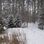
We will be exploring the winter wonders that the Pine River Nature Reserve offers.
This is a snowshoe hike so please be sure to bring your snowshoes. Should the weather not behave and snow is not in abundance, we will still do the hike but icer’s would be recommended in this case as there is sure to still be icy patches within the reserve.
Bring snowshoes, icers, mitts, hats, food, and dress according to the weather. To see the current conditions on the day of the hike, click here to access a weather station that is 5 minutes from the reserve.
Hosting Club: Niagara
Category: Loop
Location (Google Maps):
Parking Lot on Merritt Island at the west end of cross street Welland
Hike Leader(s): Sylvia Wheeler Click here to contact Hike Leader(s)
Pace: Medium
Terrain: Easy
Distance: 7k
Description
Flat hike along paved trail alongside the Welland Canal

Hosting Club: Beaver Valley
Location (Google Maps): Meet in the Kolapore parking lot on Grey County Road 2, 750 m south of km 23.8 Edition 30.
Hike Leader(s): Glenda Collings Click here to contact the hike leader.
Pace: Medium
Terrain: Moderate
Length of Hike: Approx. 8 km return
Description
This is the first hike of two to earn the Snowshoe Adventure badge. The hike will proceed without snowshoes if they’re not needed. Please do bring snowshoes and icers. We’ll be hiking along fields and through woodlands which feature quite a few cedars, as well as stands of hardwood. We’ll pass a great example of an old boulder fence line as we make our way to the trail on top of Metcalfe Rock. Great views to be had and then we’ll retrace our steps back to the cars.
COVID-19 Precautions Before, During and After your Hike
- Each hiker joining a Bruce Trail Club organized hike must perform a self-screening check before hiking.
Find Ontario’s self-assessment tool here: https://covid-19.ontario.ca/self-assessment/ - If you are experiencing COVID-19 symptoms, stay home.
- Personal Protective Equipment:
- Hikers may choose to wear masks
- Hikers may carry and use hand sanitizer, but should not be sharing it with the group
- Hikers who experience COVID-19 symptoms following a Bruce Trail Club organized hike must inform their local public health unit.
Find your local health unit at http://www.health.gov.on.ca/en/common/system/services/phu/locations.aspx
Transportation
All hikers are responsible for their own transportation to and from the hike.
Currently, there are no car shuttles on hikes – all hikes must be out-and-back or loop hikes.
Other Guidelines
- Arrive 15 minutes before the start of the hike.
- Wear sturdy footwear and appropriate attire for the weather and the terrain.
Hiking poles are a good idea in any season, especially if the terrain is rocky or slippery. In winter, snowshoes or icers/crampons are needed when conditions dictate.
Wearing appropriate clothing and footwear prevents injuries and shows consideration for a safe and positive group hiking experience. - Always carry I.D. and your health card.
- Bring sufficient water and snacks (or lunch if indicated). A minimum of 1L of water is recommended on all hikes, and 3L is recommended for long, challenging hikes in the heat of the summer.
- Bring sunscreen and insect repellent (for spring and summer hikes).
- Bring your own first aid kit.
- Please leave dogs at home.
Hike open to BTC Members only.
Hosting Club: Toronto
Category: Car Hike
Location (Google Maps): Bob Hunter Memorial Park
Hike Leader(s): Victor Ramautar Cel: 416-708-8199
Pace: Leisurely
Terrain: Variable
Description
Lots of snow. Snow shoeing , cross country skiing or just hike if you please. If just hiking ICERS might be necessary. Dress for the weather, bring water/warm drink and a lunch. We start on time so arrive about 15 mins to get gears on .
Hosting Club: Niagara
Location (Google Maps): Queenston Heights Park — We’ll meet at the lawn between the restaurant and the washrooms.
Queenston Heights Park, 14184 Niagara Pkwy Niagara On The Lake (Map #1, 0.0 km).
Hike Leader(s): Helen Hermansen Click here to contact Hike Leader(s)
Pace: Medium
Terrain: Moderate
Distance: 8km
Description
Starting at Queenston Heights Park, we’ll be hiking across the park to the the main trail with a loop along the Upper Canada Heritage Trail. The trail is mostly moderate with two steep sections to get down the escarpment, and then back up again. Bring hiking boots, poles, ice cleats and be prepared for mud, snow and/or ice. Note that if you don’t have a Niagara Parks Parking Pass, that you may need to pay for parking at the trailhead.
Hosting Club: Toronto
Category: Urban Walk
Location (Google Maps): Meet at the Tim Hortons on the NE corner of Don Mills Road and Steeles Ave. E. Free parking available just north of the corner at “Shops at Steeles and 404” mall, 2900 Steeles Ave. E. TTC access from Finch subway station, take bus #53 going north on Yonge and east on Steeles or take bus #25 northbound from Don Mills station.
Hike Leader(s): Andrew Proczek Click here to contact Hike Leader(s)
Pace: Moderate
Terrain: Flat, Variable
Distance: 11.5 km
Description
Please join me and guest leader, Claudette Baril, as she takes us on a picturesque circular hike along creeks and ravines in her neighborhood (some street walking is involved). I am hoping to do a series of exploratory hikes in the GTA by guest leaders as they take us on familiar trails in their neighborhoods. The area of our hike has a strong history. German Mills was once an industrious village in its Markham community (sadly now lost) founded by Bavarian-born William Berczy and a group of his countrymen and women. In addition to being a prosperous settlement, the community was instrumental in the early development of the area. Among the parks and trails we will be visiting are German Mills Settler’s Park, Don East Parklands Trail and Duncan Creek Trail. Lunch and washroom break will be at Cummer Community Centre (6.5 km into the hike; masks required for entry). Because of Covid-19 restrictions we will have to eat outside at picnic tables. Please arrive at our meeting spot 15 minutes ahead of time and remember to mask wherever we gather. Icers are required for participation on all TBTC winter hikes, urban or otherwise. Please carry them in your daypack in case they are needed. Hiking poles are also recommended on Winter hikes.
Proposed route: https://onthegomap.com/s/3gu4atnp
Hosting Club: Niagara
Category: Loop
Location (Google Maps): Hike along the Welland Canal to the entrance at Lake Ontario then to the Lighthouse at the end of the spit. Return on the trail along Lake Ontario side of the spit. Flat terrain and a nice leisurely hike.
Parking for the Port Weller Spit is at the end of seaway haulage rd entering from Broadway. There is a gate at the end leading into the trail.
Hike Leader(s): Karen Limardi Click here to contact Hike Leader(s)
Pace: Leisurely
Terrain: Easy
Distance: 6k
Description
Hosting Club: Iroquoia
Category: General Hike
Location (Google Maps): Park at Fletcher Creek Ecological Preserve on Concession 7 just north of Gore Rd , Puslinch
HCA passes can be used or 7.50 per vehicle
Hike Leader(s): Cathie Green Click here to contact Hike Leader(s)
Pace: Medium – 3 to 4 km/hr
Terrain: Moderate – Some hills and/or some poor footing
Distance: Approximately 10kms
Description
This is the rescheduled Jan 17 hike(cancelled due to blizzard) Note new start time 10:30 am
Fletcher’s Creek Preserve is an abandoned quarry site that has been rehabilitated and is located at the headwaters of the Spencer Creek watershed
We will take a loop hike through the preserve as well as an adjacent trail that also was part of the quarry back in the day-lots of local history and old stories associated with this area
Suitable for snowshoeing if there is enough snow-Wear hiking or winter boots, Icers, hiking pole, water snack/lunch, cell phone, and appropriate clothing for the weather
Please feel free to call or text me if you have any concerns or questions Cathie 416-931-2095 cathiekygreen@gmail.com
Hosting Club: Niagara
Location (Google Maps):
Short Hills Wiley Road Entrance
Pace: Medium
Terrain: Moderate
: 12k
Description
Explore Short Hills and the majestic side trails of Scarlett Tanager, Hemlock. Swayze Falls and Terrace. Register for each hike
Bring Poles and Icers and dress for the weather
Hosting Club: Niagara
Location (Google Maps): Short Hills Provincial Park, Pelham Road entrance
Hike Leader(s): janet davey Click here to contact Hike Leader(s)
Pace: Medium
Terrain: Moderate
Distance: 6 kilometres
Description
Hike the main and side trails in Short Hills. Bring hiking boots, icers & water.
Hike open to BTC Members only.
Hosting Club: Dufferin Hi-Land
Category: Cancelled
Location (Google Maps): Meet at roadside parking on the north-west side of Castlederg Rd at the Humber River bridge, midway between The Gore Rd and Hwy 50.
Hike Leader(s): Les Babbage, Inge Eckerich, Bob Slack Click here to contact Hike Leader(s)
Pace: Leisurely
Terrain: Easy, Slippery Sections Likely
Distance: Long hike: 6 km; Short hike 3 km
Description
We will hike north for about 3 km and back, depending on conditions. The short hike will turn back after about 1.5 km. Bring icers and snowshoes.
Hosting Club: Caledon Hills
Category: Tuesday Hikers
Location (Google Maps): Red Hill Valley Recreational Trail, Kings Forest Park, Hamilton. Please refer to the accompanying GPS co-ordinates for the Red Hill Trail south parking lot, 169 Mud St. to assist you from the Lincoln Alexander Pkwy. or Red Hill Valley Pkwy, depending on which way you will be coming.
Hike Leader(s): Doris Harper Click here to contact Hike Leader(s)
Pace: Medium – 3 to 4 km/hour
Terrain: Easy – mostly flat and usually good footing
Distance: 13 km
Description
The Red Hill Valley Recreational Trail traverses the escarpment and runs northeast to Lake Ontario. It connects to the Bruce Trail and numerous side trails that wander through the adjacent Kings Forest Park. Along the way we will pass Indigenous markers and information boards.
Bring ‘icers’, water and snacks of choice.

Hosting Club: Niagara
Category: Car Pool
Location (Google Maps): Park at the entrance to Woodend Conservation Area, Taylor Rd, Niagara-on-The-Lake
Hike Leader(s): Sam Rutherford Click here to contact Hike Leader(s)
Pace: Medium
Terrain: Moderate
Distance: 14.6km
Description
Winter End-to-End Hikes must be completed between December 21, 2021 to March 19, 2022. Bring $10 for the badge if once you have completed all 5 hikes.
Poles and icers recommended. Bring water and snack.
No Dogs.
Hosting Club: Niagara
Category: Loop
Location (Google Maps): Entrance (15.2 km Map 2) Woodend Conservation Area off Taylor Road
Hike Leader(s): Robin Garrett Click here to contact Hike Leader(s)
Pace: Medium
Terrain: Moderate
Distance: 6 km
Description
Through Woodend on the Main Trail, Wetland Ridge Side Trail and Woodend Side Trail.
Hike open to BTC Members only.
Hosting Club: Blue Mountains
Category: Blue Mountain Hike
Location (Google Maps): Hike meets in the parking lot behind Tim Horton’s on First St. in Collingwood.
Hike Leader(s): Hart Fischer (705) 606-0507 Click here to contact Hike Leader(s)
Pace: Leisurely – 3 km/hr. or less
Terrain: Easy – Mostly flat and usually good footing
Description
We will drive to the junction of the 2nd Line and the 6th Sideroad, then commence a loop hike
through the upper level of the Pretty River Valley Provincial Park.
Following the John Haigh Side Trail, we will snowshoe south to join the white blazed trail, then head north to km 52.6.
From here we proceed west to the cars.
Bring water and a snack.
Map: 23 Edition 30
Hosting Club: Sydenham
Category: Snowshoe Hike
Location (Google Maps): Visitor Center in MacGregor Point Provincial Park, 1593 Bruce Road 33, south of Port Elgin. Day use fee applies.
Hike Leader(s): Danuta Valleau Click here to contact Hike Leader(s)
Pace: Leisurely: 3 km/h or less
Terrain: Easy: Mostly flat and good footing.
Distance: approx 4 km
Description
We will follow the shoreline and the interpretive trails. Icers recommended in icy conditions or snowshoes if there is enough snow.
Hosting Club: Iroquoia
Category: Good Companions
Location (Google Maps): Chedoke Golf Course Parking Lot
Hike Leader(s): Ted Bossence Click here to contact Hike Leader(s)
Pace: Medium – 3 to 4 km/hr
Terrain: Dependent on Conditions, Moderate – Some hills and/or some poor footing, Slippery and Steep Sections, Slippery Sections Likely
Distance: 7.5 km
Description
We will head east from the Chedoke Golf Course parking lot along the radial line and then onto the Bruce Trail up the escarpment. We will need to cross busy Beckett’s Drive/Queen Street Hill. We will then follow the Bruce Trail to the top of the escarpment and then descending to the city streets and return via the tree lined streets to the radial trail and the golf course parking lot.
In case of too much snow or other impediments on the trail, we will take different routes through the city streets. without the ascent and descent of the escarpment.
Icers are essential. Covid precautions in effect. Walk will be cancelled in case of poor weather/driving conditions (please check your email the evening before).
Please arrive 15 minutes before the start time and we will start walking at 10:00 am sharp! Please inform me by email at tedbossence@sympatico.ca if you cancel after the registration cut-off time.

Hosting Club: Niagara
Location (Google Maps):
Jordan Hollow Park 3039 King St Jordan
Pace: Medium
Terrain: Moderate
: 12k
Description
From Jordan Hollow Hike the main trail to Moyer Road or Louth and Return. You must register for each hike. Bring Poles and Icers
Hosting Club: Niagara
Location (Google Maps): Jordan Hollow Park
Hike Leader(s): Bill Russell Click here to contact Hike Leader(s)
Pace: Medium
Terrain: Strenuous
Distance: 6k
Description
Hike along the Jordan Creek to Upper Balls Falls or the Jim Rainforth Trail. Bring hiking boots, icers and water.
Hosting Club: Iroquoia
Category: Thursday Group
Location (Google Maps): Meet at 9:45 at the south parking lot at City View Park, Burlington, located at Kerns Road and Highway #5.
Hike Leader(s): Lynn Sullivan Click here to contact Hike Leader(s)
Pace: Medium – 3 to 4 km/hr
Terrain: Moderate – Some hills and/or some poor footing
Distance: 9-10 km
Description
We will hike from City View Park to Grindstone Creek on mostly the main Bruce Trail. Please dress with layers and bring water, snacks and icers. Poles are also helpful.
Hike leader Lynn Sullivan. Call or text 905-330-4145 the morning of the hike for last minute cancellations.

Hosting Club: Niagara
Location (Google Maps): Veterans Memorial Park, park just outside the park on King Street
Hike Leader(s): Robin Garrett Click here to contact Hike Leader(s)
Pace: Medium
Terrain: Easy
Distance: 6-7 km
Description
Each Friday we will explore different neighbourhoods, trails and parkland throughout Historic Niagara-on-the-Lake.
Moderate pace with some weeks entirely on sidewalks and roads while others may include a mix of trails and paved pathways. Great way to build up endurance for longer more strenuous hikes.
Prepare for cooler windy conditions on open parkland and along Lake Ontario and Niagara River trails.
Plan to stay for conversation and a warm cup of coffee or tea at Sweets & Swirls, Community Centre, Niagara Stone Road, NOTL
Hosting Club: Toronto
Category: Cancelled
Location (Google Maps): Arrowhead Provincial Park
Hike Leader(s): Martina Furrer, Brenda Dalglish Click here to contact Hike Leader(s)
Description
Trip cancelled
Join us for an awesome day of winter fun at Arrowhead Provincial Park. For information about trail conditions visit: https://www.ontarioparks.com/skireport. For information about the park visit: https://www.ontarioparks.com/park/arrowhead. Join Brenda for a guided snowshoe hike, or enjoy self-guided skiing on trails groomed for classic and skate skiing. Spend some time snow tubing or ice skating in the forest.
To participate you must be fully vaccinated agains COVID-19. You will have to show proof of vaccination to enter the bus. You will also have to wear a mask at all times while on the bus.
Coach fares and park admission must be paid online when you register.
Hosting Club: Toronto
Category: Car Hike
Location (Google Maps): Bethesda Trail Head Parking Lot
Hike Leader(s): Mohammad Aghamiri Click here to contact Hike Leader(s)
Pace: Moderate
Terrain: Variable
Distance: 14-15KM
Description
We will explore Oak Ridges trails starting from Bethesda Trail Head Parking Lot then we make a loop around Bond lake and return.
Covid 19 protocol and procedure is in effect in parking lot and during hike, social distancing is mandatory all the time.
It is winter time all participants are required to have Ice cleats with them, have proper shoes, warm clothing and hot drinks with you.
Some safety procedures during the hike:
1-Hikers must stay between the leader and the sweep.
2-Hikers must advise the leader or the sweep if they wish to leave the group.
3- Hikers must follow the whistle instructions: 1 blast- stay where you are; 2 blasts come to the leader; 3 blasts – come to the leader quickly.
4-Hike leader may request volunteers to stop at trail intersections, they need to help hikers to the direction the group walk and wait till they see the sweep .
5-Hikers have to make sure they can see the persons behind and in front of them.

Hike open to BTC Members only.
Hosting Club: Niagara
Category: Car Pool
Location (Google Maps): Woodend Conservation Area, Taylor Rd
Hike Leader(s): Lauren Doig Click here to contact Hike Leader(s)
Pace: Medium
Terrain: Moderate
Distance: 14.6 km
Description
Car Pool from Woodend to Decew House and Hike along the Trail at Brock and alongside the Canal towards Woodend If you have completed all 5 hikes bring $10 for badge
Hosting Club: Niagara
Category: Hike
Location (Google Maps): Woodend Conservation Area Taylor Road NOTL
Hike Leader(s): Dan Wilson Click here to contact Hike Leader(s)
Pace: Medium
Terrain: Moderate
Distance: 12 km
Description
hike around the Woodend Conservation area. Dress for the weather and bring Poles and Icers
Hosting Club: Toronto
Category: Urban Walk
Location (Google Maps): Rouge National Urban Park. Meet in front of the Pearce House
Hike Leader(s): Wayne Crockett Click here to contact Hike Leader(s)
Pace: Moderate
Terrain: Hilly
Distance: 9-10 km
Description
Join us for a pleasant snowshoe in Toronto’s own ‘wilderness’ park, Rouge National Urban Park. We’ll do a variety of trails both north and south of Twyn Rivers Drive. Some of the hills in the park are challenging so be prepared for a workout.
Bring your own snowshoes and poles. I also recommend having a pair of icers in your pack in case there is more ice than snow. Bring enough water for several hours and your lunch.
There is extensive parking near the Pearce House but it can fill quickly so I recommend arriving at least 20 minutes prior to the start time if you are driving. Taking the TTC? You can get the 86A from Kennedy Station. One runs every ten minutes on Saturday and it takes about 40 minutes from Kennedy to the Park. Get off at the Park Road stop, just before the Zoo.
Hosting Club: Niagara
Category: Loop
Location (Google Maps):
Kinsmen Park Frost Road Beamsville
Hike Leader(s): Vince Zvonar Click here to contact Hike Leader(s)
Pace: Medium
Terrain: Moderate
Distance: 8k
Description
Hike from the park along the main trail towards Cave Springs towards Cherry and return on a side trail forming a loop.
Dress for the weather and bring icers and poles
Hosting Club: Dufferin Hi-Land
Category: General Hike
Location (Google Maps): Dundas Valley Trail Parking: From Hwy 403 going west up the escarpment past Hamilton, take Exit 64 following Mohawk /Rousseau road north. Turn right on Wilson St, continuing for 0.75 km to the next traffic light. Turn left on Montgomery Dr, then right following Old Dundas Valley Road down a steep hill, then left on Lions Club Road. Continue for about 1.3 km on Lions Club Road to park gates, and then through gates to parking further down the lane. Parking fees (currently $11/day) apply and payable by credit card.
Hike Leader(s): Gilles Gagnon Click here to contact Hike Leader(s)
Pace: Medium
Terrain: Moderate, Slippery and Steep Sections
Distance: 8 to 15km, depending on weather conditions
Description
We’ll do a circular hike through the Dundas Valley Conservation area taking in various trails, Canterbury and Sherman waterfalls, and a few other streams and hills. Icers or snowshoes will likely be required and requirements will be confirmed a few days before the hike.
Hosting Club: Beaver Valley
Location (Google Maps): Meet in the Kolapore parking lot on Grey County Road 2, south of km 23.8, Map 25 Edition 30
Hike Leader(s): Glenda Collings Click here to contact the hike leader.
Pace: Medium
Terrain: Moderate, Some steep sections
Length of Hike: Approx. 8 km depending on conditions
Description
This is an in and out snowshoe hike which may be shortened if we encounter deep snow. The hike will proceed as a “boot” hike if snowshoes aren’t needed. Please do bring snowshoes and icers. We’ll be hiking through some winter woodlands and it may be a good time to practise our animal track identification skills 🦊
Hike open to BTC Members only.
Hosting Club: Blue Mountains
Category: Blue Mountain Hike
Location (Google Maps): Hike meets in the parking lot behind Tim Horton’s on First St. in Collingwood.
Hike Leader(s): Dick Edwards – (705) 445-5849 Click here to contact Hike Leader(s)
Pace: Medium – 3 to 4 km/hr
Terrain: Moderate – Some hills and/or some poor footing
Distance: 12 km
Description
We will park at km 27.9 and follow the white blazed trail to the Chuck Grant Side Trail at km 32.6.
We will then loop around on the Side Trail and rejoin the white blazed trail back.
Enjoy the spectacular scenery and deep valleys!
This will be a workout!!
Bring water and a snack.
Map: 25 Edition 30
Hike open to BTC Members only.
Hosting Club: Blue Mountains
Category: Blue Mountain Hike
Location (Google Maps): Hike meets in the parking lot behind Tim Horton’s on First St. in Collingwood.
Hike Leader(s): Bob Moenck – (705) 441-7893 Click here to contact Hike Leader(s)
Pace: Leisurely – 3 km/hr. or less
Terrain: Easy – Mostly flat and usually good footing, Moderate – Some hills and/or some poor footing
Distance: 5 km
Description
We will drive via Grey Rd 119 to the end of the 6th Line in the Beaver Valley Section.
We will hike along the Bruce Trail to km 11.3 where it joins up with the Margaret Paull Side Trail.
We will follow the blue blazed trail back to the white blazed trail, then return to the cars.
Bring water and a snack.
Map: 24 Edition 30
Hosting Club: Sydenham
Category: Snowshoe Hike
Location (Google Maps):
Roadside parking on the shoulder of Coles and Taylor Sideroads, south of km 140.7 (Map 34)
Hike Leader(s): Carol Mullin Click here to contact Hike Leader(s)
Pace: Medium: 3 to 4 km/h
Terrain: Moderate: Some hills and/or poor footing
Distance: 4-5 km
Description
Two loops, approx 2 to 2.5 hrs depending on the route chosen that day. Kemble Wetlands and Kemble Rock Reserve but avoiding crevice sections. Route to be adjusted depending on snow/ice. Poles, snowshoes, water suggested. Ice grippers if conditions warrant.