Hike Schedule
Join us for a hike! Registration required:
All hikes available to BTC members. Some hikes are open to non-members.
TIP: The calendar view displays up to 7 hikes on a day, but often there are more. Click “More events” to see them all.
Categories

Hosting Club: Niagara
Location (Google Maps): Queenston Heights Park
Hike Leader(s): Margaret Northfield Click here to contact Hike Leader(s)
Pace: Medium
Terrain: Easy
Distance: 7k
Description
Meet near the Bruce Trail cairn in Queenston Heights Park, Niagara Parkway. Enter the park from the roundabout and take two immediate lefts to get to the cairn. Hikes are on mostly flat trails. Paid parking may apply. Niagara Parks Parking
Hike open to BTC Members only.
Hosting Club: Beaver Valley
Location (Google Maps): Meet at the Intercept Side Trail near Km 2.3. Park there on the shoulder of 21st Sideroad. Map 24 Edition 30
Hike Leader(s): Margaret Yaraskavitch Click here to contact the hike leader.
Pace: Medium
Terrain: Some rocky footing, Some steep sections
Length of Hike: 10 kms
Description
We will follow the Main Trail starting with some steep sections to a lookout over Nottawasaga Bay. The Loree Side Trail takes us by a lovely stream. Then walking under the tall trees of Loree Forest will have us returning to our starting position. What will the fall colours look like? Bring a snack and adequate water.

Hosting Club: Niagara
Category: Car Pool
Location (Google Maps):
Meet at DeCew House, DeCew Rd, Thorold (Map 3, km 29.8)
Hike Leader(s): Alan Laver Click here to contact Hike Leader(s)
Pace: Medium
Terrain: Strenuous
Distance: 20.5 km
Description
End to end hike 3 of 5. This is a tough leg of the end to end hiking through Rockway and Short Hills. Bring Poles, Bug Spray, a drink and a snack
Hosting Club: Dufferin Hi-Land
Category: Special Events
Location (Google Maps): Dufferin Hi-Land Section, Map 20, Km 29.4. The hike starts from the BTC Rock Hill parking lot on 1st Line EHS, Mulmur, 6.0 km north from Hwy 89, east of Hwy10. You will be directed to parking on the west side of the road, just opposite the meeting site. We ask that you do not park on the road.
Hike Leader(s): Robert Wray Click here to contact Hike Leader(s)
Pace: Brisk, Fast
Terrain: Slippery and Steep Sections
Distance: 25 kilometers
Description
This is a loop hike, hiking south beginning and ending at km 29.4. A detailed map will be handed out at the start. There will be one checkpoint.
along the route. Please bring your own refillable water bottle
Touch-free check-in will begin at 8:00 am, continuing until 9:00.am. Registrants may leave as soon as they check in and receive any further instructions. We ask that you maintain a 2 meter physical distance from other hikers and volunteers throughout the event. Please bring a face mask for your check-in and any situation where you are not able to maintain physical distance.
Participants will earn the new Boyne Valley 25 K badge.
Enjoy the hike!
Hosting Club: Iroquoia
Category: General Hike
Location (Google Maps): Parking in the laneway where the Bennett Heritage Trail crosses Eighth Line. GPS Coordinates: (43.692270, -79.983387). From Trafalgar Road northwest of Georgetown, turn right onto 27 Sideroad, which bends to the left onto Eighth Line. Stay on Eighth line until you see the laneway on the left-hand side. (Bruce Trail Reference, Map 13)
Hike Leader(s): Douglas Boyce Click here to contact Hike Leader(s)
Pace: Brisk – 4 to 5 km/hr
Terrain: Strenuous – Hilly with steep climbs and some poor footing
Distance: 17 km
Description
We will hike the Bennett Heritage Trail and the Main Trail through Silver Creek Conservation Area, then a 5 km loop in Terra Cotta Conservation Area, returning on the Main and Bennett Heritage Trails to our cars. The pace is brisk, stopping once or twice for a snack break. Bring snacks and water.
Hike open to BTC Members only.
Hosting Club: Blue Mountains
Category: Blue Mountain Hike
Location (Google Maps): Hike meets in the parking lot behind Tim Horton’s on First St. in Collingwood.
Hike Leader(s): Carl Wintermeyer – (705) 444-6796 Click here to contact Hike Leader(s)
Pace: Medium – 3 to 4 km/hr
Terrain: Moderate – Some hills and/or some poor footing
Distance: 5-6 km
Description
We will park at the parking lot (km 46.8) and begin by hiking the white blazed trail south along the top of the escarpment.
We will explore the Mac Kirk Side Trail as we return to the cars.
Trail passes lookouts and you can birdwatch for turkey vultures and buteo hawks.
Bring a snack and water.
Map: 26/27 Edition 30
Hosting Club: Niagara
Category: In and Out
Location (Google Maps):
Parking lot Quarry Road Beamsville
Hike Leader(s): Bill Russell Click here to contact Hike Leader(s)
Pace: Medium
Terrain: Moderate
Distance: 6k
Description
Discover the history of the 19th Century Quarry Pioneers and the Cave Spring Witch.
Note that this hike will qualify for the annual Screaming Tunnel badge
Hosting Club: Sydenham
Category: General Hike
Location (Google Maps): Parking area at the north end of Gleason Lake Rd. Where the Curly Harnden and Len Holley Side Trails meet, south of km 163.1 (Map 35, Edition 30)
Hike Leader(s): Danuta Valleau Click here to contact Hike Leader(s)
Pace: Medium: 3 to 4 km/h
Terrain: Moderate: Some hills and/or poor footing
Distance: 8.5 km
Description
We will follow the Len Holley Side Trail to the escarpment edge and proceed west to the Bruce Caves, returning via the Curly Harnden Side Trail to the cars. Bring water, snacks and a lunch. Secure footwear is essential and walking poles are recommended.
Hosting Club: Iroquoia
Category: General Hike
Location (Google Maps): Main Scotsdale Farm parking lot off Trafalgar Road north of Silver Creek. Red P parking lot on BTC Map 13 on the Bennett Heritage Side Trail just north of km 29.7 on the Main Trail.
Hike Leader(s): Stuart Law Click here to contact Hike Leader(s)
Pace: Medium – 3 to 4 km/hr
Terrain: Dependent on Conditions, Moderate – Some hills and/or some poor footing, Slippery Sections Likely
Distance: 18 kms
Description
Join us for a Sunday walk on the beautiful side trails at Scotsdale Farm: Bennett Heritage, Roberts, Irwin Quarry and Great Esker. Waterfalls, streams, steep valley, glacial remains – this hike has it all and some lovely Fall colours thrown in too. Please arrive at 8:45 am for a 9:00 am sharp start. Please wear a smile and good hiking boots and please bring poles, a lunch, snacks and at least 2L of water. Check the BTC website to see what should be in every backpack. If you’re good, you might be shown the site of a former Indigenous village. If you are not already a Bruce Trail Conservancy member, please join now.
Hike open to BTC Members only.
Hosting Club: Niagara
Category: Hike
Location (Google Maps): I will send you an email with all hiking details.
Hike Leader(s): Diane Marlatt Click here to contact Hike Leader(s)
Pace: Leisurely
Terrain: Easy
Distance: 7KM
Description
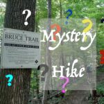
Bruce Trail Day Mystery Hike – open to members and non-members. Enjoy a hike somewhere along the Niagara section of the Bruce Trail while learning more about the Conservancy. You will be notified 24 hrs ahead as to where your hike will be located.
physical-distancing observed.

Hike open to BTC Members only.
Hosting Club: Toronto
Category: Cancelled
Location (Google Maps): Meet at MiWay Kipling Terminal Platform 16 for 8:52 a.m. departure MiWay Bus #1. Walk 5 minutes west from Kipling Subway Station to the Terminal. Or if going directly to the hike, meet the rest of us by the washrooms at Erindale Park. The entrance to Erindale Park is 1695 Dundas Street West, just east of Mississauga Road. Try to arrive 10-15 minutes ahead of time.
Hike Leader(s): Andrew Proczek Click here to contact Hike Leader(s)
Pace: Moderate
Terrain: Flat
Distance: 12.3 km
Description
Come enjoy the changing Fall colors as we explore UTM trails followed by an end to end of the Sawmill Valley Trail. The hike will originate and finish at Erindale Park with a loop on each end. Lunch Break at 5.5 km.
The route: https://onthegomap.com/s/t80impmb
The terrain is relatively easy without any major hills. We will be walking on a variety of dirt, packed gravel, and paved paths with some grass and boardwalks. Public Washrooms at Erindale park only but we will be making a nature stop at around the half way point.
Hosting Club: Peninsula
Location (Google Maps): Cape Dundas – hike leader will contact participants with meeting location
Hike Leader(s): Beth Gilhespy Click here to contact Hike Leader(s)
Terrain: Moderate
Distance: 6.5 km
Description
Join geologist Beth Gilhespy to explore all the layers of the Niagara Escarpment at Cape Dundas and learn about their formation and their fossils, as well as enjoy clifftop views on this popular geology hike. While the distance is short, there are frequent stops to observe geological features and the pace between stops is moderate. Please bring water and lunch. Expected duration is about 5 hours.
Hike open to BTC Members only.
Hosting Club: Toronto
Category: Car Hike
Location (Google Maps): Meet at the Town of Mono Community Centre located just south of the centre of Mono Centre off 2nd Line EHS. Parking is free and currently there are no restrictions on it.
Hike Leader(s): Al Brown Click here to contact Hike Leader(s)
Pace: Moderate
Terrain: Variable
Distance: 15 km
Description
We will hike from Mono Centre to the Split Rock Side Trail north of the PP and then follow this side trail along the escarpment edge past the Split Rock Narrows. Rejoining the 2nd line EHS Side Trail we return to the park along gently rolling land and trails. Expect some good fall colours along the way.
Hosting Club: Niagara
Category: Loop
Location (Google Maps): TBA
Hike Leader(s): Margaret Northfield Click here to contact Hike Leader(s)
Pace: Medium
Terrain: Moderate
Distance: 6-7 km
Description
Bruce Trail Day Mystery Hike – open to members and non-members. Enjoy a hike somewhere along the Niagara section of the Bruce Trail while learning more about the Conservancy. You will be notified 24 hrs ahead as to where your hike will be located.
physical-distancing observed.
Hosting Club: Sydenham
Category: General Hike
Location (Google Maps): Off road parking on the east side of Grey Rd. 12 just south of the trail crossing at Blantyre, at km 119.9 (Map 28, Edition 30) Please do not block access to farmers’ fields.
Hike Leader(s): Bill Snel Click here to contact Hike Leader(s)
Pace: Leisurely: 3 km/h or less
Terrain: Moderate: Some hills and/or poor footing
Distance: 8 km
Description
Hike the Beaver Valley section from Blantyre to the 7th Line and back. We will see Anthea’s Waterfall. For more information contact Bill Snel by email at w.snel2@gmail.com or call 519-470-0584 (landline).
Hosting Club: Peninsula
Location (Google Maps): Roadside parking at the end of Cathedral Drive. Bruce Trail Reference Guide Edition 30 Map 37.
Hike Leader(s): Marg Glendon Click here to contact Hike Leader(s)
Terrain: Moderate
Distance: ~5 km
Description
Fall is a wonderful time to be out hiking in the woods. No biting insects, and the fall colours some years can be beautiful. Can trees be identified by the fall colour of their leaves? In some cases, I think they can be, the focus of our hike will be on tree identifying techniques, including fall colour. Although the distance is short, the terrain is moderate and pace accommodates frequent stops for discussion about tree identification techniques.
Hike Interpreter: Bob Gray
Hosting Club: Niagara
Location (Google Maps): TBD
Hike Leader(s): Alicia Aitchison Click here to contact Hike Leader(s)
Pace: Medium
Terrain: Moderate
Distance: 7k
Description
Celebrate Bruce Trail Day with a Mystery Hike and Trivia. Hikers will be informed of hike particulars on the day.
Hosting Club: Iroquoia
Category: Happy Wanderers
Location (Google Maps): St. Helena Road
Hike Leader(s): Louise Langlais Click here to contact Hike Leader(s)
Pace: Brisk – 4 to 5 km/hr, Medium – 3 to 4 km/hr
Terrain: Strenuous – Hilly with steep climbs and some poor footing
Distance: 14-18 km
Description
We’re going to explore the mountain bike trails that criss-cross the Bruce Trail in Speyside.
Hike Leader: Louise Langlais; Email: langlaislouise@gmail.com. Cell: 519-222-4040 on day of hike. At other times, email is the best way to contact me. Wear appropriate quick-dry clothing and hiking boots. Bring sunscreen, insect repellent (summer), icers (winter), snacks, lunch, a personal first aid kit , and 1-2 litres of water. During COVID, also bring hand sanitizer and a face mask. For personalized driving directions, click on the hike in the BTC hike calendar, then on (Google Maps) to the right of the word Location, and your smart phone should navigate you to the correct location. Please arrive at least 15 minutes early. If you are unable to attend, please email me as long as possible in advance of the hike, or text me if it is <2 hours before the hike. There is often a waiting list, so the more advance notice you give, the better.
Your first aid kit should include bandaids, sterile gauze pads, a tensor bandage, Sam Splint, moleskin, SteriStrips for lacerations, antiseptic ointment, ASA (for heart attack), ibuprofen, Benadryl, gravol, imodium + personal medications such as nitroglycerin for people with Angina. For more information, click this link: https://www.gore-tex.com/blog/hiking-first-aid-kit(https://www.gore-tex.com/blog/hiking-first-aid-kit)
Hosting Club: Niagara
Category: Loop
Location (Google Maps):
Short Hills Wiley Road Entrance
Hike Leader(s): Alan Laver Click here to contact Hike Leader(s)
Pace: Brisk
Terrain: Moderate
Distance: 12k
Description
Explore Short Hills and the majestic side trails of Scarlett Tanager, Hemlock. Swayze Falls and Terrace. Register for each hike
Hosting Club: Niagara
Category: Loop
Location (Google Maps): Shirt Hills Provincial Park – Pelham Road entrance
Hike Leader(s): janet davey Click here to contact Hike Leader(s)
Pace: Medium
Terrain: Moderate
Distance: 6 kms
Description
Hike the main and side trails in Short Hills.
Hosting Club: Dufferin Hi-Land
Category: Tuesday Hike
Location (Google Maps): Caledon Hills Section, Map 18. Meet at the Bruce Trail parking lot on the north side of 5 Sideroad Mono, about 500 metres east of Airport Road (Km 45.5).
Hike Leader(s): Les Babbage, Inge Eckerich, Bob Slack Click here to contact Hike Leader(s)
Pace: Leisurely
Terrain: Moderate
Distance: 6.6 or 3.7 km
Description
We will hike north on the Main Trail to Airport Road, returning by way of Hockleycrest Side Trail. The short option will take Hockley Hollow Side Trail to pick up the Hockleycrest Side Trail and the Harmony Side Trail.
Hike open to BTC Members only.
Hosting Club: Caledon Hills
Category: Tuesday Hikers
Location (Google Maps): Parking lot is for Duncan Crevice Caves Provincial Nature Reserve & is on 9th Sideroad and only holds 8-10 cars, so please carpool if possible. Map 25 of 29th Edition of Bruce Trail Guide. Put the coordinates into your GPS or smart phone and it will get you there.
Hike Leader(s): Susan Atkinson. Cell # (519) 831-9474 for day of hike. Click here to contact Hike Leader(s)
Pace: Medium – 3 to 4 km/hour
Terrain: Moderate – some hills and/or some poor footing
Distance: 11 km
Description
We will hike the loop formed by the Chuck Grant Side Trail and the Main Trail. There will be tremendous views and fall colours. The Metcalfe Crevice Side Trail is an exciting and challenging alternative to the Main Trail. We will descend and climb the escarpment, cross Mill Creek, and pass by Metcalfe Rock and Pinnacle Rock.
Bring water, lunch or a snack, and hiking boots. No dogs please.
If you have to cancel, please email me, and take your name off the hike list, as there may be a waiting list. If you cancel on day of hike, call me on my cell or send a text.
Hosting Club: Iroquoia
Location (Google Maps): Wellington Rd 32, between Concession 2 and 401
Hike Leader(s): Louise Langlais Click here to contact Hike Leader(s)
Pace: Medium – 3 to 4 km/hr
Terrain: Strenuous – Hilly with steep climbs and some poor footing
Distance: 12-14 km
Description
We will hike the intersecting trails in this population mountain-biking destination, then go to The Old Marina Restaurant with a view of Puslinch Lake for refreshments.
Hike Leader: Louise Langlais; Email: langlaislouise@gmail.com. Cell: 519-222-4040 on day of hike. At other times, email is the best way to contact me. Wear appropriate quick-dry clothing and hiking boots. Bring sunscreen, insect repellent (summer), icers (winter), snacks, lunch, a personal first aid kit, and 1-2 litres of water. During COVID, also bring hand sanitizer and a face mask. Please email me at least 24 hours before the hike to register. Sometimes last minute changes are made to hikes; registering means you won’t be waiting around the meeting place not knowing why no-one else is there! For personalized driving directions, just copy and paste the GPS coordinates into a Google search window and voila! Please arrive at least 15 minutes early. If you are unable to attend, please email me at least 2 hours before the start of the hike, or text me if it is <2 hours before the hike. There is often a waiting list, so the more advance notice the better.
Your first aid kit should include bandaids, sterile gauze pads, a tensor bandage, Sam Splint, moleskin, SteriStrips for lacerations, antiseptic ointment, ASA (for heart attack), ibuprofen, Benadryl, gravol, imodium + personal medications such as nitroglycerin for people with Angina. For more information, click this link: https://www.gore-tex.com/blog/hiking-first-aid-kit(https://www.gore-tex.com/blog/hiking-first-aid-kit)
Hike open to BTC Members only.
Hosting Club: Blue Mountains
Category: Blue Mountain Hike
Location (Google Maps): Hike meets in the parking lot behind Tim Horton’s on First St. in Collingwood.
Hike Leader(s): Mary-Lynne Chenard (905) 713-4066 Click here to contact Hike Leader(s)
Pace: Medium – 3 to 4 km/hr
Terrain: Moderate – Some hills and/or some poor footing
Distance: 8 km
Description
We will park on Sideroad 7B at km 43.5 in the Beaver Valley section.
This in/out hike proceeds north on the white blazed trail which winds along the top of the escarpment
before descending through a crack to the bottom.
We then climb to the top again before descending once more to km 39.3.
We get to enjoy it all over again as we retrace our steps back to the cars.
Bring a snack and water.
Map: 27 Edition 30
Hike open to BTC Members only.
Hosting Club: Blue Mountains
Category: Blue Mountain Hike
Location (Google Maps): Hike meets in the parking lot behind Tim Horton’s on First St. in Collingwood.
Hike Leader(s): Heather Wintermeyer – (705) 444-6796 Click here to contact Hike Leader(s)
Pace: Leisurely – 3 km/hr. or less
Terrain: Moderate – Some hills and/or some poor footing
Distance: 4-6 km
Description
We will park on 6/7 Sideroad at Concession 10.
Following the white blazed trail south on Concession 10, we enter the Dunedin Nature Preserve on the east side.
This area covers mixed terrain and provides a chance to experience a variety of habitats.
The trail follows the banks of a tributary of the Noisy River.
When we reconnect with Concession 10, depending on the group decision,
we will either return to the cars following the road or continue across
Concession 10 to proceed through some farmers fields to a great view at the bench before returning.
Bring a snack or lunch and water.
Map: Edition 30
Hosting Club: Niagara
Category: Loop
Location (Google Maps): Short Hills Provincial Park, Roland Road Parking Lot
Hike Leader(s): Alicia Aitchison Click here to contact Hike Leader(s)
Pace: Medium
Terrain: Moderate
Distance: approximately 7 km
Description
We will meet at Roland Road parking lot and do the Swayze Falls Loop. 1.5-2 hours. Beautiful forest, some good hills & Swayze Falls!
Hike open to BTC Members only.
Hosting Club: Iroquoia
Category: Good Companions
Location (Google Maps): Bullocks Mark in Greensville. Across from the Anglican Church on Highway 8
Hike Leader(s): Lorraine Sherred Click here to contact Hike Leader(s)
Pace: Medium – 3 to 4 km/hr
Terrain: Moderate – Some hills and/or some poor footing
Distance: 10 km
Description
We will walk the Spencer Adventure walk. (Formerly called the Optimist Heritage trail) We will walk up to the dam in Christie Lake area and back
Hosting Club: Niagara
Category: In and Out
Location (Google Maps):
Jordan Hollow Park 3039 King St Jordan
Hike Leader(s): Alan Laver Click here to contact Hike Leader(s)
Pace: Fast
Terrain: Moderate
Distance: 12k
Description
From Jordan Hollow Hike the main trail to Moyer Road or Louth and Return. You must register for each hike
Hosting Club: Niagara
Category: In and Out
Location (Google Maps): Jordan Hollow Park
Hike Leader(s): Bill Russell Click here to contact Hike Leader(s)
Pace: Medium
Terrain: Strenuous
Distance: 7 kms
Description
Hike along the Jordan Creek to Upper Balls Falls or the Jim Rainforth Trail. You must register for each hike.
Hosting Club: Iroquoia
Category: Thursday Group
Location (Google Maps): Cityview Park, Kerns Rd.
Hike Leader(s): Anne Armstrong Click here to contact Hike Leader(s)
Pace: Leisurely – 3km/hr or less
Terrain: Moderate – Some hills and/or some poor footing
Distance: Approx. 9-10 km.
Description
Hiking along the escarpment and through woods will give us beautiful views as Autumn weaves its magical colours. Join us for this hike beginning at Cityview Park on the east side of Kerns Road. Park in the most southerly parking lot below Dundas on the east side of Kerns. As you drive in, the parking lot is on your right. We will hike main trail to Smokey Hollow in Waterdown and then return. Bring water, a snack/lunch and hiking poles if using. Burn off some calories pre the Thanksgiving feast! (Covid protocols in effect.)
Leader: Anne Armstrong 905 617 2937 hikingrandma@gmail.com
Hosting Club: Niagara
Category: Urban
Location (Google Maps): Veteran Memorial Park, Niagara-on-the-Lake
Hike Leader(s): Margaret Northfield Click here to contact Hike Leader(s)
Pace: Medium
Terrain: Easy
Distance: 6-8km
Description
This series of Friday hikes will take various routes around Niagara-on-the-Lake. Mostly paved pathways with some trail. These hikes are a great way to build stamina for beginners as well as see beautiful historic Niagara-on-the-Lake.
Meet in Veteran’s Memorial Park, King & Veteran’s Lane, Niagara-on-the-Lake. Park near the tennis courts.
Hosting Club: Sydenham
Category: General Hike
Location (Google Maps): Designated parking area at the end of Lundy Road, east of km 135.2 (Map 34). Please obey the parking signs and do not block the lane access for farm machinery.
Hike Leader(s): Carol Mullin Click here to contact Hike Leader(s)
Pace: Medium: 3 to 4 km/h
Terrain: There might be muddy sections.
Distance: 3.9 km loop
Description
Scenic hike around Bass Lake with views of the lake, marshes and along the top of the escarpment. Some crevices and interesting ferns. Approx. 1.5 hours. Hiking poles recommended
Hike open to BTC Members only.
Hosting Club: Blue Mountains
Category: Cancelled
Location (Google Maps): Hike meets in the parking lot behind Tim Horton’s on First St. in Collingwood.
Hike Leader(s): Annette Sandberg – (705) 795-9700 Click here to contact Hike Leader(s)
Pace: Medium – 3 to 4 km/hr
Terrain: Moderate – Some hills and/or some poor footing
Distance: 10 km
Description
We will park at the Glen Side Trail on County Road 17 in the Sydenham section.
Starting on the blue blazed trail, we will meet up with the white blazed trail
and hike northeast to km 117.4 exploring the Frank Holley Side Trail,
Walker Homestead Side Trail and the East Linton Side Trail on the way.
After lunch we will return via the Ron Savage SIde Trail to the cars.
The trail passes through the Glen Management Area where you will see a wide variety of
fossils on the underside of a rock overhang.
Bring a snack or lunch and water.
Map: 33 Edition 30

Hosting Club: Niagara
Category: Car Pool
Location (Google Maps):
Meet at entrance to Woodend Conservation Area on Taylor Rd. NOTL (Map 2, km 15.2) Carpool.
Hike Leader(s): Alan Laver Click here to contact Hike Leader(s)
Pace: Brisk
Terrain: Moderate
Distance: 16 km
Description
Hike #4 of End to End. Hike meanders through Brock University along the trail. There is some roadwork
Hike open to BTC Members only.
Hosting Club: Blue Mountains
Category: Blue Mountain Hike
Location (Google Maps): Hike meets in the parking lot behind Tim Horton’s on First St. in Collingwood.
Hike Leader(s): Myra Campbell – (c) (705) 888-9488 (h) (705) 293-2525 Click here to contact Hike Leader(s)
Pace: Medium – 3 to 4 km/hr
Terrain: Moderate – Some hills and/or some poor footing
Distance: 6.5-7 km
Description
We will park at the Blue Mountain parking lot on Swiss Meadows Road and follow
the white blazed trail through the valley to the Swiss Meadows Side Trail.
After hiking the Swiss Meadows Side Trail, we will continue on the white blazed trail to explore the beginning of the
Beaver Valley section before returning to the cars.
There are lovely views along the escarpment overlooking the bay, an interesting walk and nice forest trails.
A good variety of terrain with some flat sections but lots of ups & downs too.
Bring a snack or lunch and water.
Map: 24 Edition 30
Hosting Club: Toronto
Category: Car Hike
Location (Google Maps): Ken Reid Conservation Area, Lindsay. Meet in the parking lot at the north end of Conservation Lane by the playground overlooking Sturgeon Lake (not in the main parking lot by the administrative centre)
Hike Leader(s): Martina Furrer Click here to contact Hike Leader(s)
Pace: Moderate
Terrain: Flat
Distance: 11 KM
Description
Join me for an easy hike in Ken Reid Conservation Area. Explore cedar forest, wetland, and savannah along the shores of Sturgeon Lake. If we’re lucky we’ll spot an Osprey or a Great Blue Heron. We’ll serve coffee, tea and treats in the park afterwards.
Parking costs $4/vehicle. Pay on site using the park’s pay and display machine or pay online with MacKay Pay.
Hosting Club: Toronto
Category: Car Hike
Location (Google Maps): We meet at the Mono 5 Sideroad parking on the North side of the road where the trail crosses the road.
Hike Leader(s): Fayyaz Mahmood Click here to contact Hike Leader(s)
Pace: Brisk
Terrain: Challenging, Hilly
Distance: 18.8KM
Description
Here is your opportunity to hike the Side Trails and more interesting sections of the Main Bruce Trail in the Caledon section.
We will walk South from the parking lot Map 18, 45.5KM (Ed 30) to Coolihans Sideroad Map 17, 35.2KM. We will then hike back on the Glen Haffy Side Trail rejoining the Main Trail to return back to the cars.
Bring 1.5 – 2 liters of water and your lunch. Please dress for the weather.
Hosting Club: Niagara
Category: Loop
Location (Google Maps):
Glenridge Quarry parking Lot, St Davids Road. Map 3
Hike Leader(s): Dan Wilson Click here to contact Hike Leader(s)
Pace: Medium
Terrain: Easy
Distance: 6 km
Description
A combination of open trails with spectacular views across Lake Ontario and wooded trails including the main trail
Hosting Club: Niagara
Category: Loop
Location (Google Maps): Glenridge Quarry Naturalization Site, 1860 Sir Isaac Brock Way, St. Catharines, On
Hike Leader(s): Diane Marlatt Click here to contact Hike Leader(s)
Pace: Medium
Terrain: Moderate
Distance: 7 km
Description
Hike the trails around the quarry as well as the main trail near Brock University forming a loop
Hike open to BTC Members only.
Hosting Club: Iroquoia
Category: General Hike
Location (Google Maps): Bruce Trail Red P parking lot on 2nd Line EHS north of 25 Sideroad and Mono Cliffs Provincial Park (northern terminus of the Splitrock Side Trail). BTC Map 19 about 1.2 km northeast of km 10.0.
Hike Leader(s): Stuart Law Click here to contact Hike Leader(s)
Pace: Medium – 3 to 4 km/hr
Terrain: Dependent on Conditions, Moderate – Some hills and/or some poor footing, Slippery Sections Likely
Distance: Approx. 18 kms
Description
Joins us for a Thanksgiving Sunday hike on the many Side Trails of Mono Cliffs Provincial Park and its environs: Splitrock, Narrows, Ralph Tremill, Walter Tovell, South Outlier, Laidlaw, McCarston’s Lake and Lookout. The Fall colours should be spectacular. Please bring a smile, hiking boots, poles, lunch, snack and 2.5L of water minimum. Hike starts at 9:30 am sharp. Please be there ready to go at 9:15 am. Thanks.
Hosting Club: Toronto
Category: Urban Walk
Location (Google Maps): Meet at MiWay Kipling Terminal Platform 16 for 8:52 a.m. departure MiWay Bus #1. Walk 5 minutes west from Kipling Subway Station to the Terminal. Or if going directly to the hike, meet the rest of us by the washrooms at Erindale Park. The entrance to Erindale Park is 1695 Dundas Street West, just east of Mississauga Road. Try to arrive 10-15 minutes ahead of time.
Hike Leader(s): Andrew Proczek, David Royle Click here to contact Hike Leader(s)
Pace: Moderate
Terrain: Flat
Distance: 12.3 km
Description
Rescheduled hike from October 3rd, come enjoy the changing Fall colors as we explore UTM trails followed by an end to end of the Sawmill Valley Trail. The hike will originate and finish at Erindale Park with a loop on each end. Lunch stop at 5.5 km.
The terrain is relatively easy without any major hills. We will be walking on a variety of dirt, packed gravel, and paved paths with some grass and boardwalks. Public Washrooms available at Erindale park only, but nature stops will be offered during the hike.

Hike open to BTC Members only.
Hosting Club: Toronto
Category: Urban Walk
Location (Google Maps): Meet inside the waiting area of Jack Layton Ferry Terminal at the Foot Of Bay Street to take the 9:00 AM Ferry to Ward’s Island. Note that ferry tickets must be purchased online in advance and are only valid for the selected date.
Ferry Tickets:
https://secure.toronto.ca/FerryTicketOnline/tickets2/index.jsp
Hike Leader(s): Tom Swales;David Royle Click here to contact Hike Leader(s)
Pace: Moderate
Terrain: Flat
Distance: 12
Description
Join us for the return of our annual Thanksgiving Monday hike on the Toronto Islands to walk off some calories from Sunday, take in the fall colours, and get some fresh air after the holiday celebrations. On this hike we explore some lesser visited spots on the islands and enjoy the smaller crowds. We’ll work our way gradually across the Islands and return from the Centre Island Dock (The Hanlan’s Point Dock is out of service) at 3:00 PM. Dropout is possible by proceeding toward the Center Island Dock or back to the Wards Island Dock earlier.
** Pre-registration on Bruce Trail Conservancy Website is required – No “Walk-ups” Will Be Accepted **
Limit: 17 Hikers
Hosting Club: Iroquoia
Category: General Hike
Location (Google Maps): Meet at 512 Montgomery Drive – At the free parking inlet.
We can then get into two cars (masked with windows open) to drive to our starting point at 900 Wilson Street East / Tiffany Falls (1KM)
Parking fee is $12.00 per car. Please bring 3 dollars to contribute to the parking fee.
Hike Leader(s): Trish Murphy Click here to contact Hike Leader(s)
Pace: Medium – 3 to 4 km/hr
Terrain: Moderate – Some hills and/or some poor footing
Distance: Approximately 8KM
Description
Hike Leader: Trish Murphy
Email: onthetrails.ibtc@gmail.com
Mobile: 437.889.0852 on day of hike.
At other times, email is the best way to contact me.
This is an 8km beginner to intermediate nature hike along the Bruce Trail through forest, with stops at Tiffany, Sherman and Canterbury Falls. At about the 1km mark, we will be crossing Old Dundas Road to connect and continue on the trail.
We will take short breaks at each of the Falls stops.
With the recent rain, we will likely encounter muddy areas, please dress appropriately for the weather and for muddy conditions.
One slightly steep incline just after Sherman Falls.
Wear appropriate quick-dry, cool clothing and hiking shoes/boots.
Bring sunscreen, a sun hat, insect repellent, snacks, 1-2 litres of water, a personal first aid kit, hand sanitizer and a face mask.
Please register at least 12 hours prior to hike start time. Sometimes last minute changes are made to hikes; registering means we will be able to contact you to communicate any changes to the schedule. For driving directions, copy and paste the GPS coordinates into a Google search window or plug into your gps device, the address supplied.
Please arrive 15 minutes early. If you are unable to attend, please email me at least 2 hours before the start of the hike, or text me if it is less than 2 hours before the hike.
We will depart promptly at 10:00AM.
Hosting Club: Niagara
Location (Google Maps):
Short Hills Wiley Road Entrance
Pace: Brisk
Terrain: Moderate
: 12k
Description
Explore Short Hills and the majestic side trails of Scarlett Tanager, Hemlock. Swayze Falls and Terrace. Register for each hike
Hosting Club: Beaver Valley
Location (Google Maps): Meet at Ed’s place, 194700 on Grey Rd 13, (near km 54) Map 26, Edition 30. The house is midway between Kimberley and Eugenia on the west side of the road, with white wooden chairs near the road and apple trees in the front yard. Google Maps should find it accurately but other GPS systems may not.
Hike Leader(s): Ed Stedman Click here to contact the hike leader.
Pace: Medium
Terrain: Moderate, Some rocky footing, Some steep sections
Length of Hike: approx. 12 kms
Description
This is an out and back hike which takes us to lovely Eugenia Falls.
COVID-19 Precautions Before, During and After your Hike
- Each hiker joining a Bruce Trail Club organized hike must perform a self-screening check before hiking.
Find Ontario’s self-assessment tool here: https://covid-19.ontario.ca/self-assessment/ - If you are experiencing COVID-19 symptoms, stay home.
- Personal Protective Equipment:
- Hikers may choose to wear masks
- Hikers may carry and use hand sanitizer, but should not be sharing it with the group
- Hikers who experience COVID-19 symptoms following a Bruce Trail Club organized hike must inform their local public health unit.
Find your local health unit at http://www.health.gov.on.ca/en/common/system/services/phu/locations.aspx
Transportation
All hikers are responsible for their own transportation to and from the hike.
Currently, there are no car shuttles on hikes – all hikes must be out-and-back or loop hikes.
Other Guidelines
- Arrive 15 minutes before the start of the hike.
- Wear sturdy footwear and appropriate attire for the weather and the terrain.
Hiking poles are a good idea in any season, especially if the terrain is rocky or slippery. In winter, snowshoes or icers/crampons are needed when conditions dictate.
Wearing appropriate clothing and footwear prevents injuries and shows consideration for a safe and positive group hiking experience. - Always carry I.D. and your health card.
- Bring sufficient water and snacks (or lunch if indicated). A minimum of 1L of water is recommended on all hikes, and 3L is recommended for long, challenging hikes in the heat of the summer.
- Bring sunscreen and insect repellent (for spring and summer hikes).
- Bring your own first aid kit.
- Please leave dogs at home.
Hosting Club: Caledon Hills
Category: Tuesday Hikers
Location (Google Maps): Forks of the Credit and Environs. Meet at 8:45 for a 9 am departure at the parking area on the Escarpment Sideroad 1.6 km West of the intersection with Highway 10 (halfway up the escarpment).
Hike Leader(s): Peter Ostrowski Click here to contact Hike Leader(s)
Pace: Medium – 3 to 4 km/hour
Terrain: Moderate – some hills and/or some poor footing
Distance: 10.72 km
Description
Join us for a very pleasant fall hike through Forks of the Credit Provincial Park and enjoy the fall colours. This is a loop hike and we will walk part of the way up McLaren Rd. to enter the park and stop at the falls. We will return along the trail through the deep forest.
Hosting Club: Niagara
Location (Google Maps): Shirt Hills Provincial Park – Pelham Road entrance
Hike Leader(s): janet davey Click here to contact Hike Leader(s)
Pace: Medium
Terrain: Moderate
Distance: 6 kms
Description
Hike the main and side trails in Short Hills.
Hosting Club: Caledon Hills
Category: Tuesday Hikers
Location (Google Maps): Parking lot at km 31.7 Map 22.Take Hwy 10 North. At Primrose turn left then in 5 km turn right on County Rd. 124. Follow for 30 km. In village of Singhampton turn right and follow #124 for 4 km to parking on the right. Leader’s cell phone 905-301-4091.
Hike Leader(s): Peter Leeney Click here to contact Hike Leader(s)
Pace: Medium – 3 to 4 km/hour
Terrain: Moderate – some hills and/or some poor footing
Distance: 12 km
Description
This is a loop hike. We will follow the Main Trail south then return on the Mad River Side Trail and Main Trail to our starting point. There is no dropout point. Expect a few hills. No dogs please.
Leader’s cell phone 905-301-4091.
Hosting Club: Dufferin Hi-Land
Category: Tuesday Hike
Location (Google Maps): Dufferin Hi-Land Section, Map 20. Meet at parking lot at end of Centre Road, south of 5 Sideroad Mulmur (just north of Km 18.7).
Hike Leader(s): Les Babbage, Inge Eckerich, Bob Slack Click here to contact Hike Leader(s)
Pace: Leisurely
Terrain: Moderate
Distance: Long hike: 6.3 km, Short: 3 km
Description
We will hike a loop consisting of the Main Trail and Boyne Valley Side Trail. The short option will return to parking from the Boyne River bridges by way of Centre Road road allowance.
Hosting Club: Sydenham
Location (Google Maps): Roadside parking on the shoulder of Sideroad 3, east of 6th Concession S, at km 21.8 (Map 29, Edition 30)
Hike Leader(s): Maureen McFarland Click here to contact Hike Leader(s)
Pace: Medium: 3 to 4 km/h
Terrain: Moderate: Some hills and/or poor footing, There might be muddy sections.
Distance: 6 km
Description
This section is seldom done, except by end to enders. on this in and out hike we pass through a section of dense cedar forest where the trees form a beautiful canopy over the trail. In the forest beyond that, we will find 150+ year old beech trees, left behind by loggers years ago. We’ll hike as far as the 4th Concession S before turning around to retrace our steps back to the cars.
Hike open to BTC Members only.
Hosting Club: Blue Mountains
Category: Blue Mountain Hike
Location (Google Maps): Hike meets in the parking lot behind Tim Horton’s on First St. in Collingwood.
Hike Leader(s): Bert Beausoleil – (705) 293-2525 Click here to contact Hike Leader(s)
Pace: Medium – 3 to 4 km/hr
Terrain: Moderate – Some hills and/or some poor footing, Strenuous – Hilly with steep climbs and some poor footing
Distance: 11.5 km
Description
We will drive to the start of the hike at a roadside parking area near the cemetery
located 1 km east of Lavender on Mulmur/Nottawasaga Townline.
We will hike along the road until we reach Lavender where km 0.0 is the start of the Blue Mountains section.
We will continue hiking until we reach the bridge at the Noisy River Nature Reserve and then retrace our steps.
This hike offers a variety of terrain as we proceed along crevices, through forest,
fields, and beautiful wetlands before reaching the Noisy River.
Bring lunch and water.
Map: 21 Edition 30
Hosting Club: Niagara
Category: In and Out
Location (Google Maps):
Meet at Woodend Conservation Area off Taylor Road (Map 2)
Hike Leader(s): Karen Limardi Click here to contact Hike Leader(s)
Pace: Medium
Terrain: Easy
Distance: 7km
Description
Hike along the historic 3rd canal to the present canal bridge on Glendale. Return along same route.
Hike open to BTC Members only.
Hosting Club: Iroquoia
Category: Hikers R Us
Location (Google Maps): Meet at 91 Little John Road, Dundas.
Hike Leader(s): Charlotte Stewart Click here to contact Hike Leader(s)
Pace: Medium – 3 to 4 km/hr
Terrain: Moderate – Some hills and/or some poor footing
Distance: 12 km
Description
We will explore the Dundas Valley, entering via the Monarch Trail, and hiking the Main Loop and the Spring Creek Trail and returning via the Rail Trail to Little John Road. Street parking available on the south side of the street.
Hosting Club: Iroquoia
Category: Good Companions
Location (Google Maps): North Parking Lot off Kerns Road (Near Dundas Street)
City View Park
Burlington
Hike Leader(s): Ted Bossence Click here to contact Hike Leader(s)
Pace: Medium – 3 to 4 km/hr
Terrain: Strenuous – Hilly with steep climbs and some poor footing
Distance: 7.5 km
Description
We will do a loop on the East side of Kerns Road including the Ian Reid Side Trail and then do a loop using the main Bruce Trail and King Road Side Trail on the West side of Kerns. A couple of the hills will be steep and may be slippery. We will stop for a snack between the two loops.

Hike open to BTC Members only.
Hosting Club: Iroquoia
Category: Special Event
Location (Google Maps): Frontenac Provincial Park
Hike Leader(s): Ruth Moffatt Click here to contact Hike Leader(s)
Pace: Brisk – 4 to 5 km/hr
Terrain: Strenuous – Hilly with steep climbs and some poor footing
Distance: 11 loop hikes ranging in distance from 1.5km – 21km(+access trail distances)
Description
This is a series of hikes called the Frontenac Challenge at Frontenac Provincial Park running over 7 days of hiking. The loops are of various distances with the longest being about 27km including the access trail.
Accommodation is at Snug Harbour Resort, a short distance from the park. Email Rob at relax@snugharbour.on.ca. Let him know you’re with the Bruce Trail Group.
http://www.snugharbour.on.ca/dates-and-rates.htm
You may also choose to stay elsewhere. Parking fees for the park will also apply. Purchase of a map of the park is strongly recommended.
www.frontenacpark.ca
A hike schedule will be provided to all registrants at the beginning of October.
Please reach out to Ruth Moffatt if you have any questions.
Hosting Club: Niagara
Location (Google Maps):
Jordan Hollow Park 3039 King St Jordan
Pace: Fast
Terrain: Moderate
: 12k
Description
From Jordan Hollow Hike the main trail to Moyer Road or Louth and Return. You must register for each hike
Hosting Club: Niagara
Location (Google Maps): Jordan Hollow Park
Hike Leader(s): Bill Russell Click here to contact Hike Leader(s)
Pace: Medium
Terrain: Strenuous
Distance: 7 kms
Description
Hike along the Jordan Creek to Upper Balls Falls or the Jim Rainforth Trail. You must register for each hike.
Hosting Club: Sydenham
Category: General Hike
Location (Google Maps): Roadside parking on the east side of St Vincent-Sydenham Townline at the River Kwai Side Trail at km 56.3, Map 30. This is north of Highway 26 and south of Sideroad 24.
Hike Leader(s): Fran Turner Click here to contact Hike Leader(s)
Pace: Brisk: 4 to 5 km/h
Terrain: Moderate: Some hills and/or poor footing
Distance: 13 km
Description
This brisk 13 km hike passes through mixed hardwood forest and offers many vistas looking out over the Land Forces Training Centre. We begin on the River Kwai Side Trail and then follow the Main Trail along the escarpment edge for several km, enjoying the many crevices and cliff-top views. The trail loops back to rejoin the St Vincent-Sydenham Townline where we will walk back to our cars. The trail is relatively flat but the terrain is rugged with uneven footing. Excellent hiking boots are a must.
Hosting Club: Iroquoia
Category: Thursday Group
Location (Google Maps): Crawford Lake Conservation Area – Guelph Line
Hike Leader(s): Phillip Armstrong Click here to contact Hike Leader(s)
Pace: Medium – 3 to 4 km/hr
Terrain: Moderate – Some hills and/or some poor footing
Distance: 10 to 12 km.
Description
Meet in the lower parking lot at 9:45 am. for a 10:00 start. We’ll do loops (possibly including Nassagaweya Canyon) to see the best of the Fall colours. Bring water and a snack. Reservations are required. Make your reservation for 9:40; each reservation covers 3 hours on weekdays.
Leader: Phill Armstrong 416 895 3937 hikingrandpa@gmail.com

Hosting Club: Niagara
Category: Urban
Location (Google Maps): Veteran’s Memorial Park, King St & Veteran’s Lane
Hike Leader(s): Margaret Northfield Click here to contact Hike Leader(s)
Pace: Medium
Terrain: Easy
Distance: 6-8km
Description
These weekly hikes will take various routes around beautiful Niagara-on-the-Lake. We may take in history or just enjoy the ambiance of the area. Urban hikes are mostly paved with some trail walking.
Meet in Veteran’s Memorial Park near the tennis courts. (King St & Veteran’s Lane)
The first Friday of the month we will meet in Queenston Heights Park for a variety of hikes.

Hosting Club: Niagara
Category: Car Pool
Location (Google Maps):
Meet at the Cairn, Queenston. Niagara Parkway. (Map 1, km 0.0) Carpool to Wood end. You will need to pay for parking
Bring Poles, Bug Spray, Drink and snack plus $5 for badge if you have completed all 5 hikes
Hike Leader(s): Alan Laver Click here to contact Hike Leader(s)
Pace: Medium
Terrain: Moderate
Distance: 15.2 km
Description
Last leg of the end to end from Woodend to the Cairn.
Hosting Club: Iroquoia
Category: General Hike
Location (Google Maps): Parking at the Borer’s Falls Dog Park, at the junction of York Road and Valley Road near Dundas. GPS Coordinates: (43.289426, -79.927153). From Highway #403 near Hamilton, go north on Highway #6 towards Guelph. Take the York Road exit and turn right towards Dundas. Stay on York Road, past the four-way stop, and look for the parking area on your right immediately past Valley Road (Bruce Trail Reference, Map 8)
Hike Leader(s): Douglas Boyce Click here to contact Hike Leader(s)
Pace: Brisk – 4 to 5 km/hr
Terrain: Strenuous – Hilly with steep climbs and some poor footing
Distance: 15 km
Description
We will hike the Ray Lowes Side Trail, Main Trail and Tews Falls Side Trail to the Dundas Lookout Side Trail. Beautiful views from the Dundas peak, and then we return to our cars using the same route. Warning: this is a tough hike. Some big climbs, up and down. And we’re hiking it all at a brisk pace. We will stop at the peak for a snack break. Bring snacks and water.
Hike open to BTC Members only.
Hosting Club: Blue Mountains
Category: Blue Mountain Hike
Location (Google Maps): Hike meets in the parking lot behind Tim Horton’s on First St. in Collingwood.
Hike Leader(s): Michelle Wacker – (705) 730-8481 Click here to contact Hike Leader(s)
Pace: Medium – 3 to 4 km/hr
Terrain: Moderate – Some hills and/or some poor footing
Distance: 12 km
Description
We will park at km 44.2 on the St Vincent-Sydenham Townline.
This hike takes us south on the white blazed trail exploring the Woodford Escarpment Side Trail
and Waisberg SIde Trail before stopping for lunch.
We will hike through some crevices, see a giant pothole converted into a lime kiln,
and other signs of an old pioneer settlement (church foundation) all while enjoying a beautiful escarpment edge.
After lunch we will retrace our steps on the white blazed trail
and explore the Crevice Springs Side Trail’s crevices formed when dolostone loosened from the face of the escarpment.
Ultimately, we will descend through an interesting
crevice called the “hole-in-the-wall” before beginning our ascent.
Bring lunch and water.
Map: 30 Edition 30
Hike open to BTC Members only.
Hosting Club: Blue Mountains
Category: Blue Mountain Hike
Location (Google Maps): Hike meets in the parking lot behind Tim Horton’s on First St. in Collingwood.
Hike Leader(s): Mary Jane McIntyre – (c) (416) 788-4166 Click here to contact Hike Leader(s)
Pace: Leisurely – 3 km/hr. or less
Terrain: Moderate – Some hills and/or some poor footing
Distance: 5 km
Description
Starting at the BTC parking lot off County Rd 91, we will head east along the blue blazed trail to join the white blazed trail.
We will head along the former Duntroon View Side Trail (now a white blazed trail), passing deep crevices.
The trail follows along the locally dubbed “Walker Walkway”, adjacent to the Duntroon Quarry where operations are clearly visible.
We will reach woods and meander our way through mixed forest,
into the heart of Highlands Nordic network of cross country ski trails.
We will see amazing views across the beautifully groomed Duntroon Highlands Golf property.
Reaching Sideroad 21/22 and the popular Woolner House,
we then loop back to where we came, or follow Concession 10 north back to County Rd 91.
Bring a snack or lunch and water.
Map: 22 Edition 30
Hosting Club: Niagara
Category: In and Out
Location (Google Maps):
Parking lot Quarry Road Beamsville
Hike Leader(s): Bill Russell Click here to contact Hike Leader(s)
Pace: Medium
Terrain: Moderate
Distance: 6k
Description
Discover the history of the 19th Century Quarry Pioneers and the Cave Spring Witch.
Note that this hike will qualify for the annual Screaming Tunnel badge
Hosting Club: Sydenham
Category: General Hike
Location (Google Maps): Roadside parking and small parking area at the south end of 11th Concession, south of Superior Street, where the road intersects with the Owen Sound Rail Trail, north of km 86.5 (Map 32)
Hike Leader(s): Ian Mills Click here to contact Hike Leader(s)
Pace: Medium: 3 to 4 km/h
Terrain: Moderate: Some hills and/or poor footing, There might be muddy sections.
Distance: 6 km
Description
This will be an”in and out” hike, approx. 2 hours. Part of the trail leads through giant dolostone blocks separated by spectacular crevices. Good footwear recommended and a hiking stick will be helpful.
Hosting Club: Toronto
Category: Car Hike
Location (Google Maps): We meet at the Mono 5 Sideroad parking on the North side of the road where the trail crosses the road.
Hike Leader(s): Fayyaz Mahmood Click here to contact Hike Leader(s)
Pace: Brisk
Terrain: Challenging, Hilly
Distance: 19 KM
Description
Here is your opportunity to hike the Side Trails (ST) and more interesting sections of the Main Bruce Trail in the Caledon section.
We will walk North from the parking lot Map 18, 45.5KM (Ed 30) on the Main Trail taking in the Hemlock Ridge (ST), until we reach 4th Line EHS (54.3KM). We return hiking the Glacier Valley Side Trail (ST), Hockley Crest ST, Harmony ST and the Darcy ST coming out on Mono 5 Sideroad to walk back to the cars.
Bring 1.5 – 2 liters of water and your lunch. Please dress for the weather.
Hosting Club: Peninsula
Location (Google Maps): McIver Wetland/ Crooked Toe Road – hike leader will contact participants with meeting location
Hike Leader(s): Beth Gilhespy Click here to contact Hike Leader(s)
Terrain: Moderate
Distance: 5 km
Description
Join geologist Beth Gilhespy. Fossils and fascinating geology abound on an old favourite geology hike. While the distance is short, there are frequent stops to observe geological features and the pace between stops is moderate. Please bring water and lunch. Expected duration is about 5 hours.
Hosting Club: Iroquoia
Category: General Hike
Location (Google Maps): Dundas Valley Conservation
Hike Leader(s): Anne Armstrong Click here to contact Hike Leader(s)
Pace: Leisurely – 3km/hr or less
Terrain: Moderate – Some hills and/or some poor footing
Distance: approx. 10 km.
Description
This is the 50th hike that Phill and I have done to commemorate 50 years of marriage. We have been working on this since January, making sure we hike together. Meet at 9:45 am. for a 10:00 am. start in the last parking lot of the Dundas Valley Conservation Area on Governor’s Rd., just west of downtown Dundas. Parking fee in effect or a Conservation area pass. Bring a snack, water and poles if using. We will complete a loop hike including Gatehouse and Sherman Falls. There will be lots of hills to challenge but easy underfoot. Covid protocols in place.
Leaders: Anne and Phill Armstrong
Hosting Club: Toronto
Category: Car Hike
Location (Google Maps): Roadside Parking- km 47.8 at Boston Mills Rd Just west of the Mississauga Rd intersection (Maps and Trail Guidelines -Edition 29)
GPS ( N43.754003, W 79.948131)
Hike Leader(s): Alina Lin Click here to contact Hike Leader(s)
Pace: Brisk
Terrain: Hilly, Rocky, Variable
Distance: 16 KM
Description
COVID 19 safety guidelines will be observed for this hike. Please check here for details: https://brucetrail.org/pages/explore-the-trail/hike-schedule#guidelines

Hosting Club: Toronto
Category: Urban Walk
Location (Google Maps): Meet at Kipling Terminal for 8:30 a.m. for a 8:42 a.m. departure on MiWay express # 109 to Mississauga City Centre Transit Terminal. Transit users coming from different points can meet us at this terminal. From this terminal we will be catching the 9:30 MiWay bus # 61 to Derry Rd at Bellshire Gate arriving at 9:51 to begin the hike, a 1.4 km walk-in. Or if driving your car to the hike, meet the rest of us at 10:15 in the parking lot of the Credit Valley Conservation Authority, 1255 Old Derry Road.
Hike Leader(s): Andrew Proczek Click here to contact Hike Leader(s)
Pace: Leisurely, Moderate
Terrain: Flat
Distance: 9.7 car users; 12.5 transit users
Description
A repeat of the popular September 26th hike/heritage tour of Old Meadowvale Village, a pioneer village seemingly frozen in time, protected by a river but significantly impacted by the growing city around it. In 1980 Meadowvale Village was designated as Ontario’s first Heritage Conservation District. Joining us again will be author, story teller and memory keeper, historian and local resident, Terry Wilson, who will guide us through his replica miniature village, a labor of love for place where he grew up and for all that has been lost. After exploring his miniature Meadowvale Village, Terry will accompany and guide us through the life-size one. Taking in many of the old homes and buildings, you will never get tired of listening to Terry’s stories, as one hiker from the first tour remarked, “Terry, you have a calling.”
Starting form the Credit Valley Conservation Authority parking we will hike part of the Glassford Trail within the Meadowvale Conservation Area and work our way East to the Old Village. Together, the hike/tour will take approx. 3 hours (5.7 km), afterwards we will take our lunch near the Conservation Authority building with a splendid view of the Credit River Valley. At this point, back at their cars, the drivers will have the opportunity to drop out. Another 4 km loop, along Levi Creek, Samuelson Circle, and Meadowvale Conservation Area trails will be offered. Transit users will also have the opportunity to drop out partway on the loop.
Public Washrooms available inside the Conservation Area grounds that we can access before and after our village tour. Please bring minimum 1.5 L of water, a lunch or snacks, and your questions for Terry. Please also wear long pants.
You can watch Terry’s YouTube video here: https://www.youtube.com/watch?v=sv3xliKZtYE
Terry’s marvelous two volumes of stories, a loving tribute to his late mother, Rosemary, titled, “Rosemary’s Village” 2020 & “In Rosemary’s Garden” 2021, can be purchased from Amazon.ca.
Hosting Club: Sydenham
Category: Family Hike
Location (Google Maps): On the west side of 8th Concession North, park either in the car park or along the roadside, just south of km 73.7 (Map 31, Edition 30)
Hike Leader(s): Judy Kirsten Click here to contact Hike Leader(s)
Pace: Medium: 3 to 4 km/h
Terrain: Moderate: Some hills and/or poor footing, There might be muddy sections.
Distance: 4.8 km
Description
We will hike the scenic Clearview and Pines loops.
Hosting Club: Niagara
Category: In and Out
Location (Google Maps):
Decew House, Decew Rd., Thorold, On (Map 3, km 29.8)
Hike Leader(s): Sylvia Wheeler Click here to contact Hike Leader(s)
Pace: Leisurely
Terrain: Easy
Distance: 5.3km
Description
This hike follows the main trail along Moody lake to the Morningstar Mill side trail, past the DeCew Falls to Morningstar Mill.
Hosting Club: Beaver Valley
Location (Google Maps): Meet in the Hogg’s Falls parking lot on Lower Valley Road, km 67.5, Map 26, Edition 30
Hike Leader(s): Glenda Collings Click here to contact the hike leader.
Pace: Medium
Terrain: Moderate, Some rocky footing, Some steep sections, Strenuous
Length of Hike: 13.6 km
Description
This is an out and back hike with lots of ups and downs, running water and views. Bring snacks and water.
Hike open to BTC Members only.
Hosting Club: Sydenham
Category: General Hike
Location (Google Maps): Halfway Dump Side Trail Parking Lot, south of km 142.0 (Map 41)
Hike Leader(s): Sheri Hatcher Click here to contact Hike Leader(s)
Pace: Medium: 3 to 4 km/h
Terrain: Strenuous: Hilly with steep climbs and some poor footing.
Distance: Approximately 12 km
Description
This 12 km hike is a gorgeous section of the Bruce Trail but is also difficult and challenging. We will start off on the Halfway Dump Side Trail which meets the Main Trail. We will follow the Main Trail north to the Grotto. The Main Trail will take us along the coast line where the terrain is steep and rocky with cobble beaches. We will stop at the Grotto for lunch with time to explore. Once we are done, we will head back the same way we came. This is a full day excursion as it will take about 3 hours to hike each way.
Proper hiking footwear is a must as the terrain is rocky and the rocks on the beaches are the perfect size to roll an ankle. Hiking poles are recommended. There is a park entrance fee of $7.90 per person. Because of the difficulty of this hike, it will only go ahead if the weather is good.
Hosting Club: Niagara
Location (Google Maps):
Short Hills Wiley Road Entrance
Pace: Brisk
Terrain: Moderate
: 12k
Description
Explore Short Hills and the majestic side trails of Scarlett Tanager, Hemlock. Swayze Falls and Terrace. Register for each hike
Hosting Club: Niagara
Location (Google Maps): Shirt Hills Provincial Park – Pelham Road entrance
Hike Leader(s): janet davey Click here to contact Hike Leader(s)
Pace: Medium
Terrain: Moderate
Distance: 6 kms
Description
Hike the main and side trails in Short Hills.
Hosting Club: Dufferin Hi-Land
Category: Tuesday Hike
Location (Google Maps): Beaver Valley Section, Map 25. Meet at parking lot on 10 Line (Km 27.9). From Grey Rd 2, north of Kolapore, take Side Road 9 west to 10 Line. Turn left and drive south to the Kolapore Uplands Metcalfe Rock parking lot on the east side.
Hike Leader(s): Les Babbage, Inge Eckerich, Bob Slack Click here to contact Hike Leader(s)
Pace: Leisurely
Terrain: Moderate, Slippery and Steep Sections
Distance: Long Hike: 9 km; Short Hike: 3-4 km
Description
We will hike a loop consisting of the Main Trail and Chuck Grant Side Trail. The shorter hike will include Metcalfe Rock. Bring lunch.
Hosting Club: Caledon Hills
Category: Tuesday Hikers
Location (Google Maps): Mono Community Centre Parking, just south of Mono Centre.
Driving direction: From Highway 410 go north, continue on Highway 10, pass through Orangeville, continue to Mono Centre Rd. (8), turn right, road will merge with 2nd Line EHS north, parking on the right just before Mono Centre.
Hike Leader(s): Mohammad Shafiq Click here to contact Hike Leader(s)
Pace: Medium – 3 to 4 km/hour
Terrain: Moderate – some hills and/or some poor footing
Distance: 14 km
Description
Will hike Turnbull Side Trail, the main Bruce Trail, Walter Tovell, McCarston’s Lake and Lookout Side Trails.
Bring water, snack, face mask and hand sanitizer.
Hosting Club: Sydenham
Category: General Hike
Location (Google Maps): Roadside parking on County Rd 17 near the Glen Side Trail, southwest of km 121.4 (Map 33, Edition 30)
Hike Leader(s): Sheri Hatcher Click here to contact Hike Leader(s)
Pace: Brisk: 4 to 5 km/h
Terrain: Strenuous: Hilly with steep climbs and some poor footing.
Distance: 10 km
Description
This brisk approximately 10 km hike will take us through a variety of beautiful terrain starting at the Glen Side Trail. This trail meets the Main Trail where we will head east until we hit the East Linton Side Trail. From there we will turn around and join the Frank Holley Side Trail until we reach the Walker Homestead Side Trail. This dead end side trail leads to the ruins of a small cabin from 1875. We will continue back on the Frank Holley Side Trail until it reaches the Main Trail. We will hike a short distance and then venture off onto the Ron Savage Side Trail. This trail will take us back to the main trail and then to our vehicles. This spectacular hike will take us up, down and along a series of crevices and through hardwood and cedar forests.

Hike open to BTC Members only.
Hosting Club: Toronto
Category: Urban Walk
Location (Google Maps): LOCATION CHANGED and notice email was sent 11:20am, Oct 19.
New location: Alamosa Park @ Alamosa Dr, access from Finch E& Alamosa Dr.
Hike Leader(s): Alina Lin Click here to contact Hike Leader(s)
Pace: Moderate
Terrain: Flat
Distance: 9 km
Description
If you never walked in the moonlight, you wouldn’t be able to imagine what you have missed. Here is your chance to experience the beauty of moon night hike. It will be a leisure evening hike along a well paved path in East Don Parkland. Dress warm and bring flashlight just in case.
COVID 19 safety guidelines will be observed for this hike. Please check here for details: https://brucetrail.org/pages/explore-the-trail/hike-schedule#guidelines
Hike open to BTC Members only.
Hosting Club: Blue Mountains
Category: Blue Mountain Hike
Location (Google Maps): Hike meets in the parking lot behind Tim Horton’s on First St. in Collingwood.
Hike Leader(s): Hart Fischer (705) 606-0507 Click here to contact Hike Leader(s)
Pace: Brisk – 4 to 5 km/hr
Terrain: Strenuous – Hilly with steep climbs and some poor footing
Distance: looooong
Description
Guaranteed to be super challenging and strenuous!
This is a brisk paced hike with STRENUOUS terrain.
Expected time completion 5.5 hours.
Note the distance is about 16 to 18 km depending on the final route.
- This hike is for experienced hikers only.
It will have four major climbs and descents [one of which is at 33% grade].
Footing can be treacherous in spots especially if the ground is wet.
You must have proper hiking footwear.
Bring poles and crampons/icers in case it is raining.
There will be one dropout point at about 6 km.
Please be aware that we gain much elevation.
Make sure you are capable of doing this hike in the time prescribed.
Bring snacks, lunch and lots of water and maybe even dinner!!
Hike open to BTC Members only.
Hosting Club: Blue Mountains
Category: Blue Mountain Hike
Location (Google Maps): Hike meets in the parking lot behind Tim Horton’s on First St. in Collingwood.
Hike Leader(s): Myra Campbell – (c) (705) 888-9488 (h) (705) 293-2525 Click here to contact Hike Leader(s)
Pace: Medium – 3 to 4 km/hr
Terrain: Moderate – Some hills and/or some poor footing
Distance: 7.2 km
Description
We will drive to km 49.7 on County Road 21 in Dufferin Hi-Land section.
This is a gradual forested hike that will descend to the Black Bank River and
then climb out of the valley to km 46.1 at the Prince of Wales Rd.
We will then retrace our steps back to the cars.
Bring a snack or lunch and water.
Map: 21 Edition 30
Hosting Club: Niagara
Category: Loop
Location (Google Maps): Short Hills Provincial Park. Roland Road entrance.
Hike Leader(s): Sam Rutherford Click here to contact Hike Leader(s)
Pace: Medium
Terrain: Strenuous
Distance: 6.5 kms
Description
We will met at Roland Road parking lot and do the Swayze Falls loop. 1.5 – 2 hours. Beautiful forest, some good hills and Swayze Falls!
Hosting Club: Niagara
Location (Google Maps):
Jordan Hollow Park 3039 King St Jordan
Pace: Fast
Terrain: Moderate
: 12k
Description
From Jordan Hollow Hike the main trail to Moyer Road or Louth and Return. You must register for each hike
Hosting Club: Niagara
Location (Google Maps): Jordan Hollow Park
Hike Leader(s): Bill Russell Click here to contact Hike Leader(s)
Pace: Medium
Terrain: Strenuous
Distance: 7 kms
Description
Hike along the Jordan Creek to Upper Balls Falls or the Jim Rainforth Trail. You must register for each hike.
Hosting Club: Iroquoia
Category: General Hike
Location (Google Maps): MEET at Hamilton Rail Trail Binkley Road parking lot
To find Binkley Road parking lot -Take Governor’s road heading west past the main entrance of DVCA to Binkley Road
Turn left onto Binkley road and quick right turn onto Old Highway 99
The parking lot is beside the rail trail entrance on the left
Hike Leader(s): Cathie Green Click here to contact Hike Leader(s)
Pace: Medium – 3 to 4 km/hr
Terrain: Moderate – Some hills and/or some poor footing
Distance: 12km
Description
Fall hike on trails leading into Dundas Valley Conservation area. We will start on the Hamilton Rail Trail from the Binkley Road parking lot and follow that to Gravel Pit Road and onto the Headwaters trail – We will hike to the Lookout trail, have lunch and head back via the Reforestation Trail, Mineral Spring Roads and back onto the rail trail to our parked cars. Suitable trail for dogs as long as leashed and friendly. Please have water to hike. Bring a snack/lunch, hiking boots, poles. Please car pool if you can, small parking lot
To find Binkley Road parking lot -Take Governor’s road heading west past the main entrance of DVCA to Binkley Road Turn left onto Binkley road and quick right turn onto Old Highway 99The parking lot is beside the rail trail entrance on the left
Any questions or concerns, please email me at cathiekygreen@gmail.com
Hosting Club: Niagara
Category: Night
Location (Google Maps):
Short Hills Wiley Road Entrance
Hike Leader(s): Alan Laver Click here to contact Hike Leader(s)
Pace: Medium
Terrain: Moderate
Distance: 8 km
Description
Take in the Magical sights and sounds of Short hills for the Hunters Moon night Hike. Moderate silent hike on the trails of Short Hills Provincial Park. Bring night light and dress for the weather . 5 night hikes to earn your badge
Hosting Club: Niagara
Category: Urban
Location (Google Maps): Veteran’s Memorial Park, King St & Veteran’s Lane
Hike Leader(s): Margaret Northfield Click here to contact Hike Leader(s)
Pace: Medium
Terrain: Easy
Distance: 6-8km
Description
These weekly hikes will take various routes around beautiful Niagara-on-the-Lake. We may take in history or just enjoy the ambiance of the area. Urban hikes are mostly paved with some trail walking.
Meet in Veteran’s Memorial Park near the tennis courts. (King St & Veteran’s Lane)
The first Friday of the month we will meet in Queenston Heights Park for a variety of hikes.
Hike open to BTC Members only.
Hosting Club: Blue Mountains
Category: Blue Mountain Hike
Location (Google Maps): Hike meets in the parking lot behind Tim Horton’s on First St. in Collingwood.
Hike Leader(s): Rosemary Petrie – (705) 293-4444 Click here to contact Hike Leader(s)
Pace: Medium – 3 to 4 km/hr
Terrain: Moderate – Some hills and/or some poor footing
Distance: 10 km
Description
We will drive to Mono Centre (about 45 minutes from Collingwood south on Airport Road) and park in the village parking lot.
We will enter the park and pick up the white blazed trail at km 1.2 of the Dufferin Hi-Land section.
Climbing up the escarpment, we continue past McCarston’s Lake to km 5.1.
From here, we proceed up the Lookout Side Trail where we will have our lunch while enjoying the amazing view.
We then return down the Spillway Trail and along the valley bottom to exit the park, having completed our circuit.
Bring a snack and lunch and water.
Map: 19 Edition 30
Hosting Club: Iroquoia
Category: General Hike
Location (Google Maps): Mono Community Centre, 754483 Mono Centre Road (County Road 8). GPS Coordinates: (44.026195, -80.071516). Take Highway #10 north from Orangeville. At Camilla turn right onto County Road 8 (aka15 Sideroad). County Road 8 makes a left turn towards Mono Centre – look for the Community Centre parking on your right. Park on gravel surface lot. (Bruce Trail Reference, Map 19)
Hike Leader(s): Douglas Boyce Click here to contact Hike Leader(s)
Pace: Brisk – 4 to 5 km/hr
Terrain: Strenuous – Hilly with steep climbs and some poor footing
Distance: 14.5 km
Description
A loop hike in the beautiful Mono Cliffs Provincial Park, using the Main Trail and various side trails: South Outlier ST, Walter Tovell ST, Lookout ST and McCarston’s Lake ST. We will hike at a brisk pace, stopping once or twice for a snack break. Bring snacks and water.
Hosting Club: Toronto
Category: Car Hike
Location (Google Maps): Oak Ridges Corridor, Bethesda Trail Head Parking Lot
Hike Leader(s): Mohammad Aghamiri Click here to contact Hike Leader(s)
Pace: Moderate
Terrain: Variable
Description
We will explore Oak Ridges Corridor in Richmond Hill, Hike around Bond lake .
To reach there turn right to Bethesda side road from Bayview Ave. Then drive around 500 meter and park in Oak Ridges trail head parking.
Before leaving in the morning for the hike, all participants are responsible for performing a Covid self screening:
Difficulty breathing or shortness of breath
– high temperature – fever, chills, headache –
persistent/new/worsening cough,
sore throat –
decrease or loss of smell or taste –
not feeling well generally,
extreme tiredness,
unexplainable sore muscles
Hosting Club: Niagara
Category: Hike
Location (Google Maps):
Meet at the Niagara Glen Nature Centre Parking Lot 3050 Niagara Parkway
Hike Leader(s): Dan Wilson Click here to contact Hike Leader(s)
Pace: Medium
Terrain: Strenuous
Distance: 11 km
Description
Hike deep in the Niagara Gorge, stairways lead to 4 kilometres of rugged paths that wind through this pristine pocket of Carolinian Forest, past prehistoric geological formations, wild flora and fauna. The Niagara Glen overlooks the rapid waters of the Niagara River. This is a strenuous hike! Good chance hikers will get wet!! Parking fee required!!!
Hike open to BTC Members only.
Hosting Club: Beaver Valley
Location (Google Maps): Meet in the lower parking lot of the Beaver Valley Ski Club
Hike Leader(s): Margaret Yaraskavitch Click here to contact the hike leader.
Pace: Medium
Terrain: Moderate, Some rocky footing, Some steep sections
Length of Hike: 13 kms
Description
The lower Beaver Valley is a beautiful area to enjoy fall colours. Our hike begins with a climb up through the Beaver Valley Ski Club. We travel along the west side of the valley crossing small streams. The roadway across the valley takes us down to the Boyne River and up to the east side of the Valley. Views across the valley showcase autumn leaf palette. The Valley Crossover Trail takes us back to our original position. Please bring a lunch and adequate water.
COVID-19 Precautions Before, During and After your Hike
- Each hiker joining a Bruce Trail Club organized hike must perform a self-screening check before hiking.
Find Ontario’s self-assessment tool here: https://covid-19.ontario.ca/self-assessment/ - If you are experiencing COVID-19 symptoms, stay home.
- Follow the guidelines for safe & responsible hiking
- Personal Protective Equipment:
- Hikers may choose to wear masks
- Hikers may carry and use hand sanitizer, but should not be sharing it with the group
- Hikers who experience COVID-19 symptoms following a Bruce Trail Club organized hike must inform their local public health unit.
Find your local health unit at http://www.health.gov.on.ca/en/common/system/services/phu/locations.aspx
Transportation
All hikers are responsible for their own transportation to and from the hike.
Currently, there are no car shuttles on hikes – all hikes must be out-and-back or loop hikes. No buses are provided at this time.
Other Guidelines
- Arrive 15 minutes before the start of the hike.
- Wear sturdy footwear and appropriate attire for the weather and the terrain.
Hiking poles are a good idea in any season, especially if the terrain is rocky or slippery. In winter, snowshoes or icers/crampons are needed when conditions dictate.
Wearing appropriate clothing and footwear prevents injuries and shows consideration for a safe and positive group hiking experience. - Always carry I.D. and your health card.
- Bring sufficient water and snacks (or lunch if indicated). A minimum of 1L of water is recommended on all hikes, and 3L is recommended for long, challenging hikes in the heat of the summer.
- Bring sunscreen and insect repellent (for spring and summer hikes).
- Bring your own first aid kit.
- Please leave dogs at home.
Hosting Club: Toronto
Category: Urban Walk
Location (Google Maps): Rouge National Urban Park – Meet in front of the Pearce House
Hike Leader(s): Wayne Crockett Click here to contact Hike Leader(s)
Pace: Moderate
Terrain: Hilly
Distance: 13 km
Description
Join me for a walk through the only Canadian national park located in a major urban centre. We’ll do a series of trails that will form a loop taking in views of the Rouge and Little Rouge Rivers. Some hills and possibly mud but worth the effort. We’ll walk south from The Pearce House, which serves as the Conservation Centre for the park, to near the 401 and the back north on the other side of the rivers. We may get the beginnings of the Fall colours.
Route: Sorry, because of a glitch I couldn’t create a route map this time.
How to get there:
Driving: There are several parking lots near the Pearce House. They fill up early in the day if the weather is nice.
Transit: Bus 86A from Kennedy Station stops at Park Road, just before the Toronto Zoo Parking lot. Transit information still lists it as Zoo Road but the stop notification is Park Road. If in doubt ask the driver for the stop before the Toronto Zoo.
Hosting Club: Niagara
Category: Urban
Location (Google Maps): Short Hills Provincial Park. Wiley Road entrance.
Hike Leader(s): Sam Rutherford Click here to contact Hike Leader(s)
Pace: Medium
Terrain: Moderate
Distance: 8 kms
Description
Hike the main trail and side trails in Short Hills.
Hike open to BTC Members only.
Hosting Club: Dufferin Hi-Land
Category: General Hike
Location (Google Maps):
Dufferin Hi-Land Section, Map 20. Meet at roadside parking on Centre Road, just south of River Road (Km 34.9).
Hike Leader(s): Les Babbage Click here to contact Hike Leader(s)
Pace: Medium
Terrain: Slippery and Steep Sections, Moderate
Distance: 10 km
Description
We will follow the Main Trail around the Pine River to the recently-opened Pine River Valley Side Trail, which takes us into the new Pine River Nature Reserve. We will explore the new side trail, then follow the Main Trail to the Meladonna Side Trail loop, returning by way of Main and Kilgorie Side Trail. Our route includies two new reroutes that take parts of these trails off of 15 Sideroad.

Hike open to BTC Members only.
Hosting Club: Toronto
Category: Urban Walk
Location (Google Maps): Unionville GO Station. Meet outside station building for arrival of GO Bus from Union arriving at 9:43 AM.
Hike Leader(s): Tom Swales Click here to contact Hike Leader(s)
Pace: Moderate
Terrain: Flat
Distance: 13 km
Description
The villages of Unionville & Markham are connected by the Rouge Valley Trail System following the Rouge River and running behind the historic buildings on Main Street Unionville, by Waldon Pond in Austin Drive Park, through Milne Dam Conservation Area, and ending with a 143 metre long suspension bridge over the dam. We will walk into the village of Markham and finish with a short boardwalk trail through Tannery Pond which is close to the Markham GO Station. We begin the hike at Unionville GO Station hiking north to the historic Main Street and picking up the Rouge Valley Trail at Carlton Road. Return to Toronto or the starting point by GO Train or York Region Transit bus. Optional brewery or pub stop after hike.
Terrain is easy, mostly paved path/boardwalk with some dirt trails.
On The Go Maps Link:
https://onthegomap.com/s/g5rhpj1s
Those wishing to arrive by GO Train may take the 9:14 train from Union Station (also passes by Kennedy Subway Station) arriving at 9:52. $10 GO Transit Weekend Day Pass available on Smart Phones only (not available at the ticket counter) or can be purchased from Hike Leader at Union Station morning of the hike.
If travelling from the north end of Toronto by public transit contact hike leader for directions from Finch Subway Station.
Bring lunch, water, snacks, hat.
Hosting Club: Toronto
Category: Car Hike
Location (Google Maps): Meet at the parking area on the north side of Hockley Road, 200 meters east of the Hockley Valley Nature Reserve
Hike Leader(s): Al Brown Click here to contact Hike Leader(s)
Pace: Brisk
Terrain: Hilly
Distance: 14 km
Description
We will hike the main and side trails through the Nature Reserve. This area is one of the hilliest along the Bruce Trail and offers an excellent workout.
Expect to see late fall colours and trees well on their way to shedding their leaves. Conditions for hiking should be ideal with cool to warm temperatures.
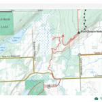
Hosting Club: Sydenham
Category: General Hike
Location (Google Maps): Roadside parking on the shoulders at the corner of Coles and Taylor Sideroads, south of km 140.7 (Map 34)
Hike Leader(s): Carol Mullin Click here to contact Hike Leader(s)
Pace: Medium: 3 to 4 km/h
Terrain: Moderate: Some hills and/or poor footing, Strenuous: Hilly with steep climbs and some poor footing., There might be muddy sections.
Distance: 6.5 km
Description
Figure 8 loop, eastern and more challenging loop first on Kemble Rock Reserve, views and crevices. Second loop through the Kemble wetlands. Approx 3 hours. Poles, water and snack recommended. Arrange private carpool safely if you wish. Carol Mullin 226-787-8804.
Hosting Club: Toronto
Category: Car Hike
Location (Google Maps): We meet at Hockley Road Parking Area just east of 61.3KM located on the North side of Hockley Road. Please do not park on Hockley Road.
Hike Leader(s): Fayyaz Mahmood Click here to contact Hike Leader(s)
Pace: Brisk
Terrain: Challenging, Hilly
Distance: 17 KM
Description
Here is your opportunity to hike the Side Trails (ST) and more interesting sections of the Main Bruce Trail in the Caledon section.
We will walk to the Main Trail Map 18, 61.3KM and walk South on the trail to 5th Line EHS, Map 18, 52.3KM. We will then turn back and hike through the Griffith Ravine ST on the way back to return to the parking lot.
Bring 1.5 – 2 liters of water and your lunch. Please dress for the weather.
Hike open to BTC Members only.
Hosting Club: Iroquoia
Category: General Hike
Location (Google Maps): Bruce Trail Parking Lot on Prince of Wales Road (County Road 19) approximately 1 km north of Hwy 89 (on the right side of the road). BTC Map 20 approximately 1 km west of km 16.3.
Hike Leader(s): Stuart Law Click here to contact Hike Leader(s)
Pace: Medium – 3 to 4 km/hr
Terrain: Slippery and Steep Sections, Slippery Sections Likely, Strenuous – Hilly with steep climbs and some poor footing
Distance: 15 kms
Description
Please join us on a hilly but beautiful trek of the Primrose Loop side trail, parts of the Main Trail and the Boyne Valley side trail on a quiet Sunday morning in the Fall leaves. Wonderful view from Murphy’s Pinnacle. Please bring your smile, hiking boots, poles, a lunch, a snack and about 2L to drink. Please arrive by 8:45 am to be ready to go at 9 am sharp. Thanks.
Hosting Club: Iroquoia, Toronto
Category: Car Hike
Location (Google Maps): Hermitage Gatehous Parking Lot, on Sulphur Springs Rd., near km 50 of Iroquoia section map 8 (BTC Guide edition 29). Parking fees are applicable by Conservation Authority.
Hike Leader(s): Dariush Khanbeigi Click here to contact Hike Leader(s)
Pace: Moderate
Terrain: Hilly, Variable
Distance: 15 km
Description
Come and join us in this event for a loop hike in Dundas Valley. Please dress, preferably in layers, according to the weather conditions. Pack a light lunch/snacks and ample amount of water to replenish your energy while enjoying the walk. COVID 19 safety guidelines will be observed for this hike.
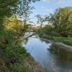
Hosting Club: Toronto
Category: Urban Walk
Location (Google Maps): Meet at Kipling Terminal for 8:30 a.m. for a 8:42 a.m. departure on MiWay express # 109 to Mississauga City Centre Transit Terminal. Transit users coming from different points can meet us at this terminal. From this terminal we will be catching the 9:30 MiWay bus # 61 to Derry Rd at Bellshire Gate arriving at 9:51 to begin the hike, a 1.4 km walk-in. Or if driving your car to the hike, meet the rest of us at 10:15 in the parking lot of the Credit Valley Conservation Authority, 1255 Old Derry Road.
Hike Leader(s): Andrew Proczek Click here to contact Hike Leader(s)
Pace: Moderate
Terrain: Flat
Distance: 13 km
Description
Come join me as we walk from the outskirts of one old village to another. Meadowvale and Churchville, once part of Toronto Township, now in separate lower-tier municipal jurisdictions (Mississauga & Brampton), have always been closely linked. Both were served by two former railways, are linked by a walking trail, share a pioneer cemetery, and are sheltered by the Credit River floodplain from urban sprawl. The hike will follow packed gravel and dirt trails and a large portion of it will be on country roads. Of special interest on these roads are two surviving and restored one-lane bridges over the Credit. We will stop for lunch at Francis Bransby Wood before making our way back to Meadowvale Conservation Area.
The route: https://onthegomap.com/s/kmdjjck4
Hosting Club: Niagara
Category: Hike
Location (Google Maps):
Woodend Conservation Area, Taylor Road parking lot
Hike Leader(s): Larry Lloyd Click here to contact Hike Leader(s)
Pace: Medium
Terrain: Moderate
Distance: Approximately 6 km
Description
Meet At Woodend Conservation Area, Taylor Road parking lot and hike the Woodend, Wetland Ridge & Margaret K Side Trails as well as the main trail.
Hosting Club: Iroquoia
Location (Google Maps): Big Chute parking: 176-180 Muskoka District Road 34, Georgian Bay @ 9:30 a.m.
Hike Leader(s): Louise Langlais Click here to contact Hike Leader(s)
Pace: Medium – 3 to 4 km/hr
Terrain: Easy – Mostly flat and usually good footing
Distance: 14-18 km
Description
If COVID-related regulations permit, we will meet at the carpool location at 7:00 am, then drive to Big Chute. Plan B: We do not carpool and meet at the parking lot location in Big Chute given above.
We will then hike the stunningly beautiful trail along the Lost Channel. After the hike, we will have dinner in Port Severn. This is therefore a full day excursion, starting early and ending after supper.
Hike Leader: Louise Langlais; Email: langlaislouise@gmail.com. Cell: 519-222-4040 on day of hike. At other times, email is the best way to contact me. Wear appropriate quick-dry clothing and hiking boots. Bring sunscreen, insect repellent (summer), icers (winter), snacks, lunch, a personal first aid kit, and 1-2 litres of water. During COVID, also bring hand sanitizer and a face mask. Please email me at least 24 hours before the hike to register. Sometimes last minute changes are made to hikes; registering means you won’t be waiting around the meeting place not knowing why no-one else is there! For personalized driving directions, just copy and paste the GPS coordinates into a Google search window and voila! Please arrive at least 15 minutes early. If you are unable to attend, please email me at least 2 hours before the start of the hike, or text me if it is <2 hours before the hike. There is often a waiting list, so the more advance notice the better.
Your first aid kit should include bandaids, sterile gauze pads, a tensor bandage, Sam Splint, moleskin, SteriStrips for lacerations, antiseptic ointment, ASA (for heart attack), ibuprofen, Benadryl, gravol, imodium + personal medications such as nitroglycerin for people with Angina. For more information, click this link: https://www.gore-tex.com/blog/hiking-first-aid-kit(https://www.gore-tex.com/blog/hiking-first-aid-kit)
Hosting Club: Niagara
Location (Google Maps):
Short Hills Wiley Road Entrance
Pace: Brisk
Terrain: Moderate
: 12k
Description
Explore Short Hills and the majestic side trails of Scarlett Tanager, Hemlock. Swayze Falls and Terrace. Register for each hike
Hosting Club: Niagara
Location (Google Maps): Shirt Hills Provincial Park – Pelham Road entrance
Hike Leader(s): janet davey Click here to contact Hike Leader(s)
Pace: Medium
Terrain: Moderate
Distance: 6 kms
Description
Hike the main and side trails in Short Hills.
Hosting Club: Dufferin Hi-Land
Category: Tuesday Hike
Location (Google Maps): Caledon Hills Section, Map 18. Meet at the roadside parking area on 3rd Line Mono, about 2 km north of Hockley Road.
Hike Leader(s): Les Babbage, Inge Eckerich, Bob Slack Click here to contact Hike Leader(s)
Pace: Leisurely
Terrain: Strenuous
Distance: Long hike – 7.5 km; Short – 4.2 km
Description
We will hike Isabel East/Glen Cross Side Trail loop and Cam Snell Side Trail loop. The shorter option will include only the Isabel East/Glen Cross loop.
Hosting Club: Caledon Hills
Category: Tuesday Hikers
Location (Google Maps): BT parking at km 29.4 (BT Ed. 30, map 20).
Directions: Go north on Hwy 10 to Hwy 89, right (east) on Hwy 89 2.7 km, left (north) on 1st Line ECL 6.0 km. Turn right (east) into trailhead parking (inconspicuous entrance!). This is just south of Dufferin Road 17 (a.k.a. 10 Sideroad).
Hike Leader(s): Bill McDonald Click here to contact Hike Leader(s)
Pace: Medium – 3 to 4 km/hour
Terrain: Moderate – some hills and/or some poor footing
Distance: 14 km
Description
From the start point, we’ll follow the main trail east and south to the Mulmur Lookout (km 21.9) for lunch, then return to the meeting point via the main trail, Oliver Creek Side Trail and Moss Haven Side Trail. Easy surface, pretty creeks and (with luck) fall colours.
Bring lunch/snack and water.
Hike open to BTC Members only.
Hosting Club: Beaver Valley
Location (Google Maps): Metcalfe Rock parking lot on the 10th Line in the Town of the Blue Mountains, 200 metres south of 27.9, map 25, Edition 30
Hike Leader(s): Bruce King, Val Jones Click here to contact the hike leader.
Pace: Medium
Terrain: Moderate, Some steep sections
Length of Hike: 6 km
Description
This loop hike will mainly follow parts of the Kolapore Wilderness Trails, with short sections on the Bruce Trail.
COVID-19 Precautions Before, During and After your Hike
- Each hiker joining a Bruce Trail Club organized hike must perform a self-screening check before hiking.
Find Ontario’s self-assessment tool here: https://covid-19.ontario.ca/self-assessment/ - If you are experiencing COVID-19 symptoms, stay home.
- Personal Protective Equipment:
- Hikers may choose to wear masks
- Hikers may carry and use hand sanitizer, but should not be sharing it with the group
- Hikers who experience COVID-19 symptoms following a Bruce Trail Club organized hike must inform their local public health unit.
Find your local health unit at http://www.health.gov.on.ca/en/common/system/services/phu/locations.aspx
Transportation
All hikers are responsible for their own transportation to and from the hike.
Currently, there are no car shuttles on hikes – all hikes must be out-and-back or loop hikes.
Other Guidelines
- Arrive 15 minutes before the start of the hike.
- Wear sturdy footwear and appropriate attire for the weather and the terrain.
Hiking poles are a good idea in any season, especially if the terrain is rocky or slippery. In winter, snowshoes or icers/crampons are needed when conditions dictate.
Wearing appropriate clothing and footwear prevents injuries and shows consideration for a safe and positive group hiking experience. - Always carry I.D. and your health card.
- Bring sufficient water and snacks (or lunch if indicated). A minimum of 1L of water is recommended on all hikes, and 3L is recommended for long, challenging hikes in the heat of the summer.
- Bring sunscreen and insect repellent (for spring and summer hikes).
- Bring your own first aid kit.
- Please leave dogs at home.
Hosting Club: Sydenham
Location (Google Maps): Parking area at the north/dead end of 2nd Concession S, at the start of the Silent Valley Side Trail, south of km 38.1 (Map 30, Edition 30)
Hike Leader(s): Maureen McFarland Click here to contact Hike Leader(s)
Pace: Medium: 3 to 4 km/h
Terrain: Strenuous: Hilly with steep climbs and some poor footing., There might be muddy sections., There might be sections with water on the trail.
Distance: 6-7 km
Description
We will do the Silent Valley and Waisburg Nature Reserves over two hikes. The order of the hikes will depend upon the weather conditions. Both hikes include steep climbs up and down the escarpment. One hike includes the Avalanche Side Trail, a beautiful but challenging climb uphill among and around large boulders. Hiking poles are highly recommended. Icers may be necessary if there has been any snow or ice.
Hosting Club: Sydenham
Category: General Hike
Location (Google Maps): Roadside parking on the east side of Irish Block Road, 450 m north of Hwy 26, at km 64.9 (Map 31)
Hike Leader(s): Maureen McFarland Click here to contact Hike Leader(s)
Pace: Medium: 3 to 4 km/h
Terrain: Moderate: Some hills and/or poor footing, There might be muddy sections., There might be sections with water on the trail.
Distance: 6 km
Description
On this hike we visit the Stonehouse, Beaver Springs and Irish Ridge Nature Reserves. The terrain varies from hardwood forest to wetland to hawthorn hedge and descends and ascends the escarpment. This area can be wet, waterproof footwear is recommended.
Hosting Club: Niagara
Category: Loop
Location (Google Maps):
Glenridge Quarry parking Lot, St Davids Road. Map 3
Hike Leader(s): Larry Lloyd Click here to contact Hike Leader(s)
Pace: Medium
Terrain: Easy
Distance: 6 km
Description
A combination of open trails with spectacular views across Lake Ontario and wooded trails including the main trail
Hike open to BTC Members only.
Hosting Club: Blue Mountains
Category: Blue Mountain Hike
Location (Google Maps): Hike meets in the parking lot behind Tim Horton’s on First St. in Collingwood.
Hike Leader(s): Frank Huggins – (705) 888-0166 Click here to contact Hike Leader(s)
Pace: Brisk – 4 to 5 km/hr, Fast – 5+ km/hr
Terrain: Moderate – Some hills and/or some poor footing
Distance: 12 km
Description
We will park at km 33.3 in the Beaver Valley section on the 9th Sideroad.
This loop hike will provide fine views from Pinnacle Rock and Metcalfe Rock,
hiking the white blazed trail then continuing on the Chuck Grant Side Trail on our return to the parking lot.
Bring lunch and water.
Map: 25 Edition 30
Hike open to BTC Members only.
Hosting Club: Blue Mountains
Category: Blue Mountain Hike
Location (Google Maps): Hike meets in the parking lot behind Tim Horton’s on First St. in Collingwood.
Hike Leader(s): Carl Wintermeyer – (705) 444-6796 Click here to contact Hike Leader(s)
Pace: Leisurely – 3 km/hr. or less
Terrain: Moderate – Some hills and/or some poor footing
Distance: 5 km
Description
Starting at km 48.6 at the parking lot off Pretty River Road,
we will climb to the summit of the Pretty River Valley on the white blazed trail.
As we descend, we will take the Pretty River Side Trail and return to the cars.
Lovely hike alongside the Pretty River.
Bring a snack or lunch and water.
Map: 23 Edition 30
Hike open to BTC Members only.
Hosting Club: Iroquoia
Category: Hikers R Us
Location (Google Maps): western area of the Dundas Valley Conservation Area
Hike Leader(s): Charlotte Stewart Click here to contact Hike Leader(s)
Pace: Medium – 3 to 4 km/hr
Terrain: Moderate – Some hills and/or some poor footing
Distance: 12-13 km
Description
We will meet for a 9 am departure at the last gravel parking lot off Martin Road before the road goes down the hill, just west of the Ancaster Community Centre. We will hike the Headwaters trail and some of the smaller side trails in the western section of the valley. Total hike distance approx. 12-13 km.
Please bring at least 1 litre of water, snack/lunch, hiking boots, sunscreen, bug spray, poles if you use them. No dogs, please. COVID protocols apply – carry hand sanitizer and a mask.
For cancellations the morning of the hike, please call/text 905 906-0519.
Hosting Club: Iroquoia
Category: Good Companions
Location (Google Maps): RBG Dog Park parking lot on the north side of York Road, Hamilton, near the intersection of York Road and Valley Road.
Hike Leader(s): Janina Vanderpost Click here to contact Hike Leader(s)
Pace: Medium – 3 to 4 km/hr
Terrain: Moderate – Some hills and/or some poor footing
Distance: 10 km
Description
From the RBG dog park we will take the Ray Lowes side-trail to the main trail. There is one steep hill and some stairs to climb. Turning left onto the main trail, we will continue along the escarpment, past Borer’s Falls, all the way to where the trail reaches Romer Drive. This hike offers great views of the Dundas Valley and Cootes Paradise, and there may be some fall colours left. This is a there and back hike.

Hosting Club: Peninsula
Location (Google Maps): Near Mar, South Bruce Peninsula. Participants will be provided with meeting location after registration.
Hike Leader(s): Hike Contact: Marg Glendon Click here to contact Hike Leader(s)
Terrain: Easy
Distance: N/A
Description
Description: We are honoured to host a special Owl Prowl evening facilitated by Saugeen Ojibway Nation (SON) Knowledge Holders Anthony Miptoon Chegahno and Jarmo Jalava. People are fascinated with owls – whether because of their unique head movement, big eyes or mysterious night time behaviour. Join us for an Owl Prowl to learn more about these wonderful nocturnal hunters. We will meet together near Mar and then drive our own vehicles to nearby locations to watch and listen for different species of owls.
Event Details:
- October 27. Owling is most successful on a calm night. If windy conditions are present, we will notify the registrants and postpone until the next evening – October 28 or 30.
- Meet at 6:45 m. Specific meeting location will be provided to registrants.
- Wear clothing appropriate to the weather
- Head lamp (not essential, but helpful)
- Free
- Pre-registration is required
- Remember to bring a mask to wear if needed
- Maximum group size is 10
Hosting Club: Niagara
Location (Google Maps):
Jordan Hollow Park 3039 King St Jordan
Pace: Fast
Terrain: Moderate
: 12k
Description
From Jordan Hollow Hike the main trail to Moyer Road or Louth and Return. You must register for each hike
Hosting Club: Iroquoia
Category: Hikers R Us
Location (Google Maps):
Hike Leader(s): Louise Langlais Click here to contact Hike Leader(s)
Pace: Brisk – 4 to 5 km/hr, Medium – 3 to 4 km/hr
Terrain: Moderate – Some hills and/or some poor footing
Distance: 14-20 km
Description
We will explore the trails in Palgrave. We won’t follow this route exactly but you can get a rough idea from: https://www.alltrails.com/explore/trail/canada/ontario/oak-ridges-moraine-palagraave-trail?mobileMap=false&ref=sidebar-static-map
Hike Leader: Louise Langlais; Email: langlaislouise@gmail.com. Cell: 519-222-4040 on day of hike. At other times, email is the best way to contact me. Wear appropriate quick-dry clothing and hiking boots. Bring sunscreen, insect repellent (summer), icers (winter), snacks, lunch, a personal first aid kit (https://www.gore-tex.com/blog/hiking-first-aid-kit), and 1-2 litres of water. During COVID, also bring hand sanitizer and a face mask. For personalized driving directions, click on the hike in the BTC hike calendar, then on (Google Maps) to the right of the word Location, and your smart phone should navigate you to the correct location. Please arrive at least 15 minutes early. If you are unable to attend, please email me as long as possible in advance of the hike, or text me if it is <2 hours before the hike. There is often a waiting list, so the more advance notice you give, the better.
Your first aid kit should include bandaids, sterile gauze pads, a tensor bandage, Sam Splint, moleskin, SteriStrips for lacerations, antiseptic ointment, ASA (for heart attack), ibuprofen, Benadryl, gravol, imodium + personal medications such as nitroglycerin for people with Angina. For more information, click this link: https://www.gore-tex.com/blog/hiking-first-aid-kit(https://www.gore-tex.com/blog/hiking-first-aid-kit)
Hosting Club: Niagara
Location (Google Maps): Jordan Hollow Park
Hike Leader(s): Bill Russell Click here to contact Hike Leader(s)
Pace: Medium
Terrain: Strenuous
Distance: 7 kms
Description
Hike along the Jordan Creek to Upper Balls Falls or the Jim Rainforth Trail. You must register for each hike.
Hosting Club: Sydenham
Category: General Hike
Location (Google Maps): Roadside parking on St. Vincent Sydenham Townline, 800m south of Sideroad 3 at km 7.4 (Map 29, Edition 30)
Hike Leader(s): Franziska Edney Click here to contact Hike Leader(s)
Pace: Medium: 3 to 4 km/h
Terrain: Strenuous: Hilly with steep climbs and some poor footing.
Distance: Linear hike, there and back, 8 km
Description
This hike will take us through a lovely mixed hardwood forest and along the beautiful sparkling waters of Rocklyn Creek. We will hike up and down some steep sections of the escarpment. Our destination is a wooden bridge built by the Canadian Military for the BTC several years ago. Bring water, and a snack if you wish. Approx. 2.5-3 hrs. Poles advised. Maps 28 & 29
Hosting Club: Iroquoia
Category: Thursday Group
Location (Google Maps): Loweville Park
Hike Leader(s): Anne Armstrong Click here to contact Hike Leader(s)
Pace: Leisurely – 3km/hr or less
Terrain: Moderate – Some hills and/or some poor footing
Distance: Approx. 6 km.
Description
Join me for a gentle hike to the River and Ruin Side Trail, followed by an exploration of trails in Loweville Park. no reservation for the Loweville Park parking lot if entering before 4:00 pm. Bring water, a snack and poles if using. The ruin on this trail has become more so since more walls of the former stone residence have collapsed. There are also two side trails here, the Dan Welsh Side Trail, to remember Dan’s achievements and contributions to Iroquoia and Squire Cleaver named after the original owner of this property.
Leader: Anne Armstrong 905 617 3937 hikingrandma@gmail.com

Hosting Club: Niagara
Category: Urban
Location (Google Maps): Veteran’s Memorial Park, King St & Veteran’s Lane
Hike Leader(s): Margaret Northfield Click here to contact Hike Leader(s)
Pace: Medium
Terrain: Easy
Distance: 6-8km
Description
These weekly hikes will take various routes around beautiful Niagara-on-the-Lake. We may take in history or just enjoy the ambiance of the area. Urban hikes are mostly paved with some trail walking.
Meet in Veteran’s Memorial Park near the tennis courts. (King St & Veteran’s Lane)
The first Friday of the month we will meet in Queenston Heights Park for a variety of hikes.

Hike open to BTC Members only.
Hosting Club: Toronto
Category: Car Hike
Location (Google Maps): Meet in the Great Hall of Union Station by the information desk (with the clock over it) no later than 8:15 AM to board the Niagara Train departing at 8:51 AM.
Hike Leader(s): Tom Swales Click here to contact Hike Leader(s)
Pace: Moderate
Terrain: Challenging, Hilly, Rocky
Distance: 12
Description
A hike by GO Train to Niagara. We will hike from the Niagara Falls GO/Via station to the Niagara Glen Nature Centre past spectacular views over the Niagara River and descend deep into the Niagara Gorge to 4 km of rugged paths winding through the forest in the gorge past geological formations to paths overlooking the rapids of the river. A beautiful area this time of year but note this will be a challenging hike with the ascent/descent and rocky terrain. After ascending the gorge we return to the GO Station to take the afternoon train back to Toronto. With GO Transit’s Weekend Day Pass (available only on smartphones/mobile devices) the return fare is just $10 (pass can purchased from hike leader at Union Station if you don’t have s smart phone). Drivers are welcome but must meet us at the GO/Via Station. As time will be limited we will proceed directly to the train station at the end of the hike (we won’t have a pub stop or visit the falls).
Hike open to BTC Members only.
Hosting Club: Blue Mountains
Category: Blue Mountain Hike
Location (Google Maps): Hike meets in the parking lot behind Tim Horton’s on First St. in Collingwood.
Hike Leader(s): Denise Shand – (705) 716-9916 Click here to contact Hike Leader(s)
Pace: Medium – 3 to 4 km/hr
Terrain: Strenuous – Hilly with steep climbs and some poor footing
Distance: 10 km
Description
We will park at km 81.1 on Windy Lane Drive in the Beaver Valley section.
We will start hiking south over Bowles Hill to meet up with the Valley Crossover Side Trail.
Following the sidetrail, we hike towards the Beaver Valley Ski Club and crossover County Road 30 to a steep ascent.
At the top, reaching County Road 13, we retrace our steps back to the ski club
eventually following the Kimberley Forest Side Trail.
We continue hiking north until meeting the white blazed trail at km 83.1.
From here, we hike south back to the cars.
Along the way are many magnificent panoramic views of the Beaver Valley
including the cliffs of Old Baldy and Kimberley Rock.
Bring lunch and plenty of water.
Map: 26 Edition 30
Hike open to BTC Members only.
Hosting Club: Blue Mountains
Category: Blue Mountain Hike
Location (Google Maps): Hike meets in the parking lot behind Tim Horton’s on First St. in Collingwood.
Hike Leader(s): Michael Treuman – (416) 518-0489 Click here to contact Hike Leader(s)
Pace: Leisurely – 3 km/hr. or less
Terrain: Moderate – Some hills and/or some poor footing
Distance: 7 km
Description
This is a loop hike.
We will take the white blazed trail at km 102.5 to the Siegerman Side Trail
and follow alongside the stream, taking a nice climb to where it reconnects to the white blazed trail.
If we can find the picnic table area, we will stop for a break.
We then continue on the white blazed trail, looping around to km 98.9 where it connects to the Allan Side Trail.
We will follow this back to the white blazed trail and the cars.
Bring a snack and water.
Optional lunch stop afterwards: Blackbird Pie Co. or Ravenna General Store.
Available parking: 3rd Line C and Sideroad 22C
Map: 28 Edition 30
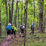
Hosting Club: Niagara
Category: Car Pool
Location (Google Maps): Fireman’s Park, Niagara Falls. Park in the lower parking lot – to the left after your cross the tracks at the top of Dorchester Rd.
Hike Leader(s): Margaret Northfield Click here to contact Hike Leader(s)
Pace: Medium
Terrain: Moderate
Distance: 18km
Description
See what can be done with a dump after is finishes being a dump! We will park in Fireman’s Park, Niagara Falls and carpool to Glen Ridge Quarry in St Catharines (1860 Sir Isaac Brock Way).
Vaccines and masks required for carpooling.
Bring water and a snack. Hiking poles recommended.
Hosting Club: Iroquoia
Category: General Hike
Location (Google Maps): Rattlesnake Snake Point – 7200 Appleby Line
Hike Leader(s): Anne Armstrong Click here to contact Hike Leader(s)
Pace: Leisurely – 3km/hr or less
Terrain: Moderate – Some hills and/or some poor footing
Distance: Approx.9-10 km.
Description
Join me at Rattlesnake Conservation Area to search for the elusive Rattlesnake after which this area was named. I haven’t seen one yet but “hope springs eternal”, maybe this will be the time! Meet in the lower parking lot by 9:40 am. for a 10:00 am. start. Bring water, a snack/lunch and hiking poles if using. Please dress appropriately for the weather. Covid protocols in place. Expect two long hills and some rocks underfoot. We will hike north and then take the Leech-Porter side trail leading downtown into Nassagaweya Canyon. We will then head south and back up to the Rattlesnake Point trails. Great views over the escarpment looking towards Crawford Lake. Reservation required. I suggest making it for 9:40 am. Make two reservations back to back as the hike will last for three hours.
Leader: Anne Armstrong 905 617 3937 hikingrandma@gmail.com
Hosting Club: Toronto
Category: Car Hike
Location (Google Maps): Map 19. Meet in the Mono Community Centre parking lot.
Hike Leader(s): Al Brown Click here to contact Hike Leader(s)
Pace: Moderate
Terrain: Variable
Distance: 14 km
Description
We will complete a loop hike through the Mono Cliffs Provincial Park on the main and side trails, including the Split Rock side trail. The terrain is generally flat to rolling with a few hills. Expect mid fall conditions.
Hosting Club: Niagara
Category: In and Out
Location (Google Maps):
Meet at Woodend Conservation Area off Taylor Road (Map 2)
Hike Leader(s): Scott Faichnie Click here to contact Hike Leader(s)
Pace: Medium
Terrain: Easy
Distance: 7km
Description
Bring your Halloween hat and hike to the screaming tunnel. Watch out for the ghosts and ghouls.
Note that this hike will count towards the screaming tunnel badge or the night hike badge but unfortunately not both
Hosting Club: Toronto
Category: Car Hike
Location (Google Maps): We meet at Hockley Road Parking Area just east of 61.3KM located on the North side of Hockley Road. Please do not park on Hockley Road.
Hike Leader(s): Fayyaz Mahmood Click here to contact Hike Leader(s)
Pace: Brisk
Terrain: Challenging, Hilly
Distance: 18.5 KM
Description
Here is your opportunity to hike the Side Trails (ST) and more interesting sections of the Main Bruce Trail in the Caledon section.
We will walk to the Main Trail Map 18, 61.3KM and walk North on the trail to Dunby Road, Map 18, 68.0KM. We will then turn back and hike through the Cam Snell ST, Glen Cross ST, Isabel East ST and Tom East ST to return to the parking lot.
Bring 1.5 – 2 liters of water and your lunch. Please dress for the weather.
Hosting Club: Toronto
Category: Car Hike
Location (Google Maps): https://goo.gl/maps/KyHgh8BaaFTqQykG7
Hike Leader(s): Jen Zhang & Alina Lin Click here to contact Hike Leader(s)
Pace: Leisurely
Terrain: Flat
Distance: 8 KM
Description
Meet at roadside parking on Keele St., 3 KM north of King Road on both side at ORTA trail sign. Terrain: rolling hills, forest & wetland. Difficult: easy.