Hike Schedule
Join us for a hike! Registration required:
All hikes available to BTC members. Some hikes are open to non-members.
TIP: The calendar view displays up to 7 hikes on a day, but often there are more. Click “More events” to see them all.
Categories
- 16February 16, 2020
Speyside Spectacular
https://hikes.brucetrail.org/event/speyside-spectacular/Hosting Club: Iroquoia
Category: General Hike
Location (Google Maps): Bruce Trail Pear Tree Parking lot at km 11.4, Map 12 (29th Edition); south side of Side Road 15 just west of Highway 25.
Hike Leader(s): Stuart Law Click here to contact Hike Leader(s)
Pace: Medium – 3 to 4 km/hr
Terrain: Moderate – Some hills and/or some poor footing
Distance: 12 kmsDescription
Join us for a quiet Sunday morning loop hike in the woods on the Al Shaw Side Trail, the Vanderleck Side Trail, the Cliff Hatch Side Trail and portions of the Main Trail connecting all three. The terrain is rocky in sections and will be icy. Please wear good hiking boots and icers and dress in layers for the weather. We will stop for a snack so please bring something to eat and a warm drink. Please pre-register at stuarthikes@gmail.com so that I can get an idea of numbers and contact you if the hike has to be cancelled for any reason. Please meet at 845 am so that we can all sign in first and be ready to hike at 9. Thank you.Copeland Forest Snowshoe Hike
https://hikes.brucetrail.org/event/copeland-forest-snowshoe-hike/Hosting Club: Dufferin Hi-Land
Category: General Hike
Location (Google Maps): Meet at 10:00 am at Food Basics parking lot in Midland or10:45 am on Ingram Road in the parking lot east of the 4th line of Oro Medonte (see map). (Ingram Road is east off Simcoe County Road 93 north of Craighurst, and just south of the Hillsdale exit on Hwy 400).
Hike Leader(s): Frieda Baldwin Click here to contact Hike Leader(s)
Pace: Leisurely
Terrain: ModerateDescription
Joint hike with Dufferin Hi-Land Bruce Trail club & the Midland Ganaraska Hiking Club. Bring a lunch and water.
Bayview Escarpment
https://hikes.brucetrail.org/event/bayview-escarpment-2/Hosting Club: Sydenham
Category: Snowshoe Hike
Location (Google Maps): Meet in the north-east corner of the parking lot at Home Depot on Highway 26 on the east side of Owen Sound.
Hike Leader(s): Maureen McFarland Click here to contact Hike Leader(s)
Pace: Medium: 3 to 4 km/h
Terrain: Moderate: Some hills and/or poor footing, Strenuous: Hilly with steep climbs and some poor footing.
Distance: 4.5 kmDescription
This loop includes rocky sections of the main trail on the escarpment and flatter areas on the side trail. Approximately 2.5 to 3 hours. Map 30. For more information, call or text 647-918-4180.Rim of Africa Loop
https://hikes.brucetrail.org/event/rim-of-africa-loop/Hosting Club: Niagara
Category: Loop
Location (Google Maps): Meet at Wiley Road parking lot.
Hike Leader(s): Debbie Demizio Click here to contact Hike Leader(s)
Pace: Medium
Terrain: Moderate
Distance: 5.3 kmDescription
Distillery Light Festival
https://hikes.brucetrail.org/event/distillery-light-festival/Registration required via email or TBTC login. Click here for details.
Hosting Club: Toronto
Location: Broadview Subway Station next to the ticket collector booth
Hike Leader(s): Sophie Chuchra
Pace: Leisurely
Terrain:Description
Difficulty: EasyJoin us for an early evening walk along the Lower Don River Recreation Trail to the historic Distillery District to experience the Toronto Light Festival. The Festival showcases local and international light artwork displays curated to warm hearts, inspire or just put a smile on your face. We will walk around the Distillery streets viewing the exhibits. Afterwards, please join us for post-walk refreshments.
Dress warmly and wear waterproof hiking/winter boots. We recommend you bring ice traction devices “icers" to wear over your boots as there may be icy patches on the trail. Also carry a headlamp/flashlight as it will get dark during our walk.
Meet at:Broadview Subway Station next to the ticket collector booth
Additional Notes: No dropoutBeginnersFamiliesHiking bootsRefreshments after
- 17February 17, 2020
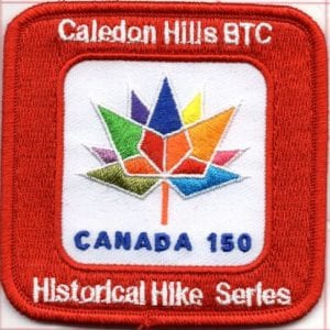
Caledon Hills - Historical Hike Series - Hike 1/3 - Hike is FULL
https://hikes.brucetrail.org/event/caledon-hills-historical-hike-series-hike-1-3/Hosting Club: Niagara, Iroquoia, Caledon Hills, Dufferin Hi-Land, Blue Mountains, Beaver Valley, Sydenham, Peninsula
Category: Special Event
Location (Google Maps): Caledon
Hike Leader(s): Ruth Moffatt Click here to contact Hike Leader(s)
Pace: Brisk – 4 to 5 km/hr
Terrain: Strenuous – Hilly with steep climbs and some poor footing
Distance: 21 kmDescription
Day 1/3 – Approx 21kmhttp://caledonbrucetrail.ca/wp-content/uploads/2019/03/Caledon-Hills-Historical-Hike-Series-Badge-2019-03-25.pdf
Meet at Roadside Parking -On Innis Lake Road, north of Finnerty Sideroad (31.6km – 5 cars) N 43.918917, W79.909387
Shuttle to Mono Side Road (44.3km – 5 cars) north side of the road where the trail crosses N 43.974055, W79.984988
Please register for this hike as it will be postponed and rescheduled in the event of inclement weather.
Limited to 10 people.
Day 2/3 Feb 18
Day3/3 Feb 20
Toronto Island Family Day Hike
https://hikes.brucetrail.org/event/toronto-island-family-day-hike-2/Hosting Club: Toronto
Location: Inside the waiting area at the Jack Layton Ferry Terminal at the foot of Bay St and Queen’s Quay
Hike Leader(s): Ray Berzins
Pace: Moderate
Terrain: Flat
Distance: 11 kmDescription
Difficulty: EasyAvoid the crowds on Family Day! The Islands are quiet in winter. We shall cover the entire Toronto Island Park from Ward’s Island to Hanlan’s Point and back. We should return on the 2:45 pm ferry to be back in Toronto about 3:00 pm. Ferry return fares before tax: approx.$8.50 adult, $5.50 senior/student, $4.50 under 14. Bring a lunch and a warm beverage. Donations to the Bruce Trail Conservancy will be gladly accepted. Bring sunglasses and icers or other slip-resistant footwear. Call (416) 392-8193 for ferry info.
Meet at:Inside the waiting area at the Jack Layton Ferry Terminal at the foot of Bay St and Queen’s Quay
Streetcar from Union Station to foot of Bay St
Additional Notes: Dropout available at anytimeBeginnersFamiliesHiking bootsIcers recommended, snowshoes optional
- 18February 18, 2020

Caledon Hills - Historical Hike Series - Hike 2/3 - Hike is FULL
https://hikes.brucetrail.org/event/caledon-hills-historical-hike-series-hike-2-3/Hosting Club: Niagara, Iroquoia, Caledon Hills, Dufferin Hi-Land, Blue Mountains, Beaver Valley, Sydenham, Peninsula
Location (Google Maps): Caledon
Hike Leader(s): Ruth Moffatt Click here to contact Hike Leader(s)
Pace: Brisk – 4 to 5 km/hr
Terrain: Strenuous – Hilly with steep climbs and some poor footing
Distance: Approx 23kmDescription
Day 2/3 – Approx 23kmhttp://caledonbrucetrail.ca/wp-content/uploads/2019/03/Caledon-Hills-Historical-Hike-Series-Badge-2019-03-25.pdf
Meet on the Forks of the Credit Rd between Chisholm and Dominion Streets. (8.8km – 5 cars) N 43.803809, W79.993002
Please register for this hike as it will be postponed and rescheduled in the event of inclement weather.
Limited to 10 people.
Day3/3 Feb 20
Black Bank Challenge
https://hikes.brucetrail.org/event/black-bank-challenge-2/Hosting Club: Dufferin Hi-Land
Category: Tuesday Hike
Location (Google Maps): Meet at SuperBurger (intersection of Hwy 10 and Hwy 89) in Primrose
Hike Leader(s): Les Babbage; Inge Eckerich; Bob Slack Click here to contact Hike Leader(s)
Pace: Leisurely
Terrain: Moderate, Slippery and Steep Sections
Distance: 4.6 kmDescription
We will hike the Main Trail from Centre Road to Dufferin Rd 21 and back. Bring icers and/or snowshoes.Palgrave Forest
https://hikes.brucetrail.org/event/palgrave-forest-2/Hosting Club: Caledon Hills
Category: Tuesday Hikers
Location (Google Maps): Map 17, Palgrave Forest Wildlife Area. Take Hwy 50 south 0.8 km from Hwy 9 and turn west onto Finnerty Sideroad. Drive 750 m to the Palgrave Forest parking lot on the south side of the road.
Hike Leader(s): Tessa Shelvey – Cell # 416-320-8555 Click here to contact Hike Leader(s)
Pace: Medium – 3 to 4 km/hour
Terrain: Moderate – some hills and/or some poor footing
Distance: 9 km loopDescription
Enjoy a nice loop hike in the Palgrave Forest. Bring a snack or lunch for break on the trail. - 19February 19, 2020
Iroquois Woods
https://hikes.brucetrail.org/event/iroquois-woods-2/Hosting Club: Iroquoia
Category: Hikers R Us
Location (Google Maps): Meet at the Oakville Town Hall
Hike Leader(s): Norman Young Click here to contact Hike Leader(s)
Pace: Medium – 3 to 4 km/hr
Terrain: Moderate – Some hills and/or some poor footing
Distance: 13 kmDescription
Dress according to the weather. Bring water, snack etc plus icersThis is a loop hike from the town hall up through Iroquois Woods and northerly on Joshua Creek paths
Snowshoe tour of Nottawasaga Bluffs.
https://hikes.brucetrail.org/event/snowshoe-tour-of-nottawasaga-bluffs/Hosting Club: Blue Mountains
Location (Google Maps): Hike meets in the parking lot behind Tim Horton’s on First St. in Collingwood.
Hike Leader(s): Rob Mooy (705) 445-3321 Click here to contact Hike Leader(s)
Pace: Medium – 3 to 4 km/hr
Terrain: Moderate – Some hills and/or some poor footing
Distance: 6-8 kmDescription
We will carpool to the parking lot at 15 / 16 Sideroad in
Singhampton for a tour of the Nottawasaga Bluffs. This
is a great place to snowshoe, and there are many great
views. Bring a beverage and a light snack. Following the
hike there will be an optional lunch at Mylar and Loreta’s.Malcolmson Park
https://hikes.brucetrail.org/event/malcolmson-park-7/Hosting Club: Niagara
Category: Hike
Location (Google Maps):Meet in Malcolmson Park at end of Niagara St & Lakeshore Rd, St.Catharines.
Hike Leader(s): Gary & Donna Sands Click here to contact Hike Leader(s)
Pace: Medium
Terrain: Moderate
Distance: 6 kmDescription
- 20February 20, 2020

Caledon Hills - Historical Hike Series - Hike 3/3 - Hike is FULL To be followed by Hike 1/3 and 2/3 of Discovery Hike Series
https://hikes.brucetrail.org/event/caledon-hills-historical-hike-series-hike-3-3-to-be-followed-by-hike-1-3-and-2-3-of-discovery-hike-series/Hosting Club: Niagara, Iroquoia, Caledon Hills, Dufferin Hi-Land, Blue Mountains, Beaver Valley, Sydenham, Peninsula
Category: Special Event
Location (Google Maps): Caledon
Hike Leader(s): Ruth Moffatt Click here to contact Hike Leader(s)
Pace: Brisk – 4 to 5 km/hr
Terrain: Strenuous – Hilly with steep climbs and some poor footing
Distance: 10kmDescription
Day 3/3 – Approx 10kmhttp://caledonbrucetrail.ca/wp-content/uploads/2019/03/Caledon-Hills-Historical-Hike-Series-Badge-2019-03-25.pdf
Meet on north side of Hockley Rd at Hockley Side Trail (60.1km) N 43.972857, W 80.056330
Please register for this hike as it will be postponed and rescheduled in the event of inclement weather.
Limited to 10 people.
Snowshoe Walters Falls Loop
https://hikes.brucetrail.org/event/snowshoe-walters-falls-loop/Hosting Club: Beaver Valley
Location (Google Maps): Meet at the Walters Falls Inn parking lot in the Sydenham section, km 11.4, Map 29.
Hike Leader(s): Mike Arkless Click here to contact Hike Leader(s)
Pace: Medium
Terrain: Moderate
Length of Hike: 2 1/2 hours kmDescription
This is a loop hike beginning at Walters Falls and following the river north before crossing over and following it south back to the falls. Please read the participant guidelines below.Participant Guidelines
- All kms mentioned are according to maps in Edition 29 of The Bruce Trail Reference.
- Please arrive 15 minutes before start of hike.
- Participants are expected to wear appropriate attire for the weather and the terrain. In summer, sturdy footwear is necessary. In winter, snowshoes or icers/crampons are needed when conditions dictate. It is a good idea to bring these items if there is snow on the ground and the hike leader will advise you as to the best footwear for the day. Hiking poles are a good idea in any season, especially if the terrain is rocky or slippery. Wearing appropriate clothing and footwear prevents injuries and shows consideration for a safe and positive group hiking experience.
- Always carry I.D. and your health card.
- Bring sufficient water and snacks (or lunch if indicated).
- For spring and summer hikes bring sunscreen and insect repellent.
- Please leave dogs at home.
- Pace: Leisurely = 3km/hr or less, Medium = 3-4 km/hr, Brisk = 4-5 km/hr, Fast = 5+km/hr
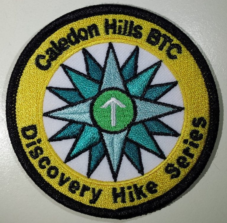
Caledon Discovery Hike Series Day 1 of 3
https://hikes.brucetrail.org/event/caledon-discovery-hike-series-day-1-of-3/Hosting Club: Iroquoia, Caledon Hills, Dufferin Hi-Land, Blue Mountains, Beaver Valley, Sydenham, Peninsula
Category: Special Event
Location (Google Maps): Caledon Hills
Hike Leader(s): Ruth Moffatt Click here to contact Hike Leader(s)
Pace: Brisk – 4 to 5 km/hr
Terrain: Strenuous – Hilly with steep climbs and some poor footing
Distance: 9.4kmDescription
This, half day, is Day 1 of the Discovery Hike Series of hikes in Caledon Hills. We will complete the requirements for Discovery Hike # 4 Map 18Meet at Hockley Road Parking Area – east of km 60.1 Located on the north side of Hockley Road, approx 2.5km east of Hwy 10
Shuttle to Parking Area – north of km 50.8 on the east side of 5th Line EHS, just south of Hockley Rd (43.993572, -80.014057)
http://caledonbrucetrail.ca/wp-content/uploads/2019/05/CHBTC-Discovery-Badge-Hikes-2019-05-18.pdf
Please register for these hikes as we will cancel/postpone in the event of inclement weather. Limited to 10 participants.
- 21February 21, 2020No events
- 22February 22, 2020
Arrowhead winter coach trip
https://hikes.brucetrail.org/event/arrowhead-winter-coach-trip-2/Registration required via email or TBTC login. Click here for details.
Hosting Club: Toronto
Location:
Hike Leader(s): Martina Furrer, Alex Brown, Edmond BrownDescription
Difficulty:Join us for a fantastic day of cross-country skiing, snowshoeing, and ice skating in Arrowhead Provincial Park. Snowshoers: Experienced snowshoers join Al Brown and Ed Brown for a level II guided snowshoe hike. Alternatively, explore the park’s trails on your own. Skiers: Enjoy self-guided tours of the scenic trails groomed for classic and skate skiing. Great views of Arrowhead Lake, the beaver pond, and the big bend. The park also has a beautiful forested ice skating trail and a tubing hill. Both will be open if conditions are good. Ski, snowshoe, and ice skate rentals available. Quantities are limited. The park rents equipment on a first come, first served basis.
Departure time: 7:30 AM
Departure location: 10 York Mills RdAdditional Notes: Dropout available at
Dump to Dump
https://hikes.brucetrail.org/event/dump-to-dump-2/Hosting Club: Niagara
Category: Car Pool
Location (Google Maps): Meet at Glenridge Quarry parking lot, St.David’s Rd, St. Catharines. Carpool to dump at Fireman’s park.
Hike Leader(s): Lauren Doig Click here to contact Hike Leader(s)
Pace: Medium
Terrain: Moderate
Distance: 18 kmDescription
Walking Wounded, Hilton Falls
https://hikes.brucetrail.org/event/walking-wounded-hilton-falls-2/Registration required via email or TBTC login. Click here for details.
Hosting Club: Toronto
Location: Tim Hortons. Milton.
Hike Leader(s): George Lennon, Makhan Dhesi & Family
Pace: Leisurely
Terrain: Flat
Distance: 8 kmDescription
Difficulty: EasyHike loop around the reservoir to the park entrance, an outdoor log fire near the frozen falls and tame chickadees that will eat your birdseed from an outstretched hand. Bring your hiking poles and icers. This can be slippery. Hike may be cancelled if driving conditions are hazardous.
Meet at:Tim Hortons. Milton.
Take 401 west to Milton, exit at Hwy 25 north. Tim Hortons on east side of Hwy 25 next to Esso Gas Station. We will then travel to Hilton Falls Conservation Area.
Map # Map 11
Additional Notes: No dropout
Dufferin Hi-Land Winter Badge, Hike #4 of 4: SNOWSHOES REQUIRED!
https://hikes.brucetrail.org/event/dufferin-hi-land-winter-badge-hike-4-of-4/Hosting Club: Dufferin Hi-Land
Category: General Hike
Location (Google Maps): Dufferin Hi-Land, Map 21. Meet on Prince of Wales Rd near km 46.2 where the Main Trail turns east off of the road. Take Hwy 124 north from Shelburne for 15 km and turn right on Dufferin Road 21. Head east for 4 km and then right on Prince of Wales Rd. The meeting place is 1 km ahead.
Hike Leader(s): Les Babbage; Helen Bailey Click here to contact Hike Leader(s)
Pace: Medium
Terrain: Moderate, Slippery and Steep Sections
Distance: 8 kmDescription
Snowshoe in and out hike. Bring snowshoes, icers, snacks, lunch, water. Optional pub stop. We still have lots of snow in Dufferin County and our route is famous for a large snow drift at the top of Blackbank hill. You will need snowshoes!
Snowshoe tour of Nottawasaga Lookout.
https://hikes.brucetrail.org/event/snowshoe-tour-of-nottawasaga-lookout/Hosting Club: Blue Mountains
Location (Google Maps): Hike meets in the parking lot behind Tim Horton’s on First St. in Collingwood.
Hike Leader(s): Mary-lynne Chenard (905) 713-4066 Click here to contact Hike Leader(s)
Pace: Medium – 3 to 4 km/hr
Terrain: Moderate – Some hills and/or some poor footing
Distance: Two hoursDescription
We will carpool to the start of the hike to be in the Notta-
wasaga Lookout Nature Reserve. We will follow a loop hike
through mixed terrain, but with some great views.
Bring a snack and beverage.St Catharines CNR and WC Route
https://hikes.brucetrail.org/event/st-catharines-cnr-and-wc-route-2/Hosting Club: Niagara
Category: Hike
Location (Google Maps): Meet at Lock 1 Parking lot St. Catharines. (Map 2 18.2k)
Hike Leader(s): Audrey Lopez Click here to contact Hike Leader(s)
Pace: Medium
Terrain: ModerateDescription