Hosting Club: Niagara Category: In and Out Location (Google Maps): Short Hills, Pelham Road Entrance Hike Leader(s): Diane Marlatt Click here to contact Hike Leader(s) Pace: Medium Terrain: Moderate
Description Dress for the weather, have your crampon devices available for icy conditions. Must register for each hike. The wearing of masks on our hikes is strongly recommended. Bring a drink.
Hosting Club: Iroquoia Category: Hikers R Us Location (Google Maps): Slit Barn, 768 Blair Rd, Cambridge Hike Leader(s): Louise Langlais Click here to contact Hike Leader(s) Pace: Medium – 3 to 4 km/hr Terrain: Easy – Mostly flat and usually good footing Distance: 12-14 km
Description We will hike on trails and some road from Blair to Galt and then back along a multi-use trail that hugs the Grand River. We will have lunch in downtown Galt, now part of Cambridge and known for it’s beautiful old churches and lovely river views.
Hike Leader: Louise Langlais; Email: langlaislouise@gmail.com. Cell: 519-222-4040 on day of hike. At other times, email is the best way to contact me. Wear appropriate quick-dry clothing and hiking boots. Bring sunscreen, insect repellent (summer), icers (winter), snacks, lunch, a personal first aid kit, and 1-2 litres of water. During COVID, also bring hand sanitizer and a face mask. Please email me at least 24 hours before the hike to register. Sometimes last minute changes are made to hikes; registering means you won’t be waiting around the meeting place not knowing why no-one else is there! For personalized driving directions, just copy and paste the GPS coordinates into a Google search window and voila! Please arrive at least 15 minutes early.
Hosting Club: Blue Mountains Category: Cancelled Location (Google Maps): Hike meets in the parking lot behind Tim Horton’s on First St. in Collingwood. Hike Leader(s): Michelle Wacker (705) 730-8481 Click here to contact Hike Leader(s) Pace: Medium – 3 to 4 km/hr Terrain: Moderate – Some hills and/or some poor footing Distance: 6 km
Description We will drive to the Hoggs Falls parking lot at km 63.2 on Lower Valley Rd. in the Beaver Valley section. After viewing the falls, we will do a figure 8 loop hike using both the main trail and various side trails. This hike takes us through a variety of different terrains and picturesque landscapes. Bring water and a snack.
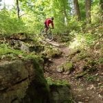
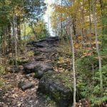
This hike has challenging terrain – lots of rocks & hills – poles are recommended, trails can be very slippery.
We will hike the Staff Ave & Louth side trails and a loop with the mail trail. For hikers seeking the Side trail badge requirements & logs are found in the Niagara Bruce Trail Club website under badges for your own tracking.
Registration is mandatory & limited to a total of 10 including hike leader.
Hosting Club: Iroquoia Category: Good Companions Location (Google Maps): Hamilton Conservation Authority Parking Lot on Old Dundas Road (Old Ancaster Road) – Trail head for Monarch Trail Hike Leader(s): Ted Bossence Click here to contact Hike Leader(s) Pace: Medium – 3 to 4 km/hr Terrain: Strenuous – Hilly with steep climbs and some poor footing Distance: 9.5 km
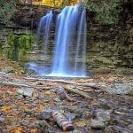
Description We will follow the Monarch trail, Main Loop Trail other trails walking past the Hermitage, Canterbury Falls and Sherman Falls, returning on Artaban Road and retracing our steps on the Monarch Trail. Distance about 8.5 km. Bring Icers (but hopefully not needed), snack and water. Please note, this hike is available to BTC members only and you are required to pre-register on line. When you register you will be sent a list of things to bring and protocols to follow. Please arrive 15 minutes before start time.
Please note: Due to high rates of community transmission, hikers on now required to wear masks at all times on club hikes.
Description Moderate silent hike on the trails of Short Hills Provincial Park. Bring night light and dress for the weather . 5 night hikes to earn your badge
Hosting Club: Sydenham Category: An evening walk. Location (Google Maps):
Meet in the municipal parking lot by the river on the west side of 1st Ave. E between 7th St. E and 8th St. E in Owen Sound.
Hike Leader(s): Sheri Hatcher Click here to contact Hike Leader(s) Pace: Medium: 3 to 4 km/h Terrain: There might be icy and slippery sections. Distance: 5 km approx.
Description We will take in the Owen Sound Festival of Northern Lights displays along the Sydenham River and Harrison Park. Approximately 2 hours. Bring icers if it’s icy. For further information call/text Sheri Hatcher at 519-270-5068.
Hosting Club: Iroquoia Category: Hikers R Us Location (Google Maps): Slit Barn, 768 Blair Rd, Cambridge Hike Leader(s): Louise Langlais Click here to contact Hike Leader(s) Pace: Medium – 3 to 4 km/hr Terrain: Easy – Mostly flat and usually good footing Distance: 12-14 km
Description We will hike on trails and some road from Blair to Galt and then back along a multi-use trail that hugs the Grand River. We will have lunch in downtown Galt, now part of Cambridge and known for it’s beautiful old churches and lovely river views.
Hike Leader: Louise Langlais; Email: langlaislouise@gmail.com. Cell: 519-222-4040 on day of hike. At other times, email is the best way to contact me. Wear appropriate quick-dry clothing and hiking boots. Bring sunscreen, insect repellent (summer), icers (winter), snacks, lunch, a personal first aid kit, and 1-2 litres of water. During COVID, also bring hand sanitizer and a face mask. Please email me at least 24 hours before the hike to register. Sometimes last minute changes are made to hikes; registering means you won’t be waiting around the meeting place not knowing why no-one else is there! For personalized driving directions, just copy and paste the GPS coordinates into a Google search window and voila! Please arrive at least 15 minutes early.
Hosting Club: Blue Mountains Category: Cancelled Location (Google Maps): Hike meets in the parking lot behind Tim Horton’s on First St. in Collingwood. Hike Leader(s): Michelle Wacker (705) 730-8481 Click here to contact Hike Leader(s) Pace: Medium – 3 to 4 km/hr Terrain: Moderate – Some hills and/or some poor footing Distance: 6 km
Description We will drive to the Hoggs Falls parking lot at km 63.2 on Lower Valley Rd. in the Beaver Valley section. After viewing the falls, we will do a figure 8 loop hike using both the main trail and various side trails. This hike takes us through a variety of different terrains and picturesque landscapes. Bring water and a snack.
This hike has challenging terrain – lots of rocks & hills – poles are recommended, trails can be very slippery.
We will hike the Staff Ave & Louth side trails and a loop with the mail trail. For hikers seeking the Side trail badge requirements & logs are found in the Niagara Bruce Trail Club website under badges for your own tracking.
Registration is mandatory & limited to a total of 10 including hike leader.
Hosting Club: Iroquoia Category: Good Companions Location (Google Maps): Hamilton Conservation Authority Parking Lot on Old Dundas Road (Old Ancaster Road) – Trail head for Monarch Trail Hike Leader(s): Ted Bossence Click here to contact Hike Leader(s) Pace: Medium – 3 to 4 km/hr Terrain: Strenuous – Hilly with steep climbs and some poor footing Distance: 9.5 km
Description We will follow the Monarch trail, Main Loop Trail other trails walking past the Hermitage, Canterbury Falls and Sherman Falls, returning on Artaban Road and retracing our steps on the Monarch Trail. Distance about 8.5 km. Bring Icers (but hopefully not needed), snack and water. Please note, this hike is available to BTC members only and you are required to pre-register on line. When you register you will be sent a list of things to bring and protocols to follow. Please arrive 15 minutes before start time.
Please note: Due to high rates of community transmission, hikers on now required to wear masks at all times on club hikes.
Description Moderate silent hike on the trails of Short Hills Provincial Park. Bring night light and dress for the weather . 5 night hikes to earn your badge
Hosting Club: Sydenham Category: An evening walk. Location (Google Maps):
Meet in the municipal parking lot by the river on the west side of 1st Ave. E between 7th St. E and 8th St. E in Owen Sound.
Hike Leader(s): Sheri Hatcher Click here to contact Hike Leader(s) Pace: Medium: 3 to 4 km/h Terrain: There might be icy and slippery sections. Distance: 5 km approx.
Description We will take in the Owen Sound Festival of Northern Lights displays along the Sydenham River and Harrison Park. Approximately 2 hours. Bring icers if it’s icy. For further information call/text Sheri Hatcher at 519-270-5068.
Hosting Club: Iroquoia Category: General Hike Location (Google Maps): Hilton Falls Conservation Area Parking Lot Hike Leader(s): Louise Langlais Click here to contact Hike Leader(s) Pace: Brisk – 4 to 5 km/hr Terrain: Moderate – Some hills and/or some poor footing Distance: 14 km
Description We will hike the trails in this lovely Conservation Area. Parking fee applies (unless you have a Halton Parks Pass, a great value) and you must reserve two time slots (9-11 and 11-1) in advance.
Hike Leader: Louise Langlais; Email: langlaislouise@gmail.com. Cell: 519-222-4040 on day of hike. At other times, email is the best way to contact me. Wear appropriate quick-dry clothing and hiking boots. Bring sunscreen, insect repellent (summer), icers (winter), snacks, lunch, a personal first aid kit, and 1-2 litres of water. During COVID, also bring hand sanitizer and a face mask. Please email me at least 24 hours before the hike to register. Sometimes last minute changes are made to hikes; registering means you won’t be waiting around the meeting place not knowing why no-one else is there! For personalized driving directions, just copy and paste the GPS coordinates into a Google search window and voila! Please arrive at least 15 minutes early.
Hosting Club: Niagara Category: In and Out Location (Google Maps): Jordan Hollow, park across from Boo’s Restaurant Hike Leader(s): Margaret Northfield Click here to contact Hike Leader(s) Pace: Medium Terrain: Moderate Distance: 7km
Description
Note the change in start time Hike along the Jordan Creek to Upper Balls Falls or the Jim Rainforth Trail. You must register for each hike
Hosting Club: Iroquoia Category: Thursday Group Location (Google Maps): Orchard Community Park – Blue Spruce Avenue entrance (Burlington) Hike Leader(s): Stuart Law Click here to contact Hike Leader(s) Pace: Medium – 3 to 4 km/hr Terrain: Easy – Mostly flat and usually good footing Distance: 10 kms
Description Join us for an invigorating local hike that will include a recitation about Devil’s Cave and a rebel that ran for his life in 1837. Learn about the lost village of Merton and be first to guess who the mystery hike leader is who claims to be a deity and most assuredly is. We will walk from Orchard Community Park to Spruce Lane Farm and back. Large mammals possible but not promised. Icers may be required. Please bring them just in case along with a warm drink and a lunch. The mystery hike leader has promised to bring chocolate. Covid protocols will be respected. Please be sure to meet us in the parking lot on the Blue Spruce Avenue entrance to the park, not the Sutton Drive entrance.
Hosting Club: Niagara Category: Night Location (Google Maps): Short Hills, Pelham Rd. Entrance Hike Leader(s): Alan Laver Click here to contact Hike Leader(s) Pace: Medium Terrain: Moderate Distance: 7 km
Description Moderate silent hike on the trails of Short Hills Provincial Park. Bring night light and dress for the weather . 5 night hikes to earn your badge
Hosting Club: Niagara Category: Urban Location (Google Maps): Veteran’s Memorial Park, Veteran’s Lane & King St, Niagara-on-the-Lake. Meet in the parking lot near the tennis courts. Hike Leader(s): Margaret Northfield Click here to contact Hike Leader(s) Pace: Medium Terrain: Easy
Description This NOTL tour will focus on Black History of the area. We will visit the Voices of Freedom Park, Niagara’s “coloured village” and Rye Heritage Park to name a few.
Some weeks may be totally on sidewalks and roads while others will include a mix of trail and paved pathways.
Great opportunity to see beautiful NOTL as well as build up your endurance for longer hikes.
Plan on staying for a coffee at the Sweets & Swirls Café, NOTL Community Centre.
Hosting Club: Niagara Category: Urban Location (Google Maps): Veteran’s Memorial Park, Veteran’s Lane and King St, Niagara-on-the-Lake, Meet in the parking lot near the tennis court Hike Leader(s): Margaret Northfield Click here to contact Hike Leader(s) Pace: Medium Terrain: Easy Distance: 6-7km
Description This NOTL tour will focus on Black History of the area. We will visit the Voices of Freedom Park, Niagara’s “coloured village” and Rye Heritage Park to name a few.
Some weeks may be totally on sidewalks and roads while others will include a mix of trail and paved pathways.
Great opportunity to see beautiful NOTL as well as build up your endurance for longer hikes.
Hosting Club: Niagara Category: Urban Location (Google Maps): Veteran’s Memorial Park, Veteran’s Lane & King St. NOTL. Park near the tennis courts Hike Leader(s): Margaret Northfield Click here to contact Hike Leader(s) Pace: Medium Terrain: Easy
Description This NOTL tour will focus on Black History of the area. We will visit the Voices of Freedom Park, Niagara’s “coloured village” and Rye Heritage Park to name a few.
Some weeks may be totally on sidewalks and roads while others will include a mix of trail and paved pathways.
Great opportunity to see beautiful NOTL as well as build up your endurance for longer hikes.
Hosting Club: Niagara Category: Loop Location (Google Maps): Short Hills Provincial Park, Pelham Road parking lot Hike Leader(s): Alicia Aitchison Click here to contact Hike Leader(s) Pace: Medium Terrain: Moderate Distance: 5.3 km
Description Friday NIAGARA SIDE TRAIL CHALLENGE HIKES!
Every Friday at 10 am starting November 20th and running through until April. Join 1 or join all to work towards earning the NBTC Side trail badge. We will have some makeup hikes at the end once we’ve worked through all the side trail requirements once.
Side trail badge requirements & logs are found in the Niagara Bruce Trail Club website under badges for your own tracking.
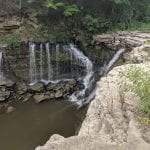
We will meet at Short Hills Provincial Park, Pelham Road parking lot & hike a loop of the Black Walnut & Rim of Africa Side trails. For our badge we will need to find & photograph Terrace Falls.
Location: Map 5, 2.2KM Beamer Memorial Conservation Area. GPS coordinates N 43.188540, W -79.573428 Hike Leader(s): Fayyaz Mahmood Pace: Moderate Terrain: Hilly Distance: 15 km
Description Difficulty: Intermediate
We will hike to 75.5KM, Map 5. Hike back to Beamer Memorial Conservation Area to return to the cars. This is an IN-OUT hike without carpooling. COVID restrictions apply.
Meet at:Map 5, 2.2KM Beamer Memorial Conservation Area. GPS coordinates N 43.188540, W -79.573428
Take QEW exit 71 for Regional Road 12/Christie St toward Ontario St/Maple Ave. Turn right onto Ridge Rd W, go 1.6KM, right on to Quarry Rd to Beamer Memorial Conservation Area. This is an IN-OUT hike without carpooling. COVID restrictions apply.
Map # 5
Additional Notes: End to End #8 of 8No dropoutHiking bootsNo dogsIcers may be required.
Hosting Club: Blue Mountains Category: Cancelled Location (Google Maps): Hike meets in the parking lot behind Tim Horton’s on First St. in Collingwood. Hike Leader(s): Annette Patrick (705) 795-9700 Click here to contact Hike Leader(s) Pace: Medium – 3 to 4 km/hr Terrain: Moderate – Some hills and/or some poor footing Distance: 3 hours
Description We will park at the intersection of the 2nd Line and the 6th Side Road. The hike will go south on the John Haigh Side Trail, to join the white blazed trail at km 49.1. We will continue north on the white blazed trail to km 51.1, then back to our cars. Bring a light lunch and water. Hike with me on the Path of the Petun and learn about a great battle that was fought between the Iroquois and the Petun at the Petun Village of Etharita, also known as the “St. Jean”. As we hike along the Escarpment ridge, we will use our imaginations to see the Battle Ground and what this beautiful area was like in the mid 1600’s, when the County of Simcoe belonged to the colony of New France.
Hosting Club: Dufferin Hi-Land Category: General Hike Location (Google Maps): Map 19. Meet at Mono Community Centre in the village of Mono Centre on Mono Centre Road. Hike Leader(s): Les Babbage;Tony Riggs Click here to contact Hike Leader(s) Pace: Medium Terrain: Moderate Distance: 8.5 km
Description We will hike a loop consisting of Main Trail and Laidlaw, Clifftop and Walter Tovell Side Trails. Bring water and snacks.
Hosting Club: Iroquoia Category: General Hike Location (Google Maps): Dundas Valley Conservation Area, Governor’s Rd. Dundas
Pace: Leisurely – 3km/hr or less Terrain: Moderate – Some hills and/or some poor footing Distance: Approx. 8 – 9km.
Description Avoid the Christmas crowds and join us for a leisurely hike exploring some of the trails of Dundas Valley Conservation Area (Sawmill Valley, John White, Spring Creek and rail trail). Meet in the last parking lot of the DVCA for a 10:00 am. start. Please arrive at least 15 minutes before. Must be a BTC member to register online. You will receive a confirmation with a list of items to bring and Covid protocols. Bring water, a snack, icers and poles if using. Leader: Anne Armstrong 905 617 3937 hikingrandma@gmail.com
Description A Leisurely hike on the Trails along the banks of 12 mile creek. Note this is the first of what is hoped to be regular leisurely hikes with distance depending on popularity
Hosting Club: Sydenham Category: General Hike Location (Google Maps): Roadside parking or in the lot on the west side of 8th Concession N, just before the road veers east, east of km 74.5 (Map 31, edition 29). Hike Leader(s): Maureen McFarland Click here to contact Hike Leader(s) Pace: Medium: 3 to 4 km/h Terrain: Moderate: Some hills and/or poor footing Distance: 4.5 kms
Description This loop hike takes us through forests and a stream bed. There may be wet and muddy sections. Approx. 2 hours. For more information, call/text 647-918-4180.
Hosting Club: Niagara, Iroquoia Category: Special Event Location (Google Maps): Parking lot behind the Kilbride School at the north end of Panton St, (Kilbride) Burlington 9:00am Dec 6/20 Hike Leader(s): Ruth Moffatt Click here to contact Hike Leader(s) Pace: Medium – 3 to 4 km/hr Terrain: Strenuous – Hilly with steep climbs and some poor footing Distance: Approximately 8 km
Description This is number 1 of 2 Dan Welsh Memorial Hikes, today. 9am and 12:30pm
As this hike is a fundraiser, Dan Welsh Memorial Hike badges will be available for $20 each. Funds raised will go towards the memorial plaque that is to be raised in his honour. This hike will take us out to the recently opened Dan Welsh Side Trail, in the newly acquired property in the River and Ruin area of Lowville, Burlington.
All pandemic protocols are to be followed – masks are strongly recommended. Please familiarize yourself with the guidelines set out on the BTC Hike Schedule website.
Please do not show up for this hike unless you are registered. All registered participants will receive an email confirmation.
Please bring $20 for the badge (cash only). If you would like to make further donations you may do so via: https://brucetrail.org/donations/memorials
Hosting Club: Iroquoia Category: General Hike Location (Google Maps): Crawford Lake Conservation Area Parking Area across from the Iroquoian Village. (BTC Map 11 on the Crawford Lake Side Trail). Hike Leader(s): Stuart Law Click here to contact Hike Leader(s) Pace: Medium – 3 to 4 km/hr Terrain: Moderate – Some hills and/or some poor footing Distance: 18 kms
Description Join us for a combination loop/in and out 18 km hike in the woods of the Crawford Lake and Rattlesnake Conservation Areas taking in the Crawford Lake, Leech Porter and Rattlesnake Point Side Trails and the Main Trails connecting them all. We will also take in Nassagaweya Canyon from the Main Trail to Canyon Road and back. Distance will be reduced if snow conditions warrant. Please be sure to make 3 two-hour reservations (6 hours total) on the Halton Parks website for Crawford Lake. Conservation Halton membership highly recommended. Please bring icers, lunch, snack, water and warm drink. Hiking boots essential. Poles recommended. Covid protocols respected. Please arrive at 9:15 to be ready to hike at 9:30. If you register to hike but end up not being able to make it, please let me know so that we can make room for somebody else to join the hike. Thank you.
Hosting Club: Dufferin Hi-Land Category: General Hike Location (Google Maps): Caledon Hills Section, Map 15. Park on McLaren Rd. north of Park entrance and before “No Waiting Signs”. We will then walk to TCT entrance. If temporary signs have been removed, then park by TCT entrance, just past park entrance. Hike Leader(s): David Francis Click here to contact Hike Leader(s) Pace: Medium Terrain: Moderate, Slippery and Steep Sections Distance: 6 km
Description Loop hike around Forks of the Credit, view old mill, Credit River. Great views, steps to climb up escarpment. Park on McLaren Rd. north of Park entrance and before “No Waiting Signs”. We will then walk to TCT entrance. If temporary signs have been removed, then park by TCT entrance, just past park entrance.
Hosting Club: Niagara, Iroquoia Category: Special Event Location (Google Maps): Parking lot behind the Kilbride School at the north end of Panton St, (Kilbride) Burlington 12:30pm Dec 6/20 Hike Leader(s): Ruth Moffatt Click here to contact Hike Leader(s) Pace: Medium – 3 to 4 km/hr Terrain: Strenuous – Hilly with steep climbs and some poor footing Distance: Approximately 8km
Description This is the second of 2 Dan Welsh Memorial Hikes, today. 9am and 12:30pm
As this hike is a fundraiser, Dan Welsh Memorial Hike badges will be available for $20 each. Funds raised will go towards the memorial plaque that is to be raised in his honour. This hike will take us out to the recently opened Dan Welsh Side Trail, in the newly acquired property in the River and Ruin area of Lowville, Burlington.
All pandemic protocols are to be followed – masks are strongly recommended. Please familiarize yourself with the guidelines set out on the BTC Hike Schedule website.
Please do not show up for this hike unless you are registered. All registered participants will receive an email confirmation.
Please bring $20 for the badge (cash only). If you would like to make further donations you may do so via: https://brucetrail.org/donations/memorials
Hosting Club: Sydenham Category: General Hike Location (Google Maps): Roadside parking at the corner of Cole’s Sideroad and Taylor Sideroad, north-west of Kemble (Map 34, edition 29). Hike Leader(s): Peter Harris Click here to contact Hike Leader(s) Pace: Medium: 3 to 4 km/h Terrain: Moderate: Some hills and/or poor footing Distance: 4.2 km
Description We will hike the Don Richards Side Trail – Kemble Wetlands Loop. Bring snowshoes if there is sufficient snow. For more information contact the hike leader via phone or text at 519-374-3468.
Hosting Club: Iroquoia Category: General Hike Location (Google Maps): Dundas Valley Conservation area , please meet outside trail centre station. Hike Leader(s): Allan Meyer Click here to contact Hike Leader(s) Pace: Brisk – 4 to 5 km/hr Terrain: Moderate – Some hills and/or some poor footing Distance: 5 km.
Description Lets start December off with a brisk hike. Look forward to getting out in the cold brisk weather.
Hosting Club: Iroquoia Category: General Hike Location (Google Maps): Chedoke Golf Course , Hamilton. Hike Leader(s): Daljeet Juneja Click here to contact Hike Leader(s) Pace: Medium – 3 to 4 km/hr Terrain: Moderate – Some hills and/or some poor footing Distance: 8 to 9 km
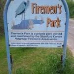
Hosting Club: Iroquoia Category: Special Event Location (Google Maps): Meet at Firemen’s Park, KM 7.0. Enter from Dorchester Rd, 1 km north of Mountain Rd Hike Leader(s): Steven White Click here to contact Hike Leader(s) Pace: Medium – 3 to 4 km/hr Terrain: Dependent on Conditions, Moderate – Some hills and/or some poor footing, Slippery Sections Likely Distance: 7 km
Description
For those working on their Niagara Night Badge or just looking for a good winter night hike, we will do two back to back hikes, one in and the other out, from Firemen’s Park to Woodend Conservation Area. We will follow the main trail from the park through hardwood bush, follow the railroad, down a slope and across pedestrian bridge over highway, through Screaming Tunnel, along Warner road and into Woodend Conservation Area. We will stop for snack and head back following same route to Firemen’s Park. Hikers should register for both hikes. Hikers to comply with Covid protocols, and bring snack, water, headlamps, batteries, boots, icers, personal first aid kit and sanitizer. No dogs please. To cancel, email Steven White at stevenwhite901@gmail.com, or text 289-242-9425
Hosting Club: Iroquoia Category: Special Event Location (Google Maps): Return leg of hike that started at Firemen’s Park, this is the second part of DOUBLE Night Hikes in Niagara Hike Leader(s): Steven White Click here to contact Hike Leader(s) Pace: Medium – 3 to 4 km/hr Terrain: Dependent on Conditions, Moderate – Some hills and/or some poor footing, Slippery Sections Likely Distance: 7 km
Description “This is the second part (return) of the DOUBLE Night Hikes in Niagara, returning from Woodend Conservation Area to Firemen’s Park. For those working on their Niagara Night Badge. We will head back after a snack at Woodend Conservation Area. Hikers should register for both hikes. Hikers to comply with Covid protocols, and bring snack, water, headlamps, batteries, boots, icers, personal first aid kit and sanitizer. No dogs please. To cancel, email Steven White at stevenwhite901@gmail.com, or text 289-242-9426”
Hosting Club: Niagara Category: Night Location (Google Maps): Dufferin Islands Hike Leader(s): Margaret Northfield Click here to contact Hike Leader(s) Pace: Leisurely Terrain: Easy Distance: 6-7km
Description Take an evening stroll around iconic Niagara Falls and view over 3 million holiday lights on display throughout the area. This winter wonderland will not disappoint. Poles and icers may be helpful (depends on the weather). Join us for hot apple cider and holiday treats at the end of the hike. Sorry but this hike does not qualify For the Night Hike Badge
Hosting Club: Iroquoia Category: General Hike Location (Google Maps): Walmart parking lot, west of Walmart, in front of Staples Hike Leader(s): Louise Langlais Click here to contact Hike Leader(s) Pace: Medium – 3 to 4 km/hr Terrain: Strenuous – Hilly with steep climbs and some poor footing Distance: 12-18 km
Description I have always wanted to explore the mountain bike trails that crisscross the Bruce Trail in this part of Waterdown. We’ll wander around and see where they all go to, on foot, not on bicycles (this is the BTC web page after all!). I will bring a GPS to lay a breadcrumb trail and to help us get back to our cars…… eventually! This is a very hilly area, so be warned, you will get a work-out.
Hike Leader: Louise Langlais; Email: langlaislouise@gmail.com. Cell: 519-222-4040 on day of hike. At other times, email is the best way to contact me. Wear appropriate quick-dry clothing and hiking boots. Bring sunscreen, insect repellent (summer), icers (winter), snacks, lunch, a personal first aid kit, and 1-2 litres of water. During COVID, also bring hand sanitizer and a face mask. Please email me at least 24 hours before the hike to register. Sometimes last minute changes are made to hikes; registering means you won’t be waiting around the meeting place not knowing why no-one else is there! For personalized driving directions, just copy and paste the GPS coordinates into a Google search window and voila! Please arrive at least 15 minutes early.
Hosting Club: Niagara Category: In and Out Location (Google Maps): Short Hills, Pelham Rd., Entrance Hike Leader(s): Diane Marlatt Click here to contact Hike Leader(s) Pace: Medium Terrain: Moderate Distance: 7km
Description Dress for the weather, have your crampon devices available for icy conditions. Must register for each hike. The wearing of masks on our hikes is strongly recommended. Bring a drink.
Hosting Club: Dufferin Hi-Land Category: Tuesday Hike Location (Google Maps): Caledon Hills, Map 18. Meet at roadside parking on Dunby Rd (Km 66.8). Hike Leader(s): Les Babbage;Inge Eckerich;Bob Slack Click here to contact Hike Leader(s) Pace: Leisurely Terrain: Moderate Distance: 6.5 or 3.8 Km
Description We will hike the Main Trail and Cam Snell Side Trail. The shorter hike will turn back at the first Cam Snell intersection (Km 64.9). Icers may be required.
Hosting Club: Iroquoia Category: Hikers R Us Location (Google Maps): Meet at 8th Line Side Trail off road parking to depart at 8:30. Hike Leader(s): Cynthia Archer Click here to contact Hike Leader(s) Pace: Medium – 3 to 4 km/hr Terrain: Strenuous – Hilly with steep climbs and some poor footing Distance: 8-12 kms depending on conditions
Description Depending upon conditions we may snowshoe – I will try to email you in advance if snowshoeing is feasible. At the very least icers are required. The trails are well used, hilly and therefore may be slippery. The goal is to start at 8:30 and be back to our cars shortly after 12 noon. Please let me know if you will not be joining us by texting meat 416 573 4236. We will stop midway for snack/lunch. Cynthia Archer
Hosting Club: Niagara Category: Leisurely Location (Google Maps): St. John’s Conservation Area Hike Leader(s): Alicia Aitchison Click here to contact Hike Leader(s) Pace: Leisurely Terrain: Moderate Distance: Approximately 5 km
Description Leisurely hike through all the trails at St. John’s Conservation Area.
Hosting Club: Blue Mountains Category: Cancelled Location (Google Maps): Hike meets in the parking lot behind Tim Horton’s on First St. in Collingwood. Hike Leader(s): Myra Campbell (705) 293-2325 Click here to contact Hike Leader(s) Pace: Medium – 3 to 4 km/hr Terrain: Moderate – Some hills and/or some poor footing Distance: 8.5 km
Description We will start at km27.9 on the 10th Line for an in/out hike past Metcalfe Rock to km 23.8 and then return. Enjoy the lovely views, a magical time in Kolapore!
Hosting Club: Iroquoia Category: Good Companions Location (Google Maps): Meet at the Borer’s Falls Dog Park parking lot, on the north side of York Road, close to the intersection of York Road and Valley Road, Hamilton Hike Leader(s): Janina Vanderpost Click here to contact Hike Leader(s) Pace: Medium – 3 to 4 km/hr Terrain: Moderate – Some hills and/or some poor footing Distance: 9km
Description From the Borer’s Falls Dog Park parking lot, we will take the Ray Lowes side-trail to the Main Trail. There is one steep hill and some stairs to climb. Turning left onto the Main Trail we will continue along the escarpment, past Borer’s Falls, all the way to where the trail reaches Romar Drive. This hike offers spectacular views of the Dundas Valley, Cootes Paradise. This is a there and back hike.
Hosting Club: Sydenham Category: General Hike Location (Google Maps): Roadside parking on Gleason Lake Road at the corner of Colpoy’s Range Road (where the Curly Harnden Side Trail meets the Len Holley Side Trail), south of km 161.1 (Map 35, edition 29). Hike Leader(s): Bob Knapp Click here to contact Hike Leader(s) Pace: Medium: 3 to 4 km/h Terrain: Moderate: Some hills and/or poor footing Distance: 6 km
Description This loop hike begins with the Len Holley Side Trail, then follows the snowmobile trail. We will return to our cars via the main trail and the Len Holley Side Trail. Bring a snack. Approximately 3 hours. For more information, call Bob Knapp at 519-371-1255 (landline).
Hosting Club: Niagara Category: In and Out Location (Google Maps): Jordan Hollow, park across from Boo’s Restaurant Hike Leader(s): Margaret Northfield Click here to contact Hike Leader(s) Pace: Medium Terrain: Moderate Distance: 7k
Description
Note the change in start time Hike along the Jordan Creek to Upper Balls Falls or the Jim Rainforth Trail. You must register for each hike
Hosting Club: Iroquoia Category: Thursday Group Location (Google Maps): Staring at the front parking lot of Shell Park Hike Leader(s): Karen Bergmann, Norman Young Click here to contact Hike Leader(s) Pace: Medium – 3 to 4 km/hr Terrain: Easy – Mostly flat and usually good footing, Moderate – Some hills and/or some poor footing, Slippery Sections Likely Distance: 13 km
Description Easy town trails – Dress appropriately for the weather Bring water; snack, etc
YOU MUST BE SELF SUFFICIENT. Bing a mask and sanitizer
Hosting Club: Caledon Hills Category: General Location (Google Maps): Map 17, Palgrave Forest & Wildlife Area. Take Hwy 50 south 0.8 km from Hwy 9 and turn west onto Finnerty Sideroad. Drive 750 m to the Palgrave Forest parking lot on the south side of the road. Hike Leader(s): Tessa Shelvey – Cell # 416-320-8555 Click here to contact Hike Leader(s) Pace: Medium – 3 to 4 km/hour Terrain: Moderate – some hills and/or some poor footing Distance: 9 km loop
Description Enjoy a nice loop hike in the Palgrave Forest. Bring a snack for break on the trail.
Hosting Club: Niagara Category: Urban Location (Google Maps): Veteran Memorial Park, King St & Veteran’s Lane Hike Leader(s): Margaret Northfield Click here to contact Hike Leader(s) Pace: Medium Terrain: Easy
Description Each Friday we will explore the area around Niagara-on-the-Lake. Discover where the Niagara River meets Lake Ontario. Experience the Heritage District, woods and the Niagara Parkway. Hike along part of the Bruce Trail’s General Brock Side Trail as well as the Heritage Trail.
Some weeks may be totally on sidewalks and roads while others will include a mix of trail and paved pathways.
Great opportunity to see beautiful NOTL as well as build up your endurance for longer hikes.
Plan on staying for a coffee at the Sweets & Swirls Café, NOTL Community Centre.
Hosting Club: Niagara Category: Urban Location (Google Maps): Veteran’s Memorial Park, Veteran’s Way & King St., NOTL. Park near the tennis courts Hike Leader(s): Margaret Northfield Click here to contact Hike Leader(s) Pace: Medium Terrain: Easy Distance: 6-7km
Description Each Friday we will explore the area around Niagara-on-the-Lake. Discover where the Niagara River meets Lake Ontario. Experience the Heritage District, woods and the Niagara Parkway. Hike along part of the Bruce Trail’s General Brock Side Trail as well as the Heritage Trail.
Some weeks may be totally on sidewalks and roads while others will include a mix of trail and paved pathways.
Great opportunity to see beautiful NOTL as well as build up your endurance for longer hikes.
Hosting Club: Niagara Category: In and Out Location (Google Maps): Rockway Community Centre Hike Leader(s): Alicia Aitchison Click here to contact Hike Leader(s) Pace: Medium Terrain: Moderate, Strenuous Distance: Approximately 6 km
Description Friday NIAGARA SIDE TRAIL CHALLENGE HIKES!
Every Friday at 10 am starting November 20th and running through until April. Join 1 or join all to work towards earning the NBTC Side trail badge. We will have some makeup hikes at the end once we’ve worked through all the side trail requirements once.
Side trail badge requirements & logs are found in the Niagara Bruce Trail Club website under badges for your own tracking.
We will hike the Rockway Side trail & the main trail in & out, photographing the upper & lower calls for badge requirements!
Hosting Club: Iroquoia Category: General Hike Location (Google Maps): Parking at Chedoke Golf Club (on Beddoe Drive, Hamilton). GPS Coordinates: (43.246205 -79.906935). From Highway 403 Hamilton, exit onto Aberdeen Avenue. Follow Aberdeen under the railway bridge, and take an immediate right onto Studholme Road. Turn left onto Beddoe Drive and it will lead you into the Golf Club parking lot (Bruce Trail Reference, Map 8) Hike Leader(s): Douglas Boyce Click here to contact Hike Leader(s) Pace: Brisk – 4 to 5 km/hr Terrain: Strenuous – Hilly with steep climbs and some poor footing Distance: 18 km
Description We will hike the Main Trail through Iroquoia Heights Conservation Area to Sherman Falls, and then explore a new piece of Main Trail, recently opened by the BTC, and loop around Canterbury Falls. If there are icy/wintry conditions, you will need icers, and poles recommended. We will hike at a brisk pace, stopping once or twice for a snack break. Bring snacks and water.
Hosting Club: Niagara Category: Loop Location (Google Maps): Woodend Conservation Area, park at the entrance near Taylor Rd Hike Leader(s): Margaret Northfield Click here to contact Hike Leader(s) Pace: Medium Terrain: Moderate Distance: 15km
Description Hike around Woodend and loop over to Fireman’s Park and back.
Bring water & snack. Dress appropriate to weather conditions.
Hosting Club: Dufferin Hi-Land Category: General Hike Location (Google Maps): Dufferin Hi-Land Section, Map 20. Meet at roadside parking on the west side of Centre Rd, just north of Dufferin Rd 17, beside the church. From the intersection of Hwy 10 and 89, drive north on Dufferin Rd 19 to the first stop sign. Turn right/east onto Dufferin Rd 17. Centre Rd is the first intersection. Hike Leader(s): Les Babbage Click here to contact Hike Leader(s) Pace: Medium Terrain: Dependent on Conditions, Moderate, Strenuous Distance: 14.4 km
Description We will hike north down Kilgorie hill to a loop consisting of Main Trail, Meladonna and Kilgorie Side Trails. In the event of poor trail conditions, hike may be shortened. Bring icers, water, lunch and snacks. Snowshoes could be required. Check back here for updates on trail conditions.
Hosting Club: Blue Mountains Category: Cancelled Location (Google Maps): Hike meets in the parking lot behind Tim Horton’s on First St. in Collingwood. Hike Leader(s): Terry Kimmerly (705) 351-2494 Click here to contact Hike Leader(s) Pace: Medium – 3 to 4 km/hr Terrain: Moderate – Some hills and/or some poor footing Distance: 7 km
Description This is one of our Friendship trails running along BTC trails and other conserved land north of Boyne Valley Provincial Park. We will park at km 29.4 on 1st Line E in the Dufferin Hi-Lands section. The 7 km figure eight hike will follow the white blazed trail to km 25.5, looping back to the parking lot via the Oliver Creek Side Trail and the Moss Haven Side Trail. *The Bibbulmun Track in Western Australia stretches 1,000 km from Kalamunda in the Perth Hills to the historic town of Albany on the south coast.
Hosting Club: Sydenham Category: General Hike Location (Google Maps): Georgian Bluffs – Roadside parking on Gleason Lake Rd. where it meets Colpoy’s Range Rd., north of Conc. 24, south of km 163.1 on Map 35 edition 30. Hike Leader(s): Bill Snel Click here to contact Hike Leader(s) Pace: Leisurely: 3 km/h or less Terrain: Moderate: Some hills and/or poor footing Distance: 6.5 km
Description 3 hrs. Curly Harnden Side Trail, main trail and Len Holley Side Trail. Nice views of Colpoy’s Bay from the main trail section.
Hosting Club: Sydenham Category: Geology Hike Location (Google Maps): Trailhead parking (P) on Concession 11 south of Superior Street where the rail trail meets the road, north of km 87.3 (Map 32, edition 29). See map attached. Hike Leader(s): Carol Mullin Click here to contact Hike Leader(s) Pace: Medium: 3 to 4 km/h Terrain: Moderate: Some hills and/or poor footing, Strenuous: Hilly with steep climbs and some poor footing., There might be icy and slippery sections.
Description From the parking area we will walk on the rail trail to the main trail and return the same way. There are interesting outcroppings and views of the karst formations from the bottom of Boyd’s Crevice. If the weather is snowy or icy, we will not be climbing the ladder but viewing from a safe location. Snowshoes / ice grippers recommended if appropriate. Approx. 2.5 hours.
Take an evening stroll around iconic Niagara Falls and view over 3 million holiday lights on display throughout the area. This winter wonderland will not disappoint. Poles and icers may be helpful (depends on the weather). Join us for hot apple cider and holiday treats at the end of the hike. Sorry but this hike does not qualify For the Night Hike Badge
Hosting Club: Iroquoia Category: General Hike Location (Google Maps): Behind the Kilbride School at the north end of Panton Street (BTC Map 10 northwest of km 97.9) Hike Leader(s): Stuart Law Click here to contact Hike Leader(s) Pace: Medium – 3 to 4 km/hr Terrain: Moderate – Some hills and/or some poor footing Distance: 20 km
Description Third in the Up the Iroquoia! series of hikes exploring the beauty of the Iroquoia Section. This is a there-and-back hike from Kilbride Public School to the Nassagaweya Canyon Lookout and back. The terrain is flat for the most part and quietly wooded. The goal is to take in the crisp fresh air and appreciate our surroundings while getting some healthy exercise and having a few laughs. Please make sure you have your icers, hiking boots, warm drink, water, lunch and snacks. Poles strongly recommended. Covid protocols respected. Please meet for 9:00 am for a 9:15 am start. If you sign up then realize you can’t make it, please let me know so that we can allow other hikers to join us.
Hosting Club: Sydenham Category: General Hike Location (Google Maps): Georgian Bluffs – Roadside parking on Gleason Lake Rd. where it meets Colpoy’s Range Road, north of Concession 24, south of km 161.1 (Map 35, edition 29). Hike Leader(s): Bill Snel Click here to contact Hike Leader(s) Pace: Leisurely: 3 km/h or less Terrain: Moderate: Some hills and/or poor footing Distance: 6.5 km
Description 3 hrs. Curly Harnden Side Trail, main trail and Len Holley Side Trail. Nice views of Colpoy’s Bay from the main trail section.
Hosting Club: Iroquoia Category: General Hike Location (Google Maps): Dundas Valley Conservation Area Hike Leader(s): Allan Meyer Click here to contact Hike Leader(s) Pace: Medium – 3 to 4 km/hr Terrain: Moderate – Some hills and/or some poor footing
Description Lets enjoy another lovely afternoon hiking on the Main Loop. Meet at the Train Station, outside.
Hosting Club: Iroquoia Category: General Hike Location (Google Maps): 6th Concession West and Middletown Road, Millgrove Hike Leader(s): Louise Langlais Click here to contact Hike Leader(s) Pace: Medium – 3 to 4 km/hr Terrain: Strenuous – Hilly with steep climbs and some poor footing Distance: 12-18 km
Description She’s hilly! We will hike the Lafarge Trail, starting with three drumlins in a row that will get your heart pumping and warm you up quickly! The rest isn’t as tough, and there is some road walking, but you’ll end it with a bang because this is an In and Out hike. Charge!
Hike Leader: Louise Langlais; Email: langlaislouise@gmail.com. Cell: 519-222-4040 on day of hike. At other times, email is the best way to contact me. Wear appropriate quick-dry clothing and hiking boots. Bring sunscreen, insect repellent (summer), icers (winter), snacks, lunch, a personal first aid kit, and 1-2 litres of water. During COVID, also bring hand sanitizer and a face mask. Please email me at least 24 hours before the hike to register. Sometimes last minute changes are made to hikes; registering means you won’t be waiting around the meeting place not knowing why no-one else is there! For personalized driving directions, just copy and paste the GPS coordinates into a Google search window and voila! Please arrive at least 15 minutes early.
Hosting Club: Iroquoia Category: General Hike Location (Google Maps): Chedoke Golf Course , Hamilton. Hike Leader(s): Daljeet Juneja Click here to contact Hike Leader(s) Pace: Medium – 3 to 4 km/hr Terrain: Moderate – Some hills and/or some poor footing Distance: 8 to 9 km
Hosting Club: Niagara Category: Register Location (Google Maps): Short Hills, Pelham Rd., Entrance Hike Leader(s): Diane Marlatt Click here to contact Hike Leader(s) Pace: Medium Terrain: Moderate Distance: 7km
Description Dress for the weather, have your crampon devices available for icy conditions. Must register for each hike. The wearing of masks on our hikes is strongly recommended. Bring a drink.
Hosting Club: Dufferin Hi-Land Category: Tuesday Hike Location (Google Maps): Dufferin Hi-Land, Map 19. Meet at Mono Community Centre parking lot in Mono Centre. Hike Leader(s): Les Babbage;Inge Eckerich;Bob Slack Click here to contact Hike Leader(s) Pace: Leisurely Terrain: Easy, Slippery Sections Likely Distance: 5.0 km
Description We will hike the Laidlaw Side Trail, Main Trail and South Outlier Loop. Shorter hike: TBD. Icers may be required.
Hosting Club: Iroquoia Category: Hikers R Us Location (Google Maps): Meet at Oakville Town Hall Hike Leader(s): Norman Young Click here to contact Hike Leader(s) Pace: Medium – 3 to 4 km/hr Terrain: Easy – Mostly flat and usually good footing Distance: 13km -/+
Description Remember to follow COVID guide line and dress according to the weather and footing
Bring water and a snack etc
Norman Young mny176@outlook.com 905 845 09039 cell 905 330 6605
Hosting Club: Niagara Category: In and Out Location (Google Maps): Rotary Park, St. Catherine’s Hike Leader(s): Alicia Aitchison Click here to contact Hike Leader(s) Pace: Medium Terrain: Moderate Distance: Approximately 6 km
Description We will hike the trails in & around Rotary Park.
Hosting Club: Blue Mountains Category: Cancelled Location (Google Maps): Hike meets in the parking lot behind Tim Horton’s on First St. in Collingwood. Hike Leader(s): Bert Beausoleil (705) 293-2525 Click here to contact Hike Leader(s) Pace: Medium – 3 to 4 km/hr Terrain: Moderate – Some hills and/or some poor footing Distance: 11 km
Description We will park on the Euphrasia-St. Vincent Townline at km 108.0 of the Beaver Valley section. From there we will hike south along the white blazed trail to Anthea’s Waterfall at km 113.3 and return. This in/out hike takes us through some nice forested areas and along fields with great views, eventually ending up at Ace’s Falls which will likely be frozen over. Bring water and a snack.
Hosting Club: Iroquoia Category: Good Companions Location (Google Maps): Oakville Maplegrove Plaza
Pace: Leisurely – 3km/hr or less Terrain: Easy – Mostly flat and usually good footing Distance: Approx. 9-10 km.
Description This hike follows Joshua Creek as it makes its way to Lake Ontario. Meet near Tim Horton’s in the parking lot of Maple Grove Plaza on Cornwall Dr. and Maple Grove Dr. for a 10:00 am. start. Bring water, a snack, icers and poles (if using). This hike is for BTC members only. Once registered you will get a confirmation with items to bring and Covid protocols. Leaders: Anne and Phill Armstrong 905 617 3937 hikingrandma@gmail.com
Hosting Club: Iroquoia Category: General Hike Location (Google Maps): St Helena Road, Milton Hike Leader(s): Louise Langlais Click here to contact Hike Leader(s) Pace: Medium – 3 to 4 km/hr Terrain: Moderate – Some hills and/or some poor footing Distance: 12-20
Description There are many trails that intersect the Bruce Trail in Scotch Block at the top of the escarpment that overlooks the Milton area. We will explore these trails. To ensure we really do not get lost, your leader will bring her handheld Garmin GPS, to lay a breadcrumb trail and to make sure the group can find their cars. It will be fun! We unlikely will get to check all of them out, meaning we can go back another time to cover more ground.
Hike Leader: Louise Langlais; Email: langlaislouise@gmail.com. Cell: 519-222-4040 on day of hike. At other times, email is the best way to contact me. Wear appropriate quick-dry clothing and hiking boots. Bring sunscreen, insect repellent (summer), icers (winter), snacks, lunch, a personal first aid kit, and 1-2 litres of water. During COVID, also bring hand sanitizer and a face mask. Please email me at least 24 hours before the hike to register. Sometimes last minute changes are made to hikes; registering means you won’t be waiting around the meeting place not knowing why no-one else is there! For personalized driving directions, just copy and paste the GPS coordinates into a Google search window and voila! Please arrive at least 15 minutes early.
Hosting Club: Niagara Category: In and Out Location (Google Maps): Jordan Hollow, park across from Boo’s Restaurant Hike Leader(s): Margaret Northfield Click here to contact Hike Leader(s) Pace: Medium Terrain: Moderate Distance: 7km
Description
Note the change in start time Hike along the Jordan Creek to Upper Balls Falls or the Jim Rainforth Trail. You must register for each hike
Hosting Club: Iroquoia Category: Thursday Group Location (Google Maps): RBG North Shore Trails Hike Leader(s): Linda Robinson Click here to contact Hike Leader(s) Pace: Leisurely – 3km/hr or less Terrain: Easy – Mostly flat and usually good footing Distance: 7-8KM
Description Meet at the Nature Interpretive Centre at the RBG Arboretum. Parking is available and free to RBG members. Non-members must pay a fee to park. This hike is open to BTC members only and you are required to pre-register online. Once you are registered you will be sent a list of items to bring and protocols to follow.
Hosting Club: Sydenham Category: Snowshoe Hike Location (Google Maps): Parking lot of the Woodford Community Centre on Woodford Crescent, north of Hwy 26, north of km 41.7 (Map 30, edition 29) Hike Leader(s): Franziska Edney Click here to contact Hike Leader(s) Pace: Medium: 3 to 4 km/h Terrain: Moderate: Some hills and/or poor footing Distance: 3 kms
Description Woodford often has more snow. Bring your snow shoes even if Owen Sound only has little snow. The hike is through a variety of forest, passing traces of an old pioneer settlement and lime kiln. Some of us might want to venture through a couple of tight crevices.
Hosting Club: Niagara Category: Youth Hike Location (Google Maps): Veterans Memorial Park, King St & Veteran’s Lane Hike Leader(s): Margaret Northfield Click here to contact Hike Leader(s) Pace: Medium Terrain: Easy Distance: 5-7km
Description Each Friday we will explore the area around Niagara-on-the-Lake. Discover where the Niagara River meets Lake Ontario. Experience the Heritage District, woods and the Niagara Parkway. Hike along part of the Bruce Trail’s General Brock Side Trail as well as the Heritage Trail.
Some weeks may be totally on sidewalks and roads while others will include a mix of trail and paved pathways.
Great opportunity to see beautiful NOTL as well as build up your endurance for longer hikes.
Plan on staying for a coffee at the Sweets & Swirls Café, NOTL Community Centre.
Hosting Club: Niagara Category: Urban Location (Google Maps): Veteran’s Memorial Park, Veteran’s Way & King St. NOTL. Park near the tennis courts. Hike Leader(s): Margaret Northfield Click here to contact Hike Leader(s) Pace: Medium Terrain: Easy Distance: 6-7km
Description Each Friday we will explore the area around Niagara-on-the-Lake. Discover where the Niagara River meets Lake Ontario. Experience the Heritage District, woods and the Niagara Parkway. Hike along part of the Bruce Trail’s General Brock Side Trail as well as the Heritage Trail.
Some weeks may be totally on sidewalks and roads while others will include a mix of trail and paved pathways.
Great opportunity to see beautiful NOTL as well as build up your endurance for longer hikes.
Hosting Club: Niagara Category: In and Out Location (Google Maps): Louth Conservation Area
Pace: Medium Terrain: Moderate, Strenuous Distance: Approximately 6 km
Description Friday NIAGARA SIDE TRAIL CHALLENGE HIKES!
Every Friday at 10 am starting November 20th and running through until April. Join 1 or join all to work towards earning the NBTC Side trail badge. We will have some makeup hikes at the end once we’ve worked through all the side trail requirements once.
Side trail badge requirements & logs are found in the Niagara Bruce Trail Club website under badges for your own tracking.
We will hike the Staff Ave & Louth side trails and a loop with the mail trail.
Registration is mandatory & limited due to limited parking. This parking lot is not always plowed so we will have to watch the weather & potentially reschedule.
Hosting Club: Sydenham Category: General Hike Location (Google Maps): Grey Sauble Conservation Authority Headquarters, 237897 Inglis Falls Road. Enter from Inglis Falls Road. Meet in the parking lot behind the building. Hike Leader(s): Carol Mullin Click here to contact Hike Leader(s) Pace: Medium: 3 to 4 km/h Terrain: Moderate: Some hills and/or poor footing, There might be icy and slippery sections. Distance: 3.5 km
Description This hike is for new members of Sydenham club only. If you have been a member for less than a year, please join us ! This is an in and out hike. There are some steep sections , approx. 2 hrs. Mostly forest with a view of Inglis Falls. If there is heavy snowfall bring snowshoes. Otherwise, boots with grippers should be fine.
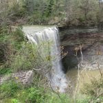
Description A loop hike from Pelham Road towards Morningstar Mill, Terrace Falls, Swayze Falls and Rim of Africa. Dress for the weather, have your crampon devices available for icy conditions. Must register for each hike. The wearing of masks on our hikes is strongly recommended. Bring a drink.
Hosting Club: Blue Mountains Category: Cancelled Location (Google Maps): Hike meets in the parking lot behind Tim Horton’s on First St. in Collingwood. Hike Leader(s): Dick Edwards (705) 445-5849 Click here to contact Hike Leader(s) Pace: Medium – 3 to 4 km/hr Terrain: Moderate – Some hills and/or some poor footing Distance: 10 km
Description ** WEAR SANTA/ELF HATS** We will park on 4th Line in the Caledon Hills section, begin at km 56.2 and hike to km 61.0 and return. Trail crosses a flat plateau, descends alongside a creek into a deep valley and then climbs onto higher ground. Bring water and a lunch.
Hosting Club: Niagara Category: Loop Location (Google Maps): FIREMANS PARK UPPER PARKING LOT Hike Leader(s): Marion Hanover Click here to contact Hike Leader(s) Pace: Medium Terrain: Moderate Distance: 11 KM
Description Hike a figure eight around Firemen’s Park. Mixture of trail and road walking. Bruce Trail, Firemen’s trails, Haulage Rd Trail and roadway.
Hosting Club: Blue Mountains Category: Cancelled Location (Google Maps): Hike meets in the parking lot behind Tim Horton’s on First St. in Collingwood. Hike Leader(s): Flo Kusiak (705) 443-5849 Click here to contact Hike Leader(s) Pace: Leisurely – 3 km/hr. or less Terrain: Easy – Mostly flat and usually good footing, Moderate – Some hills and/or some poor footing Distance: 5 km
Description ** WEAR SANTA/ELF HATS** We will drive via Grey Rd 119 to the end of the 6th Line in the Beaver Valley Section. We will hike along the Bruce Trail to km 11.3 where it joins up with the Margaret Paull Side Trail. We will follow the Side Trail back to the white blazed trail, then return to the cars. Bring water and a snack and wear your Santa/Elf hats!
Take an evening stroll around iconic Niagara Falls and view over 3 million holiday lights on display throughout the area. This winter wonderland will not disappoint. Poles and icers may be helpful (depends on the weather). Join us for hot apple cider and holiday treats at the end of the hike. Sorry but this hike does not qualify For the Night Hike Badge
Hosting Club: Iroquoia Category: General Hike Location (Google Maps): Zimmerman Park, 4275 No. 2 Side Road, Burlington (BTC Map 10, 1 km east of km 87.3) Hike Leader(s): Stuart Law Click here to contact Hike Leader(s) Pace: Medium – 3 to 4 km/hr Terrain: Moderate – Some hills and/or some poor footing Distance: 14 km with an optional ramble in Zimmerman park after the main hike.
Description Join us for the fourth in our series of hikes celebrating the mighty Iroquoia Section. This stop – the truly momentous Mount Nemo – like hiking on a cloud – tremendous views on a clear day. Breath-taking elevation. Slippery rocks when wet or icy which is virtually certain. Please wear icers and hiking boots. Poles highly recommended. Please bring warm drink, water, snacks and lunch. “Holiday” attire welcome but no reindeer please. Covid protocols respected. Please let me know if you sign up but later find out you can’t make it so that we can free up space for another hiker.
Hosting Club: Sydenham Category: General Hike Location (Google Maps): Parking Lot at the Owen Sound Tranportation and Tourism Office, 717875 Hwy 6 North, Georgian Bluffs, west of km 105.3 (Map 32, edition 29). Hike Leader(s): Maureen McFarland Click here to contact Hike Leader(s) Pace: Medium: 3 to 4 km/h Terrain: Easy: Mostly flat and good footing., Moderate: Some hills and/or poor footing Distance: 2.3 kms
Description We will hike the Merle Gunby Side Trail and main trail with views of Jones Falls from above. Snowshoes/ice grippers recommended if it is snowy or icy. For more information, call/text 647-918-4180.
Hosting Club: Iroquoia Category: General Hike Location (Google Maps): Dundas Valley Conservation Area, Hike Leader(s): Allan Meyer Click here to contact Hike Leader(s) Pace: Brisk – 4 to 5 km/hr Terrain: Moderate – Some hills and/or some poor footing
Description Meet me at the Dundas Velley Trail Centre, outside by the picnic tables. The trail might be muddy and slippery at this time of year so come prepared.
Description Leaving from the Roland Road entrance of Short Hills Provincial Park we will do a 90 minute in and out hike through the beautiful park, stopping to view the spectacular Swayze Falls. Pace will be leisurely (approximately 3km/hr).
Hikers can work to earn the Young Nature Blazers Badge or the Young Trail Blazers Badge & hikers that earn both badges will receive a copy of Birthday Boots, by Cindi Conlon, a delightful tale of a young family’s first hike on the Bruce Trail.
All youth must be accompanied by a parent or guardian and the registration process must be completed for each family member separately, including children, so we have an accurate head count. Participant numbers are limited. Use your membership number for any youth you will be bringing.
If you are new to Bruce Trail hikes please review the Know Before You Go section on brucetrail.org to ensure you are prepared for your hiking adventure & familiar with hiking responsibly & safely in the time of Covid-19.
If you are a new Bruce Trail member or don’t have a membership number yet please contact the hike leader for information on how to register.
Due to Covid restrictions & social distancing requirements please ensure you are prepared & self sufficient. Have masks (not required to wear but you should have on hand), hand sanitizer, first aid supplies, water, snacks.
Hosting Club: Iroquoia Category: Special Event Location (Google Maps): Toronto Double Winter End to End Hike Leader(s): Ruth Moffatt Click here to contact Hike Leader(s) Pace: Brisk – 4 to 5 km/hr Terrain: Strenuous – Hilly with steep climbs and some poor footing Distance: 23km
Description [wpdatachart id=]This hike is Full.
**This hike is cancelled due to COVID 19 precautions** This is the first of 5 hikes to complete the Toronto section for the new winter end to end badge. The other dates will be December 22, 23, 28 & 29, weather permitting. All hikes will be done from both directions in/out, no car shuttling.
Due to limited parking, this is a small group hike limited to 6 people including the hike leader and is specifically for participants wishing to complete the entire section twice. Please do not sign up if you only wish to hike one day. Sorry, no exceptions to the group size. The other meeting locations will be provided on the first morning. Each hike will start 8:30, brisk pace, 15 min lunch. Please bring icers in case of icy conditions.
Please familiarize yourself with the pandemic protocols.
Hosting Club: Iroquoia Category: General Hike Location (Google Maps): Chedoke Golf Course , Hamilton. Hike Leader(s): Daljeet Juneja Click here to contact Hike Leader(s) Pace: Medium – 3 to 4 km/hr Terrain: Moderate – Some hills and/or some poor footing Distance: 8 to 9 km
Hosting Club: Niagara Category: Register Location (Google Maps): Short Hills, Pelham Rd., Entrance Hike Leader(s): Diane Marlatt Click here to contact Hike Leader(s) Pace: Medium Terrain: Moderate Distance: 7k
Description Dress for the weather, have your crampon devices available for icy conditions. Must register for each hike. The wearing of masks on our hikes is strongly recommended. Bring a drink.
Hosting Club: Dufferin Hi-Land Category: Tuesday Hike Location (Google Maps): Island Lake Conservation Area. Meet at parking on east side of Party City/Winners building at Hwy 10 and 4th Ave, Orangeville. Hike Leader(s): Les Babbage, Inge Eckerich, Bob Slack Click here to contact Hike Leader(s) Pace: Leisurely Terrain: Easy Distance: 8.5 or 3-4 km
Description We will hike the Vicki Barron Lakeside Trail loop. Shorter hike will turn back somewhere around the beach area. Icers may be required.
Hosting Club: Iroquoia Category: General Hike Location (Google Maps): Meet at the Trail Head on Fourth Line Nassagaweya just North of Side Rd 10 Park on the roadside or the small parking lot here if it’s clear. Turn East off Guelph Line onto Side Rd 10 at the Church. SR10 becomes 4th line Nassagaweya at the bend. Hike Leader(s): Phillip Armstrong Click here to contact Hike Leader(s) Pace: Medium – 3 to 4 km/hr Terrain: Moderate – Some hills and/or some poor footing Distance: 10km
Description A 10km moderate hike. The route is mainly in the forest and sheltered from the wind. The route will be decided based on trail conditions on the day. Bring food and adequate clothing. Prudent hikers will have ice cleats with them. This hike is the same as the one on Dec 24th. Both hikes will run. This is not a date change.
Hosting Club: Blue Mountains Category: Cancelled Location (Google Maps): Hike meets in the parking lot behind Tim Horton’s on First St. in Collingwood. Hike Leader(s): David Little (705) 606-1077 Click here to contact Hike Leader(s) Pace: Medium – 3 to 4 km/hr Terrain: Moderate – Some hills and/or some poor footing Distance: 9 km
Description ** WEAR YOUR HOLIDAY SPIRIT** We will head to the Loree Forest parking on the 21st Sideroad. We will walk down the hill, starting the hike at km 8.4 of the Beaver Valley section. This will be a loop hike with great views along the way. The actual route will be a surprise. Bring water/snacks, Wear Santa hats and Christmas bells.
Hosting Club: Blue Mountains Category: Cancelled Location (Google Maps): Hike meets in the parking lot behind Tim Horton’s on First St. in Collingwood. Hike Leader(s): Michael Treuman 416-518-0489 Click here to contact Hike Leader(s) Pace: Leisurely – 3 km/hr. or less Terrain: Moderate – Some hills and/or some poor footing Distance: 5 km
Description ** WEAR YOUR HOLIDAY SPIRIT** We will head to the Loree Forest parking on the 21st Sideroad. We will walk down the hill, starting the hike at km 8.4 of the Beaver Valley section. This will be a loop hike with great views along the way. The actual route will be a surprise. Bring water/snacks, Wear Santa hats and Christmas bells
Hosting Club: Iroquoia Category: Good Companions Location (Google Maps): Directions: From Hamilton take 403 to West. Exit at Wilson St in Ancaster. Turn right on Wilson St. At the traffic take the exit right onto Meadowbrook St (3rd exit). Take Meadowbrook to Jerseyville Side Rd. and turn right. Just pass the high school the Little League Park is on the right at the bottom of the hill. Hike Leader(s): Lorraine Sherred Click here to contact Hike Leader(s) Pace: Medium – 3 to 4 km/hr Terrain: Moderate – Some hills and/or some poor footing Distance: 9to 10km
Description Walk through Spring Valley to rail trail and back by Martin’s Rd. Please bring water and snack. Icers if needed.
Hosting Club: Niagara Category: In and Out Location (Google Maps): Meet at offroad parking on York Road (regional road 81) just east of Concession 2 (Map 1) Hike Leader(s): Alicia Aitchison Click here to contact Hike Leader(s) Pace: Medium Terrain: Moderate Distance: approximately 6 km
Description This is a make up hike for those doing the Friday Niagara Side Trail Challenge Hikes that weren’t able to register for the Upper Canada Side Trail hike on November 20th.
Friday NIAGARA SIDE TRAIL CHALLENGE HIKES!
Every Friday at 10 am starting November 20th and running through until April. Join 1 or join all to work towards earning the NBTC Side trail badge. We will have some makeup hikes at the end once we’ve worked through all the side trail requirements once.
Side trail badge requirements, descriptions & logs are found in the Niagara Bruce Trail Club website under badges for your own tracking.
We will meet at the parking lot on York Road (Map 1) & hike the Upper Canada Heritage Trail from York road to the main Bruce trail, follow the mail trail towards Queenston & hike back out the same way. For the badge we will need to find & photograph the dry stone wall & lime kiln ruins.
Hosting Club: Niagara Category: In and Out Location (Google Maps): Jordan Hollow, park across from Boo’s Restaurant Hike Leader(s): Margaret Northfield Click here to contact Hike Leader(s) Pace: Medium Terrain: Moderate
Description
Note the change in start time Hike along the Jordan Creek to Upper Balls Falls or the Jim Rainforth Trail. You must register for each hike
Hosting Club: Iroquoia Category: Thursday Group Location (Google Maps): Meet at the Trail Head on Fourth Line Nassagaweya just North of Side Rd 10. Park on the roadside or the small parking lot here if it’s clear. Turn East off Guelph Line onto Side Rd 10 at the Church. SR10 becomes Fourth Line Nassagaweya at the bend. Hike Leader(s): Phillip Armstrong Click here to contact Hike Leader(s) Pace: Medium – 3 to 4 km/hr Terrain: Moderate – Some hills and/or some poor footing Distance: 10km
Description A 10 km moderate hike. The route is mainly in forest and sheltered from the wind.
The route will be decided based on trail conditions on the day.
Location: Jack Layton Ferry Terminal Hike Leader(s): Thomas Swales, David Royle & Family Pace: Moderate Terrain: Flat Distance: 12 km
Description Difficulty: Intermediate
Skip the Boxing Day crowds and join us on the quiet Toronto Islands for our annual Boxing Day Hike.. We will catch the 3:30 pm ferry to be back in Toronto before 4:00. Approximate ferry return fares $8.19 Adult, $5.37 Seniors. At time of writing ferry tickets must be purchased online at the city of Toronto website. Voluntary donations to the Bruce Trail Conservancy to help preserve the Niagara Escarpment will be accepted (bills preferred) . We will divide into two separate groups at the start of the hike to be in compliance with maximum outdoor gathering size.
Meet at:Jack Layton Ferry Terminal
Meet at 9:45am inside waiting area of Jack Layton Ferry Terminal at the foot of Bay St.
Additional Notes: Dropout available at any timeHiking boots
Hosting Club: Niagara, Iroquoia Category: Special Event Location (Google Maps): Dundas Valley Conservation Area – Governor’s Rd. Dundas
Pace: Leisurely – 3km/hr or less Terrain: Moderate – Some hills and/or some poor footing Distance: Approx. 9 km.
Description Meet in the last parking lot of the Dundas Valley CA on Governor’s Rd., west of Dundas. Meet by 9:45 for a 10:00 am. start. This hike is limited to 10 people including the leader. You must be a BTC member in order to register. COVID protocols in place. Memorial Bluebird badges for sale for $20 each with funds going to the purchase of a plaque to erected on the trail in memory of Dan. Bring water, snack. Icers may be needed. Parking fee or Conservation Area pass.
Leader: Anne Armstrong 905 617 3937 hikingrandma@gmail.com
Hosting Club: Sydenham Category: General Hike Location (Google Maps): Roadside parking where East Linton Road takes a sharp bend to the right, east of km 119.2 (Map 33, edition 29). Hike Leader(s): Danuta Valleau Click here to contact Hike Leader(s) Pace: Leisurely: 3 km/h or less Terrain: Moderate: Some hills and/or poor footing Distance: 2 km
Description Suitable for snowshoeing if enough snow. Good idea to bring poles. Steep but short access trail leads to main trail that winds through a series of crevasses. We will return on blue blazed Frank Holley Side Trail.
Hosting Club: Iroquoia Category: General Hike Location (Google Maps): Chedoke Golf Course , Hamilton Hike Leader(s): Daljeet Juneja Click here to contact Hike Leader(s) Pace: Medium – 3 to 4 km/hr Terrain: Moderate – Some hills and/or some poor footing Distance: 8 to 9 km
Hosting Club: Iroquoia Category: General Hike Location (Google Maps): City View Park Burlington. Use the South entrance off Kerns Rd that leads to the trailheads. Don’t go to the North entrance foe the soccer fields and playgrounds. Hike Leader(s): Phillip Armstrong Click here to contact Hike Leader(s) Pace: Medium – 3 to 4 km/hr Terrain: Moderate – Some hills and/or some poor footing Distance: 10 km
Description We will take side trails and the main trail. We’ll explore and walk around the pond then walk the main trail back to the cars. This is an extra hike similar to the one the day after. There is no date change.
Hosting Club: Iroquoia Category: Good Companions Location (Google Maps): Meet at Glenhurst Gardens on Ava Rd in Brantford. From Hamilton take the 403 to Paris Rd exi. Turn left on Paris rd . Follow to stoplights and turn right onto Hardy Rd. Once over train tracks turn left onto Ava Rd . Meet at upper parking lot next to cochleae house Address is 20 Ava Rd Hike Leader(s): Lorraine Sherred Click here to contact Hike Leader(s) Pace: Medium – 3 to 4 km/hr Terrain: Moderate – Some hills and/or some poor footing Distance: 8 to 9Km
Description Walk through Waterworks Park along the grand River.
Hosting Club: Iroquoia Category: Thursday Group Location (Google Maps): City View Park Burlington. Use the South entrance off Kerns Rd that leads to the Trail Heads. Don’t go to the North entrance for the soccer fields and playgrounds. Hike Leader(s): Phillip Armstrong Click here to contact Hike Leader(s) Pace: Medium – 3 to 4 km/hr Terrain: Moderate – Some hills and/or some poor footing Distance: 10km
Description We’ll take side trails and the main trail. We’ll explore and walk around the pond and walk the main trail back to the cars
Hosting Club: Sydenham Category: An evening walk. Location (Google Maps): Meet in the municipal parking lot by the river on the west side of 1st Ave. E between 7th St. E and 8th St. E in Owen Sound. Hike Leader(s): Maureen McFarland Click here to contact Hike Leader(s) Pace: Medium: 3 to 4 km/h Terrain: Easy: Mostly flat and good footing., Moderate: Some hills and/or poor footing
Description We will walk to the fish dam, then to Harrison Park to enjoy the festival of lights and explore the park. Then return to our cars. Dress warmly, bring icers and a warm beverage. A headlamp or flashlight is recommended. Approx 2 hours. For more information, call/text 647-918-4180.