Hike Schedule
Join us for a hike! Registration required:
All hikes available to BTC members. Some hikes are open to non-members.
TIP: The calendar view displays up to 7 hikes on a day, but often there are more. Click “More events” to see them all.
Categories
Hosting Club: Iroquoia
Category: General Hike
Location (Google Maps): Kelso Conservation Area parking lot near the Halton Region Museum just southwest of km 120.2, BTC Map 11, 30th Ed.
Hike Leader(s): Stuart Law Click here to contact Hike Leader(s)
Pace: Medium – 3 to 4 km/hr
Terrain: Moderate – Some hills and/or some poor footing
Distance: 10 km with an optional additional 4.5 km.
Description
Join us for an Iroquoia pop-up hike – the first in the “Up the Iroquoia!” series of hikes exploring the mighty Iroquoia Section of the Bruce Trail. We will take in the magnificent heights of Kelso in a combination loop/”in-and-out”. The main hike is 10 kms which will take us back to the cars where folks can drop out if they so desire. The more intrepid among us will grasp the nettle firmly and head to the Hilton Falls parking lot and back (4.5 kms). Participants must navigate their own way through the Conservation Halton website to make at least two back-to-back two-hour reservations (4 hours total) if they opt for the 10 kms. Three two-hour back-to-back reservations suggested if the 15 km hike is chosen. Halton Conservation annual pass membership strongly recommended as we will be hiking other Halton Conservation trails in the weeks ahead. Please don’t forget the Daylight Savings Time change the day of the hike. Hiking boots mandatory. Bring plenty of liquids, a snack and a lunch. Your own song and singing on the trail optional. Beatles preferred. Godspeed.
Hosting Club: Sydenham
Category: General Hike
Location (Google Maps): From Grey County Rd 18 meet at the north end of Concession 2 S. Concession 2 S is 2.8 km east of Bognor Marsh & opposite Grey Rd 29.
Hike Leader(s): Peter Harris Click here to contact Hike Leader(s)
Pace: Medium: 3 to 4 km/h
Terrain: Moderate: Some hills and/or poor footing, Strenuous: Hilly with steep climbs and some poor footing.
Distance: 5.6 km
Description
This hike will follow the Silent Valley, Avalanche Pass & Wilson Homestead side trails as well as the main Bruce Trail. It includes a steep uphill (and downhill) as well as some scrambling through rocky terrain. Hiking poles will be helpful. Bring water and snacks. Map 30. Please preregister on this website. For more information phone/text Peter: cell 519-374-3468.
Hosting Club: Dufferin Hi-Land
Category: General Hike
Location (Google Maps): Meet on Coolihans SR, east of Airport Rd, where the Main Trail crosses (Caledon Hills Section, Km 35.1)
Hike Leader(s): David Francis Click here to contact Hike Leader(s)
Pace: Medium
Terrain: Moderate
Distance: 6 km
Description
Loop hike exploring The “Dingle Schoolhouse,” home and studio of Rosemary Kilbourn, one of Caledon’s most thoughtful and talented artists, set in a wooded valley surrounded by conservation lands along a moraine that forms part of the Niagara Escarpment.
Hosting Club: Iroquoia
Category: General Hike
Location (Google Maps): Dundas Valley Conservation Area, Meet at the Trail Centre, outside at picnic tables.
Hike Leader(s): Allan Meyer Click here to contact Hike Leader(s)
Pace: Brisk – 4 to 5 km/hr
Terrain: Moderate – Some hills and/or some poor footing
Description
Pleasant hike that should get a little sweat going. A chance to see the Valley in all its fall glory. Please dress for the weather. the outdoor site offers some protection from the weather and a good place to gather. We may add on Deer Run Trail, lets see.
Please feel free to bring your dog (on leash). It might be a good idea to bring hiking stick as trail can be slippery.
Please meet at the Trail Centre, outside
Hosting Club: Iroquoia
Category: Happy Wanderers
Location (Google Maps): We will depart from the lower parking lot at the junction of St. Helena Rd and Regional Rd 25.
Hike Leader(s): Cynthia Archer Click here to contact Hike Leader(s)
Pace: Medium – 3 to 4 km/hr
Terrain: Moderate – Some hills and/or some poor footing
Description
We will hike north and loop back covering about 15 kms.
Please not that this hike is open to BTC members (and one guest). You are required to pre-register online. After registration you will be sent a list of items to bring and Covid protocols to follow.
Cancellations the morning of the hike – Please contact leader by phone 416 573 4236.
Hosting Club: Iroquoia
Category: General Hike
Location (Google Maps): Chedoke Golf course parking lot
Hike Leader(s): Daljeet Juneja Click here to contact Hike Leader(s)
Pace: Medium – 3 to 4 km/hr
Terrain: Moderate – Some hills and/or some poor footing
Description
Hosting Club: Niagara
Category: Night
Location (Google Maps):
Wiley Road Parking Lot Short Hills
Hike Leader(s): Alan Laver Click here to contact Hike Leader(s)
Pace: Medium
Terrain: Moderate
Distance: 7k
Description
This is a silent hike for the first 45 minutes. Enjoy the sounds of the deep woods along the trail from Wiley Road. There will be a full moon if it is clear and the stars will be out. Follow the Terrace Falls Trail around the Rim of Africa and the Black Walnut trail. Bring Headlamp,. This hike will count towards the night hike badge.
Hosting Club: Niagara
Category: Loop
Location (Google Maps): Woodend Conservation Area Taylor Rd NOTL,
Hike Leader(s): Alan Laver Click here to contact Hike Leader(s)
Pace: Brisk
Terrain: Moderate
Distance: 12k
Description
With Short Hills Closed for the deer Harvest the Tuesday Hike will move for this week only
Hosting Club: Niagara
Category: In and Out
Location (Google Maps): Rotary Park, 395 Pelham Road, St Catharines
Hike Leader(s): janet davey Click here to contact Hike Leader(s)
Pace: Medium
Terrain: Moderate
Distance: 7 kilometres
Description
Moderate hike around the trails in and around Rotary Park.
Hosting Club: Dufferin Hi-Land
Category: Tuesday Hike
Location (Google Maps):
Meet at Cold Creek CA on 11th Concession, King, 3.5 km north of King Rd
Hike Leader(s): Les Babbage, Inge Eckerich, Bob Slack Click here to contact Hike Leader(s)
Pace: Leisurely
Terrain: Easy
Distance: 6.6 km
Description
We will hike a loop, exploring the park’s nature trails.
Hosting Club: Caledon Hills
Category: Tuesday Hikers
Location (Google Maps): Meet at Pear Tree parking lot on 15 Side Road.
Driving directions: Go West on Highway 401, right on Halton Road 25 (exit 320), continue north to 15 Side road, turn Left – about 200 meters to Bruce Trail Pear Tree parking on the left. (km 11.4)
Hike Leader(s): Mohammad Shafiq Click here to contact Hike Leader(s)
Pace: Medium – 3 to 4 km/hour
Terrain: Moderate – some hills and/or some poor footing
Distance: 14 km
Description
From Speyside we will go south about 7 to 8 kilometres on main Bruce Trail, a section of it is classified as the Kythera Hiking BT Friendship Trail. Part of this section of trail runs along edge of Escarpment with some spectacular views. Hike will include Al Shaw and part of Hilton Falls Side Trails.
Hosting Club: Niagara
Category: In and Out
Location (Google Maps): Woodend Conservation Area
Hike Leader(s): Alicia Aitchison Click here to contact Hike Leader(s)
Pace: Medium
Terrain: Moderate
Distance: Approximately 6 km
Description
Hike will begin at Woodend Conservation Area, Taylor Road parking lot. We will hike the Wetland Ridge Side trail and the main trail.
Hosting Club: Iroquoia
Category: Hikers R Us
Location (Google Maps): 650 Governors Rd., Dundas, ON L9H 5E3
Hike Leader(s): Wayne Riley Click here to contact Hike Leader(s)
Pace: Medium – 3 to 4 km/hr
Terrain: Moderate – Some hills and/or some poor footing
Distance: 12 km
Description
Meet at the second parking lot. We will explore the trails of the DVCA including the Sawmill Trail, the Main loop, and some of the Headwaters Trail.
Hosting Club: Blue Mountains
Category: Blue Mountain Hike
Location (Google Maps): Hike meets in the parking lot behind Tim Horton’s on First St. in Collingwood.
Hike Leader(s): Mary-lynne Chenard (905) 713-4066 Click here to contact Hike Leader(s)
Pace: Medium – 3 to 4 km/hr
Terrain: Moderate – Some hills and/or some poor footing
Distance: 13 km
Description
We will park at Lavender Cemetery roadside parking about 0.5 km east of Lavender Hill Rd on Mulmur-Notawasaga Town Line.
We will hike from the cemetery over to the start of the Blue Mountain section then up to County Rd 9 and back.
This hike offers a variety of terrain, along crevices, through forest, fields and alongside the Noisy River and a beautiful wetland.
Bring snacks and adequate water.
Hosting Club: Iroquoia
Category: Good Companions
Location (Google Maps): Dundas Valley Highway 99 Dundas. Meet at last parking lot in Dundas Valley.
Hike Leader(s): Lorraine Sherred Click here to contact Hike Leader(s)
Pace: Medium – 3 to 4 km/hr
Terrain: Strenuous – Hilly with steep climbs and some poor footing
Distance: 11Km
Description
We will complete several loops through the valley.
Registration required via email or TBTC login. Click here for details.
Hosting Club: Toronto
Location: at side trail crossing on 8th Line
Hike Leader(s): Barbara Euler
Pace: Moderate
Terrain: Rocky
Distance: 12 km
Description
Difficulty: Intermediate
Experience late fall with unseasonal warm weather in Silver Creek/Scotsdale Farm areas.
Meet at:at side trail crossing on 8th Line
From Trafalgar Rd north of Hwy 7, turn right (east) on 27 Sideroad, then left on 8th Line.
Map # 13
Additional Notes: Dropout available at
Hosting Club: Niagara
Category: In and Out
Location (Google Maps):
Jordan Hollow Park 3039 King St Jordan
Hike Leader(s): Alan Laver Click here to contact Hike Leader(s)
Pace: Fast
Terrain: Moderate
Distance: 12k
Description
From Jordan Hollow Hike the main trail to Moyer Road or Louth and Return. You must register for each hike
Hosting Club: Sydenham
Category: General Hike
Location (Google Maps):
Roadside parking on the west side of East Linton Road where the road turns north (east of km 119.2).
Hike Leader(s): Maureen McFarland Click here to contact Hike Leader(s)
Pace: Medium: 3 to 4 km/h
Terrain: Moderate: Some hills and/or poor footing, Strenuous: Hilly with steep climbs and some poor footing.
Distance: 8.2 km
Description
We start with a climb up to the top of the escarpment on the East Linton Side Trail, then follow the main trail and return via the Ron Savage and Frank Holley Side Trails. This is a beautiful wooded area with many crevices. Approximately 2 to 3 hours. Bring a snack and water. Map 33. For more information, call or text 647-918-4180.
Hosting Club: Iroquoia
Category: Thursday Group
Location (Google Maps): Meet at Hidden Valley Park in west Burlington – intersection of Hidden Valley Road and Lemonville Road.
Hike Leader(s): Terry Rose Click here to contact Hike Leader(s)
Pace: Medium – 3 to 4 km/hr
Terrain: Strenuous – Hilly with steep climbs and some poor footing
Distance: 10km
Description
We will hike along the east side of Grindstone Creek to the Norman Pearson Side Trail. From there we will return via the main trail and the west side of the creek to Lemonville Road. BTC Map 9. Please note that this hike is open to BTC members only and you are required to pre-register online. When you register you will be sent a list of items to bring and protocols to follow.
Hosting Club: Niagara
Category: In and Out
Location (Google Maps):
Jordan Hollow Park
Hike Leader(s): Bill Russell Click here to contact Hike Leader(s)
Pace: Medium
Terrain: Moderate
Distance: 7k
Description
Note the change in start time
Hike along the Jordan Creek to Upper Balls Falls or the Jim Rainforth Trail. You must register for each hike
Hosting Club: Niagara
Category: Urban
Location (Google Maps): King St & Veteran’s Lane
Hike Leader(s): Margaret Northfield Click here to contact Hike Leader(s)
Pace: Medium
Terrain: Easy
Distance: 6-7km
Description
Each Friday we will explore the area around Niagara-on-the-Lake. Explore where the Niagara River meets Lake Ontario. Experience the Heritage District, woods and the Niagara Parkway. Hike along part of the Bruce Trail’s General Brock Side Trail as well as the Heritage Trail.
Some weeks may be totally on sidewalks and roads while other will include a mix of trail and paved pathways.
Great opportunity to see beautiful NOTL as well as build up your endurance for longer hikes.
Registration required via email or TBTC login. Click here for details.
Hosting Club: Toronto
Location: Splitrock Narrows parking lot
Hike Leader(s): Barbara Euler
Pace: Moderate
Terrain: Variable
Distance: 14 km
Description
Difficulty: Intermediate
We’ll explore side trails in the Splitrock Narrows property and do a loop in Mono Cliffs Provincial Park. Lunch by McCarston’s Lake.
Meet at:Splitrock Narrows parking lot
From Hwy 10 north of Orangeville, go east on 25th Sideroad to 2nd Line EHS. Turn north and go app 1 km north to the parking lot on the right.
Map # 19
Additional Notes: No dropoutHiking bootsNo dogsPub stop after
Hosting Club: Dufferin Hi-Land, Peninsula
Category: Cancelled
Location (Google Maps): Parking is on 1st Line, Mulmur about .5 km south of 10 Sideroad
Hike Leader(s): Robert Wray Click here to contact Hike Leader(s)
Terrain: Strenuous
Distance: 25 km
Description
Successful hikers will earn the new 25k challenge badge!
No refunds within 14 days of the event.
14 Years and older
For on line registration details, please click here
Registration required via email or TBTC login. Click here for details.
Hosting Club: Toronto
Location: Map 3, KM 44.5 Rockway Community Centre. GPS coordinates: N 43.111255 W -79.321901
Hike Leader(s): Fayyaz Mahmood
Pace: Moderate
Terrain: Variable
Distance: 22 km
Description
Difficulty: Intermediate
We will hike to 33.5KM Map 3 past Short Hills Provincial Park and walk OUT to return to the cars. We may need to switch this hike as Short Hills closes ever year for the First Nation Deer Harvest.
Meet at:Map 3, KM 44.5 Rockway Community Centre. GPS coordinates: N 43.111255 W -79.321901
QEW to Lincoln. Take exit 51 for Regional Rd 34 toward Seventh St. At the roundabout, take the 1st exit onto Seventh Street Louth/Regional Rd 34. Turn right onto Niagara Regional Rd 81 (King St.). Turn left onto Ninth St go 3.3KM and turn left onto Pelham Rd/Regional Rd 69. Drive 350 meters to Rockway CC. Park only on the east side of the building.
This is an IN-OUT hike without carpooling. COVID restrictions apply.
Map # 3
Additional Notes: End to End #4 of 8No dropoutHiking bootsNo dogs
Registration required via email or TBTC login. Click here for details.
Hosting Club: Toronto
Location: Km 17.5-Roadside parking on the east side of the road where the Trail crosses Fourth Line. Do not park in front of the junkyard.
Hike Leader(s): Mei Juan (Alina) Lin
Pace: Moderate
Terrain: Hilly
Distance: 17 km
Description
Difficulty: Intermediate
Do you know we have two End-to-End badges for independent hikers? Well you can win both through a series of six double traverse hikes. Toronto Bruce Trail Club members only and preregistration on the website only. This is a there and back hike, we will follow the main trail in and main trail or a mix of main&side trails out.
Meet at:Km 17.5-Roadside parking on the east side of the road where the Trail crosses Fourth Line. Do not park in front of the junkyard.
N43.615163, W79.975157
Map # 12
Additional Notes: End to End #5 of 6No dropoutHiking bootsNo dogs
Registration required via email or TBTC login. Click here for details.
Hosting Club: Toronto
Location: Union Station, inside at the Clock Tower
Hike Leader(s): Thomas Swales
Pace: Moderate
Terrain: Variable
Distance: 12 km
Description
Difficulty: Intermediate
On this day trip we will explore parks and places around Burlington & Hamilton using the GO train. From Aldershot GO station we will meander over to Hidden Valley Park, Royal Botanical Gardens Hendrie Valley Sanctuary and Dundurn Castle, a national historic site. If you wish to visit the musuem advance tickets are required. Bring water and lunch. Return to Union Station by the GO train from Aldershot (local bus connection required). Optional walk into downtown Hamilton. Hikers can also meet us at Aldershot GO station where we will start hike at about 9:50.
Meet at:Union Station, inside at the Clock Tower
Meet: 8:30a.m. Union Station, inside by the Information Desk with the Clock, to take the 8:51a.m Express GO train to Aldershot. This train makes limited stops enroute..
Additional Notes: No dropout
Registration required via email or TBTC login. Click here for details.
Hosting Club: Toronto
Location: Greenwood CA parking lot
Hike Leader(s): Glynn & Brenda Richardson & Family
Pace: Moderate
Terrain: Variable
Distance: 14 km
Description
Difficulty: Intermediate
Join us on our 14 km hike through Greenwood Conservation Area along both Trans Canada & Greenwood CA trails.
Depart 8:30 am, South end of Greenwood Rd, Ajax. GPS: 43.898530, -79.058767.
Meet at:Greenwood CA parking lot
Exit Hwy 401 in Ajax at Regional Rd 31 / Westney Rd. Go north on Westney Rd. West on Greenwood Rd. South on Greenwood Rd (at junction). At south end of Greenwood Rd enter parking lot on west side. GPS: 43.898530, -79.058767
Additional Notes: No dropoutHiking bootsNo dogs
Hosting Club: Niagara
Category: Loop
Location (Google Maps):
Short Hills Pelham Road Entrance
Hike Leader(s): Bruce Manion Click here to contact Hike Leader(s)
Pace: Medium
Terrain: Moderate
Description
Moderate hike on the trails around Short Hills Provincial Park
Hosting Club: Blue Mountains
Category: Blue Mountain Hike
Location (Google Maps): Hike meets in the parking lot behind Tim Horton’s on First St. in Collingwood.
Hike Leader(s): Hart Fischer (705) 606-0507 Click here to contact Hike Leader(s)
Pace: Medium – 3 to 4 km/hr
Terrain: Moderate – Some hills and/or some poor footing, Strenuous – Hilly with steep climbs and some poor footing
Distance: 12 km
Description
We will park on the 4th Line in the Caledon Hills section, begin at km56.2 and hike to km50.0 and return.
Trail descends by way of switchbacks, passes through valleys and climbs the eastern ridge.
Bring water and lunch

Hosting Club: Niagara
Category: Loop
Location (Google Maps): Queenston Heights Park, near the BTC cairn
Hike Leader(s): Margaret Northfield Click here to contact Hike Leader(s)
Pace: Fast
Terrain: Moderate
Distance: 11km
Description
Start in Queenston Heights Park near the Bruce Trail cairn. (enter near the roundabout on the Niagara Parkway and immediate left and left again to see the cairn). Parking fees may apply ($1.25/hr).
This hike is a combination of Bruce Trail (main & side trail), roads and Niagara Parkway. It should take 2.5-3 hrs.
Bring poles, water, snack, mask and hand sanitizer.
Hosting Club: Blue Mountains
Category: Blue Mountain Hike
Location (Google Maps): Hike meets in the parking lot of Tim Hortons in Wasaga Beach
Hike Leader(s): Isabelle Mikosza (705) 444-4273 Click here to contact Hike Leader(s)
Pace: Medium – 3 to 4 km/hr
Terrain: Moderate – Some hills and/or some poor footing
Distance: 6 km
Description
We will meet at Tim Hortons in Wasaga Beach (take #26 to Mosley St. and Tim Horton’s is on the right just before the bridge).
We will hike over the Dunes and along the river. The hike is partially on the Ganaraska trail.
Bring water and a snack.
Hosting Club: Dufferin Hi-Land
Category: Cancelled
Location (Google Maps):
Parking is on 1st Line, Mulmur about .5 km south of 10 Sideroad
Hike Leader(s): Robert Wray Click here to contact Hike Leader(s)
Terrain: Strenuous
Distance: 25 km
Description
Successful hikers will earn the new 25k challenge badge!
No refunds within 14 days of the event.
14 Years and older
For on line registration details, please click here
Hosting Club: Iroquoia
Category: General Hike
Location (Google Maps): Pear Tree Parking Lot at km 11.4 BTC Map 12, 30th Ed. From the 401 proceed north on Hwy #25 then turn left at 15 Sideroad.
Hike Leader(s): Stuart Law Click here to contact Hike Leader(s)
Pace: Medium – 3 to 4 km/hr
Terrain: Strenuous – Hilly with steep climbs and some poor footing
Distance: 18 km.
Description
Rocky but rewarding hike in peaceful woodland. Some road walking. We will take in the Main Trail and part of the Canada Goose ST, the Vanderleck ST and the Al Shaw ST. Please bring a lunch, water, and a warm drink. Hiking boots essential.
Hosting Club: Niagara
Category: Loop
Location (Google Maps): Harold Black Park, 953 Haist St., Fonthill, Ont
Hike Leader(s): Diane Marlatt Click here to contact Hike Leader(s)
Pace: Leisurely
Terrain: Moderate
Distance: 7 kilometers
Description
This morning’s hike will take us on the Steve Bauer Trail and includes urban walking.
Registration required via email or TBTC login. Click here for details.
Hosting Club: Toronto
Location: 20 Sideroad where the trail crosses the road, east of Glen Williams Cemetery
Hike Leader(s): Andrew Proczek & Family
Pace: Moderate
Terrain: Hilly
Distance: 10 km
Description
Difficulty: Intermediate
A coda to my series of Credit River Valley hikes begun in July, this scenic hike is part of the Bruce Trail System and roughly 15 kilometers upstream from the last hike that carried us as far as Churchville and the Eldorado Park neighborhood in Brampton. We will be hiking a there and back on a 5 km section of CVF closest to the town of Georgetown with the option of extending the hike another 2 km north of our meeting spot. This hike is not for the faint-hearted as it entails a number of difficult climbs, some steep and requires caution on the part of each participant. Feel free to contact me regarding your suitability and for me to answer any of your questions. Hiking poles highly recommended.
Meet at:20 Sideroad where the trail crosses the road, east of Glen Williams Cemetery
Follow Winston Churchill Blvd. north of Bovaird Drive (HWY 7) to 17 Sideroad/Mayfield Rd. Turn left onto 17 Sideroad. At the intersection of 17 Sideroad and River Drive continue straight on Tenth Line to 20 Sideroad. Turn left and drive 650 meters to where the blue blazed trail with a stile on the north side crosses the road, east of the cemetery. Park on the shoulder.
Map # 13
Additional Notes: No dropoutHiking bootsStrong beginners
Hosting Club: Beaver Valley
Location (Google Maps): Map 25 Meet at the Kolapore parking lot on Grey Road 2, 500 metres south of km 23.8 Edition 30
Hike Leader(s): Bruce King Click here to contact Hike Leader(s)
Pace: Medium
Terrain: Moderate
Length of Hike: 8 km
Description
The hike will follow the Bruce Trail to Metcalfe Rock and return on the Kolapore Trails.
COVID-19 Precautions Before, During and After your Hike
- Each hiker joining a Bruce Trail Club organized hike must perform a self-screening check before hiking.
Find Ontario’s self-assessment tool here: https://covid-19.ontario.ca/self-assessment/ - If you are experiencing COVID-19 symptoms, stay home.
- Follow the guidelines for safe & responsible hiking
- Personal Protective Equipment:
- Hikers may choose to wear masks
- Hikers may carry and use hand sanitizer, but should not be sharing it with the group
- Hikers who experience COVID-19 symptoms following a Bruce Trail Club organized hike must inform their local public health unit.
Find your local health unit at http://www.health.gov.on.ca/en/common/system/services/phu/locations.aspx
Other Guidelines
- Arrive 15 minutes before the start of the hike.
- Wear sturdy footwear and appropriate attire for the weather and the terrain.
Hiking poles are a good idea in any season, especially if the terrain is rocky or slippery. In winter, snowshoes or icers/crampons are needed when conditions dictate.
Wearing appropriate clothing and footwear prevents injuries and shows consideration for a safe and positive group hiking experience. - Always carry I.D. and your health card.
- Bring sufficient water and snacks (or lunch if indicated). A minimum of 1L of water is recommended on all hikes, and 3L is recommended for long, challenging hikes in the heat of the summer.
- Bring sunscreen and insect repellent (for spring and summer hikes).
- Bring your own first aid kit.
- Please leave dogs at home.
Transportation
All hikers are responsible for their own transportation to and from the hike.
Currently, there are no car shuttles on hikes – all hikes must be out-and-back or loop hikes. No buses are provided at this tim
Hosting Club: Sydenham
Category: General Hike
Location (Google Maps): Roadside parking and small parking lot on 8th Concession N, just before the road veers right (east of km 74.5)
Hike Leader(s): Maureen McFarland Click here to contact Hike Leader(s)
Pace: Medium: 3 to 4 km/h
Terrain: Moderate: Some hills and/or poor footing
Distance: 4.6 km
Description
These loops take us through forests and a stream valley. Map 31. For more information, call/text 647-918-4180
Hosting Club: Iroquoia
Category: General Hike
Location (Google Maps): Chedoke Golf course parking lot Hamilton.
Hike Leader(s): Daljeet Juneja Click here to contact Hike Leader(s)
Pace: Medium – 3 to 4 km/hr
Terrain: Moderate – Some hills and/or some poor footing
Distance: 9 to 10 km
Description
Hosting Club: Niagara
Category: Loop
Location (Google Maps):
Short Hills Wiley Road Entrance
Hike Leader(s): Alan Laver Click here to contact Hike Leader(s)
Pace: Brisk
Terrain: Moderate
Distance: 12k
Description
Explore Short Hills and the majestic side trails of Scarlett Tanager, Hemlock. Swayze Falls and Terrace. Register for each hike
Hosting Club: Niagara
Category: Loop
Location (Google Maps): Short Hills, Pelham Road Entrance
Hike Leader(s): janet davey Click here to contact Hike Leader(s)
Pace: Medium
Terrain: Moderate
Distance: 7 kilometres
Description
Moderate hike on the trails of Short Hills Provincial Park.
Hosting Club: Dufferin Hi-Land
Category: Tuesday Hike
Location (Google Maps): Caledon Hills, Map 18. Meet at parking lot on north side of Mono 5 Sideroad where the Main Trail crosses (Km 44.3).
Hike Leader(s): Les Babbage, Inge Eckerich, Bob Slack Click here to contact Hike Leader(s)
Pace: Leisurely
Terrain: Moderate
Distance: 6.1 or 4 km
Description
We will hike the Main Trail, returning on Hockleycrest Side Trail. Shorter hike will turn back at the Hockleycrest Shortcut Side Trail (Km 46.5)
Hosting Club: Caledon Hills
Category: Tuesday Hikers
Location (Google Maps): Mono Community Centre
Hike Leader(s): Ralph Shapiro Click here to contact Hike Leader(s)
Pace: Medium – 3 to 4 km/hour
Terrain: Moderate – some hills and/or some poor footing
Distance: 12 km
Description
Loop hike around McCarston’s Lake and Mono Cliffs Provincial Park.
Hosting Club: Caledon Hills
Category: Tuesday Hikers
Location (Google Maps): Streetsville Arena – 335 Church St, Streetsville- lower lot near ball diamond.
From Hwy 401 go south on Mississauga Rd. Pass Argentia Rd. and at the next lights, turn left to stay on Mississauga Rd. Follow 3 km into Streetsville (where Mississauga Rd. becomes Queen St.) and turn left on Church St. Or from QEW or Hwy 403 go north on Erin Mills Pkwy. Just south of Erin Mills Town Centre Mall, turn right on Eglinton Ave. W, then left at lights on to Mississauga Rd. Follow for 2 km to right turn at Church St.
Hike Leader(s): Tessa Shelvey Click here to contact Hike Leader(s)
Pace: Medium – 3 to 4 km/hour
Terrain: Easy – mostly flat and usually good footing
Distance: 8 km
Description
Nice easy walk along the Credit River. We will hike north for approximately 4 km and then return the same way. Cell on day of hike 416-320-8555.
Hosting Club: Beaver Valley
Location (Google Maps): Map 26 Meet in the Beaver Valley ski club lower parking lot. Edition 30
Hike Leader(s): Margaret Yaraskavitch Click here to contact Hike Leader(s)
Pace: Medium
Terrain: Moderate, Some rocky footing, Some steep sections, Strenuous
Length of Hike: approx. 12 km
Description
This hike will loop it’s way along the east and west heights of the Beaver Valley, using the Graham’s Hill/Campbell’s Hill and Valley Crossover Side Trails to cross twice through the bottom of the valley. Numerous great views to be had!
COVID-19 Precautions Before, During and After your Hike
- Each hiker joining a Bruce Trail Club organized hike must perform a self-screening check before hiking.
Find Ontario’s self-assessment tool here: https://covid-19.ontario.ca/self-assessment/ - If you are experiencing COVID-19 symptoms, stay home.
- Follow the guidelines for safe & responsible hiking
- Personal Protective Equipment:
- Hikers may choose to wear masks
- Hikers may carry and use hand sanitizer, but should not be sharing it with the group
- Hikers who experience COVID-19 symptoms following a Bruce Trail Club organized hike must inform their local public health unit.
Find your local health unit at http://www.health.gov.on.ca/en/common/system/services/phu/locations.aspx
Other Guidelines
- Arrive 15 minutes before the start of the hike.
- Wear sturdy footwear and appropriate attire for the weather and the terrain.
Hiking poles are a good idea in any season, especially if the terrain is rocky or slippery. In winter, snowshoes or icers/crampons are needed when conditions dictate.
Wearing appropriate clothing and footwear prevents injuries and shows consideration for a safe and positive group hiking experience. - Always carry I.D. and your health card.
- Bring sufficient water and snacks (or lunch if indicated). A minimum of 1L of water is recommended on all hikes, and 3L is recommended for long, challenging hikes in the heat of the summer.
- Bring sunscreen and insect repellent (for spring and summer hikes).
- Bring your own first aid kit.
- Please leave dogs at home.
Transportation
All hikers are responsible for their own transportation to and from the hike.
Currently, there are no car shuttles on hikes – all hikes must be out-and-back or loop hikes. No buses are provided at this tim
Hosting Club: Niagara
Category: In and Out
Location (Google Maps): Rockway Conservation Area
Hike Leader(s): Alicia Aitchison Click here to contact Hike Leader(s)
Pace: Medium
Terrain: Moderate
Distance: Approximately 6 km
Description
Starting out at Rockway Community Centre we will hike the side trail and main trail. Beautifully wooded, hilly area with water fall views. Terrain can be challenging with rocks & steep hills. Pace is moderate to fast at approximately 4 km/hr. Hiking boots & poles are strongly recommended.
Hosting Club: Blue Mountains
Category: Blue Mountain Hike
Location (Google Maps): Hike meets in the parking lot behind Tim Horton’s on First St. in Collingwood.
Hike Leader(s): David Little (705) 606-1077 Click here to contact Hike Leader(s)
Pace: Leisurely – 3 km/hr. or less
Terrain: Easy – Mostly flat and usually good footing
Distance: 6 km
Description
We will drive to the Feversham Gorge parking lot south of the bridge on County Road 2.
We will hike on the trail under the bridge and through the village of Feversham, cross the bridge then proceed on the Gorge trail.
Great views of the Beaver River.
The trail continues back to the top of the gorge, returning to the cars.
The hike will include historical information.
Bring a snack and water.
Hosting Club: Iroquoia
Category: Good Companions
Location (Google Maps): Chedoke Golf Club Parking Lot – Hamilton
Hike Leader(s): Ted Bossence Click here to contact Hike Leader(s)
Pace: Leisurely – 3km/hr or less
Terrain: Moderate – Some hills and/or some poor footing
Distance: 8 km
Description
We will walk up the Chedoke Radial Trail and into the Iroquoia Heights Conservation Area. We will then loop back and follow the Scenic Drive Side Trail along the top of the escarpment and down the Chedoke stairs to the golf course parking lot. Please note, this hike is open to BTC members only and you are required to pre-register on-line. When you register you will be sent a list of items to bring and protocols to follow.
Hosting Club: Niagara
Category: In and Out
Location (Google Maps):
Jordan Hollow Park 3039 King St Jordan
Hike Leader(s): Alan Laver Click here to contact Hike Leader(s)
Pace: Fast
Terrain: Moderate
Distance: 12k
Description
From Jordan Hollow Hike the main trail to Moyer Road or Louth and Return. You must register for each hike
Hosting Club: Iroquoia
Category: Thursday Group
Location (Google Maps): Staring at Glen Abbey Rec Centre
Hike Leader(s): Norman Young Click here to contact Hike Leader(s)
Pace: Medium – 3 to 4 km/hr
Terrain: Moderate – Some hills and/or some poor footing
Distance: 13km
Description
Meet at the south end of Glen Abbey Rec Centre. We will do a loop hike using various town trails and the rougher trail along the creek. You must be self sufficient. Remember your mask, sanitizer, water, snack/lunch, poles etc. You must be self sufficient.
Leader: Norman Young mny176@outloook.com 905 845 0939 Cell 905 330 6605

Hosting Club: Niagara
Category: In and Out
Location (Google Maps):
Jordan Hollow Park
Hike Leader(s): Bill Russell Click here to contact Hike Leader(s)
Pace: Medium
Terrain: Moderate
Distance: 7k
Description
Note the change in start time
Hike along the Jordan Creek to Upper Balls Falls or the Jim Rainforth Trail. You must register for each hike
Hosting Club: Niagara
Category: Urban
Location (Google Maps):
King St & Veteran’s Lane
Hike Leader(s): Margaret Northfield Click here to contact Hike Leader(s)
Pace: Medium
Terrain: Easy
Distance: 6-7km
Description
Each Friday we will explore the area around Niagara-on-the-Lake. Explore where the Niagara River meets Lake Ontario. Experience the Heritage District, woods and the Niagara Parkway. Hike along part of the Bruce Trail’s General Brock Side Trail as well as the Heritage Trail.
Some weeks may be totally on sidewalks and roads while other will include a mix of trail and paved pathways.
Great opportunity to see beautiful NOTL as well as build up your endurance for longer hikes.

Hosting Club: Niagara, Iroquoia
Category: Special Event
Location (Google Maps): Woodend Conservation Area
Hike Leader(s): Ruth Moffatt Click here to contact Hike Leader(s)
Pace: Medium – 3 to 4 km/hr
Terrain: Strenuous – Hilly with steep climbs and some poor footing
Distance: 7-8km
Description
This hike is another chance to obtain the hikes required for the coveted Halloween badge and will incorporate both a Night Hike and a Halloween Hike. You may use this hike toward both badges as it’s a sanctioned “Double Dip!”
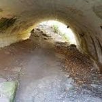
We will start at Woodend Conservation Area and make our way over to the Screaming Tunnel on the main trail, some of which is newly opened trail.
Please wear a Halloween costume or hat must be worn as you are to include a photo (selfie) with your log.
Please bring a head lamp as we will finish under darkness.
Limited to a total of 15 hikers including the leader. All hikers must be registered; please do not show up for the hike as an unregistered participant.
This hike is subject to the regulations for Covid19. Please familiarize yourself with the current rules: https://brucetrail.org/pages/explore-the-trail/hike-schedule#guidelines
Hosting Club: Iroquoia
Category: General Hike
Location (Google Maps): Parking in the laneway where the Bennett Heritage Trail crosses Eighth Line. GPS Coordinates: (43.692270 -79.983387). From Trafalgar Road northwest of Georgetown, turn right onto 27 Sideroad, which bends to the left onto Eighth Line. Stay on Eighth line until you see the laneway on the left-hand side. (Bruce Trail Reference, Map 13)
Hike Leader(s): Douglas Boyce Click here to contact Hike Leader(s)
Pace: Brisk – 4 to 5 km/hr
Terrain: Strenuous – Hilly with steep climbs and some poor footing
Distance: 14 km
Description
A loop hike in Silver Creek Conservation Area, including the Great Esker Side Trail. We will hike at a brisk pace, stopping once or twice for a snack break. Bring snacks and water.
Registration required via email or TBTC login. Click here for details.
Hosting Club: Toronto
Location: Map 3, KM 44.5 Rockway Community Centre. GPS coordinates: N 43.111255 W -79.321901
Hike Leader(s): Fayyaz Mahmood
Pace: Moderate
Terrain: Hilly
Distance: 21 km
Description
Difficulty: Intermediate
We will hike IN to 55KM, Map 4. Hike past Louth to Balls Falls conservation areas and walk OUT to return to the cars.
Meet at:Map 3, KM 44.5 Rockway Community Centre. GPS coordinates: N 43.111255 W -79.321901
QEW to Lincoln. Take exit 51 for Regional Rd 34 toward Seventh St. At the roundabout, take the 1st exit onto Seventh Street Louth/Regional Rd 34. Turn right onto Niagara Regional Rd 81 (King St.). Turn left onto Ninth St go 3.3KM and turn left onto Pelham Rd/Regional Rd 69. Drive 350 meters to Rockway CC. Park only on the east side of the building.
This is an IN-OUT hike without carpooling. COVID restrictions apply.
Map # 3/4
Additional Notes: End to End #5 of 8No dropoutHiking bootsNo dogsIcers may be required.
Registration required via email or TBTC login. Click here for details.
Hosting Club: Toronto
Location: Km 8.9 – Roadside parking on St. Helena Rd, near its junction with Regional Rd 25.
Hike Leader(s): Mei Juan (Alina) Lin
Pace: Moderate
Terrain: Hilly
Distance: 18 km
Description
Difficulty: Intermediate
Do you know we have two End-to-End badges for independent hikers? Well you can win both through a series of six double traverse hikes. Toronto Bruce Trail Club members only and preregistration on the website only. This is a there and back hike, we will follow the main trail in and main trail or a mix of main&side trails out.
Meet at:Km 8.9 – Roadside parking on St. Helena Rd, near its junction with Regional Rd 25.
N43.573248,W79.962319
Map # 12/11
Additional Notes: End to End #6 of 6No dropoutHiking bootsNo dogs

Hosting Club: Niagara
Category: Hike
Location (Google Maps): Meet at the Niagara Glen Parking Lot
Hike Leader(s): Dan Wilson Click here to contact Hike Leader(s)
Pace: Medium
Terrain: Strenuous
Distance: 11 km
Description
Hike deep in the Niagara Gorge, stairways lead to 4 kilometres of rugged paths that wind through this pristine pocket of Carolinian Forest, past prehistoric geological formations, wild flora and fauna. The Niagara Glen overlooks the rapid waters of the Niagara River.
Hosting Club: Niagara
Category: Loop
Location (Google Maps): Old Glendale Rd off of Glendale Road
Hike Leader(s): Vince Zvonar Click here to contact Hike Leader(s)
Pace: Fast
Terrain: Easy
Distance: 16k
Description
Hike the Trails along the Banks of 12 mile creek
Hosting Club: Blue Mountains
Category: Blue Mountain Hike
Location (Google Maps): Hike meets in the parking lot behind Tim Horton’s on First St. in Collingwood.
Hike Leader(s): Myra Campbell (705) 293-2525 Click here to contact Hike Leader(s)
Pace: Medium – 3 to 4 km/hr
Terrain: Moderate – Some hills and/or some poor footing
Distance: 8 km
Description
Starting at km0.0 of the Beaver Valley section, we will head to km3.6 (edge of Loree Forest) and return.
Not normally done in this direction but will be an exciting change.
Registration required via email or TBTC login. Click here for details.
Hosting Club: Toronto
Location: Northeast Corner of Leslie & York Mills
Hike Leader(s): Thomas Swales
Pace: Moderate
Terrain: Variable
Distance: 14 km
Description
Difficulty: Intermediate
First in a series of hikes following former railway lines around Toronto that have been converted to recreational trails. This hike will follow the Leaside Spur Rail Trail and continue along Wilket Creek and then the Don River to the Crothers Woods area finishing at the Evergreen Brickworks. The Brickworks is served by the TCC #28 Bayview South Bus to Davisville Station. Dropout anywhere we cross public transit routes.
Meet at:Northeast Corner of Leslie & York Mills
Take any York Mills Bus from York Mills Station to Leslie Street. Meet in front of the McDonald Restaurant in the corner of the plaza.
Additional Notes: Dropout available at
Hosting Club: Sydenham
Category: General Hike
Location (Google Maps): Roadside parking at the corner of Cole’s and Taylor Sideroads, northwest of Kemble (at km 138.3)
Hike Leader(s): Peter Harris Click here to contact Hike Leader(s)
Pace: Medium: 3 to 4 km/h
Terrain: Moderate: Some hills and/or poor footing
Distance: 5.4 km
Description
This loop hike will follow the Don Richards, Kemble Wetlands & Cedar Point Side Trails as well as the main Bruce Trail. If it has been raining a lot then there might be some soggy sections. Bring water and snacks. Map 34 (edition 29) with online updates. Please preregister on this website. For more information contact Peter. Phone/text cell 519-374-3468
Hosting Club: Iroquoia
Category: General Hike
Location (Google Maps): Crawford Lake Conservation Area/Guelph Line
Pace: Leisurely – 3km/hr or less
Terrain: Easy – Mostly flat and usually good footing
Distance: Approx. 7 km.
Description
Crawford Lake is always a lovely area to hike, with its meromictic lake, escarpment views and Indian village. This hike is open to BTC members only and you must pre-register. Once you have registered you will receive a list of items to bring and Covid protocols. You must also register for a booking to get into Crawford Lake. Once you have registered for this hike with BTC immediately go to the Conservation Halton website to register for a 10:00 am. time slot. You may find that you will have to do this closer to the date of the hike. You need to get a time slot that matches that start time of the hike. Bring a snack and water.
Leader: Anne Armstrong 905 617 3937
Hosting Club: Niagara, Iroquoia
Category: Special Event
Location (Google Maps): De Cew House at the First Nations Peace Monument
Hike Leader(s): Ruth Moffatt Click here to contact Hike Leader(s)
Pace: Brisk – 4 to 5 km/hr
Terrain: Moderate – Some hills and/or some poor footing
Distance: 5-6km
Description
This hike is another chance to obtain the hikes required for the coveted Halloween badge and will incorporate both a Night Hike and a Halloween Hike. You may use this hike toward both badges as it’s a sanctioned “Double Dip!”
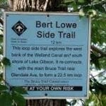
We will start at the parking lot and make our way on the Bert Lowe Side Trail, through the tunnel at the 406 Hwy and continue along Lake Gibson and the Power Canal, turnaround and make our way back.
Please bring a head lamp as we will finish under darkness.
Limited to a total of 15 hikers including the leader. All hikers must be registered; please do not show up for the hike as an unregistered participant.
This hike is subject to the regulations for Covid19. Please familiarize yourself with the current rules: https://brucetrail.org/pages/explore-the-trail/hike-schedule#guidelines

Hosting Club: Niagara, Iroquoia
Category: Special Event
Location (Google Maps): Quarry Rd to Cave Springs Conservation Area
Hike Leader(s): Ruth Moffatt Click here to contact Hike Leader(s)
Pace: Medium – 3 to 4 km/hr
Terrain: Strenuous – Hilly with steep climbs and some poor footing
Distance: 5-6km
Description
Another chance to earn the coveted Halloween Badge – We will make our way over to the Cave Springs Conservation Area and explore this unique area.
This is a small group hike, limited to 6 hikers, due to limited parking capacity at Quarry Rd which has space for 6 vehicles. If you are car pooling to attend this hike, please let me know so I can open more space up. Please do not show up for this hike as an unregistered participant.
Please familiarize yourself with the current rules: https://brucetrail.org/pages/explore-the-trail/hike-schedule#guidelines
Hosting Club: Niagara
Category: Loop
Location (Google Maps): 10638 Quarry Rd, Wainfleet, On L0F1V0
Hike Leader(s): Diane Marlatt Click here to contact Hike Leader(s)
Pace: Leisurely
Terrain: Easy
Distance: 6 Km
Description
We walk around the Quarry, take the Gord Harry path to the Clay Pitts and return. Expect sloppy damp surfaces. Bring poles and a rain hat.
Hosting Club: Sydenham
Category: General Hike
Location (Google Maps): Georgian Bluffs – Roadside parking on the shoulder of Kemble Rock Rd. north of Concession 24
Hike Leader(s): Bill Snel Click here to contact Hike Leader(s)
Pace: Leisurely: 3 km/h or less
Terrain: Moderate: Some hills and/or poor footing
Distance: 3.7 km
Description
This hike starts in the bush and walking through nice crevices followed by return on the Dodds Hill Side Trail (road). Map 34.
Hosting Club: Iroquoia
Category: Happy Wanderers
Location (Google Maps): Concession Road 7, north of Gore Road, Puslinch
Pace: Medium – 3 to 4 km/hr
Terrain: Easy – Mostly flat and usually good footing
Description
he Fletcher Creek Ecological Preserve is a unique natural area. The area is 414 acres in size and is located at the headwaters of the Spencer Creek Watershed. The area is an important groundwater recharge area and is considered a provincially significant wetland.
An abandoned quarry at the site was rehabilitated, resulting in the creation of a rare type of wetland. Environmental improvements to the area resulting from the restoration are significant and include the expansion of a fen plant community — the rarest form of wetland in Ontario — creation of additional habitat for rare plants and animals already in the area, a new breeding area for leopard frogs, snakes, and a variety of small mammals, such as groundhogs, foxes and bats. A mix of coniferous and deciduous trees will create a canopy that, over time, will provide valuable shelter for wintering birds and mammals. The area contains a trail system and interpretive panels.
Hike Leader: Louise Langlais; Email: langlaislouise@gmail.com. Cell: 519-222-4040 on day of hike. At other times, email is the best way to contact me. Wear appropriate quick-dry clothing and hiking boots. Bring sunscreen, insect repellent (summer), icers (winter), snacks, lunch, a personal first aid kit, and 1-2 litres of water. Please email me at least 24 hours before the hike to register. Sometimes last minute changes are made to hikes; registering means you won’t be waiting around the meeting place not knowing why no-one else is there! For personalized driving directions, just copy and paste the GPS coordinates into a Google search window and voila!
Hosting Club: Iroquoia
Category: General Hike
Location (Google Maps):
Chedoke Golf course parking lot Hamilton.
Hike Leader(s): Daljeet Juneja Click here to contact Hike Leader(s)
Pace: Medium – 3 to 4 km/hr
Terrain: Moderate – Some hills and/or some poor footing
Distance: 9 to 10 km
Description
Hosting Club: Iroquoia
Category: General Hike
Location (Google Maps): Chedoke Golf course , Hamilton
Hike Leader(s): Daljeet Juneja Click here to contact Hike Leader(s)
Pace: Medium – 3 to 4 km/hr
Terrain: Moderate – Some hills and/or some poor footing
Description
Hosting Club: Niagara
Category: Loop
Location (Google Maps):
Short Hills Wiley Road Entrance
Hike Leader(s): Alan Laver Click here to contact Hike Leader(s)
Pace: Brisk
Terrain: Moderate
Distance: 12k
Description
Explore Short Hills and the majestic side trails of Scarlett Tanager, Hemlock. Swayze Falls and Terrace. Register for each hike
Hosting Club: Niagara
Category: Loop
Location (Google Maps): Short Hills – Pelham Road entrance
Hike Leader(s): janet davey Click here to contact Hike Leader(s)
Pace: Medium
Terrain: Moderate
Distance: 7 kilometres
Description
Moderate hike on the trails of Short Hills Provincial Park
Hosting Club: Dufferin Hi-Land
Category: Tuesday Hike
Location (Google Maps): Toronto Section, Map 13. Meet at Scotsdale Farm parking lot, north-east of Trafalgar Rd, about 1 km north-west of 27 Sideroad.
Hike Leader(s): Les Babbage, Inge Eckerich, Bob Slack Click here to contact Hike Leader(s)
Pace: Leisurely
Terrain: Easy
Distance: 8.5 or 4.2 km
Description
We will hike a loop consisting of Main, Bennett Heritage and Maureen Smith Side Trails. Shorter hike will loop back on Maureen Smith and Main Trail at Eighth Line.
Hosting Club: Caledon Hills
Category: Tuesday Hikers
Location (Google Maps): Scotsdale Farm
Hike Leader(s): Ralph Shapiro Click here to contact Hike Leader(s)
Pace: Medium – 3 to 4 km/hour
Terrain: Moderate – some hills and/or some poor footing
Distance: 12 km
Description
Hosting Club: Sydenham
Category: General Hike
Location (Google Maps): Roadside parking on Irish Block Road, about 400m north on of Hwy 26 (at km 65.0)
Hike Leader(s): Franziska Edney Click here to contact Hike Leader(s)
Pace: Medium: 3 to 4 km/h
Terrain: Moderate: Some hills and/or poor footing
Distance: 3.6 km
Description
This loop will take us along the white and blue trails through hardwood forest, farmland, over a creek and across an old beaver dam. Map 31. Approx. 1.5 hrs
Hosting Club: Blue Mountains
Category: Cancelled
Location (Google Maps): Hike meets in the parking lot behind Tim Hortons on First St. Collingwood.
Hike Leader(s): David Little (705) 606-1077 Click here to contact Hike Leader(s)
Pace: Medium – 3 to 4 km/hr
Terrain: Moderate – Some hills and/or some poor footing, Strenuous – Hilly with steep climbs and some poor footing
Distance: 10km
Description
The hike begins in Glen Huron and we head to the Ganaraska cairn. From here we follow the Bruce Trail to the lookout and then a loop to the Keyhole ST. We return on the Betty Carter and Hamilton Brothers ST
Hosting Club: Niagara
Category: In and Out
Location (Google Maps): Short Hills Provincial Park, Roland Road entrance
Hike Leader(s): Alicia Aitchison Click here to contact Hike Leader(s)
Pace: Medium
Terrain: Moderate
Distance: Approximately 6 km
Description
Leaving from the Roland Road entrance of Short Hills Provincial Park we will do a 90 minute in and out hike through the beautiful park, stopping to view the spectacular Swayze Falls. Terrain can be challenging with some steep hills, hiking boots & poles strongly recommended. Pace is medium to fast at approximately 4km/hr.
Hosting Club: Iroquoia
Category: Hikers R Us
Location (Google Maps): Starting at Valley Ridge Park, Oakville
Hike Leader(s): Norman Young Click here to contact Hike Leader(s)
Pace: Medium – 3 to 4 km/hr
Terrain: Moderate – Some hills and/or some poor footing
Distance: 14 km
Description
Bring water, snack, etc YOU ARE TO BE SELF SUFGFICIENT . Mask and sanitizer must be with you
Hosting Club: Blue Mountains
Category: Cancelled
Location (Google Maps): Hike meets in the parking lot behind Tim Horton’s on First St. in Collingwood.
Hike Leader(s): Carl Wintermeyer (705) 444-6796 Click here to contact Hike Leader(s)
Pace: Leisurely – 3 km/hr. or less
Terrain: Moderate – Some hills and/or some poor footing
Distance: 5 km
Description
Starting at km47, we will climb the hill to the lookout and make our way back down to the start via the Pretty River Side Trail.
Hosting Club: Iroquoia
Category: Good Companions
Location (Google Maps): Christie Lake Conservation Area Hamilton
Hike Leader(s): Janina Vanderpost Click here to contact Hike Leader(s)
Pace: Medium – 3 to 4 km/hr
Terrain: Moderate – Some hills and/or some poor footing
Distance: 10km
Description
Meet in the parking lot to the right after entering the Christie Lake Conservation Area main entrance off Hwy 5 (Dundas Street). Entry fee or Hamilton Conservation Authority pass required. We will hike a number of the trails at Christie Lake, including the “around the lake” trail. Please bring hiking boots, water, a snack. Register by clicking on the hike in the hike schedule. Hike Leader: Janina Vanderpost kayakhiker1@gmail.com
Hosting Club: Niagara
Category: In and Out
Location (Google Maps):
Jordan Hollow Park 3039 King St Jordan
Hike Leader(s): Alan Laver Click here to contact Hike Leader(s)
Pace: Fast
Terrain: Moderate
Distance: 12k
Description
From Jordan Hollow Hike the main trail to Moyer Road or Louth and Return. You must register for each hike
Hosting Club: Iroquoia
Category: Thursday Group
Location (Google Maps): Park and meet on Twiss Rd where the BT crosses. Parking is just south of Camp Manitou and just north of the very steep hairpin hill.
Hike Leader(s): Karen Capindale-Smith Click here to contact Hike Leader(s)
Pace: Medium – 3 to 4 km/hr
Terrain: Moderate – Some hills and/or some poor footing
Distance: approx. 12km
Description
We will hike the main trail to the Lookout at Crawford Lake CA. We will return via a combination of side trails and conservation trails. Please remember to bring water, a snack, lunch, a mask and hand sanitizer. Please note that Covid-19 Protocol will be in full effect and that sharing will not be permitted.
Please contact Karen Capindale-Smith (Hike Leader) at kjcapindale@gmail.com or (905)749-0914 with questions.

Hosting Club: Niagara
Category: In and Out
Location (Google Maps):
Jordan Hollow Park
Hike Leader(s): Bill Russell Click here to contact Hike Leader(s)
Pace: Medium
Terrain: Moderate
Distance: 7k
Description
Note the change in start time
Hike along the Jordan Creek to Upper Balls Falls or the Jim Rainforth Trail. You must register for each hike
Registration required via email or TBTC login. Click here for details.
Hosting Club: Toronto
Location: Victoria Park Subway Station. Victoria Park entrance, street level.
Hike Leader(s): Taizo Shinkoda, Johanna Lanfranco
Pace: Moderate
Terrain: Flat
Distance: 12 km
Description
Difficulty: Intermediate
We will hike from the Victoria Park Subway Station through Taylor Creek Park and along the Lower Don Parklands to the Broadview Subway Station
Meet at:Victoria Park Subway Station. Victoria Park entrance, street level.
Additional Notes: Dropout available at anywhereBeginnersHiking bootsNo dogswalking shoes

Hosting Club: Niagara
Category: Urban
Location (Google Maps):
King St & Veteran’s Lane
Hike Leader(s): Margaret Northfield Click here to contact Hike Leader(s)
Pace: Medium
Terrain: Easy
Distance: 6-7km
Description
Each Friday we will explore the area around Niagara-on-the-Lake. Explore where the Niagara River meets Lake Ontario. Experience the Heritage District, woods and the Niagara Parkway. Hike along part of the Bruce Trail’s General Brock Side Trail as well as the Heritage Trail.
Some weeks may be totally on sidewalks and roads while other will include a mix of trail and paved pathways.
Great opportunity to see beautiful NOTL as well as build up your endurance for longer hikes.
Hosting Club: Niagara
Category: In and Out
Location (Google Maps): Meet at offroad parking on York Rd (regional road 81) just east of concession 2 (Map 1).
Hike Leader(s): Alicia Aitchison Click here to contact Hike Leader(s)
Pace: Medium
Terrain: Moderate
Distance: Approximately 6 km
Description
Friday NIAGARA SIDE TRAIL CHALLENGE HIKES!
Every Friday at 10 am starting November 20th and running through until April. Join 1 or join all to work towards earning the NBTC Side trail badge. We will have some makeup hikes at the end once we’ve worked through all the side trail requirements once.
Side trail badge requirements & logs are found in the Niagara Bruce Trail Club website under badges for your own tracking.
For our first side trail hike we will meet at the parking lot on York road (Map 1) and hike the Upper Canada Heritage trail from York road to the main Bruce trail , follow the main trail towards Queenston & hike back out the same way. For the badge we will need to find & photograph the dry stone wall & lime kiln ruins.
Registration is mandatory & limited due to parking. THIS HIKE WILL ALSO BE OFFERED ON DECEMBER 23rd FOR THOSE THAT WEREN’T ABLE TO REGISTER THIS TIME AROUND.
Registration required via email or TBTC login. Click here for details.
Hosting Club: Toronto
Location: Map 4, KM 65 road side parking. GPS coordinates N 43.1428057, W -79.4587077
Hike Leader(s): Fayyaz Mahmood
Pace: Moderate
Terrain: Hilly
Distance: 20 km
Description
Difficulty: Intermediate
We will hike to 55KM, Map 4 past Cave Springs and Balls Falls conservation areas and walk OUT to return to the cars. This is an IN-OUT hike without carpooling. COVID restrictions apply.
Meet at:Map 4, KM 65 road side parking. GPS coordinates N 43.1428057, W -79.4587077
Take QEW to Beamsville. Take exit 64 for Ontario Street toward County Road 18/Beamsville. Turn right onto Ontario St/Regional Rd 18. Turn left onto Niagara Regional Rd 81 (King Rd.) Turn right onto Quarry Rd. Roadside Parking about 2KM.
This is an IN-OUT hike without carpooling. COVID restrictions apply.
Map # 2/3
Additional Notes: End to End #6 of 8No dropoutHiking bootsNo dogsIcers may be required.
Hosting Club: Niagara
Category: Loop
Location (Google Maps):
Merritt Trail Parking Lot beside Sobey’s 344 Glendale Avenue
Hike Leader(s): Marion Hanover Click here to contact Hike Leader(s)
Pace: Medium
Terrain: Easy
Distance: 21 km
Description
One of the longer hikes for the side trail badge, follow the Merritt Trail to the Bert Lowe
Trail to Decew House and the main trail back to Glendale Avenue. Remember to take
photo’s.
Hosting Club: Niagara
Category: In and Out
Location (Google Maps):
Parking lot Quarry Road Beamsville
Hike Leader(s): Bill Russell Click here to contact Hike Leader(s)
Pace: Medium
Terrain: Moderate
Distance: 6k
Description
Discover the history of the 19th Century Quarry Pioneers and the Cave Spring Witch. This hike will count towards the Screaming Tunnel Badge
Hosting Club: Blue Mountains
Category: Cancelled
Location (Google Maps): Hike meets in the parking lot behind Tim Horton’s on First St. in Collingwood.
Hike Leader(s): Mary Jane McIntyre 705-481-1269 Click here to contact Hike Leader(s)
Pace: Leisurely – 3 km/hr. or less
Terrain: Moderate – Some hills and/or some poor footing
Distance: 6 km
Description
We will drive to the parking lot at 15/16 Sideroad in Singhampton and explore the Nottawasaga Bluffs.
Two options in length and difficulty will be offered.
Bring water and snack.
The Medium option will include the Keyhole Side Trail and Betty Carter Side Trail.
Hosting Club: Blue Mountains
Category: Cancelled
Location (Google Maps): Hike meets in the parking lot behind Tim Horton’s on First St. in Collingwood.
Hike Leader(s): Michelle Wacker (705) 730-8481 Click here to contact Hike Leader(s)
Pace: Medium – 3 to 4 km/hr
Terrain: Moderate – Some hills and/or some poor footing
Distance: 8 km
Description
We will drive to the parking lot at 15/16 Sideroad in Singhampton and explore the Nottawasaga Bluffs.
Two options in length and difficulty will be offered.
Bring water and snack.
The Medium option will include the Keyhole Side Trail and Betty Carter Side Trail.
Registration required via email or TBTC login. Click here for details.
Hosting Club: Toronto
Location: Outside Castle Frank subway station.
Hike Leader(s): Wayne Crockett
Pace: Moderate
Terrain: Flat
Distance: 13 km
Description
Difficulty: Easy
Join me for an exploration of the Don River and the Don West River from Castle Frank subway to the Glendon Campus of York University. We’ll follow part of the Lower Don Trail past the Brickworks, through Crothers Woods and along the west side of the Don (the path less travelled) north to E.T. Seton Park. From there we’ll walk westward via Sunnybrook Park, ending the walk at the gates to Glendon College at Bayview and Lawrence. From there you can pick up a bus to either Lawrence or Davisville subway station.
Meet at:Outside Castle Frank subway station.
Additional Notes: Dropout available at at various pointsBeginnersFamiliesNo dogs

Hosting Club: Niagara
Category: Hike
Location (Google Maps):
Glendale Avenue km 19.7. 50 metres east of Welland Canal. Next to Lorenzo’s Diner. Do not park immediately next to the restaurant.
Hike Leader(s): Alan Laver Click here to contact Hike Leader(s)
Pace: Medium
Terrain: Moderate
Distance: 10k
Description
Last chance to hike for the screaming Tunnel Badge. Hike along the Welland Canal through Woodend to the Screaming Tunnel.
Note that this hike plus the Cave Spring witch hunt will earn hikers the Halloween screaming Tunnel badge
Hosting Club: Sydenham
Category: General Hike
Location (Google Maps): Roadside parking at the north end of Concession 3 (north of km 99.5)
Hike Leader(s): Judy Kirsten Click here to contact Hike Leader(s)
Pace: Medium: 3 to 4 km/h
Terrain: Easy: Mostly flat and good footing., There might be muddy sections.
Description
This hike will explore the Derby Forest Trails. Map 32.

Hosting Club: Iroquoia
Category: General Hike
Location (Google Maps): Trail Centre Dundas Valley Conservation. meet outside at the train station.
Hike Leader(s): Allan Meyer Click here to contact Hike Leader(s)
Pace: Brisk – 4 to 5 km/hr
Terrain: Moderate – Some hills and/or some poor footing
Description
Please join me for a hike around the Main Loop. The terrain can be slippery, so bring your walking poles. We may add on a bit more hiking depending upon the group and the weather.

Hosting Club: Iroquoia
Category: General Hike
Location (Google Maps): Dundas Valley Trail Centre, meet outside train station
Hike Leader(s): Allan Meyer Click here to contact Hike Leader(s)
Pace: Brisk – 4 to 5 km/hr
Terrain: Moderate – Some hills and/or some poor footing
Distance: about 4 km
Description
Nothing like the cool brisk weather to get the blood flowing. Please make sure you have proper hiking footwear as the route may be slippery in parts.

Hosting Club: Niagara
Category: Youth Hike
Location (Google Maps): Woodend Conservation Area, Taylor Road parking lot
Hike Leader(s): Alicia Aitchison Click here to contact Hike Leader(s)
Pace: Leisurely
Terrain: Moderate
Distance: Approximately 4-5 km
Description
This is the first of two family hikes in November. We will meet at the Taylor Road parking lot at Woodend Conservation Area and enjoy a leisurely paced (approximately 3km/hr) 90 minute hike on the main Bruce Trail as well as on the Wetland Ridge Side trail. There will be some hills, beautiful forest, wetlands & vineyard vistas.
During this hike youth hikers will be encouraged to think about how they are using their 5 senses during the hike & after the hike they can do a small write up or drawing of how they used their 5 senses during the hike & bring this to the second hike to earn their Young Nature Blazers Badge. Youth hikers that earn both the Young Nature Blazers Badge and the Young Trail Blazers Badge will receive a copy of Birthday Boots, by Cindy Conlon, a delightful tale of a young family’s first hike on the Bruce Trail.
All youth must be accompanied by a parent or guardian and the registration process must be completed for each family member separately, including children, so we have an accurate head count. Participant numbers are limited. Use your membership number for any youth you will be bringing.
If you are new to Bruce Trail hikes please review the Know Before You Go section on brucetrail.org to ensure you are prepared for your hiking adventure & familiar with hiking responsibly & safely in the time of Covid-19.
If you are a new Bruce Trail member or don’t have a membership number yet please contact the hike leader for information on how to register.
Due to Covid restrictions & social distancing requirements please ensure you are prepared & self sufficient. Have masks (not required to wear but you should have on hand), hand sanitizer, first aid supplies, water, snacks. We cannot share.
Hosting Club: Niagara
Category: Hike
Location (Google Maps):
Parking Lot on Merritt Island at the west end of cross street Welland
Hike Leader(s): Sheila Massey Click here to contact Hike Leader(s)
Pace: Leisurely
Terrain: Easy
Distance: 7k
Description
Flat hike along paved trail alongside the Welland Canal
Hosting Club: Iroquoia
Category: Happy Wanderers
Location (Google Maps): Old Guelph Rd side trail map 9 66.0 marker N43.307417 W79.911580
BE CAREFUL USING THE GPS CO-ORDINATES, THEY MAY TAKE YOU DOWN #6 HWY, NOT OLD GUELPH RD
Pace: Brisk – 4 to 5 km/hr, Medium – 3 to 4 km/hr
Terrain: Strenuous – Hilly with steep climbs and some poor footing
Distance: 14 km
Description
We will head east on the main trail from the parking area to Smokey Hollow and return. We are using this starting point due to the lack of parking at Smokey Hollow
Starting point is at the end of Old Guelph RD
Hike leader: Wayne Riley RSVP thru the hike calendar
Bring water, lunch, hiking boots, no dogs please. Cancellations the morning of the hike: 289-456-3498
HAND SANITIZER AND MASK ARE REQUIRED ( mask is not mandatory to wear but must be available)
Hosting Club: Iroquoia
Category: General Hike
Location (Google Maps): Chedoke Golf course parking lot, Hamilton.
Hike Leader(s): Daljeet Juneja Click here to contact Hike Leader(s)
Pace: Medium – 3 to 4 km/hr
Terrain: Moderate – Some hills and/or some poor footing
Description
Hosting Club: Niagara
Category: Loop
Location (Google Maps):
Short Hills Wiley Road Entrance
Hike Leader(s): Alan Laver Click here to contact Hike Leader(s)
Pace: Brisk
Terrain: Moderate
Distance: 12k
Description
Explore Short Hills and the majestic side trails of Scarlett Tanager, Hemlock. Swayze Falls and Terrace. Register for each hike
Hosting Club: Niagara
Category: In and Out
Location (Google Maps): Decew Parking Lot., Thorold (Map 3, Km 29.8km)
Hike Leader(s): Diane Marlatt Click here to contact Hike Leader(s)
Pace: Medium
Terrain: Moderate
Distance: 7-9km
Description
Dress for the weather; have your crampon devices available for icy conditions; bring water. You must register for each hike. The wearing of masks is strongly recommended.
Hosting Club: Niagara
Category: Loop
Location (Google Maps): Short Hills Pelham Road entrance
Hike Leader(s): janet davey Click here to contact Hike Leader(s)
Pace: Medium
Terrain: Moderate
Distance: 7 kilometres
Description
Moderate hike on the trails of Short Hills Provincial Park
Hosting Club: Dufferin Hi-Land
Category: Tuesday Hike
Location (Google Maps): Dufferin Hi-Land, Maps 19, 20. Meet at roadside parking on 30 Sideroad Mono (Km 13.3)
Hike Leader(s): Les Babbage; Inge Eckerich; Bob Slack Click here to contact Hike Leader(s)
Pace: Leisurely
Terrain: Easy
Distance: 6.6 or 3.3 km
Description
We will hike to Km 10.0 on 1st Line and back to Km 13.3. The shorter hike will hike one way only.
Hosting Club: Caledon Hills
Category: Tuesday Hikers
Location (Google Maps): Roadside parking at Calcium Pits on Twiss Rd.
Direction: From Highway 401, south on Guelph Line, right on Conservation Rd., left on Twiss Rd. to the Calcium Pits (after passing Camp Manitou).
Hike Leader(s): Mohammad Shafiq Click here to contact Hike Leader(s)
Pace: Medium – 3 to 4 km/hour
Terrain: Moderate – some hills and/or some poor footing
Distance: 12 km
Description
Starting from Calcium Pits, we will discover Crawford Forestry Tract using the main Bruce Trail, on the way visiting lookout points overlooking Nassagaweya Canyon, turn on Crawford Lake ST to reach Crawford Lake, a walk around the lake. Return to starting point using side trail and main trail.
Bring water and snack.
Hiking poles recommended.
Physical distancing to be observed throughout the hike.
Hosting Club: Caledon Hills
Category: Tuesday Hikers
Location (Google Maps): Limehouse Conservation Area at the baseball diamonds
Hike Leader(s): Barbara Euler Click here to contact Hike Leader(s)
Pace: Medium – 3 to 4 km/hour
Terrain: Moderate – some hills and/or some poor footing
Distance: 9 km
Description
Pleasant walk in a popular area with considerable historic significance. It also includes an area developed by the Toronto Club’s Conservation group to encourage the regrowth of native species.
Hosting Club: Iroquoia
Category: Hikers R Us
Location (Google Maps): City View Park SOUTH parking lot off of Kerns Rd which runs south from #5 hwy
Pace: Brisk – 4 to 5 km/hr, Medium – 3 to 4 km/hr
Terrain: Moderate – Some hills and/or some poor footing
Distance: 12 km
Description
We will head east from the parking lot returning using the Ian Reid and King Rd side trails and on to Smokey Hollow then return to the parking lot. The new starting lot is due to the lack of space at Smokey Hollow.
Hike leader: Wayne Riley RSVP thru the hike calendar
Cancellations the morning of the hike: 289-456-3498
Bring lunch, water, no dogs please, Hiking boots required
HAND SANITIZER AND MASKS ARE MANATORY ( mask is not mandatory to wear but must be available )
Hosting Club: Niagara
Category: In and Out
Location (Google Maps): Louth Conservation Area
Hike Leader(s): Alicia Aitchison Click here to contact Hike Leader(s)
Pace: Medium
Terrain: Moderate
Distance: Approximately 6 km
Description
Hike will start out at Louth Conservation Area parking lot and hike the Louth Side trail and main trail to form a loop through the beautifully wooded conservation area with spectacular water fall views. The terrain can be challenging with lots of rocks, crevices and hills. Hiking boots & poles are strongly recommended. Pace is medium to brisk at approximately 4 km/hr.
Hosting Club: Blue Mountains
Category: Cancelled
Location (Google Maps): Hike meets in the parking lot behind Tim Horton’s on First St. in Collingwood.
Hike Leader(s): Jennifer Roy (705) 445-8940 Click here to contact Hike Leader(s)
Pace: Medium – 3 to 4 km/hr
Terrain: Moderate – Some hills and/or some poor footing
Distance: 6 km
Description
We will head to Dunedin Valley Nature Preserve parking on 6/7 Sideroad at Concession Road 10.
Following the white blazed trail south on Concession Road 10, we enter the nature preserve on the east side.
This area covers mixed terrain and provides a chance to experience a variety of habitats.
The trail goes along the banks of a tributary of the Noisy River.
After crossing Concession Road 10, we proceed through some farmers fields to a great view at the bench.
We will then return following the road.
Hosting Club: Iroquoia
Category: Good Companions
Location (Google Maps): RBG North Shore Trails
Hike Leader(s): Linda Robinson Click here to contact Hike Leader(s)
Pace: Leisurely – 3km/hr or less
Terrain: Easy – Mostly flat and usually good footing
Distance: 7-8KM
Description
Meet at the Nature Interpretive Centre at the RBG Arboretum. Parking is available and free to RBG members. Non-members must pay a fee to park. This hike is open to BTC members only and you are required to pre-register online. Once you are registered you will be sent a list of items to bring and protocols to follow.
Hosting Club: Niagara
Category: In and Out
Location (Google Maps):
Jordan Hollow Park 3039 King St Jordan
Hike Leader(s): Alan Laver Click here to contact Hike Leader(s)
Pace: Fast
Terrain: Moderate
Distance: 12k
Description
From Jordan Hollow Hike the main trail to Moyer Road or Louth and Return. You must register for each hike
Hosting Club: Niagara
Category: In and Out
Location (Google Maps): Decew Parking Lot., Thorold (Map 3, Km 29.8km)
Hike Leader(s): Diane Marlatt Click here to contact Hike Leader(s)
Pace: Medium
Terrain: Moderate
Distance: 7-9km
Description
Dress for the weather; have your crampon devices available for icy weather. Must register for each hike. The wearing of masks on our hikes is strongly recommended.
Hosting Club: Niagara
Category: In and Out
Location (Google Maps):
Jordan Hollow Park 3039 King St Jordan
Hike Leader(s): Vince Zvonar Click here to contact Hike Leader(s)
Pace: Fast
Terrain: Moderate
Distance: 12k
Description
From Jordan Hollow Hike the main trail to Moyer Road or Louth and Return. You must register for each hike
Hosting Club: Iroquoia
Category: Thursday Group
Location (Google Maps): Valley Ridge Park to Bronte Park and back
Hike Leader(s): Norman Young Click here to contact Hike Leader(s)
Pace: Medium – 3 to 4 km/hr
Terrain: Moderate – Some hills and/or some poor footing
Distance: 13km -/+
Description
High Valley Rd is the first street south of Dundas Street off Bronte Rd to the west
If the gate to Valley Ridge park is closed, park on the first street to the left-Highbourne Cres.
Remember all Covid measures. Dress according to the weather.
Hosting Club: Niagara
Category: In and Out
Location (Google Maps):
Jordan Hollow Park
Hike Leader(s): Margaret Northfield Click here to contact Hike Leader(s)
Pace: Medium
Terrain: Moderate
Distance: 7k
Description
Note the change in start time
Hike along the Jordan Creek to Upper Balls Falls or the Jim Rainforth Trail. You must register for each hike
Hosting Club: Sydenham
Category: General Hike
Location (Google Maps): Parking area on St. Vincent-Sydenham Townline north of Hwy 26 where the road turns left (km 55.2)
Hike Leader(s): Maureen McFarland Click here to contact Hike Leader(s)
Pace: Medium: 3 to 4 km/h
Terrain: Moderate: Some hills and/or poor footing, Strenuous: Hilly with steep climbs and some poor footing.
Distance: 4.5 km
Description
This loop includes rocky sections of the main trail on the escarpment and flatter areas on the side trail. Approximately 2.5 to 3 hours. Map 30. For more information, call or text 647-918-4180.

Hosting Club: Niagara
Category: In and Out
Location (Google Maps):
Jordan Hollow Park
Hike Leader(s): Bill Russell Click here to contact Hike Leader(s)
Pace: Medium
Terrain: Moderate
Distance: 7k
Description
Note the change in start time
Hike along the Jordan Creek to Upper Balls Falls or the Jim Rainforth Trail. You must register for each hike
Registration required via email or TBTC login. Click here for details.
Hosting Club: Toronto
Location: Scotsdale Farm parking area
Hike Leader(s): Tessa Shelvey
Pace: Moderate
Terrain: Rocky
Distance: 9 km
Description
Difficulty: Easy
Pretty loop hike incorporating a mixture of Main and side trails. Bring lunch or snack for break on the trail.
Meet at:Scotsdale Farm parking area
Take Hwy 401 west to Trafalgar Rd (exit 328). Follow Trafalgar Rd north to Hwy 7, turn left (west) on Hwy 7 about 4 km to Trafalgar Rd. Follow Trafalgar Rd north about 2 km to Scotsdale Farm on right side of the road.
Map # 13
Additional Notes: No dropoutHiking bootsNo dogs
Hosting Club: Niagara
Category: Urban
Location (Google Maps):
King St & Veteran’s Lane
Hike Leader(s): Margaret Northfield Click here to contact Hike Leader(s)
Pace: Medium
Terrain: Easy
Distance: 6-7km
Description
Each Friday we will explore the area around Niagara-on-the-Lake. Explore where the Niagara River meets Lake Ontario. Experience the Heritage District, woods and the Niagara Parkway. Hike along part of the Bruce Trail’s General Brock Side Trail as well as the Heritage Trail.
Some weeks may be totally on sidewalks and roads while other will include a mix of trail and paved pathways.
Great opportunity to see beautiful NOTL as well as build up your endurance for longer hikes.
Hosting Club: Beaver Valley
Location (Google Maps): Map 27 Meet on the shoulder of Sideroad 16C (access east off 7th Line only, no access from Grey Rd. 7) km 91.9 Edition 30
Hike Leader(s): Glenda Collings Click here to contact Hike Leader(s)
Pace: Medium
Terrain: Easy, Moderate
Length of Hike: 14.6 km
Description
This is an easy to moderate in and out hike taking in the Sligo Sidetrail and lovely field walks, with some nice views across the valley. See the Beaver Pond (and maybe the resident beaver)!
COVID-19 Precautions Before, During and After your Hike
- Each hiker joining a Bruce Trail Club organized hike must perform a self-screening check before hiking.
Find Ontario’s self-assessment tool here: https://covid-19.ontario.ca/self-assessment/ - If you are experiencing COVID-19 symptoms, stay home.
- Follow the guidelines for safe & responsible hiking
- Personal Protective Equipment:
- Hikers may choose to wear masks
- Hikers may carry and use hand sanitizer, but should not be sharing it with the group
- Hikers who experience COVID-19 symptoms following a Bruce Trail Club organized hike must inform their local public health unit.
Find your local health unit at http://www.health.gov.on.ca/en/common/system/services/phu/locations.aspx
Other Guidelines
- Arrive 15 minutes before the start of the hike.
- Wear sturdy footwear and appropriate attire for the weather and the terrain.
Hiking poles are a good idea in any season, especially if the terrain is rocky or slippery. In winter, snowshoes or icers/crampons are needed when conditions dictate.
Wearing appropriate clothing and footwear prevents injuries and shows consideration for a safe and positive group hiking experience. - Always carry I.D. and your health card.
- Bring sufficient water and snacks (or lunch if indicated). A minimum of 1L of water is recommended on all hikes, and 3L is recommended for long, challenging hikes in the heat of the summer.
- Bring sunscreen and insect repellent (for spring and summer hikes).
- Bring your own first aid kit.
- Please leave dogs at home.
Transportation
All hikers are responsible for their own transportation to and from the hike.
Currently, there are no car shuttles on hikes – all hikes must be out-and-back or loop hikes. No buses are provided at this tim
Hosting Club: Niagara
Category: In and Out
Location (Google Maps): Woodend Conservation Area, Taylor Road parking lot
Hike Leader(s): Alicia Aitchison Click here to contact Hike Leader(s)
Pace: Medium
Terrain: Moderate
Distance: Approximately 6 km
Description
Friday NIAGARA SIDE TRAIL CHALLENGE HIKES!
Every Friday at 10 am starting November 20th and running through until April. Join 1 or join all to work towards earning the NBTC Side trail badge. We will have some makeup hikes at the end once we’ve worked through all the side trail requirements once.
Side trail badge requirements, descriptions & logs are found in the Niagara Bruce Trail Club website under badges for your own tracking.
We will meet At Woodend Conservation Area, Taylor Road parking lot and hike the Woodend & Wetland Ridge Side Trails as well as the main trail. For the badge we will need to find & photograph the outdoor classroom & First Nations, Metis & Inuit Garden.
Registration is mandatory.
Registration required via email or TBTC login. Click here for details.
Hosting Club: Toronto
Location: Map 4, KM 65 road side parking. GPS coordinates N 43.1428057, W -79.4587077
Hike Leader(s): Fayyaz Mahmood
Pace: Moderate
Terrain: Variable
Distance: 21 km
Description
Difficulty: Intermediate
We will hike IN to 75.5KM, Map 5, past Thirty Mile Creek and Mountainview Conservation Area and walk OUT to return to the cars. This is an IN-OUT hike without carpooling. COVID restrictions apply.
Meet at:Map 4, KM 65 road side parking. GPS coordinates N 43.1428057, W -79.4587077
Take QEW to Beamsville. Take exit 64 for Ontario Street toward County Road 18/Beamsville. Turn right onto Ontario St/Regional Rd 18. Turn left onto Niagara Regional Rd 81 (King Rd.) Turn right onto Quarry Rd. Roadside Parking about 2KM.
This is an IN-OUT hike without carpooling. COVID restrictions apply.
Map # 4/5
Additional Notes: End to End #7 of 8No dropoutHiking bootsNo dogsIcers may be required.
Hosting Club: Iroquoia
Category: General Hike
Location (Google Maps): Parking at Paramount Park (1170 Paramount Drive), on East Hamilton escarpment. GPS Coordinates: (43.203023 -79.799399). From the Red Hill Valley Parkway, exit onto Mud Street. At the first set of lights, turn left onto Winterberry Drive, which becomes Paramount Drive. After the bend to the right, look for the park on your left-hand side. (Bruce Trail Reference, Map 7)
Hike Leader(s): Douglas Boyce Click here to contact Hike Leader(s)
Pace: Brisk – 4 to 5 km/hr
Terrain: Strenuous – Hilly with steep climbs and some poor footing
Distance: 15 km
Description
We will hike into the Red Hill Valley and back along the Main Bruce Trail, with some loops using the Mountain Brow and Red Hill Creek side trails and the Escarpment Rail Trail. If there are icy/wintry conditions, you will need icers, and poles recommended. We will hike at a brisk pace, stopping once or twice for a snack break. Bring snacks and water.
Hosting Club: Niagara
Category: Loop
Location (Google Maps):
Short Hills Wiley Road Entrance
Hike Leader(s): Vince Zvonar Click here to contact Hike Leader(s)
Pace: Brisk
Terrain: Moderate
Distance: 12k
Description
Explore Short Hills and the majestic side trails of Scarlett Tanager, Hemlock. Swayze Falls and Terrace.
Hosting Club: Niagara
Category: Loop
Location (Google Maps):
Glenridge Quarry parking Lot, St Davids Road. Map 3
Hike Leader(s): Marion Hanover Click here to contact Hike Leader(s)
Pace: Medium
Terrain: Easy
Distance: 6 km
Description
A combination of open trails with spectacular views across Lake Ontario and wooded trails including the main trail
Hosting Club: Niagara
Category: Loop
Location (Google Maps): Queenston Heights Park near the Bruce Trail Cairn
Hike Leader(s): Margaret Northfield Click here to contact Hike Leader(s)
Pace: Medium
Terrain: Moderate
Description
Start in Queenston Heights Park near the Bruce Trail cairn. (enter near the roundabout on the Niagara Parkway and immediate left and left again to see the cairn). Parking fees may apply ($1.25/hr).
This hike is a combination of Bruce Trail (main & side trail), roads and Niagara Parkway. It should take 2.5-3 hrs.
Bring poles, water, snack, mask and hand sanitizer.
Hosting Club: Iroquoia
Category: General Hike
Location (Google Maps): Scotsdale Farm parking lot off Trafalgar Road on the Bennett Heritage Side Trail (BTC Map 13)
Hike Leader(s): Stuart Law Click here to contact Hike Leader(s)
Pace: Medium – 3 to 4 km/hr
Terrain: Moderate – Some hills and/or some poor footing
Distance: 18 kms
Description
Join us for an 18 km walk in the woods on the Bennett Heritage ST, the Roberts ST, the Irwin Quarry ST, the Great Esker ST and the Main Trail connecting them all. Please bring a lunch, a snack, a warm drink and icers (just in case). Covid protocols will be respected. Please arrive at 8:45 for a 9 am start. Hiking boots a must and poles strongly recommended.
Hosting Club: Niagara
Category: Loop
Location (Google Maps):
Glenridge Quarry parking Lot, St Davids Road. Map 3
Hike Leader(s): janet davey Click here to contact Hike Leader(s)
Pace: Medium
Terrain: Easy
Distance: 6 km
Description
A combination of open trails with spectacular views across Lake Ontario and wooded trails including the main trail
Note that this group will follow a short distance behind the group led by Marion
Hosting Club: Niagara
Category: Loop
Location (Google Maps):
Short Hills Wiley Road Entrance
Hike Leader(s): Alan Laver Click here to contact Hike Leader(s)
Pace: Brisk
Terrain: Moderate
Distance: 12k
Description
Explore Short Hills and the majestic side trails of Scarlett Tanager, Hemlock. Swayze Falls and Terrace.
Hosting Club: Dufferin Hi-Land
Category: General Hike
Location (Google Maps): Map 19. Meet at Mono Cliffs Provincial Park lot (pass/fee required) on 3rd Line north of Mono Centre Rd (Dufferin Rd 8).
Hike Leader(s): Les Babbage;Tony Riggs Click here to contact Hike Leader(s)
Pace: Medium
Terrain: Moderate
Distance: 11.5 km
Description
We will hike a loop consisting of Main Trail, and Carriage, South Outlier Connector, South Outlier Loop and McCarston Lake Side Trails. Bring water and snacks.
Hosting Club: Blue Mountains
Category: Cancelled
Location (Google Maps): Hike meets in the parking lot behind Tim Horton’s on First St. in Collingwood.
Hike Leader(s): Bert Beausoleil (705) 293-2525 Click here to contact Hike Leader(s)
Pace: Medium – 3 to 4 km/hr
Terrain: Moderate – Some hills and/or some poor footing
Distance: 7 km
Description
We will park at km 46.2 on Prince of Wales Rd. in the Dufferin Hi-Lands section.
From there we will head to km 49.7 on County Rd. 21 and return.
This is a beautiful hike through the Black Bank River area.
Registration required via email or TBTC login. Click here for details.
Hosting Club: Toronto
Location: Eglinton West Subway Station
Hike Leader(s): Thomas Swales
Pace: Moderate
Terrain: Flat
Distance: 10 km
Description
Difficulty: Intermediate
Second in a series of hikes following former railway lines around Toronto that have been converted to recreational trails. This hike will follow the York Beltline Trail extension from Allen Road to Caledonia Road. We continue through Prospect Cemetery and into the Junction to finish on the West Toronto Railpath to Bloor Street..
Meet at:Eglinton West Subway Station
Meet outside the main entrance of Eglinton West Subway Station.
Additional Notes: Dropout available at
Hosting Club: Iroquoia
Category: General Hike
Location (Google Maps): Meet at the North East Corner of the Mohawk Elements Casino parking Area. The Casino is on Guelph Line just North of highway 401.
Hike Leader(s): Phillip Armstrong Click here to contact Hike Leader(s)
Pace: Leisurely – 3km/hr or less
Terrain: Moderate – Some hills and/or some poor footing
Distance: 8km
Description
This hike uses a combination of hiking and biking trails in the Halton Agreement Forest. It will take us to Hilton Falls and back in a circular route.
Bring snacks/lunch water and poles if you use them. The hike is for BTC members only although you can bring a guest. Please pre register online. You will receive a list of items to bring and Covid protocols.
Leader: Phill Armstrong, hikingrandpa@gmail.com 416 895 3937
Hosting Club: Sydenham
Category: General Hike
Location (Google Maps): Roadside parking on Colpoy’s Range Road off Centre Road. This road becomes a cart path, unmaintained in winter. Do not block farm gates.
Hike Leader(s): Carol Mullin Click here to contact Hike Leader(s)
Pace: Medium: 3 to 4 km/h
Terrain: Moderate: Some hills and/or poor footing
Distance: 5.4 km loop
Description
Unique views over the Slough of Despond and Georgian Bay. Some crevices, hardwood forests and open fields. Hiking poles suggested. Boot icers suggested if below freezing.

Hosting Club: Niagara, Iroquoia
Category: Special Event
Location (Google Maps):
Hike Leader(s): Ruth Moffatt Click here to contact Hike Leader(s)
Pace: Brisk – 4 to 5 km/hr
Terrain: Moderate – Some hills and/or some poor footing
Distance: Approx 20km in total
Description
Last chance for the Screaming Tunnel Badge in 2020
We’ll meet at Quarry Rd and hike to Cave Springs for an exploration around this conservation area out and back – about 5km. We’ll then proceed to Decew House for a hike on the Bert Lowe Side Trail out and back – about 5km. Lastly, we’ll proceed to Woodend Conservation Area for a hike to the Screaming Tunnel out and back – about 10km. Wear a funky hat for a picture in front of the tunnel.
Participation in all three hikes will qualify you for the badge. Please bring $5 for the badge.
This hike is subject to precautions around the pandemic. Please familiarize yourself with all regulations and protocols.
This hike is limited to 9 hikers plus the hike leader in accordance with guidelines.

Hosting Club: Iroquoia
Category: General Hike
Location (Google Maps): Dundas Valley Conservation Area, meet by the Depot, meet outside
Hike Leader(s): Allan Meyer Click here to contact Hike Leader(s)
Pace: Brisk – 4 to 5 km/hr
Terrain: Moderate – Some hills and/or some poor footing
Description
A chance to enjoy our lovely fall weather. Please dress for the weather.

Hosting Club: Niagara
Category: Youth Hike
Location (Google Maps): Short Hills Provincial Park, Wiley Road Parking lot
Pace: Leisurely
Terrain: Moderate
Distance: Approximately 4-5 km
Description
This is the second of two family hikes in November. We will meet at the Wiley Road parking lot of Short Hills Provincial Park and enjoy a leisurely paced (approximately 3km/hr) 90 minute hike on the Bruce Trail. There will be some hills, woods & fields.
During this hike youth hikers can earn their Young Trail Blazers Badge and hikers that participated in the first hike can bring their write up or drawing of how they used their 5 senses during the hike & also earn their Young Nature Blazers Badge. Youth hikers that earn both the Young Nature Blazers Badge and the Young Trail Blazers Badge will receive a copy of Birthday Boots, by Cindi Conlon, a delightful tale of a young family’s first hike on the Bruce Trail. Please bring $4 for each badge (correct change only please).
All youth must be accompanied by a parent or guardian and the registration process must be completed for each family member separately, including children, so we have an accurate head count. Participant numbers are limited. Use your membership number for any youth you will be bringing.
If you are new to Bruce Trail hikes please review the Know Before You Go section on brucetrail.org to ensure you are prepared for your hiking adventure & familiar with hiking responsibly & safely in the time of Covid-19.
If you are a new Bruce Trail member or don’t have a membership number yet please contact the hike leader for information on how to register.
Due to Covid restrictions & social distancing requirements please ensure you are prepared & self sufficient. Have masks (not required to wear but you should have on hand), hand sanitizer, first aid supplies, water, snacks. We cannot share.
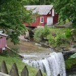
Hosting Club: Niagara
Category: Leisurely
Location (Google Maps):
DeCew House, DeCew Rd, Thorold (Map 3, km 29.8)
Hike Leader(s): Sheila Massey Click here to contact Hike Leader(s)
Pace: Leisurely
Terrain: Easy
Distance: 5.3 km
Description
This hike follows the main trail along Moody lake to the Morningstar Mill side trail, past the DeCew Falls to Morningstar Mill.
Hosting Club: Iroquoia
Category: General Hike
Location (Google Maps): Chedoke Golf Course parking lot,Hamilton.
Hike Leader(s): Daljeet Juneja Click here to contact Hike Leader(s)
Pace: Medium – 3 to 4 km/hr
Terrain: Moderate – Some hills and/or some poor footing
Description

Hosting Club: Niagara
Category: Cancelled
Location (Google Maps): Jordan Hollow Park
King St Jordon
Hike Leader(s): Alan Laver Click here to contact Hike Leader(s)
Pace: Medium
Terrain: Moderate
Distance: 7k
Description
Earn the NBTC night hike badge by completing 5 night hikes.
Experience the sounds of the night on this Beaver Full Moon along the Jim Rainforth Trail. Apart from the last 15 minutes Hike will be in complete silence giving you the opportunity to get the full experience of night hiking. Bring Headlamp or flashlight and dress accordingly. Hike goes ahead regardless of the weather.